أذربيجان
Republic of Azerbaijan Azərbaycan Respublikası (آذربيجاني) | |
|---|---|
النشيد: Azərbaycan marşı "March of Azerbaijan" | |
 | |
| العاصمة و أكبر مدينة | Baku 40°23′43″N 49°52′56″E / 40.39528°N 49.88222°E |
| اللغات الرسمية | Azerbaijani[1] |
| Minority languages | See full list |
| الجماعات العرقية (2019[2]) |
|
| الدين |
|
| صفة المواطن |
|
| الحكومة | Unitary semi-presidential republic[3] under a hereditary dictatorship |
| Ilham Aliyev | |
| Mehriban Aliyeva | |
| Ali Asadov | |
| Sahiba Gafarova | |
| التشريع | National Assembly |
| Formation | |
| 28 May 1918 | |
| 28 April 1920 | |
• Independence from Soviet Union |
|
• Constitution adopted | 12 November 1995 |
| المساحة | |
• الإجمالية | 86،600 km2 (33،400 sq mi) (112th) |
• الماء (%) | 1.6 |
| التعداد | |
• تقدير 2022 | 10,353,296[4] (90th) |
• الكثافة | 117/km2 (303.0/sq mi) (99th) |
| ن.م.إ. (ق.ش.م.) | تقدير 2024 |
• الإجمالي | ▲ $199.195 billion[5] (78th) |
• للفرد | ▲ $19,328[5] (88th) |
| ن.م.إ. (الإسمي) | تقدير 2024 |
• الإجمالي | ▲ 78.749 billion[5] (82nd) |
• للفرد | ▲ $7,641[5] (90th) |
| جيني (2008) | ▲ 33.7[6] medium |
| م.ت.ب. (2022) | ▲ 0.760[7] high · 89th |
| العملة | Manat (₼) (AZN) |
| التوقيت | UTC+4 (AZT) |
| صيغة التاريخ | dd.mm.yyyy (CE) |
| جانب السواقة | right |
| مفتاح الهاتف | +994 |
| النطاق العلوي للإنترنت | .az |
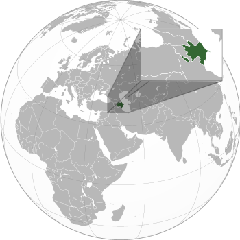
جمهورية أذربيجان (تــُنطـَق /ˌæzərbaɪˈdʒɑːn/ az-ər-bye-JAHN; آذربيجاني: Azərbaycan)، هي دولة مسلمة تقع في منطقة جبال القوقاز، على الشاطئ الغربي لبحر قزوين. وقد حصلت على استقلالها عام 1412هـ، 1991م. بعد أن استمرت ما يقرب من سبعين عامًا جزءا من الاتحاد السوفيتي السابق. واسم الدولة الرسمي جمهورية أذربيجان. تبلغ مساحة أذربيجان نحو 86,600 كم، وسكانها نحو من 7,854,000 نسمة (2002م). تقع معظمها في قارة آسيا لكن جزءًا من شماليها يُعتبر من أوروبا. وهناك جزء منها يُعرف باسم جمهورية ناخيشيڤان ذات الحكم الذاتي، وتفصلها أرمينيا عن بقية أذربيجان. وعاصمة أذربيجان هي باكو وهي أكبر مدنها.
The territory of what is now Azerbaijan was first ruled by Caucasian Albania and later various Persian empires. Until the 19th century, it remained part of Qajar Iran, but the Russo-Persian wars of 1804–1813 and 1826–1828 forced the Qajar Empire to cede its Caucasian territories to the Russian Empire; the treaties of Gulistan in 1813 and Turkmenchay in 1828 defined the border between Russia and Iran.[8][9] The region north of the Aras was part of Iran until it was conquered by Russia in the 19th century,[10][11] where it was administered as part of the Caucasus Viceroyalty.
By the late 19th century, an Azerbaijani national identity emerged when the Azerbaijan Democratic Republic proclaimed its independence from the Transcaucasian Democratic Federative Republic in 1918, a year after the Russian Empire collapsed, and became the first secular democratic Muslim-majority state. In 1920, the country was conquered and incorporated into the Soviet Union as the Azerbaijan SSR.[10][12] The modern Republic of Azerbaijan proclaimed its independence on 30 August 1991,[13][14] shortly before the dissolution of the Soviet Union. In September 1991, the ethnic Armenian majority of the Nagorno-Karabakh region formed the self-proclaimed Republic of Artsakh,[15] which became de facto independent with the end of the First Nagorno-Karabakh War in 1994, although the region and seven surrounding districts remained internationally recognized as part of Azerbaijan.[16][17][18][19] Following the Second Nagorno-Karabakh War in 2020, the seven districts and parts of Nagorno-Karabakh were returned to Azerbaijani control.[20] An Azerbaijani offensive in 2023 ended the Republic of Artsakh and resulted in the flight of Nagorno-Karabakh Armenians.[21]
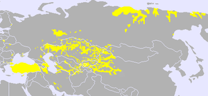
Azerbaijan is a unitary semi-presidential republic.[3] It is one of six independent Turkic states and an active member of the Organization of Turkic States and the TÜRKSOY community. Azerbaijan has diplomatic relations with 182 countries and holds membership in 38 international organizations,[22] including the United Nations, the Council of Europe, the Non-Aligned Movement, the OSCE, and the NATO PfP program. It is one of the founding members of GUAM, the Commonwealth of Independent States,[23] and the OPCW. Azerbaijan is also an observer state of the World Trade Organization.
The vast majority of the country's population (97%) is nominally[24] Muslim,[25] but the Constitution of Azerbaijan does not declare an official religion, and all major political forces in the country are secular. Azerbaijan is a developing country and ranks 91st on the Human Development Index. The ruling New Azerbaijan Party, in power since 1993, has been accused of authoritarianism under president Heydar Aliyev and his son Ilham Aliyev, and deteriorating the country's human rights record, including increasing restrictions on civil liberties, particularly on press freedom and political repression.[26]
التسمية
 Azerbaijan is one of the six independent Turkic States as of 1991. |
The term Azerbaijan derives from Atropates,[27][28] a Persian[29][30] satrap under the Achaemenid Empire who was reinstated as the satrap of Media under Alexander the Great.[31][32] The original etymology of this name is thought to have its roots in the once-dominant Zoroastrianism. In the Avesta's Frawardin Yasht ("Hymn to the Guardian Angels"), there is a mention of âterepâtahe ashaonô fravashîm ýazamaide, which translates from Avestan as "we worship the fravashi of the holy Atropatene".[33] The name "Atropates" is the Greek transliteration of an Old Iranian, probably Median, compounded name with the meaning "Protected by the (Holy) Fire" or "The Land of the (Holy) Fire".[34] The Greek name was mentioned by Diodorus Siculus and Strabo. Over the span of millennia, the name evolved to Āturpātākān (Middle Persian), then to Ādharbādhagān, Ādhorbāygān, Āzarbāydjān (New Persian) and present-day Azerbaijan.[35]
The name Azerbaijan was first adopted by the government of Musavat in 1918[36] after the collapse of the Russian Empire, when the independent Azerbaijan Democratic Republic was established. Until then, the designation had been used exclusively to identify the adjacent region of contemporary northwestern Iran,[37][38][39][40] while the area of the Azerbaijan Democratic Republic was formerly referred to as Arran and Shirvan.[41] On that basis Iran protested the newly adopted country name.[42]
During Soviet rule, the country was also spelled in Latin from the Russian transliteration as Azerbaydzhan (روسية: Азербайджа́н).[43] The country's name was also spelled in Cyrillic script from 1940 to 1991 as Азәрбајҹан.
التاريخ
 مقالة مفصلة: تاريخ أذربيجان
التاريخ العتيق
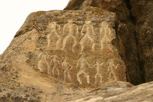
عاش الناس في المنطقة التي تُعرف حاليًا باسم أذربيجان منذ عصور ما قبل التاريخ. قام الميديّون بغزو المنطقة في القرن الثامن قبل الميلاد، ثم غزاها فرس الإمبراطورية الأخمينية في القرن السادس قبل الميلاد. والإسكندر في القرن الرابع قبل الميلاد. ثم حكمها الفرس من سلالة الساسانيين من القرن الثالث الميلادي حتى السابع الميلادي. ثم كان الفتح الإسلامي حيث نشر العرب المسلمون الإسلام في المنطقة.[44]
العصور الوسطى
كانت أَذْرَبيجان تدعى «البرزخ الميدي» لأنه عبر طرقها التي يسهل اجتيازها من الشمال الشرقي والشمال الغربي يمكن اختراق الهضبة الإِيرانية من الجبهة الشمالية المنيعة, وقد جلبت هذه المنطقة التي تكوَّن أحد منفذين طبيعيين اثنين (أَذْرَبيجان وخراسان) إِلى قلب إِيران شعوباً كثيرة جاءت واستقرت حول بحيرة أُرْميَة ذات المياه المالحة والتي هي أهم معلم طبيعي في أَذْرَبيجان, وفي هذه البقعة ولدت ونشأت الأسر المالكة في ميدية وفارس, وعند بوابات أَذْرَبيجان كان على الجيوش الامبراطورية الفارسية الأخمينية (559-331ق.م) أن تقف حارساً يقظاً في وجه الشعوب الطامعة القادمة من جبال القفقاس ومن السهوب الروسية الجنوبية, ويمكن القول إِن أَذْرَبيجان بقيت منذ تأسيس الامبراطورية الأخمينية سنة 559 ق.م حتى انهيار الدولة الساسانية على يد العرب إِما تحت سيطرة أُسر فارسية أو أنها كانت تؤلف جزءاً من الامبراطورية الفارسية كما حدث في عهد الأرشاقيين Arshakids (الفرثيين) والساسانيين .
وفي بدايات القرن الحادي عشر الميلادي بدأت جحافل الغُزَّ بالوصول إِلى أَذْرَبيجان, فلما دخلوا المراغة سنة 429هـ وقتلوا أهلها وأحرقوا مساجدها, اتفقت كلمة صاحبي أَذْرَبيجان, ابن ربيب الدولة من الأكراد الهذبانية ووهوذان من بني الرَّواد على الوقوف في وجه الغُز واجتمع معهما أهل همذان فنجحوا في الانتصاف منهم سنة 433هـ/1041م واضطروهم إِلى مغادرة أَذْرَبيجان, إِلا أن أَذْرَبيجان دخلت ضمن نطاق دولة سلاجقة العراق, عندما توجه طُغْرُلْبِك إِليها سنة 446هـ/ 1054م, وأعلن صاحب تَبْريز أبو منصور وهوذان بن محمد الروادي الطاعة لطغرلبك وخطب له وحمل إِليه ما أرضاه, وأعطاه ولده رهينة, كما أرسل إِليه سائر حكام تلك النواحي يبذلون له الطاعة والخطبة, وانقاد العساكر إِليه, فأبقى بلادهم عليهم وأخذ رهائنهم, فلما نزل الضعف بالسلاجقة انقسمت دولتهم إِلى عدة فروع وأخذ المماليك الذين يحملون لقب أتابك ينوبون في الحكم عن الأمراء الفتيان, ثم لم يمض زمن قصير حتى انتقلت مهمة الحكم إِليهم وأصبحوا حكاماً, ونشأ أتابكة أذربيجان من أسرة إِيلدكز القبجاقي مملوك السلطان مسعود من سلاجقة العراق، ونعمت أَذْرَبيجان بحقبة من الهدوء والسلام في عهد شمس الدين إِيلدكز (541-568هـ/ 1146-1172م) وابنه محمد بهلوان (568-587هـ/ 1172-1191م) فلما كان حكم أبي بكر بن محمد البهلوان (587-607هـ/1191-1210م) ساءت حالها لسوء سيرته, كما كثرت عليها الغارات من الكرج, وكثر النهب والقتل والسبي في أهلها ومالها, وأنهى الشاه جلال الدين منكبرتي الخوارزمي شاه خوارزم حكم أسرة إِيلدكز, عندما توجه سنة 622هـ/1225م إِلى المراغة فملكها وأقام بها وأخذ في عمارتها وتحصينها, ثم قصد تبريز فملكها في رجب سنة 622هـ وهزم الكرج ونجح بمساعدة وزيره شرف الملك في أن يسترجع القلاع والمدن التي كان نائب خلاط قد استولى عليها, كما هزم الأمراء البهلوانية الذين انتقضوا عليه وفتح مدناً كثيرة وتسلم أكثر قلاعها ثم سار قاصداً الران.
لم ينعم جلال الدين طويلاً بانتصاراته, إِذ جاء المنغول في أعقابه, وبوصول هولاكو سنة 654هـ/ 1256م أصبحت أَذْرَبيجان مركز امبراطورية ضخمة, واتخذ المغول المراغة عاصمة لهم في بادئ الأمر ثم تبريز التي ازدهرت في أيام غازان أو قازان خان وأصبحت مركزاً تجارياً وثقافياً مهماً في القرن الثامن الهجري / الرابع عشر الميلادي إِذ شرع قازان خان ببناء أرباض كبيرة فيما يلي سورها القديم الذي بني بعد زلزال سنة 434هـ/1043م وزاد خلفاؤه على أبنيته كثيراً من المساجد الكبيرة وغيرها من الأبنية داخل المدينة.
بعد المغول وخلفائهم الجلائريين احتل التركمان أَذْرَبيجان فحكمها القرة قيونلو (782-874هـ/ 1380-1469م) والآق قيونلو (806-914هـ/1403-1508م) ثم صارت بيد الصفويين الذين ينتمون إِلى الشيخ صفي الدين الأردبيلي, عندما نجح إِسماعيل بن حيدر في الاستيلاء على تبريز من الآق قيونلو, وتوج شاهاً لأَذْرَبيجان في تموز 907هـ/1501م ثم بادر إِلى الاستيلاء على إِيران كلها, وأصبحت أردبيل عاصمة في أيام الدولة الصفوية, قبل أن ينقلوا قاعدة ملكهم إِلى تبريز أولاً ثم إِلى أصفهان. وبين سنتي 920و1012هـ/1514و1603م احتل العثمانيون تبريز مراراً ومناطق أخرى, غير أن الشاه عباس (986-1038هـ/1578-1628م) استطاع أن يستعيد هذه المناطق, ثم عاد العثمانيون فاستولوا على أَذْرَبيجان وولايات أخرى غربي إِيران في أثناء الغزو الأفغاني (1132-1141هـ/1722-1728م) حتى طردهم منها نادر شاه من أسرة إِفشار (1153هـ/1740م).
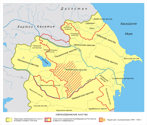
شهد القرن الثامن عشر كذلك نهوض روسية عسكرياً وتوسعها على حساب تركية وإِيران واستطاعت نتيجة حروب طويلة أن تستولي على دربند وباكو وشيروان وشيكي وغانجا وناختشيفان والقسم الجنوبي من تاليش Talish بموجب معاهدة گلستان (غلستان) (1229هـ/1813م) ومعاهدة تركمنچاي (1244هـ/1828م) وتعينت منذ ذلك الوقت الحدود بين أَذْرَبيجان الروسية وأَذْرَبيجان الإيرانية.
العهد الإسلامي
خلت أَذْرَبيجان ضمن نطاق الدولة العربية الإِسلامية في خلافة عمر بن الخطاب (13- 23هـ/ 634 -643م) وترجح الروايات المتعلقة بتاريخ الفتح سنتي 20و 22هـ حينما توجه حذيفة بن اليمان من نهاوند إِلى أَذْرَبيجان, كما وجهت إِليها حملات أخرى من شهرزور, وصالحَ المرزبان حاكم أَذْرَبيجان حذيفة بن اليمان عن جميع أهل أَذْرَبيجان على 800 ألف درهم على أن لا يقتل منهم أحداً ولا يسبيه ولا يهدم بيت نار, وأن لا يعرض لأكراد البلاسجان Balasagân والسبلان Sabalan وساترودان Shatrudan.
بدأ انتشار الإِسلام في أَذْرَبيجان في خلافة عثمان بن عفان (23-35هـ) عندما أسكن الوالي الأشعث بن قيس جماعة من العرب من أهل العطاء والديوان في أَذْرَبيجان وأمرهم بدعاء الناس إِلى الإِسلام, فلما وليها ثانية في خلافة علي بن أبي طالب وجد أكثرهم قد أسلموا وقرؤوا القرآن, كما أخذت العشائر العربية, من البصرة والكوفة والشام تستقر في مختلف مناطقها. ولأن أَذْرَبيجان كانت من فتوح الكوفة فقد بقيت تابعة إِدارياً لوالي الكوفة حتى سنة 83هـ/702م عندما جعلها عبد الملك بن مروان (65-86هـ/ 684- 705م) ولاية تابعة إِدارياً لوالي الجزيرة, وكانت أَرْدَبيل أكبر مدينة في أَذْرَبيجان وعاصمة لها قبل الفتح, فلما ولي محمد بن مروان الجزيرة وأرمينية وأَذْرَبيجان سنة 114هـ, اتخذ المراغة معسكراً له, وبنى فيها دار الإِمارة, واتبع العباسيون أسلوب الأمويين في جمع أرمينية وأَذْرَبيجان لوال واحد, كما بقي للمراغة أهميتها, ففي خلافة هارون الرشيد (170-193هـ/ 786-808م) عين خُزَيْمة بن خازم بن خزيمة والياً على أرمينية و أَذْرَبيجان, فبنى سور المراغة وأنزلها جنداً كثيفاً. ولما أعلن بابك الخرمي [ر] ثورته على الخلافة العباسية سنة 201هـ, متخذاً من جبال أَذْرَبيجان مركزاً لحركته, لجأ الناس إِلى المراغة فنزلوها وتحصنوا فيها. وعلى الرغم من الجهود التي بذلها المأمون للقضاء على هذه الحركة, فإِنها استمرت بعد وفاته, لانهماك قواته بحرب البيزنطيين, وحصانة المنطقة الجبلية التي اعتصم بها بابك وجماعته. وسخَّر الخليفة المعتصم (218-227هـ/ 833-841م) كل إِمكاناته وقواته حتى قضى عليها سنة 222هـ, ولكن هذه الحركة لم تنته إِلا بعد أن أفنت عدداً كبيراً من جند الخلافة, وكلفت الدولة الكثير من الأموال وأضعفت سلطة الخلافة في أَذْرَبيجان, وكان آخر الحكام الأقوياء فيها الساجيون (276-318هـ/ 889-930م) وبدأت تظهر بعد سقوط هذه الأسرة أُسر محلية (373-463هـ/983-1070م) فبعد سيطرة ديسم بن إِبراهيم الكردي, سيطر بنو سافر المعروفون ببني السلار من الديلم, ثم بنو الرَّواد الأكراد.
كانت أذربيجان إقليما من بلاد فارس اسمه أتروباتين وكانت قاعدتها تبريز. فتحت في أيام عمر بن الخطاب رضي الله عنه، وكان الوالي عليها عتبة بن فرقد السلمي الذي دخلها بعد الفتح وكتب لأهلها أمانًا، وفرض عليهم الجزية على قدر الطاقة.
كانت عاصمتها تبريز على أيام عمر، وانتقلت إلى أردبيل أيام العباسيين ثم على أيام الصفويين وتحولت العاصمة إلى مراغة أيام المغول.
ومن القرن الحادي عشر حتى القرن الثالث عشر الميلاديين، هاجرت أعداد كبيرة من القبائل التركية إلى أذربيجان، وامتزجوا مع الفرس الذين عاشوا في المنطقة. وهؤلاء هم الأجداد الأوائل للأذربيجانيين. في أوائل القرن السادس عشر الميلادي خضعت أذربيجان لسيطرة الإمبراطورية الصفوية، التي حكمت إيران، ثم انتقلت السيادة على أذربيجان من الصفويين إلى الأتراك العثمانيين في أواخر القرن السادس عشر الميلادي، ولكنهم لم يحتفظوا بهذه السيادة في القرن السابع عشر الميلادي.
أخرجت أذربيجان طائفة من العلماء منهم الخطيب التبريزي اللغوي النحوي شارح المفضليات والحماسة، والمظفر التبريزي الفقيه الشافعي (ت621هـ، 1224م) وأبو الفتح التبريزي الفقيه الحنفي (ت736هـ، 1336م) ومحمد بن عبدالغني الأردبيلي النحوي (ت647هـ، 1249م) ويوسف بن إبراهيم الأردبيلي الشافعي (ت 799هـ، 1397م). وجماعة من الفضلاء.
العصر الحديث
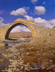
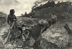
بتعاقب الأحداث سيطر الروس على أذربيجان وغيرها من الدول. أقام القوميون الأذربيجانيون حكومة مستقلة في غربي أذربيجان، ومع هذا، استعادت روسيا الشيوعية سيطرتها على المنطقة عام 1920م.
في أوائل عام 1922م، اتحدت كل من أذربيجان وجورجيا، وأرمينيا وشكلت جمهورية ما وراء القوقاز، تحت القيادة الروسية. وبعدذلك بعام واحد، اتحدت جمهورية ما وراء القوقاز وروسيا البيضاء وروسيا وأوكرانيا؛ لتشكل معًا الاتحاد السوفييتي السابق. في عام 1936م، انفصلت الوحدات الثلاث من جمهورية ما وراء القوقاز، إلى ثلاث جمهوريات ضمن الاتحاد السوفييتي السابق. وسُميت أذربيجان باسم جمهورية أذربيجان السوفيتية الاشتراكية.
أحدث الاتحاد السوفييتي السابق، تغييرات عديدة في أذربيجان. فقد سيطرت الحكومة الروسية على مظاهر الحياة الأذرية كافة. وأسست حكومة شيوعية قوية، وسيطرت على كامل الصناعات والأرض الأذربيجانية وأقامت الزراعة التعاونية التي حولت المزارع ذات الملكية الخاصة إلى ملكية الدولة. قضى القادة الروس على الكثير من مظاهر التراث والتقاليد الأذربيجانية. وعملوا على تقليص التأثير الإسلامي في الجمهورية. ورغم ذلك، فقد بنى الروس الطرق والمدارس، والمباني الحديثة، والمستشفيات وأنظمة الاتصالات في أذربيجان.
الاستقلال
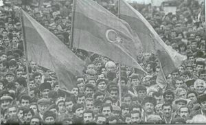
في نهاية عقد الثمانينيات من القرن العشرين، عملت الحكومة السوفيتية على إعطاء الشعب حرية أكثر. وفي عام 1989م، جعل الأذربيجانيون قوانينهم نافذة على قوانين السوفييت. وفي نهاية عام 1991م تفتّت الاتحاد السوفييتي، وأصبحت أذربيجان دولة مستقلة.
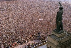
أصبحت المنطقة المعروفة باسم ناغورنو ـ كرباخ، منطقة غير مستقرة ومصدر صراع بين أذربيجان وجارتها أرمينيا. فغالبية سكان ناغورنو ـ كرباخ من الأرمن، مما جعل أرمينيا تدعي ملكيتها لها. ومنذ أواخر عقد الثمانينيات من القرن العشرين دار صراع مرير بين أذربيجان والأرمن للسيطرة على ناغورنو ـ كرباخ، بسبب هذا الصراع، نزح قرابة 200,000 أذري غالبيتهم من أرمينيا إلى أذربيجان، مقابل نحو 250,000 أرمني، نزحوا من أذربيجان إلى أرمينيا. وفي عام 1994م، أعلنت أذربيجان وأرمينيا وقف العمليات القتالية بينهما.
التطورات الأخيرة. بنهاية تسعينيات القرن الماضي، كانت الحكومة قد قطعت شوطًا كبيرًا في بيع كثير من أراضيها الزراعية ومنشآتها الصناعية للقطاع الخاص. وقد وقعت الحكومة اتفاقات مع عدد من شركات النفط الأجنبية للتنقيب عن النفط في بحر قزوين. ومن المتوقع أن تعود هذه الاتفاقات بالفائدة الكبيرة على أذربيجان.
وفي أغسطس 2002م، تم تعديل الدستور بموجب استفتاء خول لرئيس الوزراء، وليس البرلمان تولي زمام الأمور في حالة عجز الرئيس عن مزاولة شؤون الحكم.
الجغرافيا
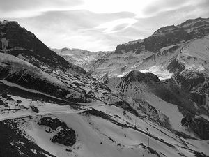
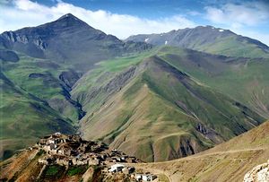
تشغل أذربيجان كتلة من اليابسة كبيرة الاتساع، تبلغ مساحتها 86.6 ألف كيلو متر مربع، وهي تقع في الجزء الشرقي لمنطقة ما وراء جبال القوقاز، وتَحُدُّ أذربيجان من الشمال جمهورية داغستان، ومن الشمال الغربي جمهورية جورجيا، ومن الجنوب الغربي جمهورية أرمينيا، ومن الجنوب جمهورية إيران الإسلامية، وحدودها معها 611 كيلو متر، وكذلك الجمهورية التركية بحدود 11 كيلو متر.
كما يحدها من الشرق سواحل بحر الخرز بطول يقدر بـ 825 كيلو متر. وعاصمتها باكو ويبلغ تعداد سكانها 6.303.000 نسمة.
الجبال
اقليم ناخيتشيفان منفصل جغرافياً عن باقي أذربيجان. ويتطلب الوصول إليه المرور إما عبر أذربيجان الغربية التي هي مقاطعة إيرانية أو عبر أرمينيا. ويتيح اقليم ناخيتشيفان لأذربيجان الإتصال الجغرافي مع تركيا نافذة عرضها 8 كيلومترات فقط. و من أشهر أبناء الإقليم حيدر علييف أول رئيس لأذربيجان وابنه إلهام علييف الرئيس الحالي.
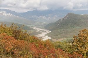
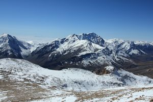
تمتد جبال القوقاز من شمال غربي إلى شمال شرقي أذربيجان، بينما تمتد جبال القوقاز الصغرى من الجنوب الغربي، إلى الجنوب الشرقي. تعتبر المساحة الواقعة شمالي جبال القوقاز جزءًا من أوروبا. أما المنطقة الواقعة جنوبي السلاسل الجبلية فتتبع قارة آسيا. يصل ارتفاع قمة جبل بازار ديوزي وهي الأعلى في البلاد، إلى 4,466م.
تشغل الهضبة الأرمينية الوعرة، وهي أراضٍ مجزأة بالخوانق العميقة، الجزء الجنوبي الغربي من أذربيجان. يجري نهر كورا وهو نهر أذربيجان الرئيسي عبر السلاسل الجبلية، كما يجتاز سهلاً واسعًا، وجافًا يطلق عليه منخفض كورا ـ أراس. ويجري نهر أراس، الرافد الرئيسي لنهر كورا، على امتداد أجزاء من الحدود الجنوبية من أذربيجان. وتوجد أنهار أخرى مهمة في أذربيجان، ومنها نهر ترتر ونهر أكيرا. تُعتبر الأنهار مصدرًا لمياه الري، وتوليد الكهرباء. يوفر سدّ منجشاور المقام على نهر كورا الطاقة الكهرومائية لمدينة باكو ولإقليم غياندزها الصناعي.
الطقس
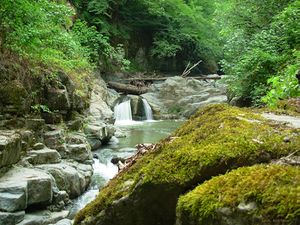
صيف الأراضي المنخفضة في أذربيجان طويل وحار، والشتاء بارد. متوسط درجة حرارة شهر أغسطس في الأراضي المنخفضة 26°م، و4°م في يناير. تتراوح معدلات التساقط السنوي للأمطار بين 13 إلى 38سم، في معظم المناطق المنخفضة من القطر. وتتلقى المرتفعات والمناطق الجنوبية الشرقية من أذربيجان الواقعة على بحر قزوين أمطارًا تتراوح ما بين 100 و 140سم في المتوسط كل عام.
التنوع الحيوي
The first reports on the richness and diversity of animal life in Azerbaijan can be found in travel notes of Eastern travelers. Animal carvings on architectural monuments, ancient rocks, and stones survived up to the present times. The first information on flora and fauna of Azerbaijan was collected during the visits of naturalists to Azerbaijan in the 17th century.[46]
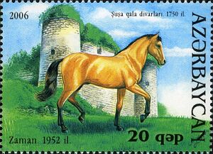
There are 106 species of mammals, 97 species of fish, 363 species of birds, 10 species of amphibians, and 52 species of reptiles which have been recorded and classified in Azerbaijan.[46] The national animal of Azerbaijan is the Karabakh horse, a mountain-steppe racing and riding horse endemic to Azerbaijan. The Karabakh horse has a reputation for its good temper, speed, elegance, and intelligence. It is one of the oldest breeds, with ancestry dating to the ancient world, but today the horse is an endangered species.[47]
Azerbaijan's flora consists of more than 4,500 species of higher plants. Due to the unique climate in Azerbaijan, the flora is much richer in the number of species than the flora of the other republics of the South Caucasus. Sixty-six percent of the species growing in the whole Caucasus can be found in Azerbaijan.[48] The country lies within four ecoregions: Caspian Hyrcanian mixed forests, Caucasus mixed forests, Eastern Anatolian montane steppe, and Azerbaijan shrub desert and steppe.[49]
Azerbaijan had a 2018 Forest Landscape Integrity Index mean score of 6.55/10, ranking it 72nd globally out of 172 countries.[50] Forest cover is around 14.% of the total land area, equivalent to 1,131,770 hectares (ha) of forest in 2020, up from 944,740 hectares (ha) in 1990. In 2020, naturally regenerating forest covered 826,200 hectares (ha) and planted forest covered 305,570 hectares (ha). Of the naturally regenerating forest 0% was reported to be primary forest (consisting of native tree species with no clearly visible indications of human activity) and around 33% of the forest area was found within protected areas. In 2015, 100% of the forest area was reported to be under public ownership, 0% private ownership and 0% with ownership listed as other or unknown. [51] [52]
الأنهار والبحيرات

المحميات
التقسيمات الإدارية
|
|
|
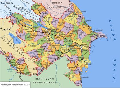 تنقسم أذربيجان إلى 59 رايون و جمهورية نخجوان ذاتية الحكم.
|
ملحوظة: المدن المحافظات بالخط المائل.
المدن الرئيسية
| الترتيب | المدينة | المقاطعة | التعداد | الترتيب | المدينة | المقاطعة | التعداد | |||
|---|---|---|---|---|---|---|---|---|---|---|
| 1 | باكو (Bakı) | أبشوران | 2,039,000 | 11 | خانكندي (Xankəndi) | يوخاري قرهباغ | 55,282 | |||
| 2 | گانكا (Gəncə) | گانكا-قازاخ | 323,760 | 12 | لانكاران (Lənkəran) | لانكاران-أستارا | 50,534 | |||
| 3 | سومقايت (Sumqayıt) | أبشوران | 282,280 | 13 | رسولزاده (Rəsulzadə) | أبشوران | 48,716 | |||
| 4 | مينگا-چوير (Mingəçevir) | أورتا كور | 100,778 | 14 | بيلهجري (Biləcəri) | أبشوران | 45,678 | |||
| 5 | قاراجوخور | أبشوران | 78,730 | 15 | مشتاگا | أبشوران | 42,635 | |||
| 6 | شيروان (Şirvan) | أورتا كور | 76,648 | 16 | آقدام (Ağdam) | يوخاري-قرهباغ | 42,587 | |||
| 7 | نخجوان (Naxçıvan) | نخجوان | 75,972 | 17 | باردا (Bərdə) | أورتا كور | 40,741 | |||
| 8 | باكيخانوف | أبشوران | 71,836 | 18 | خاشماز (Xaçmaz) | قوبا-خاشماز | 40,391 | |||
| 9 | شاكي (Şəki) | شاكي-زاقاتالا | 65,616 | 19 | جليلأباد (Cəlilabad) | لانكران-أستلرا | 39,974 | |||
| 10 | يولاخ (Yevlax) | أروتا كور | 57,449 | 20 | هوسان | أبشوران | 38,675 | |||
| ملحوظة: تعداد السكان حسب تقديرات 2009 | ||||||||||
الحكومة والسياسة
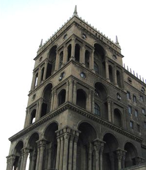
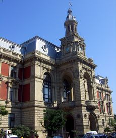
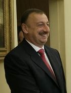
نص الدستور الذي أقر عام 1995م على أن أقوى شخصية رسمية في الحكومة الأذربيجانية هو الرئيس. وينتخبه الشعب لمدة خمس سنوات. يقوم مجلس الوزراء، ويرأسه رئيس الوزراء، بتسيير دفة الحكم، ويتولى الرئيس تعيين أعضائه. يسنّ المجلس الوطني المسمى ملي مجلس القوانين. ويتألف من 125 عضوًا.
تشتمل الوحدات الإدارية الرئيسية على جمهورية ناخيشيفان ذات الحكم الذاتي، وعلى مقاطعات، ومدن، وقرى. يحكم كل وحدة من هذه الوحدات مجلس إدارة لتسيير الشؤون المحلية. لكل شخص أذربيجاني عمره 18 سنة فأكثر حق التصويت.
أعلى محكمة في أذربيجان هي المحكمة العليا، وتوجد محاكم محلية أيضًا.
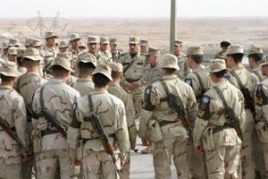
لأذربيجان جيش يتكون من 85,000 جندي وأسطول بحري صغير وقوات جوية. يخدم كل أذربيجاني بلغ سنه 18 عامًا في القوات المسلحة مدة 17 شهرًا.
نظام الحكم
حيدر علييف، الرجل الثاني باللجنة المركزية للحزب الشيوعي السوفييتي المنحل، عاد إلى مسقط رأسه وأطاح في عام 1992 بأول رئيس منتخب ديمقراطياً أبو الفضل الشيبي.
تقسيم المياه الإقليمية لبحر القزوين
نظراً لثراء بحر القزوين بالنفط والغاز الطبيعي تتصارع الدول الست المطلة عليه لتقاسمه. تقسيم المياه الإقليمية لبحر القزوين هل هو بحر أم بحيرة. البحر يتم تقاسمه حسب طول شواطئ كل دولة. البحيرة يتم تقاسم ثرواتها بنسبة طول شواطئ كل دولة. وحسب قانون البحيرات الدولي، لو اُنتِج النفط من أمام الشاطئ الأذري فإن لروسيا حق فيه.
نزاع ناجورنو قرةباغ
تحتل أرمينيا اقليم قرةباغ والذي يشكل 20% من مساحة أذربيجان.
العلاقات الخارجية
العسكرية
الاقتصاد
After gaining independence in 1991, Azerbaijan became a member of the International Monetary Fund, the World Bank, the European Bank for Reconstruction and Development, the Islamic Development Bank, and the Asian Development Bank.[53] The banking system consists of the Central Bank of Azerbaijan, commercial banks, and non-banking credit organizations. The National (now Central) Bank was created in 1992 based on the Azerbaijan State Savings Bank, an affiliate of the former State Savings Bank of the USSR. The Central Bank serves as Azerbaijan's central bank, empowered to issue the national currency, the Azerbaijani manat, and to supervise all commercial banks. Two major commercial banks are UniBank and the state-owned International Bank of Azerbaijan, run by Abbas Ibrahimov.[54]
Pushed up by spending and demand growth, the 2007 Q1 inflation rate reached 16.6%.[55] Nominal incomes and monthly wages climbed 29% and 25% respectively against this figure, but price increases in the non-oil industry encouraged inflation.[55] Azerbaijan shows some signs of the so-called "Dutch disease" because of its fast-growing energy sector, which causes inflation and makes non-energy exports more expensive.[56] In the early 2000s, chronically high inflation was brought under control. This led to the launch of a new currency, the new Azerbaijani manat, on 1 January 2006, to cement the economic reforms and erase the vestiges of an unstable economy.[57][58] Azerbaijan is also ranked 57th in the Global Competitiveness Report for 2010–2011, above other CIS countries.[59] By 2012 the GDP of Azerbaijan had increased 20-fold from its 1995 level.[60]
الطاقة والموارد الطبيعية
أجزاء من هذا المقال (أولئك المتعلقين بـ القِسم) تحتاج أن تـُحدَّث. السبب المعطى هو: some future tense sentences have years in the past. (December 2023) |
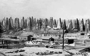
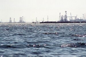
Two-thirds of Azerbaijan is rich in oil and natural gas.[61] The oil industry dates back to the ancient period. Arabian historian and traveler Ahmad Al-Baladhuri discusses the economy of the Absheron Peninsula in antiquity, mentioning its oil in particular.[62] There are many pipelines in Azerbaijan. The goal of the Southern Gas Corridor, which connects the giant Shah Deniz gas field in Azerbaijan to Europe,[63] is to reduce European Union's dependency on Russian gas.[64]
The region of the Lesser Caucasus accounts for most of the country's gold, silver, iron, copper, titanium, chromium, manganese, cobalt, molybdenum, complex ore and antimony.[61] In September 1994, a 30-year contract was signed between the State Oil Company of Azerbaijan Republic (SOCAR) and 13 oil companies, among them Amoco, BP, ExxonMobil, Lukoil and Equinor.[53] As Western oil companies are able to tap deepwater oilfields untouched by the Soviet exploitation, Azerbaijan is considered one of the most important spots in the world for oil exploration and development.[65] Meanwhile, the State Oil Fund of Azerbaijan was established as an extra-budgetary fund to ensure macroeconomic stability, transparency in the management of oil revenue, and safeguarding of resources for future generations.
Access to biocapacity is less than world average. In 2016, Azerbaijan had 0.8 global hectares[66] of biocapacity per person within its territory, half the world average of 1.6 global hectares per person.[67] In 2016 Azerbaijan used 2.1 global hectares of biocapacity per person – their ecological footprint of consumption. This means they use more biocapacity than Azerbaijan contains. As a result, Azerbaijan is running a biocapacity deficit.[66]
Azeriqaz, a sub-company of SOCAR, intends to ensure full gasification of the country by 2021.[68] Azerbaijan is one of the sponsors of the east–west and north–south energy transport corridors. Baku–Tbilisi–Kars railway line connects the Caspian region with Turkey. The Trans-Anatolian gas pipeline and Trans Adriatic Pipeline deliver natural gas from Azerbaijan's Shah Deniz gas to Turkey and Europe.[63] Azerbaijan extended the agreement on development of ACG until 2050 according to the amended PSA signed on 14 September 2017 by SOCAR and co-ventures (BP, Chevron, Inpex, Equinor, ExxonMobil, TP, ITOCHU and ONGC Videsh).[69]
الزراعة
Azerbaijan has the largest agricultural basin in the region. About 54.9 percent of Azerbaijan is agricultural land.[70] At the beginning of 2007 there were 4,755,100 hectares of used agricultural area.[71] In the same year the total wood resources counted 136 million m3.[71] Agricultural scientific research institutes are focused on meadows and pastures, horticulture and subtropical crops, green vegetables, viticulture and wine-making, cotton growing and medicinal plants.[72] In some areas it is profitable to grow grain, potatoes, sugar beets, cotton[73] and tobacco. Livestock, dairy products, and wine and spirits are also important farm products. The Caspian fishing industry concentrates on the dwindling stocks of sturgeon and beluga. In 2002 the Azerbaijani merchant marine had 54 ships.
Some products previously imported from abroad have begun to be produced locally. Among them are Coca-Cola by Coca-Cola Bottlers LTD., beer by Baki-Kastel, parquet by Nehir and oil pipes by EUPEC Pipe Coating Azerbaijan.[74]
السياحة
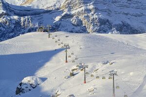
The country was a well-known tourist spot in the 1980s. The fall of the Soviet Union and the First Nagorno-Karabakh War during the 1990s damaged the tourist industry and the image of Azerbaijan as a tourist destination.[75] It was not until the 2000s that the tourism industry began to recover, and the country has since experienced a high rate of growth in the number of tourist visits and overnight stays.[76] In recent years, Azerbaijan has also become a popular destination for religious, spa, and health care tourism.[77] During winter, the Shahdag Mountain Resort offers skiing with state of the art facilities.[78]
The government has set development as an elite tourist destination as a top priority. It is a national strategy to make tourism a major, if not the single largest, contributor to the Azerbaijani economy.[79] These activities are regulated by the Ministry of Culture and Tourism of Azerbaijan. There are 63 countries which have a visa-free score.[80] E-visa[81] – for a visit of foreigners of visa-required countries to the Republic of Azerbaijan. According to the Travel and Tourism Competitiveness Report 2015 of the World Economic Forum, Azerbaijan holds 84th place.[82]
According to a report by the World Travel and Tourism Council, Azerbaijan was among the top ten countries showing the strongest growth in visitor exports between 2010 and 2016,[83] In addition, Azerbaijan placed first (46.1%) among countries with the fastest-developing travel and tourism economies, with strong indicators for inbound international visitor spending in 2016.[84]
النقل
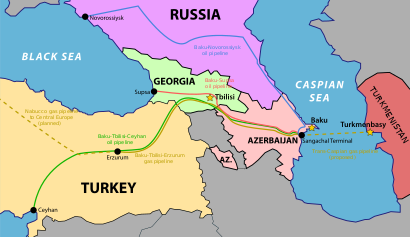
The convenient location of Azerbaijan on the crossroad of major international traffic arteries, such as the Silk Road and the south–north corridor, highlights the strategic importance of the transportation sector for the country's economy.[85] The transport sector includes roads, railways, aviation, and maritime transport. It is also an important economic hub in the transportation of raw materials. The Baku–Tbilisi–Ceyhan pipeline (BTC) became operational in May 2006 and extends more than 1،774 km (1،102 mi) through the territories of Azerbaijan, Georgia, and Turkey. The BTC is designed to transport up to 50 million tons of crude oil annually and carries oil from the Caspian Sea oilfields to global markets.[86] The South Caucasus Pipeline, also stretching through the territory of Azerbaijan, Georgia, and Turkey, became operational at the end of 2006 and offers additional gas supplies to the European market from the Shah Deniz gas field. Shah Deniz is expected to produce up to 296 billion cubic meters of natural gas per year.[87] Azerbaijan also plays a major role in the EU-sponsored Silk Road Project.[88]
In 2002, the government established the Ministry of Transport with a broad range of policy and regulatory functions. In the same year, the country became a member of the Vienna Convention on Road Traffic.[89] Priorities are upgrading the transport network and improving transportation services to better facilitate the development of other sectors of the economy.[بحاجة لمصدر] The 2012 construction of Kars–Tbilisi–Baku railway was meant to improve transportation between Asia and Europe by connecting the railways of China and Kazakhstan in the east to the European railway system in the west via Turkey. In 2010 Broad-gauge railways and electrified railways stretched for 2،918 km (1،813 mi) and 1،278 km (794 mi) respectively. By 2010, there were 35 airports and one heliport.[24]
العلوم والتكنولوجيا
In the 21st century, a new oil and gas boom helped improve the situation in the science and technology sectors. The government launched a campaign aimed at modernization and innovation. The government estimates that profits from the information technology and communication industry will grow and become comparable to those from oil production.[90] Azerbaijan has a large and steadily growing Internet sector. In 2012, rapid growth was forecast for at least five more years.[91] Azerbaijan was ranked 89th in the Global Innovation Index in 2023.[92][93]
The country has been making progress in developing its telecoms sector. The Ministry of Communications & Information Technologies and an operator through its role in Aztelekom are both policy-makers and regulators. Public payphones are available for local calls and require the purchase of a token from the telephone exchange or some shops and kiosks. Tokens allow a call of indefinite duration. اعتبارا من 2009[تحديث], there were 1,397,000 main telephone lines[94] and 1,485,000 internet users.[95] There are four GSM providers: Azercell, Bakcell[az], Azerfon (Nar Mobile), Nakhtel mobile network operators and one CDMA.
In the 21st century several prominent Azerbaijani geodynamics and geotectonics scientists, inspired by the fundamental works of Elchin Khalilov and others, designed hundreds of earthquake prediction stations and earthquake-resistant buildings that now constitute the bulk of The Republican Center of Seismic Service.[96][97][98] The Azerbaijan National Aerospace Agency launched its first satellite AzerSat 1 into orbit on 7 February 2013 from Guiana Space Centre in French Guiana at orbital positions 46° East.[99][100][101] The satellite covers Europe and a significant part of Asia and Africa and serves the transmission of TV and radio broadcasting as well as the Internet.[102] The launching of a satellite into orbit is Azerbaijan's first step in realizing its goal of becoming a nation with its own space industry, capable of successfully implementing more projects in the future.[103][104]
السكان
ينحدر ما يقرب من 83% من سكان أذربيجان من أصل أذري. ويشكل كل من الأرمن والروس 5% من السكان.
يعيش 52% من الشعب الأذري في مدن و48% في الريف.
يدين معظم الأذربيجانيين بالإسلام، بينما يدين الأرمن بالنصرانية، ويرتبط معظمهم بالكنيستين الأرمنية والأورثوذكسية الشرقية. في حين يرتبط الروس بالكنيسة الأورثوذكسية الروسية.
عمل الشيوعيون حتى نهاية عقد الثمانينيات على إضعاف الأنشطة الدينية فقاموا بإغلاق المساجد، والمدارس الدينية. وفي أواخر عقد الثمانينيات خففت الحكومة من سيطرتها على الدين وأنهت تدخلها تمامًا عام 1990م.
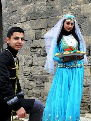
يرتدي الرجال الزي الأوروبي ويلبسون في العطلات اللباس التقليدي الفضفاض. أما النساء المسلمات في المناطق الريفية فيرتدين الشال الأسود الذي يغطي الرأس والكتفين وربما أسدل على الوجه. أما اللغة الأذرية فهي مزيج من لغات الفرس والترك الذين كانوا يقطنون أذربيجان سابقًا وتشبه اللغة الأذرية اللغة التركية الحديثة جدًا. معظم سكان جمهورية أَذْرَبيجان من أصول إِيرانية, إِلا أن سيطرة السلاجقة في القرن الخامس الهجري/ الحادي عشر الميلادي أدى إِلى تتريكها واستمر هذا التتريك حتى بعد الغزو المغولي لها, إِذ أجبرت أعداد كبيرة من العائلات من آسيا الوسطى, وآسيا الصغرى على الاستقرار فيها, ولذلك فإِنه عندما احتلت القوات التركية باكو في 15 أيلول سنة 1918م أعاد نوري باشا قائد القوات التركية تنظيم هذه المنطقة, وأطلق عليها اسم أَذْرَبيجان, لأن معظم سكان أَذْرَبيجان الإِيرانية وسكان هذه المنطقة من أصول واحدة تقريباً, ويتكلمون التركية, وعندما عاد الحلفاء, فاحتلوا باكو إِثر معاهدة مودرُس Mudros في 17 تشرين الأول 1918م اعترف الجنرال ثومسون Thomson بحكومة حزب المساواة في أَذْرَبيجان. وبعد جلاء الحلفاء عنها, أُعلن النظام الشيوعي في باكو في 28 نيسان 1920م من دون مقاومة تذكر, وأصبحت أَذْرَبيجان واحدة من جمهوريات ثلاث في الاتحاد الفدرالي الذي ضم أَذْرَبيجان وجورجية وأرمينية ولكن العداوات العرقية والدينية أدت إِلى إِخفاق هذه المحاولة وأصبحت أَذْرَبيجان ابتداءً من الخامس من كانون الأول 1936م جمهورية من جمهوريات الاتحاد السوفييتي, وقد استقلت عن الجمهوريات التي كانت تؤلف الاتحاد السوفييتي في أواخر عام 1991م وغدت جمهورية مستقلة ذات سيادة. أما أَذْرَبيجان الإِيرانية, فهي التي تقع إِلى الجنوب من جمهورية أَذْرَبيجان المستقلة, وفي الزاوية الشمالية الغربية من إِقليم فارس.
ولصعوبة تحديد كل من أَذْرَبيجان والرّان وأرمينية, عدها الجغرافيون العرب إِقليماً واحداً سماه المقدسي إِقليم الرحاب تمييزاً له من إِقليم الجبال Media وإِقليم آقور (الأرض المطمئنة وهي الجزيرة).
استولى الأتراك على أَذْرَبيجان الإِيرانية في أثناء الحرب العالمية الأولى, كما استولى الروس عليها في الحرب العالمية الثانية, وأعلن الاتحاد السوفييتي تأسيس جمهورية أَذْرَبيجان وعاصمتها تبريز ولكن القوات الإِيرانية استعادت المنطقة الإِيرانية من أَذْرَبيجان سنة 1947م.
تنقسم أَذْرَبيجان الإِيرانية اليوم إِلى قسمين: أَذْرَبيجان الغربية ومساحتها 39216كم2 وعاصمتها أُرْمِية وسكانها 1688000 نسمة (إِحصاء 1983) ومعظمهم من الأتراك إِضافة إِلى أقليات من الأكراد والأرمن, ويسكن الأكراد في المنطقة الممتدة من نهر أراكس Araxes في الشمال إِلى قرب خُوي Khǘy في الجنوب. أما الأرمن فهم قلة منتشرة في الشمال الغربي. وتُعدّ الزراعة التي تتوضع في حوض أُرْمِية عماد اقتصادها.
أما أَذْرَبيجان الشرقية [ر. إِيران] فمساحتها 67102كم2 وعاصمتها تبريز, وهي جبلية تخترقها سلسلة جبال زاغروس الشرقية من الشمال إِلى الجنوب, كما أن فيها مرتفعات بركانية شاهقة أبرزها جبل سبلان ويقدر عدد سكانها بنحو 3679000 نسمة (عام 1983). ومعظمهم من الأتراك إِلى جانب الأرمن وقلة من الأكراد, والأتراك مسلمون شيعة, والزراعة عماد حياتهم, وتصل شبكة من الطرق والسكك الحديدية بين مدنها المهمة, تبريز والمراغة وأردبيل وأهار Ahar وميانة Mianeh ومرند وسَرَب, كما أن هناك خط أنابيب نفط يمتد من تبريز إِلى طهران.
التعليم
الدين
Azerbaijan is considered the most secular Muslim-majority country.[106] Around 97% of the population are Muslims.[107] Around 55–65% of Muslims are estimated to be Shia, while 35–45% of Muslims are Sunnis.[108][109][110][111] Other faiths are practised by the country's various ethnic groups. Under article 48 of its constitution, Azerbaijan is a secular state and ensures religious freedom. In a 2006–2008 Gallup poll, only 21% of respondents from Azerbaijan stated that religion is an important part of their daily lives.[112]
Of the nation's religious minorities, the estimated 280,000 Christians (3.1%)[113] are mostly Russian and Georgian Orthodox and Armenian Apostolic (almost all Armenians live in the break-away region of Nagorno-Karabakh).[24] In 2003, there were 250 Roman Catholics.[114] Other Christian denominations as of 2002 include Lutherans, Baptists and Molokans.[115] There is also a small Protestant community.[116][117] Azerbaijan also has an ancient Jewish population with a 2,000-year history; Jewish organizations[من؟] estimate that 12,000 Jews remain in Azerbaijan, which is home to the only Jewish-majority town outside of Israel and the United States.[118][119][120][121] Azerbaijan also is home to members of the Baháʼí, Hare Krishna and Jehovah's Witnesses communities, as well as adherents of the other religious communities.[115] Some religious communities have been unofficially restricted from religious freedom. A U.S. State Department report on the matter mentions detention of members of certain Muslim and Christian groups, and many groups have difficulty registering with the agency who regulates religion, The State Committee on Religious Associations of the Republic of Azerbaijan.[122]
أذربيجان دولة اسلامية حيث غالبية سكانها من الشيعة حيث يشكلون حوالي 70% من السكان اما الباقي فهم من الأحناف والشوافع ويوجد ايضاً أديان اخرى صغيرة مثل هاري كريشنا الهندوسية.
اللغات
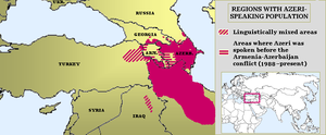
The official language is Azerbaijani, a Turkic language. Approximately 92% of the national population speak it as their mother tongue.[123] Russian and Armenian (only in Nagorno-Karabakh) are still spoken in Azerbaijan. Each is the mother tongue of around 1.5% of the national population.[123] In 1989, Armenian was the majority language in the region of Nagorno-Karabakh, spoken by about 76% of the regional population.[124] After the first Nagorno-Karabakh war, native speakers of Armenian composed around 95% of the regional population.[125]
A dozen other minority languages are spoken natively,[126] including Avar, Budukh,[127] Georgian, Juhuri,[127] Khinalug,[127] Kryts,[127] Lezgin, Rutul,[127] Talysh, Tat,[127] Tsakhur,[127] and Udi.[127] All these are spoken only by small minority populations, some of which are tiny and decreasing.[128]
الثقافة
العمارة
السينما
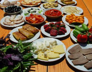
المطبخ
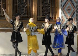
الرقص الشعبي
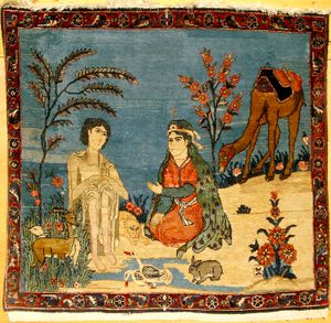
الفنون الشعبية
الأدب
الموسيقى
الرياضة
 مقالة مفصلة: الرياضة في أذربيجان

انظر أيضا
معرض الصور
أذربيجان ، صورة من القمر الصناعي ناسا في مارس 2003
المصادر
- الهوامش
- ^ "The Constitution of the Republic of Azerbaijan" (PDF). President of the Republic of Azerbaijan. The Official Website of the President of the Republic of Azerbaijan. Archived (PDF) from the original on 2022-10-09. Retrieved 31 August 2020.
I. The official language of the Republic of Azerbaijan is Azerbaijani Language. The Republic of Azerbaijan guarantees the development of Azerbaijani Language.
- ^ "National (ethnic) composition of population". State Statistics Committee. 2019. Retrieved 16 September 2023.
- ^ أ ب LaPorte, Jody (2016). "Semi-presidentialism in Azerbaijan". In Elgie, Robert; Moestrup, Sophia (eds.). Semi-Presidentialism in the Caucasus and Central Asia. London: Palgrave Macmillan (published 15 May 2016). pp. 91–117. doi:10.1057/978-1-137-38781-3_4. ISBN 978-1-137-38780-6. LCCN 2016939393. OCLC 6039791976.
LaPorte examines the dynamics of semi-presidentialism in Azerbaijan. Azerbaijan's regime is a curious hybrid, in which semi-presidential institutions operate in the larger context of authoritarianism. The author compares formal Constitutional provisions with the practice of politics in the country, suggesting that formal and informal sources of authority come together to enhance the effective powers of the presidency. In addition to the considerable formal powers laid out in the Constitution, Azerbaijan's president also benefits from the support of the ruling party and informal family and patronage networks. LaPorte concludes by discussing the theoretical implications of this symbiosis between formal and informal institutions in Azerbaijan's semi-presidential regime.
- ^ قالب:Cite CIA World Factbook
- ^ أ ب ت ث "World Economic Outlook Database, April 2024 Edition. (Azerbaijan)". International Monetary Fund. April 2024. Retrieved 21 April 2024.
- ^ "Gini Index coefficient". CIA World Factbook. Retrieved 16 July 2021.
- ^ "Human Development Report 2023/24" (PDF) (in الإنجليزية). United Nations Development Programme. 13 March 2024. Retrieved 13 March 2024.
- ^ Harcave, Sidney (1968). Russia: A History: Sixth Edition. Lippincott. p. 267.
- ^ Mojtahed-Zadeh, Pirouz (2007). Boundary Politics and International Boundaries of Iran: A Study of the Origin, Evolution, and Implications of the Boundaries of Modern Iran with Its 15 Neighbors in the Middle East by a Number of Renowned Experts in the Field. Universal. p. 372. ISBN 978-1-58112-933-5.
- ^ أ ب Swietochowski, Tadeusz (1995). Russia and Azerbaijan: A Borderland in Transition. Columbia University Press. pp. 69, 133. ISBN 978-0-231-07068-3.
- ^ L. Batalden, Sandra (1997). The newly independent states of Eurasia: handbook of former Soviet republics. Greenwood Publishing Group. p. 98. ISBN 978-0-89774-940-4.
- ^ Pipes, Richard (1997). The Formation of the Soviet Union: Communism and Nationalism 1917–1923 (2nd ed.). Cambridge, Massachusetts: Harvard University Press. pp. 218–220, 229. ISBN 978-0-674-30951-7.
- ^ "Азербайджан. Восстановлена государственная независимость". Ельцин Центр (in الروسية). Archived from the original on 24 September 2021. Retrieved 2021-09-24.
- ^ King, David C. (2006). Azerbaijan. Marshall Cavendish. p. 27. ISBN 978-0-7614-2011-8.
- ^ Zürcher, Christoph (2007). The Post-Soviet Wars: Rebellion, Ethnic Conflict, and Nationhood in the Caucasus ([Online-Ausg.]. ed.). New York: New York University Press. p. 168. ISBN 978-0-8147-9709-9.
- ^ Резолюция СБ ООН № 822 от 30 April 1993 года (in الروسية). United Nations. Archived from the original on 3 May 2011. Retrieved 4 January 2011.
- ^ Резолюция СБ ООН № 853 от 29 июля 1993 года (in الروسية). United Nations. Retrieved 4 January 2011.
- ^ Резолюция СБ ООН № 874 14 октября 1993 года (in الروسية). United Nations. Archived from the original on 3 May 2011. Retrieved 4 January 2011.
- ^ Резолюция СБ ООН № 884 от 12 ноября 1993 года (in الروسية). United Nations. Archived from the original on 3 May 2011. Retrieved 4 January 2011.
- ^ Kramer, Andrew E. (10 November 2020). "Facing Military Debacle, Armenia Accepts a Deal in Nagorno-Karabakh War". The New York Times. Archived from the original on 2020-11-10.
- ^ Ebel, Francesca (28 September 2023). "Defeated by force, Nagorno-Karabakh government declares it will dissolve". The Washington Post. Retrieved 28 September 2023.
- ^ "Azerbaijan: Membership of international groupings/organisations". British Foreign & Commonwealth Office. Archived from the original on 9 June 2007. Retrieved 26 May 2007.
- ^ Europa Publications Limited (1998). Eastern Europe and the Commonwealth of Independent States. Routledge. p. 154. ISBN 978-1-85743-058-5.
- ^ أ ب ت خطأ استشهاد: وسم
<ref>غير صحيح؛ لا نص تم توفيره للمراجع المسماةcia - ^ Cornell, Svante E. (2010). Azerbaijan Since Independence. M.E. Sharpe. pp. 165, 284.
Indicative of general regional trends and a natural reemergence of previously oppressed religious identity, an increasingly popular ideological basis for the pursuit of political objectives has been Islam.... The government, for its part, has shown an official commitment to Islam by building mosques and respecting Islamic values... Unofficial Islamic groups sought to use aspects of Islam to mobilize the population and establish the foundations for a future political struggle.... Unlike Turkey, Azerbaijan does not have the powerful ideological legacy of secularism... the conflict with Armenia has bred frustration that is increasingly being answered by a combined Islamic and nationalist sentiment, especially among younger people... All major political forces are committed to secularism and are based, if anything, on a nationalist agenda.
- ^ "Human Rights Watch: Azerbaijan". Human Rights Watch. Retrieved 6 March 2014.
- ^ Houtsma, M. Th. (1993). First Encyclopaedia of Islam 1913–1936 (reprint ed.). Brill. ISBN 978-90-04-09796-4.
- ^ Schippmann, Klaus (1989). Azerbaijan: Pre-Islamic History. Encyclopædia Iranica. pp. 221–224. ISBN 978-0-933273-95-5.
- ^ Chamoux, François (2003). Hellenistic Civilization. John Wiley and Sons. p. 26. ISBN 978-0-631-22241-5.
- ^ Bosworth A.B., Baynham E.J. (2002). Alexander the Great in Fact and fiction. Oxford University Press. p. 92. ISBN 978-0-19-925275-6.
- ^ Nevertheless, "despite being one of the chief vassals of Sasanian Shahanshah, the Albanian king had only a semblance of authority, and the Sassanid marzban (military governor) held most civil, religious, and military authority.
- ^ Swietochowski, Tadeusz (1999). Historical Dictionary of Azerbaijan. Lanham, Maryland: The Scarecrow Press. ISBN 978-0-8108-3550-4.
- ^ Darmesteter, James (2004). "Frawardin Yasht". Avesta Khorda Avesta: Book of Common Prayer (reprint ed.). Kessinger Publishing. p. 93. ISBN 978-1-4191-0852-5.
- ^ "Azerbaijan: Early History: Iranian and Greek Influences". U.S. Library of Congress. Retrieved 7 June 2006.
- ^ Sabahi, Farian (2000). La pecora e il tappeto: i nomadi Shahsevan dell'Azerbaigian iraniano (in الإيطالية). Ariele. p. 23. ISBN 978-88-86480-74-1.
- ^ Atabaki, Touraj (4 September 2006). Iran and the First World War: Battleground of the Great Powers. I.B.Tauris. p. 132. ISBN 978-1-86064-964-6.
- ^ Atabaki, Touraj (2000). Azerbaijan: Ethnicity and the Struggle for Power in Iran. I.B.Tauris. p. 25. ISBN 978-1-86064-554-9.
- ^ Dekmejian, R. Hrair; Simonian, Hovann H. (2003). Troubled Waters: The Geopolitics of the Caspian Region. I.B. Tauris. p. 60. ISBN 978-1-86064-922-6.
Until 1918, when the Musavat regime decided to name the newly independent state Azerbaijan, this designation had been used exclusively to identify the Iranian province of Azerbaijan.
- ^ Rezvani, Babak (2014). Ethno-territorial conflict and coexistence in the caucasus, Central Asia and Fereydan: academisch proefschrift. Amsterdam: Amsterdam University Press. p. 356. ISBN 978-90-485-1928-6.
The region to the north of the river Araxes was not called Azerbaijan prior to 1918, unlike the region in northwestern Iran that has been called since so long ago.
- ^ Fragner, B.G. (2001). Soviet Nationalism: An Ideological Legacy to the Independent Republics of Central Asia. I.B. Tauris and Company. pp. 13–32.
In the post Islamic sense, Arran and Shirvan are often distinguished, while in the pre-Islamic era, Arran or the western Caucasian Albania roughly corresponds to the modern territory of the Republic of Azerbaijan. In the Soviet era, in a breathtaking manipulation, historical Azerbaijan (northwestern Iran) was reinterpreted as "South Azerbaijan" for the Soviets to lay territorial claim on historical Azerbaijan proper which is located in modern-day northwestern Iran.
- ^ Atabaki, Touraj (2000). Azerbaijan: Ethnicity and the Struggle for Power in Iran. I.B.Tauris. p. 8. ISBN 978-1-86064-554-9.
- ^ Bournoutian, George A. (2016). The 1820 Russian Survey of the Khanate of Shirvan: A Primary Source on the Demography and Economy of an Iranian Province prior to its Annexation by Russia. Gibb Memorial Trust. p. 18. ISBN 978-1-909724-83-9.
(...) the Baku and Elisavetpol guberniias, declared their independence (to 1920), and, despite Iranian protests, took the name of Azerbaijan (as noted, the same designation as the historical region in northwestern Iran) (...)
- ^ Comrie, Bernard (1981). The languages of the Soviet Union. Cambridge [England]: Cambridge University Press. p. 162. ISBN 978-0-521-29877-3. OCLC 6627395.
- ^ "أَذْرَبيجان تاريخياً". الموسوعة العربية.
- ^ "However the result of the Treaty of Turkmenchay was a tragedy for the Azerbaijani people. It demarcated a borderline through their territory along the Araxes river, a border that still today divides the Azerbaijani people." in Svante Cornell, "Small nations and great powers: A Study of Ethnopolitical Conflict in the Caucasus", Richmond: Curzon Press, 2001, p. 37.
- ^ أ ب خطأ استشهاد: وسم
<ref>غير صحيح؛ لا نص تم توفيره للمراجع المسماةGEO - ^ "The Karabakh Horse". Karabakh Foundation. Archived from the original on 13 October 2010.
- ^ "Azerbaijan – Flora". Heydar Aliyev Foundation. Retrieved 5 March 2010.
- ^ Dinerstein, Eric; Olson, David; Joshi, Anup; Vynne, Carly; Burgess, Neil D.; Wikramanayake, Eric; Hahn, Nathan; Palminteri, Suzanne; Hedao, Prashant; Noss, Reed; Hansen, Matt; Locke, Harvey; Ellis, Erle C; Jones, Benjamin; Barber, Charles Victor; Hayes, Randy; Kormos, Cyril; Martin, Vance; Crist, Eileen; Sechrest, Wes; Price, Lori; Baillie, Jonathan E. M.; Weeden, Don; Suckling, Kierán; Davis, Crystal; Sizer, Nigel; Moore, Rebecca; Thau, David; Birch, Tanya; Potapov, Peter; Turubanova, Svetlana; Tyukavina, Alexandra; de Souza, Nadia; Pintea, Lilian; Brito, José C.; Llewellyn, Othman A.; Miller, Anthony G.; Patzelt, Annette; Ghazanfar, Shahina A.; Timberlake, Jonathan; Klöser, Heinz; Shennan-Farpón, Yara; Kindt, Roeland; Lillesø, Jens-Peter Barnekow; van Breugel, Paulo; Graudal, Lars; Voge, Maianna; Al-Shammari, Khalaf F.; Saleem, Muhammad (2017). "An Ecoregion-Based Approach to Protecting Half the Terrestrial Realm". BioScience. 67 (6): 534–545. doi:10.1093/biosci/bix014. ISSN 0006-3568. PMC 5451287. PMID 28608869.
- ^ Grantham, H. S.; Duncan, A.; Evans, T. D.; Jones, K. R.; Beyer, H. L.; Schuster, R.; Walston, J.; Ray, J. C.; Robinson, J. G.; Callow, M.; Clements, T.; Costa, H. M.; DeGemmis, A.; Elsen, P. R.; Ervin, J.; Franco, P.; Goldman, E.; Goetz, S.; Hansen, A.; Hofsvang, E.; Jantz, P.; Jupiter, S.; Kang, A.; Langhammer, P.; Laurance, W. F.; Lieberman, S.; Linkie, M.; Malhi, Y.; Maxwell, S.; Mendez, M.; Mittermeier, R.; Murray, N. J.; Possingham, H.; Radachowsky, J.; Saatchi, S.; Samper, C.; Silverman, J.; Shapiro, A.; Strassburg, B.; Stevens, T.; Stokes, E.; Taylor, R.; Tear, T.; Tizard, R.; Venter, O.; Visconti, P.; Wang, S.; Watson, J. E. M. (2020). "Anthropogenic modification of forests means only 40% of remaining forests have high ecosystem integrity – Supplementary Material". Nature Communications. 11 (1): 5978. Bibcode:2020NatCo..11.5978G. doi:10.1038/s41467-020-19493-3. ISSN 2041-1723. PMC 7723057. PMID 33293507.
- ^ Terms and Definitions FRA 2025 Forest Resources Assessment, Working Paper 194. Food and Agriculture Organization of the United Nations. 2023.
- ^ "Global Forest Resources Assessment 2020, Azerbaijan". Food Agriculture Organization of the United Nations.
- ^ أ ب "Azerbaijan – General Information". Heydar Aliyev Foundation. Archived from the original on 5 May 2007. Retrieved 22 May 2007.
- ^ "Rəhbərlik". ibar.az (in الأذربيجانية). International Bank of Azerbaijan.
- ^ أ ب "Azerbaijan's Q1 inflation rate 16.6%, National Bank Chief says". Today.Az. Retrieved 29 May 2007.
- ^ "Dutch disease and the Azerbaijan economy". Communist and Post-Communist Studies. 46 (4): 463–480. 1 December 2013. doi:10.1016/j.postcomstud.2013.09.001.
- ^ Mehdizade, Sevinj. "Azerbaijan's New Manats: Design and Transition to a New Currency". Azerbaijan International.
- ^ Ismayilov, Rovshan. "Azerbaijan's Manat Makeover: Good Times Ahead?". EurasiaNet. Retrieved 7 December 2010.
- ^ "World Economic Forum – The Global Competitiveness Report 2010-2011" (PDF). Archived (PDF) from the original on 6 December 2010. Retrieved 4 January 2011.
- ^ "Bibliothek der Friedrich-Ebert-Stiftung" (PDF). Archived (PDF) from the original on 2022-10-09. Retrieved 11 November 2019.
- ^ أ ب "Azerbaijan – General Information". Heydar Aliyev Foundation. Archived from the original on 28 May 2007. Retrieved 22 May 2007.
- ^ "History of Development of Oil Industry".
- ^ أ ب "Southern Gas Corridor project about to come on stream". Deutsche Welle. 11 November 2020.
- ^ "New gas pipeline could heat up Azeri-Russian rivalry". Reuters. 6 October 2020.
- ^ "Azerbaijan: Economy". globalEDGE. Archived from the original on 12 October 2007. Retrieved 29 May 2007.
- ^ أ ب "Country Trends". Global Footprint Network. Retrieved 4 June 2020.
- ^ Lin, David; Hanscom, Laurel; Murthy, Adeline; Galli, Alessandro; Evans, Mikel; Neill, Evan; Mancini, MariaSerena; Martindill, Jon; Medouar, FatimeZahra; Huang, Shiyu; Wackernagel, Mathis (2018). "Ecological Footprint Accounting for Countries: Updates and Results of the National Footprint Accounts, 2012–2018". Resources (in الإنجليزية). 7 (3): 58. doi:10.3390/resources7030058.
- ^ "SOCAR plans to completed full gasification of Azerbaijan only by 2021". Azerbaijan Business Center. Archived from the original on 3 October 2011. Retrieved 6 June 2010.
- ^ "The Azerbaijan government and co-venturers sign amended and restated Azeri-Chirag-Deepwater Gunashli PSA | Press releases | Media | BP". bp.com (in الإنجليزية). Retrieved 21 September 2017.
- ^ خطأ استشهاد: وسم
<ref>غير صحيح؛ لا نص تم توفيره للمراجع المسماةSTA - ^ أ ب "Natural resources". The State Statistical Committee of the Republic of Azerbaijan. Archived from the original on 10 June 2007. Retrieved 26 May 2007.
- ^ "Azerbaijan: Status of Database". Central Asia and Caucasus Institute. Archived from the original on 20 March 2007. Retrieved 28 May 2007.
- ^ "Findings on the Worst Forms of Child Labor – Azerbaijan". Archived from the original on 14 May 2015. Retrieved 4 July 2015.
- ^ "Industry" (PDF). Statistical Yearbook of Azerbaijan 2004. Archived from the original (PDF) on 2 February 2007. Retrieved 26 May 2007.
- ^ "Rapid Tourism Assessment for the Azerbaijan Tourism Sector Development Program – Organization for Security and Cooperation in Europe (OSCE)". Retrieved 9 September 2013.
- ^ "Azərbaycan Qarabağın turizm imkanlarını təbliğ edir". Azadlıq Radiosu (in الأذربيجانية). 18 April 2007.
- ^ Ismayilov, Rovshan. "Azerbaijan: Baku Boom Has Yet to Hit Regions". EurasiaNet. Archived from the original on 19 August 2007. Retrieved 12 August 2007.
- ^ "$2 bn to be invested in Shahdag winter-summer resort in Azerbaijan". News.az. Archived from the original on 8 April 2011. Retrieved 11 July 2011.
- ^ "Ministry of Culture and Tourism of Azerbaijan: Goals". Tourism.az. 6 February 2004. Archived from the original on 28 November 2010. Retrieved 4 January 2011.
- ^ Global Passport Power Rank | Passport Index 2017. Passportindex.org. Retrieved 1 July 2017.
- ^ Home Page | The Electronic Visa System of Azerbaijan Republic Archived 20 ديسمبر 2016 at the Wayback Machine. Evisa.gov.az. Retrieved 1 July 2017.
- ^ Crotti, Robert and Misrahi, Tiffany(2015) Chapter 1.1 "The Travel & Tourism Competitiveness Index 2015: T&T as a Resilient Contribution to National Development" in The Travel & Tourism Competitiveness Index 2015. World Economic Forum
- ^ "Research" (PDF). wttc.org. 2017. Archived from the original (PDF) on 13 November 2018. Retrieved 22 April 2020.
- ^ Hope, Katie (19 July 2017). "Where's hot? This summer's most popular holiday spots". BBC.
- ^ Ziyadov, Taleh. "The New Silk Roads" (PDF). Central Asia-Caucasus Institute Silk Road Studies Program. Archived from the original (PDF) on 25 July 2013.
- ^ Zeyno Baran (2005). "The Baku-Tbilisi-Ceyhan Pipeline: Implications for Turkey" (PDF). The Baku-Tbilisi-Ceyhan Pipeline: Oil Window to the West: 103–118. Archived from the original (PDF) on 27 February 2008. Retrieved 30 December 2007.
- ^ "SCP Commissioning Commences" (Press release). BP. 1 June 2006. Archived from the original on 11 October 2007. Retrieved 4 June 2008.
- ^ Ziyadov, Taleh. "The New Silk Roads" (PDF). Central Asia-Caucasus Institute Silk Road Studies Program. Archived from the original (PDF) on 25 يوليو 2013.
- ^ "List of Contracting Parties to the Convention on Road Traffic" (PDF). UN Economic Commission for Europe. Archived from the original (PDF) on 14 August 2011. Retrieved 23 January 2010.
- ^ "Azerbaijan aims for hi-tech state". Euronews. Retrieved 19 December 2010.
- ^ "Azerbaijan is in TOP 10 of countries showing dynamic growth in Internet and mobile communications penetration". bakutel.az. Archived from the original on 7 May 2013. Retrieved 15 April 2013.
- ^ WIPO (2022). Global Innovation Index 2023, 15th Edition (in الإنجليزية). World Intellectual Property Organization. doi:10.34667/tind.46596. ISBN 978-92-805-3432-0. Retrieved 2023-10-29.
{{cite book}}:|website=ignored (help) - ^ "Global Innovation Index". INSEAD Knowledge (in الإنجليزية). 2013-10-28. Archived from the original on 2 September 2021. Retrieved 2021-09-02.
- ^ CIA.gov Archived 13 يونيو 2007 at the Wayback Machine, CIA World Factbook Telephones – main lines in use, Azerbaijan 1,397,000 main lines
- ^ CIA.gov Archived 4 يناير 2018 at the Wayback Machine, CIA World Factbook Internet users, Azerbaijan Internet users: 1,485,000.
- ^ "Azerbaijani scientist invents earthquake-resistant building". News.Az. Retrieved 18 March 2011.
- ^ "International Station for the Forecasting of Earthquakes Atropatena-AZ3, Baku, Azerbaijan". Global Network for the Forecasting of Earthquakes.
- ^ Азербайджанский ученый изобрел метод оповещения о землетрясении (in الروسية). BlackSea News. Retrieved 29 March 2011.
- ^ "Arianespace signs deal to launch Azerbaijani satellite". News.Az. Archived from the original on 8 November 2010. Retrieved 5 November 2010.
- ^ "Azerbaijan signs deal with Arianespace to launch satellite". Space Travel. Archived from the original on 6 November 2010. Retrieved 5 November 2010.
- ^ "Orbital Contracted to Build Azerbaijan's First Satellite". SatelliteToday. 28 November 2010. Archived from the original on 10 May 2011. Retrieved 1 April 2011.
- ^ "Baku developing satellite to kick off national space program". Hurriyet Daily News and Economic Review. 3 December 2009. Archived from the original on 7 October 2011. Retrieved 4 January 2011.
- ^ "Meeting held to coordinate orbital slots for Azersat". News.Az. 16 November 2009. Archived from the original on 11 May 2011. Retrieved 18 March 2016.
- ^ "Азербайджан рассчитывает запустить спутник связи AzerSat" (in الروسية). ComNews. Retrieved 29 July 2009.
- ^ Sharifov, Azad. "Legend of the Bibi-Heybat Mosque". Azerbaijan International. Retrieved 11 July 2010.
- ^ "Islam and Secularism: the Azerbaijani experience and its reflection in France". PR Web. Archived from the original on 14 February 2015. Retrieved 2013-08-16.
- ^ "Mapping The Global Muslim Population" (PDF). Archived from the original (PDF) on 19 May 2011. Retrieved 22 May 2011.
- ^ "Religion" (PDF). Administrative Department of the President of the Republic of Azerbaijan – Presidential Library. Retrieved 2023-05-12.
- ^ Sources:
- "2021 Report on International Religious Freedom: Azerbaijan". U.S Department of State. 2 June 2022. Archived from the original on 4 June 2022.
According to 2011 SCWRA data (the most recent available), 96 percent of the population is Muslim, of which approximately 65 percent is Shia and 35 percent Sunni.
- Greenger, Nurit (8 May 2017). "Azerbaijan a Destination Worthwhile. My week travel log in Azerbaijan – Day two". The Jerusalem Post. Archived from the original on 19 January 2023.
- Balci, Bayram (18 March 2013). "The Syrian Crisis: A View from Azerbaijan". Carnegie Endowment for International Peace. Archived from the original on 18 January 2022.
- S. Nielsem, Jorgen; Balciz Goyushov, Bayram, Altay (2013). "Azerbaijan". Yearbook of Muslims in Europe: Volume 5. Leiden, The Netherlands: Brill. p. 65. ISBN 978-90-04-25456-5.
quote:"While traditionally approximately 65% of local Muslims are considered Shi'i and 35% Sunnis, due to a great success of international Sunni missionary organisations after the collapse of the Soviet Union, currently the estimated number of practicising Sunni and Shi'i Muslims in the big urban areas are almost equal"
{{cite book}}: CS1 maint: multiple names: authors list (link) - Mammadli, Nijat (7 June 2018). "Islam and Youth in Azerbaijan". Baku Research Institute. Archived from the original on 20 April 2023.
quote:"Also, according to rough estimates, Shiites constitute 60–65% of the Muslim population, and Sunnis – 35–40%."
- "2021 Report on International Religious Freedom: Azerbaijan". U.S Department of State. 2 June 2022. Archived from the original on 4 June 2022.
- ^ Ismayilov, Murad (2018). "1: Hybrid Intentionality and Exogenus Sources of Elite's Manifold Attitudes to Islam in Azerbaijan". The Dialectics of Post-Soviet Modernity and the Changing Contours of Islamic Discourse in Azerbaijan. London: Lexington Books. p. 2. ISBN 9781498568364.
The country's population historically divided between the Shia (currently some 50-65 percent of the population) and the Sunni (about 35–50 percent).
- ^ Whitaker's Shorts 2015: International. Bloomsbury. 2014. ISBN 9781472914842.
- ^ Gallup – What Alabamians and Iranians Have in Common – data accessed on 19 August 2014
- ^ "Global Christianity". Pew Research Center's Religion & Public Life Project. 1 December 2014. Archived from the original on 19 July 2014. Retrieved 4 July 2015.
- ^ "Catholic Church in Azerbaijan". Catholic-Hierarchy. Archived from the original on 29 April 2007. Retrieved 27 May 2007.
- ^ أ ب Corley, Felix (9 March 2002). "Azerbaijan: 125 religious groups re-registered". Keston News Service. Archived from the original on 24 July 2011. Retrieved 9 April 2002.
- ^ "5,000 Azerbaijanis adopted Christianity" (in الروسية). Day.az. 7 July 2007. Retrieved 30 January 2012.
- ^ "Christian Missionaries Becoming Active in Azerbaijan" (in الأذربيجانية). Tehran Radio. 19 June 2011. Archived from the original on 19 February 2014. Retrieved 12 August 2012.
- ^ Rothholz, Peter (20 November 2015). "Jewish Life in Azerbaijan Embodies Muslim-Majority Nation's Culture of Tolerance". BreakingIsraelNews. Jewish News Syndicate. Archived from the original on 21 November 2015.
- ^ "Baku gives land for Jewish cultural center, kosher restaurant". Jewish Telegraphic Agency. 11 December 2013.
- ^ Allen-Ebrahimian, Bethany. "How I Accidentally Became a Lobbyist for Azerbaijan". Foreign Policy.
- ^ Sloame, Joanna. "Azerbaijan". Jewish Virtual Library. American-Israeli Cooperative Enterprise.
- ^ Azerbaijan. state.gov
- ^ أ ب Population by language, sex and urban/rural residence, UN Data. Retrieved 27 August 2016.
- ^ Miller, Donald E.; Miller, Lorna Touryan (2003). Armenia: Portraits of Survival and Hope. Berkeley, California: University of California Press. p. 7. ISBN 978-0-520-23492-5.
- ^ "Nagorno Karabakh Republic – Country Overview". Nkrusa.org. Archived from the original on 19 أبريل 2012. Retrieved 6 مايو 2012.
- ^ "Ethnologue report for Azerbaijan". Ethnologue: Languages of the World. Archived from the original on 18 December 2008. Retrieved 3 January 2009.
- ^ أ ب ت ث ج ح خ د "Endangered languages in Europe and North Asia". Retrieved 4 July 2015.
- ^ Clifton, John M., editor. 2002 (vol. 1), 2003 (vol. 2). Studies in languages of Azerbaijan. Baku, Azerbaijan and Saint Petersburg, Russia: Institute of International Relations, Academy of Sciences of Azerbaijan and North Eurasian Group, SIL International.
وصلات خارجية
- Global Integrity Report: Azerbaijan has information on anti-corruption efforts
- State Statistical Committee of Azerbaijan
- Chief of State and Cabinet Members
- United Nations Office in Azerbaijan
- The Ministry of Culture and Tourism
- إعلام
- سياحة
أذربيجان travel guide from Wikitravel
- معلومات عامة
- شركات أذربيجان
- فنادق أذربيجان
- عن أذربيجان
- ملف البلد من بي بي سي نيوز
- Azerbaijan entry at The World Factbook
- Azerbaijan at UCB Libraries GovPubs
- أذربيجان at the Open Directory Project
- أخرى
- CS1 الروسية-language sources (ru)
- CS1 uses الروسية-language script (ru)
- CS1 الإيطالية-language sources (it)
- CS1 الأذربيجانية-language sources (az)
- CS1 errors: periodical ignored
- Pages using gadget WikiMiniAtlas
- Short description is different from Wikidata
- Articles containing آذربيجاني-language text
- Pages using infobox country or infobox former country with the symbol caption or type parameters
- Pages using Lang-xx templates
- Articles with hatnote templates targeting a nonexistent page
- Articles containing آڤستان-language text
- Articles containing روسية-language text
- مقالات المعرفة بحاجة للتحديث from December 2023
- كل مقالات المعرفة بحاجة لتحديث
- Articles with unsourced statements from October 2020
- مقالات فيها عبارات متقادمة منذ 2009
- جميع المقالات التي فيها عبارات متقادمة
- جميع المقالات الحاوية على عبارات مبهمة
- جميع المقالات الحاوية على عبارات مبهمة from June 2022
- Coordinates on Wikidata
- قوالب
- دول بحر قزوين
- أذربيجان
- بلدان جنوب شرق آسيا
- بلدان أوروپا
- بلدان ثنائية القارات
- جمهوريات
- شرق أوروپا
- بلدان حبيسة
- دول توركية حديثة
- قوقاز
- بلدان الشرق الأدنى
- أعضاء منظمة المؤتمر الإسلامي
- دول ومناطق تأسست في 1991
- غرب آسيا


