کونمینغ
کونمینگ
昆明市 Kunming | |||||||||||
|---|---|---|---|---|---|---|---|---|---|---|---|
|
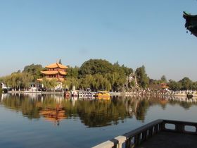
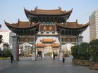
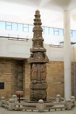
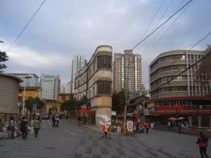
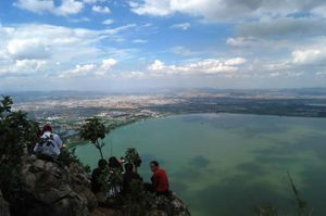
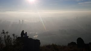
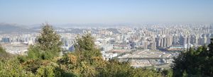
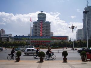
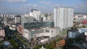
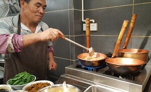
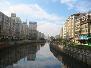
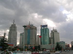
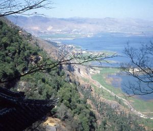
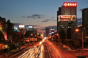
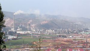
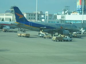
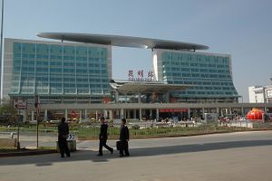
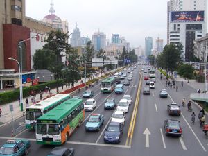
من أعلى، من اليسار إلى اليمين: وسط کونمینگ، بحيرة ديان، طريق بكين، طريق الأقواس التذكاري للحصان الذهبي بکونمینگ، کونمینگ ديانتشي مركز المؤتمرات والمعارض العالمي | |||||||||||
    | |||||||||||
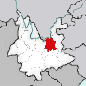
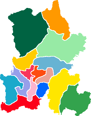
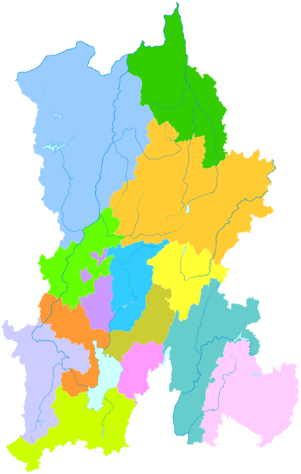
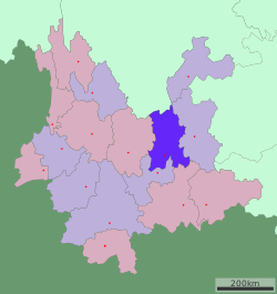 موقع حدود مدينة کونمینگ في يوننان | |||||||||||
| الإحداثيات: 25°02′36″N 102°42′22″E / 25.04333°N 102.70611°E | |||||||||||
| البلد | الصين | ||||||||||
| مقاطعة | يوننان | ||||||||||
| التقسيمات بمستوى ناحية | 14 | ||||||||||
| تقسيمات بمستوى بلدية | 137 | ||||||||||
| مركز اداري | تشنگگونگ | ||||||||||
| الوحدات الادارية | |||||||||||
| الحكومة | |||||||||||
| • أمين لجنة الحزب | Liu Hongting | ||||||||||
| • Congress Chairman | Yan Zhengxiao | ||||||||||
| • العمدة | Liu Jiachen | ||||||||||
| • CPPCC Chairman | Xiong Ruili | ||||||||||
| المساحة | |||||||||||
| • مدينة بمستوى محافظة | 21٬473 كم² (8٬291 ميل²) | ||||||||||
| • الحضر | 4٬013 كم² (1٬549 ميل²) | ||||||||||
| • العمران | 2٬622 كم² (1٬012 ميل²) | ||||||||||
| المنسوب | 1٬892 m (6٬207 ft) | ||||||||||
| التعداد (2020 census)[1] | |||||||||||
| • مدينة بمستوى محافظة | 8٬460٬088 | ||||||||||
| • الكثافة | 390/km2 (1٬000/sq mi) | ||||||||||
| • Urban | 5٬950٬578 | ||||||||||
| • الكثافة الحضرية | 1٬500/km2 (3٬800/sq mi) | ||||||||||
| • العمرانية | 5٬604٬310 | ||||||||||
| • الكثافة العمرانية | 2٬100/km2 (5٬500/sq mi) | ||||||||||
| • Rank in China | 16th | ||||||||||
| منطقة التوقيت | UTC+08:00 (China Standard) | ||||||||||
| Postal code | 650000 | ||||||||||
| مفتاح الهاتف | 0871 | ||||||||||
| ISO 3166 code | CN-YN-01 | ||||||||||
| License plate prefixes | 云A | ||||||||||
| GDP (PPP) (2014) | $88.631 billion[2] | ||||||||||
| GDP (PPP) per capita (2014) | $13,418[2] | ||||||||||
| المناخ | Cwb | ||||||||||
| Home to | Karst wonders | ||||||||||
| الموقع الإلكتروني | www | ||||||||||
| |||||||||||
| کونمینغ | |||
|---|---|---|---|
 "کونمینغ" بالحروف الصينية | |||
| الصينية | 昆明 | ||
| المعنى الحرفي | (transcription of an ancient tribal name) | ||
| |||
| الأسماء القديمة | |||
|---|---|---|---|
| يوننان-فو | |||
| الصينية التقليدية | 雲南府 | ||
| الصينية المبسطة | 云南府 | ||
| |||
کونمینگ هي عاصمة وأكبر مدن مقاطعة يوننان- رابع أقل مقاطعات الصين تطوراً بناءً على دخل الفرد. ، في جنوب غرب الصين.[3] وكانت تـُعرف بإسم يوننان-فو (مدينة يوننان) حتى ع1920، واليوم هي مدينة بمستوى محافظة والمركز السياسي والاقتصادي والاتصالاتي والثقافي للمقاطعة وكذلك مقر حكومة المقاطعة. وهي مقر العديد من الأعمال الكبرى في يوننان. وكانت ذات أهمية أثناء الحرب العالمية الثانية كمركز عسكري صيني، وقاعدة جوية أمريكية، والمحطة النهائية لـطريق بورما. وتقع في وسط Yunnan–Guizhou Plateau, Kunming is located at an altitude of 1,900 metres (6,234 feet) above sea level and at a latitude just north of the Tropic of Cancer. As of 2014, Kunming has a population of 6,626,000 with an urban population of 4,575,000,[4] and is located at the northern edge of Dian Lake, surrounded by temples and lake-and-limestone hill landscapes.
Kunming consists of an old, previously walled city, a modern commercial district, residential zones and university areas. تضم المدينة مرصداً فلكياً، ومؤسسات للتعليم العالي منها جامعة يوننان وجامعة يوننان للمعلمين وجامعة کونمینگ للعلوم والتكنولوجيا وجامعة کونمینگ الطبية. On the northeast mountainous outskirt is a bronze temple dating from the Ming dynasty, the largest of its kind in China.
Its economic importance derives from its geographical position. It is positioned near the border with Southeastern Asian countries, serving as a transportation hub in Southwest China, linking by rail to Vietnam and by road to Burma, Laos and Thailand. This positioning also makes it an important trade center in this region of the nation. It also houses some manufacturing, chiefly the processing of copper, as well as various chemicals, machinery, textiles, paper and cement. Though having a nearly 2,400-year history, its modern prosperity dates only from 1910, when the railway from Hanoi was built. The city has continued to develop rapidly under China's modernization efforts. Kunming's streets have widened while office buildings and housing projects develop at a fast pace. Kunming has been designated a special tourism center and as such sports a proliferation of high-rises and luxury hotels.
التسمية
الاسم "کونمینگ" تطور من عرق قديم كان يُدعى کونمینگ يي أو برابرة کونمینغ (昆明夷), which was a branch of Di-Qiang. The Kunming Yi lived in the neighbouring region of Erhai Lake during the Western Han dynasty. The Han dynasty incorporated the territory of the Dian Kingdom and set a division called Yizhou Commandery in 109 BC; the Han dynasty also incorporated the Kunming Yi into Yizhou Commandery soon after. Therefore, Kunming Yi expanded east to the Lake Dian area later. "Kunming" has acted as a place name since the Three Kingdoms period, but the reference was not clear because this ethnicity occupied a large region. In the Yuan dynasty, the central government set "Kunming County" in modern Kunming; the name "Kunming" has continued to this day.[5]
Some modern research states that the name "Kunming" of Kunming Yi is a cognate word of "Khmer" and "Khmu" that originally meant "people".[6]
التاريخ
التاريخ المبكر
Kunming long profited from its position on the caravan roads through to South-East Asia, India and Tibet. Early townships in the southern edge of Lake Dianchi (outside the contemporary city perimeter) can be dated back to 279 BC, although they have been long lost to history. Early settlements in the area around Lake Dian date back to Neolithic times. The Dian Kingdom, whose original language was likely related to Tibeto-Burman languages was also established near the area.[7]
Dian was subjugated by the Chinese Han dynasty under the reign of Emperor Wu of Han in 109 BC. The Han dynasty incorporated the territory of the Dian Kingdom into their Yizhou Commandery, but left the King of Dian as the local ruler.[8]
The Han dynasty (205 BC–AD 220), seeking control over the Southern Silk Road running to Burma and India, brought small parts of Yunnan into China's orbit, though subsequent dynasties could do little to tame what was then a remote and wild borderland. During the Sui dynasty (581–618), two military expeditions were launched against the area, and it was renamed Kunzhou in Chinese sources.[9]
الصين الوسيطة
تأسست في 765، عـُرفت کونمینگ للصينيين بإسم مدينة توودونگ (拓东 Tuodong) في مملكة نانژاو (737–902) في القرنين الثامن والتاسع. وقد أصبحت توودونگ لاحقاً جزءا من مملكة دالي التالية (937–1253). إلا أن ذلك تغير وقعت توودونگ تحت سيطرة غزو أسرة يوان للجنوب الغربي في 1252-1253. وفي 1276 أسسها الحكام المنغول بإسم محافظة کونمینگ وأصبحت العاصمة الإقليمية لمقاطعة يوننان. نمت المدينة كمركز تجاري بين الجنوب الغربي وباقي الصين. ويعتبر الباحثون أنها مدينة ياچي فو (بلدة بركة البط) حيث كان الناس يستخدمون الودع (أصداف البحر) كعملة مالية وكانوا يأكلون اللحم نيئاً، كما وصف الرحالة البندقي من القرن 13، ماركو پولو الذي سافر إلى المنطقة وكتب عن اعجابه بالمكان.
أسرتا مينگ و چينگ

في القرن 14، استُعيدت کونمینگ بانتصار أسرة منڲ على المنغول، الذين بنوا سوراً يحيط بـکونمینگ الحالية. جنرال المنگ وو سانگوي فر إلى صف الغزاة المانشو بعد 300 عام وسيطر على المدينة حتى وفاته في 1678، بعد فترة طويلة من سقوط باقي الصين تحت حكم المانشو. وفي عهد أسرتي منگ (1368–1644) وچنگ (1644–1911)، كانت مقر محافظة يوننان الكبرى.
المنطقة سُميت کونمینگ لأول مرة في فترة انحدار أسرة يوان وما بعد ذلك حتى 1832، بداية المدينة الحقيقية داخل أسوار المدينة التي نما عمرانها. ولذا يمكن القول أن تأسيس المدينة الفعلي كان في القرن 19. وفي ذلك القرن أيضاً نمت المدينة لتصبح السوق الرئيسي ومركز المواصلات للمنطقة.
عانت کونمینگ على يد زعيم المتمردين دو ونشيو، سلطان دالي، الذي هاجم وحاصر المدينة عدة مرات بين 1858 و 1868. وقد نجا القليل من ثروة المدينة في تمرد پانثاي المسلم 1856، حين أزيلت من الوجود المواقع البوذية في العاصمة. وبعد عقود، بدأت کونمینگ في التأثر بالغرب، وخصوصاً من الامبراطورية الفرنسية. وفي ع1890، أسفرت انتفاضة ضد أحوال العمل في شريط سكة حديد کونمینگ-هايفونگ إلى إعدام العديد من العمال بعد أن شحنت فرنسا أسلحة لإخماد التمرد. خط السكة الحديد بعرض متر، اكتمل في حوالي 1911، وقد صممه الفرنسيون لاستغلال ثروات يوننان المعدنية في مستعمراتها بالهند الصينية.
كانت کونمینگ مركزا للمواصلات في العصور المبكرة ونقطة تقاطع لطريقين تجاريين رئيسيين، أحدهما يتجه غرباً عبر دالي و محافظة تنگچونگ إلى ميانمار، والآخر يتجه جنوباً عبر محافظة منگزي إلى النهر الأحمر في الهند الصينية. وباتجاه الشرق، كان يوجد طريق جبلي وعر يؤدي إلى گوييانگ في مقاطعة گويژو ثم إلى مقاطعة هونان. وباتجاه الشمال الشرقي كان يوجد ممر تجاري راسخ إلى ييبين في مقاطعة سيشوان على نهر يانگتزى. إلا أن كل تلك الطرق كانت وعرة جداً، ويمكن عبورها فقط على ظهور البغال أو العتالين.
التاريخ المعاصر
تحولت کونمینگ إلى مكانة "محافظة county" في 1912، بإسم کونمینگ، وأصبحت بلدية في 1935. انفتاح منطقة کونمینگ بدأ حثيثاً بالإكتمال في 1906-1910 لـسكة حديد يوننان-ڤيتنام إلى هايفونگ في شمال ڤيتنام (جزء من الهند الصينية الفرنسية). وقد أصبحت کونمینگ ميناء معاهدة مفتوح للتجارة الأجنبية في 1908 وسرعان ما أصبحت مركزاً تجارياً. وفي ع1930 تزايدت أهميتها حين أنشئ أول طريق سريع، ليربط کونمینگ مع چونگچنگ في سيشوان وگوييانگ في گويژو إلى الشرق. وصلة السكة الحديدية بين کونمینگ وهانوي انقطعت أثناء الحرب العالمية الثانية، ثم عادت للعمل في 1957، ثم قـُطعت مرة أخرى في 1979، وأعيد افتتاحها في 1996.
Later in the war, Kunming was targeted by the Imperial Japanese Army Air Force during its bombing campaigns, and when the Burma Road was lost to the Japanese, the 1st American Volunteer Group, known as the "Flying Tigers", used Kunming as a base in 1941 and 1942 to fly in supplies over the Himalayas from British bases in India in defiance of Japanese assaults. They also were tasked with defending China's lifeline to the outside world, the Burma Road and the Ledo Road, which had Kunming as a northern terminus.[10]
Industry became important in Kunming during World War II. The large state-owned Central Machine Works[11] was transferred there from Hunan, while the manufacture of electrical products, copper, cement, steel, paper, and textiles expanded.
الحرب العالمية الثانية
تحولت کونمینگ إلى مدينة عصرية نتيجة اندلاع الحرب الصينية اليابانية الثانية في 1937 حين تسببت القوات اليابانية الغازية في تدفق أعداداً هائلة من اللاجئين من صينيي الساحل الشرقي، وبعضهم كان ثرياً، إلى جنوب غرب الصين. They brought with them dismantled industrial plants, which were then re-erected beyond the range of Japanese bombers. In addition, a number of universities and institutes of higher education were evacuated there. The increased money and expertise quickly established Kunming as an industrial and manufacturing base for the wartime government in Chongqing.
أثناء الحرب العالمية الثانية، أُعِدت مدينة کونمینگ كـ معقل وطني في حالة سقوط العاصمة المؤقتة في Chongqing fell, an elaborate system of underground caves to serve as offices, barracks and factories was prepared but never utilised. Kunming was to have served again in this role during the ensuing الحرب الأهلية الصينية، ولكن الحامية الوطنية غيرت ولاءها وانضمت للشيوعيين. Instead Taiwan would become the last redoubt and home of the Chinese Nationalist government, a role it fulfills to this day.[12]
حين احتل اليابانيون الهند الصينية الفرنسية في 1940، أصبحت طرق اتصال کونمینگ مع الغرب، عبر طريق بورما حديث الإنشاء وجواً، أكثر حيوية، إذ أمدّت قوات الحلفاء دعماً أساسياً باستيراد مواد من المستعمرة البريطانية بورما. By this time, Kunming acted as an Allied military command center, which grouped the Chinese, American, British and French forces together for operations in Southeast Asia, including China, India and Burma. The Office of Strategic Services' Service Unit Detachment 101 (predecessor to the 1st Special Forces Group) كانت أيضاً متمركزة في کونمینگ and whose mission was to divert and disrupt Japanese combat operations in Burma.[13]
Later on in the war, Kunming was targeted by the Imperial Japanese Air Force during their bombing campaigns, and when the Burma Road was lost to the Japanese, the American Volunteer Group, known as the "Flying Tigers", used Kunming as a base in 1941 and 1942 to fly in supplies over the Himalayas from British bases in India in defiance of Japanese assaults. They also were tasked with defending China's lifeline to the outside world, the Burma Road and the Ledo Road, which had Kunming as a northern terminus.[14]
أصبحت الصناعة مهمة في کونمینگ أثناء الحرب العالمية الثانية. The large state-owned Central Machine Works[15] was transferred there من هونان, while the manufacture of electrical products, copper, cement, steel, paper, and textiles expanded. A university was set up in 1922. Until 1952, Kunming was a walled city. The city government in 1952 ordered hundreds of young people to tear down the wall and use its bricks to make a new road running north-south. To show its appreciation for the young people that demolished the east wall, the city government named the new street after them. Their existence still echoes today in place names like Xiao Ximen (小西门, 'Lesser west gate') and Beimen Jie (北门街, 'North gate Street'). There are also less obvious connections to the wall, such as Qingnian Lu (青年路, 'Youth Road'), which was once Kunming's east wall.
النشيد
الجغرافيا والمناح
Kunming is located in east-central Yunnan province. It is located between north latitude 24°23' and 26°22' N, and east longitude 102°10' and 103°40' E, with a total area of 21,600 square kilometres (8,340 square miles). Its widest stretch from the east to the west amounts to 140 kilometres (87 miles) and its largest expansion from the north to the south amounts to 220 kilometres (137 miles).
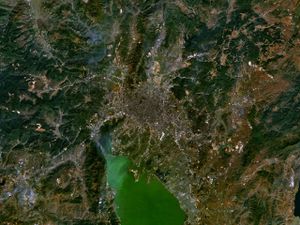
Situated in a fertile lake basin on the northern shore of the Lake Dian and surrounded by mountains to the north, west, and east, Kunming has always played a pivotal role in the communications of southwestern China. Lake Dian, titled as "the Pearl of the Plateau", is the sixth largest fresh water lake in China, is the largest lake in Yunnan and has an area of approximately 340 square kilometres (130 square miles). Kunming's highest point is Mazong Ridge of the Jiaozi Mountain in Luquan with an elevation of 4,247 metres (13,934 feet), and its lowest point is the joint of the Xiao River and the Jinsha River in Dongchuan District, with an elevation of 695 metres (2,280 feet). Its downtown area is 1,891 metres (6,204 feet) above sea level.
About 96 km (60 mi) southeast of the city centre is the Stone Forest in Shilin County, a karst formation developed as a tourist attraction consisting of rock caves, arches, and pavilions. It is part of the larger karst-based landscape of the area.
المناخ
| أخفمتوسطات الطقس لکونمینگ | |||||||||||||
|---|---|---|---|---|---|---|---|---|---|---|---|---|---|
| شهر | يناير | فبراير | مارس | أبريل | مايو | يونيو | يوليو | أغسطس | سبتمبر | اكتوبر | نوفمبر | ديسمبر | السنة |
| متوسط العظمى °م (°ف) | 15.9 (61) | 17.2 (63) | 21.7 (71) | 24.8 (77) | 25.3 (78) | 24.5 (76) | 24.7 (76) | 24.8 (77) | 23.3 (74) | 20.6 (69) | 17.7 (64) | 15.8 (60) | 21٫4 (71) |
| متوسط الصغرى °م (°ف) | 2.3 (36) | 4.4 (40) | 7.4 (45) | 10.2 (50) | 14.5 (58) | 17.2 (63) | 17.1 (63) | 16.0 (61) | 14.2 (58) | 10.1 (50) | 7.1 (45) | 3.4 (38) | 10٫9 (52) |
| هطول الأمطار mm (بوصة) | 12.5 (0.5) | 12.5 (0.5) | 17.5 (0.7) | 22.5 (0.9) | 82.5 (3.2) | 177.5 (7) | 212.5 (8.4) | 202.5 (8) | 122.5 (4.8) | 77.5 (3.1) | 37.5 (1.5) | 12.5 (0.5) | 920 (36٫2) |
| المصدر: China Meteorological Administration. November 18 2007 | |||||||||||||
الموارد الطبيعية
البيئة والبستنة
المحكمة البيئية
الحياة البرية
الإحاثة
الحدود
التقسيمات الادارية
| Prefecture-level | County-level | ||
|---|---|---|---|
| Name | Chinese (S) | Hanyu Pinyin | |
| Kunming City 昆明市 Kūnmíng Shì |
Panlong District | 盘龙区 | Pánlóng Qū |
| Wuhua District | 五华区 | Wǔhuá Qū | |
| Guandu District | 官渡区 | Guāndù Qū | |
| Xishan District | 西山区 | Xīshān Qū | |
| Dongchuan District | 东川区 | Dōngchuān Qū | |
| Anning City | 安宁市 | Ānníng Shì | |
| Chenggong County | 呈贡县 | Chénggòng Xiàn | |
| Jinning County | 晋宁县 | Jìnníng Xiàn | |
| Fumin County | 富民县 | Fùmín Xiàn | |
| Yiliang County | 宜良县 | Yíliáng Xiàn | |
| Songming County | 嵩明县 | Sōngmíng Xiàn | |
| Shilin Yi Autonomous County | 石林彝族自治县 | Shílín Yízú Zìzhìxiàn | |
| Luquan Yi and Miao Autonomous County |
禄劝彝族 苗族自治县 |
Lùquàn Yízú Miáozú Zìzhìxiàn | |
| Xundian Hui and Yi Autonomous County |
寻甸回族 彝族自治县 |
Xúndiàn Huízú Yízú Zìzhìxiàn | |
الديموغرافيا
Of the more than five million people registered as residents in Kunming in 2006, around four million are Han. The Yi people are the most prominent minority in the city, with more than 400,000 residents. The least-represented ethnic minority in Kunming were the 75 Dulong people living in the city.
Registered ethnic populations of Kunming اعتبارا من 2006[تحديث]:[16]
- Han: 4,383,500
- Yi: 400,200
- Hui: 149,000
- Bai: 73,200
- Miao: 46,100
- Lisu: 17,700
- Zhuang: 14,000
- Dai: 13,200
- Hani: 11,000
- Naxi: 8,400
- Manchu: 4,800
- Buyei: 3,400
- Mongol: 2,500
- Lahu: 1,700
- Tibetan: 1,500
- Yao: 1,100
- Jingpo: 1,100
- Va: 1,000
- Blang: 441
- Primi: 421
- Sui: 294
- Achang: 263
- Nu: 156
- Jino: 135
- Derung: 75
Cityscape
The city center has three major squares and five major streets: Jinma Biji Square, Nanping Square and Dongfeng Square along with Nanping Jie, Jinbi Lu, Renmin Lu, Zhengyi Lu and Jingxin Jie. Qingnian Lu, Zhengyi Lu, and Renmin Lu are the main commercial areas in Kunming; the most popular pedestrian streets are Nanping Jie, Jingxing Birds-Flowers' Market, and Jinma Biji Fang.
Kunming's public focus is the huge square outside the now-demolished Workers' Cultural Hall at the Beijing Lu-Dongfeng Lu intersection, where in the mornings there are crowds doing taijiquan and playing badminton. Weekend amateur theatre are also performed in the square. Rapidly being modernized, the city's true center is west of the square across the adjacent Panlong River (now more of a canal), outside the Kunming Department Store at the Nanping Lu/Zhengyi Lu crossroads, a densely crowded shopping precinct packed with clothing and electronics stores. The river receives sewage and wastewater from surrounding pipes.[17] Surrounding the area are plenty of new high-rises.
The center is an area of importance to Kunming's Hui population, with Shuncheng Jie, one of the last old streets in the center of the city, previously forming a Muslim quarter. Until shortly before 2005, this street was full of wind-dried beef and mutton carcasses, pitta bread and raisin sellers, and huge woks of roasting coffee beans being stirred with shovels.[بحاجة لمصدر] Under Kunming's rapid modernisation, however, the street has been demolished to make way for apartments and shopping centers. Rising behind a supermarket one block north off Zhengyi Lu, Nancheng Qingzhen Si is the city's new mosque, its green dome and chevron-patterned minaret visible from afar and built on the site of an earlier Qing edifice.
Running west off Zhengyi Jie just past the mosque, Jingxing Jie leads into one of the more bizarre corners of the city, with Kunming's huge Bird and Flower Market convening daily in the streets connecting it with the northerly, parallel Guanghua Jie. The market offers many plants such as orchids that have been collected and farmed across the province. In the small grounds of Wen Miao, a now vanished Confucian temple off the western end of Changchun Lu, there is an avenue of pines, an ancient pond and pavilion, and beds of bamboo, azaleas and potted palms.[بحاجة لمصدر]
Jinbi Lu runs roughly parallel to and south of Dongfeng Lu, reached from Beijing Lu. Two large Chinese pagodas rise in the vicinity, each a solid thirteen stories of whitewashed brick crowned with four iron cockerels. The West Pagoda was built between 824 and 859, during the Tang dynasty; its original counterpart, the East Pagoda, was built at the same time, but was destroyed by an earthquake in 1833 and rebuilt in the same Tang style in 1882.[بحاجة لمصدر] South down Dongsi Jie, past another mosque, the entrance to the West Pagoda is along a narrow lane on the right. In the tiny surrounding courtyard, sociable idlers while away sunny afternoons playing cards and sipping tea in the peaceful, ramshackle surroundings. The East Pagoda is a more cosmetic, slightly tilted duplicate standing in an ornamental garden a few minutes' walk east on Shulin Jie. The temples associated with both pagodas are closed to the public.
Parks
Cuihu Park (Green Lake Park) is one of Kunming's major parks and is predominately a lake surrounded by greenery. Located in the west side of the park is the statue of one of Yunnan's most famous patriots—Nie Er, the composer of China's national anthem. Now it is open to public for free.
Daguan Park lies on Dian Chi in Kunming's southwestern limits. Originally laid out by the Kangxi Emperor in the Qing dynasty, it has been modified over the years to include a noisy funfair, food stalls and emporiums, and is a favourite haunt of Kunming's youth.
Kunming's zoo, founded in 1950, is adjoined to Yuantong Park. The zoo houses 5,000 animals from 140 species and receives 3 million visitors a year.[18]
Other parks in Kunming include Black Dragon Pool, and the Kunming Botanical Gardens in the north, and Wenmiao Tea Garden in Wuhua District.
Landmarks
The "Garden of the World Horticultural Exposition", located in the northern suburbs of Kunming, is six kilometres (3.7 miles) from central Kunming. From 1 May to 31 October 1999, Kunming held the 1999 World Horticulture Exposition, with the theme of "Man and Nature—Marching Toward the 21st Century".
The "Golden Hall Scenic Zone", located on the Mingfeng Hill in the northern suburbs of Kunming, is eight kilometres (5.0 miles) from central Kunming. Constructed in 1602 (the 30th year of the Wanli reign period of the Ming dynasty), all of its beams, pillars, arches, doors, windows, tiles, Buddhist statues, and horizontal inscribed boards are made of copper, weighing more than 200 tons. It is the largest copper building in China.
Notable museums in Kunming:
- Yunnan Provincial Museum
- Kunming City Museum (redeveloped in 2014)
- Kunming Natural History Museum of Zoology (opened in November 2006)
- Yunnan Ethnology Museum (opened 1995)

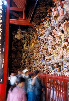
Yuantong Si is Kunming's major Buddhist temple. It is Kunming's largest and most famous temple with the original structure being first constructed more than 1,200 years ago during the Tang dynasty. The temple sits in a depression on the southern side of Yuantong Park. Northwest about 12 km (7.5 mi) from the city center is the Qiongzhu Si (Bamboo Temple) built in 639 and rebuilt in 1422 to 1428. Numerous Buddhist temples line the road to the Dragon Gate (龙门) in the Western Mountains.
التقسيمات الإدارية
The prefecture-level city of Kunming has jurisdiction over 14 subdivisions; seven districts, one county-level city, three counties and three autonomous counties. Kunming also borders with Panzhihua prefecture level city and Liangshan Yi Autonomous Prefecture of Sichuan province.
Kunming plans to add two new districts to its existing four urban districts (Panlong, Wuhua, Guandu, Xishan) over the next few years.
| الخريطة | ||||||
|---|---|---|---|---|---|---|
| Name | Simplified Chinese | Hanyu Pinyin | Population (2020 census) |
Area (km2) | Density (/km2) | |
| City Proper | ||||||
| Chenggong District | 呈贡区 | Chénggòng Qū | 649,501 | 510 | 1,273.5 | |
| Panlong District | 盘龙区 | Pánlóng Qū | 987,955 | 869 | 1,136.9 | |
| Wuhua District | 五华区 | Wǔhuá Qū | 1,143,085 | 315 | 3,628.8 | |
| Guandu District | 官渡区 | Guāndù Qū | 1,602,279 | 633 | 2,531.2 | |
| Xishan District | 西山区 | Xīshān Qū | 960,746 | 880 | 1,091.8 | |
| Suburban and satellite city | ||||||
| Jinning District | 晋宁区 | Jìnníng Qū | 346,268 | 1,337 | 259.0 | |
| Dongchuan District | 东川区 | Dōngchuān Qū | 260,744 | 1,866 | 139.7 | |
| Anning city | 安宁市 | Ānníng Shì | 483,753 | 1,303 | 371.2 | |
| Rural | ||||||
| Fumin County | 富民县 | Fùmín Xiàn | 149,506 | 1,060 | 141 | |
| Yiliang County | 宜良县 | Yíliáng Xiàn | 384,875 | 1,913 | 201 | |
| Songming County | 嵩明县 | Sōngmíng Xiàn | 410,929 | 826 | 497.5 | |
| Shilin Yi Autonomous County | 石林彝族自治县 | Shílín Yízú Zìzhìxiàn | 240,827 | 1,680 | 143.3 | |
| Luquan Yi and Miao Autonomous County | 禄劝彝族苗族自治县 | Lùquàn Yízú Miáozú Zìzhìxiàn | 378,881 | 4,234 | 89.5 | |
| Xundian Hui and Yi Autonomous County | 寻甸回族彝族自治县 | Xúndiàn Huízú Yízú Zìzhìxiàn | 460,739 | 3,588 | 128.4 | |
المجتمع والثقافة
التنزه والترفيه
Within Kunming, the entertainment district has its focus around Kundu Square, with many cinemas, bars, clubs and restaurants. Food aside, one feature of less formal Yunnanese restaurants is that they often have a communal bamboo water pipe and tobacco for their customers.[بحاجة لمصدر] There are plenty of student bars and clubs. The city has several operatic troupes and indigenous entertainments which include huadeng, a lantern dance. Although indoor performances are lacking, there are often informal shows at the weekend outside the Workers' Cultural Hall and in Cuihu Park. There are similar shows at the Yunnan Arts Theater on Dongfeng Xi Lu. Kunming's main cinema house is on the south side of the Dongfeng Lu/Zhengyi Lu intersection. The other main multiplex, the XJS, at the junction of Wenlin Jie and Dongfeng Xi Lu.
اللغة
The Kunming dialect is very similar to that of Sichuan and Guizhou but uses the third tone much less than standard Chinese. Many terms are used only in Kunming dialect, such as "板扎" meaning 'terrific'.
The pronunciations of certain Chinese characters are very different from Mandarin Chinese. For example, "鱼 (fish)" would be pronounced as "yi" in Kunming dialect instead of "yu" in Mandarin Chinese; "街 (street)" would be pronounced as "gai" instead of "jie".
When someone speaks Mandarin Chinese with a strong Kunming accent, it'll be called Mapu (马普), short for Majie (马街, a place in Kunming) Mandarin Chinese.
The Kunming Dialect is slowly dying due to it being 'informal' and is being replaced by Mandarin Chinese. Sometimes this is called dirt language or slum language (土话)
السياحة
Kunming attracts domestic and foreign tourists year-round. At the center of Yunnan and as its capital, Kunming is also a transport hub for tourists heading to other parts of Yunnan such as Dali, Lijiang and Shangrila.
Conference and exhibition venues in Kunming include the Kunming International Convention and Exhibition Center and the Yunnan Provincial Science and Technology Hall.
Kingdom of the Little People, a theme park featuring performers with dwarfism, is also located near Kunming.[19]
Other famous attractions include Stone Forest and Yunnan's Ethnic Village.
العمارة
وسط کونمینگ
المتاحف
متحف مدينة کونمینگ
Yuantong Temple

کونمینگ الجنوبية
تضاريس أخرى
المطبخ
الرياضة
الاقتصاد
Kunming has three economic advantages over other cities in southwest China: significant natural resources, a large consumer market and a mild climate. Due to its position at the center of Yunnan, one of China's largest producers of agricultural products, minerals and hydroelectricity, Kunming is the main commercial hub for most of the province's resources.
Kunming's chief industries are copper, lead and zinc production. Its iron and steel industry has been expanded. Salt and phosphate mines around Kunming are some of the largest in China. Yunnan Copper Company Limited, based in Kunming, is one of Yunnan's largest mining corporations. From the late 1970s, Kunming's main industries also came to include food and tobacco processing and the manufacture of construction equipment and machines.[بحاجة لمصدر]
In May 1995, the State Council approved Kunming as an Open City. By the end of 1995, the city had approved 929 overseas-funded enterprises with a total investment of $2.3 billion including $1.1 billion of foreign capital. More than 40 projects each had an investment of more than $9 million.
Kunming is a center of engineering and the manufacture of machine tools, electrical machinery, equipment and automobiles (including heavy goods vehicles). It has a chemical industry, and plastics, cement works and textile factories. Its processing plants, which include tanneries, woodworking and papermaking factories, use local agricultural products. In 1997, Yunnan Tire Co. opened a tire plant in Kunming, with a capacity to produce two million tires per year.[بحاجة لمصدر]
مناطق التنمية
Kunming has two major development zones, Kunming High-tech Industrial Development Zone (biological medicine, new materials, electronic information, photoelectron, agriculture) and Kunming Economic and Technology Development Zone (mechanical equipment production, biological science and food industry, information industry, software).
المناطق الصناعية
There are 30 key industrial parks promulgated and recognized by National Development and Reform Commission in Yunnan Province.[20]
The largest include:
- Chenggong Industrial Park
- Anning Industrial Park
- Songming Yanglin Industrial Development Zone
- Dongchuan Special Industrial Park
- Xundian Special Industrial Park
- Kunming Haikou Industrial Park.
الشركات
اعتبارا من 2008[تحديث], Kunming is home to 65 of the Top 100 Enterprises in Yunnan Province. The top 100 enterprises were based on their revenues for 2007. Hongta Group, with revenues of some RMB39.88 billion for 2007 topped the list. The tobacco sector remains the largest sector in the province.
صناعة الزهور
Yunnan has developed into the largest flower export base in Asia, with many Dutch experts having transferred technology to the area. The Dounan Flower Market, located in suburban Kunming, is the largest in China with daily sales of 2.5 million yuan (US$300,000) from the 2 million sprays of flowers (اعتبارا من 2006[تحديث]). The provincial government agency, the Yunnan Flower Association, regulates the industry.[21]
النقل
Kunming East Station is at present Yunnan province's only container handling depot, with direct links to only three provinces; Guangdong, Guizhou and Sichuan. It also has direct access to the metropolitan district of Chongqing.
The Jiaying Depot is connected with the new system of highways built linking Yunnan to the increasingly important markets of Southeast Asia, facilitating cheap Chinese exports to the region and granting resource-poor China greater access to the region's massive raw material resources. Yunnan has thereby become a progressively important area in the Southwest's rail logistics both in terms of national and international logistics.
الطاقة الشمسية
In July 2008, Kunming began to implement a program to transform the city's solar energy industry into a US$8.8 billion industrial base in China by 2013. Kunming receives an annual average sunshine of more than 2,400 hours. Each 1 kW PV system has the potential to generate 1500 kilowatt-hours of electricity a year from solar energy.[بحاجة لمصدر]
اعتبارا من 2007[تحديث], the Kunming Economic Committee listed about 130 solar energy enterprises in the city. Of these, 118 enterprises produce solar lamps and solar water heaters, with a combined total production value of about US$43.8 million, and 10 enterprises are engaged in solar photovoltaic cells manufacturing, with a total production value of about US$51.2 million.[22]
Suntech Power announced in December 2008 that it was jointly constructing a solar energy project with Yunnan Provincial Power Investment and other investors. The 1MW first-phase of the Shilin 66MW on-grid solar power station began generating power on 28 December 2009. The initial phase of the 66MW project was originally scheduled to start production in first half of 2010 while the 20MW second phase and 36 MW third phase were under construction.
المواصلات
الطيران
السكك الحديدية
النقل المحلي
وسط کونمینگ
الطريق السريع
الجامعات والكليات
- جامعة يونان (1922)
- Kunming University of Science and Technology (1925)
- Yunnan Normal University
- Yunnan Normal University Business School
- Yunnan University of Finance and Economics
- Yunnan Agricultural University
- Yunnan University of Traditional Chinese Medicine
- Kunming Medical University
- Kunming University
- Southwest Forestry University
- Yunnan Arts University
- Kunming Metallurgy College
المكتبات
الصحة
المدن الشقيقة
Kunming currently maintains sister city agreements with the following foreign cities.[23]
| City | Region | Country | Date |
|---|---|---|---|
| Fujisawa | Kanagawa | Japan | 1981-01-15 |
| Zürich | Zürich | Switzerland | 1982-02-17 |
| Chefchaouen | Tanger-Tetouan-Al Hoceima | Morocco | 1985-05-14 |
| Denver | Colorado | United States | 1986-05-15 |
| Wagga Wagga | New South Wales | Australia | 1988-08-14 |
| Cochabamba | Cochabamba | Bolivia | 1997-09-25 |
| Chiang Mai | Chiang Mai | Thailand | 1999-06-07 |
| Mandalay | Mandalay | Myanmar | 2001-05-10 |
| New Plymouth | Taranaki | New Zealand | 2003-08-11 |
| Chittagong | Chittagong | Bangladesh | 2005-08-18 |
| Jyväskylä | Central Finland | Finland | 2008-09-18 |
| Yangon | Yangon | Myanmar | 2008-12-01 |
| Phnom Penh | – | Cambodia | 2011-06-08 |
| Polonnaruwa | North Central Province | Sri Lanka | 2011-07-27 |
| Vientiane | Vientiane | Laos | 2011-10-17 |
| Kuching | Sarawak | Malaysia | 2012-04-19[24] |
| Antalya | Antalya | Turkey | 2013-05-10 |
| Pokhara | Gandaki Province | Nepal | 2013-07-08 |
| Kolkata | West Bengal | India | 2013-10-23 |
| Schenectady | New York | United States | 2014-03-25 |
| Da Nang | – | Vietnam | 2015-02-06 |
| Grasse | Alpes-Maritimes | France | 2016-03-27 |
| Olomouc | Olomouc | Czech Republic | 2017-09-11 |
On April 2020, The City of Wagga Wagga council voted to cut ties with its sister city Kunming city, a week later they would vote again joining Kunming as a sister city.[25][26] [27]
البعثات الأجنبية
البلدان التالية لها بعثات دبلوماسية في کونمینغ :
- مكاتب تجارية:
- أستراليا
- هولندا
مشاهير المدينة
انظر أيضا
| Kunming
]].- National Southwestern Associated University (Lianda)
- قائمة مدن الصين
- Kunming Dog, an established breed of wolf-dog hybrid.
- کونمینگ 3650
- تفجير حافلة کونمینگ 2008
مرئيات
| طريق سيارات برمائي في کونمینگ جنوب الصين |
المصادر
- ^ "China: Yúnnán (Prefectures, Cities, Districts and Counties) - Population Statistics, Charts and Map".
- ^ أ ب "Global Metro Monitor 2014". Brookings Institution. Archived from the original on 21 March 2015. Retrieved 25 February 2016.
- ^ "Illuminating China's Provinces, Municipalities and Autonomous Regions". PRC Central Government Official Website. Archived from the original on 18 يونيو 2014. Retrieved 17 مايو 2014.
- ^ "Archived copy" 15-2各州市户数、人口数及构成(2014年)-tjsql.com. www.tjsql.com. Archived from the original on 5 أغسطس 2016. Retrieved 6 مارس 2016.
{{cite web}}: CS1 maint: archived copy as title (link) - ^ 《云南各民族历史大事概略》编写组古代史组 (1975). "云南历史上几个族名、地名的由来和演变" [The origin and the evolvement of some ethnic names and the place names in the history of Yunnan]. 思想战线 (Thinking) (in الصينية) (6): 83–86.
- ^ Tu, Liang-jun (2009). ""昆明"得名来源考" [The Original Meaning of the Word "昆明"]. Journal of Yunnan Normal University(Humanities and Social Sciences Edition) (in الصينية). 41 (6): 124–131.
- ^ The Peopling of East Asia, pp. 192
- ^ Theobald, Ulrich. "Dian 滇 (www.chinaknowledge.de)". www.chinaknowledge.de (in الإنجليزية). Retrieved 2019-06-02.
- ^ The geography of China : sacred and historic places. Pletcher, Kenneth. (1st ed.). New York, NY: Britannica Educational Pub. in association with Rosen Education Services. 2011. p. 260. ISBN 9781615301829. OCLC 656841273.
{{cite book}}: CS1 maint: others (link) - ^ Rossi, J.R. "History: The Flying Tigers — American Volunteer Group — Chinese Air Force". Archived from the original on 22 يوليو 2013. Retrieved 7 يونيو 2012.
- ^ "AIM25 collection description". Aim25.ac.uk. Archived from the original on 30 مارس 2012. Retrieved 23 ديسمبر 2011.
- ^ "Last Stand". Time magazine. December 19, 1949. Retrieved 2007-12-03.
{{cite news}}: Cite has empty unknown parameter:|coauthors=(help) - ^ "Special Operations Association" (2005) By Special Operations Association. Turner Publishing. ISBN 1-59652-156-2
- ^ Rossi, J.R. "History: The Flying Tigers — American Volunteer Group — Chinese Air Force".
- ^ "AIM25 collection description". Aim25.ac.uk. Retrieved 2011-12-23.
- ^ 新昆明网. Newkm.cn. Archived from the original on 1 October 2011. Retrieved 23 December 2011.
- ^ Duan, Chang-Qun; Hu, Bin; Wang, Zheng-Hong; Wen, Chuan-Hao; Yan, Shen-Qi; Jiang, Xiao-Hua; Wang, Ding-Kang; Li, Qing; Liang, Xiao-Feng (1999-05-19). "Tradescantia bioassays for the determination of genotoxicity of water in the Panlong River, Kunming, People's Republic of China". Mutation Research/Fundamental and Molecular Mechanisms of Mutagenesis. 426 (2): 127–131. doi:10.1016/S0027-5107(99)00054-8. ISSN 0027-5107. PMID 10350584.
- ^ Ma, Guihua (29 June 2004). "A farewell to two zoos?". China Daily. Archived from the original on 5 November 2007. Retrieved 21 January 2008.
- ^ LaFraniere, Sharon (26 March 2010). "A Miniature World Magnifies Dwarf Life". The New York Times. Archived from the original on 6 October 2011. Retrieved 13 May 2011.
- ^ "Kunming - China.GOV". Archived from the original on 6 October 2008. Retrieved 17 November 2008.
- ^ Bradsher, Keith (25 September 2006). "Bouquet of Roses May Have Note: 'Made in China'". The New York Times. Archived from the original on 17 October 2015. Retrieved 17 February 2017.
- ^ "Kunming aims to build a city run by solar energy". emerging-china.com. Archived from the original on 8 August 2008. Retrieved 12 December 2018.
- ^ 全国各省、自治区、直辖市建立友好城市统计-云南 [Friendly city statics – Yunnan]. www.cifca.org.cn (in الصينية). 中国国际友好城市联合会. Retrieved 2018-08-30.[dead link]
- ^ InKunming (20 April 2012). "Kunming and Kuching build sister city relations". en.kunming.cn. Archived from the original on 4 June 2014. Retrieved 9 August 2012.
- ^ "City council severs China relations over 'death and destruction across the world with COVID-19'". ABC News (in الإنجليزية الأسترالية). 2020-04-15. Retrieved 2023-01-11.
- ^ "Wagga Wagga severs ties with Chinese sister city over 'death and destruction' from coronavirus". the Guardian (in الإنجليزية). 2020-04-15. Retrieved 2023-01-11.
- ^ "Wagga council reverses controversial decision to cut ties with Chinese sister city". ABC News (in الإنجليزية الأسترالية). 2020-04-22. Retrieved 2023-01-11.
- ^ "Kunming - China.GOV". en.km.gov.cn. Archived from the original on 7 October 2008. Retrieved 11 January 2022.
- ^ "Welcoming to the Website of the Consulate-General of the Union of Myanmar in Kunming,P.R.China". www.mcg-kunming.com. Archived from the original on 4 October 2003. Retrieved 11 January 2022.
- ^ "Redirecting". Archived from the original on 27 August 2016. Retrieved 30 June 2016.
قراءات إضافية
- Kunming Statistical Yearbook-2007 (صينية) China Statistics Press [1].
- Qi Duxia (1999). A Complete Guide Series of Travel and Tourism in China - Kunming. China Travel & Tourism Press. ISBN 7503214910.
- Carl Fingerhuth, Ernst Joos (2002). The Kunming Project: Urban Development in China - A Dialogue. Birkhauser Verlag AG. ISBN 3764367423.
- Sustainable Urban Development - the Case Study of Kunming, China Willy Schmid, Markus Eggenberger, 1997.
- NSL - Network City and Landscape - contains Kunming sustainable development papers
- Franklin, B. Evans (2005). 600 Days in Kunming China, 1944-45. AuthorHouse. ISBN 1420821172.
- Maochun Yu (1997). OSS in China: Prelude to Cold War. Yale University Press. ISBN 0300066988.
- Le Cai and Virasakdi Chongsuvivatwong. "Rural-urban differentials of premature mortality burden in south-west China" - International Journal for Equity in Health 2006, 5:13 doi:10.1186/1475-9276-5-13
- Elizabeth J. Remick. "Police-Run Brothels in Republican Kunming" Modern China, Vol. 33, No. 4, 423-461 (2007) DOI: 10.1177/0097700407304804
- Chin, K. and Zhang, S. "Street-Level Heroin Sales in Kunming, China". American Society of Criminology (ASC) 2008-06-26
- Kunming Communiqué on Cross-border Collaboration for Drug Demand Reduction and HIV/AIDS Prevention Social Development Division, United Nations ESCAP
- Kobusingye KA. Voluntary counseling and testing among injecting drug users in Kunming city, Yunnan Province. Int Conf AIDS. 2004 Jul 11-16; 15: abstract no. WePeC5999.
- China's Disabled Get Helping Hand in High Places Kunming Journal. Nicholas D. Kristof. May 30, 1991
- Book about Kunming's regional cooperation with Southeast Asia: ASEAN-China Relations: Realities and Prospects (2005) Saw Swee Hock, Lijun Sheng, Sheng Lijun, Kin Wah Chin, Chin Kin Wah. Institute of Southeast Asian Studies (ISEAS) ISBN 9812303421
- Wei Xing. "Prevalence of ethnic intermarriage in Kunming: Social exchange or insignificance of ethnicity?" Asian Ethnicity, Volume 8, Issue 2 June 2007 , pages 165 - 179
- Jianli Li; Mary Francis Marx. "A Survey of Four Libraries in Kunming: Library Automation and Modernization in a Far Removed Province in China" Journal of Southern Academic and Special Librarianship (2000)
وصلات خارجية
- Pages using gadget WikiMiniAtlas
- CS1 uses الصينية-language script (zh)
- CS1 الصينية-language sources (zh)
- CS1 maint: others
- Articles with dead external links from February 2020
- CS1 الإنجليزية الأسترالية-language sources (en-au)
- Short description is different from Wikidata
- Articles containing صينية-language text
- Coordinates on Wikidata
- Pages using infobox settlement with unknown parameters
- Articles containing traditional Chinese-language text
- Articles with hatnote templates targeting a nonexistent page
- مقالات فيها عبارات متقادمة منذ 2006
- جميع المقالات التي فيها عبارات متقادمة
- Articles with unsourced statements from June 2016
- مقالات فيها عبارات متقادمة منذ 2008
- مقالات فيها عبارات متقادمة منذ 2007
- کونمینگ
- تأسيسات 765
- عواصم المقاطعات في الصين
- مدن تأسست في القرن 8
- 8th-century establishments in China
- Cities in Yunnan
- National Forest Cities in China
- Populated places established in the 8th century
- Provincial capitals in China
- Tourism in Yunnan
- صفحات مع الخرائط

