هونان
Hunan
湖南 | |
|---|---|
| الترجمة اللفظية بالـ Name | |
| • Chinese | 湖南省 (Húnán Shěng) |
| • Abbreviation | HN / 湘 (pinyin: Xiāng) |
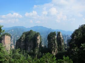
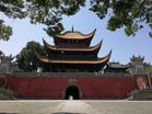
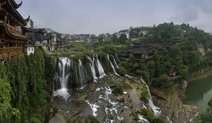
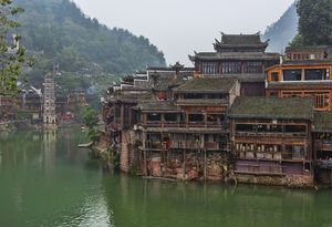
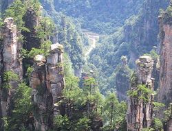
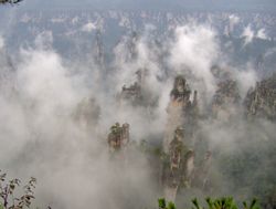
(clockwise from top)
| |
 | |
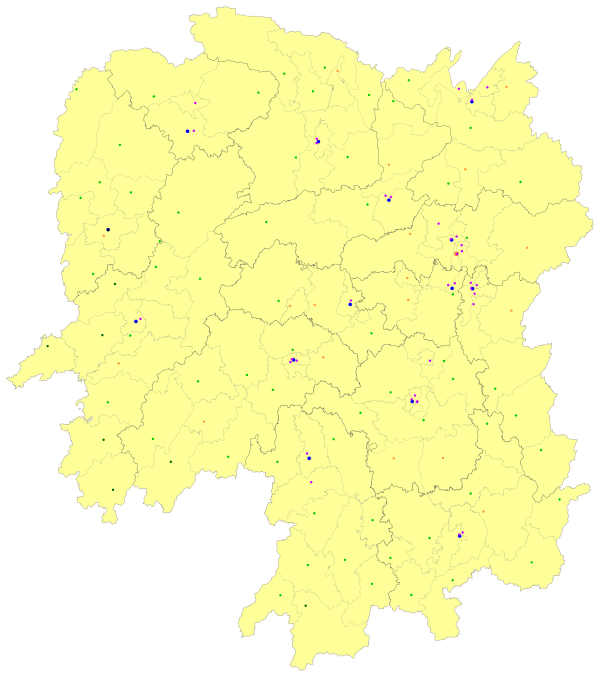
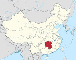 Map showing the location of Hunan Province | |
| الإحداثيات: 28°06′46″N 112°59′00″E / 28.11265°N 112.98338°E | |
| Country | China |
| السمِيْ | 湖, hú – lake 南, nán – south "South of the lake" |
| Capital (and largest city) | Changsha |
| Divisions | 14 prefectures، 122 counties، 1,933 townships (2018)، 29,224 villages (2018) |
| الحكومة | |
| • النوع | Province |
| • الكيان | Hunan Provincial People's Congress |
| • CCP Secretary | Shen Xiaoming |
| • Congress chairman | Zhang Qingwei |
| • Governor | Mao Weiming |
| • CPPCC chairman | Mao Wanchun |
| المساحة | |
| • الإجمالي | 210٬000 كم² (80٬000 ميل²) |
| ترتيب المساحة | 10th |
| أعلى منسوب | 2٬115٫2 m (6٬939٫6 ft) |
| التعداد (2020)[2] | |
| • الإجمالي | 66٬444٬864 |
| • الترتيب | 7th |
| • الكثافة | 320/km2 (820/sq mi) |
| • ترتيب الكثافة | 13th |
| صفة المواطن | Hunanese |
| Demographics | |
| • Ethnic composition | Han – 90% Tujia – 4% Miao – 3% Dong – 1% Yao – 1% Other peoples – 1% |
| • Languages and dialects | Chinese varieties: Xiang, Gan, Southwestern Mandarin, Xiangnan Tuhua, Waxiang, Hakka Non-Chinese languages: Xong, Tujia, Mien, Gam |
| ISO 3166 code | CN-HN |
| GDP (2021[3]) | CNY 4.6 trillion USD 724 billion $1.1 trillion (PPP)[3] (9nd) |
| • per capita | ¥69,300 $ 10,908 (14th) $16,618 (PPP) |
| HDI (2019) | ▲ 0.755[4] high · 15th |
| الموقع الإلكتروني | www |
| هونان | |||||||||||||||||||||||||||||||||||
|---|---|---|---|---|---|---|---|---|---|---|---|---|---|---|---|---|---|---|---|---|---|---|---|---|---|---|---|---|---|---|---|---|---|---|---|
 "Hunan" in Chinese characters | |||||||||||||||||||||||||||||||||||
| الصينية | 湖南 | ||||||||||||||||||||||||||||||||||
| Xiang | ɣu˩˧ nia˩˧ (fu-lã) | ||||||||||||||||||||||||||||||||||
| المعنى الحرفي | "South of the (Dongting) Lake" | ||||||||||||||||||||||||||||||||||
| |||||||||||||||||||||||||||||||||||
هونان (صينية تقليدية: 湖南; پنين: Húnán) هي مقاطعة في الصين، تقع إلى الجنوب من القطاع الأوسط لنهر يانگتسه وجنوب بحيرة دونگتنگ (ولذلك الاسم هونان ، يعني "جنوب البحيرة"[5]). هونان تـُسمى أحياناً 湘 (پنين: Xiāng) اختصاراً لنهر شيانگ الذي يجري عبر المقاطعة. Located in the middle reaches of the Yangtze watershed, it borders the province-level divisions of Hubei to the north, Jiangxi to the east, Guangdong and Guangxi to the south, Guizhou to the west and Chongqing to the northwest. Its capital and largest city is Changsha, which also abuts the Xiang River. Hengyang, Zhuzhou, and Yueyang are among its most populous urban cities. With a population of just over 66 million اعتبارا من 2020[تحديث] residing in an area of approximately 210,000 km2 (81,000 sq mi), it is China's 7th most populous province, the fourth most populous among landlocked provinces, the second most populous in South Central China after Guangdong and the most populous province in Central China. It is the largest province in South-Central China and the fourth largest among landlocked provinces and the 10th most extensive province by area.
Hunan's nominal GDP was US$724 billion (CNY 4.6 trillion) as of 2021, appearing in the world's top 20 largest sub-national economies, with its GDP (PPP) being over US$1.1 trillion.[6][7] Hunan is the 9th-largest provincial economy of China, the fourth largest in South Central China, the third largest in Central China and the fourth largest among landlocked provinces. Its GDP (nominal) per capita exceeded US$10,900 (69,300 CNY), making it the third richest province in the South Central China region after Guangdong and Hubei.[6] As of 2020, Hunan's GDP (nominal) reached 605 billion US dollars (CNY 4.18 trillion),[8][9] exceeding that of Poland, with a GDP of US$596 billion and Thailand, with a GDP of US$501 billion, the 22nd and 25th largest in the world respectively.[10]
The name Hunan literally means "south of the lake".[11] The lake that is referred to is Dongting Lake, a lake in the northeast of the province; Vehicle license plates from Hunan are marked Xiāng (Chinese: 湘), after the Xiang River, which runs from south to north through Hunan and forms part of the largest drainage system for the province. The area of Hunan was under Chinese rule as far back as 350 BC. Hunan was the birthplace of communist revolutionary Mao Zedong,[12] who became the Chairman of the Chinese Communist Party and the founding father of the People's Republic of China. Hunan today is home to some ethnic minorities, including the Tujia and Miao, along with the Han Chinese, who make up a majority of the population. Varieties of Chinese spoken include Xiang, Gan and Southwestern Mandarin.
The site of Wulingyuan was inscribed as a UNESCO World Heritage Site in 1992.[13] Changsha, the capital, is located in the eastern part of the province; it is now an important commercial, manufacturing and transportation centre.[14] The busiest airports serve domestic and international flights for Hunan, including Changsha Huanghua International Airport, Zhangjiajie Hehua International Airport and Changde Taohuayuan Airport.[15] Hunan is the seat of the Yuelu Academy (later become Hunan University), which is one of the four major academies over the last 1000 years in ancient China.[16] As of 2022, Hunan hosts 130 institutions of higher education, ranking sixth among all Chinese provinces.[17]
التاريخ

Hunan's primeval forests were first occupied by the ancestors of the modern Miao, Tujia, Dong and Yao peoples. It entered the written history of China around 350 BC, when under the kings of the Zhou Dynasty, it became part of the State of Chu. After Qin conquered the Chu heartland in 278 BC, the region came under the control of Qin, and then the Han dynasty. At this time, and for hundreds of years thereafter, it was a magnet for migration of Han Chinese from the north, who displaced or assimilated the indigenous people, cleared forests and began farming rice in the valleys and plains.[18] The agricultural colonization of the lowlands was carried out in part by the Han state, which managed river dikes to protect farmland from floods.[19] To this day many of the small villages in Hunan are named after the Han families who settled there. Migration from the north was especially prevalent during the Eastern Jin Dynasty and the Southern and Northern Dynasties Periods, when nomadic invaders pushed these peoples south.
During the Five Dynasties and Ten Kingdoms Period, Hunan was home to its own independent regime, Ma Chu.
As Mao Zedong's home province, Hunan supported the Cultural Revolution of 1966–1976. However, it was slower than most provinces in adopting the reforms implemented by Deng Xiaoping in the years that followed Mao's death in 1976.
Former Chinese Premier Zhu Rongji is also Hunanese, as are the late President Liu Shaoqi and the late Marshal Peng Dehuai.
الجغرافيا
Hunan is located on the south bank of the Yangtze River, about half way along its length, situated between 108° 47'–114° 16' east longitude and 24° 37'–30° 08' north latitude. It covers an area of 211,800 square kilometres (81,800 sq mi)*, making it the 10th largest provincial-level division. The east, south and west sides of the province are surrounded by mountains and hills, such as the Wuling Mountains to the northwest, the Xuefeng Mountains to the west, the Nanling Mountains to the south, and the Luoxiao Mountains to the east. The mountains and hills occupy more than 80% of the area and plains comprises less than 20% of the whole province.
The Xiang, the Zi, the Yuan and the Lishui Rivers converge on the Yangtze River at Lake Dongting in the north of Hunan. The center and northern parts are somewhat low and a U-shaped basin, open in the north and with Lake Dongting as its center. Most of Hunan lies in the basins of four major tributaries of the Yangtze River.
Lake Dongting is the largest lake in the province and the second largest freshwater lake of China.
The Xiaoxiang area and Lake Dongting figure prominently in Chinese poetry and paintings, particularly during the Song Dynasty when they were associated with officials who had been unjustly dismissed.[20]
التقسيمات الإدارية
Hunan is divided into fourteen prefecture-level divisions: thirteen prefecture-level cities and an autonomous prefecture:
| Administrative divisions of Hunan | ||||||||
|---|---|---|---|---|---|---|---|---|
| Division code[21] | Division | Area in km2[22] | Population 2010[23] | Seat | Divisions[24] | |||
| Districts | Counties | Aut. counties | CL cities | |||||
| 430000 | Hunan Province | 210000.00 | 65,683,722 | Changsha city | 36 | 61 | 7 | 18 |
| 430100 | Changsha city | 11,819.46 | 7,044,118 | Yuelu District | 6 | 1 | 2 | |
| 430200 | Zhuzhou city | 11,262.20 | 3,855,609 | Tianyuan District | 5 | 3 | 1 | |
| 430300 | Xiangtan city | 5,006.46 | 2,748,552 | Yuetang District | 2 | 1 | 2 | |
| 430400 | Hengyang city | 15,302.78 | 7,141,462 | Zhengxiang District | 5 | 5 | 2 | |
| 430500 | Shaoyang city | 20,829.63 | 7,071,826 | Daxiang District | 3 | 6 | 1 | 2 |
| 430600 | Yueyang city | 14,897.88 | 5,477,911 | Yueyanglou District | 3 | 4 | 2 | |
| 430700 | Changde city | 18,177.18 | 5,747,218 | Wuling District | 2 | 6 | 1 | |
| 430800 | Zhangjiajie city | 9,516.03 | 1,476,521 | Yongding District | 2 | 2 | ||
| 430900 | Yiyang city | 12,325.16 | 4,313,084 | Heshan District | 2 | 3 | 1 | |
| 431000 | Chenzhou city | 19,317.33 | 4,581,778 | Beihu District | 2 | 8 | 1 | |
| 431100 | Yongzhou city | 22,255.31 | 5,180,235 | Lengshuitan District | 2 | 8 | 1 | |
| 431200 | Huaihua city | 27,562.72 | 4,741,948 | Hecheng District | 1 | 5 | 5 | 1 |
| 431300 | Loudi city | 8,107.61 | 3,785,627 | Louxing District | 1 | 2 | 2 | |
| 433100 | Xiangxi Autonomous Prefecture | 15,462.30 | 2,547,833 | Jishou city | 7 | 1 | ||
| Administrative divisions in Chinese and varieties of romanizations | ||||
|---|---|---|---|---|
| English | Chinese | Pinyin | Xiang Romanization | |
| Hunan Province | 湖南省 | Húnán Shěng | fu12 nan12 sǝn2 | |
| Changsha city | 长沙市 | Chángshā Shì | c̣an2 sa11 ṣî32 | |
| Zhuzhou city | 株洲市 | Zhūzhōu Shì | ćy11 c̣ôu11 ṣî32 | |
| Xiangtan city | 湘潭市 | Xiāngtán Shì | ? ? ṣî32 | |
| Hengyang city | 衡阳市 | Héngyáng Shì | xǝn12 ian12 ṣî32 | |
| Shaoyang city | 邵阳市 | Shàoyáng Shì | ? ian12 ṣî32 | |
| Yueyang city | 岳阳市 | Yuèyáng Shì | io4 ian12 ṣî32 | |
| Changde city | 常德市 | Chángdé Shì | ? tô4 ṣî32 | |
| Zhangjiajie city | 张家界市 | Zhāngjiājiè Shì | ? ćia11 kai31 ṣî32 | |
| Yiyang city | 益阳市 | Yìyáng Shì | i4 ian12 ṣî32 | |
| Chenzhou city | 郴州市 | Chēnzhōu Shì | ? c̣ôu11 ṣî32 | |
| Yongzhou city | 永州市 | Yǒngzhōu Shì | yn2 c̣ôu11 ṣî32 | |
| Huaihua city | 怀化市 | Huáihuà Shì | fai12 fa31 ṣî32 | |
| Loudi city | 娄底市 | Lóudǐ Shì | ? ti2 ṣî32 | |
| Xiangxi Autonomous Prefecture | 湘西自治州 | Xiāngxī Zìzhìzhōu | ? si11 ci31 c̣î31 c̣ôu11 | |
The fourteen prefecture-level divisions of Hunan are subdivided into 122 county-level divisions (35 districts, 17 county-level cities, 63 counties, 7 autonomous counties). Those are in turn divided into 2587 township-level divisions (1098 towns, 1158 townships, 98 ethnic townships, 225 subdistricts, and eight district public offices). At the year end of 2017, the total population is 68.6 million.[1]
Urban areas
| Population by urban areas of prefecture & county cities | |||||
|---|---|---|---|---|---|
| # | City | Urban area[25] | District area[25] | City proper[25] | Census date |
| 1 | Changsha[أ] | 2,963,218 | 3,092,213 | 7,040,952 | 2010-11-01 |
| (1) | Changsha (new district)[أ] | 230,136 | 523,660 | see Changsha | 2010-11-01 |
| 2 | Hengyang | 1,115,645 | 1,133,967 | 7,148,344 | 2010-11-01 |
| 3 | Zhuzhou[ب] | 999,404 | 1,055,150 | 3,857,100 | 2010-11-01 |
| (3) | Zhuzhou (new district)[ب] | 94,326 | 383,598 | see Zhuzhou | 2010-11-01 |
| 4 | Yueyang | 924,099 | 1,231,509 | 5,476,084 | 2010-11-01 |
| 5 | Xiangtan | 903,287 | 960,303 | 2,752,171 | 2010-11-01 |
| 6 | Changde | 846,308 | 1,457,419 | 5,714,623 | 2010-11-01 |
| 7 | Yiyang | 697,607 | 1,245,517 | 4,307,933 | 2010-11-01 |
| 8 | Liuyang | 588,081 | 1,279,469 | see Changsha | 2010-11-01 |
| 9 | Chenzhou | 582,971 | 822,534 | 4,583,531 | 2010-11-01 |
| 10 | Shaoyang | 574,527 | 753,194 | 7,071,735 | 2010-11-01 |
| 11 | Yongzhou | 540,930 | 1,020,715 | 5,194,275 | 2010-11-01 |
| (12) | Ningxiang[ت] | 498,055 | 1,166,138 | see Changsha | 2010-11-01 |
| 13 | Leiyang | 476,173 | 1,151,554 | see Hengyang | 2010-11-01 |
| 14 | Huaihua | 472,687 | 552,622 | 4,741,673 | 2010-11-01 |
| 15 | Liling | 449,067 | 947,387 | see Zhuzhou | 2010-11-01 |
| 16 | Loudi | 425,037 | 496,744 | 3,784,634 | 2010-11-01 |
| 17 | Changning | 332,927 | 810,447 | see Hengyang | 2010-11-01 |
| 18 | Miluo | 321,074 | 692,080 | see Yueyang | 2010-11-01 |
| 19 | Yuanjiang | 281,097 | 666,270 | see Yiyang | 2010-11-01 |
| 20 | Zhangjiajie | 250,489 | 494,528 | 1,478,149 | 2010-11-01 |
| 21 | Lianyuan | 245,360 | 995,515 | see Loudi | 2010-11-01 |
| 22 | Lengshuijiang | 238,275 | 327,146 | see Loudi | 2010-11-01 |
| 23 | Linxiang | 225,054 | 498,319 | see Yueyang | 2010-11-01 |
| 24 | Zixing | 215,707 | 337,294 | see Chenzhou | 2010-11-01 |
| 25 | Jishou | 212,328 | 302,065 | part of Xiangxi Prefecture | 2010-11-01 |
| 26 | Xiangxiang | 210,799 | 788,216 | see Xiangtan | 2010-11-01 |
| 27 | Hongjiang | 197,753 | 477,996 | see Huaihua | 2010-11-01 |
| 28 | Wugang | 187,436 | 734,870 | see Shaoyang | 2010-11-01 |
| 29 | Jinshi | 156,230 | 250,898 | see Changde | 2010-11-01 |
| 30 | Shaoshan | 27,613 | 86,036 | see Xiangtan | 2010-11-01 |
- ^ أ ب New district established after census: Wangcheng (Wangcheng County). The new district not included in the urban area & district area count of the pre-expanded city.
- ^ أ ب New district established after census: Lukou (Zhuzhou County). The new district not included in the urban area & district area count of the pre-expanded city.
- ^ Ningxiang County is currently known as Ningxiang CLC after census.
أكبر cities في Hunan
Source: China Urban Construction Statistical Yearbook 2018 Urban Population and Urban Temporary Population[26] | |||||||||
|---|---|---|---|---|---|---|---|---|---|
| الترتيب | التعداد | الترتيب | التعداد | ||||||
 Changsha  Hengyang |
1 | Changsha | 3,744,300 | 11 | Yongzhou | 574,500 |  Zhuzhou  Changde | ||
| 2 | Hengyang | 1,437,900 | 12 | Leiyang | 573,000 | ||||
| 3 | Zhuzhou | 1,152,600 | 13 | Loudi | 516,800 | ||||
| 4 | Changde | 997,900 | 14 | Ningxiang | 472,700 | ||||
| 5 | Yueyang | 892,000 | 15 | Jishou | 315,000 | ||||
| 6 | Chenzhou | 842,000 | 16 | Changning | 300,000 | ||||
| 7 | Xiangtan | 817,700 | 17 | Wugang | 290,000 | ||||
| 8 | Shaoyang | 712,300 | 18 | Liuyang | 260,100 | ||||
| 9 | Yiyang | 668,200 | 19 | Liling | 247,500 | ||||
| 10 | Huaihua | 624,000 | 20 | Xiangxiang | 235,000 | ||||
الاقتصاد
As of the mid 19th century, Hunan exported rhubarb, musk, honey, tobacco, hemp, and birds.[27] The Lake Dongting area is an important center of ramie production, and Hunan is also an important center of tea cultivation. Aside from agricultural products, in recent years Hunan has grown to become an important center for steel, machinery and electronics production, especially as China's manufacturing sector moves away from coastal provinces such as Guangdong and Zhejiang.[28]
The Lengshuijiang area is noted for its stibnite mines, and is one of the major centers of antimony extraction in China.[بحاجة لمصدر]
الثقافة
الهامش
- ^ "Doing Business in China – Survey". Ministry Of Commerce – People's Republic Of China. Archived from the original on 5 August 2013. Retrieved 5 August 2013.
- ^ "Communiqué of the Seventh National Population Census (No. 3)". National Bureau of Statistics of China. 11 May 2021. Retrieved 11 May 2021.
- ^ أ ب "List of Chinese provinces by 2021 GDP". National Bureau of Statistics of China. Retrieved 3 October 2021.[dead link]
- ^ "Sub-national HDI - Subnational HDI - Global Data Lab". globaldatalab.org. Retrieved 2020-04-17.
- ^ Origin of the Names of China's Provinces, People's Daily Online.
- ^ أ ب "Decoding China's 2021 GDP Growth Rate: A Look at Regional Numbers". China Briefing News (in الإنجليزية). 2022-02-07. Retrieved 2022-06-15.
- ^ "Hunan Province's Regional GDP Hit 4.6 Trillion Yuan in 2021". www.enghunan.gov.cn. Retrieved 2022-06-15.
- ^ "Top 10 provincial regions in China by GDP 2020". ex.chinadaily.com.cn. Retrieved 2022-06-15.
- ^ rsatax (2021-06-11). "Investing in Hunan". rsa-tax (in الإنجليزية). Retrieved 2022-06-15.
- ^ "2020 GDP (current US$) - Poland, Thailand, Nigeria". data.worldbank.org. Retrieved 2022-06-15.
- ^ (in صينية) Origin of the Names of China's Provinces Archived 2016-04-27 at the Wayback Machine, People's Daily Online.
- ^ Schram, Stuart R. (Stuart Reynolds), 1924-2012. (1967). Mao Tse-tung. Harmondsworth: Penguin. ISBN 0140208402. OCLC 7874661.
{{cite book}}: CS1 maint: multiple names: authors list (link) CS1 maint: numeric names: authors list (link) - ^ "Wulingyuan Scenic and Historic Interest Area". UNESCO World Heritage Centre (in الإنجليزية). Archived from the original on 2019-06-11. Retrieved 2019-06-12.
- ^ Planet, Lonely. "Changsha travel | Hunan, China". Lonely Planet (in الإنجليزية). Archived from the original on 2019-07-11. Retrieved 2019-06-12.
- ^ 2021年民航机场吞吐量排名 (PDF) (in الصينية). Civil Aviation Administration of China. 2022-03-22. Retrieved 2022-03-23.
- ^ Fan Chengda (1126-1193). Shigushanji(石鼓山记):"天下有书院四:徂徕、金山、岳麓、石鼓。"
- ^ خطأ استشهاد: وسم
<ref>غير صحيح؛ لا نص تم توفيره للمراجع المسماة:7 - ^ Harold Wiens. Han Expansion in South China. (Shoe String Press, 1967).
- ^ Brian Lander. State Management of River Dikes in Early China: New Sources on the Environmental History of the Central Yangzi Region . T'oung Pao 100.4-5 (2014): 325–362
- ^ Alfreda Murck (2000). Poetry and Painting in Song China: The Subtle Art of Dissent. Harvard Univ Asia Center. ISBN 978-0-674-00782-6.
- ^ 中华人民共和国县以上行政区划代码 (in الصينية المبسطة). Ministry of Civil Affairs. Archived from the original on 2015-04-02. Retrieved 2015-12-11.
- ^ Shenzhen Bureau of Statistics. 《深圳统计年鉴2014》 (in الصينية المبسطة). China Statistics Print. Archived from the original on 2015-05-12. Retrieved 2015-05-29.
- ^ Census Office of the State Council of the People's Republic of China; Population and Employment Statistics Division of the National Bureau of Statistics of the People's Republic of China (2012). 中国2010人口普查分乡、镇、街道资料 (1 ed.). Beijing: China Statistics Print. ISBN 978-7-5037-6660-2.
- ^ Ministry of Civil Affairs (August 2014). 《中国民政统计年鉴2014》 (in الصينية المبسطة). China Statistics Print. ISBN 978-7-5037-7130-9.
- ^ أ ب ت 国务院人口普查办公室、国家统计局人口和社会科技统计司编 (2012). 中国2010年人口普查分县资料. Beijing: China Statistics Print. ISBN 978-7-5037-6659-6.
- ^ Ministry of Housing and Urban-Rural Development of the People's Republic of China(MOHURD) (2019). 中国城市建设统计年鉴2018 [China Urban Construction Statistical Yearbook 2018] (in الصينية). Beijing: China Statistic Publishing House. Archived from the original on 2020-07-18. Retrieved 2021-11-30.
- ^ Roberts, Edmund (1837). Embassy to the Eastern Courts of Cochin-China, Siam, and Muscat. New York: Harper & Brothers. p. 123.
- ^ http://www.thechinaperspective.com/topics/province/hunan-province/
وصلات خارجية
- Pages using gadget WikiMiniAtlas
- Articles with dead external links from September 2022
- Articles with صينية-language sources (zh)
- CS1 maint: numeric names: authors list
- CS1 uses الصينية-language script (zh)
- CS1 الصينية-language sources (zh)
- CS1 الصينية المبسطة-language sources (zh-hans)
- Short description is different from Wikidata
- Articles containing صينية-language text
- Coordinates on Wikidata
- Articles containing Pinyin-language text
- مقالات فيها عبارات متقادمة منذ 2020
- جميع المقالات التي فيها عبارات متقادمة
- Articles containing Chinese-language text
- Convert invalid options
- Articles with hatnote templates targeting a nonexistent page
- Articles with unsourced statements from November 2015
- هونان
- مقاطعات جمهورية الصين الشعبية
- Central China
- صفحات مع الخرائط
