جزر مارشال
جمهورية جزر مارشال | |
|---|---|
الشعار الحادي: "Jepilpilin ke ejukaan" ("الانجاز عبر الجهد المشترك") | |
 | |
| العاصمة | ماجورو (دلاپ)[3] 7°7′N 171°4′E / 7.117°N 171.067°E |
| أكبر مدينة | العاصمة |
| اللغات الرسمية | |
| الجماعات العرقية (2021[4]) |
|
| الدين (2021[4]) |
|
| صفة المواطن | Marshallese |
| الحكومة | جمهورية رئاسية ديمقراطية |
• الرئيس | هيلدا هايني |
• Speaker | Brenson Wase |
| التشريع | Nitijela |
| Independence from the United States | |
• Self-government | May 1, 1979 |
| October 21, 1986 | |
| المساحة | |
• الإجمالية | 181.43 km2 (70.05 sq mi) (189th) |
• الماء (%) | n/a (negligible) |
| التعداد | |
• إحصاء 2021 | 42,418[4] |
• الكثافة | 233/km2 (603.5/sq mi) (47th) |
| ن.م.إ. (ق.ش.م.) | تقدير 2019 |
• الإجمالي | $215 million |
• للفرد | $3,789[5] |
| ن.م.إ. (الإسمي) | تقدير 2019 |
• الإجمالي | $220 million |
• للفرد | $3,866[5] |
| م.ت.ب. (2022) | ▲ 0.731[6] high · 102nd |
| العملة | United States dollar (USD) |
| التوقيت | UTC+12 (MHT) |
• الصيفي (التوقيت الصيفي) | not observed |
| صيغة التاريخ | MM/DD/YYYY |
| جانب السواقة | right |
| مفتاح الهاتف | +692 |
| كود آيزو 3166 | MH |
| النطاق العلوي للإنترنت | .mh |
| |
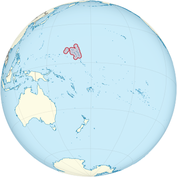
جزر مارشال ( Marshall Islands ؛ (قالب:Lang-mh),[7] officially the Republic of the Marshall Islands (قالب:Lang-mh),[note 1] هي بلد جزر يقع إلى الغرب من International Date Line and north of the equator in the Micronesia region in the Northwestern Pacific Ocean. The territory consists of 29 coral atolls and five islands,[8] divided across two island chains: Ratak in the east and Ralik in the west. 97.87% of its territory is water, the largest proportion of water to land of any sovereign state. The country shares maritime boundaries with Wake Island to the north,[note 2] Kiribati to the southeast, Nauru to the south, and the Federated States of Micronesia to the west. The capital and largest city is Majuro, home to approximately half of the country's population.
Austronesian settlers reached the Marshall Islands as early as the 2nd millennium BC and introduced Southeast Asian crops, including coconuts, giant swamp taro, and breadfruit, as well as domesticated chickens, which made the islands permanently habitable. Several Spanish expeditions visited the islands in the mid-16th century, but Spanish galleons usually sailed a Pacific route farther north and avoided the Marshalls. European maps and charts named the group for British captain John Marshall, who explored the region in 1788. American Protestant missionaries and Western business interests began arriving in the 1850s. German copra traders dominated the economy in the 1870s and 1880s, and the German Empire annexed the Marshalls as a protectorate in 1885. The Empire of Japan occupied the islands in the autumn of 1914 at the beginning of World War I. After the war, the Marshalls and other former German Pacific colonies north of the equator became the Japanese South Seas Mandate. The United States occupied the islands during World War II and administered them as part of the Trust Territory of the Pacific Islands after the war. Between 1946 and 1958, the United States conducted 67 nuclear tests at Bikini Atoll and Enewetak Atoll.
The U.S. government formed the Congress of Micronesia in 1965, a plan for increased self-governance of Pacific islands. In May 1979, the United States gave the Marshall Islands independence by recognizing its constitution and president, Amata Kabua. Full sovereignty or self-government was achieved in a Compact of Free Association with the United States. Marshall Islands has been a member of the Pacific Community (PC) since 1983 and a United Nations member state since 1991.[9] Politically, the Marshall Islands is a parliamentary republic with an executive presidency in free association with the United States, with the U.S. providing defense, subsidies, and access to U.S.-based agencies such as the Federal Communications Commission and the United States Postal Service. With few natural resources, the islands' wealth is based on a service economy, as well as fishing and agriculture; aid from the United States represents a large percentage of the islands' gross domestic product, and although most financial aid from the Compact of Free Association was set to expire in 2023,[10] it was extended for another 20 years that same year.[11] The country uses the United States dollar as its currency. In 2018, it also announced plans for a new cryptocurrency to be used as legal tender.[12][13]
The majority of the citizens of the Republic of Marshall Islands are of Marshallese descent, though there are small numbers of immigrants from the United States, China, Philippines, and other Pacific islands. The two official languages are Marshallese, which is one of the Oceanic languages, and English. Almost the entire population of the islands practices some religion: three-quarters of the country follows either the United Church of Christ – Congregational in the Marshall Islands (UCCCMI) or the Assemblies of God.[14]
بعد نحو أربع عقود من إدارة الولايات المتحدة للجزر كجزء من منطقة تحت الوصاية للأمم المتّحدة حصلت جزر المارشال على الاستقلال في عام 1986. بينما يستمرّ البعض بطالب لبتعويض من الولايات المتّحدة لاجرائها اختبار نووي على بعض الجزر المرجانيّة بين 1947 و 1962. ولذلك تعتبر الجزيرة عنصر رئيسيّ في شبكة الدفاع الصاروخي للولايات المتّحدة.
مساعدة حكومة الولايات المتّحدة هي دعامة لاقتصاد هذه الدولة الصغيرة جدّا. الإنتاج زراعيّ، مصدر الدخل الرئيس معتمد على مزارع صغيرة؛ أكثر المحاصيل التجاريّة مهمّة هي جوز الهند و شجرة الخبز. صناعة محدودة معالجة سمك التونة ، و لبّ جوز الهند المجفّف. السياحّة، تعتبر الآن مصدر عملة أجنبية صغير يوظّف أقلّ من 10% قوّة الشغل ، و قد أضاف الأمل لمستقبل أفضل دخلا. تملك الجزر بضع مواردا طبيعيّة ضئيلة ، و تتجاوز الواردات الصادرات. ستزوّد الولايات المتّحدة ملايين الدولارات سنويا إلى جزر المارشال (RMI) حتى عام 2023.
الموقع
تقع جزر مارشال في المحيط الهادئ الغربي، إلى الشرق من جزر كارولينا Carolines وجزر ماريانا Mariana، وإلى الشمال الغربي من جزر گلبرت. وتبعد شرقاً عن الصين نحو 4,800 كم، وشمالاً عن أستراليا نحو 3,500 كم، وتمتد بين خطي عرض 5 - 15 شمال خط الاستواء، وبين خطي طول 161- 172 شرق گرينتش، وتبلغ مساحة الجزر نحو 180 كم². يعد البحار الإسباني ألڤارو ساڤدرا Alvaro Saavedra أول رجل أبيض زار جزر مارشال في عام 1529، وسميت الجزر باسم قبطان البحر البريطاني «جون مارشال» الذي نسب إليه اكتشافها عام 1788م، وقد امتلكت ألمانيا الجزر عام 1885م بشرائها من إسبانيا، وكذلك جزر ماريانا وجزر كارولينا عام 1899. واحتلت القوات اليابانية الجزر في أثناء الحرب العالمية الأولى (1914- 1918).
التاريخ
Prehistory
Linguistic and anthropological studies have suggested that the first Austronesian settlers of the Marshall Islands arrived from the Solomon Islands.[15] Radiocarbon dating suggests that Bikini Atoll may have been inhabited as early as 1200 BCE,[16] though samples may not have been collected from secure stratigraphic contexts and older driftwood samples may have affected results.[17] Archaeological digs on other atolls have found evidence of human habitation dating around the 1st century CE at the village of Laura on Majuro and on Kwajalein Atoll.[18]
The Austronesian settlers introduced Southeast Asian crops, including coconuts, giant swamp taro, and breadfruit, as well as domesticated chickens throughout the Marshall Islands. They possibly seeded the islands by leaving coconuts at seasonal fishing camps before permanently settling years later.[19] The southern islands receive heavier rainfall than the north, so communities in the wet south subsisted on prevalent taro and breadfruit, while northerners were more likely to subsist on pandanus and coconuts. Southern atolls probably supported larger, more dense populations.[15]
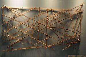
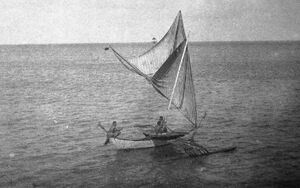
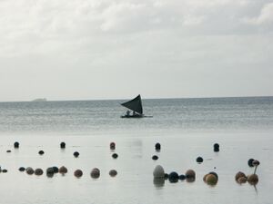
The Marshallese sailed between islands on walaps made from breadfruit-tree wood and coconut-fiber rope.[21] They navigated by using the stars for orientation and initial course setting, but also developed a piloting technique of interpreting disruptions in ocean swells to determine the location of low coral atolls below the horizon.[22] They noticed that swells refracted around the undersea slope of atolls. When refracted swells from different directions met, they created noticeable disruption patterns, which Marshallese pilots could read to determine the direction of an island.[23] When interviewed by anthropologists, some Marshallese sailors noted that they piloted their canoes by both sight and feeling changes in the motion of the boat.[20] Sailors also invented stick charts to map the swell patterns, but unlike western navigational charts, the Marshallese stick charts were tools for teaching students and for consultation before embarking on a voyage; navigators did not take charts with them when they set sail.[24]
When Russian explorer Otto von Kotzebue visited the Marshalls in 1817, the islanders still showed few signs of western influence. He observed that the Marshallese lived in thatched-roof huts, but their villages did not include the large ornate meeting houses found in other parts of Micronesia. They did not have furniture, except for woven mats, which they used for both floor coverings and clothing. The Marshallese had pierced ears and tattoos. He learned that Marshallese families practiced infanticide after the birth of a third child as a form of population planning due to frequent famines. He also noted that Marshallese iroij held considerable authority and rights to all property, though he had a more favorable view of the condition of Marshallese commoners than of that of Polynesian commoners.[25] The Marshalls' two island groups, the Ratak and Ralik chains, were each ruled by a paramount chief, or iroijlaplap, who held authority over the individual island iroij.[26]
European exploration
On August 21, 1526, Spanish explorer Alonso de Salazar was the first European to sight the Marshall Islands. While commanding the Santa Maria de la Victoria, he sighted an atoll with a green lagoon, which may have been Taongi. The crew could not land, because of strong currents and water too deep for the ship's anchor, so the ship sailed for Guam two days later.[27][28] On January 2, 1528, the expedition of Álvaro de Saavedra Cerón landed on an uninhabited island, possibly in Ailinginae Atoll, where they resupplied and stayed for six days. Natives from a neighboring island briefly met the Spanish. This expedition named the islands 'Los Pintados' or "the Painted Ones" for the natives who wore tattoos.[29] Later Spanish explorers of the Marshalls included Ruy López de Villalobos, Miguel López de Legazpi, Alonso de Arellano, and Álvaro de Mendaña de Neira, though coordinates and geographic descriptions in 16th century Spanish logs are sometimes imprecise, leaving uncertainty about the specific islands they sighted and visited.[30][31] On July 6, 1565, the Spanish ship San Jeronimo nearly wrecked at Ujelang Atoll after the ship's pilot Lope Martín led a mutiny.[32] While the mutineers were resupplying at Ujelang, several crew members took back control of the ship and marooned Martín and twenty-six other mutineers in the Marshalls.[33] By the late 16th century, Spanish galleons sailing between the Americas and the Philippines kept to a sea lane at 13°N and provisioned at Guam, avoiding the Marshalls, which Spanish sailors saw as unprofitable islands amid hazardous waters.[34][35]
The British sea captains John Marshall and Thomas Gilbert visited the islands in 1788.[36] Their vessels had been part of the First Fleet taking convicts from England to Botany Bay in New South Wales, and were en route to Guangzhou when they passed through the Gilbert Islands and Marshall Islands.[37] On June 25, 1788, the British ships had peaceful interactions and traded with islanders at Mili Atoll;[38] their meeting may have been the first contact between Europeans and Marshallese since the Mendaña expedition of 1568.[26] Subsequent navigational charts and maps named the islands for John Marshall.[38]
From the 1820s through the 1850s, the Marshall Islanders became increasingly hostile to western vessels, possibly because of violent punishments that sea captains exacted for theft as well as the abduction of Marshallese people for sale into slavery on Pacific plantations.[39] One of the earliest violent encounters occurred in February 1824, when the inhabitants of Mili Atoll massacred marooned sailors from the American whaler Globe.[40] Similar encounters occurred as late as 1851 and 1852, when three separate Marshallese attacks on ships occurred at Ebon, Jaluit, and Namdrik Atolls.[39]
Colonial period
In 1857, American Board of Commissioners for Foreign Missions sent two families to establish a mission church and school at Ebon. By 1875, the missionaries had established churches on five atolls and had baptized more than 200 islanders,[41] and one traveler noted that most women on Ebon wore western clothes and many men wore trousers by the mid-1870s.[42]
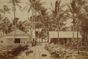
In 1859, Adolph Capelle and another merchant arrived at Ebon and set up a trading post for the German company Hoffschlaeger & Stapenhorst.[43] When the firm went bankrupt in 1863, Capelle partnered with Portuguese ex-whaler Anton Jose DeBrum to establish a copra trading firm: Capelle & Co.[44] In 1873, the company moved its headquarters to Jaluit, the home of Kabua, a powerful iroij and disputed successor for the paramount chieftainship of the southern Ralik Chain.[45] In the 1870s, various other companies from Germany, Hawaii, New Zealand, and the United States engaged in the copra trade in the Marshall Islands.[46] By 1885, the German firms Hernsheim & Co. and Deutsche Handels- und Plantagen-Gesellschaft Der Südee Inseln zu Hamburg controlled two-thirds of the trade.[47]
Contact between the Marshallese and westerners led to sometimes lethal outbreaks of western diseases, including influenza, measles, syphilis, and typhoid fever.[48] Increased access to alcohol led to social problems in some Marshallese communities,[49] and on several atolls conflicts erupted between rival iroij with access to firearms.[50]
German protectorate
In 1875, the British and German governments conducted a series of secret negotiations to divide the Western Pacific into spheres of influence. The German sphere included the Marshall Islands.[51] On November 26, 1878, the German warship SMS Ariadne anchored at Jaluit to begin treaty negotiations with the chiefs to grant the German Empire "most favored nation" status in the Ralik Chain. During the second day of negotiations, Captain Bartholomäus von Werner ordered his men to give military demonstrations which he later said were intended to "show the islanders, who have not seen anything like it before, the power of the Europeans."[52] On November 29, Werner signed a treaty with Kabua and several other Ralik Chain iroij which secured a German fuelling station at Jaluit and free use of the atoll's harbor.[53][54]
On August 29, 1885, German Chancellor Otto von Bismarck authorized the annexation of the Marshall Islands as a protectorate[55] following repeated petitions by German business interests.[56] The German gunboat SMS Nautilus docked at Jaluit on October 13 to take control.[57] On October 15, iroij Kabua, Loeak, Nelu, Lagajime, and Launa signed a protection treaty in German and Marshallese at the German consulate. While the Marshallese text made no distinction of rank among the five chiefs, the German text recognized Kabua as the King of the Marshall Islands, despite an ongoing dispute between Kabua and Loeak over the paramount chieftainship.[58] A company of German marines hoisted the flag of the German Empire over Jaluit, and performed similar ceremonies at seven other atolls in the Marshalls,[57] though several pro-American iroij refused to recognize the German protectorate until threatened with German naval force in mid-1886.[59] Nauru was incorporated into the German Protectorate of the Marshall Islands in 1888, following the Anglo-German Declarations of April 1886.[60]
The German commercial interests formed the joint-stock Jaluit Company, which was responsible for financing the colony's administration. In addition to controlling two-thirds of the Marshallese copra trade, the company had the authority to collect commercial license fees and an annual poll tax.[61] The company also had the right to be consulted on all new laws and ordinances and nominated all colonial administrative staff.[62] The company's licensing fees and legal advantages pushed out American and British competition, creating a monopoly in the German Pacific colonies.[63] The British government protested the regulations benefiting the Jaluit Company as a violation of the Anglo-German Declarations' free-trade provision.[64] On March 31, 1906, the German government assumed direct control and reorganized the Marshall Islands and Nauru as part of the protectorate of German New Guinea.[65]
Japanese mandate
The Imperial Japanese Navy invaded Enewetak on September 29, 1914, and Jaluit on September 30 at the beginning of World War I. An occupation force was stationed on Jaluit on October 3.[66] At the Paris Peace Conference in 1919, Germany's Pacific colonies north of the equator became the Japanese South Seas Mandate under the system of League of Nations mandates.[67][68] Germany ceded the Marshall Islands to Japan with the signing of the Treaty of Versailles on June 28, 1919.[69]
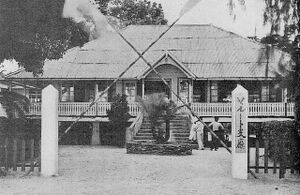
The Japanese navy administered the islands from late 1914 through 1921. The civilian South Seas Government (南洋廳, Nan'yō-chō) set up its headquarters in Palau in April 1922 and administered the Marshalls until World War II.[70] Japanese surveys determined that the Marshalls' value was primarily strategic, because they could enable future southward expansion.[71][72] The Marshalls also continued to be a major producer of copra during the Japanese period, with the South Seas Trading Company (南洋貿易会社, Nan'yō Bōeki Kaisha) taking over the Jaluit Company's operations and building upon the German colonial infrastructure.[73] Other parts of the South Seas Mandate experienced heavy Japanese settlement, shifting the population to majority Japanese in the Northern Mariana Islands and Palau, but Japanese settlers remained a minority under 1,000 people in the Marshall Islands throughout the Japanese period, because the islands were distant from Japan and had the most limited economic potential in Micronesia.[74][75]
On March 27, 1933, Japan declared its intentions to withdraw from the League of Nations, officially withdrawing in 1935 but continuing to control the territory of the South Seas Mandate.[76] Japanese military planners initially discounted the Marshalls as too distant and indefensible for extensive fortification, but as Japan developed long-range bombers, the islands became useful as a forward base to attack Australia, British colonies, and the United States. In 1939 and 1940, the navy built military airfields on Kwajalein, Maloelap, and Wotje Atolls as well as seaplane facilities at Jaluit.[77]
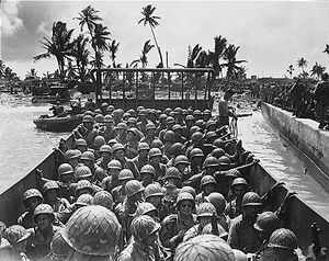
After the outbreak of the Pacific War, the United States Pacific Fleet carried out the Marshalls–Gilberts raids, which struck Jaluit, Kwajalein, Maloelap, and Wotje on February 1, 1942. They were the first American air raids on Japanese territory.[78] The United States invaded the Marshall Islands on January 31, 1944, during the Gilbert and Marshall Islands campaign. The Americans simultaneously invaded Majuro and Kwajalein.[79] By autumn 1944, the Americans controlled all of the Marshall Islands, except for Jaluit, Maloelap, Mili, and Wotje.[80] As the American campaign advanced through Micronesia and into the Ryukyu Islands, the four Japanese-held atolls were cut off from supplies and subject to American bombardment. The garrisons began running out of provisions in late 1944, leading to high casualties from starvation and disease.[81]
U.S. Trust Territory
هذا القسم يحتاج المزيد من الأسانيد للتحقق. (September 2023) (Learn how and when to remove this template message) |
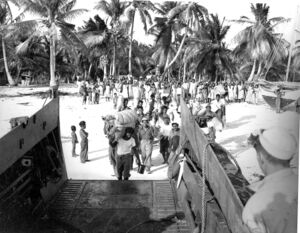

في أوائل عام 1944، وفي أثناء الحرب العالمية الثانية، احتلت القوات الأمريكية الجزر. وأصبحت جزر مارشال في عام 1947م تحت وصاية الأمم المتحدة بإدارة الولايات المتحدة الأمريكية التي منحت الجزر في عام 1986م، نوعاً من أنواع الحكم الذاتي، وهي منضمة إلى اتحاد حر مع الولايات المتحدة ، ويقوم شعب الجزر بمقتضاه بإدارة شؤونه الداخلية والخارجية، وتلتزم الولايات المتحدة الدفاع عن الجزر.
In 1947, the United States entered into an agreement with the UN Security Council to administer much of Micronesia, including the Marshall Islands, as the Trust Territory of the Pacific Islands.
From 1946 to 1958, it served as the Pacific Proving Grounds for the United States and was the site of 67 nuclear tests on various atolls.[82]
Operation Crossroads atomic bomb testing began in 1946 on Bikini Atoll after some of the residents were forcibly evacuated.
The world's first hydrogen bomb, codenamed "Mike", was tested at the Enewetak atoll in the Marshall Islands on November 1 (local date) in 1952, which produced significant fallout in the region.[83]
Over the years just one of over 60 islands was cleaned by the U.S. government, and the inhabitants are still waiting for the 2 billion dollars in compensation assessed by the Nuclear Claims Tribunal. Many of the islanders and their descendants still live in exile, as the islands remain contaminated with high levels of radiation.[84]
A significant radar installation was constructed on Kwajalein atoll.[85]
Independence
هذا القسم يحتاج المزيد من الأسانيد للتحقق. (August 2023) (Learn how and when to remove this template message) |
On May 1, 1979, in recognition of the evolving political status of the Marshall Islands, the United States recognized the constitution of the Marshall Islands and the establishment of the Government of the Republic of the Marshall Islands. The constitution incorporates both American and British constitutional concepts.
There have been a number of local and national elections since the Republic of the Marshall Islands was founded. The United Democratic Party, running on a reform platform, won the 1999 parliamentary election, taking control of the presidency and cabinet.
The islands signed a Compact of Free Association with the United States in 1986. Trusteeship was ended under United Nations Security Council Resolution 683 of December 22, 1990. Until 1999 the islanders received US$180 million for continued American use of Kwajalein atoll, US$250 million in compensation for nuclear testing, and US$600 million in other payments under the compact.
Despite the constitution, the government was largely controlled by Iroij. It was not until 1999, following political corruption allegations, that the aristocratic government was overthrown, with Imata Kabua replaced by the commoner Kessai Note.
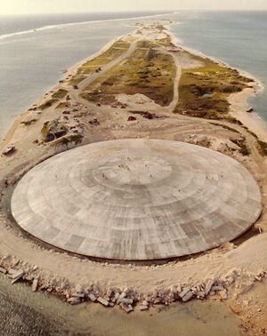
The Runit Dome was built on Runit Island to deposit U.S.-produced radioactive soil and debris, including lethal amounts of plutonium. There are ongoing concerns about deterioration of the waste site and a potential radioactive spill.[86]
In February 2018, the Marshall Islands became the first country in the world to recognize its cryptocurrency as its own legal tender for digital currency.
In January 2020, David Kabua, son of founding president Amata Kabua, was elected as the new President of the Marshall Islands. His predecessor Hilda Heine lost the position after a vote.[87]
Since the late 1980s, Marshallese have migrated to the US, with over 4,000 in Arkansas and over 7,000 in Hawaii in the 2010 US Census.[88]
Following independence, the Marshall Islands continued to play a prominent role in the testing and launches of missiles and rockets for both military and commercial space purposes. All five of the SpaceX Falcon 1 rocket flights were carried out on Omelek Island within the Kwajalein Atoll. The fourth launch of the Falcon 1 was successful, marking the first time in history a privately developed, fully liquid-fueled launch vehicle achieved orbit. SpaceX founder Elon Musk was present in Kwajalein for select launches.[89]
Geography

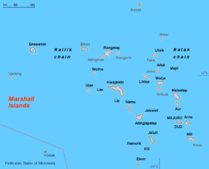
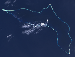
The Marshall Islands sit atop ancient submerged volcanoes rising from the ocean floor, about halfway between Hawaii and Australia,[90] north of Nauru and Kiribati, east of the Federated States of Micronesia, and south of the disputed U.S. territory of Wake Island, to which it also lays claim.[91] The atolls and islands form two groups: the Ratak (sunrise) and the Ralik (sunset). The two island chains lie approximately parallel to one another, running northwest to southeast, comprising about 750,000 square miles (1,900,000 km2) of ocean but only about 70 square miles (180 km2) of land mass.[90] Each includes 15 to 18 islands and atolls.[92]
The country consists of a total of 29 atolls and five individual islands situated in about 180,000 square miles (470,000 km2) of the Pacific.[91] The largest atoll with a land area of 6 square miles (16 km2) is Kwajalein. It surrounds a 655-square-mile (1,700 km2) lagoon.[93]
Twenty-four of the atolls and islands are inhabited. The remaining atolls are uninhabited due to poor living conditions, lack of rain, or nuclear contamination. The uninhabited atolls are:
- Ailinginae Atoll
- Bikar (Bikaar) Atoll
- Bikini Atoll
- Bokak Atoll
- Erikub Atoll
- Jemo Island
- Nadikdik Atoll
- Rongerik Atoll
- Toke Atoll
- Ujelang Atoll
The average altitude above sea level for the entire country is 7 feet (2.1 m).[91]
Shark sanctuary
In October 2011, the government declared that an area covering nearly 2,000,000 square kilometers (772,000 sq mi) of ocean shall be reserved as a shark sanctuary. This is the world's largest shark sanctuary, extending the worldwide ocean area in which sharks are protected from 2,700,000 to 4,600,000 square kilometers (1,042,000 to 1,776,000 sq mi). In protected waters, all shark fishing is banned and all by-catch must be released. However, some have questioned the ability of the Marshall Islands to enforce this zone.[94]
Territorial claim on Wake Island
The Marshall Islands also lays claim to Wake Island based on oral legends.[95] While Wake Island has been administered by the United States since 1899, the Marshallese government refers to it by the name Ānen Kio (new orthography) or Enen-kio (old orthography).[96][97] The United States does not recognize this claim.[95]
يبلغ عدد جزر مارشال الرئيسية 32 جزيرة مرجانية حلقية atolls وفيها أكثر من 867 شعبة مرجانية Reefs تتناثر عليها نحو 1150جزيرة صغيرة منخفضة السطح، ومن أهم جزر مارشال الجزر الآتية:
جزيرة ماجورو Majuro، وتضم عاصمة مدينة الجزر ماجور وجزيرة إنييوتك Eniwetok، وجزيرة أرنو Arno، وجزيرة بيكيني Bikini، وجزيرة مالويلاب Maloelap وجزيرة أوتيريك Utirik وجزيرة جالويت Jaluit.
وجزر مارشال من الجزر المحيطية المنشأ، التي تكونت فوق صخور قاع المحيط الهادئ البازلتية. وتتكون الصخور المرجانية المشكلة لها من كتل صخرية كلسية كانت أصلاً أجزاء من هياكل عظمية صلبة لحيوان المرجان. وعند اندثار الهياكل الكلسية للكائنات البحرية المختلفة وتجمع الهياكل المرجانية واختلاطها بمعادن مختلفة، تكوَّنت صخور مرجانية متنوعة.
وتنتشر جزر مارشال عبر سلسلتين متوازيتين باتجاه شمالي غربي - جنوبي شرقي، وبفاصل بينهما نحو 200كم، وبطول لكل منهما نحو 1000كم. وتعرف السلسلة الشرقية بسلسلة راتاك Ratak أو سلسلة الشروق، وتسمى السلسلة الغربية بسلسلة راليك Ralik أو سلسلة الغروب.
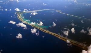
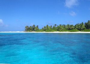
وتتصف الجزر المرجانية الرئيسة بتكون جزر من النوع الحلقي، مستديرة الشكل تتوسطها بحيرة. ومن الملاحظ أن مساحة الجزر المرجانية الحلقية صغيرة إذا ما قيست بمساحة البحيرة الضحلة التي تتوسطها. وعلى سبيل المثال تبلغ مساحة الأشرطة الحلقية لجزيرة ماجور المرجانية عرض 12 َ 7 ْ وطول 25 َ 171 ْ شرقاً نحو 9 كم2، أما مساحة البحيرة الداخلية فنحو 289كم2. ولايزيد عدد سكانها على 1600 نسمة عام 2003،
- Ailinglaplap Atoll - Christopher J. Loeak (AKA), Ruben R. Zackhras (UDP)
- Ailuk Atoll - Maynard Alfred (UDP)
- Arno Atoll - Nidel Lorak (UPP), Gerald M. Zackios (UDP)
- Aur Atoll - Norman Matthew (UPP)
- Ebon Atoll - John M. Silk (UDP)
- Enewetak Atoll - Jack Ading (UPP)
- Jabat Island- Kessai H. Note (UDP)
- Jaluit Atoll - Rien R. Morris (UDP), Speaker Alvin T. Jacklick (UDP)
- كيلي (جزيرة) - Tomaki Juda (UDP)
- كواجالين (شعاب حلقية) - Michael Kabua (AKA), Tony A. deBrum (AKA), Jeban Riklon (AKA)
- Lae Atoll - Rellong D. Lemari (AKA)
- Lib Island - Jerakoj Jerry Bejang (AKA)
- Likiep Atoll - Donald F. Capelle (UDP)
- Majuro Atoll - Wilfred I. Kendall (UDP), David Kramer (IND), Brenson S. Wase (UDP), Vice Speaker Alik J. Alik (UDP), 'H.E. President Jurelang Zedkaia' (UDP)
- Maloelap Atoll - Michael Konelios (UDP)
- Mejit Island - Dennis Momotaro (UPP)
- Mili Atoll - Kejjo Bien (UPP)
- Namdrik Atoll - Mattlan Zackhras (UDP)
- Namu Atoll - Kaiboke Kabua (AKA)
- Rongelap Atoll - Kenneth Kedi (IND)
- Ujae Atoll - Frederick H. Muller (UPP)
- Utrik Atoll - Amenta Matthew (IND)
- Wotho Atoll - David Kabua (AKA)
- Wotje Atoll - Litokwa Tomeing (UPP)
المناخ
ومناخ الجزر استوائي إلى مداري بحري دافئ طوال العام، وهذا ما لاءم بعض الكائنات البحرية مثل حيوان المرجان. وموقع الجزر من خط الاستواء في أواسط المياه، جعل حرارتها مرتفعة طوال العام، بمتوسط حرارة شهري نحو 25 ْم، مع مدى حراري نحو درجتين ما بين جزر الجنوب 26 ْم، وجزر الشمال 24 ْم، علماً أن المدى السنوي للحرارة يراوح ما بين أقل من درجة واحدة في الجنوب ونحو درجتين في الشمال. وتهطل الأمطار دوماً، مع تركز الجزء الأعظم منها 65% في الفترة الممتدة من بداية شهر تموز/يوليو حتى نهاية شهر تشرين الأول/أكتوبر. وفي حين يكون معدل الأمطار السنوية في الجزر الجنوبية نحو 1200مم، فإنه يتناقص في الجزر الشمالية إلى نحو 850مم، وتتأثر الجزر بالأعاصير المدارية، حتى الجنوبية منها، (إذ ضربها إعصار مداري يوم 30 حزيران/يونيو عام 1905م بأمواجه العالية التي بلغ ارتفاعها نحو 15م)، وتقل كثافة النباتات فوق الجزر ذات التربة الكلسية المسامية، بفعل تسرب المياه إلى جوف الصخور، مما أثَّر سلباً في توافر المياه العذبة السطحية. ومن أشهر أنواع الأشجار جوز الهند والپپايا papaya والموز وأشجار الخبز.
السكان
وسكان الجزر من الميكرونيزيين الذين عرفوا بهذا الاسم لسكنهم جزراً مرجانية صغيرة المساحة محدودة الموارد. وتظهر بينهم الصفات المغولية بوضوح، ويتميزون بأنهم قصار القامة عامة ويميل لون بشرتهم إلى الصفرة. وهم آخر مجموعة عرقية وفدت إلى جزر المحيط الهادئ بعد الميلانيزيين والبولينيزيين. وهم مشهورون بحرفهم اليدوية، وقد مات كثير من الميكرونيزيين بأمراض نقلها إلى جزرهم الأوربيون في القرن التاسع عشر الميلادي. ويبلغ إجمالي عدد سكان الجزر لعام 2003 نحو 60 ألف نسمة تقريباً.
الاقتصاد
The islands have few natural resources, and their imports far exceed exports. According to the CIA, the value of exports in 2013 was approximately $53.7 million while estimated imports were $133.7 million. Agricultural products include coconuts, tomatoes, melons, taro, breadfruit, fruits, pigs and chickens. Industry is made of the production of copra and craft items, tuna processing and tourism. The GDP in 2016 was an estimated $180 million, with a real growth rate of 1.7%. The GDP per capita was $3,300.[98]
The International Monetary Fund reported in mid-2016 that the economy of the Republic had expanded by about 0.5 percent in the Fiscal Year 2015 thanks to an improved fisheries sector. A surplus of 3% of GDP was recorded "owing to record-high fishing license fees. Growth is expected to rise to about 1.5 percent and inflation to about 0.5 percent in FY2016, as the effects of the drought in earlier 2016 are offset by the resumption of infrastructure projects."[99]
In 2018, the Republic of Marshall Islands passed the Sovereign Currency Act, which made it the first country to issue their own cryptocurrency and certify it as legal tender; the currency is called the "Sovereign".[100][101]
Marshall Islands has signed a bilateral trade agreement with Taiwan in 2019, this agreement has been approved in 2023 and will take effect at a future date.[102]
الشحن البحري
The Marshall Islands plays a vital role in the international shipping industry as a flag of convenience for commercial vessels.[103] The Marshallese registry began operations in 1990, and is managed through a joint venture with International Registries, Inc., a US-based corporation that has offices in major shipping centers worldwide.[104] As of 2017, the Marshallese ship registry was the second largest in the world, after that of Panama.[105]
Unlike some flag countries, there is no requirement that a Marshallese flag vessel be owned by a Marshallese individual or corporation. Following the 2015 seizure of the MV Maersk Tigris, the United States announced that its treaty obligation to defend the Marshall Islands did not extend to foreign-owned Marshallese flag vessels at sea.[106]
As a result of ship-to-ship transfers by Marshallese flag tanker vessels, the Marshall Islands have statistically been one of the largest importers of crude oil from the United States, despite the fact that the islands have no oil refining capacity.[107]
العمالة
In 2007, the Marshall Islands joined the International Labour Organization, which means its labor laws will comply with international benchmarks. This may affect business conditions in the islands.[108]
الضرائب
The income tax has two brackets, with rates of 8% and 12%.[109] The corporate tax is 3% of revenue.[109]
المعونات الدولية
United States government assistance is the mainstay of the economy. Under terms of the Amended Compact of Free Association, the U.S. is committed to providing US$57.7 million per year in assistance to the Marshall Islands (RMI) through 2013 and then US$62.7 million through 2023, at which time a trust fund, made up of U.S. and RMI contributions, will begin perpetual annual payouts.[110]
The United States Army maintains the Ronald Reagan Ballistic Missile Defense Test Site on Kwajalein Atoll. Marshallese landowners receive rent for the base.
الزراعة
وتنتشر زراعة الكومارا kumara التي تمثل الغذاء الرسمي للسكان، والساجوsago palm واليام yam (يشبه البطاطا كبيرة الحجم)، والتارو (القلقاس) taro. إلا أن لنخيل جوز الهند الأهمية الكبرى في الحياة الاقتصادية. والمنتج الرئيسي هو لب جوز الهند المجفف (الكوبرا copra) الذي يعدّ أهم صادرات الجزر، كما تعد المادة السائلة داخل جوز الهند المشروب الرئيسي لسكان الجزر. ويستخدم زيت جوز الهند في أغراض متنوعة، أهمها الطهي. كما تستعمل قشرة جوز الهند كأوعية لطهي الطعام. ويصنع من ألياف نخيل جوز الهند وسعفه الحقائب والحبال والشباك والقبعات والملابس، أما الأسماك فهي متوافرة بكثرة بين الشعب المرجانية، وتعدّ مصدراً مهماً للدخل.

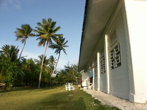
Agricultural production is concentrated on small farms.[111] The most important commercial crop is copra,[112][113] followed by coconut, breadfruit, pandanus, banana, taro and arrowroot. The livestock consists primarily of pigs and chickens.[114][99]
الصناعة
Small-scale industry is limited to handicrafts, fish processing, and copra.[115]
صيد الأسماك
Majuro is the world's busiest tuna transshipment port, with 704 transshipments totaling 444,393 tons in 2015.[116] Majuro is also a tuna processing center; the Pan Pacific Foods plant exports processed tuna to a number of countries, primarily the United States under the Bumble Bee brand.[117] Fishing license fees, primarily for tuna, provide noteworthy income for the government.[99]
In 1999, a private company built a tuna loining plant with more than 400 employees, mostly women. But the plant closed in 2005 after a failed attempt to convert it to produce tuna steaks, a process that requires half as many employees. Operating costs exceeded revenue and the plant closed. It was taken over by the government, which had been the guarantor of a $2 million loan to the business.[بحاجة لمصدر]
الطاقة
Coconut trees abound in the Pacific's tropical islands. Copra, the meat of the coconut, yields 1 liter of coconut oil for every 6 to 10 coconuts. As of 2007 power authorities, private companies, and entrepreneurs on the islands had been experimenting with coconut oil as alternative to diesel fuel for vehicles, power generators, and ships.[118] In 2009, a 57 kW solar power plant was installed, the largest in the Pacific at the time, including New Zealand.[119] It is estimated that 330 kW of solar and 450 kW of wind power would be required to make the College of the Marshall Islands energy self-sufficient.[120] Marshalls Energy Company (MEC), a government entity, provides the islands with electricity. In 2008, two 100-Wp solar home systems were installed on 420 homes on Ailinglaplap Atoll, sufficient for limited electricity use.[121][122]
التعليم
The Human Rights Measurement Initiative (HRMI)[123] finds that the Marshall Islands are fulfilling only 66.1% of what it should be fulfilling for the right to education based on the country's level of income.[124] HRMI breaks down the right to education by looking at the rights to both primary education and secondary education. While taking into consideration the Marshall Islands' income level, the nation is achieving 65.5% of what should be possible based on its resources (income) for primary education and 66.6% for secondary education.[124]
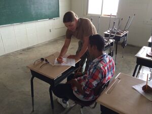
The Ministry of Education is the education agency of the islands. Marshall Islands Public School System operates the state schools in the Marshall Islands.
In the 1994–1995 school year the country had 103 elementary schools and 13 secondary schools. There were 27 private elementary schools and one private high school. Christian groups operated most of the private schools.[125]
Historically the Marshallese population was taught in English first with Marshallese instruction coming later, but this was reversed in the 1990s to keep the islands' cultural heritage and so children could write in Marshallese. Now English language instruction begins in grade 3. Christine McMurray and Roy Smith wrote in Diseases of Globalization: Socioeconomic Transition and Health that this could potentially weaken the children's English skills.[125]
There are two tertiary institutions operating in the Marshall Islands, the College of the Marshall Islands[126] and the University of the South Pacific.
النقل
The Marshall Islands are served by the Marshall Islands International Airport in Majuro, the Bucholz Army Airfield in Kwajalein, and other small airports and airstrips.[127]
Airlines include United Airlines, Nauru Airlines, Air Marshall Islands, and Asia Pacific Airlines.[128]
Media and communications
The Marshall Islands have several AM and FM radio stations. AM stations are 1098 5 kW V7AB Majuro (Radio Marshalls, national coverage) and 1224 AFN Kwajalein (both public radio) as well as 1557 Micronesia Heatwave. The FM stations are 97.9 V7AD Majuro,[129] V7AA 96.3 FM Uliga[130] and 104.1 V7AA Majuro (Baptist religious). BBC World is broadcast on 98.5 FM Majuro.[131] The most recent station is Power 103.5 which started broadcasting in 2016.[132]
AFRTS stations include 99.9 AFN Kwajalein (country), 101.1 AFN (adult rock) and 102.1 AFN (hot AC).[133][134]
There is one broadcast television station, MBC-TV operated by the state.[135] Cable TV is available. On cable TV, most programs are shown two weeks later than in North America but news in real time can be viewed on CNN, CNBC and BBC.[136] American Forces Radio and Television also provides TV service to Kwajalein Atoll.[137]
The Marshall Islands National Telecommunications Authority (NTA) provides telephone, cable TV (MHTV), FAX, cellular and Internet services.[138][139] The Authority is a private corporation with significant ownership by the national government.[140]
الصحف
Loan Ran Kein, a Marshallese language paper, was published from 1953 to 1954. The current national newspaper is a bilingual (Marshallese and English) weekly, The Marshall Islands Journal.[141] It has been published since 1980.[142]
انظر أيضاً
- Outline of the Marshall Islands
- Index of Marshall Islands–related articles
- List of islands of the Marshall Islands
- Pacific Proving Grounds
- List of island countries
- The Plutonium Files
- Visa policy of the Marshall Islands
- Naval Base Marshall Islands
ملاحظات
- ^ Pronunciations:
* English: Republic of the Marshall Islands /ˈmɑrʃəl ˈaɪləndz/
قالب:Lang-mh ([]) - ^ Wake Island is claimed as a territory of the Marshall Islands, but is also claimed as an unorganized, unincorporated territory of the United States, with de facto control vested in the Office of Insular Affairs (and all military defenses managed by the United States military).
معرض الصور
مرئيات
| أمواج عاتية تضرب جزر مارشال (18 يوليو 2024) |
|---|
أنظر أيضاً
المصادر
- ^ Names of the countries of Oceania in local languages, Omniglot. Retrieved 5 March 2011.
- ^ GEONAMES - Marshall Islands, Geonames.de. Retrieved 5 March 2011.
- ^ The largest cities in Marshall Islands, ranked by population Archived سبتمبر 3, 2011 at the Wayback Machine. population.mongabay.com. Retrieved May 25, 2012.
- ^ أ ب ت "Republic of the Marshall Islands 2021 Census Report, Volume 1: Basic Tables and Administrative Report". Pacific Community (SPC): Statistics for Development Division. May 30, 2023. Archived from the original on October 20, 2023. Retrieved September 27, 2023.
- ^ أ ب "Report for Selected Countries and Subjects". imf.org. Archived from the original on 2020-06-12. Retrieved 2019-06-06.
- ^ "HUMAN DEVELOPMENT REPORT 2023-24" (PDF). United Nations Development Programme (in الإنجليزية). United Nations Development Programme. 13 March 2024. pp. 274–277. Archived (PDF) from the original on May 1, 2024. Retrieved May 6, 2024.
- ^ "Marshall Islands". marshallese.org. Archived from the original on November 25, 2022. Retrieved 23 April 2022.
- ^ "Marshall Islands Geography". CIA World Factbook. Archived from the original on 2021-02-04. Retrieved 2021-01-24.
- ^ "Marshall Islands profile – Timeline". Bbc.com. July 31, 2017. Archived from the original on August 14, 2017. Retrieved August 22, 2017.
- ^ "Republic of the Marshall Islands country brief". Department of Foreign Affairs and Trade Australia. Archived from the original on 2021-05-16. Retrieved 2021-06-09.
- ^ Brunnstrom, David; Martina, Michael (17 October 2023). "U.S. finalizes 20-year extension of Marshall Islands ties". The Japan Times. Archived from the original on February 18, 2024. Retrieved 17 February 2024.
- ^ Liao, Shannon (2018-05-23). "The Marshall Islands replaces the U.S. dollar with its own cryptocurrency". The Verge. Archived from the original on 2019-01-16. Retrieved 2019-01-16.
- ^ Chavez-Dreyfuss, Gertrude (2018-02-28). "Marshall Islands to issue own sovereign cryptocurrency". Technology News. Reuters (in الإنجليزية). Archived from the original on 2019-01-17. Retrieved 2019-01-16.
- ^ "Marshall Islands" (PDF). imr.ptc.ac.fj. Archived (PDF) from the original on 2019-01-15. Retrieved 2019-01-16.
- ^ أ ب Weisler 2000, p. 113
- ^ Streck 1990, p. 256
- ^ Kirch & Weisler 1994, p. 292
- ^ Weisler 2000, pp. 113–114
- ^ Reséndez 2021, pp. 107–108
- ^ أ ب Finney 1998, p. 479
- ^ Hezel 1983, p. 92
- ^ Finney 1998, p. 475
- ^ Finney 1998, pp. 476–478
- ^ Finney 1998, p. 443
- ^ Hezel 1983, pp. 92–94
- ^ أ ب Fortune 2000, p. 287
- ^ Sharp 1960, pp. 11–13
- ^ Hezel 1983, p. 13
- ^ Sharp 1960, pp. 16–18
- ^ Sharp 1960, pp. 19–47
- ^ Hezel 1983, pp. 13–33
- ^ Sharp 1960, pp. 40–41
- ^ Hezel 1983, pp. 30–31
- ^ Sharp 1960, p. 39
- ^ Hezel 1983, p. 34
- ^ Sharp 1960, p. 152
- ^ Hezel 1983, pp. 63–64
- ^ أ ب Hezel 1983, pp. 64–65
- ^ أ ب Hezel 1983, p. 200
- ^ Beardslee, L. A. (1870). Marshall Group: North Pacific Islands. Washington D.C.: U.S. Bureau of Navigation: Hydrological Office. p. 3. Archived from the original on February 24, 2021. Retrieved August 25, 2023.
- ^ Hezel 1983, pp. 200–209
- ^ Hezel 1983, pp. 219–220
- ^ Hezel 1983, pp. 210–211
- ^ Hezel 1983, p. 214
- ^ Hezel 1983, p. 215
- ^ Hezel 1983, p. 216
- ^ Hezel 2003, p. 46
- ^ Hezel 1983, p. 206
- ^ Hezel 1983, p. 292
- ^ Hezel 1983, pp. 293–303
- ^ Hezel 1983, pp. 300–301
- ^ Fitzpatrick 2022, pp. 303–304
- ^ Hezel 1983, pp. 298–299
- ^ Hezel 2003, p. 47
- ^ Fitzpatrick 2022, p. 306
- ^ Hezel 1983, p. 304
- ^ أ ب Hezel 1983, p. 305
- ^ Fitzpatrick 2022, pp. 307–308
- ^ Fitzpatrick 2022, p. 309
- ^ Firth 1978, p. 37
- ^ Hezel 2003, p. 48
- ^ Storr 2020, p. 86
- ^ Firth 1973, p. 25
- ^ Firth 1973, p. 26
- ^ Firth 1978, p. 39
- ^ Peattie 1992, p. 42
- ^ Hezel 2003, p. 155
- ^ Peattie 1984, p. 182
- ^ Purcell 1976, p. 195
- ^ Hezel 2003, p. 166
- ^ Hiery 1995, p. 132
- ^ Peattie 1984, p. 183
- ^ Purcell 1976, p. 210
- ^ Hiery 1995, p. 133
- ^ Peattie 1984, p. 197
- ^ Hezel 2003, pp. 207–208
- ^ Hezel 2003, p. 217
- ^ Peattie 1984, pp. 203–204
- ^ Peattie 1984, p. 205
- ^ Peattie 1984, p. 207
- ^ Peattie 1984, p. 208
- ^ "Marshall Islands marks 71 years since start of U.S. nuclear tests on Bikini". Radio New Zealand (in الإنجليزية). 2017-03-01. Archived from the original on 2019-01-16. Retrieved 2019-01-16.
- ^ "What the First H-Bomb Test Looked Like". Time. Archived from the original on 2020-09-20. Retrieved 2020-08-26.
- ^ France-Press, Agence (March 1, 2014). "Bikini Atoll nuclear test: 60 years later and islands still unliveable". The Guardian. Archived from the original on September 1, 2017. Retrieved August 22, 2017.
- ^ "Rising seas could threaten $1 billion Air Force radar site". cbsnews.com (in الإنجليزية الأمريكية). October 18, 2016. Archived from the original on 2019-01-16. Retrieved 2019-01-16.
- ^ "How the U.S. betrayed the Marshall Islands, kindling the next nuclear disaster". Los Angeles Times. November 10, 2019. Archived from the original on November 14, 2019. Retrieved November 14, 2019.
- ^ "New president for Marshall Islands". RNZ.co.nz. 6 January 2020. Archived from the original on 18 September 2020. Retrieved 24 August 2021.
- ^ "Encyclopedia of Arkansas". Encyclopedia of Arkansas. Archived from the original on September 22, 2022. Retrieved April 27, 2022.
- ^ Berger, Eric (2021). Liftoff: Elon Musk and the desperate early days that launched SpaceX (First ed.). New York, NY: William Morrow, an imprint of HarperCollinsPublishers. p. 76. ISBN 978-0062979971.
- ^ أ ب "Republic of the Marshall Islands". Pacific RISA. 3 February 2012. Archived from the original on 22 October 2015. Retrieved November 1, 2015.
- ^ أ ب ت "Geography". Rmiembassyus.org. Archived from the original on نوفمبر 15, 2013. Retrieved أغسطس 22, 2017.
- ^ Beardslee, L. A. (1870). Marshall Group. North Pacific Islands. Publications.no. 27. Washington DC: U.S. Government Printing Office. p. 33. Archived from the original on February 24, 2021. Retrieved November 1, 2015.
- ^ Alcalay, Glenn; Fuchs, Andrew. "History of the Marshall Islands". atomicatolls.com. Archived from the original on January 7, 2017. Retrieved January 7, 2017.
- ^ "Vast shark sanctuary created in Pacific". BBC News. October 3, 2011. Archived from the original on November 15, 2011. Retrieved November 25, 2011.
- ^ أ ب Wake Island Archived 2021-01-20 at the Wayback Machine. The World Factbook. Central Intelligence Agency.
- ^ "Enen Kio (a.k.a. Wake Island) • Marshall Islands Guide". Marshall Islands Guide (in الإنجليزية الأمريكية). 2016-12-16. Archived from the original on 2019-01-16. Retrieved 2019-01-16.
- ^ "Dictionary: ānen Kio". marshallese.org. Archived from the original on 2021-08-28. Retrieved 2021-08-28.
- ^ "Marshall Islands Economy 2017, CIA World Factbook". Theodora.com. Archived from the original on August 14, 2017. Retrieved August 22, 2017.
- ^ أ ب ت "Republic of the Marshall Islands : 2016 Article IV Consultation-Press Release; Staff Report; and Statement by the Executive Director for Republic of the Marshall Islands". Imf.org. Archived from the original on August 14, 2017. Retrieved August 22, 2017.
- ^ "Marshall Islands to issue own sovereign cryptocurrency". Reuters. Archived from the original on March 1, 2018. Retrieved March 5, 2018.
- ^ "Unlocking the potential of blockchain technology". MIT News | Massachusetts Institute of Technology (in الإنجليزية). June 16, 2021. Archived from the original on 2021-12-13. Retrieved 2021-06-20.
- ^ "ECA/FTA簽訂夥伴". 臺灣ECAFTA總入口網站. Bureau of Foreign Trade. Archived from the original on June 11, 2023. Retrieved 11 June 2023.
- ^ Galbraith, Kate (يونيو 3, 2015). "Marshall Islands, the Flag for Many Ships, Seeks to Rein In Emissions". The New York Times (in الإنجليزية الأمريكية). ISSN 0362-4331. Archived from the original on يناير 4, 2018. Retrieved يناير 3, 2018.
- ^ "Marshall Islands – The Shipping Law Review – Edition 4". The Law Reviews (in الإنجليزية). Archived from the original on يناير 4, 2018. Retrieved يناير 3, 2018.
- ^ Hand, Marcus (مارس 22, 2017). "Marshall Islands becomes the world's second largest ship registry". Seatrade Maritime News (in الإنجليزية). Archived from the original on أغسطس 15, 2017. Retrieved يناير 3, 2018.
- ^ Kopel, David (مايو 1, 2015). "U.S. treaty obligation to defend Marshall Islands ships". The Washington Post (in الإنجليزية الأمريكية). ISSN 0190-8286. Archived from the original on يناير 4, 2018. Retrieved يناير 3, 2018.
- ^ Gloystein, Henning (أغسطس 12, 2016). "How the Marshall Islands became a top U.S. crude export destination". Intel. Reuters. Archived from the original on يناير 4, 2018. Retrieved يناير 3, 2018.
- ^ "Republic of the Marshall Islands becomes 181st ILO member State". Ilo.org. July 6, 2007. Archived from the original on July 24, 2008.
- ^ أ ب "Official Homepage of the NITIJELA (PARLIAMENT)". NITIJELA (PARLIAMENT) of the Republic of the Marshall Islands. Archived from the original on 2018-01-16. Retrieved 2018-01-16.
- ^ "COMPACT OF FREE ASSOCIATION AMENDMENTS ACT OF 2003" (PDF). Public Law 108–188, 108th Congress. December 17, 2003. Archived from the original (PDF) on October 26, 2007.
- ^ Mellgard, Peter (2015-12-12). "In The Marshall Islands, Traditional Agriculture And Healthy Eating Are A Climate Change Strategy". Huffington Post (in الإنجليزية الأمريكية). Archived from the original on 2018-02-25. Retrieved 2019-01-16.
- ^ "Copra Processing Plant • Marshall Islands Guide". Infomarshallislands.com. November 18, 2016. Archived from the original on October 27, 2017. Retrieved August 22, 2017.
- ^ "Copra production up on 2014 – The Marshall Islands Journal". Marshallislandsjournal.com. أكتوبر 9, 2015. Archived from the original on أغسطس 14, 2017. Retrieved أغسطس 22, 2017.
- ^ Speedy, Andrew. "Marshall Islands". Fao.org. Archived from the original on أبريل 17, 2016. Retrieved أغسطس 22, 2017.
- ^ "Marshall Islands". United States Department of State (in الإنجليزية الأمريكية). Archived from the original on September 22, 2022. Retrieved 2022-09-22.
- ^ "Marshall Islands' Majuro is world's tuna hub". Undercurrent News (in الإنجليزية الأمريكية). Archived from the original on August 8, 2018. Retrieved January 5, 2018.
- ^ "Majuro Tuna Plant Exports World-Wide". U.S. Embassy in the Republic of the Marshall Islands (in الإنجليزية الأمريكية). نوفمبر 23, 2012. Archived from the original on يناير 6, 2018. Retrieved يناير 5, 2018.
- ^ "Pacific Islands look to coconut power to fuel future growth". September 13, 2007. Archived from the original on January 13, 2008. Retrieved October 25, 2015.
- ^ College of the Marshall Islands Archived فبراير 8, 2013 at the Wayback Machine. (PDF) . reidtechnology.co.nz. June 2009
- ^ College of the Marshall Islands: Reiher Returns from Japan Solar Training Program with New Ideas Archived أكتوبر 28, 2012 at the Wayback Machine. Yokwe.net. Retrieved September 11, 2013.
- ^ "Republic of the Marshall Islands". Rep5.eu. Archived from the original on May 10, 2013. Retrieved October 25, 2015.
- ^ Marshalls Energy Company. Report of the Installation of the EU REP-5 Solar Project at Ailinglaplap Atoll, Republic of the Marshall Islands. p. 4. 9 ACP MH 1. Archived from the original. You must specify the date the archive was made using the
|archivedate=parameter. http://www.rep5.eu/files/pages/file/RMI/REPORT%20OF%20THE%20INSTALLATION%20OF%20REP5%20Final.pdf. - ^ "Human Rights Measurement Initiative – The first global initiative to track the human rights performance of countries". humanrightsmeasurement.org. Archived from the original on March 29, 2023. Retrieved 2022-03-25.
- ^ أ ب "Marshall Islands – HRMI Rights Tracker". rightstracker.org (in الإنجليزية). Archived from the original on March 29, 2023. Retrieved 2022-03-25.
- ^ أ ب McMurray, Christine; Smith, Roy (2013-10-11). Diseases of Globalization: Socioeconomic Transition and Health (in الإنجليزية). Routledge. ISBN 9781134200221. Archived from the original on February 17, 2023. Retrieved December 13, 2021.
- ^ College of the Marshall Islands (CMI) Archived أبريل 27, 2013 at the Wayback Machine. Cmi.edu. Retrieved on September 11, 2013.
- ^ "Republic of the Marshall Islands – Amata Kabua International Airport". Republic of the Marshall Islands Ports Authority. Archived from the original on 2016-12-31. Retrieved 2014-01-02.
- ^ "Airlines Serving the Marshall Islands – RMIPA". Rmipa.com. Archived from the original on August 23, 2017. Retrieved August 22, 2017.
- ^ "Radio Majuro 979 – Listen Radio Majuro 979 online radio FM – Marshall Islands". Topradiofree.com. Archived from the original on August 14, 2017. Retrieved August 22, 2017.
- ^ "V7AA – 96.3 FM Uliga Radio Online". radio.gjoy24.com. Archived from the original on August 14, 2017. Retrieved August 22, 2017.
- ^ "Marshall Islands country profile". Bbc.com. July 31, 2017. Archived from the original on August 20, 2017. Retrieved August 22, 2017.
- ^ "Hot Radio Station • Marshall Islands Guide". Infomarshallislands.com. September 27, 2016. Archived from the original on August 20, 2017. Retrieved August 22, 2017.
- ^ "Marshall Islands: Radio Station Listings". Radiostationworld.com. Archived from the original on August 14, 2017. Retrieved August 22, 2017.
- ^ "Micronesia Heatwave 1557 – Listen Micronesia Heatwave 1557 online radio FM – Marshall Islands". Topradiofree.com. Archived from the original on August 14, 2017. Retrieved August 22, 2017.
- ^ "Marshall Islands profile – Media". Bbc.com. July 31, 2012. Archived from the original on August 23, 2017. Retrieved August 22, 2017.
- ^ "Marshall Islands facts, information, pictures – Encyclopedia.com articles about Marshall Islands". Encyclopedia.com. Archived from the original on August 23, 2017. Retrieved August 22, 2017.
- ^ "AUSTRALIA-OCEANIA : MARSHALL ISLANDS". Cia.gov. Archived from the original on February 4, 2021. Retrieved August 22, 2017.
- ^ "Internet Options • Marshall Islands Guide". Infomarshallislands.com. June 11, 2017. Archived from the original on November 14, 2017. Retrieved August 22, 2017.
- ^ Hasegawa. "MHTV". Ntamar.net. Archived from the original on August 23, 2017. Retrieved August 22, 2017.
- ^ Hasegawa. "About Us". Minta.mh. Archived from the original on August 23, 2017. Retrieved August 22, 2017.
- ^ "Home". marshallislandsjournal.com. Archived from the original on 26 August 2021. Retrieved 24 August 2021.
- ^ "Pacific Islands Newspapers : Marshall Islands". University of Hawaii at Manoa. Archived from the original on 25 November 2020. Retrieved 7 September 2020.
قراءات إضافية
- Barker, H. M. (2004). Bravo for the Marshallese: Regaining Control in a Post-nuclear, Post-colonial World. Belmont, California: Thomson/Wadsworth.
- Rudiak-Gould, P. (2009). Surviving Paradise: One Year on a Disappearing Island. New York: Union Square Press.
- Niedenthal, J. (2001). For the Good of Mankind: A History of the People of Bikini and Their Islands. Majuro, Marshall Islands: Bravo Publishers.
- Carucci, L. M. (1997). Nuclear Nativity: Rituals of Renewal and Empowerment in the Marshall Islands. DeKalb: Northern Illinois University Press.
- Hein, J. R., F. L. Wong, and D. L. Mosier (2007). Bathymetry of the Republic of the Marshall Islands and Vicinity [Miscellaneous Field Studies; Map-MF-2324]. Reston, VA: U.S. Department of the Interior, U.S. Geological Survey.
- Woodard, Colin (2000). Ocean's End: Travels Through Endangered Seas. New York: Basic Books. (Contains extended account of sea-level rise threat and the legacy of U.S. Atomic testing.)
وصلات خارجية
- حكومية
- Office of the President
- Embassy of the Republic of the Marshall Islands Washington, DC official government site
- Chief of State and Cabinet Members
- معلومات عامة
- Marshall Islands entry at The World Factbook
- Marshall Islands from UCB Libraries GovPubs
- جزر مارشال at the Open Directory Project
 Wikimedia Atlas of the Marshall Islands
- جزر مارشال travel guide from Wikitravel
- أخبار
- Marshall Islands Journal Weekly independent national newspaper
- أخرى
- 360 Panoramas and map of Marshall Islands
- Digital Micronesia - Marshalls by Dirk HR Spennemann, Associate Professor in Cultural Heritage Management
- Plants & Environments of the Marshall Islands Book turned website by Dr. Mark Merlin of the University of Hawaii
- Atomic Testing Information
- [1]
- Pictures of victims of U.S. nuclear testing in the Marshall Islands on Nuclear Files.org
- "Kenner hearing: Marshall Islands-flagged rig in Gulf oil spill was reviewed in February"
- CS1 الإنجليزية الأمريكية-language sources (en-us)
- Pages using gadget WikiMiniAtlas
- Short description is different from Wikidata
- Articles containing مارشالية-language text
- Pages using infobox country or infobox former country with the symbol caption or type parameters
- Articles with hatnote templates targeting a nonexistent page
- Articles needing additional references from September 2023
- All articles needing additional references
- Articles needing additional references from August 2023
- Articles with unsourced statements from August 2015
- Coordinates on Wikidata
- دول اوقيانوسية
- بلدان اوقيانوسيا
- أرخبيلات
- جزر مارشال
- بلدان محيطية
- أرخبيلات المحيط الهادي
- بلدان وأراضي ناطقة بالإنگليزية
- مستعمرات ألمانية سابقة
- مستعمرات يابانية سابقة
- Freely associated states
- بلدان جزر
- ديمقراطيات ليبرالية
- مايكرونيزيا
- جمهوريات
- دول ومناطق تأسست في 1986
- الدول الأعضاء في الأمم المتحدة


