لويفيل، كنتاكي
لويڤل/مقاطعة جفرسون
الحكومة العمرانية Louisville/Jefferson County Metro Government | |
|---|---|
| الكنية: | |
 تمثل الأراضي باللون الأصفر "توازن" سكان لويفيل. | |
| الإحداثيات: 38°15′22″N 85°45′05″W / 38.25611°N 85.75139°W | |
| البلد | الولايات المتحدة |
| الولاية | كنتكي |
| المقاطعة | جفرسون |
| أسسها | جورج روجرز كلارك |
| السمِيْ | لويس السادس عشر |
| الحكومة | |
| • النوع | العمدة-المجلس |
| • العمدة | كريج جرينبرج (د) |
| • مجلس المدينة | 26 عضواً |
| المساحة | |
| • مقاطعة-مدينة موحدة | 341٫44 ميل² (884٫32 كم²) |
| • البر | 324٫94 ميل² (841٫59 كم²) |
| • الماء | 16٫50 ميل² (42٫73 كم²) |
| المنسوب | 466 ft (142 m) |
| التعداد (2020) | |
| • مقاطعة-مدينة موحدة | 633٬045 |
| • Estimate (2022)[5] | 624٫٫444 |
| • الترتيب | 28th in the United States[أ] رقم 1 في كنتكي |
| • الكثافة | 1٬900/sq mi (720/km2) |
| • Urban | 974٬397 (الولايات المتحدة: رقم 48) |
| • الكثافة الحضرية | 2٬430٫8/sq mi (938٫5/km2) |
| • العمرانية | 1٬395٬634 (الولايات المتحدة: رقم 43) |
| صفة المواطن | Louisvillian[7] |
| منطقة التوقيت | UTC-5 (الشرقي) |
| • الصيف (التوقيت الصيفي) | UTC-4 (الشرقي) |
| الرمز البريدي | major: 402xx minor: 400xx, 401xx |
| رمز المنطقة | 502 |
| رمز FIPS | 21-48000 |
| رمز FIPS | 21-48006 |
| GNIS feature ID | 0509453[8] |
| الموقع الإلكتروني | louisvilleky |
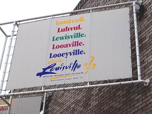
لويڤل (إنگليزية: Louisville؛ /ˈluːivɪl/ LOO-ee-vil، الأمريكي /ˈluːəvəl/ LOO-ə-vəl، local /ˈlʊvəl/ LUUV-əl)، هي أكبر مدن ولاية كنتاكي الأمريكية، وسادس أكثر المدن اكتظاظاً بالسكان في جنوب شرق البلاد، والمدينة 28 الأكثر اكتظاظاً بالسكان في الولايات المتحدة.[أ][10] لويڤل هي مركز تاريخي، ومنذ 2003، المركز الاسمي لمقاطعة جفرسون، على حدود إنديانا.
سُميت المدينة على اسم لويس السادس عشر ملك فرنسا، وتأسست عام 1778 على يد جورج روجرز كلارك، مما يجعلها واحدة من أقدم المدن غرب الأپلاش.[11] مع شلالات أوهايو المجاورة باعتبارها العائق الرئيسي الوحيد لحركة المرور النهرية بين أعالي نهر أوهايو وخليج المكسيك، نمت المستوطنة أولاً كموقع للنقل اليدوي عبر النهر. كانت المدينة المؤسسة لسكك حديد لويفيل وناشفيل، والتي نمت إلى نظام سكك حديدية يمتد بطول 9700 كم عبر 13 ولاية.
اليوم، تُعرف المدينة بأنها موطن الملاكم محمد علي كلاي ودربي كنتكي وكنتكي فرايد تشيكن وجامعة لويفيل والكاردينالات، مضارب بيسبول لويفيل سلجر، وثلاثة من ست شركات على قائمة فورتشن 500: هومانا، كيندرد للرعاية الصحية، ويوم! براندز.[12][13] مطار محمد علي الدولي، هو المطار التجاري الرئيسي في لويفيل، ويستضيف المركز العالمي لخدمة الطرود المتحدة.
منذ عام 2003، كانت حدود لويفيل هي نفسها حدود مقاطعة جفرسون، بعد دمج المدينة والمقاطعة.[14] The official name of this consolidated city-county government is the Louisville/Jefferson County Metro Government,[15] abbreviated to Louisville Metro.[16] Despite the merger and renaming, the term "Jefferson County" continues to be used in some contexts in reference to Louisville Metro, particularly including the incorporated cities outside the "balance" which make up Louisville proper. The city's total consolidated population as of the 2020 census was 782,969.[17] However, the balance total of 633,045[18] excludes other incorporated places and semiautonomous towns within the county and is the population listed in most sources and national rankings.
The Louisville-Jefferson County, KY-IN Metropolitan Statistical Area (MSA) includes Louisville-Jefferson County and 12 surrounding counties, seven in Kentucky and five in Southern Indiana. As of 2019, the MSA had a population of 1,395,634,[19] the 43rd largest in the nation.[ب]
الاسم والنطق
أنشأ جماعة من الرواد يقودهم المكتشف الأمريكي جورج روجرز كلارك مستوطنة فوق الموقع الذي يُعرف باسم لويڤل وذلك عام 1778. وفي العام التالي، أطلق كلارك على المدينة اسم الملك لويس السادس عشر ملك فرنسا. وذلك عرفانًا بجميل فرنسا في مساعدتها للمستعمرات الأمريكية أثناء الثورة الأمريكية (1775- 1783).
التاريخ
The history of Louisville spans hundreds of years, and has been influenced by the area's geography and location at the head of the Falls of the Ohio River.
التاريخ المبكر والتأسيس

The rapids at the Falls of the Ohio created a barrier to river travel, as a result, settlements grew up at this stopping point. The first European settlement in the vicinity of modern-day Louisville was on Corn Island in 1778 by Col. George Rogers Clark, credited as the founder of Louisville. Several landmarks in the community are named after him.[20]
Two years later, in 1780, the Virginia General Assembly approved the town charter of Louisville. The city was named in honor of King Louis XVI of France, whose soldiers were then aiding Americans in the Revolutionary War. Early residents lived in forts to protect themselves from raids from the local indigenous population, but moved out by the late 1780s.[21] In 1803, explorers Meriwether Lewis and William Clark organized their expedition across America in the town of Clarksville, Indiana at the present-day Falls of the Ohio opposite Louisville, Kentucky.[22][23]
القرن التاسع عشر
The city's early growth was influenced by the fact that river boats had to be unloaded and moved downriver before reaching the falls. By 1828, the population had grown to 7,000 and Louisville became an incorporated city.[24]
ساعدت التجارة النهرية على تطور لويڤل المبكر. واتسع مجال صناعتها بسرعة كبيرة منذ الحرب العالمية الثانية (1939-1945).
القرنان العشرون والحادي والعشرون
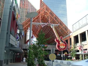
Since the late 1990s, Downtown has experienced significant residential, tourist and retail growth, including the addition of major sports complexes KFC Yum! Center, Lynn Family Stadium and Louisville Slugger Field, conversion of waterfront industrial sites into Waterfront Park, openings of varied museums (see Museums, galleries and interpretive centers below), and the refurbishing of the former Galleria into the bustling entertainment complex Fourth Street Live!, which opened in 2004.
On March 13, 2020, four plainclothed officers from Louisville Metro Police Department executed a “no-knock” search warrant which led to the killing of Breonna Taylor, a 26-year-old African-American woman.[25] For months afterward, Taylor’s family, members of the local community, and people around the world protested to demand that officers involved in the shooting be fired and criminally charged.[26] These protests and demonstrations coincided and intertwined with the international George Floyd protests, as well as the Black Lives Matter movement and a broader movement of racial unrest.[27] As a result of the incident, the police chief was fired and four officers received federal charges, but no significant systemic changes were made.[28][29]
On April 10, 2023, a mass shooting occurred at the Old National Bank, killing five people, and injuring nine others. The suspect, who was a bank employee and who officials said was livestreaming the rampage, was killed by the police after exchanging fire with them.[30]
الجغرافيا
Louisville and Jefferson County have a combined area of 397.68 square miles (1,030.0 km2), of which 380.46 square miles (985.4 km2) is land and 17.23 square miles (44.6 km2) (4.33%) is covered by water.[31]
Louisville is southeasterly situated along the border between Kentucky and Indiana, the Ohio River, in north-central Kentucky at the Falls of the Ohio. Louisville is an Upper South city located in a Southern state that is influenced by both Southern and Midwestern culture. It is sometimes referred to as either one of the northernmost Southern cities or as one of the southernmost Northern cities in the United States.[32][33]
Louisville is located in Kentucky's outer Bluegrass region.[34] Its development has been influenced by its location on the Ohio River, which spurred Louisville's growth from an isolated camp site into a major shipping port. Much of the city is located on a very wide and flat floodplain surrounded by hill country on all sides. Much of the area was swampland that had to be drained as the city grew. In the 1840s, most creeks were rerouted or placed in canals to prevent flooding and disease outbreaks.
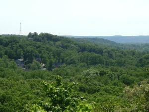
Areas generally east of I-65 are above the flood plain, and are composed of gently rolling hills. The southernmost parts of Jefferson County are in the scenic and largely undeveloped Knobs region, which is home to Jefferson Memorial Forest.
The Louisville-Jefferson County, KY-IN Metropolitan Statistical Area (MSA), the 43rd largest in the United States,[ب][19] includes the Kentucky county of Jefferson (coterminous with Louisville Metro), plus twelve outlying counties—seven in Kentucky and five in Southern Indiana. Louisville's MSA is included in the Louisville–Elizabethtown–Madison, KY–IN Combined Statistical Area (CSA), which also includes the Elizabethtown, KY MSA, as well as the Madison, IN Micropolitan Statistical Area.
The Louisville area is near several other urban areas, especially Frankfort, Kentucky (the state's capital); Cincinnati, Ohio (the two cities' metropolitan statistical areas almost border each other); Lexington, Kentucky; Bowling Green, Kentucky; Nashville, Tennessee; and the Indianapolis, Indiana area (especially Columbus, Indiana, to the north of Southern Indiana).
منظر المدينة
The downtown business district of Louisville is located immediately south of the Ohio River and southeast of the Falls of the Ohio. Major roads extend outwards from the downtown area in all directions. The airport is about 6.75 miles (10.86 km) south of the downtown area. The industrial sections of town are to the south and west of the airport, while most of the residential areas of the city are to the southwest, south, and east of downtown. In 2010, the 22,000-seat KFC Yum! Center was completed.[35][36] Twelve of the 15 buildings in Kentucky over 300 feet (91 m) are located in downtown Louisville.
Another primary business and industrial district is located in the suburban area east of the city on Hurstbourne Parkway.[37]
Louisville's late 19th- and early 20th-century development was spurred by three large suburban parks built at the edges of the city in 1890.
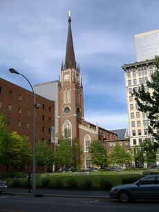
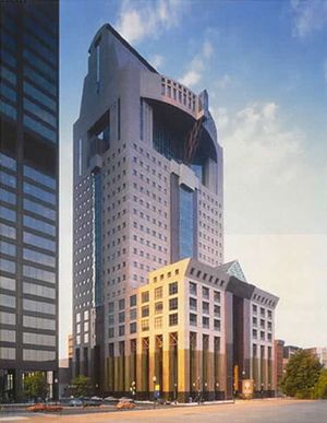
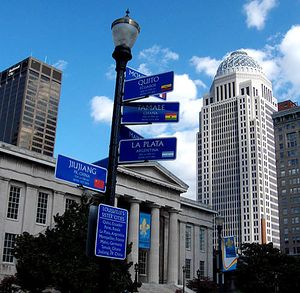
The city's architecture contains a blend of old and new. The Old Louisville neighborhood is the largest historic preservation district solely featuring Victorian homes and buildings in the United States;[38][39] it is also the third-largest district containing such architectural distinctions in the United States. The style, which originated in Great Britain, spread to the Commonwealth and eventually to the United States, including the rapidly growing city of Louisville.قالب:Relevance inline Many modern skyscrapers are located downtown, as well as older preserved structures, such as the Southern National Bank building. The buildings of West Main Street in downtown Louisville have the largest collection of cast iron facades of anywhere outside of New York's SoHo neighborhood.[40]

Since the mid-20th century, Louisville has in some ways been divided into three sides of town: the West End, the South End, and the East End. In 2003, Bill Dakan, a University of Louisville geography professor, said that the West End, west of 7th Street and north of Algonquin Parkway, is "a euphemism for the African American part of town" although he points out that this belief is not entirely true, and most African Americans no longer live in areas where more than 80% of residents are black. Nevertheless, he says the perception is still strong.[41] The South End has long had a reputation as a white, working-class part of town, while the East End has been seen as middle and upper class.[42]
According to the Greater Louisville Association of Realtors, the area with the lowest median home sales price is west of Interstate 65, in the West and South Ends. The middle range of home sales prices are between Interstates 64 and 65 in the South and East Ends, and the highest median home sales price are north of Interstate 64 in the East End.[43] Immigrants from Southeast Asia tend to settle in the South End, while immigrants from Eastern Europe settle in the East End.[44]
المناخ
قالب:Louisville, Kentucky weatherbox
الحكومة والسياسة
الجريمة
الديموغرافيا
| التعداد التاريخي | |||
|---|---|---|---|
| التعداد | Pop. | %± | |
| 1790 | 200 | — | |
| 1800 | 359 | 79٫5% | |
| 1810 | 1٬357 | 278�0% | |
| 1820 | 4٬012 | 195٫7% | |
| 1830 | 10٬341 | 157٫8% | |
| 1840 | 21٬210 | 105٫1% | |
| 1850 | 43٬194 | 103٫6% | |
| 1860 | 68٬033 | 57٫5% | |
| 1870 | 100٬753 | 48٫1% | |
| 1880 | 123٬758 | 22٫8% | |
| 1890 | 161٬129 | 30٫2% | |
| 1900 | 204٬731 | 27٫1% | |
| 1910 | 223٬928 | 9٫4% | |
| 1920 | 234٬891 | 4٫9% | |
| 1930 | 307٬745 | 31�0% | |
| 1940 | 319٬077 | 3٫7% | |
| 1950 | 369٬129 | 15٫7% | |
| 1960 | 390٬639 | 5٫8% | |
| 1970 | 361٬706 | −7٫4% | |
| 1980 | 298٬694 | −17٫4% | |
| 1990 | 269٬063 | −9٫9% | |
| 2000 | 256٬231 | −4٫8% | |
| 2010 | 597٬337 | 133٫1% | |
| 2020 | 633٬045 | 6�0% | |
| 2022 (تق.) | 624٬444 | [45] | −1٫4% |
| U.S. Decennial Census[46] In 2003, Louisville merged with Jefferson County and population counts were combined thereafter.[47] 2010–2020[18] | |||
هذا القسم يحتاج المزيد من الأسانيد للتحقق. (June 2014) (Learn how and when to remove this template message) |
هذا القسم يحتاج أن يـُحدَّث. السبب المعطى هو: Newer information is available from the 2020 census reports.. (September 2021) |
Between 1970 and 2000, Louisville lost population each decade. As of the 2000 census, Louisville had a population of 256,231, down from the 1990 census population of 269,063.[10] Due to the city-county merger that occurred in 2003, which expanded the city limits, the city's population increased to 597,337 at the 2010 census count.
ولد أكثر من 98% من سكان لويفيل في الولايات المتحدة، ويضم سكانها جماعات كبيرة من سلالات إنجليزية وألمانية وأيرلندية وتكوِّن الجالية السوداء أكثر سكان لويسفيل، ويعيش معظمهم على الحدود الغربية للمدينة وأيضًا في وسط المدينة، وتسود هذه المناطق مشاكل البطالة ومشاكل الأحياء الفقيرة.
الدين
Louisville hosts religious institutions of various faiths, including Christianity, Judaism, Islam, Hinduism, Buddhism, Sikhism and the Baháʼí Faith.
يعتنق نحو نصف سكان لويفيل المذهب البروتستانتي ومنهم تتشكل أكبر الجماعات المعمدانية الميثودية، كما يعتنق أكثر من 40% من السكان مذهب الروم الكاثوليك.
الدين

الاقتصاد
بدأ نمو اقتصاد لويسفيل منذ أواخر الأربعينيات ولكن المدينة مازالت تعاني من المشكلات الاقتصادية. وفي أوائل الثمانينيات، واجهت المدينة حالة تدهور في الصناعة، ولكن حدث في الفترة نفسها زيادة في صناعة الخدمات مثل خدمات السياحة والشؤون المالية والرعاية الصحية.
من المشكلات التي تواجه صناعة الدخان بلويسفيل انخفاض العمالة بها بسبب الكساد الذي أصاب مبيعات السجائر خلال الستينيات وأجبرت شركات الدخان على تسريح الكثير من العاملين بها. ولكن أدى التطور الصناعي بالمدينة إلى زيادة تلوث الهواء في منطقة لويسفيل، مما دفع الحكومة المحلية إلى إصدار قوانين الحد من التلوث لتخفيف حدة آثار هذه المشكلة. ويوجد في العاصمة لويسفيل حوالي ألف ومائة مصنع تنتج ما قيمته 15 بليون دولار سنويًا من السلع، وتتضمن المنتجات الرئيسية بالمدينة المواد الكيميائية والأجهزة والدهانات وأدوات السمكرة والأجهزة الرياضية. ومن الصناعات المهمة بالمدينة، صناعة نشر الأخشاب وتصنيع اللحوم والطباعة، كما يوجد في لويسفيل أكبر دار نشر أمريكية للمكفوفين، وهي في الوقت نفسه أكبر دار نشر في العالم تختص بإصدار مطبوعات بريل للمكفوفين.
الثقافة

الحدائق والمنتزهات

الفنون
الرياضة
| النادي | الرياضة | تأسس | الاتحاد | الاستاد |
|---|---|---|---|---|
| Louisville Bulls | Football | 1988 | Mid Continental Football League | Various |
| Louisville Kings | Australian rules football | 1996 | USAFL (USFOOTY) | Hays-Kennedy Park |
| Louisville Bats | Baseball | 2002 | International League | Louisville Slugger Field |
البنية التحتية
التعليم

النقل


المدن الشقيقة
لويفيل متوأمة مع:[48]
In addition, Louisville has been recognized as a "friendship city". The two cities have engaged in many cultural exchange programs, particularly in the fields of nursing and law, and cooperated in several private business developments, including the Frazier History Museum.[49]
Although not technically a sister city, Louisville has friendly and cooperative relations with Chengdu, China.[50]
ملاحظات
انظر أيضا
المصادر
هذه المقالة بحاجة لمصادر إضافية لتحسين وثوقيتها. (September 2009) |
- ^ "Transit Authority of River City (TARC)". ridetarc.org. Retrieved June 11, 2016.
- ^ * "The Gateway to the South: A Beginner's Guide to Louisville". The Virgin Atlantic Blog. January 2014. Archived from the original on September 11, 2015. Retrieved August 10, 2015.
- K'Meyer, Tracy E. (January 1, 2010). Civil Rights in the Gateway to the South: Louisville, Kentucky, 1945–1980. Lexington, Kentucky: University Press of Kentucky. ISBN 978-0813139203. Retrieved August 10, 2015.
- "Flooded riverfront, Louisville, Kentucky, 1937. :: R. G. Potter Collection". Archived from the original on September 29, 2015. Retrieved August 10, 2015.
View of downtown Louisville, Kentucky, with buildings submerged by floodwater. Neon sign on top of building reads: "The Gateway to the South Louisville Gas & Electric Co."
- ^
- Puckett, Jeffrey Lee (March 9, 2016). "The Who, other must-see shows in the 'Ville". The Courier-Journal. Retrieved June 11, 2016.
- Forde, Pat (September 10, 2003). "UofL's bogus billboards don't impress experts". The Courier-Journal.
- ^ "2020 U.S. Gazetteer Files". United States Census Bureau. Retrieved March 18, 2022.
- ^ "Annual Estimates of the Resident Population for Incorporated Places in Kentucky: April 1, 2020 to July 1, 2022". United States Census Bureau. Retrieved May 26, 2023.
- ^ "2020 Population and Housing State Data". United States Census Bureau. Retrieved 22 August 2021.
- ^ "Definition of Louisvillian". Merriam-Webster Dictionary. Retrieved November 5, 2020.
- ^ "GNIS Detail—Louisville". Retrieved June 23, 2014.
- ^ Commonwealth of Kentucky. Office of the Secretary of State. Land Office. "Louisville, Kentucky". Accessed September 19, 2013.
- ^ أ ب "Annual Estimates of the Resident Population for Incorporated Places of 50,000 or More, Ranked by July 1, 2016 Population: April 1, 2010 to July 1, 2016—United States—Places of 50,000+ Population". 2016 Population Estimates. United States Census Bureau, Population Division. May 2017. Archived from the original on September 12, 2019. Retrieved July 12, 2017.
- ^ The Kentucky encyclopedia. John E. Kleber, Scott A. Wymer, Thomas P. Kmetz, University Press of Kentucky, Morehead State University. Camden-Carroll Library, Morehead State University. Institute for Regional Analysis and Public Policy. Lexington: University Press of Kentucky. 1992. ISBN 978-0-8131-5901-0. OCLC 900344833.
{{cite book}}: CS1 maint: others (link) - ^ "Visualize The Fortune 500". Fortune. Archived from the original on March 22, 2019. Retrieved 2019-03-22.
- ^ CNN Money. "Fortune 500 2012: States: Kentucky Companies". May 21, 2012. Accessed September 19, 2013.
- ^ "Louisville-Jefferson County Local Government Consolidation" (PDF). louisvilleky.gov. Archived from the original (PDF) on June 30, 2014. Retrieved August 19, 2014.
- ^ "Louisville/Jefferson County Metro Government Code of Ordinances". American Legal Publishing Corporation. Archived from the original on July 1, 2014. Retrieved August 19, 2014.
- ^ "Louisville/Jefferson County Metro Government Code of Ordinances § 10.06 DEFINITIONS". American Legal Publishing Corporation. Archived from the original on August 20, 2014. Retrieved August 19, 2014.
- ^ "QuickFacts: Jefferson County, Kentucky". United States Census Bureau. Retrieved 22 August 2021.
- ^ أ ب "QuickFacts: Louisville city, Kentucky; Louisville/Jefferson County metro government (balance), Kentucky". United States Census Bureau. Retrieved 22 August 2021.
- ^ أ ب Bureau, U.S. Census. "U.S. Census website". United States Census Bureau. Retrieved June 29, 2018.
- ^ "George Rogers Clark: Kentucky Frontiersman, Hero, and Founder of Louisville". Kentucky Department for Libraries and Archives. Archived from the original on April 25, 2007. Retrieved July 19, 2007.
- ^ Yater, George H. (1987). Two Hundred Years at the Fall of the Ohio: A History of Louisville and Jefferson County (2nd ed.). Louisville, Kentucky: Filson Club, Incorporated. pp. 9–10. ISBN 978-0-9601072-3-0.
- ^ "The Journals of the Lewis and Clark Expedition". Retrieved July 30, 2009.
- ^ "Lewis and Clark—Falls of the Ohio". Archived from the original on February 17, 2009. Retrieved July 30, 2009.
- ^ Yater, pp. 46–48.
- ^ Oppel, Richard A. Jr. (May 30, 2020). "Here's What You Need to Know About Breonna Taylor's Death". The New York Times. ISSN 0362-4331. Archived from the original on June 1, 2020. Retrieved June 1, 2020. (From the Internet Archive index for the page, compare captures for August 30, 2020 and September 2, 2020 to see the change in coverage concerning the warrant.)
- ^ Sanchez, Ray; Joseph, Elizabeth (June 19, 2020). "Louisville, Kentucky, seeks to fire police officer in shooting of Breonna Taylor". CNN. Retrieved June 19, 2020.
- ^ Waldrop, Evan McMorris-Santoro,Kevin Brunelli,Theresa (2020-06-01). "Louisville fires its police chief over handling of fatal shooting during protest". CNN (in الإنجليزية). Retrieved 2022-09-28.
{{cite web}}: CS1 maint: multiple names: authors list (link) - ^ Costello, Darcy (June 19, 2020). "Louisville police is firing officer Brett Hankison involved in Breonna Taylor shooting". USA Today. Gannett. ISSN 0734-7456. Archived from the original on 2020-06-19.
{{cite news}}:|archive-date=/|archive-url=timestamp mismatch; 2020-06-20 suggested (help) - ^ Rabinowitz, Eliott C. McLaughlin,Sonia Moghe,Hannah (2022-08-04). "Four current, former Louisville police officers federally charged in Breonna Taylor's death". CNN (in الإنجليزية). Retrieved 2022-09-28.
{{cite web}}: CS1 maint: multiple names: authors list (link) - ^ "Louisville shooting live updates: 4 victims killed inside bank, 9 injured". ABC News (in الإنجليزية). Archived from the original on April 10, 2023. Retrieved April 10, 2023.
- ^ "U.S. Gazetteer file for Kentucky counties (Jefferson County)". United States Census Bureau. 2015. Retrieved August 26, 2016.
- ^ Meyer, David R. (December 1989). "Midwestern Industrialization and the American Manufacturing Belt in the Nineteenth Century". The Journal of Economic History. 49 (4): 921–937. doi:10.1017/S0022050700009505. JSTOR 2122744. S2CID 154436086.
- ^ "Emporis:Louisville, KY". Archived from the original on June 4, 2012. Retrieved February 6, 2007.
- ^ "University of Kentucky Atlas entry". Retrieved August 22, 2009.
- ^ Green, Marcus (May 22, 2007). "Hotel removed from arena plan". The Courier-Journal. Archived from the original on November 7, 2012. Retrieved July 6, 2017.
- ^ Green, Marcus (April 27, 2007). "First look inside the arena". The Courier-Journal. Archived from the original on November 7, 2012. Retrieved July 6, 2017.
- ^ Berzof, Ken (February 26, 2006). "Office space goes begging". The Courier-Journal.
- ^ "Louisville Facts & Firsts". LouisvilleKy.gov. Archived from the original on October 6, 2014. Retrieved December 14, 2009.
- ^ "What is Old Louisville?". Old Louisville Guide. Archived from the original on November 27, 2009. Retrieved December 14, 2009.
- ^ "Louisville's Downtown Alive with Development". LouisvilleKy.gov. February 24, 2006. Archived from the original on September 29, 2007. Retrieved July 28, 2009.
- ^ Pike, Bill (January 23, 2003). "Will old names work in 'new' city?". The Courier-Journal. p. 1N.
- ^ Forde, Pat (August 26, 2002). "Read all about it: Valley has city united". The Courier-Journal.
- ^ "The Courier-Journal 2006–07 Kentuckiana Guide". Pqasb.pqarchiver.com. June 29, 2007. Archived from the original on June 29, 2011. Retrieved August 15, 2011.
- ^ Cummins, Peggy. "Continuity and Change in Louisville's Ethnic Communities". Jefferson Community College.
- ^ "Annual Estimates of the Resident Population for Incorporated Places in Kentucky: April 1, 2020 to July 1, 2022". United States Census Bureau. Retrieved May 26, 2023.
- ^ "Census of Population and Housing". Census.gov. Retrieved September 16, 2017.
- ^ "A 10-Year Perspective of the Merger of Louisville and Jefferson County, KY: Louisville Metro Vaults From 65th to 18th Largest City in the Nation" (PDF). Archived from the original (PDF) on February 5, 2021. Retrieved July 20, 2020.
- ^ "Home". sclou.org. Sister Cities of Louisville. Retrieved 2020-10-24.
- ^ "Friendship City Status Archived أبريل 27, 2006 at the Wayback Machine." Sister Cities of Louisville. 2006. Retrieved June 1, 2006.
- ^ "Our Sister Cities". Go Chengdu. 2016-07-31. Retrieved 2019-03-22.
قراءات اضافية
- Louisville Then and Now. Butler Books. 2006. ISBN 1-884532-68-3. Retrieved 2009-04-21.
{{cite book}}:|first=missing|last=(help) - Domer, Dennis (2004). The Louisville Guide. New York: Princeton Architectural Press. ISBN 1-56898-451-0.
{{cite book}}: Unknown parameter|coauthors=ignored (|author=suggested) (help) - Kleber, John E., et al. (editor) (2000). The Encyclopedia of Louisville. University Press of Kentucky. ISBN 1-56898-451-0.
{{cite book}}:|first=has generic name (help)CS1 maint: multiple names: authors list (link) - Lee, Gary (2006-08-20). "Louisville Old and New: Either Way, It's a Knockout". Washington Post. Retrieved 2006-10-01.
- Nold, Chip (1997). Insiders' Guide to Louisville, Kentucky & Southern Indiana. Globe Pequot. ISBN 1-57380-043-0.
{{cite book}}: Unknown parameter|coauthors=ignored (|author=suggested) (help) - Sanders, David (2000). Fact Sheet: Ohio River Floods. Kentucky Climate Center. Retrieved 2009-04-21.
{{cite book}}: Unknown parameter|coauthors=ignored (|author=suggested) (help) - Yater, George H. (1987). Two Hundred Years at the Fall of the Ohio: A History of Louisville and Jefferson County (2nd ed.). Louisville, KY: Filson Club, Incorporated. ISBN 0-9601072-3-1.
وصلات خارجية
![]() تعريفات قاموسية في ويكاموس
تعريفات قاموسية في ويكاموس
![]() كتب من معرفة الكتب
كتب من معرفة الكتب
![]() اقتباسات من معرفة الاقتباس
اقتباسات من معرفة الاقتباس
![]() نصوص مصدرية من معرفة المصادر
نصوص مصدرية من معرفة المصادر
![]() صور و ملفات صوتية من كومونز
صور و ملفات صوتية من كومونز
![]() أخبار من معرفة الأخبار.
أخبار من معرفة الأخبار.
- Official Website of Louisville, Kentucky
- Louisville Convention and Visitors Bureau
- Possibility City — Louisville's branding campaign
- Louisville/Jefferson County Information Consortium
- Metro Mapper - Interactive Maps for the Louisville Metro Area
- City Mayors feature: "Louisville Metro has shown other regions how mergers can change balance of power"
- Louisville travel guide from Wikitravel
- Louisville Life — weekly broadcast on Kentucky Educational Television
- State of Affairs — daily radio broadcast on WFPL that provides a public forum for discussion of the issues, people and events that impact the Louisville community
قالب:Louisville قالب:Jefferson County, Kentucky
قالب:Kentucky county seats قالب:KYLargestCities
خطأ استشهاد: وسوم <ref> موجودة لمجموعة اسمها "lower-alpha"، ولكن لم يتم العثور على وسم <references group="lower-alpha"/>
- CS1 maint: others
- CS1 errors: archive-url
- Short description is different from Wikidata
- Pages using multiple image with auto scaled images
- Pages using gadget WikiMiniAtlas
- Articles containing إنگليزية-language text
- Pages using Lang-xx templates
- Articles with hatnote templates targeting a nonexistent page
- Articles needing additional references from June 2014
- All articles needing additional references
- مقالات المعرفة بحاجة للتحديث from September 2021
- كل مقالات المعرفة بحاجة لتحديث
- Pages with empty portal template
- Articles needing additional references from September 2009
- CS1 errors: missing name
- CS1 errors: unsupported parameter
- CS1 errors: generic name
- لويفيل، كنتاكي
- مدن كنتكي
- مقاعد مقاطعة في كنتكي
- مقاطعة جفرسون، كنتكي
- Louisville metropolitan area
- مدن تأسست في 1778
- مدن الولايات المتحدة الأمريكية


