فريزنو، كاليفورنيا
فرزنو
Fresno | |
|---|---|
| الإحداثيات: 36°45′N 119°46′W / 36.750°N 119.767°W | |
| Country | United States |
| State | California |
| County | Fresno |
| Region | San Joaquin Valley |
| Railway station | May 1872 |
| Incorporated | October 21, 1885[1] |
| السمِيْ | Spanish for "ash tree" |
| الحكومة | |
| • النوع | Strong Mayor |
| • Mayor | Jerry Dyer[2] |
| • Council President | Annalisa Perea |
| • Council Vice President | Mike Karbassi |
| • City council[4] | |
| • City manager | Georgeanne White[3] |
| المساحة | |
| • City | 116٫00 ميل² (300٫43 كم²) |
| • البر | 114٫79 ميل² (297٫30 كم²) |
| • الماء | 1٫21 ميل² (3٫13 كم²) 1.04% |
| المنسوب | 308 ft (94 m) |
| التعداد | |
| • City | 542٬107 |
| • الترتيب | 89th in North America 33rd in the United States 5th in California |
| • الكثافة | 4٬722٫60/sq mi (1٬823٫43/km2) |
| • Urban | 717٬589 (US: 61st) |
| • الكثافة الحضرية | 4٬510٫0/sq mi (1٬741٫3/km2) |
| • العمرانية | 1٬164٬909 (49th) |
| صفة المواطن | Fresnan |
| منطقة التوقيت | UTC−08:00 (Pacific) |
| • الصيف (التوقيت الصيفي) | UTC−07:00 (PDT) |
| ZIP Codes[9] | 93650, 93701–93712, 93714–93718, 93720–93730, 93737, 93740, 93741, 93744, 93745, 93747, 93750, 93755, 93760, 93761, 93764, 93765, 93771–93779, 93786, 93790–93794, 93844, 93888 |
| Area code | 559 |
| FIPS code | 06-27000[10] |
| GNIS feature IDs | 277606, 2410546 |
| الموقع الإلكتروني | www |
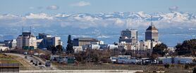
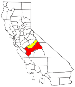
فرزنو ( Fresno ؛ /ˈfrɛznoʊ/؛ إسپانية for 'شجر المران')، هي خامس أكبر مدن ولاية كاليفورنيا قدر عدد سكانها عام 2020 بنحو 542,107 نسمة، It is the county seat of Fresno County and the largest city in the greater Central Valley region. It covers about 115 square miles (300 km2) and had a population of 542,107 as of the 2020 census, making it the fifth-most populous city in California, the most populous inland city in California, and the 34th-most populous city in the nation.[7][11][12]
Named for the abundant ash trees lining the San Joaquin River, Fresno was founded in 1872 as a railway station of the Central Pacific Railroad before it was incorporated in 1885. It has since become an economic hub of Fresno County and the San Joaquin Valley, with much of the surrounding areas in the Metropolitan Fresno region predominantly tied to large-scale agricultural production. Fresno is near the geographic center of California, approximately 220 miles (350 km) north of Los Angeles, 170 miles (270 km) south of the state capital, Sacramento, and 185 miles (300 km) southeast of San Francisco. Yosemite National Park is about 60 miles (100 km) to the north, Kings Canyon National Park 60 miles (100 km) to the east, and Sequoia National Park 75 miles (120 km) to the southeast.
Fresno is also the third-largest majority-Hispanic city in the United States with 50.5% of its population being Hispanic in 2020.[13]
التاريخ
The original inhabitants of the San Joaquin Valley region were the Yokuts people and Miwok people, who engaged in trading with other Californian tribes of Native Americans including coastal peoples such as the Chumash of the Central California coast, with whom they are thought to have traded plant and animal products.
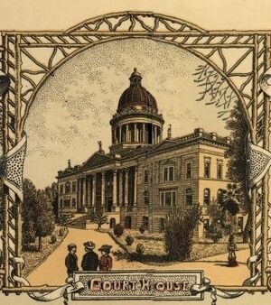
The first European to enter the San Joaquin Valley was Pedro Fages in 1772.[14] The county of Fresno was formed in 1856 after the California Gold Rush and was named for the abundant ash trees (Spanish: fresno) lining the San Joaquin River.
The San Joaquin River flooded on December 24, 1867, inundating Millerton. Some residents rebuilt, others moved. Flooding also destroyed the town of Scottsburg on the nearby Kings River that winter. Rebuilt on higher ground, Scottsburg was renamed Centerville.[15]
In 1867, Anthony Easterby purchased land bounded by the present Chestnut, Belmont, Clovis and California avenues, that today is called the Sunnyside district. Unable to grow wheat for lack of water, he hired sheep man Moses Church in 1870 to create an irrigation system.[16] Building new canals and purchasing existing ditches, Church then formed the Fresno Canal and Irrigation Company, a predecessor of the Fresno Irrigation District.
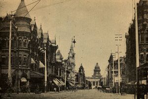
In 1872, the Central Pacific Railroad established a station near Easterby's—by now a hugely productive wheat farm—for its new Southern Pacific line. Soon there was a store near the station and the store grew into the town of Fresno Station, later called Fresno. At that time, Mariposa street was the main artery, a rough dusty or muddy depression.[17] Many Millerton residents, drawn by the convenience of the railroad and worried about flooding, moved to the new community. Fresno became an incorporated city in 1885. In 1903, the faltering San Joaquin Power Company was renamed the San Joaquin Light and Power Corporation and included the Fresno City Water Company and the Fresno City Railway.[18] By 1931 the railway, now known as the Fresno Traction Company, operated 47 streetcars over 49 miles (79 km) of track.[19]

In 1865, William Helm brought his sheep to Fresno county, which was then a vast space of open land.[20] By 1877, Helm made Fresno his home with a five-acre tract of land at the corner of Fresno and R streets. Helm was the largest individual sheep grower in Fresno County.[21]
Two years after the station was established, county residents voted to move the county seat from Millerton to Fresno. When the Friant Dam was completed in 1944, the site of Millerton became inundated by the waters of Millerton Lake. In extreme droughts, when the reservoir shrinks, ruins of the original county seat can still be observed.
In the nineteenth century, with so much wooden construction and in the absence of sophisticated firefighting resources, fires often ravaged American frontier towns. The greatest of Fresno's early-day fires, in 1882, destroyed an entire block of the city. Another devastating blaze struck in 1883.
In 1909, Fresno's first and oldest synagogue, Temple Beth Israel, was founded.
Fresno entered the ranks of the 100 most populous cities in the United States in 1960 with a population of 134,000. Thirty years later, in the 1990 census, it moved up to 47th place with 354,000, and in the census of 2000, it achieved 37th place with 428,000.[22]
The Fresno Municipal Sanitary Landfill was the first modern landfill in the United States, and incorporated several important innovations to waste disposal, including trenching, compacting, and the daily covering of trash with dirt. It was opened in 1937 and closed in 1987. It is a National Historic Landmark as well as a Superfund site.[23]
Before World War II, Fresno had many ethnic neighborhoods, including Little Armenia, German Town, Little Italy, and Chinatown. In 1940, the Census Bureau reported Fresno's population as 94.0% white, 3.3% black and 2.7% Asian.[24] Chinatown was primarily a Japanese neighborhood and today few Japanese-American businesses remain.[25] During 1942, Pinedale, in what is now North Fresno, was the site of the Pinedale Assembly Center, an interim facility for the relocation of Fresno area Japanese Americans to internment camps.[26] The Fresno Fairgrounds were also utilized as an assembly center.

Row crops and orchards gave way to urban development particularly in the period after World War II; this transition was particularly vividly demonstrated in locations such as the Blackstone Avenue corridor.
In September 1958, Bank of America launched a new product called BankAmericard in Fresno. After a troubled gestation during which its creator resigned, BankAmericard went on to become the world's first successful credit card. This financial instrument was usable across a large number of merchants and also allowed cardholders to revolve a balance (earlier financial products could do one or the other but not both). In 1976, BankAmericard was renamed and spun off into a separate company known today as Visa Inc.
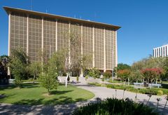
In the 1960's, Fresno suffered numerous demolitions of historic buildings, including the old Fresno County Courthouse and the original buildings of Edison High School.
The dance style commonly known as popping evolved in Fresno in the 1970s.[27]
In 1995, the Federal Bureau of Investigation's Operation Rezone sting resulted in several prominent Fresno and Clovis politicians being charged in connection with taking bribes in return for rezoning farmland for housing developments. Before the sting brought a halt to it, housing developers could buy farmland cheaply, pay off council members to have it rezoned, and make a large profit building and selling inexpensive housing. Sixteen people were eventually convicted as a result of the sting.[28]
In the early 2000's, Fresno's two major venues were built, Chukchansi Park (2002) and Save Mart Center (2003). The 2017 Fresno shootings resulted in the death of 4 people.
الجغرافيا
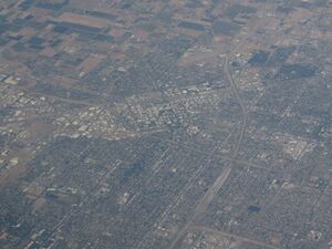
Fresno has a total area of 116 square miles (300 km2) with 98.96% land covering 114.79 square miles (297.3 km2), and 1.04% water, 1.21 square miles (3.1 km2).
Fresno's location, very near the geographical center of California, places the city a comfortable distance from many of the major recreation areas and urban centers in the state. Just 60 mi (97 km) south of Yosemite National Park, it is the nearest major city to the park. Likewise, Sierra National Forest is 40 mi (64 km), Kings Canyon National Park is 60 mi (97 km) and Sequoia National Park is 75 mi (121 km). The city is located near several Sierra Nevada lakes including Bass Lake, Shaver Lake, and Huntington Lake. Fresno is also only two and a half hours from Monterey, Carmel, Big Sur and the central coast.
Because Fresno sits at the junction of Highways 41 and 99 (SR 41 is Yosemite National Park's southern access road, and SR 99 bypasses Interstate 5 to serve the urban centers of the San Joaquin Valley), the city is a major gateway for Yosemite visitors coming from Los Angeles. The city also serves as an entrance into Sierra National Forest via Highway 168, and Sequoia and Kings Canyon National Parks via Highway 180.
Fresno has three large public parks, two in the city limits and one in county land to the southwest. Woodward Park, which features the Shinzen Japanese Gardens, boasts numerous picnic areas and several miles of trails. It is in North Fresno and is adjacent to the San Joaquin River Parkway. Roeding Park, near Downtown Fresno, is home to the Fresno Chaffee Zoo, and Rotary Storyland and Playland. Kearney Park is the largest of the Fresno region's park system and is home to historic Kearney Mansion and plays host to the annual Civil War Revisited, the largest reenactment of the Civil War in the west coast of the U.S.[29][30]
In its 2023 ParkScore ranking, The Trust for Public Land, a national land conservation organization, reported that Fresno had one of the worst park systems among the 100 most populous U.S. cities, with only 5% of city land being used for parks and recreation. [31] The survey measures median park size, park acres as percent of city area, residents' access to parks, spending on parks per resident, and playgrounds per 10,000 residents.
المناخ
| أخفمتوسطات الطقس لفرزنو، كاليفورنيا | |||||||||||||
|---|---|---|---|---|---|---|---|---|---|---|---|---|---|
| شهر | يناير | فبراير | مارس | أبريل | مايو | يونيو | يوليو | أغسطس | سبتمبر | اكتوبر | نوفمبر | ديسمبر | السنة |
| العظمى القياسية °F (°C) | 78 (25.6) | 84 (28.9) | 90 (32.2) | 101 (38.3) | 110 (43.3) | 112 (44.4) | 115 (46.1) | 113 (45.0) | 111 (43.9) | 102 (38.9) | 89 (31.7) | 77 (25.0) | 115 (46٫1) |
| متوسط العظمى °ف (°م) | 54 (12.2) | 61 (16.1) | 66 (18.9) | 74 (23.3) | 81 (27.3) | 91 (32.8) | 97 (36.1) | 95 (35.0) | 87 (30.7) | 76 (24.6) | 61 (16.2) | 54 (12.1) | 75 (24٫1) |
| متوسط الصغرى °ف (°م) | 38 (3.3) | 41 (5.0) | 45 (7.2) | 48 (8.9) | 55 (12.8) | 61 (16.1) | 66 (18.9) | 65 (18.3) | 60 (15.6) | 52 (11.1) | 42 (5.6) | 37 (2.8) | 51 (10٫5) |
| الصغرى القياسية °ف (°C) | 17 (-8.3) | 24 (-4.4) | 26 (-3.3) | 32 (0.0) | 36 (2.2) | 42 (5.6) | 50 (10.0) | 49 (9.4) | 37 (2.8) | 27 (-2.8) | 26 (-3.3) | 18 (-7.8) | 17 (−8٫3) |
| هطول الأمطار بوصة (mm) | 2.4 (59.9) | 2.2 (54.8) | 2.2 (56.9) | 0.8 (20.3) | 0.4 (9.9) | 0.2 (5.8) | 0 (0.3) | 0 (0.3) | 0.3 (7.6) | 0.7 (17.5) | 1.2 (29.9) | 1.4 (36) | 11٫2 (285٫2) |
| المصدر: weather.com[1] 2008-03-01 | |||||||||||||
الديموغرافيا
| التعداد التاريخي | |||
|---|---|---|---|
| التعداد | Pop. | %± | |
| 1880 | 1٬112 | — | |
| 1890 | 10٬818 | 872٫8% | |
| 1900 | 12٬470 | 15٫3% | |
| 1910 | 24٬892 | 99٫6% | |
| 1920 | 45٬086 | 81٫1% | |
| 1930 | 52٬513 | 16٫5% | |
| 1940 | 60٬685 | 15٫6% | |
| 1950 | 91٬669 | 51٫1% | |
| 1960 | 133٬929 | 46٫1% | |
| 1970 | 165٬655 | 23٫7% | |
| 1980 | 217٬491 | 31٫3% | |
| 1990 | 354٬202 | 62٫9% | |
| 2000 | 427٬652 | 20٫7% | |
| 2010 | 494٬665 | 15٫7% | |
| 2020 | 542٬107 | 9٫6% | |
| U.S. Decennial Census[32] 2010–2020[7] | |||
الحكومة
أسماء العمد
- 2009-present Ashley Swearengin
- 2001-2009 Alan Autry
- 1993-2001 Jim Patterson
- 1989-1993 Karen Humphrey
- 1985-1989 Dale Doig
- 1977-1985 Dan Whitehurst
- 1969-1977 Ted C. Wills
- 1965-1969 Floyd H. Hyde
- 1964-1965 Wallace Henderson (acting)
- 1958-1964 Arthur L. Selland †
- 1957-1958 C. Cal Evans
- 1949-1957 Gordon D. Dunn
- 1947 Glenn M. Devore (acting)
- 1941-1947 Z.S. Leymel †
- 1937-1941 Frank A. Homan
- 1929-1934 Z.S. Leymel
- 1925-1929 A.E. Sunderland
- 1921-1925 Truman C. Hart
- 1917-1921 William F. Toomey
- 1912-1917 Alva E. Snow
- 1909-1912 Chester Rowell †
- 1908-1909 Ed. F. Bush (acting)
- 1905-1908 W. Parker Lyon
- 1901-1905 L.O. Stephens
† توفي في المنصب
منظر المدينة
الاقتصاد
التعليم
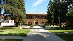
الأحياء
الثقافة
الرياضة
Foot Ball - WAC Bulldog Stadium| النادي | الرياضة | تأسس | الاتحاد | الاستاد |
|---|---|---|---|---|
| Fresno Grizzlies | Baseball | 1998 | Pacific Coast League | Chukchansi Park |
| Central Valley Coyotes | Arena Football | 2002 | Arena Football 1 | Selland Arena |
| Fresno Fuego | Soccer | 2003 | USL Premier Development League | Chukchansi Park |
| Fresno Monsters | Hockey | 2009 | Western States Hockey League | Selland Arena |
الاعلام
النقل
In popular culture
In the 1970s, the city was the subject of a song, "Walking Into Fresno", written by Hall Of Fame guitarist Bill Aken and recorded by Bob Gallion of the "WWVA Jamboree" radio and television show in Wheeling, West Virginia. Aken also made his first TV appearance playing guitar on the old country-western show at The Fresno Barn.[بحاجة لمصدر]
Fictional residents of the town were portrayed in a 1986 comedic miniseries titled "Fresno", featuring Carol Burnett, Dabney Coleman, Teri Garr and Charles Grodin, along with numerous other celebrities. The mini series was presented as a parody of the prime time soap operas popular in the 1980s.[بحاجة لمصدر]
BBC documentarian, Louis Theroux, visited Fresno, and rode with Fresno police as they dealt with the high drug usage in the city. Additionally, he interviewed many of the individuals involved in the drug scene, some languishing in their habit, and others working to overcome it. From that footage, he produced a British documentary The City Addicted to Crystal Meth, first aired on August 9, 2009.[34]
Fresno is mentioned in the 2009 animation film Monsters vs. Aliens.
The 2014 horror film Unfriended is set in Fresno along with the 2000 Motocross film Fresno smooth.
Notable people
المدن الشقيقة
فرزنو لديها خمس مدن شقيقة هي:[35][36]
 Guadalajara, Mexico[37][36]
 Kōchi, Japan (1965)[38][36]
 Münster, Germany (1984)[39][36]
 Morogoro, Tanzania (1992)[36]
 Verona, Italy (2000, friendship not sister)[40][36][41]
 Vagharshapat (also known as Etchmiadzin), Armenia (2009)[42][36][43]
 Châteauroux, France (2016)[44][36]
 Taishan, China[45][36]
 Afula-Gilboa, Israel[36]
 Taraz (formerly known as Djambul; relationship currently inactive), Kazakhstan[36][46]
 Torreon, Mexico[36]
انظر أيضا
- Environmental issues in Fresno, California
- Fresno County Public Library
- Fresno Police Department
- 2017 Fresno shootings
- 2019 Fresno shooting
- List of Mexican-American communities
- List of U.S. cities with large Hispanic populations
- USS Fresno, 3 ships
- Japanese American internment
- For a long list of [Fresnans][47] who have been first to win major awards of all types, see the Fresno Bee article: "Fresno First Pulitzer Pursuits," Sunday, February 28, 1988.
Explanatory notes
المصادر
- ^ "California Cities by Incorporation Date". California Association of Local Agency Formation Commissions. Archived from the original (Word) on November 3, 2014. Retrieved April 6, 2013.
- ^ "Mayor's Office". City of Fresno. Archived from the original on April 3, 2013. Retrieved April 6, 2013.
- ^ "City Manager". City of Fresno. Archived from the original on January 30, 2017. Retrieved July 15, 2017.
- ^ "Fresno City Council". City of Fresno. Archived from the original on July 11, 2017. Retrieved July 9, 2017.
- ^ "2019 U.S. Gazetteer Files". United States Census Bureau. Retrieved July 1, 2020.
- ^ "Fresno". نظام معلومات الأسماء الجغرافية، المسح الجيولوجي الأمريكي.
- ^ أ ب ت "QuickFacts: Fresno city, California". United States Census Bureau. Retrieved August 25, 2021.
- ^ "2020 Population and Housing State Data". United States Census Bureau. Retrieved August 22, 2021.
- ^ "ZIP Code(tm) Lookup". United States Postal Service. Archived from the original on November 16, 2014. Retrieved November 23, 2014.
- ^ "U.S. Census website". United States Census Bureau. Retrieved January 31, 2008.
- ^ "Population of the 100 Largest Cities and Other Urban Places in the United States: 1790 TO 1990". U.S. Census Bureau. Archived from the original on July 25, 2017. Retrieved July 2, 2010.
- ^ قالب:Cite US Gazetteer
- ^ أ ب "P2:: Hispanic or Latino, and Not Hispanic or Latino by Race". 2020 Census. United States Census Bureau. Retrieved October 10, 2021. خطأ استشهاد: وسم
<ref>غير صالح؛ الاسم "2020Hispanic" معرف أكثر من مرة بمحتويات مختلفة. - ^ Capace, Nancy (1999). Encyclopedia of California. North American Book Dist LLC. Page 410. ISBN 9780403093182.
- ^ قالب:California's Geographic Names
- ^ "Fresno Irrigation District | Full History". Fresno Irrigation (in الإنجليزية). Retrieved 2023-03-27.
- ^ Vandor, Paul E. (1919). History of Fresno County, California, with biographical sketches of the leading men and women of the county who have been identified with its growth and development from the early days to the present. Los Angeles, CA: Historic Record Company.
Mariposa Street, the main artery, was a rough depression
- ^ "Huntington Boulevard Historic District (Fresno, California)". A Guide to Historic Architecture in Fresno, California. historicfresno.org. Retrieved 2023-03-05.
- ^ Demoro, Harre W. (1986). California's Electric Railways. Glendale, California: Interurban Press. p. 201. ISBN 978-0-916374-74-7.
- ^ Guinn, J. M. (1905). History of the State of California with Biographical Record. Chicago: The Chapman Publishing Co. pp. 669–670.
- ^ Vandor, Paul E. (1919). History of Fresno County California with Biographical Sketches. Los Angeles, California: Historic Record Company. pp. 220–221.
- ^ "U.S. Census Bureau, Population of the 100 Largest Cities and Other Urban Places in the United States: 1790 TO 1990". Archived from the original on July 25, 2017. Retrieved July 2, 2010.
- ^ Kevin Enns-Rempel; John Edward Powell. "Fresno Sanitary Landfill (1937)". HistoricFresno.org. Archived from the original on March 21, 2005. Retrieved April 23, 2007.
- ^ خطأ استشهاد: وسم
<ref>غير صحيح؛ لا نص تم توفيره للمراجع المسماةcensus - ^ Bowden, Bridgit; Johnson, Shawn (September 18, 2019). "The High-Speed Rail Debate Persists In California". Wisconsin Public Radio (in الإنجليزية). Archived from the original on November 5, 2019. Retrieved November 14, 2019.
- ^ "Pinedale Assembly Center, California". U.S. National Park Service. Archived from the original on April 7, 2007. Retrieved April 23, 2007.
- ^ Holman, Michael (October 1984). "History". Breaking and the New York City Breakers. Freundlich Books. ISBN 978-0-88191-016-2. Archived from the original on October 19, 2007. Retrieved May 15, 2007.
- ^ Jim Boren (December 12, 2002). "Lessons learned from Rezone can't be forgotten". The Fresno Bee. Archived from the original on December 28, 2002. Retrieved April 23, 2007.
- ^ "Civil War Revisited Wraps Up". ABC30.com. October 10, 2005. Archived from the original on March 10, 2007. Retrieved March 6, 2007.
- ^ "The Civil War Revisited". Fresno Historical Society. Archived from the original on June 10, 2013. Retrieved March 6, 2007.
- ^ "City Profiles: Fresno" Archived فبراير 1, 2014 at the Wayback Machine. "The Trust for Public Land". Retrieved on July 10, 2013.
- ^ "Census of Population and Housing". U.S. Census Bureau. Retrieved June 4, 2015.
- ^ History, SCCC Foundation: Old Administration Building, Accessed August 3, 2009.
- ^ "BBC Two - Louis Theroux Specials, The City Addicted to Crystal Meth". BBC (in الإنجليزية البريطانية). Retrieved March 15, 2024.
- ^ "Home". Fresno Sister Cities. Archived from the original on December 1, 2020. Retrieved November 30, 2020.
- ^ أ ب ت ث ج ح خ د ذ ر ز س "City Search: Fresno, California". Sister Cities International. Archived from the original on November 19, 2022. Retrieved February 24, 2021.
- ^ "Fresno's new sister city is Guadalajara. What the relationship could mean for city residents". The Fresno Bee. Retrieved November 6, 2022.
- ^ "Kochi, Japan". Sister Cities. Fresno Sister Cities. Archived from the original on August 30, 2019. Retrieved September 15, 2021.
- ^ "Münster, Germany". Sister Cities. Fresno Sister Cities. Archived from the original on August 30, 2019. Retrieved September 15, 2021.
- ^ "Verona, Italy". Sister Cities. Fresno Sister Cities. Archived from the original on July 28, 2019. Retrieved September 15, 2021.
- ^ "Grandi Eventi - Gemellaggi e Patti d'Amicizia". comune.verona.it (in الإيطالية). Verona. Retrieved November 30, 2020.
- ^ "Etchmiadzin, Armenia". Sister Cities. Fresno Sister Cities. Archived from the original on July 28, 2019. Retrieved September 15, 2021.
- ^ Official Website of the Municipality of Ejmiatsin
- ^ "Châteauroux, France". Sister Cities. Fresno Sister Cities. Archived from the original on September 17, 2021. Retrieved September 15, 2021.
- ^ "Taishan, China". Sister Cities. Fresno Sister Cities. Archived from the original on August 4, 2019. Retrieved September 15, 2021.
- ^ "VisitFresnoCounty.org - About Fresno County". www.visitfresnocounty.org (in الإنجليزية الأمريكية). Retrieved September 15, 2021.
- ^ http://en.wikipedia.org/wiki/Fresnans
وصلات خارجية
- City of Fresno Official website
- City of Fresno Developer's Guide for Downtown Housing
- Guide to Historic Architecture in Fresno, California at FresnoHistory.org
- Fresno Arts Council
- Fresno City and County Historical Society
- Fresno Convention & Visitor Bureau
- Greater Fresno Area Chamber of Commerce
- Central Valley Independent Media Center
- The Community Alliance newspaper
- The Fresno Bee Web Site
- Fresno Jobs Community Board
- Fresno Wiki
- Fresno Undercurrent Website
خطأ لوا في وحدة:Authority_control على السطر 278: attempt to call field '_showMessage' (a nil value).
- Pages using gadget WikiMiniAtlas
- CS1 الإنجليزية البريطانية-language sources (en-gb)
- CS1 الإيطالية-language sources (it)
- CS1 الإنجليزية الأمريكية-language sources (en-us)
- Short description is different from Wikidata
- Pages using multiple image with auto scaled images
- Coordinates on Wikidata
- Pages with Langnf omitting second positional parameter
- Articles with hatnote templates targeting a nonexistent page
- Articles with unsourced statements from May 2023
- Portal-inline template with redlinked portals
- Pages with empty portal template
- فرزنو، كاليفورنيا
- مدن مقاطعة فرزنو، كاليفورنيا
- مدن كاليفورنيا
- مقاعد مقاطعة في كاليفورنيا
- مدن تأسست في 1870s
- 1872 establishments in California
- 1885 establishments in California
- Armenian diaspora communities in the United States
- Cities in Fresno County, California
- County seats in California
- Incorporated cities and towns in California
- Populated places established in 1872
- Populated places established in 1885
- San Joaquin Valley
- Railway towns in California
- Chicano and Mexican neighborhoods in California
- صفحات مع الخرائط
