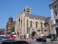
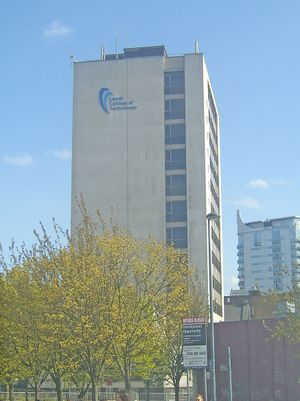
ليدز
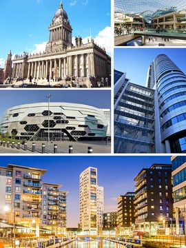
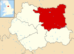
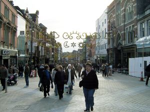
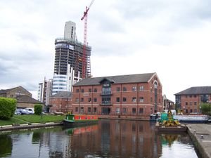
ليدز (بالإنجليزية: Leeds) هي مدينة بريطانية تقع في دوقية ويست يوركشاير على نهر الآير في شمال انغلترا، تبعد عن مدينة يورك حوالي 40 كم. يبلغ عدد سكانها حوالي 430,000 نسمة (عام 2001) جاعلا منها ثاني أكبر مدن مقاطعة يوركشاير بعد شيفيلد. تنشط فيها صناعات المنسوجات، الأثاث، الورق، الجلد و الكهربائيات. تشكل اليوم مركز تجاري و ثقافي في منطقة وسط بريطانيا. بها جامعة عريقة، أهم كلياتها هي الطب والهندسة
التاريخ
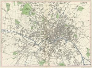
تاريخ ليدز يعود للعصر الروماني، حيث بني حصن في مناطق المدينة الحالية لصد هجمات الأعداء، خاصة تلك الآتية من الشمال. المدينة الحديثة تأسست في القرن الثامن عشر مع إزدهار التجارة في المنطقة. خاصة في نقل الفحم من المناجم القريبة التي تبعد خمسة كيلومترات عن ليدز. تم بناء أول خط سكة حديد في بريطانيا بين ليدز و مناجم ميدلستون في عام 1758، التي سار عليها أيضا في عام 1812 أول قطار بخاري بريطاني. نمت المدينة بشكل سريع أثناء الثورة الصناعية في القرن التاسع عشر، خاصة من خلال إنشاء العديد من مصانع المنسوجات في المدينة.
الإدارة
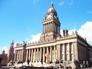
عمدة ليدز
الجغرافيا
التوزيع السكاني
الإقتصاد
التنمية
المناخ
| أخفClimate data for ليدز | |||||||||||||
|---|---|---|---|---|---|---|---|---|---|---|---|---|---|
| Month | Jan | Feb | Mar | Apr | May | Jun | Jul | Aug | Sep | Oct | Nov | Dec | Year |
| Mean daily maximum °C (°F) | 5.5 (41.9) |
5.6 (42.1) |
8.1 (46.6) |
10.7 (51.3) |
14.3 (57.7) |
16.9 (62.4) |
19.1 (66.4) |
18.7 (65.7) |
15.9 (60.6) |
12.1 (53.8) |
8.3 (46.9) |
5.8 (42.4) |
11.8 (53.2) |
| Mean daily minimum °C (°F) | 0.5 (32.9) |
0.3 (32.5) |
1.7 (35.1) |
3.2 (37.8) |
5.9 (42.6) |
8.8 (47.8) |
11.1 (52.0) |
10.9 (51.6) |
8.9 (48.0) |
6.1 (43.0) |
3.2 (37.8) |
0.9 (33.6) |
5.1 (41.2) |
| Average precipitation mm (inches) | 109.8 (4.32) |
77.2 (3.04) |
81.5 (3.21) |
72.9 (2.87) |
65.2 (2.57) |
77.1 (3.04) |
63.0 (2.48) |
81.1 (3.19) |
77.1 (3.04) |
99.8 (3.93) |
105.2 (4.14) |
114.3 (4.50) |
1٬024٫2 (40.33) |
| Average precipitation days | 15.4 | 12.3 | 13.4 | 11.2 | 11.2 | 11.1 | 10.3 | 11.8 | 11.2 | 14.4 | 15.3 | 14.8 | 152.4 |
| Source: [5] | |||||||||||||
السياحة
معالم المدينة
من أهم معالم المدينة:
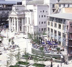
- ميدان فيكتوريا (Victoria Square)
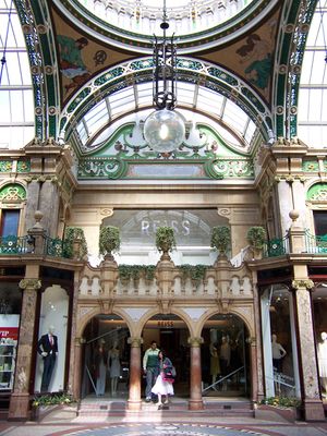
- شارع فيكتوريا (victorian Quarter)
- معرض فن المدينة (City Art Gallery)
- مصنع تيتلي للمشروبات (Tetley's Brewery)
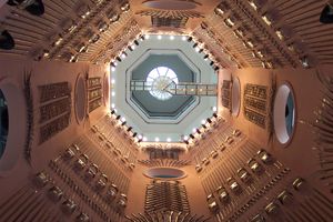
- متحف الأسلحة الملكية (Royal Armouries)
- بيت هيروود (Harewood House)
النقل
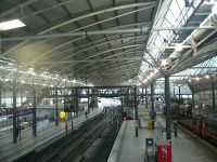
يتقاطع في ليدز كل من الطرق السريعة M 1 و M 621 . يبعد مطار ليدز-برادفورد حوالي 13 كم شمال غرب المدينة. يوجد في المدينة محطة قطارات تؤمن المواصلات البرية لباقي أنحاء البلاد.
السكك الحديدية
النقل البحرى
أحداث
الرياضة
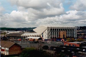
كرة القدم
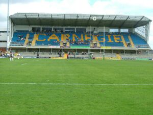
لعبة الرجبي
الثقافة والترفية
التسوق
|
الديانة
التعليم
المدن الشقيقة
كما أن للمدينة "صلات قوية" مع المدن التالية "لأغراض المشاريع الجارية":[7]
وصلات خارجية
- Leeds travel guide from Wikitravel
- Leeds City Council Leeds City (Metropolitan) Council.
- 'Leeds, Live it, Love it' Official city website, for visitors, business, students and residents.
- 'Leeds Initiative' Leeds Initiative city partnership.
- Leeds Communities Online Community Group Website Portal
- Leeds Local History Wiki Add your memories of Leeds.
قالب:City of Leeds قالب:West Yorkshire قالب:Core Cities Group
- ^ Max (City of Leeds) at SE140445 Hawksworth Moor in extreme west of district.
- ^ Min (City of Leeds) at points where district boundary crosses Rivers Aire and Wharfe in extreme east.
- ^ أ ب "Global city GDP 2014". Brookings Institution. Archived from the original on 4 June 2013. Retrieved 18 November 2014.
{{cite web}}: Unknown parameter|deadurl=ignored (|url-status=suggested) (help) - ^ خطأ استشهاد: وسم
<ref>غير صحيح؛ لا نص تم توفيره للمراجع المسماةleeds.gov.uk - ^ "Leeds climate". Retrieved 11 January 2017.
- ^ مجلس مدينة ليدز. "Leeds - Brno partnership". Retrieved 2007-10-23.
- ^ أ ب ت Leeds City Council. "International relations". Retrieved 2008-01-30.
{{cite web}}: Cite has empty unknown parameter:|1=(help) - ^ Leeds City Council. "Leeds - Dortmund partnership". Retrieved 2007-10-23.
- ^ مجلس مدينة ليدز. "Leeds - Durban partnership". Retrieved 2007-10-23.
- ^ Leeds City Council. "Leeds - Hangzhou partnership". Retrieved 2007-10-23.
- ^ Leeds City Council. "Leeds - Lille partnership". Retrieved 2007-10-23.
- ^ Leeds City Council. "Leeds - Louisville partnership". Retrieved 2007-10-23.
- Pages using gadget WikiMiniAtlas
- Short description is different from Wikidata
- Pages using infobox settlement with possible motto list
- Coordinates on Wikidata
- صفحات تستخدم جدول مستوطنة بقائمة محتملة لصفات المواطن
- Articles with OS grid coordinates
- بلدات في غرب يوركشاير
- ليدز
- Leeds City Region
- University towns in the United Kingdom
- Market towns in West Yorkshire
- مدن إنگلترة
- CS1 errors: unsupported parameter
