كنتكي
Kentucky | |
|---|---|
| Commonwealth of Kentucky | |
| الكنية: The Bluegrass State | |
| الشعار: United we stand, divided we fall Deo gratiam habeamus (Let us be grateful to God) | |
| النشيد: My Old Kentucky Home | |
 خريطة الولايات المتحدة، موضح فيها Kentucky | |
| البلد | الولايات المتحدة |
| قبل الولائية | Part of Virginia (District of Kentucky) |
| انضمت للاتحاد | June 1, 1792 (15th) |
| العاصمة | Frankfort |
| أكبر مدينة | Louisville |
| أكبر منطقة عمرانية | Louisville |
| الحكومة | |
| • الحاكم | Andy Beshear (D) |
| • نائب الحاكم | Jacqueline Coleman (D) |
| المجلس التشريعي | Kentucky General Assembly |
| • المجلس العلوي | Senate |
| • المجلس السفلى | House of Representatives |
| القضاء | Kentucky Supreme Court |
| سناتورات الولايات المتحدة | Mitch McConnell (R) Rand Paul (R) |
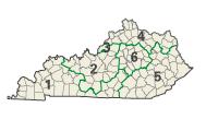
| وفد مجلس النواب | 5 Republicans 1 Democrat (القائمة) |
| المساحة | |
| • الإجمالي | 40٬408 ميل² (104٬656 كم²) |
| • البر | 39٬486 ميل² (102٬269 كم²) |
| • الماء | 921 ميل² (2٬387 كم²) 2.2% |
| ترتيب المساحة | 37th |
| الأبعاد | |
| • الطول | 397 mi (640 km) |
| • العرض | 187 mi (302 km) |
| المنسوب | 750 ft (230 m) |
| أعلى منسوب | 4٬145 ft (1٬265 m) |
| أوطى منسوب | 250 ft (78 m) |
| التعداد (2020) | |
| • الإجمالي | 4٬509٬342[2] |
| • الترتيب | 26th |
| • الكثافة | 110/sq mi (42٫5/km2) |
| • ترتيب الكثافة | 23rd |
| • الدخل الأوسط للأسرة | $52٬295[3] |
| • ترتيب الدخل | 44th |
| صفة المواطن | Kentuckian |
| اللغة | |
| • اللغة الرسمية | English[4] |
| منطقة التوقيت | |
| eastern half | UTC−05:00 (Eastern) |
| • الصيف (التوقيت الصيفي) | UTC−04:00 (EDT) |
| western half | UTC−06:00 (Central) |
| • Summer (DST) | UTC−05:00 (CDT) |
| اختصار البريد | KY |
| ISO 3166 code | US-KY |
| الاختصار التقليدي | Ky |
| خط العرض | 36° 30′ N to 39° 09′ N |
| خط الطول | 81° 58′ W to 89° 34′ W |
| الموقع الإلكتروني | kentucky |
| أخفرموز ولاية Kentucky | |
|---|---|
 The علم Kentucky | |
 The ختم Kentucky | |
| الشارات الحية | |
| الطائر | Cardinal |
| الفراشة | Viceroy butterfly |
| الحيوان البري | Gray squirrel |
| السمكة | Kentucky spotted bass |
| الزهرة | Goldenrod |
| سلالة الخيول | Thoroughbred |
| الحشرة | Western honeybee |
| الشجرة | Tulip poplar |
| الشارات الجامدة | |
| المشروب | Milk |
| الرقصة | Clogging |
| الطعام | Blackberry |
| الأحفورة | Brachiopod |
| الحجر الكريم | Freshwater pearl |
| المعدن | Coal |
| الصخرة | Kentucky agate |
| الشعار | Kentucky Unbridled Spirit |
| التربة | Crider Soil Series |
| غيرهم | Chevrolet Corvette (state sports car) |
| State route marker | |
 | |
| State quarter | |
 Released in 2001 | |
| قوائم رموز الولايات الأمريكية | |
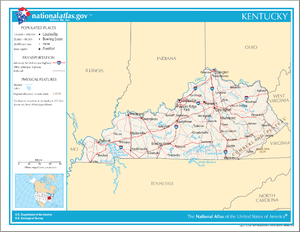
كنتكي ( Kentucky ؛ الأمريكي /kənˈtʌki/ kən-TUK-ee، UK /kɛnʔ/ ken-)،[5] ورسمياً هي كومنولث كنتكي،[note 2] هي إحدى الولايات الجبيسة في المنطقة الجنوبية الشرقية في الولايات المتحدة. تحد كنتكي إلينوي وإنديانا و أوهايو إلى الشَمال منها، ڤرجينيا الغربية إلى الشمال الشرقي وڤرجينيا إلى الشرق، وتنسي إلى الجنوب، ومزوري إلى الغرب. وحدها الشمالي هو نهر أوهايو. عاصمتها هي فرانكفورت وأكبر مدنها لويڤل. وفي 2020، كان عدد سكان كنتكي يناهز 4.5 مليون نسمة.[2]
Kentucky was admitted into the Union as the 15th state on June 1, 1792, splitting from Virginia in the process.[6] It is known as the "Bluegrass State", a nickname based on Kentucky bluegrass, a species of green grass introduced by European settlers for the purpose of grazing in pastures, which has supported the thoroughbred horse industry in the center of the state.[7]
Historically, Kentucky had excellent farming conditions, which led to the development of large tobacco plantations similar to those in Virginia and North Carolina in the central and western parts of the state that utilized enslaved labor during the Antebellum South and Civil War periods. Kentucky ranks fifth nationally in goat farming, eight in beef cattle production,[8] and 14th in corn production.[9] While Kentucky has been a long-standing major center for the tobacco industry, the state's economy has diversified in multiple non-agricultural sectors, including auto manufacturing, energy fuel production, and medical facilities.[10] The state ranks 4th among US states in the number of automobiles and trucks assembled.[11] Kentucky is one of several states considered a part of the Upland South.
The state is home to the world's longest cave system in Mammoth Cave National Park, the greatest length of navigable waterways and streams in the contiguous United States, and the two largest artificial lakes east of the Mississippi River. Cultural aspects of Kentucky include horse racing, bourbon, moonshine, coal, My Old Kentucky Home State Park, automobile manufacturing, tobacco, southern cuisine, barbecue, bluegrass music, college basketball, Louisville Slugger baseball bats, Kentucky Fried Chicken, and the Kentucky Colonel.
في عام 1792 أصبحت الولاية رقم 15 التي تنظم للولايات المتحدة الأمريكة. تحتل ولاية كنتكي المرتبة رقم 37 بين الولايات الأمريكية من حيث المساحة. عاصمتها فرانكفورت وهي مدينة صغيرة. أكبر مدنها لويفل وتشتهر مدينة لويڤل بأنها تحتضن أشهر سباق خيل في أمريكا.
إحدى ولايات جنوبي الولايات المتحدة. وقد ظل اسمها عهدًا طويلاً رمزاً للتبغ الوفير وخيول السباق الممتازة. وتتجه الأنظار في كل البلاد في شهر مايو من كل عام إلى سباق خيول ديربي كنتاكي. تعد كنتاكي من أهم الولايات المنتجة لتبغ البرلي (تبغ أمريكي رقيق الأوراق) والفحم الحجري. يكمن معظم احتياطي الولايات المتحدة من الذهب في أقبية تحت الأرض في فورت نوكس بمدينة فرانكفورت عاصمة الولاية.
أصل الاسم
In the late 18th century, prior to 1769, Botetourt and successor counties of the Colony of Virginia, whose geographical extent was south of the Ohio/Allegheny rivers beyond the Appalachian Mountains, became known to European Americans as Kentucky (or Kentucke) country. It was named for the Kentucky River, a tributary of the Ohio River in east central Kentucky.[12]
The precise etymology of the name is uncertain.[13] One theory sees the word based on an Iroquoian name meaning "(on) the meadow" or "(on) the prairie"[14][15] (cf. Mohawk kenhtà:ke, Seneca gëdá'geh (phonemic /kɛ̃taʔkɛh/), "at the field").[16] Another theory suggests a derivation from the term Kenta Aki, which could have come from an Algonquian language, in particular from Shawnee. Folk etymology translates this as "Land of Our Fathers". The closest approximation in another Algonquian language, Ojibwe, translates as "Land of Our In-Laws", thus making a fairer English translation "The Land of Those Who Became Our Fathers".[17] In any case, the word aki means "land" in most Algonquian languages.
التاريخ
Native American settlement
The first archaeological evidence of human occupation of Kentucky is approximately 9500BCE, and it was Clovis culture, primitive hunter-gatherers with stone tools. Around 1800 BCE, a gradual transition began from a hunter-gatherer economy to agriculturalism. Around 900 CE, a Mississippian culture took root in western and central Kentucky; by contrast, a Fort Ancient culture appeared in eastern Kentucky. While the two had many similarities, the distinctive ceremonial earthwork mounds constructed in the former's centers were not part of the culture of the latter. Fort Ancient settlements depended largely on corn, beans, and squash, and practiced a system of agriculture that prevented ecological degradation by rotating crops, burning sections of forest to create ideal habitat for wild game, relocating villages every 10–30 years, and continually shifting the location of fields to maintain plots of land in various stages of ecological succession.[18]
In about the 10th century, the Kentucky native people's variety of corn became highly productive, supplanting the Eastern Agricultural Complex, and replaced it with a maize-based agriculture in the Mississippian era. As of the 16th century, what became Kentucky was home to tribes from diverse linguistic groups. The Kispoko, an Algonquian-speaking tribe controlled much of the interior of the state.[19]
French explorers in the 17th century documented numerous tribes living in Kentucky until the Beaver Wars in the 1670s; however, by the time that European colonial explorers and settlers began entering Kentucky in greater numbers in the mid-18th century, there were no major Native American settlements in the region.
The Chickasaw had territory up to the confluence of Mississippi and Ohio rivers. During a period known as the Beaver Wars (1640–1680), another Algonquian tribe called the Maumee, or Mascouten was chased out of southern Michigan.[20] The vast majority of them moved to Kentucky, pushing the Kispoko east and war broke out with the Tutelo of North Carolina and Virginia that pushed them further north and east. The Maumee were closely related to the Miami from Indiana. Later, the Kispoko merged with the Shawnee, who migrated from the east and the Ohio River valley.
Early explorations: the discovery of Kentucky
European explorers arrived in Kentucky possibly as early as 1671. While French explorers surely spied Kentucky during expeditions on the Mississippi, there is no evidence French or Spanish explorers set foot in the lands south of the Ohio, notwithstanding speculations about Hernando de Soto and Robert de la Salle. The terrain in those days was not surveyed, so there is some uncertainty whether and to what extent the early English explorers out of Virginia set foot on the land. Confounding the issue is that the region south of the Ohio/Allegheny later known as Kentucke country was larger than the state of Kentucky today, encompassing most of today's West Virginia and (vaguely) part of southwestern Pennsylvania.[21] Notable expeditions were Batts and Fallam 1671, Needham and Arthur 1673.[22] Dr. Thomas Walker and surveyor Christopher Gist surveyed the area now known as Kentucky in 1750 and 1751.
European settlement: The Treaty of Fort Stanwix 1768
As more settlers entered the area, warfare broke out with the Native Americans over their traditional hunting grounds.[23]
June 16, 1774, James Harrod founded Harrod's Town (modern Harrodsburg). The settlement was abandoned during the conflict period of Dunmore's War, and resettled in March 1775, becoming the first permanent European settlement in Kentucky. It was followed within months by Boone's Station, Logan's Fort and Lexington before Kentucky was organized.
This period was the time of Daniel Boone's legendary expeditions starting in 1767 through the Cumberland Gap and down the Kentucky River to reach the bluegrass heartland of Kentucky.
While the Cherokee did not settle in Kentucky, they hunted there. They relinquished their hunting rights there in an extra-legal private contract with speculator Richard Henderson called Treaty of Sycamore Shoals in 1775.[24]
Kentucky County and the Cherokee-American wars
On December 31, 1776, by an act of the Virginia General Assembly, the portion of Fincastle County west of the Big Sandy River (including today's Tug Fork tributary) terminating at the North Carolina border (today Tennessee) extending to the Mississippi River, previously most of what was known as Kentucky (or Kentucke) country, was split off into its own county of Kentucky. Harrod's Town (Oldtown as it was known at the time) was named the county seat.
A 1790 U.S. government report states that 1,500 Kentucky settlers had been killed by Native Americans since the end of the Revolutionary War.[25]
Statehood
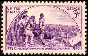
The county was subdivided into Jefferson, Lincoln and Fayette Counties in 1780, but continued to be administered as the District of Kentucky even as new counties were split off.
On several occasions the region's residents petitioned the General Assembly and the Confederation Congress for separation from Virginia and statehood. Ten constitutional conventions were held in Danville between 1784 and 1792. One petition, which had Virginia's assent, came before the Confederation Congress in early July 1788. Unfortunately, its consideration came up a day after word of New Hampshire's all-important ninth ratification of the proposed Constitution, thus establishing it as the new framework of governance for the United States. In light of this development, Congress thought that it would be "unadvisable" to admit Kentucky into the Union, as it could do so "under the Articles of Confederation" only, but not "under the Constitution", and so declined to take action.[26]
On December 18, 1789, Virginia again gave its consent to Kentucky statehood. The United States Congress gave its approval on February 4, 1791.[27] (This occurred two weeks before Congress approved Vermont's petition for statehood.[28]) Kentucky officially became the fifteenth state in the Union on June 1, 1792. Isaac Shelby, a military veteran from Virginia, was elected its first Governor.[29]
Post-colonial plantation economy
Central Kentucky, the bluegrass region, as well as western Kentucky, were the areas of the state with the most slave owners. Planters cultivated tobacco and hemp (see Hemp in Kentucky) on plantations with the use of enslaved labor, and were noted for their quality livestock. During the 19th century, Kentucky slaveholders began to sell unneeded slaves to the Deep South, with Louisville becoming a major slave market and departure port for slaves being transported downriver.
The Civil War
Kentucky was one of the Southern border states during the American Civil War, and it remained neutral within the Union.[30] Despite this, representatives from 68 of 110 counties met at Russellville calling themselves the "Convention of the People of Kentucky" and passed an Ordinance of Secession on November 20, 1861.[31] They established a Confederate government of Kentucky with its capital in Bowling Green, and Kentucky was officially admitted into the Confederacy on December 10, 1861, as the 13th Confederate state with full recognition in Richmond.[32] The Confederate shadow government was never popularly elected statewide, though 116 delegates were sent representing 68 Kentucky counties which at the time made up a little over half the territory of the Commonwealth to the Russellville Convention in 1861, and were occupied and governed by the Confederacy at some point in the duration of the war, and Kentucky had full representation within the Confederate Government. Although Confederate forces briefly controlled Frankfort, they were expelled by Union forces before a Confederate government could be installed in the state capital. After the expulsion of Confederate forces after the Battle of Perryville, this government operated in-exile. Though it existed throughout the war, Kentucky's provisional government only had governing authority in areas of Kentucky under direct Confederate control and had very little effect on the events in the Commonwealth or in the war once they were driven out of the state.
Kentucky remained officially "neutral" throughout the war[بحاجة لمصدر] due to the Southern Unionists sympathies of a majority of the Commonwealth's citizens who were split between the struggle of Kentucky's sister Southern States fully in the Confederate States of America and a continued loyalty to the Unionist cause that was prevalent in other areas of the South such as in East Tennessee, West Virginia, Western North Carolina, and others. Despite this, some 21st-century Kentuckians observe Confederate Memorial Day on Confederate leader Jefferson Davis' birthday, June 3, and participate in Confederate battle re-enactments.[33][34] Both Davis and U.S. president Abraham Lincoln were born in Kentucky. John C. Breckinridge, the 14th and youngest-ever Vice President was born in Lexington, Kentucky at Cabell's Dale Farm. Breckenridge was expelled from the U. S. Senate for his support of the Confederacy.
Henry W. Grady, editor of the Atlanta Constitution, coined the term New South in 1874, urging transformation from an agrarian economy to a modern industrial one.
Reconstruction and the New South
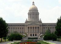
On January 30, 1900, Governor William Goebel, flanked by two bodyguards, was mortally wounded by an assassin while walking to the State Capitol in downtown Frankfort. Goebel was contesting the Kentucky gubernatorial election of 1899, which William S. Taylor was initially believed to have won. For several months, J. C. W. Beckham, Goebel's running mate, and Taylor fought over who was the legal governor until the Supreme Court of the United States ruled in May in favor of Beckham. After fleeing to Indiana, Taylor was indicted as a co-conspirator in Goebel's assassination. Goebel is the only governor of a U.S. state to have been assassinated while in office.[35]
The Black Patch Tobacco Wars, a vigilante action, occurred in Western Kentucky in the early 20th century. As a result of the tobacco industry monopoly, tobacco farmers in the area were forced to sell their crops at prices that were too low. Many local farmers and activists united in a refusal to sell their crops to the major tobacco companies.
An Association meeting occurred in downtown Guthrie,[36] where a vigilante wing of "Night Riders", formed. The riders terrorized farmers who sold their tobacco at the low prices demanded by the tobacco corporations. They burned several tobacco warehouses throughout the area, stretching as far west as Hopkinsville to Princeton. In the later period of their operation, they were known to physically assault farmers who broke the boycott. Governor Augustus E. Willson declared martial law and deployed the Kentucky National Guard to end the wars.
الجغرافيا
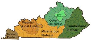
تكوِّن هضبة الأبلاش، أو هضبة كمبرلاند في شرقي كنتاكي جزءًا من الإقليم الممتد من نيويورك إلى ألاباما. وتسمى هذه الهضبة أيضًا منجم الفحم الحجري الشرقي؛ فهي من كبرى المناطق المنتجة للفحم الحجري.
يغطي إقليم العشب الأزرق الشمال الأوسط من كنتاكي، وينمو فيه عشب أزهاره مغبرة زرقاء اللون، ويُنتج محصولاً كبيرًا من الذرة الشامية والتبغ، كما أن به أكبر مدن الولاية ومعظم مزارع الخيول وكثير من المصانع.
يمتد في محاذاة معظم حدود كنتاكي الجنوبية إقليم بنيرويال الذي يوجد به كهف ماموث المشهور.
يقع في الشمال الغربي منجم الفحم الحجري الغربي، وهو إقليم ذو سطح شديد التموج، وبه نحو نصف احتياطي الولايات المتحدة من الفحم الحجري. أما في الجنوب الغربي فيوجد إقليم صغير المساحة يسمى جاكسون بيرتشيز. وكان قد أسهم الجنرال الأمريكي أندرو جاكسون في شرائه من الهنود عام 1818م. وبهذا الإقليم سهول فيضية واسعة، تغطيها مستنقعات أشجار السّرو والبحيرات المتقطعة.
الدين
=
| الحدث | عدد الضحايا |
|---|---|
| Louisville Tornado of 1890 | est. 76–120+ |
| April 3, 1974 Tornado Outbreak | 72 |
| April 7, 1977 Flooding (Cumberland River toppled Pineville floodwall) | ? |
| March 1, 1997 Flooding | 18 |
| 2008 Super Tuesday tornado outbreak | 7 |
| January 2009 ice storm | 24+ |
| درجات الحرارة في مختلف مدن كنتكي | ||||||||||||
| City | Jan | Feb | Mar | Apr | May | Jun | Jul | Aug | Sep | Oct | Nov | Dec |
|---|---|---|---|---|---|---|---|---|---|---|---|---|
| Lexington | 40/24 | 45/28 | 55/36 | 65/44 | 74/54 | 82/62 | 86/66 | 85/65 | 78/58 | 67/46 | 54/37 | 44/28 |
| Louisville | 41/25 | 47/28 | 57/37 | 67/46 | 75/56 | 83/65 | 87/70 | 86/68 | 79/61 | 68/48 | 56/39 | 45/30 |
| Paducah | 42/24 | 48/28 | 58/37 | 68/46 | 77/55 | 85/64 | 89/68 | 87/65 | 81/57 | 71/45 | 57/36 | 46/28 |
| Pikeville | 46/23 | 50/25 | 60/32 | 69/39 | 77/49 | 84/58 | 87/63 | 86/62 | 80/56 | 71/42 | 60/33 | 49/26 |
| Ashland | 42/19 | 47/21 | 57/29 | 68/37 | 77/47 | 84/56 | 88/61 | 87/59 | 80/52 | 69/40 | 57/31 | 46/23 |
البحيرات والأنهار
البيئة الطبيعية والحفاظ عليها
الجذب السياحي
الحكومة والقانون
الفرع التنفيذي

الفرع التشريعي
القضاء
التمثيل الفدرالي
القانون
التوزيع السكاني
| التعداد تاريخياً | |||
|---|---|---|---|
| الإحصاء | التعداد | %± | |
| 1790 | 73٬677 | ||
| 1800 | 220٬955 | 199.9% | |
| 1810 | 406٬511 | 84.0% | |
| 1820 | 564٬317 | 38.8% | |
| 1830 | 687٬917 | 21.9% | |
| 1840 | 779٬828 | 13.4% | |
| 1850 | 982٬405 | 26.0% | |
| 1860 | 1٬155٬684 | 17.6% | |
| 1870 | 1٬321٬011 | 14.3% | |
| 1880 | 1٬648٬690 | 24.8% | |
| 1890 | 1٬858٬635 | 12.7% | |
| 1900 | 2٬147٬174 | 15.5% | |
| 1910 | 2٬289٬905 | 6.6% | |
| 1920 | 2٬416٬630 | 5.5% | |
| 1930 | 2٬614٬589 | 8.2% | |
| 1940 | 2٬845٬627 | 8.8% | |
| 1950 | 2٬944٬806 | 3.5% | |
| 1960 | 3٬038٬156 | 3.2% | |
| 1970 | 3٬218٬706 | 5.9% | |
| 1980 | 3٬660٬777 | 13.7% | |
| 1990 | 3٬685٬296 | 0.7% | |
| 2000 | 4٬041٬769 | 9.7% | |
| تقديري 2008 | 4٬269٬245 | [37] | 5.6% |
| http://ukcc.uky.edu/census/21.txt | |||
العرق والنسب
الميول السياسية
الدين
الإقتصاد


تُعد الصناعة أهم النشاطات الاقتصادية في كنتاكي. وتوجد أهم مراكز الصناعة في كل من مدينة كوفنجتون، وليكسنجتون، ولويسفيل. وفي مقدمة المنتجات الصناعية معدات السيارات، والكيميائيات، والمعدات الكهربائية. Early in its history, Kentucky gained recognition for its excellent farming conditions. It was the site of the first commercial winery in the United States (started in present-day Jessamine County in 1799) and due to the high calcium content of the soil in the Bluegrass region quickly became a major horse breeding (and later racing) area. Today Kentucky ranks 5th nationally in goat farming, 8th in beef cattle production,[38] and 14th in corn production.[9] Kentucky has been a long-standing major center of the tobacco industry – both as a center of business and tobacco farming.
Kentucky's economy has expanded to in non-agricultural terms as well, especially auto manufacturing, energy fuel production, and medical facilities.[10]
Kentucky ranks 4th among U.S. states in the number of automobiles and trucks assembled.[11] The Chevrolet Corvette, Cadillac XLR (2004–09), Ford Escape, Ford Super Duty trucks, Ford Expedition, Lincoln Navigator, Toyota Camry,[39] Toyota Avalon,[39] Toyota Solara, Toyota Venza,[39] and Lexus ES 350[39] are assembled in Kentucky.
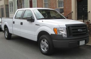
Kentucky has historically been a major coal producer, but the industry has been in decline since the 1980s, and the number employed dropped by more than half between 2011 and 2015.[39]
اعتبارا من 2010[تحديث], 24% of electricity produced in the U.S. depended on either enriched uranium rods coming from the Paducah Gaseous Diffusion Plant (the only domestic site of low-grade uranium enrichment),[needs update] or from the 107,000 tons of coal extracted from the state's two coal fields (which combined produce 4% percent of the electricity in the US).[40]
Kentucky produces 95% of the world's supply of bourbon whiskey, and the number of barrels of bourbon being aged in Kentucky (more than 5.7 million) exceeds the state's population.[39][41] Bourbon has been a growing market – with production of Kentucky bourbon rising 170 percent between 1999 and 2015.[39] In 2019 the state had more than fifty distilleries for bourbon production.[42]
Kentucky exports reached a record $22.1 billion in 2012, with products and services going to 199 countries.[43]
According to the Kentucky Cabinet for Economic Development, the primary state agency in Kentucky responsible for creating new jobs and new investment in the state, new business investment in Kentucky in 2012 totaled nearly $2.7 billion, with the creation of more than 14,000 new jobs. One such investment was L'Oréal in Northern Kentucky, which added 200 jobs on top of the 280 already in existing facilities in Florence and Walton.[44]
Fort Knox, a United States Army post best known as the site of the United States Bullion Depository, which is used to house a large portion of the United States official gold reserves, is located in Kentucky between Louisville and Elizabethtown. In May 2010, the Army Human Resource Center of Excellence, the largest office building in the state at nearly 900,000 square feet (84,000 m2) opened at Fort Knox. The complex employs nearly 4,300 soldiers and civilians.[45]
Kentucky contains two of the twenty U.S. Federal Penitentiaries: USP Big Sandy (in the east in Martin County near Inez) and USP McCreary (in the south in McCreary County in the Daniel Boone National Forest).
The total gross state product for 2020 was $213 billion.[46] Its per capita income was $25,888 in 2017.[47] An organization called the Institute for Truth in Accounting estimated that the state government's debts exceeded its available assets by $26,300 per taxpayer اعتبارا من 2011[تحديث], ranking the state as having the 5th highest such debt burden in the nation.[48]
As of March 2024, the state's unemployment rate is 4.5%.[49] In 2014 Kentucky was the most affordable U.S. state in which to live.[50][needs update]
تُعد ليكسنجتون أحد المراكز المهمة لتجارة الجملة بالنسبة للبلاد كلها في مجال التبغ وخيول السباق. أما لويسفيل فهي ميناء تجاري رئيسي على نهر أوهايو، فضلاً عن أن المنطقة المحيطة بها مركز مهم لتجارة التجزئة وسوق المال، كما يقام بها أحد أشهر سباقات الخيل في العالم وهو المعروف باسم ديربي كنتاكي.
يأتي أكبر موارد التجارة في مجال الثروة الحيوانية التي تبلغ نحو الخُمسَيْن من تربية وبيع الخيول الأصيلة التي يُستجلب أغلبها من مراعي بلوجراس القريبة من ليكسنجتون. أما أهم المنتجات المعدنية في كنتاكي فهو الفحم الحجري.
الضريبة
ترويج الحكومة لشعارات
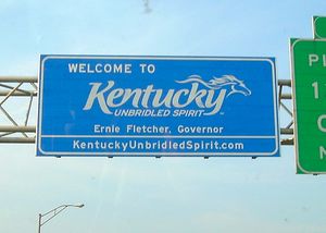
- "الروح الجامحة" Unbridled Spirit
السياحة
Tourism has become an increasingly important part of the Kentucky economy. In 2019 tourism grew to $7.6 billion in economic impact. Key attractions include horse racing with events like the Kentucky Derby and the Keeneland Fall and Spring Meets, bourbon distillery tours, including along the Kentucky Bourbon Trail and Louisville Urban Bourbon Trail,[51] and natural attractions such as the state's many lakes and parks to include Mammoth Cave, Lake Cumberland and Red River Gorge.[52]
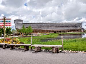
The state also has several religious destinations such as the Creation Museum and Ark Encounter of Answers in Genesis.[53][54]
صناعة الجياد
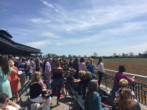
Horse Racing has long been associated with Kentucky. Churchill Downs, the home of the Derby, is a large venue with a capacity exceeding 165,000.[55] The track hosts multiple events throughout the year and is a significant draw to the city of Louisville. Keeneland Race Course, in Lexington, hosts two major meets, the Spring and Fall running. Beyond hosting races Keeneland also hosts a significant horse auction drawing buyers from around the world. In 2019 $360 million was spent on the September Yearling sale.[56] The Kentucky Horse Park in Georgetown hosts multiple events throughout the year, including international equestrian competitions and also offers horseback riding from April to October.[57]
النقل
- مقال رئيسي: النقل في كنتاكي.
الطرق


السكك الحديدية

الجو
الماء

التقسيمات الفرعية والمستوطنات
المقاطعات
Consolidated city-county governments
المدن والبلدات
| الترتيب | المدينة | 2008 Pop | 2000 Pop | Δ Pop |
|---|---|---|---|---|
| 1 | Louisville | 557,224 | 551,299 | +1.13% |
| 2 | Lexington | 282,114 | 260,512 | +7.76% |
| 3 | Owensboro | 55,516 | 54,067 | +2.72% |
| 4 | Bowling Green | 55,097 | 49,296 | +10.63% |
| 5 | Covington | 42,235 | 43,370 | -2.72% |
| 6 | Richmond | 32,895 | 27,152 | +17.56% |
| 7 | Hopkinsville | 32,076 | 30,089 | +5.20% |
| 8 | Henderson | 27,933 | 27,373 | +2.11% |
| 9 | Florence | 27,745 | 23,551 | +15.22% |
| 10 | Frankfort | 27,322 | 27,741 | -1.62% |
| 11 | Nicholasville | 26,444 | 19,680 | +25.68% |
| 12 | Jeffersontown | 26,226 | 26,633 | -1.63% |
| 13 | Paducah | 25,521 | 26,307 | -3.09% |
| 14 | Elizabethtown | 24,144 | 22,542 | +6.74% |
| 15 | Radcliff | 22,013 | 21,961 | +0.34% |
Louisville is the state's largest city with a metro population of 1.2 million.
Lexington is the state's second largest city with a metro population of around 500,000.
Although Covington, Kentucky only has a population of 42,000, the Kentucky side of the Cincinnati/Northern Kentucky metropolitan area has a population of over 450,000.
التعليم

الثقافة

{{See also|مسرح كنتكي}
الموسيقى
المطبخ
الرياضة
رموز الولاية
الأماكن والمناسبات الرسمية
الصور
The world famous Louisville Slugger baseball bat is made in Kentucky.It is also holds the guiness world record for the largest bat.
Kentucky's 2001 commemorative quarter.
Thunder Over Louisville is the largest annual fireworks show in the world.
The Ohio River forms the northern border of Kentucky.
Many Kentucky cities have historic areas near downtown, such as this example in Bowling Green.
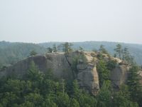
US Highway 23 cuts through the rugged Cumberland Plateau near Pikeville.
انظر أيضا
الملاحظات
- ^ أ ب Elevation adjusted to North American Vertical Datum of 1988.
- ^ كنتكي هي واحدة من أربع ولايات أمريكية فقط تستخدم مصطلح "كومنوِلث" في اسمها الرسمي، مع مساتشوستس وڤرجينيا و پنسلڤانيا.
المصادر
- ^ أ ب "Elevations and Distances in the United States". United States Geological Survey. 2001. Archived from the original on October 15, 2011. Retrieved October 21, 2011.
- ^ أ ب "2020 Census Apportionment Results". census.gov. United States Census Bureau. Archived from the original on April 26, 2021. Retrieved April 26, 2021.
- ^ "Median Annual Household Income". The Henry J. Kaiser Family Foundation. Retrieved May 14, 2019.
- ^ "Kentucky State Symbols". Kentucky Department for Libraries and Archives. Archived from the original on July 3, 2007. Retrieved November 29, 2006.
- ^ Wells, John C. (2008). Longman Pronunciation Dictionary (3rd ed.). Longman. ISBN 978-1-4058-8118-0.
- ^ "How Kentucky Became a State". Puerto Rico 51st. August 8, 2014. Archived from the original on February 21, 2020. Retrieved February 21, 2020.
- ^ "The Bluegrass State". State Symbols USA. June 2014. Archived from the original on April 21, 2020. Retrieved March 19, 2020.
- ^ "2007 Rankings of States and Counties". Alabama Cattlemen's Association. Archived from the original on May 4, 2006. Retrieved May 1, 2007.
- ^ أ ب "Corn Production Detective" (PDF). National Council on Economic Education. Archived from the original (PDF) on June 5, 2007. Retrieved May 3, 2007.
- ^ أ ب Hunt, Matthew (2019). "Are Kentucky Farmers Prepared for Farm-Related Emergencies?". Journal of Agromedicine. 24 (1): 9–14. doi:10.1080/1059924x.2018.1536571. PMID 30317936. S2CID 52977999.
- ^ أ ب Strong, Marvin E. "Gene" Jr. (December 31, 2003). "Kentucky: In the Middle of Auto Alley". Trade and Industry Development. Archived from the original on August 14, 2022. Retrieved November 28, 2012.
- ^ Johnson and Parrish. "Kentucky River Development: The Commonwealth's Waterways" (PDF). University of Kentucky. Archived from the original (PDF) on January 11, 2021.
- ^ قالب:OEtymD "Kentucky". Oxford English Dictionary. Archived from the original on August 2, 2007. Retrieved February 25, 2007.
- ^ Mithun, Marianne. 1999. Languages of Native North America. Cambridge: Cambridge University Press, pg. 312
- ^ "Kentucky". Microsoft Encarta Online Encyclopedia 2006. Archived from the original on October 30, 2009. Retrieved February 25, 2007.
- ^ McCafferty, Michael (2008). Native American Place Names of Indiana. University of Illinois Press. p. 250. ISBN 9780252032684.
- ^ Nichols, John & Nyholm, Earl. Concise Dictionary of Minnesota Ojibwe, 1994.
- ^ Patrick, Andrew P. (2017). "Birth of the Bluegrass: Ecological Transformations in Central Kentucky to 1810". The Register of the Kentucky Historical Society. 115 (2): 155–182. doi:10.1353/khs.2017.0049. S2CID 133557743.
- ^ Louis, Franquelin, Jean Baptiste. "Franquelin's map of Louisiana.". LOC.gov. Retrieved August 17, 2017.
- ^ "Early Indian Migration in Ohio." GenealogyTrails.com. Retrieved August 17, 2017.
- ^ "South of the Ohio" was almost, but not quite, synonymous with Kentucke country.
- ^ The First Explorations of the Trans-Allegheny Region by the Virginians 1650–1674
- ^ "The Presence". History of Native Americans in Central Kentucky. Mercer County Online. Archived from the original on December 12, 2006. Retrieved November 29, 2006.
- ^ Murphree, Daniel S. (2012). Native America: A State-by-State Historical Encyclopedia. Santa Barbara, CA: ABC-CLIO. p. 395. ISBN 9780313381270. Archived from the original on March 26, 2023. Retrieved March 19, 2023.
- ^ James, James Alton (1928). The Life of George Rogers Clark. Chicago: University of Chicago Press. ISBN 978-0-404-03549-5.
- ^ Kesavan, Vasan (December 1, 2002). "When Did the Articles of Confederation Cease to Be Law". Notre Dame Law Review. 78 (1): 70–71. Archived from the original on January 1, 2016. Retrieved October 31, 2015.
- ^ 1 Stat. 189
- ^ 1 Stat. 191
- ^ "Constitution Square State Historic Site". Danville-Boyle County Convention and Visitors Bureau. Archived from the original on October 11, 2007. Retrieved November 29, 2006.
- ^ "Border States in the Civil War". CivilWarHome.com. February 15, 2002. Archived from the original on December 8, 2006. Retrieved November 29, 2006.
- ^ "Ordinances of Secession". Historical Text Archive. Archived from the original on نوفمبر 23, 2010. Retrieved نوفمبر 29, 2006.
- ^ "Civil War Sites – Bowling Green, KY". WMTH Corporation. Archived from the original on October 9, 2007. Retrieved November 29, 2006.
- ^ "KRS 2.110 Public Holidays" (PDF). Kentucky General Assembly. Archived from the original (PDF) on September 27, 2006. Retrieved November 29, 2006.
- ^ Tony Hiss, Confederates in the Attic
- ^ "The Old State Capitol". Kentucky Historical Society. Archived from the original on August 27, 2007. Retrieved September 9, 2007.
- ^ Lochte, Kate; Markgraf, Matt (September 22, 2014). "Understanding the Black Patch Tobacco War of West Kentucky and Tennessee". WKMS. Archived from the original on June 10, 2016. Retrieved May 6, 2016.
- ^ خطأ استشهاد: وسم
<ref>غير صحيح؛ لا نص تم توفيره للمراجع المسماة08CenEst - ^ "2007 Rankings of States and Counties". bamabeef.org. Archived from the original on May 4, 2006. Retrieved May 1, 2007.
- ^ أ ب ت ث ج ح خ Eblin, Tom (December 27, 2015). "Year in Kentucky business saw Toyota expand, bourbon boom, coal decline". Lexington Herald-Leader. Archived from the original on December 31, 2015. Retrieved January 3, 2016.
- ^ "U.S. Coal Production by State, 1994–2009" (PDF). Utah Geological Survey. Archived from the original (PDF) on November 3, 2010. Retrieved December 7, 2011.
- ^ Schreiner, Bruce (February 3, 2015). "Bourbon, Tennessee whiskey sales soar in U.S.; exports top $1B". The Seattle Times (in الإنجليزية الأمريكية). Associated Press. Archived from the original on May 22, 2023.
- ^ Havens, Sara (March 19, 2019). "Best Driving Vacations: Kentucky Bourbon Trail". Columbus Monthly. Archived from the original on April 28, 2021.
- ^ Snchez, Francisco J. (March 15, 2013). "Ky. one of fastest-growing states in exporting products | Op-Ed". Lexington Herald Leader. Archived from the original on March 8, 2016. Retrieved July 10, 2013.
- ^ "Maker of hair care products to expand in Kentucky". Businessweek. November 15, 2012. Archived from the original on June 3, 2013. Retrieved July 10, 2013.
- ^ "Human resource center opens at Fort Knox". Louisville Business First. May 27, 2010. Archived from the original on October 10, 2012. Retrieved November 28, 2012.
- ^ "Gross Domestic Product: All Industry Total in Kentucky (KYNGSP)". FRED | St. Louis Fed. Archived from the original on January 20, 2022. Retrieved January 27, 2022.
- ^ "QuickFacts: Kentucky". U.S. Census Bureau. Archived from the original on September 22, 2019. Retrieved September 22, 2019.
- ^ "Kentucky : State Data and Comparisons". State Data Lab. Archived from the original on June 6, 2013. Retrieved April 3, 2013.
- ^ "Kentucky Education and Labor Cabinet Releases March 2024 Unemployment Report". Kentucky Center for Statistics. April 18, 2024. Archived from the original on April 30, 2024. Retrieved April 30, 2024.
- ^ Cohn, Scott (June 24, 2014). "America's cheapest states to live in 2014". CNBC. Archived from the original on November 20, 2015. Retrieved November 19, 2015.
- ^ "Louisville, KY's Urban Bourbon Trail (UBT)". BourbonCounty.com. Archived from the original on February 19, 2015. Retrieved July 2, 2022.
- ^ "Kentucky Tourism says visitor spending rose to $7.6 billion in 2018". August 14, 2019. Archived from the original on September 14, 2019. Retrieved August 26, 2020.
- ^ "Itinerary: Northern Kentucky Biblical Wonders". Archived from the original on September 18, 2020. Retrieved September 20, 2020.
- ^ "Answers in Genesis". Archived from the original on February 20, 2021. Retrieved September 20, 2020.
- ^ "Second-Highest Derby Attendance, Handle". bloodhorse.com. May 7, 2016. Archived from the original on June 24, 2021. Retrieved August 9, 2021.
- ^ Warren, Katie. "What it's like going to the 'Super Bowl of horse sales,' where royals and millionaires bid on horses they hope might be the next Kentucky Derby winner". Business Insider. Archived from the original on September 10, 2020. Retrieved August 27, 2020.
- ^ "Home". Kentucky Horse Park. Archived from the original on February 11, 2021. Retrieved August 27, 2020.
- ^ "Kentucky's State Symbols". Kentucky Department of Libraries and Archives. Retrieved 2006-12-18.
- ^ "Unbridled Spirit Information". Kentucky.gov. 2006-11-20. Retrieved 2006-12-18.
{{cite web}}: External link in|publisher= - ^ "HB71: An act designating bluegrass music as the official state music of Kentucky" (DOC). Legislative Research Commission. Retrieved 2007-06-26.
قائمة المراجع
السياسة
- Miller, Penny M. Kentucky Politics & Government: Do We Stand United? (1994)
- Jewell, Malcolm E. and Everett W. Cunningham, Kentucky Politics (1968)
التاريخ
المصادر
- Bodley, Temple and Samuel M. Wilson. History of Kentucky 4 vols. (1928).
- Caudill, Harry M., Night Comes to the Cumberlands (1963). ISBN 0-316-13212-8
- Channing, Steven. Kentucky: A Bicentennial History (1977).
- Clark, Thomas Dionysius. A History of Kentucky (many editions, 1937–1992).
- Collins, Lewis. History of Kentucky (1880).
- Harrison, Lowell H. and James C. Klotter. A New History of Kentucky (1997).
- Kleber, John E. et al. The Kentucky Encyclopedia (1992), standard reference history.
- Klotter, James C. Our Kentucky: A Study of the Bluegrass State (2000), high school text
- Lucas, Marion Brunson and Wright, George C. A History of Blacks in Kentucky 2 vols. (1992).
- Notable Kentucky African Americans http://www.uky.edu/Subject/aakyall.html
- Share, Allen J. Cities in the Commonwealth: Two Centuries of Urban Life in Kentucky (1982).
- Wallis, Frederick A. and Hambleton Tapp. A Sesqui-Centennial History of Kentucky 4 vols. (1945).
- Ward, William S., A Literary History of Kentucky (1988) (ISBN 0-87049-578-X).
- WPA, Kentucky: A Guide to the Bluegrass State (1939), classic guide.
- Yater, George H. (1987). Two Hundred Years at the Fall of the Ohio: A History of Louisville and Jefferson County (2nd ed.). Filson Club, Incorporated. ISBN 0-9601072-3-1.
دراسات علمية متخصصة
- Bakeless, John. Daniel Boone, Master of the Wilderness (1989)
- Blakey, George T. Hard Times and New Deal in Kentucky, 1929–1939 (1986)
- Coulter, E. Merton. The Civil War and Readjustment in Kentucky (1926)
- Davis, Alice. "Heroes: Kentucky's Artists from Statehood to the New Millennium" (2004)
- Ellis, William E. The Kentucky River (2000).
- Faragher, John Mack. Daniel Boone (1993)
- Fenton, John H. Politics in the Border States: A Study of the Patterns of Political Organization, and Political Change, Common to the Border States: Maryland, West Virginia, Kentucky, and Missouri (1957)
- Ireland, Robert M. The County in Kentucky History (1976)
- Klotter, James C. (2005). Jerlene Rose (ed.). Kentucky's Civil War 1861–1865. Back Home In Kentucky Inc. ISBN 0-9769231-1-4.
{{cite book}}: Unknown parameter|coauthors=ignored (|author=suggested) (help)
- Klotter, James C. Kentucky: Portrait in Paradox, 1900–1950 (1992)
- Pearce, John Ed. Divide and Dissent: Kentucky Politics, 1930–1963 (1987)
- Remini, Robert V. Henry Clay: Statesman for the Union (1991).
- Sonne, Niels Henry. Liberal Kentucky, 1780–1828 (1939)
- Tapp, Hambleton and James C Klotter. Kentucky Decades of Discord, 1865–1900 (1977)
- Townsend, William H. Lincoln and the Bluegrass: Slavery and Civil War in Kentucky (1955)
- Waldrep, Christopher Night Riders: Defending Community in the Black Patch, 1890–1915 (1993) tobacco wars
وصلات خارجية
- Kentucky.gov: My New Kentucky Home
- Kentucky State Databases - Annotated list of searchable databases produced by Kentucky state agencies and compiled by the Government Documents Roundtable of the American Library Association.
- كنتكي at the Open Directory Project
- Kentucky Department of Tourism
- كنتكي travel guide from Wikitravel
- The Kentucky Highlands Project
- USGS real-time, geographic, and other scientific resources of Kentucky
- Energy & Environmental Data for Kentucky
- Kentucky State Facts
- Kentucky: Unbridled Spirit
- Kentucky Virtual Library
- "Science In Your Backyard: Kentucky" U.S. Department of the Interior | U.S. Geological Survey, July 3, 2006, retrieved November 4, 2006
- U.S. Census Bureau Kentucky QuickFacts
- Interactive Kentucky for Kids

|
ڤرجنيا الغربية | إنديانا / اوهايو | إلينوي | 
|
| ڤرجنيا | ميزوري | |||
| تنسي |
| سبقه Vermont |
List of U.S. states by date of admission to the Union Admitted on June 1, 1792 (15th) |
تبعه Tennessee |
- CS1 الإنجليزية الأمريكية-language sources (en-us)
- Short description is different from Wikidata
- Pages using infobox settlement with possible motto list
- Pages using infobox settlement with no coordinates
- Articles containing Mohawk-language text
- Articles containing Seneca-language text
- Articles with text in Algonquian languages
- Articles with hatnote templates targeting a nonexistent page
- Articles with unsourced statements from May 2023
- مقالات فيها عبارات متقادمة منذ 2010
- جميع المقالات التي فيها عبارات متقادمة
- Wikipedia articles in need of updating from May 2021
- All Wikipedia articles in need of updating
- مقالات فيها عبارات متقادمة منذ 2011
- Wikipedia articles in need of updating from January 2024
- Pages with empty portal template
- CS1 errors: unsupported parameter
- تأسيسات 1792 في الولايات المتحدة
- دول وأقاليم تأسست في 1792
- كنتكي
- ولايات الجنوب
- ولايات الغرب الأوسط
- دول ومناطق تأسست في 1792
- 1792 establishments in the United States
- Southern United States
- States of the United States
- U.S. states with multiple time zones
- الولايات المتحدة المتجاورة


