مقاطعة كرن، كاليفورنيا
Kern County, California | |
|---|---|
| County of Kern | |
|
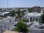
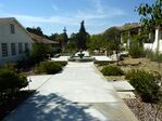
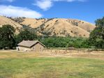
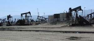
Images, from top down, left to right: Downtown Bakersfield, Cesar E. Chavez National Monument, Fort Tejon barracks, an F-35 landing at Edwards Air Force Base, the Midway-Sunset Oil Field | |
 Interactive map of Kern County | |
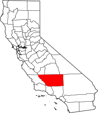 Location in the state of California | |
| الإحداثيات: 35°20′N 118°43′W / 35.34°N 118.72°W | |
| Country | United States |
| State | California |
| Incorporated | 2 أبريل 1866 |
| السمِيْ | Kern River and Edward Kern |
| County seat (and largest city) | Bakersfield |
| الحكومة | |
| • النوع | Council–Administration |
| • الكيان | Board of Supervisors |
| • Chair | Zack Scrivner |
| • Vice Chair | Phillip Peters |
| • Board of Supervisors | Supervisors
|
| • Chief Administrative Officer | Ryan J. Alsop |
| المساحة | |
| • الإجمالي | 8٬163 ميل² (21٬140 كم²) |
| • البر | 8٬132 ميل² (21٬060 كم²) |
| • الماء | 31 ميل² (80 كم²) |
| أعلى منسوب | 8٬755 ft (2٬669 m) |
| أوطى منسوب | 206 ft (63 m) |
| التعداد | |
| • الإجمالي | 909٬235 |
| • الكثافة | 110/sq mi (43/km2) |
| منطقة التوقيت | UTC−8 (Pacific Time Zone) |
| • الصيف (التوقيت الصيفي) | UTC−7 (Pacific Daylight Time) |
| Area code | 661, 760 |
| FIPS code | 06-029 |
| GNIS feature ID | 2054176 |
| الموقع الإلكتروني | www |
مقاطعة كـِرن إنگليزية: Kern County هي إحدى مقاطعات وسط ولاية كاليفورنيا في الولايات المتحدة الأمريكية. As of the 2020 census, the population was 909,235.[2] Its county seat is Bakersfield.[3]
Kern County comprises the Bakersfield, California, Metropolitan statistical area. The county spans the southern end of the Central Valley. Covering 8,161.42 square miles (21,138.0 km2), it ranges west to the southern slope of the Coast Ranges, and east beyond the southern slope of the eastern Sierra Nevada into the Mojave Desert, at the city of Ridgecrest. Its northernmost city is Delano, and its southern reach extends to just beyond Frazier Park ,and the northern extremity of the parallel Antelope Valley.
The county's economy is heavily linked to agriculture and to petroleum extraction. There is also a strong aviation, space, and military presence, such as Edwards Air Force Base, the China Lake Naval Air Weapons Station, and the Mojave Air and Space Port.
With a population that is 54.9% Hispanic as of 2020, Kern is California's third-most populous majority-Hispanic county and the sixth-largest nationwide.[4]
. . . . . . . . . . . . . . . . . . . . . . . . . . . . . . . . . . . . . . . . . . . . . . . . . . . . . . . . . . . . . . . . . . . . . . . . . . . . . . . . . . . . . . . . . . . . . . . . . . . . . . . . . . . . . . . . . . . . . . . . . . . . . . . . . . . . . . . . . . . . . . . . . . . . . . . . . . . . . . . . . . . . . . . .
History
Indigenous Era
Native Americans lived in this region for thousands and thousands of years: Chumash, tribes grouped together under the settler name Yokuts, and others.[5]
Spanish era
Spain claimed the area in 1769. Entering from Grapevine Canyon to the south in 1772, Commander Don Pedro Fages became the first European to set foot in the area.
The Battle of San Emigdio took place in Kern County in March 1824. The Chumash Native Americans of Mission Santa Barbara rebelled against the Mexican government and its taking over mission property and ejecting the natives. The battle occurred in the canyon where San Emigdio Creek flows down San Emigdio Mountain and the Blue Ridge, south of Bakersfield near today's Highway 166. Mexican forces from Monterey were commanded by Carlos Carrillo and the conflict was a low-casualty encounter, with only four Native Americans being killed and no Mexicans. The surviving Native Americans were pacified and brought back to Santa Barbara in June 1824 after a pursuit and negotiation in which many were allowed to keep their arms for the return march over the mountains.[6]
American era
In the beginning, what was to become Kern County was dominated by mining in the mountains and in the desert. In 1855 the California legislature attempted to form a county in the area by giving the southeastern territory of Tulare County on the west of the Sierra Nevada Mountains to Buena Vista County. However, it was never officially organized prior to 1859, when the enabling legislation expired. The south of Tulare County was later organized as Kern County in 1866, with additions from Los Angeles and San Bernardino Counties. Its first county seat was the mining town of Havilah, in the mountains east of Bakersfield and north of Tehachapi.[7]
Settlers considered the flat land of the valley inhospitable and impassable at the time due to swamps, lakes, tule reeds and diseases such as malaria. This changed when residents started draining land for farming and constructing canals, most dug by hired Chinese laborers. Within 10 years the valley surpassed the mining areas as the economic power of the county, and as a result the county seat was moved from Havilah to Bakersfield in 1874.[بحاجة لمصدر]
In 1899, the discovery well of the Kern River Oil Field was dug by hand[8] and soon the towns of Oil City, Oil Center and Oildale came into existence.[8]
Etymology
The county derives its name from the Kern River, which was named for Edward Kern, cartographer for General John C. Frémont's 1845 expedition, which crossed Walker Pass. The Kern River was originally named Rio Bravo de San Felipe by Father Francisco Garcés when he explored the area in 1776.
Earthquakes
هذا القسم يحتاج المزيد من الأسانيد للتحقق. (August 2017) (Learn how and when to remove this template message) |
Throughout recorded history, severe earthquakes have struck Kern County, including the 1857 Fort Tejon earthquake.
Demographics
| التعداد التاريخي | |||
|---|---|---|---|
| التعداد | Pop. | %± | |
| 1870 | 2٬925 | — | |
| 1880 | 5٬601 | 91٫5% | |
| 1890 | 9٬808 | 75٫1% | |
| 1900 | 16٬480 | 68�0% | |
| 1910 | 37٬715 | 128٫9% | |
| 1920 | 54٬843 | 45٫4% | |
| 1930 | 82٬570 | 50٫6% | |
| 1940 | 135٬124 | 63٫6% | |
| 1950 | 228٬309 | 69�0% | |
| 1960 | 291٬984 | 27٫9% | |
| 1970 | 329٬162 | 12٫7% | |
| 1980 | 403٬089 | 22٫5% | |
| 1990 | 543٬477 | 34٫8% | |
| 2000 | 661٬645 | 21٫7% | |
| 2010 | 839٬631 | 26٫9% | |
| 2020 | 909٬235 | 8٫3% | |
| U.S. Decennial Census[9] 1790–1960[10] 1900–1990[11] 1990–2000[12] 2010[13] 2020[2] | |||
According to the 2020 United States Census, Kern County's population was 909,235.[2] It was the eleventh-largest county by population in California.[14] The center of population of California is located in Kern County, in the town of Buttonwillow [1].
2020 census
| Race / Ethnicity | Pop 2010[13] | Pop 2020[15] | % 2010 | % 2020 |
|---|---|---|---|---|
| White alone (NH) | 323,794 | 279,600 | 38.56% | 30.75% |
| Black or African American alone (NH) | 45,377 | 46,776 | 5.40% | 5.14% |
| Native American or Alaska Native alone (NH) | 5,893 | 5,197 | 0.70% | 0.57% |
| Asian alone (NH) | 33,100 | 44,257 | 3.94% | 4.87% |
| Pacific Islander alone (NH) | 995 | 1,127 | 0.12% | 0.12% |
| Some Other Race alone (NH) | 1,472 | 4,557 | 0.18% | 0.50% |
| Mixed Race/Multi-Racial (NH) | 15,967 | 28,563 | 1.90% | 3.14% |
| Hispanic or Latino (any race) | 413,033 | 499,158 | 49.19% | 54.90% |
| Total | 839,631 | 909,235 | 100.00% | 100.00% |
Note: the US Census treats Hispanic/Latino as an ethnic category. This table excludes Latinos from the racial categories and assigns them to a separate category. Hispanics/Latinos can be of any race.
According to the 2020 United States Census:[16]
- Hispanic (54.9%)
- White Non-Hispanic (30.8%)
- Black (5.5%)
- Asian (5.1%)
- Two or more races (16.1%)
- Indigenous (2.0%)
- Some other race (30.2%)
(Total can be greater than 100% because Hispanics may be counted in any race.)
. . . . . . . . . . . . . . . . . . . . . . . . . . . . . . . . . . . . . . . . . . . . . . . . . . . . . . . . . . . . . . . . . . . . . . . . . . . . . . . . . . . . . . . . . . . . . . . . . . . . . . . . . . . . . . . . . . . . . . . . . . . . . . . . . . . . . . . . . . . . . . . . . . . . . . . . . . . . . . . . . . . . . . . .
Economy
The county has a large agricultural base and is a significant producer of oil, natural gas, hydro-electric power, Biomass, solar power, and wind power. Kern is noted for minerals, including gold, borate, and kernite. The largest open pit mine in California, which mines borax, is at Boron.[17] As of October 1, 2016, Kern County contains nearly 25% of California's in-state renewable energy production, including 1,785 MW of solar power and 3,310 MW of wind power.[18] Kern County is home to the Tehachapi Energy Storage Project, which was commissioned in 2014.[19]
Aerospace and military
Department of Defense facilities include Edwards Air Force Base and China Lake Naval Air Weapons Station. As home to Edwards Air Force Base the Air Force's main flight test facility, Kern has been the site of many milestones, including the first supersonic flight and the first landing of the Space Shuttle. The base has brought prosperity to the railroad towns of Mojave and Rosamond.[20] Kern County is also the home of the first inland spaceport in the United States, the Mojave Spaceport.[21]
Agriculture
Major producer of almonds with production greater than 100 million pounds annually.[22]
Petroleum
اعتبارا من 2015[تحديث], Kern is California's top oil-producing county, with 78% of the state's 56,653 active oil wells and 71% of oil production.[23][24] The county produced 144.5 million barrels of oil in 2015, accounting for about 4% of overall U.S. oil production.[23][25]
Discovery and development
Oil development began with the 1894 discovery of the Midway-Sunset Oil Field, now the third-largest in the United States, in the southwestern portion of Kern County near Maricopa. The 1899 discovery along the Kern River was a breakthrough in oil production.[8] Oil was refined here even before the establishment of the county.[8] The Buena Vista Petroleum Company was organized and incorporated in 1864.[8] Soon thereafter a refinery was built that operated until April 1867 when work ceased because of high freight charges.[8]
The 1910 Lakeview Gusher was the largest recorded oil strike in U.S. history. The well spewed approximately nine million barrels for 18 months before workers finally were able to cap it.[26]
Other big oil fields in southwestern Kern County discovered early in the 20th century include the Buena Vista, the South Belridge and the Cymric fields. The latter is the fastest-growing field in California in terms of barrels produced per year.[27] Later large fields include the Kern River Oil Field, the fifth-largest in the U.S., the adjacent Kern Front Oil Field, the Mount Poso Oil Field in the lower foothills of the Sierra north-northeast of Bakersfield and the Fruitvale Oil Field, which underlies much of the city of Bakersfield, along and north of the Kern River.[28][29]
On July 22, 2009, Occidental Petroleum announced it had discovered the equivalent of 150 million to 250 million barrels of oil in Kern County, which the company called the largest oil discovery in California in 35 years. The find added about 10 percent to California's known reserves. Occidental's Ray Irani said it is likely that more oil would be found in the areas outside the initial six wells that tapped the discovery. Occidental has not revealed the exact location of the find, two-thirds of which is natural gas. BNET, an industry web publication, said the find would add to the company's 708 million barrels of proven reserves in California.[بحاجة لمصدر]
Petroleum today
The county today contributes more than three-quarters of all the oil produced onshore in California.[27] Some of the large oil fields in Kern County which are still active include:
- Buena Vista Oil Field
- Cymric Oil Field
- Edison Oil Field
- Elk Hills Oil Field
- Fruitvale Oil Field
- Kern Front Oil Field
- Kern River Oil Field
- Lost Hills Oil Field
- McKittrick Oil Field
- Midway-Sunset Oil Field
- Mountain View Oil Field
- Mount Poso Oil Field
- North Belridge Oil Field
- Round Mountain Oil Field
- South Belridge Oil Field
Communities
| Population reported at 2010 United States Census | |||||||||
|---|---|---|---|---|---|---|---|---|---|
| The County | Total Population |
White | African American |
Native American |
Asian | Pacific Islander |
other races |
two or more races |
Hispanic or Latino (of any race) |
| Kern County | 839,631 | 499,766 | 48,921 | 12,676 | 34,846 | 1,252 | 204,314 | 37,856 | 413,033 |
| Incorporated city |
Total Population |
White | African American |
Native American |
Asian | Pacific Islander |
other races |
two or more races |
Hispanic or Latino (of any race) |
| Arvin | 19,304 | 10,247 | 192 | 240 | 155 | 6 | 7,655 | 809 | 17,892 |
| Bakersfield | 347,483 | 197,349 | 28,368 | 5,102 | 21,432 | 478 | 77,686 | 17,068 | 158,205 |
| California City | 14,120 | 9,188 | 2,150 | 132 | 367 | 59 | 1,431 | 793 | 5,385 |
| Delano | 53,041 | 19,304 | 4,191 | 501 | 6,757 | 30 | 20,307 | 1,951 | 37,913 |
| Maricopa | 1,154 | 958 | 1 | 27 | 16 | 2 | 112 | 38 | 232 |
| McFarland | 12,707 | 5,433 | 236 | 171 | 84 | 6 | 6,330 | 447 | 11,625 |
| Ridgecrest | 27,616 | 21,387 | 1,113 | 341 | 1,209 | 143 | 1,836 | 1,587 | 4,941 |
| Shafter | 16,988 | 8,150 | 219 | 198 | 111 | 19 | 7,645 | 646 | 13,634 |
| Taft | 9,327 | 7,388 | 396 | 118 | 93 | 65 | 1,023 | 244 | 3,353 |
| Tehachapi | 14,414 | 9,426 | 1,297 | 206 | 238 | 21 | 2,725 | 501 | 5,466 |
| Wasco | 25,545 | 12,579 | 1,951 | 283 | 180 | 12 | 9,714 | 826 | 19,585 |
| Census-designated place |
Total Population |
White | African American |
Native American |
Asian | Pacific Islander |
other races |
two or more races |
Hispanic or Latino (of any race) |
| Bear Valley Springs | 5,172 | 4,776 | 74 | 46 | 57 | 3 | 89 | 127 | 399 |
| Bodfish | 1,956 | 1,758 | 4 | 50 | 13 | 3 | 49 | 79 | 189 |
| Boron | 2,253 | 1,746 | 162 | 49 | 47 | 4 | 141 | 104 | 406 |
| Buttonwillow | 1,508 | 534 | 36 | 11 | 10 | 0 | 890 | 27 | 1,183 |
| Cherokee Strip | 227 | 84 | 0 | 4 | 0 | 0 | 117 | 22 | 187 |
| China Lake Acres | 1,876 | 1,601 | 35 | 29 | 16 | 7 | 84 | 104 | 265 |
| Derby Acres | 322 | 289 | 0 | 1 | 0 | 0 | 23 | 9 | 36 |
| Dustin Acres | 652 | 539 | 4 | 9 | 1 | 0 | 71 | 28 | 129 |
| Edmundson Acres | 279 | 108 | 5 | 3 | 1 | 0 | 143 | 19 | 225 |
| Edwards Air Force Base | 2,063 | 1,518 | 165 | 16 | 99 | 10 | 96 | 159 | 355 |
| Fellows | 106 | 94 | 1 | 5 | 0 | 0 | 2 | 4 | 11 |
| Ford City | 4,278 | 2,735 | 28 | 153 | 36 | 32 | 1,113 | 181 | 1,971 |
| Frazier Park | 2,691 | 2,297 | 16 | 31 | 22 | 3 | 212 | 110 | 528 |
| Fuller Acres | 991 | 607 | 13 | 12 | 1 | 0 | 329 | 29 | 768 |
| Golden Hills | 8,656 | 7,235 | 129 | 124 | 120 | 15 | 670 | 363 | 1,674 |
| Greenacres | 5,566 | 4,612 | 49 | 116 | 70 | 8 | 511 | 200 | 1,119 |
| Greenfield | 3,991 | 2,512 | 71 | 63 | 45 | 1 | 1,112 | 187 | 2,263 |
| Inyokern | 1,099 | 930 | 14 | 24 | 25 | 2 | 49 | 55 | 116 |
| Johannesburg | 172 | 152 | 2 | 2 | 8 | 0 | 0 | 8 | 8 |
| Keene | 431 | 385 | 2 | 10 | 8 | 0 | 16 | 10 | 47 |
| Kernville | 1,395 | 1,257 | 1 | 19 | 7 | 0 | 33 | 78 | 82 |
| Lake Isabella | 3,466 | 3,069 | 6 | 96 | 18 | 7 | 73 | 197 | 339 |
| Lake of the Woods | 917 | 820 | 3 | 18 | 11 | 0 | 34 | 31 | 123 |
| Lamont | 15,120 | 6,677 | 130 | 230 | 72 | 9 | 7,351 | 651 | 14,293 |
| Lebec | 1,468 | 1,152 | 14 | 46 | 17 | 0 | 148 | 91 | 395 |
| Lost Hills | 2,412 | 132 | 5 | 1 | 17 | 1 | 2,232 | 24 | 2,354 |
| McKittrick | 115 | 101 | 1 | 1 | 0 | 0 | 7 | 5 | 9 |
| Mettler | 136 | 74 | 0 | 0 | 0 | 0 | 43 | 19 | 109 |
| Mexican Colony | 281 | 162 | 0 | 15 | 0 | 0 | 93 | 11 | 227 |
| Mojave | 4,238 | 2,381 | 638 | 54 | 53 | 19 | 867 | 226 | 1,592 |
| Mountain Mesa | 777 | 687 | 7 | 16 | 6 | 2 | 27 | 32 | 77 |
| North Edwards | 1,058 | 847 | 43 | 26 | 20 | 1 | 60 | 61 | 179 |
| Oildale | 32,684 | 27,463 | 255 | 590 | 316 | 30 | 2,635 | 1,395 | 6,301 |
| Onyx | 475 | 406 | 4 | 9 | 0 | 0 | 16 | 40 | 30 |
| Pine Mountain Club | 2,315 | 2,079 | 29 | 25 | 45 | 0 | 58 | 79 | 231 |
| Randsburg | 69 | 62 | 0 | 4 | 2 | 0 | 0 | 1 | 2 |
| Rosamond | 18,150 | 11,294 | 1,476 | 221 | 658 | 66 | 3,258 | 1,177 | 6,230 |
| Rosedale | 14,058 | 11,695 | 208 | 159 | 389 | 24 | 997 | 586 | 2,495 |
| Smith Corner | 524 | 227 | 10 | 3 | 2 | 3 | 263 | 16 | 440 |
| South Taft | 2,169 | 1,404 | 21 | 55 | 5 | 11 | 596 | 77 | 931 |
| Squirrel Mountain Valley | 547 | 509 | 2 | 9 | 1 | 0 | 13 | 13 | 22 |
| Stallion Springs | 2,488 | 2,239 | 30 | 26 | 32 | 7 | 79 | 75 | 285 |
| Taft Heights | 1,949 | 1,602 | 15 | 35 | 11 | 0 | 220 | 66 | 441 |
| Tupman | 161 | 149 | 0 | 0 | 0 | 0 | 2 | 10 | 12 |
| Valley Acres | 527 | 428 | 1 | 10 | 1 | 0 | 42 | 45 | 121 |
| Weedpatch | 2,658 | 1,212 | 8 | 78 | 14 | 0 | 1,237 | 109 | 2,484 |
| Weldon | 2,642 | 2,375 | 5 | 82 | 11 | 1 | 53 | 115 | 217 |
| Wofford Heights | 2,200 | 2,037 | 6 | 41 | 10 | 1 | 26 | 79 | 156 |
| Other unincorporated areas |
Total Population |
White | African American |
Native American |
Asian | Pacific Islander |
other races |
two or more races |
Hispanic or Latino (of any race) |
| All others not CDPs (combined) | 138,644 | 81,305 | 5,079 | 2,730 | 1,907 | 141 | 41,670 | 5,812 | 82,746 |
. . . . . . . . . . . . . . . . . . . . . . . . . . . . . . . . . . . . . . . . . . . . . . . . . . . . . . . . . . . . . . . . . . . . . . . . . . . . . . . . . . . . . . . . . . . . . . . . . . . . . . . . . . . . . . . . . . . . . . . . . . . . . . . . . . . . . . . . . . . . . . . . . . . . . . . . . . . . . . . . . . . . . . . .
Cities
- Arvin
- Bakersfield (county seat)
- California City
- Delano
- Maricopa
- McFarland
- Ridgecrest
- Shafter
- Taft
- Tehachapi
- Wasco
Census-designated places
- Bakersfield Country Club
- Bear Valley Springs
- Bodfish
- Boron
- Buttonwillow
- Cherokee Strip
- China Lake Acres
- Derby Acres
- Dustin Acres
- Edmundson Acres
- Edwards AFB
- Fellows
- Ford City
- Frazier Park
- Fuller Acres
- Golden Hills
- Greenacres
- Greenfield
- Inyokern
- Johannesburg
- Keene
- Kernville
- Lake Isabella
- Lake of the Woods
- Lamont
- Lebec
- Lost Hills
- McKittrick
- Mettler
- Mexican Colony
- Mojave
- Mountain Mesa
- North Edwards
- Oildale
- Onyx
- Pine Mountain Club
- Randsburg
- Rosamond
- Rosedale
- Smith Corner
- South Taft
- Squirrel Mountain Valley
- Stallion Springs
- Taft Heights
- Tupman
- Valley Acres
- Weedpatch
- Weldon
- Wofford Heights
Unincorporated communities
- Actis
- Aerial Acres
- Alameda
- Alta Sierra
- Armistead
- Bealville
- Bena
- Caliente
- Canebrake
- Cantil
- Cawelo
- Cinco
- Claraville
- Di Giorgio
- Edison
- Edwards
- Famoso
- Glennville
- Goler Heights
- Grapevine
- Gypsite
- Havilah
- Indian Wells
- Jasmin
- Kecks Corner
- Keyesville
- Loraine
- Meridian
- Midoil
- Millux
- Miracle Hot Springs
- Missouri Triangle
- Monolith
- Neufeld
- Old Garlock
- Old River
- Old West Ranch[30][31][32]
- Panama
- Pentland
- Pinon Pines Estates
- Pond
- Pumpkin Center
- Reward
- Ricardo
- Rio Bravo
- Riverkern
- Rowen
- Saco
- Sageland
- Saltdale
- Sanborn
- Sand Canyon
- Semitropic
- Shirley Meadows
- South Lake
- Spicer City
- Twin Oaks
- Wheeler Ridge
- Willow Springs
- Wonder Acres
- Woody
Former places
- Adobe Station
- Glenburn
Population ranking
The population ranking of the following table is based on the 2020 census of Kern County.[33]
† county seat
| Rank | City/Town/etc. | Municipal type | Population (2020 Census) |
|---|---|---|---|
| 1 | † Bakersfield | City | 403,455 |
| 2 | Delano | City | 51,428 |
| 3 | Oildale | CDP | 36,135 |
| 4 | Ridgecrest | City | 27,959 |
| 5 | Wasco | City | 27,047 |
| 6 | Rosamond | CDP | 20,961 |
| 7 | Shafter | City | 19,953 |
| 8 | Arvin | City | 19,495 |
| 9 | Rosedale | CDP | 18,639 |
| 10 | California City | City | 14,973 |
| 11 | McFarland | City | 14,161 |
| 12 | Lamont | CDP | 14,049 |
| 13 | Tehachapi | City | 12,939 |
| 14 | Golden Hills | CDP | 9,578 |
| 15 | Taft | City | 8,546 |
| 16 | Bear Valley Springs | CDP | 5,592 |
| 17 | Greenacres | CDP | 5,496 |
| 18 | Mojave | CDP | 4,699 |
| 19 | Ford City | CDP | 4,348 |
| 20 | Lake Isabella | CDP | 3,573 |
| 21 | Greenfield | CDP | 3,447 |
| 22 | Stallion Springs | CDP | 3,139 |
| 23 | Frazier Park | CDP | 2,592 |
| 24 | Pine Mountain Club | CDP | 2,422 |
| 25 | Lost Hills | CDP | 2,370 |
| 26 | Weldon | CDP | 2,303 |
| 27 | Wofford Heights | CDP | 2,213 |
| 28 | Weedpatch | CDP | 2,206 |
| 29 | Edwards AFB | CDP | 2,135 |
| 30 | South Taft | CDP | 2,100 |
| 31 | Boron | CDP | 2,086 |
| 32 | Bodfish | CDP | 2,008 |
| 33 | Taft Heights | CDP | 1,999 |
| 34 | China Lake Acres | CDP | 1,757 |
| 35 | Kernville | CDP | 1,549 |
| 36 | Buttonwillow | CDP | 1,337 |
| 37 | Lebec | CDP | 1,239 |
| 38 | North Edwards | CDP | 1,054 |
| 39 | Maricopa | City | 1,026 |
| 40 | Inyokern | CDP | 988 |
| 41 | Fuller Acres | CDP | 917 |
| 42 | Mountain Mesa | CDP | 823 |
| 43 | Lake of the Woods | CDP | 790 |
| 44 | Squirrel Mountain Valley | CDP | 760 |
| 45 | Dustin Acres | CDP | 677 |
| 46 | Smith Corner | CDP | 594 |
| 47 | Valley Acres | CDP | 504 |
| 48 | Keene | CDP | 469 |
| 49 | Onyx | CDP | 457 |
| 50 | Derby Acres | CDP | 301 |
| 51 | Edmundson Acres | CDP | 296 |
| 52 | Mexican Colony | CDP | 283 |
| 53 | Cherokee Strip | CDP | 206 |
| 54 | Tupman | CDP | 177 |
| 55 | Johannesburg | CDP | 113 |
| 56 | McKittrick | CDP | 102 |
| 57 | Mettler | CDP | 90 |
| 58 | Fellows | CDP | 52 |
| 59 | Randsburg | CDP | 45 |
Education
School districts include:[34]
Unified:
Secondary:
- Delano Joint Union High School District
- Kern High School District
- Taft Union High School District
- Wasco Union High School District
Elementary:
- Arvin Union School District
- Bakersfield City School District
- Beardsley Elementary School District
- Belridge Elementary School District
- Blake Elementary School District
- Buttonwillow Union Elementary School District
- Caliente Union Elementary School District
- Delano Union Elementary School District
- Di Giorgio Elementary School District
- Edison Elementary School District
- Elk Hills Elementary School District
- Fairfax Elementary School District
- Fruitvale Elementary School District
- General Shafter Elementary School District
- Greenfield Union School District
- Kernville Union Elementary School District
- Lakeside Union School District
- Lamont Elementary School District
- Linns Valley-Poso Flat Union School District
- Lost Hills Union Elementary School District
- Maple Elementary School District
- McKittrick Elementary School District
- Midway Elementary School District
- Norris Elementary School District
- Panama-Buena Vista School District
- Pond Union Elementary School District
- Richland Union School District
- Rio Bravo-Greeley Union Elementary School District
- Rosedale Union Elementary School District
- Semitropic Elementary School District
- South Fork Union School District
- Standard Elementary School District
- Taft City School District
- Vineland Elementary School District
- Wasco Union Elementary School District
In popular culture
The 2015 Disney film McFarland, USA, starring Kevin Costner, is based on the cross-country team in the city of McFarland, California, which is located in northern Kern County.
See also
- List of museums in the San Joaquin Valley
- National Register of Historic Places listings in Kern County, California
Notes
References
- ^ أ ب Physical Features of Kern County Archived أبريل 19, 2010 at the Wayback Machine. County of Kern. Retrieved July 22, 2010.
- ^ أ ب ت ث "QuickFacts Kern county, California". United States Census Bureau. Retrieved فبراير 13, 2022.
{{cite web}}: CS1 maint: url-status (link) - ^ "Find a County". National Association of Counties. Archived from the original on مايو 31, 2011. Retrieved يونيو 7, 2011.
- ^ "P2: HISPANIC OR LATINO, AND NOT HISPANIC OR LATINO BY RACE". 2020 Census. United States Census Bureau. Retrieved أكتوبر 10, 2021.
{{cite web}}: CS1 maint: url-status (link) - ^ "Native Land Digital Map". Native-Land.ca (in الإنجليزية). Retrieved ديسمبر 2, 2021.
- ^ Hubert Howe Bancroft, History of California. The History Company, Publishers. San Francisco, 1886. pp. 532-536.
- ^ 1865-1866 Calif. Stats., Chap. 569, § 3
- ^ أ ب ت ث ج ح Hoover, p.128
- ^ "Census of Population and Housing from 1790-2000". US Census Bureau. Retrieved يناير 24, 2022.
- ^ "Historical Census Browser". University of Virginia Library. Retrieved سبتمبر 26, 2015.
- ^ Forstall, Richard L., ed. (مارس 27, 1995). "Population of Counties by Decennial Census: 1900 to 1990". United States Census Bureau. Retrieved سبتمبر 26, 2015.
- ^ "Census 2000 PHC-T-4. Ranking Tables for Counties: 1990 and 2000" (PDF). United States Census Bureau. أبريل 2, 2001. Retrieved سبتمبر 26, 2015.
- ^ أ ب "P2 HISPANIC OR LATINO, AND NOT HISPANIC OR LATINO BY RACE - 2010: DEC Redistricting Data (PL 94-171) - Kern County, California". United States Census Bureau.
- ^ California State Association of Counties Archived مايو 12, 2011 at the Wayback Machine
- ^ "P2 HISPANIC OR LATINO, AND NOT HISPANIC OR LATINO BY RACE - 2020: DEC Redistricting Data (PL 94-171) - Kern County, California". United States Census Bureau.
- ^ "2020: DEC Redistricting Data (PL 94-171)". Retrieved فبراير 13, 2022.
- ^ "Archived copy". Archived from the original on يونيو 30, 2007. Retrieved يوليو 4, 2007.
{{cite web}}: CS1 maint: archived copy as title (link) Rio Tinto Borax. Accessed July 3, 2007. - ^ Tracking Progress: Renewable Energy – Overview. California Energy Commission. December 22, 2016. Archived from the original. You must specify the date the archive was made using the
|archivedate=parameter. http://energy.ca.gov/renewables/tracking_progress/documents/renewable.pdf. - ^ Edison International. "SCE Unveils Largest Battery Energy Storage Project in North America". Edison International (in الإنجليزية). Retrieved مايو 10, 2020.
- ^ Hoover, p. 134
- ^ "Gateway to Space". www.faa.gov (in الإنجليزية الأمريكية). Retrieved أكتوبر 18, 2019.
- ^ Green, Miranda (أبريل 10, 2021). "A California county, despite the state's climate goals, further embraces fossil fuels". Washington Post (in الإنجليزية الأمريكية). ISSN 0190-8286. Retrieved أبريل 11, 2021.
- ^ أ ب "Well Count And Production Of Oil, Gas And Water By County" (PDF). Division of Oil, Gas and Geothermal Resources. California Department of Conservation. 2015. Retrieved أغسطس 1, 2017.
- ^ Hsu, Tiffany (January 30, 2015) "Plunging oil prices choke off boom in Bakersfield" Los Angeles Times
- ^ "Crude Oil Production". Energy Information Administration. 2015.
- ^ www.sjgs.com http://www.sjgs.com/lakeview.html. Retrieved مايو 28, 2017.
{{cite web}}: Missing or empty|title=(help) - ^ أ ب California Department of Conservation, Oil and Gas Statistics, Annual Report, December 31, 2006, p. 2
- ^ Hluza, A.G. Calloway Area of Fruitvale Oil Field: California Division of Oil and Gas, Summary of Operations. 1961. Vol. 47 No. 2. 5-6
- ^ DOGGR (2009), 63
- ^ smayer@bakersfield.com, STEVEN MAYER. "Rural neighborhood fielding a cluster of complaints".
- ^ Martz, Matthew. "Victim of Old West Ranch shooting identified". Retrieved مايو 28, 2017.
- ^ "Tehachapi Life- Tehachapi, CA". www.tehachapilife.com. Retrieved مايو 28, 2017.
- ^ "Explore Census Data". United States Census Bureau. United States Census Bureau. Retrieved سبتمبر 27, 2021.
- ^ "2020 CENSUS - SCHOOL DISTRICT REFERENCE MAP: Kern County, CA" (PDF). U.S. Census Bureau. Retrieved يوليو 25, 2022. - Text list
Further reading
- Hoover, Mildred Brooke; Douglas E. Kyle (1990). Historic Spots in California. Stanford University Press. ISBN 978-0-8047-1734-2.
External links
- Official website
- Keysville Massacre, April 19, 1863—original report from officer in charge
- Pages using gadget WikiMiniAtlas
- CS1 maint: url-status
- CS1 الإنجليزية الأمريكية-language sources (en-us)
- CS1 errors: missing title
- CS1 errors: bare URL
- Short description is different from Wikidata
- Use mdy dates from February 2021
- Coordinates on Wikidata
- صفحات تستخدم قالب:تاريخ إطلاق وعمر مع وسائط غير معروفة
- Articles containing إنگليزية-language text
- Pages using Lang-xx templates
- Articles with unsourced statements from December 2011
- Articles with hatnote templates targeting a nonexistent page
- Articles needing additional references from August 2017
- All articles needing additional references
- مقالات فيها عبارات متقادمة منذ 2015
- جميع المقالات التي فيها عبارات متقادمة
- Pages with empty portal template
- Official website different in Wikidata and Wikipedia
- Portal-inline template with redlinked portals
- Kern County, California
- 1866 establishments in California
- California counties
- Mojave Desert
- Populated places established in 1866
- San Joaquin Valley
- Majority-minority counties in California
- مقاطعات ولاية كاليفورنيا الأمريكية
- بذرة كاليفورنيا
- صفحات مع الخرائط
