مقاطعة لوس أنجلس، كاليفورنيا
Los Angeles County | |
|---|---|
| County of Los Angeles | |
|
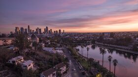
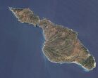
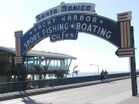
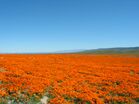
Images, from top down, left to right: Downtown Los Angeles in June 2019; Venice, Los Angeles during sunset; Rodeo Drive in Beverly Hills; satellite picture of Santa Catalina Island; the Santa Monica Pier; Antelope Valley California Poppy Reserve; and the Hollywood Sign | |
| الكنية: "L.A. County" | |
 Interactive map of Los Angeles County | |
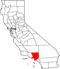 Location in California | |
| الإحداثيات: 34°3′N 118°15′W / 34.050°N 118.250°W | |
| Country | United States |
| State | California |
| Region | Southern California |
| Metro area | Greater Los Angeles |
| Formed | February 18, 1850[2] |
| County seat | Los Angeles |
| Largest city | Los Angeles |
| Incorporated cities | 88 |
| الحكومة | |
| • النوع | Council–CEO |
| • الكيان | Board of Supervisors |
| • Chair | Janice Hahn (D) |
| • Chair Pro Tem | Lindsey Horvath (D) |
| • Board of Supervisors | Supervisors
|
| • Chief Executive Officer | Fesia Davenport |
| المساحة | |
| • الإجمالي | 4٬751 ميل² (12٬310 كم²) |
| • البر | 4٬058 ميل² (10٬510 كم²) |
| • الماء | 693 ميل² (1٬790 كم²) |
| أعلى منسوب | 10٬068 ft (3٬069 m) |
| أوطى منسوب | 0 ft (0 m) |
| التعداد (2022) | |
| • الإجمالي | 9٬861٬224 |
| • الكثافة | 2٬430/sq mi (940/km2) |
| منطقة التوقيت | UTC−8 (Pacific Time Zone) |
| • الصيف (التوقيت الصيفي) | UTC−7 (Pacific Daylight Time) |
| ZIP Codes | 90xxx–918xx, 92397, 92821, 92823, 93243, 935xx[5] |
| Area codes | 213/323, 310/424, 442/760, 562, 626, 657/714, 661, 747/818, 840/909 |
| FIPS code | 06-037 |
| GNIS feature ID | 277283 |
| GDP | $712 billion[6] · 1st |
| Congressional districts | 23rd, 26th, 27th, 28th, 29th, 30th, 31st, 32nd, 34th, 35th, 36th, 37th, 38th, 42nd, 43rd, 44th, 45th |
| الموقع الإلكتروني | lacounty.gov |
مقاطعة لوس أنجلس (بالإنجليزية: Los Angeles County) هي مقاطعة تقع في كاليفورنيا، الولايات المتحدة الأمريكية. عدد سكانها 9,861,224 (في 2022)، وبذلك تكون المقاطعة الأكثر اكتظاظاً بالسكان في الولايات المتحدة. أهم مدنها لوس أنجلس. تتضمن المقاطعة 88 مدينة بالإضافة إلى العديد من المدن الصغيرة (المجموع 136). مساحتها الكلية 12308 كم2 (4752 ميل مربع).[1] Its population is greater than that of 40 individual U.S. states. Comprising 88 incorporated cities and many unincorporated areas within a total area of 4,083 square miles (10,570 km2), it is home to more than a quarter of Californians and is one of the most ethnically diverse U.S. counties.[7] The county's seat, Los Angeles, is the second most populous city in the United States, with about 3.9 million residents. Being the home of the U.S. motion-picture industry, since its inception in the early 20th century, has given the county global prominence.
. . . . . . . . . . . . . . . . . . . . . . . . . . . . . . . . . . . . . . . . . . . . . . . . . . . . . . . . . . . . . . . . . . . . . . . . . . . . . . . . . . . . . . . . . . . . . . . . . . . . . . . . . . . . . . . . . . . . . . . . . . . . . . . . . . . . . . . . . . . . . . . . . . . . . . . . . . . . . . . . . . . . . . . .
التاريخ
Los Angeles County is one of the original counties of California, created at the time of statehood in 1850.[8] The county originally included parts of what are now Kern, San Bernardino, Riverside, Inyo, Tulare, Ventura, and Orange counties. In 1851 and 1852, Los Angeles County stretched from the coast to the state line of Nevada.[9] As the population increased, sections were split off to organize San Bernardino County in 1853, Kern County in 1866, and Orange County in 1889.
Prior to the 1870s, Los Angeles County was divided into townships, many of which were amalgamations of one or more old ranchos.[10] They were:
- Azusa – encompassed the foothill communities east of the San Gabriel River, including present-day Covina and Duarte
- El Monte – encompassed communities in the Whittier Narrows area, including present-day El Monte, La Puente, as well as Monterey Park
- Azusa and El Monte Townships – merged for the 1870 census
- City of Los Angeles – then consisting solely of its four-league Spanish land grant
- Los Angeles Township – consisted of areas surrounding the City of Los Angeles, including the San Fernando Valley and present-day West Los Angeles and East Los Angeles. Most of this area has now been annexed to the city of Los Angeles.
- Los Nietos – consisted of areas south of the Whittier Narrows and Puente Hills south to present-day Long Beach, centered on the early settlement at Los Nietos. Some of this area is now in Orange County
- San Jose – consisted of the eastern portions of the county drained by San Jose Creek, including what is now the cities of Pomona, Claremont and Walnut
- San Gabriel – consisted of the western San Gabriel Valley and foothill communities, including present-day Alhambra and Pasadena. Centered on the Mission San Gabriel
- Santa Ana – consisted of what is now northern and central Orange County, including what is now Fullerton, Huntington Beach and the City of Orange. Centered on Santa Ana).
- For the 1870 census, Anaheim district was enumerated separately[11][12]
- San Juan – consisted of what is now southern Orange County. Centered on Mission San Juan Capistrano
- San Pedro – consisted of the present-day South Bay communities, Compton and western Long Beach. Centered on the wharf of San Pedro. Renamed Wilmington Township by 1870).
- Tejon – consisted of all of northern Los Angeles County and what is now southern Kern County. Centered on Fort Tejon
- When Kern County was formed, the portion of the township remaining in Los Angeles County became Soledad Township.[13] More recently, statewide droughts in California have further strained Los Angeles County's water security[14]
جغرافيا
مساحة مقاطعة لوس أنجلس هي 12308 كم2 (4752 ميل مربع)، 10518 كم2 (4061 ميل2) منها يمثل اليابسة، و 1791 كم2 (691 ميل2) مياه، أو 14.55 % من المساحة الكلية. تقع بالقرب من المحيط الهادي، وبها العديد من الأنهار هي: نهر لوس أنجلس، وريو هوندو، ونهر سان گابرييل، ونهر سانتا كلارا. السلاسل الجبلية الرئيسية بالمقاطعة هي جبال سانتا مونيكا وجبال سان گابرييل.
الأقسام الرئيسية للمقاطعة
- الشرق: إيستسايد، وادي سان گابرييل، وادي پومونا
- الغرب: وستسايد, مدن الشاطئ
- الجنوب: South Bay, شبه جزيرة پالوس ڤردس, جنوب لوس أنجلس، Gateway Cities
- الشمال: وادي سان فرناندو, portions of the Conejo Valley، وأجزاء من Antelope Valley ووادي سانتا كلاريتا
- الوسط: وسط لوس أنجلس, Mid-Wilshire
المدن
توجد 88 مدينة مشهرة في مقاطعة لوس أنجلس. وحسب تعداد الولايات المتحدة في 2010، فإن الأكثر تعداداً هم: [15]
|
|
الديمغرافيا
| التعداد تاريخياً | |||
|---|---|---|---|
| الإحصاء | التعداد | %± | |
| 1850 | 3٬530 | ||
| 1860 | 11٬333 | 221.0% | |
| 1870 | 15٬309 | 35.1% | |
| 1880 | 33٬381 | 118.0% | |
| 1890 | 101٬454 | 203.9% | |
| 1900 | 170٬298 | 67.9% | |
| 1910 | 504٬131 | 196.0% | |
| 1920 | 936٬455 | 85.8% | |
| 1930 | 2٬208٬492 | 135.8% | |
| 1940 | 2٬785٬643 | 26.1% | |
| 1950 | 4٬151٬687 | 49.0% | |
| 1960 | 6٬038٬771 | 45.5% | |
| 1970 | 7٬041٬980 | 16.6% | |
| 1980 | 7٬477٬421 | 6.2% | |
| 1990 | 8٬863٬164 | 18.5% | |
| 2000 | 9٬519٬338 | 7.4% | |
| 2010 | 9٬818٬605 | 3.1% | |
السياسة
| Year | GOP | DEM | Others |
|---|---|---|---|
| 2008 | 28.8% 956,425 | 69.2% 2,295,853 | 2.0% 65,970 |
| 2004 | 35.6% 1,076,225 | 63.2% 1,907,736 | 1.3% 39,319 |
| 2000 | 32.4% 871,930 | 63.5% 1,710,505 | 4.2% 112,719 |
| 1996 | 31.0% 746,544 | 59.3% 1,430,629 | 9.7% 233,841 |
| 1992 | 29.0% 799,607 | 52.5% 1,446,529 | 18.4% 507,267 |
| 1988 | 46.9% 1,239,716 | 51.9% 1,372,352 | 1.2% 32,603 |
| 1984 | 54.5% 1,424,113 | 44.4% 1,158,912 | 1.1% 29,889 |
| 1980 | 50.2% 1,224,533 | 40.2% 979,830 | 9.7% 235,822 |
| 1976 | 47.8 1,174,926 | 49.7% 1,221,893 | 2.5% 62,258 |
| 1972 | 54.8% 1,549,717 | 42.0% 1,189,977 | 3.2% 90,676 |
| 1968 | 47.6% 1,266,480 | 46.0% 1,223,251 | 6.3% 168,251 |
| 1964 | 42.5% 1,161,067 | 57.4% 1,568,300 | 0.1% 1,551 |
| 1960 | 49.4% 1,302,661 | 50.2% 1,323,818 | 0.3% 8,020 |
| 1956 | 55.4% 1,260,206 | 44.3% 1,007,887 | 0.3% 7,331 |
| 1952 | 56.2% 1,278,407 | 42.7% 971,408 | 1.1% 24,725 |
| 1948 | 46.5% 804,232 | 47.0% 812,690 | 6.5% 112,160 |
| 1944 | 42.7% 666,441 | 56.8% 886,252 | 0.6% 8,871 |
| 1940 | 40.6% 574,266 | 58.1% 822,718 | 1.3% 18,285 |
| 1936 | 31.6% 357,401 | 67.0% 757,351 | 1.4% 15,663 |
| 1932 | 38.6% 373,738 | 57.2% 554,476 | 4.3% 41,380 |
| 1928 | 70.2% 513,526 | 28.7% 209,945 | 1.1% 7,830 |
| 1924 | 65.5% 299,675 | 7.3% 33,554 | 27.2% 124,228 |
| 1920 | 69.1% 178,117 | 21.6% 55,661 | 9.3% 23,992 |
مقاطعات مجاورة
- مقاطعة ڤنتورا (الغرب)
- مقاطعة كيرن (الشمال)
- مقاطعة سان برناردينو (الشرق)
- مقاطعة اورنج (الجنوب)
. . . . . . . . . . . . . . . . . . . . . . . . . . . . . . . . . . . . . . . . . . . . . . . . . . . . . . . . . . . . . . . . . . . . . . . . . . . . . . . . . . . . . . . . . . . . . . . . . . . . . . . . . . . . . . . . . . . . . . . . . . . . . . . . . . . . . . . . . . . . . . . . . . . . . . . . . . . . . . . . . . . . . . . .
أكبر المدن
الهامش
- ^ أ ب خطأ استشهاد: وسم
<ref>غير صحيح؛ لا نص تم توفيره للمراجع المسماةLosAngelesCountyDecline2022 - ^ "Chronology". California State Association of Counties. Archived from the original on January 29, 2016. Retrieved February 6, 2015.
- ^ Mount San Antonio in the San Gabriel Mountains, on border with San Bernardino County.
- ^ Sea level at the Pacific Ocean.
- ^ "Archived copy" (PDF). Archived from the original (PDF) on October 20, 2019. Retrieved September 12, 2019.
{{cite web}}: CS1 maint: archived copy as title (link) - ^ "Gross Domestic Product by County, 2021" (PDF). bea.gov. Retrieved December 27, 2018.
- ^ "Newsroom: Population: Census Bureau Releases State and County Data Depicting Nation's Population Ahead of 2010 Census". Census.gov. Archived from the original on August 24, 2012. Retrieved August 23, 2012.
- ^ Coy, Owen C.; Ph.D. (1923). California County Boundaries. Berkeley: California Historical Commission. p. 140. ASIN B000GRBCXG.
{{cite book}}: CS1 maint: multiple names: authors list (link) - ^ "State and County Maps of California". Archived from the original on July 2, 2018. Retrieved July 2, 2018.
- ^ A partial listed can be found for the San Fernando Valley, the Los Angeles basin, the San Gabriel valley, and high desert
- ^ Paul R. Spitzzeri (Fall 2007). "What a Difference a Decade Makes: Ethnic and Racial Demographic Change in Los Angeles County during the 1860s" (PDF). Branding Iron.
- ^ U.S. Census Bureau. "Population of the United States in 1860: California" (PDF).
- ^ Paul R. Spitzzeri (Fall 2007). "What a Difference a Decade Makes: Ethnic and Racial Demographic Change in Los Angeles County during the 1860s" (PDF). Branding Iron. Archived (PDF) from the original on February 4, 2019. Retrieved February 3, 2019.
- ^ "California drought continues after state has its driest January and February on record". www.latimes.com. March 2022. Retrieved May 28, 2022.قالب:SemiBareRefNeedsTitle
- ^ http://quickfacts.census.gov/qfd/states/06/06037.html
وصلات خارجية
- Pages using gadget WikiMiniAtlas
- Short description is different from Wikidata
- Articles with hatnote templates targeting a nonexistent page
- Missing redirects
- Coordinates on Wikidata
- Portal-inline template with redlinked portals
- Pages with empty portal template
- بذرة كاليفورنيا
- مقاطعات كاليفورنيا
- مقاطعة لوس أنجلس، كاليفورنيا
- Geography of Los Angeles County, California
- 1850 establishments in the United States
- صفحات مع الخرائط
