مقاطعة تولير، كاليفورنيا
Tulare County, California | |
|---|---|
| County of Tulare | |
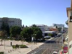
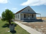
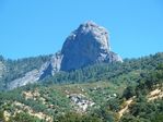
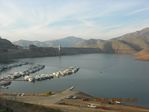
Images, from top down, left to right: Acequia Avenue in Visalia, Allensworth Hotel in Colonel Allensworth State Historic Park, Moro Rock in Sequoia National Park, Lake Kaweah | |
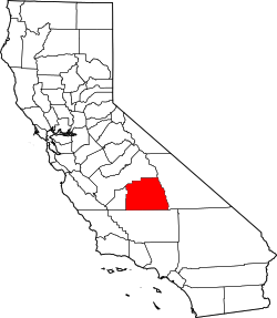 Tulare County's location in California | |
| الإحداثيات: 36°14′N 118°48′W / 36.23°N 118.80°W | |
| Country | |
| State | |
| Regions | San Joaquin Valley and Sierra Nevada |
| Metro area | Visalia-Porterville Metropolitan Area |
| Incorporated | 1852 |
| السمِيْ | Tulare Lake |
| County seat | Visalia |
| Incorporated cities | 8 |
| الحكومة | |
| • Administrative Officer | Michael Spata[1] |
| • Board of Supervisors[2] | |
| المساحة | |
| • الإجمالي | 4٬839 ميل² (12٬530 كم²) |
| • البر | 4٬824 ميل² (12٬490 كم²) |
| • الماء | 14 ميل² (40 كم²) |
| أعلى منسوب | 14٬501 ft (4٬420 m) |
| التعداد | |
| • الإجمالي | 442٬179 |
| • Estimate (2015)[4] | 459٬863 |
| • الكثافة | 91/sq mi (35/km2) |
| منطقة التوقيت | UTC-8 (Pacific) |
| • الصيف (التوقيت الصيفي) | UTC-7 (PDT) |
| Area code | 559 |
| FIPS code | 06-107 |
| GNIS feature ID | 277318 |
| الموقع الإلكتروني | www |
مقاطعة تولير إنگليزية: Tulare County هي إحدى مقاطعات ولاية كاليفورنيا في الولايات المتحدة الأمريكية.
الجغرافيا
البحيرات
- Arctic Lake
- Bullfrog Lakes
- Columbine Lake
- Crescent Lake
- Eagle Lake
- Franklin Lakes
- Lake Kaweah
- Lake Success
- Rockslide Lake
- Rocky Basin Lakes
- Weaver Lake
Rivers
|
|
Parks
|
|
National protected areas
- Blue Ridge National Wildlife Refuge
- Giant Sequoia National Monument (part)
- Inyo National Forest (part)
- Kings Canyon National Park (part)
- Pixley National Wildlife Refuge
- Sequoia National Forest (part)
- Sequoia National Park
Sequoia National Park
Sequoia National Park is a national park in the southern Sierra Nevada, east of Visalia. It was established in 1890 as the second U.S. national park, after Yellowstone. The park spans 404,051 acres (1,635.14 km2). Encompassing a vertical relief of nearly 13,000 feet (3,962 m), the park contains among its natural resources the highest point in the contiguous 48 United States, Mount Whitney, at 14,505 feet (4,421 m) above sea level. The park is south of and contiguous with Kings Canyon National Park; the two are administered by the National Park Service as one unit, called Sequoia and Kings Canyon National Parks.
Demographics
2011
| أظهرPopulation, race, and income |
|---|
Places by population, race, and income
| أظهرPlaces by population and race |
|---|
| أظهرPlaces by population and income |
|---|
2010
The 2010 United States Census reported that Tulare County had a population of 442,179. The racial makeup of Tulare County was 265,618 (60.1%) White, 7,196 (1.6%) African American, 6,993 (1.6%) Native American, 15,176 (3.4%) Asian, 509 (0.1%) Pacific Islander, 128,263 (29.0%) from other races, and 18,424 (4.2%) from two or more races. Hispanic or Latino of any race were 268,065 persons (60.6%).[13]
| أظهرPopulation reported at 2010 United States Census |
|---|
2000
| التعداد التاريخي | |||
|---|---|---|---|
| التعداد | Pop. | %± | |
| 1860 | 4٬638 | — | |
| 1870 | 4٬533 | −2٫3% | |
| 1880 | 11٬281 | 148٫9% | |
| 1890 | 24٬574 | 117٫8% | |
| 1900 | 18٬375 | −25٫2% | |
| 1910 | 35٬440 | 92٫9% | |
| 1920 | 59٬031 | 66٫6% | |
| 1930 | 77٬442 | 31٫2% | |
| 1940 | 107٬152 | 38٫4% | |
| 1950 | 149٬264 | 39٫3% | |
| 1960 | 168٬403 | 12٫8% | |
| 1970 | 188٬322 | 11٫8% | |
| 1980 | 245٬738 | 30٫5% | |
| 1990 | 311٬921 | 26٫9% | |
| 2000 | 368٬021 | 18�0% | |
| 2010 | 442٬179 | 20٫2% | |
| 2015 (تق.) | 459٬863 | [14] | 4�0% |
| U.S. Decennial Census[15] 1790-1960[16] 1900-1990[17] 1990-2000[18] 2010-2015[4] | |||
Politics
Voter registration statistics
| أظهرPopulation and registered voters |
|---|
Cities by population and voter registration
| أظهرCities by population and voter registration |
|---|
Overview
| Year | GOP | DEM | Others |
|---|---|---|---|
| 2016 | 52.0% 54,340 | 41.0% 42,838 | 7.1% 7,372 |
| 2012 | 56.2% 56,956 | 41.2% 41,752 | 2.5% 2,571 |
| 2008 | 56.6% 59,765 | 41.3% 43,634 | 2.0% 2,126 |
| 2004 | 66.2% 65,399 | 32.9% 32,494 | 1.0% 967 |
| 2000 | 60.2% 54,070 | 36.8% 33,006 | 3.1% 2,742 |
| 1996 | 53.9% 46,272 | 38.1% 32,669 | 8.1% 6,905 |
| 1992 | 45.7% 40,482 | 35.2% 31,188 | 19.1% 16,883 |
| 1988 | 59.6% 46,891 | 39.0% 30,711 | 1.4% 1,067 |
| 1984 | 63.9% 51,066 | 35.1% 28,065 | 1.0% 812 |
| 1980 | 58.3% 41,317 | 35.5% 25,155 | 6.2% 4,374 |
| 1976 | 54.5% 31,864 | 43.7% 25,551 | 1.8% 1,027 |
| 1972 | 59.9% 36,048 | 36.2% 21,775 | 3.9% 2,327 |
| 1968 | 52.2% 29,314 | 39.5% 22,180 | 8.4% 4,695 |
| 1964 | 39.8% 22,527 | 60.1% 33,974 | 0.1% 51 |
| 1960 | 54.0% 29,456 | 45.6% 24,887 | 0.4% 239 |
| 1956 | 52.5% 26,051 | 47.2% 23,407 | 0.3% 160 |
| 1952 | 57.1% 30,108 | 42.1% 22,208 | 0.8% 437 |
| 1948 | 47.0% 18,414 | 50.2% 19,681 | 2.8% 1,097 |
| 1944 | 49.3% 16,005 | 50.0% 16,221 | 0.7% 238 |
| 1940 | 42.9% 15,414 | 56.0% 20,129 | 1.2% 428 |
| 1936 | 30.8% 8,624 | 67.7% 18,956 | 1.6% 435 |
| 1932 | 32.3% 8,066 | 62.5% 15,631 | 5.2% 1,302 |
| 1928 | 63.8% 12,057 | 35.1% 6,635 | 1.2% 218 |
| 1924 | 50.8% 9,484 | 18.3% 3,425 | 30.9% 5,765 |
| 1920 | 61.3% 9,136 | 32.4% 4,837 | 6.3% 941 |
Tulare is a strongly Republican county in Presidential and congressional elections. The last Democratic candidate for President to win a majority in the county was Lyndon Johnson in 1964.
In the United States House of Representatives, Tulare County is split between 3 congressional districts:[21]
- California's 21st congressional district, represented by قالب:Representative/format/pfl
- California's 22nd congressional district, represented by قالب:Representative/format/pfl and
- California's 23rd congressional district, represented by قالب:Representative/format/pfl.[22]
In the California State Senate, it is split between 3 legislative districts:[23]
- the 8 Senate District, represented by Republican Tom Berryhill,
- the 14 Senate District, represented by Republican Andy Vidak, and
- the 16 Senate District, represented by Republican Jean Fuller.
In the California State Assembly, the county is split between the 23rd Assembly District, represented by Republican Jim Patterson, and the 26 Assembly District, represented by Republican Devon Mathis.[24]
الاقتصاد
Communities
Cities
Census designated places
- Allensworth
- Alpaugh
- California Hot Springs
- Camp Nelson
- Cedar Slope
- Cutler
- Delft Colony
- Ducor
- Earlimart
- East Orosi
- East Porterville
- East Tulare Villa
- El Rancho
- Goshen
- Hartland
- Idlewild
- Ivanhoe
- Kennedy Meadows
- Lemon Cove
- Lindcove
- Linnell Camp
- London
- Matheny
- McClenney Tract
- Monson
- Orosi
- Panorama Heights
- Patterson Tract
- Pierpoint
- Pine Flat
- Pixley
- Plainview
- Ponderosa
- Poplar-Cotton Center
- Posey
- Poso Park
- Richgrove
- Rodriguez Camp
- Sequoia Crest
- Seville
- Silver City
- Springville
- Strathmore
- Sugarloaf Mountain Park
- Sugarloaf Saw Mill
- Sugarloaf Village
- Sultana
- Terra Bella
- Teviston
- Three Rivers
- Tipton
- Tonyville
- Tooleville
- Traver
- Waukena
- West Goshen
- Wilsonia
- Woodville
- Yettem
Other unincorporated communities
Indian reservation
Population ranking
The population ranking of the following table is based on the 2010 census of Tulare County.[25]
† county seat
| Rank | City/Town/etc. | Municipal type | Population (2010 Census)
|
|---|---|---|---|
| 1 | † Visalia | City | 124,442 |
| 2 | Tulare | City | 59,278 |
| 3 | Porterville | City | 54,165 |
| 4 | Dinuba | City | 21,453 |
| 5 | Lindsay | City | 11,768 |
| 6 | Farmersville | City | 10,588 |
| 7 | Exeter | City | 10,334 |
| 8 | Orosi | CDP | 8,778 |
| 9 | Earlimart | CDP | 8,357 |
| 10 | Woodlake | City | 7,279 |
| 11 | East Porterville | CDP | 6,767 |
| 12 | Cutler | CDP | 5,000 |
| 13 | Ivanhoe | CDP | 4,495 |
| t-14 | Pixley | CDP | 3,310 |
| t-14 | Terra Bella | CDP | 3,310 |
| 15 | Goshen | CDP | 3,006 |
| 16 | Richgrove | CDP | 2,882 |
| 17 | Strathmore | CDP | 2,819 |
| 18 | Tipton | CDP | 2,543 |
| 19 | Poplar-Cotton Center | CDP | 2,470 |
| 20 | Three Rivers | CDP | 2,182 |
| 21 | London | CDP | 1,869 |
| 22 | Patterson Tract | CDP | 1,752 |
| 23 | Woodville | CDP | 1,740 |
| 24 | Teviston | CDP | 1,214 |
| 25 | Matheny | CDP | 1,212 |
| 26 | Tule River Reservation[26] | AIAN | 1,049 |
| 27 | Alpaugh | CDP | 1,026 |
| 28 | Plainview | CDP | 945 |
| 29 | Springville | CDP | 934 |
| 30 | Linnell Camp | CDP | 849 |
| 31 | East Tulare Villa | CDP | 778 |
| 32 | Sultana | CDP | 775 |
| 33 | Traver | CDP | 713 |
| 34 | Ducor | CDP | 612 |
| 35 | West Goshen | CDP | 511 |
| 36 | East Orosi | CDP | 495 |
| 37 | Seville | CDP | 480 |
| 38 | Allensworth | CDP | 471 |
| 39 | Delft Colony | CDP | 454 |
| 40 | Lindcove | CDP | 406 |
| 41 | Tooleville | CDP | 339 |
| 42 | Tonyville | CDP | 316 |
| 43 | Lemon Cove | CDP | 308 |
| 44 | Yettem | CDP | 211 |
| 45 | Monson | CDP | 188 |
| 46 | Pine Flat | CDP | 166 |
| 47 | Rodriguez Camp | CDP | 156 |
| 48 | El Rancho | CDP | 124 |
| 49 | Waukena | CDP | 108 |
| 50 | Camp Nelson | CDP | 97 |
| 51 | Pierpoint | CDP | 52 |
| 52 | Idlewild | CDP | 43 |
| 53 | Panorama Heights | CDP | 41 |
| 54 | California Hot Springs | CDP | 37 |
| 55 | Hartland | CDP | 30 |
| 56 | Kennedy Meadows | CDP | 28 |
| 57 | Sugarloaf Saw Mill | CDP | 18 |
| 58 | Ponderosa | CDP | 16 |
| t-59 | McClenney Tract | CDP | 10 |
| t-59 | Posey | CDP | 10 |
| t-59 | Sequoia Crest | CDP | 10 |
| t-59 | Sugarloaf Village | CDP | 10 |
| 60 | Poso Park | CDP | 9 |
| 61 | Wilsonia | CDP | 5 |
| t-62 | Cedar Slope | CDP | 0 |
| t-62 | Silver City | CDP | 0 |
| t-62 | Sugarloaf Mountain Park | CDP | 0 |
See also
- List of museums in the San Joaquin Valley
- National Register of Historic Places listings in Tulare County, California
- Tulare Lake
- Tule
Notes
References
- ^ "County Administrative Officer - CAO". County of Tulare. Retrieved February 8, 2015.
- ^ "Home - Board of Supervisors". County of Tulare. Retrieved March 24, 2017.
- ^ "Mount Whitney". Peakbagger.com. Retrieved February 9, 2015.
- ^ أ ب ت خطأ استشهاد: وسم
<ref>غير صحيح؛ لا نص تم توفيره للمراجع المسماةQF - ^ أ ب ت ث ج ح خ د ذ ر ز س ش ص ض ط U.S. Census Bureau. American Community Survey, 2011 American Community Survey 5-Year Estimates, Table B02001. American FactFinder. Retrieved 2013-10-26.
- ^ أ ب U.S. Census Bureau. American Community Survey, 2011 American Community Survey 5-Year Estimates, Table B03003. American FactFinder. Retrieved 2013-10-26.
- ^ أ ب U.S. Census Bureau. American Community Survey, 2011 American Community Survey 5-Year Estimates, Table B19301. American FactFinder. Retrieved 2013-10-21.
- ^ أ ب U.S. Census Bureau. American Community Survey, 2011 American Community Survey 5-Year Estimates, Table B19013. American FactFinder. Retrieved 2013-10-21.
- ^ أ ب U.S. Census Bureau. American Community Survey, 2011 American Community Survey 5-Year Estimates, Table B19113. American FactFinder. Retrieved 2013-10-21.
- ^ أ ب U.S. Census Bureau. American Community Survey, 2011 American Community Survey 5-Year Estimates. American FactFinder. Retrieved 2013-10-21.
- ^ U.S. Census Bureau. American Community Survey, 2011 American Community Survey 5-Year Estimates, Table B01003. American FactFinder. Retrieved 2013-10-21.
- ^ أ ب ت ث ج ح خ د ذ ر ز س ش ص ض ط ظ ع غ ف ق ك ل م ن هـ و ي أأ أب أت أث أج أح أخ أد أذ أر Data unavailable
- ^ قالب:USCensus2010CA
- ^ "County Totals Dataset: Population, Population Change and Estimated Components of Population Change: April 1, 2010 to July 1, 2015". Retrieved July 2, 2016.
- ^ "U.S. Decennial Census". United States Census Bureau. Retrieved May 31, 2014.
- ^ "Historical Census Browser". University of Virginia Library. Retrieved May 31, 2014.
- ^ "Population of Counties by Decennial Census: 1900 to 1990". United States Census Bureau. Retrieved May 31, 2014.
- ^ "Census 2000 PHC-T-4. Ranking Tables for Counties: 1990 and 2000" (PDF). United States Census Bureau. Retrieved May 31, 2014.
- ^ أ ب ت ث ج ح خ د ذ ر ز س ش ص ض ط ظ California Secretary of State. February 10, 2013 - Report of Registration. Retrieved 2013-10-31.
- ^ http://uselectionatlas.org/RESULTS/
- ^ "Counties by County and by District". California Citizens Redistricting Commission. Retrieved September 24, 2014.
- ^ قالب:Cite GovTrack
- ^ "Communities of Interest — County". California Citizens Redistricting Commission. Retrieved September 28, 2014.
- ^ "Communities of Interest — County". California Citizens Redistricting Commission. Retrieved September 28, 2014.
- ^ http://www.census.gov/2010census/
- ^ http://www.census.gov/2010census/popmap/ipmtext.php?fl=4300
للاستزادة
- Jennifer Medina, "With Dry Taps and Toilets, California Drought Turns Desperate," New York Times, Oct. 2, 2014.
وصلات خارجية
- Official website

- Tulare County Agricultural Commissioner/Sealer official website (with Annual Crop and Livestock Reports)

|
Fresno County | 
| ||
| Inyo County | Kings County | |||
| Kern County |
- Pages using gadget WikiMiniAtlas
- Short description is different from Wikidata
- Coordinates on Wikidata
- Articles containing إنگليزية-language text
- Pages using Lang-xx templates
- Pages using US Census population needing update
- Pages using div col with unknown parameters
- Portal-inline template with redlinked portals
- Pages with empty portal template
- Tulare County, California
- California counties
- San Joaquin Valley
- 1852 establishments in California
- Populated places established in 1852
- مقاطعات ولاية كاليفورنيا الأمريكية
