زامبيا
جمهورية زامبيا Zambia | |
|---|---|
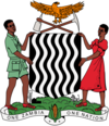
الشعار الحادي: "زامبيا واحدة، أمة واحدة" | |
 موقع زامبيا (الأزرق الداكن) | |
 | |
| العاصمة | لوساكا 15°25′S 28°17′E / 15.417°S 28.283°E |
| أكبر مدينة | العاصمة |
| اللغات الرسمية | الإنگليزية |
| اللغات الإقليمية المعترف بها | |
| الجماعات العرقية (2010[2]) | |
| الدين | Christianity (official)[3] |
| صفة المواطن | زامبي |
| الحكومة | جمهورية رئاسية |
• الرئيس | Hakainde Hichilema |
| Mutale Nalumango | |
| التشريع | الجمعية الوطنية |
| الاستقلال | |
| 27 يونيو 1890 | |
| 28 نوفمبر 1899 | |
| 29 January 1900 | |
| 17 August 1911 | |
| 1 أغسطس 1953 | |
| 24 October 1964 | |
| 5 يناير 2016 | |
| المساحة | |
• الإجمالية | 752.618 km2 (290.587 sq mi)[4] (39) |
• الماء (%) | 1 |
| التعداد | |
• تقدير 2023 | 20,216,029[5] (63rd) |
• الكثافة | 17.2/km2 (44.5/sq mi) (191st) |
| ن.م.إ. (ق.ش.م.) | تقدير 2019 |
• الإجمالي | $75.857 billion[6] |
• للفرد | $4,148[6] |
| ن.م.إ. (الإسمي) | تقدير 2019 |
• الإجمالي | $23.946 billion[6] |
• للفرد | $1,307[6] |
| جيني (2015) | 57.1[7] high |
| م.ت.ب. (2019) | medium · 146th |
| العملة | كواتشا زامبية (ZMW) |
| التوقيت | UTC+2 (CAT) |
| صيغة التاريخ | dd/mm/yyyy |
| جانب السواقة | left |
| مفتاح الهاتف | +260 |
| النطاق العلوي للإنترنت | .zm |
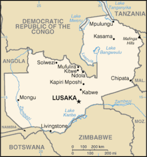
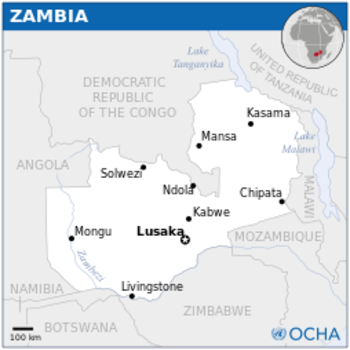
جمهورية زامبيا /ˈzæmbiə/، هي بلد حبيس في أفريقيا الجنوبية،[9] تجاورها جمهورية الكونغو الديمقراطية من الشمال، تنزانيا من الشمال الرقي، ملاوي من الغرب. عاصمتها مدينة لوساكا، في المنطقة الجنوبية الوسطى من البلاد. يتركز سكانها حول لوساكا في الجنوب وفي محافظة كوپربلت في الشمال الغربي.
سكانها الأصليين من شعوب الخويسان، وكانت المنطقة قد استعمرات أثناء مد البانتو في القرن الثالث عشر. بعد زيارات المستكشفين الأوروپيين في القرن الثامن عشر، أصبحت زامبيا محمية روديسيا الشمالية البريطانية حتى نهاية القرن التاسع عشر. معظم الفترة الاستعمارية، كانت البلاد تحت حكم ادارة تعينها لندن بمشورة شركة جنوب أفريقيا البريطانية.
في 28 أكتوبر 1964، نالت البلاد استقلالها عن المملكة المتحدة وأصبح كنث كاوندا رئيساً المتوج. حزب الاستقلال الوطني المتحد، حزب اشتراكي بزعامة كاوندا، سيطر على السلطة من 1964 حتى 1991. من 1972 حتى 1991 كانت زامبيا دولة حزب واحد حيث يعتبر حزب الاستقلال الوطني المتحد هو الحزب السياسي القانوني الوحيد تحت شعار زامبيا واحدة، أمة واحدة. عام 1991 جاء فردريك چيبولا خلفاً لكوندا، وينتمي إلى الحزب الديمقراطي الاشتراكي الحركة من أجل ديمقراطية متعددة الأحزاب، لتبدأ فترة من النمو الاجتماعي-الاقتصادي ولنتهي الحكومة المركزية. لـِڤي مواناواسا، خليفة چيبولا المختار، تولى الحكم من يناير 2002 حتى وفاته في أغسطس 2008، ويرجع له الفضل في حملات تقليل الفساد وزيادة معيار الحياة. بعد وفاة مواناواسا، خلفه روپيا باندا كرئيساً بالإنابة قبل انتخابه رئيساً عام 2008. تولى المنصب ثلاث سنوات فقط، بعد هزيمته في انتخابات 2011 من قبل مايكل ساتا مرشح حزب الجبهة الوطنية.
توفى سانتا في 28 أكتوبر 2014 ليخلفه نائبه گاي سكوت.
التسمية
أراضي ما تعرف اليوم بزامبيا كانت تعرف باسم روديسيا الشمالية من 1911. أعيد تسميتها إلى زامبيا عند اعلان استقلالها عام 1964، الاسم الجديد لزامبيا مشتق من نهر زامبيزي (زامبيزي قد يكون اسم "إله النهر")[بحاجة لمصدر] والذي ينبع من تلال كالني في المنطقة الشمالية الغربية من البلاد ويتدفق غرباً ويشكل حدودها الجنوبية.
التاريخ
عصر ما قبل التاريخ
Archaeological excavation work on the Zambezi Valley and Kalambo Falls shows a succession of human cultures. Ancient camp site tools near the Kalambo Falls have been radiocarbon dated to more than 36,000 years ago.
The fossil skull remains of Broken Hill Man (also known as Kabwe Man), dated between 300,000 and 125,000 years BC, further shows that the area was inhabited by early humans.[10] Broken Hill Man was discovered in Zambia in Kabwe District.
الخويسان والباتوا
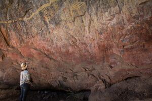
Modern Zambia once was inhabited by the Khoisan and Batwa peoples until around AD 300, when migrating Bantu began to settle the areas.[11] It is believed the Khoisan people originated in East Africa and spread southwards around 150,000 years ago. The Twa people were split into two groups: the Kafwe Twa lived around the Kafue Flats and the Lukanga Twa who lived around the Lukanga Swamp.[12] Many examples of ancient rock art in Zambia, like the Mwela Rock Paintings, Mumbwa Caves, and Nachikufu Cave, are attributed to these early hunter-gatherers.[13]The Khoisan and especially the Twa formed a patron-client relationship with farming Bantu peoples across central and southern Africa but were eventually either displaced by or absorbed into the Bantu groups.
البانتو (أبانتو)
The Bantu people or Abantu (meaning people) are an enormous and diverse ethnolinguistic group that comprise the majority of people in much of eastern, southern and central Africa. Due to Zambia's location at the crossroads of Central Africa, Southern Africa, and the African Great Lakes, the history of the people that constitute modern Zambians is a history of these three regions.
Many of the historical events in these three regions happened simultaneously, and thus Zambia's history, like that of many African nations, cannot be presented perfectly chronologically. The early history of the peoples of modern Zambia is deduced from oral records, archaeology, and written records, mostly from non-Africans.[14]
أصول البانتو
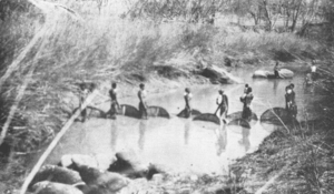
The Bantu people originally lived in West and Central Africa around what is today Cameroon and Nigeria.[15] Around 5000 years ago they began a millennia-long expansion into much of the continent. This event has been called the Bantu expansion;[16] it was one of the largest human migrations in history. The Bantu are believed to have been the first to have brought iron working technology into large parts of Africa. The Bantu Expansion happened primarily through two routes: a western one via the Congo Basin and an eastern one via the African Great Lakes.[17]
أول استيطان للبانتو
The first Bantu people to arrive in Zambia came through the eastern route via the African Great Lakes. They arrived around the first millennium C.E, and among them were the Tonga people (also called Ba-Tonga, "Ba-" meaning "men") and the Ba-Ila and Namwanga and other related groups, who settled around Southern Zambia near Zimbabwe. Ba-Tonga oral records indicate that they came from the east near the "big sea".
They were later joined by the Ba-Tumbuka who settled around Eastern Zambia and Malawi.
These first Bantu people lived in large villages. They lacked an organised unit under a chief or headman and worked as a community and help each other in times of field preparation for their crops. Villages moved around frequently as the soil became exhausted as a result of the slash-and-burn technique of planting crops. The people also keep large herds of cattle, which formed an important part of their societies.[18]
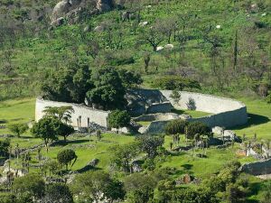
The first Bantu communities in Zambia were highly self-sufficient. Early European missionaries who settled in Wl southern Zambia noted the independence of these Bantu societies. One of these missionaries noted: "[If] weapons for war, hunting, and domestic purposes are needed, the [Tonga] man goes to the hills and digs until he finds the iron ore. He smelts it and with the iron thus obtained makes axes, hoes, and other useful implements. He burns wood and makes charcoal for his forge. His bellows are made from the skins of animals and the pipes are clay tile, and the anvil and hammers are also pieces of the iron he has obtained. He moulds, welds, shapes, and performs all the work of the ordinary blacksmith."[19]
These early Bantu settlers also participated in the trade at the site Ingombe Ilede (which translates to sleeping cow in Chi-Tonga because the fallen baobab tree appears to resemble a cow) in Southern Zambia. At this trading site they met numerous Kalanga/Shona traders from Great Zimbabwe and Swahili traders from the East African Swahili coast. Ingombe Ilede was one of the most important trading posts for rulers of Great Zimbabwe, others being the Swahili port cities like Sofala.
The goods traded at Ingombe Ilede included fabrics, beads, gold, and bangles. Some of these items came from what is today southern Democratic Republic of Congo and Kilwa Kisiwani while others came from as far away as India, China and the Arab world.[20] The African traders were later joined by the Portuguese in the 16th century.[21]
The decline of Great Zimbabwe, due to increasing trade competition from other Kalanga/Shona kingdoms like Khami and Mutapa, spelt the end of Ingombe Ilede.
ثاني استيطان للبانتو
The second mass settlement of Bantu people into Zambia was of people groups that are believed to have taken the western route of the Bantu migration through the Congo Basin. These Bantu people spent the majority of their existence in what is today the Democratic Republic of Congo and are ancestors of the majority of modern Zambians.[22]
While there is some evidence that the Bemba people or AbaBemba have a strong ancient connection to the Kongo Kingdom through BaKongo ruler Mwene Kongo VIII Mvemba, this is not well documented.
دويلات لوبا-لوندا
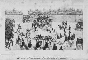
The Bemba, along with other related groups like the Lamba, Bisa, Senga, Kaonde, Swaka, Nkoya and Soli, formed integral parts of the Luba Kingdom in Upemba part of the Democratic Republic of Congo and have a strong relation to the BaLuba people. The area which the Luba Kingdom occupied has been inhabited by early farmers and iron workers since the 300s C.E.
Over time these communities learned to use nets and harpoons, make dugout canoes, clear canals through swamps and make dams as high as 2.5 meters (8 ft 2 in). As a result, they grew a diverse economy trading fish, copper and iron items and salt for goods from other parts of Africa, like the Swahili coast and, later on, the Portuguese. From these communities arose the Luba Kingdom in the 14th century.[23]
The Luba Kingdom was a large kingdom with a centralised government and smaller independent chiefdoms. It had large trading networks that linked the forests in the Congo Basin and the mineral-rich plateaus of what is today Copperbelt Province and stretched from the Atlantic coast to the Indian Ocean coast. The arts were also held in high esteem in the kingdom, and artisans were held in high regard.[23]
Literature was well developed in the Luba Kingdom. One renowned Luba genesis story that articulated the distinction between two types of Luba emperors goes as follows:
Nkongolo Mwamba, the red king, and Ilunga Mbidi Kiluwe, a prince of legendary black complexion. Nkongolo Mwamba is the drunken and cruel despot, Ilunga Mbidi Kiluwe the refined and gentle prince. Nkongolo the Red is a man without manners, a man who eats in public, gets drunk, and cannot control himself, whereas [Ilunga] Mbidi Kiluwe is a man of reservation, obsessed with good manners; he does not eat in public, controls his language and his behaviour, and keeps a distance from the vices and modus vivendi of ordinary people. Nkongolo Mwamba symbolizes the embodiment of tyranny, whereas Mbidi Kiluwe remains the admired caring and compassionate kin.[24]
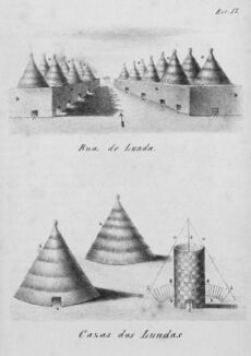
In the same region of Southern Congo the Lunda people were made into a satellite of the Luba empire and adopted forms of Luba culture and governance, thus becoming the Lunda Empire to the south. According to Lunda genesis myths, a Luba hunter named Chibinda Ilunga, son of Ilunga Mbidi Kiluwe, introduced the Luba model of statecraft to the Lunda sometime around 1600 when he married a local Lunda princess named Lueji and was granted control of her kingdom. Most rulers who claimed descent from Luba ancestors were integrated into the Luba empire. The Lunda kings, however, remained separate and actively expanded their political and economic dominance over the region.[23]
The Lunda, like its parent state Luba, also traded with both coasts, the Atlantic and Indian Oceans. While ruler Mwaant Yaav Naweej had established trade routes to the Atlantic coast and initiated direct contact with European traders eager for slaves and forest products and controlling the regional Copper trade, and settlements around Lake Mweru regulated commerce with the East African coast.[23]
The Luba-Lunda states eventually declined as a result of both Atlantic slave trade in the west and Indian Ocean slave trade in the east and wars with breakaway factions of the kingdoms. The Chokwe, a group that is closely related to the Luvale and formed a Lunda satellite state, initially suffered from the European demand for slaves, but once they broke away from the Lunda state, they themselves became notorious slave traders, exporting slaves to both coasts.
The Chokwe eventually were defeated by the other ethnic groups and the Portuguese.[25] This instability caused the collapse of the Luba-Lunda states and a dispersal of people into various parts of Zambia from the Democratic Republic of the Congo. The majority of Zambians trace their ancestry to the Luba-Lunda and surrounding Central African states.[26]
اتحاد الماراڤي
In the 1200s, before the founding of the Luba-Lunda states, a group of Bantu people started migrating from the Congo Basin to Lake Mweru then finally settled around Lake Malawi. These migrants are believed to have been one of the inhabitants around the Upemba area in the Democratic Republic of Congo. By the 1400s these groups of migrants collectively called the Maravi, and most prominently among them was the Chewa people (AChewa), who started assimilating other Bantu groups like the Tumbuka.[27]
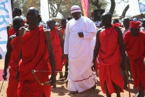
In 1480 the Maravi Empire was founded by the kalonga (paramount chief of the Maravi) from the Phiri clan, one of the main clans, with the others being Banda, Mwale and Nkhoma. The Maravi Empire stretched from the Indian Ocean through what today is Mozambique to Zambia and large parts of Malawi. The political organization of the Maravi resembled that of the Luba and is believed to have originated from there. The primary export of the Maravi was ivory, which was transported to Swahili brokers.[27]
Iron was also manufactured and exported. In the 1590s the Portuguese endeavoured to take monopoly over Maravi export trade. This attempt was met with outrage by the Maravi of Lundu, who unleashed their WaZimba armed force. The WaZimba sacked the Portuguese trade towns of Tete, Sena and various other towns.[28]
The Maravi are also believed to have brought the traditions that would become Nyau secret society from Upemba. The Nyau form the cosmology or indigenous religion of the people of Maravi. The Nyau society consists of ritual dance performances and masks used for the dances; this belief system spread around the region.[29]
The Maravi declined as a result of succession disputes within the confederacy, attack by the Ngoni and slave raids from the Yao.[28]
إمبراطورية موتاپا و مفـِكانى
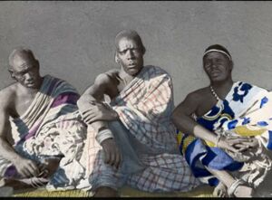
As Great Zimbabwe was in decline, one of its princes, Nyatsimba Mutota, broke away from the state forming a new empire called Mutapa. The title of Mwene Mutapa, meaning "Ravager of the Lands", was bestowed on him and subsequent rulers.[30]
The Mutapa Empire ruled territory between the Zambezi and Limpopo rivers, in what is now Zambia, Zimbabwe and Mozambique, from the 14th to the 17th century. By its, peak Mutapa had conquered the Dande area of the Tonga and Tavara. The Mutapa Empire predominately engaged in the Indian Ocean transcontinental trade with and via the WaSwahili. The primary exported gold and ivory for silk and ceramics from Asia.[31]
Like their contemporaries in Maravi, Mutapa had problems with the arriving Portuguese traders. The peak of this uneasy relationship was reached when the Portuguese attempted to influence the kingdoms internal affairs by establishing markets in the kingdom and converting the population to Christianity. This action caused outrage by the Muslim WaSwahili living in the capital, this chaos gave the Portuguese the excuse they were searching for to warrant an attack on the kingdom and try to control its gold mines and ivory routes. This attack failed when the Portuguese succumbed to disease along the Zambezi river.[32]
In the 1600s internal disputes and civil war began the decline of Mutapa. The weakened kingdom was finally conquered by the Portuguese and was eventually taken over by rival Shona states.[32]
The Portuguese also had vast estates, known as Prazos, and they used slaves and ex-slaves as security guards and hunters. They trained the men in military tactics and gave them guns. These men became expert elephant hunters and were known as the Chikunda. After the decline of the Portuguese the Chikunda made their way to Zambia.[33]
It is hypothesised by Julian Cobbing that the presence of early Europeans slave trading and attempts to control resources in various parts of Bantu-speaking Africa caused the gradual militarization of the people in the region. This can be observed with the Maravi's WaZimba warrior caste, who, once defeating the Portuguese, remained quite militaristic afterwards.
The Portuguese presence in the region was also a major reason for the founding of the Rozvi Empire, a breakaway state of Mutapa. The ruler of the Rozvi, Changamire Dombo, became one of the most powerful leaders in South-Central Africa's history. Under his leadership, the Rozvi defeated the Portuguese and expelled them from their trading posts along the Zambezi river.[34]
But perhaps the most notable instance of this increased militarization was the rise of the Zulu under the leadership of Shaka. Pressures from the English colonialists in the Cape and increased militarization of the Zulu resulted in the Mfecane (the crushing). The Zulu expanded by assimilating the women and children of tribes they defeated, if the men of these Nguni tribes escaped slaughter, they used the military tactics of the Zulu to attack other groups.[35]
This caused mass displacements, wars and raids throughout Southern, Central and Eastern Africa as Nguni or Ngoni tribes made their way throughout the region and is referred to as the Mfecane. The arriving Nguni under the leadership of Zwagendaba crossed the Zambezi river moving northwards. The Ngoni were the final blow to the already weakened Maravi Empire. Many Nguni eventually settled around what is today Zambia, Malawi, Mozambique and Tanzania and assimilated into neighbouring tribes.[35]
In the western part of Zambia, another Southern African group of Sotho-Tswana heritage called the Kololo manage to conquer the local inhabitants who were migrants from the fallen Luba and Lunda states called the Luyana or Aluyi. The Luyana established the Barotse Kingdom on the floodplains of the Zambezi upon their arrival from Katanga. Under the Kololo, the Kololo language was imposed upon the Luyana until the Luyana revolted and overthrew the Kololo by this time the Luyana language was largely forgotten and a new hybrid language emerged, SiLozi and the Luyana began to refer to themselves as Lozi.[36]
At the end of the 18th century, some of the Mbunda migrated to Barotseland, Mongu upon the migration of among others, the Ciyengele.[37][38] The Aluyi and their leader, the Litunga Mulambwa, especially valued the Mbunda for their fighting ability.
By the late 19th century, most of the various peoples of Zambia were established in their current areas.
ما قبل الاستعمار
الأوروپيون
One of the earliest recorded Europeans to visit the area was the Portuguese explorer Francisco de Lacerda in the late 18th century. Lacerda led an expedition from Mozambique to the Kazembe region in Zambia (with the goal of exploring and to crossing Southern Africa from coast to coast for the first time),[39] and died during the expedition in 1798. The expedition was from then on led by his friend Francisco Pinto.[40] This territory, located between Portuguese Mozambique and Portuguese Angola, was claimed and explored by Portugal in that period.
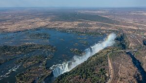
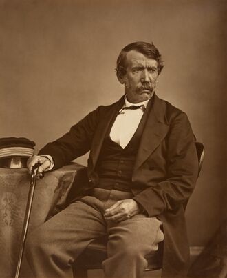
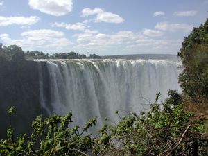
Other European visitors followed in the 19th century. The most prominent of these was David Livingstone, who had a vision of ending the slave trade through the "3 Cs": Christianity, Commerce, and Civilisation. He was the first European to see the magnificent waterfalls on the Zambezi River in 1855, naming them the Victoria Falls after Queen Victoria of the United Kingdom. He described them thus: "Scenes so lovely must have been gazed upon by angels in their flight".[41]
Locally the falls are known as "Mosi-o-Tunya" or "thundering smoke" in the Lozi or Kololo dialect. The town of Livingstone, near the Falls, is named after him. Highly publicised accounts of his journeys motivated a wave of European visitors, missionaries and traders after his death in 1873.[42]
British South Africa Company
In 1888, the British South Africa Company (BSA Company), led by Cecil Rhodes, obtained mineral rights from the Litunga of the Lozi people, the Paramount Chief of the Lozi (Ba-rotse) for the area which later became Barotziland-North-Western Rhodesia.[43]
To the east, in December 1897 a group of the Angoni or Ngoni (originally from Zululand) rebelled under Tsinco, son of King Mpezeni, but the rebellion was put down,[44] and Mpezeni accepted the Pax Britannica. That part of the country then came to be known as North-Eastern Rhodesia. In 1895, Rhodes asked his American scout Frederick Russell Burnham to look for minerals and ways to improve river navigation in the region, and it was during this trek that Burnham discovered major copper deposits along the Kafue River.[45]
North-Eastern Rhodesia and Barotziland-North-Western Rhodesia were administered as separate units until 1911 when they were merged to form Northern Rhodesia, a British protectorate. In 1923, the BSA Company ceded control of Northern Rhodesia to the British Government after the government decided not to renew the company's charter.
الاستعمار البريطاني
In 1923, Southern Rhodesia (now Zimbabwe), a conquered territory which was also administered by the BSA Company, became a self-governing British colony. In 1924, after negotiations, the administration of Northern Rhodesia transferred to the British Colonial Office.
- Federation of Rhodesia and Nyasaland
In 1953, the creation of the Federation of Rhodesia and Nyasaland grouped together Northern Rhodesia, Southern Rhodesia, and Nyasaland (now Malawi) as a single semi-autonomous region. This was undertaken despite opposition from a sizeable minority of the population, who demonstrated against it in 1960–61.[46] Northern Rhodesia was the center of much of the turmoil and crisis characterizing the federation in its last years. Initially, Harry Nkumbula's African National Congress (ANC) led the campaign, which Kenneth Kaunda's United National Independence Party (UNIP) subsequently took up.
الاستقلال
A two-stage election held in October and December 1962 resulted in an African majority in the legislative council and an uneasy coalition between the two African nationalist parties. The council passed resolutions calling for Northern Rhodesia's secession from the federation and demanding full internal self-government under a new constitution and a new National Assembly based on a broader, more democratic franchise.[بحاجة لمصدر]
The federation was dissolved on 31 December 1963, and in January 1964, Kaunda won the only election for Prime Minister of Northern Rhodesia. The Colonial Governor, Sir Evelyn Hone, was very close to Kaunda and urged him to stand for the post. Soon after, there was an uprising in the north of the country known as the Lumpa Uprising led by Alice Lenshina – Kaunda's first internal conflict as leader of the nation.[47]
Northern Rhodesia became the Republic of Zambia on 24 October 1964, with Kenneth Kaunda as the first president. At independence, despite its considerable mineral wealth, Zambia faced major challenges. Domestically, there were few trained and educated Zambians capable of running the government, and the economy was largely dependent on foreign expertise. This expertise was provided in part by John Willson CMG[48] There were over 70,000 Europeans resident in Zambia in 1964, and they remained of disproportionate economic significance.[49]
بعد الاستقلال
Kaunda's endorsement of Patriotic Front guerrillas conducting raids into neighbouring (Southern) Rhodesia resulted in political tension and a militarisation of the border, leading to its closure in 1973.[50] The Kariba hydroelectric station on the Zambezi River provided sufficient capacity to satisfy the country's requirements for electricity, despite Rhodesian management.

On 3 September 1978, civilian airliner, Air Rhodesia Flight 825, was shot down near Kariba by the Zimbabwe People's Revolutionary Army (ZIPRA). 18 people, including children, survived the crash only for most of them to be shot by militants of the Zimbabwe African People's Union (ZAPU) led by Joshua Nkomo. Rhodesia responded with Operation Gatling, an attack on Nkomo's guerilla bases in Zambia, in particular, his military headquarters just outside Lusaka; this raid became known as the Green Leader Raid. On the same day, two more bases in Zambia were attacked using air power and elite paratroops and helicopter-borne troops.[51]
A railway (TAZARA – Tanzania Zambia Railways) to the Tanzanian port of Dar es Salaam, completed in 1975 with Chinese assistance, reduced Zambian dependence on railway lines south to South Africa and west through an increasingly troubled Portuguese Angola. Until the completion of the railway, Zambia's major artery for imports and the critical export of copper was along the TanZam Road, running from Zambia to the port cities in Tanzania. The Tazama oil pipeline was also built from Dar es Salaam to Ndola in Zambia.
By the late 1970s, Mozambique and Angola had attained independence from Portugal. Rhodesia's predominantly white government, which issued a Unilateral Declaration of Independence in 1965, accepted majority rule under the Lancaster House Agreement in 1979.[52]
Civil strife in both Portuguese colonies and a mounting Namibian War of Independence resulted in an influx of refugees[53] and compounded transportation issues. The Benguela railway, which extended west through Angola, was essentially closed to Zambian traffic by the late 1970s. Zambia's support for anti-apartheid movements such as the African National Congress (ANC) also created security problems as the South African Defence Force struck at dissident targets during external raids.[54]
In 1989, Zambia's two natural sites, Mosi-oa-Tunya National Park and Victoria Falls were inscribed on the UNESCO World Heritage List.
المتاعب الاقتصادية
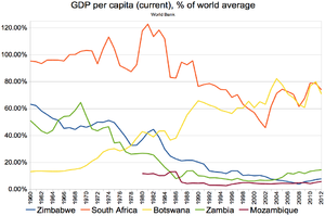
In the mid-1970s, the price of copper, Zambia's principal export, suffered a severe decline worldwide. In Zambia's situation, the cost of transporting the copper great distances to the market was an additional strain. Zambia turned to foreign and international lenders for relief, but, as copper prices remained depressed, it became increasingly difficult to service its growing debt. By the mid-1990s, despite limited debt relief, Zambia's per capita foreign debt remained among the highest in the world.[55]
التحول الديمقراطي
In June 1990 riots against Kaunda accelerated. Many protesters were killed by the regime in breakthrough June 1990 protests.[56][57] In 1990 Kaunda survived an attempted coup, and in 1991 he agreed to reinstate multiparty democracy, having instituted one-party rule under the Choma Commission of 1972. Following multiparty elections, Kaunda was removed from office (see below).
In the 2000s, the economy stabilised, attaining single-digit inflation in 2006–2007, real GDP growth, decreasing interest rates, and increasing levels of trade. Much of its growth is due to foreign investment in mining and to higher world copper prices. All this led to Zambia being courted enthusiastically by aid donors and saw a surge in investor confidence in the country.
السياسة
ينتخب شعب زامبيا رئيس الدولة والحكومة. كما ينتخب الشعب أيضًا 150 عضوًا للجمعية الوطنية، وهي الهيئة التشريعية للبلاد. تستغرق مدة عضوية الرئيس وأعضاء الجمعية الوطنية خمسة أعوام. يعين الرئيس الوزراء من بين أعضاء الجمعية الوطنية.والاقتراع حق لجميع من تزيد أعمارهم على 18 عامًا. يعتبر حزب الحركة الديمقراطية للتعددية الحزبية أكبر الأحزاب في زامبيا. أما حزب الاستقلال الوطني المتحد فيأتي في المرتبة الثانية. تنقسم البلاد إلى تسع محافظات، يدير كلاً منها وزير دولة. لوساكا عاصمة زامبيا ومركزها التجاري وهي مدينة حديثة ذات مبانٍ عالية وتبدو طرقاتها دائبة الحركة والنشاط.
التقسيمات الادارية
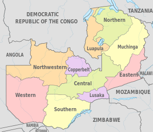
|تنقسم زامبيا إلى عشر محافظات، تدار كل منها بواسطة نائر وزير معين. تنقسم كل محافظة إلى عدة مقاطعات بإجمالي 89 مقاطعة.
العسكرية
تتكون قوات الدفاع الزامبية من الجيش، القوات الجوية، الخدمة الوطنية الزامبية. قوات الدفاع الزامبية مسئولة بشكل رئيسي عن الدفاع ضد التهديدات الخارجية.
الجغرافيا
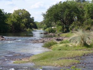
تتألف أراضي زامبيا من نجد يرتفع بين 900 ـ 1500 متر فوق سطح البحر، إذ ترتفع الهضبة تدريجياً باتجاه الشرق نحو إقليم بحيرة نياسا الجبلي الانكساري، كما ترتفع تدريجياً نحو الغرب إلى مرتفعات أنغولا، ونحو الشمال إلى مرتفعات كاتنگا جنوب الكونغو الديمقراطية، ولكنها تنحدر جنوباً نحو وادي الزمبيزي الأوسط. وقد قُطِعتْ الهضبة تقطيعاً شديداً بفعل نهر الزمبيزي وروافده إلى عدد من الأحواض الصغيرة التي تحتلها بعض البحيرات والسبخات، وقد تصل بين هذه الأحواض جبال وتلال اندفاعية كرد فعل للحركات الإنكسارية المجاورة في الأخدود إلى نهر الزمبيزي، الذي يخترق الجزء الغربي من البلاد، ثم يُكَوِنْ الحدود الجنوبية مع زمبابوي، وينحدر بشدة عند موقع مارامبا (لفنجستون) مكوناً شلالات فكتوريا، ثم يبدأ النهر بالجريان في مضيق أنشىء في نهايته سد عظيم لحجز المياه وتوليد الطاقة الكهربائية، مكوناً بحيرة يبلغ طولها نحو 240 كم،هي بحيرة كاريبا الاصطناعية. أما نهر كافوي فيصرف مياه منطقة مناجم النحاس متجهاً جنوباً، مخترقاً مناطق المستنقعات وغابات الصيد السياحية، ثم يجري في سهل فيضي بالقرب من العاصمة لوساكا، ليصب مياهه بعد ذلك في نهر الزمبيزي، ويعد نهر كافوي أكثر أهمية بالنسبة لزامبيا، لأنه يمد المناجم والمدن في مناطق النحاس بالمياه الضرورية، بينما تصرف مجاري البلاد الشمالية مياهها نحو نهر الكونغو.
تنتشر الغابات النفضية ودائمة الخضرة، ولاسيما في بطون الأودية، بينما تمتد الحشائش على سطح الهضبة. وقد قُطعت مساحات كبيرة من الغابات لتحل محلها أراضي التوسع الزراعي والرعوي الحديثة، كما احتجزت بعض المساحات لتكون مناطق سياحية للصيد ومحمية طبيعية للحيوانات البرية كما هي الحال في منتزه كافوي.
وتتباين أنماط التربة ما بين تربة سبخية ملحية فقيرة حول البحيرات والسبخات إلى تربة طفلية حمراء وتربة داكنة صلصالية على سطح الهضبة والمنحدرات الحوضية، وتربة رسوبية فيضية في بطون الأودية وضفاف الأنهار.
يبلغ عدد سكان زامبيا نحو 10ملايين نسمة، يعيشون في مساحة تقدر بنحو 746.25 ألف كم2، بكثافة تبلغ نحو 13نسمة/كم2، وهي كثافة منخفضة بسبب فقر التربة وانتشار ذبابة تسي تسي والجفاف،يعيش نحو 49% من السكان في المدن، ولاسيما العاصمة لوساكا (800 ألف نسمة)، وفي مدن كتوى وندولا وكابوى ولوانشيا، بينما يعيش 51% منهم في الأرياف.
In the Zambezi basin, there are a number of major rivers flowing wholly or partially through Zambia: the Kabompo, Lungwebungu, Kafue, Luangwa, and the Zambezi itself, which flows through the country in the west and then forms its southern border with Namibia, Botswana and Zimbabwe. Its source is in Zambia but it diverts into Angola, and a number of its tributaries rise in Angola's central highlands. The edge of the Cuando River floodplain (not its main channel) forms Zambia's southwestern border, and via the Chobe River that river contributes very little water to the Zambezi because most are lost by evaporation.[58]
Two of the Zambezi's longest and largest tributaries, the Kafue and the Luangwa, flow mainly in Zambia. Their confluences with the Zambezi are on the border with Zimbabwe at Chirundu and Luangwa town respectively. Before its confluence, the Luangwa River forms part of Zambia's border with Mozambique. From Luangwa town, the Zambezi leaves Zambia and flows into Mozambique, and eventually into the Mozambique Channel.
The Zambezi falls about 100 metres (328 ft) over the 1.6-kilometre-wide (1-mile) Victoria Falls, located in the southwest corner of the country, subsequently flowing into Lake Kariba. The Zambezi valley, running along the southern border, is both deep and wide. From Lake Kariba going east, it is formed by grabens and like the Luangwa, Mweru-Luapula, Mweru-wa-Ntipa and Lake Tanganyika valleys, is a rift valley.
The north of Zambia is very flat with broad plains. In the west the most notable being the Barotse Floodplain on the Zambezi, which floods from December to June, lagging behind the annual rainy season (typically November to April). The flood dominates the natural environment and the lives, society, and culture of the inhabitants and those of other smaller, floodplains throughout the country.
In Eastern Zambia the plateau which extends between the Zambezi and Lake Tanganyika valleys is tilted upwards to the north, and so rises imperceptibly from about 900 m (2,953 ft) in the south to 1,200 m (3,937 ft) in the centre, reaching 1,800 m (5,906 ft) in the north near Mbala. These plateau areas of northern Zambia have been categorised by the World Wildlife Fund as a large section of the Central Zambezian miombo woodlands ecoregion.[59]
Eastern Zambia shows great diversity. The Luangwa Valley splits the plateau in a curve north-east to south-west, extended west into the heart of the plateau by the deep valley of the Lunsemfwa River. Hills and mountains are found by the side of some sections of the valley, notably in its north-east the Nyika Plateau (2,200 m or 7,218 ft) on the Malawi border, which extend into Zambia as the Mafinga Hills, containing the country's highest point, Mafinga Central (2,339 m or 7,674 ft).[60]
The Muchinga Mountains, the watershed between the Zambezi and Congo drainage basins, run parallel to the deep valley of the Luangwa River and form a sharp backdrop to its northern edge, although they are almost everywhere below 1,700 m (5,577 ft). Their culminating peak Mumpu is at the western end and at 1,892 m (6,207 ft) is the highest point in Zambia away from the eastern border region. The border of the Congo Pedicle was drawn around this mountain.
The southernmost headstream of the Congo River rises in Zambia and flows west through its northern area firstly as the Chambeshi and then, after the Bangweulu Swamps as the Luapula, which forms part of the border with the Democratic Republic of the Congo. The Luapula flows south then west before it turns north until it enters Lake Mweru. The lake's other major tributary is the Kalungwishi River, which flows into it from the east. The Luvua River drains Lake Mweru, flowing out of the northern end to the Lualaba River (Upper Congo River).
Lake Tanganyika is the other major hydrographic feature that belongs to the Congo basin. Its south-eastern end receives water from the Kalambo River, which forms part of Zambia's border with Tanzania. This river has Africa's second highest uninterrupted waterfall, the Kalambo Falls.
المناخ
Zambia is located on the plateau of Central Africa, between 1,000 and 1,600 metres (3,300 and 5,200 ft) above sea level. The average elevation of 1,200 metres (3,900 ft) gives the land a generally moderate climate. The climate of Zambia is tropical, modified by elevation. In the Köppen climate classification, most of the country is classified as humid subtropical or tropical wet and dry, with small stretches of semi-arid steppe climate in the south-west and along the Zambezi valley.
There are two main seasons, the rainy season (November to April) corresponding to summer, and the dry season (May/June to October/November), corresponding to winter. The dry season is subdivided into the cool dry season (May/June to August), and the hot dry season (September to October/November). The modifying influence of altitude gives the country pleasant subtropical weather rather than tropical conditions during the cool season of May to August.[61] However, average monthly temperatures remain above 20 °C (68 °F) over most of the country for eight or more months of the year.
التنوع الحيوي
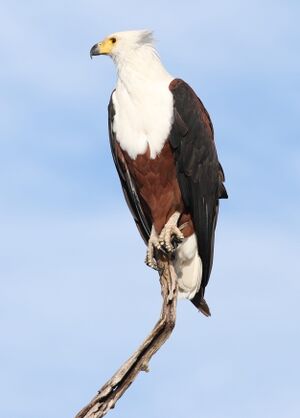
There are numerous ecosystems in Zambia, such as forest, thicket, woodland and grassland vegetation types.
Zambia has approximately 12,505 identified species – 63% animal species, 33% plant species and 4% bacterial species and other microorganisms.[بحاجة لمصدر]
There are an estimated 3,543 species of wild flowering plants, consisting of sedges, herbaceous plants and woody plants.[62] The Northern and North-Western provinces of the country especially have the highest diversity of flowering plants. Approximately 53% of flowering plants are rare and occur throughout the country.[63]
A total of 242 mammal species are found in the country, with most occupying the woodland and grassland ecosystems. The Rhodesian giraffe and Kafue lechwe are some of the well-known subspecies that are endemic to Zambia.[64]
An estimated 757 bird species have been seen in the country, of which 600 are either resident or Afrotropic migrants; 470 breed in the country; and 100 are non-breeding migrants. The Zambian barbet is a species endemic to Zambia.
Roughly 490 known fish species, belonging to 24 fish families, have been reported in Zambia, with Lake Tanganyika having the highest number of endemic species.[65]
The country had a 2019 Forest Landscape Integrity Index mean score of 7.5/10, ranking it 39th globally out of 172 countries.[66]
الديموغرافيا
- سكان المدن الرئيسية
| المدينة | تعداد 2000[67] | Pop. 2010[67] | |
|---|---|---|---|
| 1. | لوساكا | 1,084,703 | 1,460,566 |
| 2. | ندولا | 374,757 | 495,004 |
| 3. | كيتوه | 363,734 | 547,700 |
| 4. | كابوه | 176,758 | 215,015 |
| 5. | چينگولا | 147,448 | 178,092 |
| 6. | موفوليرا | 122,336 | 141,056 |
| 7. | لاونشيا | 115,579 | 132,117 |
| 8. | ليڤنگستون | 97,488 | 133,936 |
| 9. | كاساما | 74,243 | 111,588 |
| 10. | چيپاتا | 73,110 | 109,344 |
يعد معدل النمو السكاني في زامبيا من المعدلات العالية عالمياً، إذ يبلغ هذا المعدل 1.3% سنوياً، ويعود السبب في ذلك إلى ارتفاع معدل الولادات (47.5) في الألف، وانخفاض معدل الوفيات إلى 17 في الألف، وهذا يعني أن السكان يتضاعفون كل 22.7 سنة. ويعتبر المجتمع الزامبي من المجتمعات الفتية، حيث تصل نسبة السكان دون 15 سنة من العمر إلى 48.9% والسكان بين 15-65 سنة إلى 48.8%، بينما يشكل السكان فوق 65 سنة 2.3% من السكان.
وعلى الرغم من انخفاض نسبة الأمية بشكل ملحوظ في السنوات الأخيرة، فهي مازالت تتجاوز 25% من مجموع السكان، ترتفع هذه النسبة إلى 35% بين الإناث وتنخفض إلى 18% بين الذكور، وقد أدى ذلك إلى تدني الوضع الصحي، ويتجلى ذلك بنقص عدد الأطباء والممرضين والممرضات،إذ يتوافر طبيب واحد لكل 10000 شخص وممرضتان فقط لنفس العدد، الأمر الذي أدى إلى انخفاض متوسط العمر المتوقع إلى 45.6 سنة لدى الذكور و47.2 سنة لدى النساء.
اللغات
قالب:Dominant regional languages in Zambia The exact number of Zambian languages is unknown, although many texts claim that Zambia has 73 languages and/or dialects; this figure is probably due to a non-distinction between language and dialect, based on the criterion of mutual intelligibility. On this basis, the number of Zambian languages would probably be only about 20 or 30.[68]
The official language of Zambia is English, which is used for official business and public education. The main local language, especially in Lusaka, is Nyanja (Chewa), followed by Bemba. In the Copperbelt, Bemba is the main language and Nyanja second. Bemba and Nyanja are spoken in the urban areas, in addition to other indigenous languages that are commonly spoken in Zambia. These include Lozi, Tumbuka, Kaonde, Tonga, Lunda and Luvale, which featured on the Zambia National Broadcasting Corporation (ZNBC) local-languages section.[69][68][70]
Urbanisation has had a dramatic effect on some of the indigenous languages, including the assimilation of words from other languages. Urban dwellers sometimes differentiate between urban and rural dialects of the same language by prefixing the rural languages with 'deep'.
Most will thus speak Bemba and Nyanja in the Copperbelt; Nyanja is predominantly spoken in Lusaka and Eastern Zambia. English is used in official communications and is the language of choice at home among – now common – interethnic families. This evolution of languages has led to Zambian slang heard throughout Lusaka and other major cities. The majority of Zambians usually speak more than one language: the official language, English, and the most spoken language in the town or area they live in. Portuguese has been introduced as a second language into the school curriculum due to the presence of a large Portuguese-speaking Angolan community.[71] French is commonly studied in private schools, while some secondary schools have it as an optional subject. A German course has been introduced at the University of Zambia (UNZA).
الدين
الدين في زامبيا (2010)[72]
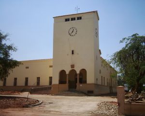
المسيحية هي الديانة الرئيسية في البلاد، كما تعتبر زامبيا دولة مسيحية وفقا للدستور الزامبي، وتوجد جالية إسلامية في زامبيا معظمها من أصول هندية، بالإضافة إلى ديانات وثنية يتبعها عدد قليل من السكان لا يتعدى 1%.
الإسلام
يعيش في زامبيا 189000 من المسلمين وهم يمثلون 2.4% من مجموع السكان ،ولهم فيها عدد من المؤسسات أهمها:
- الجمعية الاسلامية: وتشرف على المساجد و شؤون العاملين.
- جمعية الشباب المسلم: وينتمي معظم أعضائها إلى الهند وباكستان.[73]
- رابطة المسلمات. وللمسلمين في زامبيا مسجدان أحدهما للهنود والآخر للإفريقيين
الاقتصاد
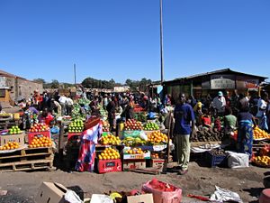
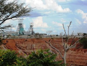
The Bank of Zambia serves as the Central Bank which implements monetary policies for the country.[74]
الزراعة
اقتصاد زامبيا زراعي بالدرجة الأولى، إذ يعمل 68.5% من السكان بالزراعة والجمع والصيد، ومع أن مساحة الأراضي الزراعية تعادل 47.4% من المساحة الإجمالية إلا أن الزراعة لا تسهم سوى بنحو 17% من الدخل القومي للبلاد. وتعمل الدولة جادة على رفع المستوى الاقتصادي والثقافي والاجتماعي للفلاحين، فتقدم لهم الكثير من خدمات الري والتقنية الزراعية وإرشاد المزارعين لمتابعة الدورات الزراعية وعلاج فقر التربة وتحسين نسل الماشية ومكافحة الأمراض ونشر التعليم والخدمات المدنية تشجيعاً للفلاحين للبقاء في أراضيهم، إلا أن الزراعة تعاني من قلة اليد العاملة بسبب الهجرة إلى المدن والمراكز الصناعية وكذلك إلى خارج البلاد.[75]
يمارس الفلاحون زراعة المحاصيل الغذائية بصورة أساسية، مثل الذرة والبطاطا الحلوة والكسافا والفول السوداني والبقوليات والخضروات، والمحاصيل النقدية مثل القطن والتبغ وقصب السكر، كما يمارسون تربية الحيوان، وقد وصل إنتاج الذرة إلى 464 ألف طن والفول السوداني 21 ألف طن والبطاطا 4 آلاف طن، أما في المحاصيل النقدية فقد وصل إنتاج قصب السكر إلى1.15 مليون طن والقطن 10آلاف طن والتبغ 5 آلاف طن، يأتي نصف الإنتاج، ولاسيما من المحاصيل النقدية، من المزارع الواسعة التي يملكها بضع مئات من المزارعين الكبار والباقي ينتجه الفلاحون من مزارع فردية صغيرة المساحة، وقد نما الإنتاج الزراعي بعد الاستقلال، ولكن هذا النمو لا يزال بطيئاً بسبب تخلف الفلاحين ومشروعات الري وطرق المواصلات.
التعدين
انصب اهتمام المستعمر في البداية على استغلال المعادن، ولا سيما النحاس من إقليم شمال غربي البلاد المجاور لإقليم نحاس شابا في الكونغو الديمقراطية، والكوبالت الذي يعد ناتجاً ثانوياً لتعدين النحاس، والفحم في مناجم «مامبا» في وادي الزمبيزي، وكذلك كميات قليلة من المنغنيز والفضة والحديد في المناطق المتأثرة بالانكسارات.
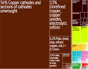
تأتي زامبيا في المركز الثالث عالمياً بإنتاج النحاس، ويمثل نحو 90% من قيمة الصادرات، وتتركز مناطق الإنتاج و التعدين في نطاقين: الأول في وادي نهر لوانجو و وادي نهر كافوي وما بينهما من أرض هضبية، والثاني في أقصى غرب البلاد ممثلاً في وادي أعالي نهر الزمبيزي وروافده، مثل نهر كابمبو ونهر كواندو وما بينهما من إقليم هضبي.
تطور إنتاج النحاس في أثناء الحرب العالمية الثانية لأهميته في الصناعات الحربية واستمر نمو الإنتاج بعد ذلك، وقد ساعد على زيادة الإنتاج والتصدير توافر وسيلة النقل السريعة والرخيصة المتمثلة بالسكة الحديدية التي تربط مناطق الإنتاج بموانىء التصدير بخطين: الأول عبر الكونغو الديمقراطية وأنغولا إلى ميناء لوبيتو على المحيط الأطلسي، والثاني عبر زمبابوي وموزمبيق إلى ميناء بيرا على المحيط الهندي.
ومنذ عام 1969 أصدرت الحكومة مراسيم حددت فيها مدة الامتياز للشركات الأجنبية العاملة في التعدين بـ 25 سنة على أن تتقاضى الدولة 51% من الأرباح، مما ضاعف الدخل القومي فانعكس على النمو الاقتصادي المتواصل في مختلف المجالات ولاسيما الزراعة والصناعة والنقل، ورفع المستوى الصحي والثقافي والاجتماعي.
النقل
تعمل الحكومة الزامبية اليوم على استكمال الخط الحديدي عبر تنزانيا الذي سوف ينتهي في دار السلام، الأمر الذي سوف يجنبها الكثير من المشكلات مع الدول المجاورة، إضافة إلى تقليل المسافة بين مناطق الإنتاج وميناء التصدير، كما تعمل على بناء محطتين لتوليد الطاقة الكهربائية على مساقط فكتوريا داخل أراضيها للاستغناء عن الطاقة المولدة من المحطة المقامة على نهر الزمبيزي، ولكن في أراضي زمبابوي، وذلك من أجل تأمين الاستقلال السياسي والاقتصادي للبلاد.
السياحة
بدأ انفتاح زامبيا على السياحة سنة 1990 حيث أن البلاد تتمتع بمناظر سياحية خلابة وفيها عدة منتزهات وطنية كمنتزه "لوانگوا الجنوبية"، "سهول ليوفا" و"كافوي" و"ايسانگافو". ومن أهم المناظر الطبيعية في البلاد هي الشلالات (كاسانگا، كافوما، نگامبوي وڤكتوريا)
كما أن يمثل النصب التذكاري للڤنگستون أحد المباني التاريخية التي تستقطب السيَاح.
الضمان الاجتماعي في زامبيا
التعليم
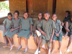
يتلقى معظم الأطفال في زامبيا تعليمًا ابتدائيًا، بينما يذهب 20% منهم فقط إلى المدارس الثانوية.
التعليم العالي
توجد ثلاث جامعات رئيسية في زامبيا وجامعات أخرى
- جامعة زامبيا
- جمعة مولونگوشي
- جامعة كوپربلت
- جامعة لوساكا
- جامعة كاڤنيدش زامبيا
- جامعة لوساكا أپكس الطبية
- جامعة زامبيا المفتوحة
الصحة
تفشي الإيدز
المستشفيات
الطاقة
In 2009, Zambia generated 10.3 Twh and has been rated high in use of both Solar power and Hydroelectricity.[76]
الثقافة

الإعلام
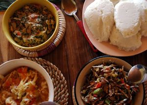
المطبخ
الرياضة
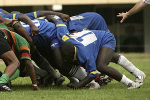
أعلنت زامبيا استقلالها يوم الحفل الختامي لدورة الألعاب الأولمبية الصيفية لعام 1964، وتم الانضمام إلى الفيفا في عام 1964 ومن أهم انجازات كرة القدم الزامبية الفوز بكأس الأمم الأفريقية لكرة القدم 2012 للمرة الأولى في تاريخها واحتلال المركز الثالث في كأس الأمم الأفريقية سنة 1996 بعد الفوز على غانا ب1/0 خسارة مباراة نهائي كاس لامم الأفريقية 1994 امام نيجيريا احتلال المركز الثالث سنة 1990 احتلال المركز الثالث سنة 1982 وصيف منتخب جمهورية الكونغو سنة 1974 كذلك من الرياضات الشعبية في زامبيا الرگبي والملاكمة والكريكيت.
انظر أيضاً
المصادر
- ^ Brunner, Borgna (ed.). TIME Almanac 2004 (2004 ed.). Pearson Education, Inc. pp. 875–905. ISBN 1-931933-78-2.
- ^ Census of Population and Housing National Analytical Report 2010 Central Statistical Office, Zambia
- ^ "Amended Constitution of Zambia". Government of Zambia. Retrieved 15 October 2016.
- ^ United Nations Statistics Division. "Population by sex, rate of population increase, surface area and density" (PDF). Retrieved 9 November 2007.
- ^ قالب:Cite CIA World Factbook
- ^ أ ب ت ث "Zambia". International Monetary Fund.
- ^ "Gini Index". World Bank. Retrieved 2 September 2019.
- ^ Human Development Report 2020: The Next Frontier: Human Development and the Anthropocene (PDF). United Nations Development Programme. 15 December 2020. pp. 343–346. ISBN 978-92-1-126442-5. Retrieved 16 December 2020.
- ^ "United Nations Statistics Division- Standard Country and Area Codes Classifications (M49)". Unstats.un.org. 2013-10-31. Retrieved 2014-04-11.
- ^ Malcolm Southwood, Bruce Cairncross & Mike S. Rumsey (2019). "Minerals of the Kabwe ("Broken Hill") Mine, Central Province, Zambia, Rocks & Minerals". Rocks & Minerals. 94 (2): 114–149. doi:10.1080/00357529.2019.1530038. S2CID 135446729.
- ^ Holmes, Timothy (1998). Cultures of the World: Zambia. Tarrytown, New York: Times Books International. pp. 19–20. ISBN 978-0-7614-0694-5.
- ^ "Twa". Zambia's Traditional History (in الإنجليزية). 30 March 2020. Retrieved 27 October 2020.
- ^ Musonda, Francis B. (1984). "Late Pleistocene and Holocene Microlithic Industries from the Lunsemfwa Basin, Zambia". The South African Archaeological Bulletin. JSTOR. 39 (139): 24–36. doi:10.2307/3888592. ISSN 0038-1969. JSTOR 3888592.
- ^ Taylor, Scott D. "Culture and Customs of Zambia" (PDF). Greenwood Press. Retrieved 25 March 2018.
- ^ Flamming, D. (2009). African Americans in the West. Cultures in the American West. ABC-CLIO. p. 15. ISBN 978-1-59884-003-2. Retrieved 2023-06-17.
- ^ Grollemund, Rebecca; Branford, Simon; Bostoen, Koen; Meade, Andrew; Venditti, Chris; Pagel, Mark (2015-09-14). "Bantu expansion shows that habitat alters the route and pace of human dispersals". Proceedings of the National Academy of Sciences. 112 (43): 13296–13301. Bibcode:2015PNAS..11213296G. doi:10.1073/pnas.1503793112. ISSN 0027-8424. PMC 4629331. PMID 26371302.
- ^ Bostoen, Koen (26 April 2018). "The Bantu Expansion". Oxford Research Encyclopedia of African History (in الإنجليزية). doi:10.1093/acrefore/9780190277734.013.191. ISBN 9780190277734. Retrieved 27 October 2020.
- ^ "Ila". Zambia's Traditional History (in الإنجليزية). 12 January 2019. Retrieved 27 October 2020.
- ^ "The Project Gutenberg eBook of South and South Central Africa, by H. Frances Davidson". www.gutenberg.org. Retrieved 29 October 2020.
- ^ "Origins of trade - Zambia Travel Guide". www.zambia-travel-guide.com. Retrieved 28 October 2020.
- ^ Pikirayi, Innocent (August 2017). "Ingombe Ilede and the demise of Great Zimbabwe". Antiquity (in الإنجليزية). 91 (358): 1085–1086. doi:10.15184/aqy.2017.95. ISSN 0003-598X. S2CID 158120419.
- ^ "Luba". Zambia's Traditional History (in الإنجليزية). 8 August 2019. Retrieved 7 November 2020.
- ^ أ ب ت ث Bortolot, Alexander Ives. "Kingdoms of the Savanna: The Luba and Lunda Empires". Metropolitan Museum of Art. Retrieved 7 November 2020.
- ^ "Luba | people". Encyclopedia Britannica (in الإنجليزية). Retrieved 7 November 2020.
- ^ Azuonye, Chukwuma (15 December 1996). Chokwe: (Angola, Zambia) (in الإنجليزية). The Rosen Publishing Group, Inc. ISBN 978-0-8239-1990-1.
- ^ "Luba". Zambia's Traditional History (in الإنجليزية). 8 August 2019. Retrieved 30 November 2020.
- ^ أ ب Team, Editorial (26 December 2018). "The Maravi Confederacy". Think Africa (in الإنجليزية الأمريكية). Retrieved 13 December 2020.
- ^ أ ب Team, Editorial (26 December 2018). "The Maravi Confederacy". Think Africa (in الإنجليزية الأمريكية). Retrieved 14 December 2020.
- ^ Maptia. "The Secret Cult of Nyau Dancers". Maptia (in الإنجليزية). Archived from the original on 8 November 2020. Retrieved 3 January 2021.
- ^ "Mwene Matapa | historical dynastic title, southern Africa". Encyclopedia Britannica (in الإنجليزية). Retrieved 31 December 2020.
- ^ "Mutapa". World History Encyclopedia. Retrieved 31 December 2020.
- ^ أ ب "Mutapa". World History Encyclopedia. Retrieved 1 January 2021.
- ^ "Chikunda". Zambia's Traditional History (in الإنجليزية). 11 January 2019. Retrieved 12 January 2021.
- ^ "Rozwi | historical state, Africa". Encyclopedia Britannica (in الإنجليزية). Retrieved 2 January 2021.
- ^ أ ب "Mfecane | African history". Encyclopedia Britannica (in الإنجليزية). Retrieved 2 January 2021.
- ^ "Lozi | people". Encyclopedia Britannica (in الإنجليزية). Retrieved 2 January 2021.
- ^ The elites of Barotseland, 1878–1969: a political history of Zambia's Western Province: a. Gerald L. Caplan, C. Hurst & Co Publishers Ltd, 1970, ISBN 0900966386
- ^ Bantu-Languages.com, citing Maniacky 1997
- ^ "Instructions and Travel Diary that Governor Francisco Joze de Lacerda e Almeida Wrote about His Travel to the Center of Africa, Going to the River of Sena, in the Year of 1798". 1798. Retrieved 3 September 2015.
- ^ Communications., Craig Hartnett of NinerNet. "Portuguese Expedition to Northern Rhodesia, 1798–99 – Great North Road (GNR, Northern Rhodesia, Zambia)". www.greatnorthroad.org. Archived from the original on 24 سبتمبر 2015. Retrieved 3 سبتمبر 2015.
- ^ "Livingstone Discovers Victoria Falls, 1855". www.eyewitnesstohistory.com. Retrieved 28 May 2020.
- ^ "HISTORY". THE PROVINCIAL ADMINISTRATION WEBSITE. Archived from the original on 27 June 2020.
- ^ Livingstone Tourism Association. "Destination:Zambia – History and Culture". Archived from the original on 12 October 2007. Retrieved 29 October 2007.
- ^ Human Rights & Documentation Centre. "Zambia: Historical Background". Archived from the original on 11 March 2007. Retrieved 14 January 2011.
- ^ Burnham, Frederick Russell (1899). "Northern Rhodesia". In Wills, Walter H. (ed.). . Simpkin, Marshall, Hamilton, Kent & Co. pp. 177–180.
- ^ Pearson Education. "Rhodesia and Nyasaland, Federation of". Retrieved 29 October 2007.
- ^ "Alice Lenshina". The British Empire. 26 May 2020. Retrieved 26 May 2020.
- ^ WILLSON, John Michael (born 15 July 1931)[dead link]. BDOHP Biographical Details and Interview Index. chu.cam.ac.uk
- ^ 1964: President Kaunda takes power in Zambia. BBC 'On This Day'.
- ^ Raeburn, Michael (1978). We are everywhere: Narratives from Rhodesian guerillas. Random House. pp. 1–209. ISBN 978-0394505305.
- ^ "GREEN LEADER. OPERATION GATLING, THE RHODESIAN MILITARY'S RESPONSE TO THE VISCOUNT TRAGEDY". Archived from the original on 25 January 2017. Retrieved 22 April 2017.
- ^ Nelson, Harold (1983). Zimbabwe: A Country Study. Claitors Publishing Division. pp. 54–137. ISBN 978-0160015984.
- ^ Kaplan, Irving (1971). Area Handbook for the Republic of South Africa. U.S. Government Printing Office. pp. 404–405.
- ^ Evans, M. (1984). "The Front-Line States, South Africa and Southern African Security: Military Prospects and Perspectives" (PDF). Zambezia. 12: 1.
- ^ "Zambia (12/08)". U.S. Department of State. Retrieved 27 May 2020.
- ^ "About Zambia". 20 May 2020. Archived from the original on 9 May 2016. Retrieved 20 May 2020.
- ^ Bartlett, David M. C. (2000). "Civil Society and Democracy: A Zambian Case Study". Journal of Southern African Studies. 26 (3): 429–446. doi:10.1080/030570700750019655. ISSN 0305-7070. JSTOR 2637411. S2CID 143480603.
- ^ Beilfuss, Richard and dos Santos, David (2001) "Patterns of Hydrological Change in the Zambezi Delta, Mozambique". Archived 17 ديسمبر 2008 at the Wayback Machine Working Paper No 2 Program for the Sustainable Management of Cahora Bassa Dam and The Lower Zambezi Valley.
- ^ "Geography | Zambian High Commission". www.zambiapretoria.net. Retrieved 27 May 2020.
- ^ "Mafinga South and Mafinga Central: the highest peaks in Zambia". Footsteps on the Mountain blog. 24 September 2014. Retrieved 16 October 2014.
- ^ Spectrum Guide to Zambia. Camerapix International Publishing, Nairobi, 1996. ISBN 1874041148.
- ^ Bolnick, Doreen; Bingham (2007). A guide to the common wild flowers of Zambia and neighbouring regions 2nd Edition. Lusaka: Wildlife & Environmental Conservation Society of Zambia. p. 75. ISBN 9789982180634.
- ^ Zambia- Ministry of Lands Natural Resources (June 2015). "Ministry of Lands Natural Resources and Environmental Protection : United Nations Convention on Biological Diversity Fifth National Report". Zambia- Ministry of Lands Natural Resources. Archived from the original on 26 June 2020.
- ^ Ministry of Lands (June 2015). "Ministry of Lands Natural Resources and Environmental Protection:United Nations Convention on Biological Diversity Fifth National Report". Zambia - Ministry of Lands and Natural Resources. Archived from the original on 26 June 2020.
- ^ "Fish – arczambia.com" (in الإنجليزية البريطانية). Retrieved 26 May 2020.
- ^ Grantham, H. S.; et al. (2020). "Anthropogenic modification of forests means only 40% of remaining forests have high ecosystem integrity - Supplementary Material". Nature Communications. 11 (1): 5978. Bibcode:2020NatCo..11.5978G. doi:10.1038/s41467-020-19493-3. ISSN 2041-1723. PMC 7723057. PMID 33293507.
- ^ أ ب [1][dead link]
- ^ أ ب Chanda, Vincent M.; Mkandawire, Sitwe Benson (2013). Speak Zambian Languages: Phrase Book in Bemba, Kaonde, Lozi, Luvale, Lunda, Nyanja and Tonga, all in one. Lusaka, Zambia: UNZA Press. pp. 1–173. ISBN 978-9982-03-073-1.
- ^ "Encyclopedia Britanica". 26 May 2020. Retrieved 26 May 2020.
- ^ Mkandawire, Sitwe Benson. (2015). The State of Affairs of Cultural Literacy in Zambia's Multicultural Education System. In A. L. Jotia and J. Dudu (Ed.), Multicultural Education Discourses: Breaking Barriers of Exclusion in Selected African Contexts. Windhoek, Namibia: Zebra publishing (Pty) LTD. pp. 190–204. ISBN 978-99945-84-99-4.
- ^ Zambia to introduce Portuguese into school curriculum. Archived 8 ديسمبر 2012 at the Wayback Machine
- ^ (ZAMBIA)
- ^ الأقليات المسلمة في أفريقيا . سيد عبد المجيد بكر.
- ^ Bank of Zambia Website
- ^ عبد الرؤوف رهبان. "زامبيا". الموسوعة العربية. Retrieved 2014-10-29.
- ^ Zambia. Renewable Energy Agency Country Profile. International Renewable Energy Agency
قراءات إضافية
- أحمد نجم الدين فليجة. إفريقيا دراسة عامة وإقليمية (مركز الاسكندرية للكتاب، الاسكندرية 1996).
- علي موسى، محمد الحمادي. جغرافية القارات (دار الفكر، دمشق 2001).
- محمد حسن، دراسات في جغرافية إفريقية وحوض النيل (مركز الاسكندرية للكتاب، الاسكندرية 1997).
- Burke, Mark, Glimmers of Hope : A Memoir of Zambia, (lulu.com, 2009)
- Ferguson, James (1999). Expectations of Modernity: Myths and Meanings of Urban Life in the Zambian Copperbelt. Berkeley: University of California Press. ISBN 0-520-21701-2.
- Ihonvbere, Julius, Economic Crisis, Civil Society and Democratisation: The Case of Zambia, (Africa Research & Publications, 1996)
- LaMonica, Christopher, Local Government Matters: The Case of Zambia , (Lambert Academic Publishing, 2010)
- Mcintyre, Charles, Zambia (Bradt Travel Guides), (Bradt Travel Guides, 2008)
- Murphy, Alan and Luckham, Nana, Zambia and Malawi (Lonely Planet Multi Country Guide), (Lonely Planet Publications, 2010)
- Phiri, Bizeck Jube, A Political History of Zambia: From the Colonial Period to the 3rd Republic, (Africa Research & Publications, 2005)
- Roberts, Andrew, A History of Zambia, (Heinemann, 1976)
- Sardanis, Andrew, Africa: Another Side of the Coin: Northern Rhodesia's Final Years and Zambia's Nationhood, (I.B.Tauris, 2003)
- Various, One Zambia, Many Histories: Towards a History of Post-colonial Zambia, (Brill, 2008)
- Wotela, Kambidima (2010). "Deriving Ethno-geographical Clusters for Comparing Ethnic Differentials in Zambia". University of California Irvine: World Cultures eJournal, 17(2).
{{cite journal}}: Cite journal requires|journal=(help) - First early human fossil found in Africa makes debut
وصلات خارجية
- Official website
- Zambia entry at The World Factbook
- Zambia Corruption Profile from the Business Anti-Corruption Portal
- زامبيا at the Open Directory Project
- Zambia profile from the BBC News
 Wikimedia Atlas of Zambia
- Key Development Forecasts for Zambia from International Futures
- World Bank Summary Trade Statistics Zambia
- CS1 الإنجليزية الأمريكية-language sources (en-us)
- Articles with dead external links from June 2023
- CS1 الإنجليزية البريطانية-language sources (en-gb)
- Articles with dead external links from December 2013
- Short description is different from Wikidata
- Pages using gadget WikiMiniAtlas
- Pages using infobox country with unknown parameters
- Articles with unsourced statements from July 2011
- Articles with hatnote templates targeting a nonexistent page
- مقالات ذات عبارات بحاجة لمصادر
- Articles with unsourced statements from August 2020
- Pages with empty portal template
- Pages using country topics with unknown parameters
- زامبيا
- بلدان وأراضي البانتو
- جمهورية الكومنولث
- بلدان أفريقيا
- بلدان وأراضي ناطقة بالإنگليزية
- بلدان حبيسة
- البلدان الأقل نماء
- تصنيف:دول أعضاء الاتحاد الأفريقي
- الدول الأعضاء في كومنولث الأمم
- الدول الأعضاء في الأمم المتحدة
- جنوب شرق أفريقيا
- أفريقيا الجنوبية
- دول وأراضي تأسست في 1964


