جزيرة عيد الميلاد
| ||||||||||||||||||||||||||||||||||||||||||||||||||||||||||||||||||||
| ||||||||||||||||||||||||||||||||||||||||||||||||||||||||||||||||||||
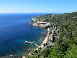
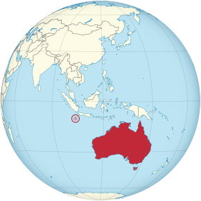
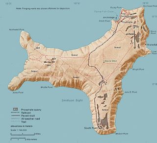
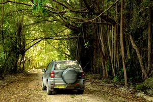
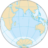
جزيرة عيد الميلاد (بالإنجليزية: Christmas Island) هي منطقة صغيرة غير ذاتية الحكم تتبع أستراليا. تقع الجزيرة في المحيط الهندي على بعد 2360 كلم من شمال غرب مدينة پرث في أستراليا الغربية، و 500 كلم من جنوب مدينة جاكرتا في إندونيسيا. يقارب عدد سكانها 1600 نسمة، يتركزون في مناطق الاستقرار في الحافة الشمالية من الجزيرة حيث تقع العاصمة فلاينغ فيش كوف. لها طوبوغرافيا طبيعية فريدة، وتثير اهتمام العلماء لكثرة الأحياء النباتية والحيوانية التي تنمو بعزلة وبدون تدخل البشر. مساحتها 135 كم2.
يسكنها صينيو إندونيسيا وملايو لانها كانت ضمن سلطنات اندونيسيا السابقة
والاسلام هو الدين الأول علي الجزيرة بنسبة 20%
يليه البوذية 15%
وتعد جزيرة كريسماس و جزر كوكوز معقل للمسلمين الملايو في استراليا
بالاضافة انهم نقطتين للتهريب واللاجئين لقربهم الجغرافي من اندونيسيا اكثر من استراليا
التاريخ
أول زيارات الأوروپيين، 1643
The first European to sight the island was Richard Rowe of the Thomas in 1615.[2] Captain William Mynors of the Royal Mary, an English East India Company vessel, named the island when he sailed past it on Christmas Day, in 1643.[3] The island was included on English and Dutch navigation charts as early as the beginning of the 17th century, but it was not until 1666 that a map published by Dutch cartographer Pieter Goos included the island. Goos labelled the island "Mony" or "Moni",[4] the meaning of which is unclear.[5]
الاستكشاف والضم
The first attempt at exploring the island was in 1857 by the crew of the Amethyst. They tried to reach the summit of the island but found the cliffs impassable.
التحويل إلى أستراليا
At Australia's request, the United Kingdom transferred sovereignty to Australia, with a $20 million payment from the Australian government to Singapore as compensation for the loss of earnings from the phosphate revenue.[6] The United Kingdom's Christmas Island Act was given royal assent on 14 May 1958, enabling Britain to transfer authority over Christmas Island from Singapore to Australia by an order-in-council.[7] Australia's Christmas Island Act was passed in September 1958 and the island was officially placed under the authority of the Commonwealth of Australia on 1 October 1958.[8]
الجغرافيا
The island is about 19 kilometres (12 mi) in greatest length and 14.5 km (9.0 mi) in breadth. The total land area is 135 square kilometres (52 sq mi), with 138.9 km (86.3 mi) of coastline. The island is the flat summit of an underwater mountain more than 4,500 metres (14,800 ft) high,[9] which rises from about 4,200 m (13,780 ft) below the sea and only about 300 m (984 ft) above it.[10]
المناخ
Christmas Island is located towards the southern edge of the equatorial region. Climate is tropical and temperatures vary little throughout the year. The highest temperature is usually around 29 °C (84 °F) in March and April, while the lowest temperature is 23 °C (73 °F) and occurs in August. There is a dry season from July to October with only occasional showers. The wet season is between November and June, and includes monsoons, with downpours of rain at random times of the day. Tropical cyclones also occur in the wet season, bringing very strong winds, rain and enormous seas.
| أخفClimate data for مطار جزيرة عيد الميلاد | |||||||||||||
|---|---|---|---|---|---|---|---|---|---|---|---|---|---|
| Month | Jan | Feb | Mar | Apr | May | Jun | Jul | Aug | Sep | Oct | Nov | Dec | Year |
| Record high °C (°F) | 30.7 (87.3) |
31.5 (88.7) |
31.5 (88.7) |
31.4 (88.5) |
30.5 (86.9) |
29.8 (85.6) |
29.3 (84.7) |
29.5 (85.1) |
30.9 (87.6) |
31.4 (88.5) |
31.8 (89.2) |
31.2 (88.2) |
31.8 (89.2) |
| Mean daily maximum °C (°F) | 28.0 (82.4) |
28.0 (82.4) |
28.3 (82.9) |
28.3 (82.9) |
27.8 (82.0) |
27.1 (80.8) |
26.3 (79.3) |
26.1 (79.0) |
26.3 (79.3) |
26.9 (80.4) |
27.3 (81.1) |
27.8 (82.0) |
27.4 (81.3) |
| Mean daily minimum °C (°F) | 22.7 (72.9) |
22.7 (72.9) |
23.1 (73.6) |
23.5 (74.3) |
23.8 (74.8) |
23.3 (73.9) |
22.6 (72.7) |
22.2 (72.0) |
22.3 (72.1) |
22.7 (72.9) |
22.9 (73.2) |
22.6 (72.7) |
22.9 (73.2) |
| Record low °C (°F) | 18.8 (65.8) |
18.4 (65.1) |
18.6 (65.5) |
18.3 (64.9) |
19.3 (66.7) |
14.1 (57.4) |
16.2 (61.2) |
17.7 (63.9) |
16.7 (62.1) |
18.2 (64.8) |
18.0 (64.4) |
18.0 (64.4) |
14.1 (57.4) |
| Average rainfall mm (inches) | 297.2 (11.70) |
344.5 (13.56) |
302.7 (11.92) |
227.5 (8.96) |
186.7 (7.35) |
172.3 (6.78) |
99.7 (3.93) |
42.3 (1.67) |
57.4 (2.26) |
78.5 (3.09) |
156.8 (6.17) |
222.1 (8.74) |
2٬183 (85.94) |
| Source: Australian Bureau of Meteorology[11] | |||||||||||||
الديمغرافيا
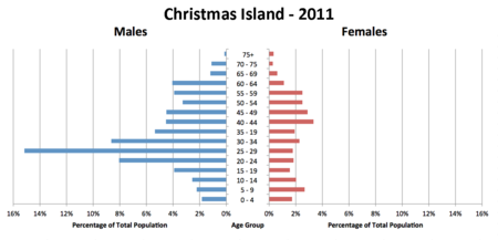
As of the 2016 Australian census, the population of Christmas Island is 1,843.[1] 21.2% of the population had Chinese ancestry (up from 18.3% in 2001), 12.7% had generic Australian ancestry (11.7% in 2001), 12% had Malay ancestry (9.3% in 2001), 10% had English ancestry (8.9% in 2001), and 2.3% of the population was of Irish origin (the same share as in 2001). 48.1% of the population has undetermined ancestry. اعتبارا من 2016[تحديث], most of them are people born in Christmas Island and many are of Chinese and Malay origin.[1] 38.5% of people were born in Australia. The next most common country of birth was Malaysia at 20.1%. 27.8% of the population spoke English as their family language, while 17.2% spoke Mandarin Chinese, 17.2% spoke Malay, 3.7% Cantonese, 1.5% Southern Min, and 1% Tagalog.[1] Additionally, there are small local populations of Malaysian Indians and Eurasians.[12][13]
الثقافة
هذا القسم يحتاج المزيد من الأسانيد للتحقق. (June 2013) (Learn how and when to remove this template message) |
The culture of Christmas Island is unique, for people of many different ethnicities inhabit the area. Historically, the majority of Christmas Islanders were those of Chinese, Malay, and Indian origins, the initial permanent settlers; as a result, they have significantly influenced the local culture.[14] Today, the majority of residents are Chinese, with significant numbers of European Australians and Malays as well as smaller Indian and Eurasian communities too. The main languages of Christmas Island are English and Chinese. Dress is usually modest, and tourists should keep a wrap, such as a sarong or pareo, on hand to cover shorts, bathing suits, and tank tops. It is common to remove shoes when entering a house and to also avoid touching anyone's head.
| الدين | 2011 | 2016 |
|---|---|---|
| Islam | 14.8% | 19.4% |
| Buddhism | 16.8% | 18.1% |
| Christianity | 10.8% | 8.9% |
| Not religious | 9.2% | 15.2% |
| Other religion | 48.4% | 38.4% |
الدين
Religious beliefs are diverse, but people are very tolerant of each other's religions. The religions practised include Buddhism, Taoism, Confucianism, Islam, and Christianity. There is a Mosque in Flying Fish Cove. With all of these religions, there are many religious festivals, such as Spring Festival, Hari Raya, Christmas and Easter.[15] Additionally, there is a Bahá'í centre on the island.[16]
عناصر الجذب
النبيت والوحيش
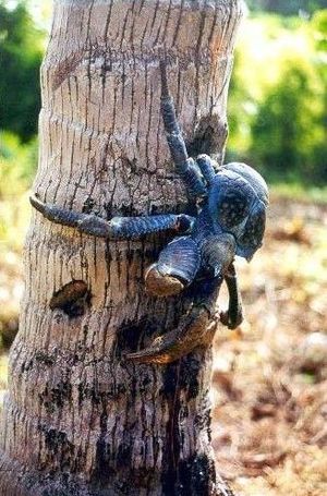
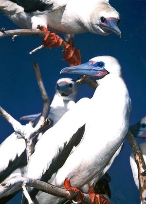
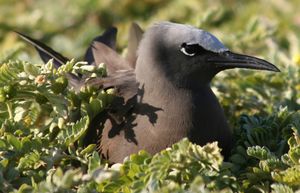
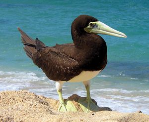
Christmas Island was uninhabited until the late 19th century, allowing many species to evolve without human interference. Two-thirds of the island has been declared a National Park, which is managed by the Australian Department of Environment and Heritage through Parks Australia. Christmas Island contains unique species, both of flora and fauna, some of which are threatened with, or have become, extinct.
انظر أيضاً
ملاحظات
- ^ الإنگليزية ليس لها وضع قانوني في جزيرة عيد الميلاد وفي أستراليا، ولكنها لغة الأمر الواقع في التواصل في الحكومة.
المراجع
- ^ أ ب ت ث ج "2016 Census: Christmas Island" (PDF). Department of Infrastructure and Regional Development. Australia: Australian Government. Archived (PDF) from the original on 11 January 2018. Retrieved 10 January 2018.
- ^ James, David J.; Mcallan, Ian A.W. (August 2014). "The birds of Christmas Island, Indian Ocean: A review". ResearchGate. Australian Field Ornithology. Archived from the original on 2 February 2017. Retrieved 20 January 2017.
- ^ "Department of the Environment, Water, Heritage and the Arts – Christmas Island History". Australian Government. 8 يوليو 2008. Archived from the original on 4 مارس 2012. Retrieved 26 أبريل 2009.
- ^
 Chisholm, Hugh, ed. (1911). . دائرة المعارف البريطانية. Vol. 6 (eleventh ed.). Cambridge University Press. pp. 294–295.
 {{cite encyclopedia}}: Cite has empty unknown parameter:|coauthors=(help) - ^ "Digital Collections – Maps – Goos, Pieter, ca. 1616–1675. Paskaerte Zynde t'Oosterdeel Van Oost Indien (cartographic material) : met alle de Eylanden deer ontrendt geleegen van C. Comorin tot aen Iapan". National Library of Australia. Retrieved 26 April 2009.
- ^ قالب:Cite media
- ^ "All set for transfer". The Straits Times. 1958-05-16. p. 2. Archived from the original on 6 September 2015. Retrieved 8 August 2015.
- ^ Kerr, A. (2009). A federation in these seas: An account of the acquisition by Australia of its external territories, with selected documents. Attorney General's Dept. (A.C.T. Barton). p. 329. call no.: R 325.394 KER. Archived from the original. You must specify the date the archive was made using the
|archivedate=parameter. http://eservice.nlb.gov.sg/item_holding_s.aspx?bid=13849897. Retrieved on 8 August 2015. - ^ "Submission on Development Potential" (PDF). Northern Australia Land and Water Taskforce. 16 أغسطس 2007. No. 37. Archived from the original (PDF) on 20 مايو 2009. Retrieved 26 أبريل 2009.
- ^ "Christmas island". World Factbook. CIA. 23 April 2009. Archived from the original on 12 September 2009. Retrieved 26 April 2009.
- ^ "Climate statistics for Christmas Island". Australia: Bureau of Meteorology. Archived from the original on 27 December 2011. Retrieved 21 September 2011.
- ^ "Island induction". Archived from the original on 3 August 2017. Retrieved 28 October 2015.
- ^ Dennis, Simone (2008). Christmas Island: An Anthropological Study. Cambria Press. pp. 91ff. ISBN 9781604975109. Archived from the original on 31 December 2015. Retrieved 6 November 2015 – via Google Books.
- ^ خطأ استشهاد: وسم
<ref>غير صحيح؛ لا نص تم توفيره للمراجع المسماةSCMP - ^ Destination Specialist: South Pacific including Micronesia. Institute of Certified Travel Agents. 2001.
- ^ "Christmas Island Tourism – Culture". Christmas.net.au. Archived from the original on 24 يناير 2014. Retrieved 25 مايو 2014.
- "Flora: Endemic plants". Dept. of Sustainability, Environment, Water, Population and Communities. Parks and Reserves: Christmas Island National Park. Australia Government. 21 November 2012. Retrieved 25 December 2012.
 This article contains material from the CIA World Factbook which, as a U.S. government publication, is in the المشاع.
- L., Klemen (1999–2000). "Forgotten Campaign: The Dutch East Indies Campaign 1941–1942". Archived from the original on 26 يوليو 2011.
للاستزادة
- Adams, Jan; Neale, Marg (1993). Christmas Island – The Early Years – 1888–1958. Bruce Neale. ISBN 0-646-14894-X. 96 pages, including many b&w photographs.
- Allen, Gerald R.; Steene, Roger C. (1998). Fishes of Christmas Island (1 ed.). Christmas Island Natural History Association. ISBN 0-9591210-1-3. 197 pages including many photographs and plates.
- Allen, Gerald R.; Steene, Roger C.; Orchard, Max (2007). Fishes of Christmas Island (2 ed.). Christmas Island Natural History Association. ISBN 978-0-9591210-8-7.
- Andrews, Charles W. (1899). "A Description of Christmas Island (Indian Ocean)". Geographical Journal. 13 (1): 17–35. doi:10.2307/1774789. JSTOR 1774789.
- Andrews, Charles W. (1900). A Monograph of Christmas Island. Indian Ocean: Physical Features and Geology. Vol. II. London, UK: British Museum. Archived from the original on 5 August 2011.
With descriptions of the fauna and flora by numerous contributors. 8vo; xiii+337 pp., 22 plates, 1 map, text illustrated.
- Christmas Island, Indian Ocean – a Unique Island. Published by a committee of present and former employees of the phosphate mining company. 1984. 60 pages including colour photographs.
- Ayris, Cyril (1993). Tai Ko Seng – Gordon Bennett of Christmas Island. Gordon Bennett Educational Foundation. ISBN 0-646-15483-4. 263 pages including photographs.
- Bosman, D., ed. (1993). Christmas Island Police – 1958–1983. D Bosman. 112 pages including many photographs.
- "CIA World Factbook". Central Intelligence Agency. 2002.
{{cite journal}}: Cite journal requires|journal=(help) - Gray, H.S. (1981). Christmas Island Naturally. H.S. Gray. ISBN 0-9594105-0-3. 133 pages including many colour photographs.
- Hicks, John; Rumpff, Holger; Yorkston, Hugh (1984). Christmas Crabs. Christmas Island Natural History Association. ISBN 0-9591210-0-5. 76 pages including colour photographs.
- Hunt, John (2011). Suffering Through Strength: The men who made Christmas Island. ISBN 9780646550114.
- The Indian Ocean: a select bibliography. National Library of Australia. 1979. ISBN 0-642-99150-2.
- Neale, Margaret (1988). We were the Christmas Islanders. Bruce Neale. ISBN 0-7316-4158-2. 207 pages including many b&w photographs.
- Orchard, Max (2012). Crabs of Christmas Island. Christmas Island Natural History Association. ISBN 9780646576428. 288 pages pictorial illustration of crabs.
- Stokes, Tony (2012). Whatever Will Be, I'll See: Growing Up in the 1940s, 50s and 60s in the Northern Territory, Christmas and the Cocos (Keeling) Islands, New South Wales and the Australian Capital Territory. ISBN 9780646575643. 238 pages.
- Wharton, W.J.L. (1888). "Account of Christmas Island, Indian Ocean". Proceedings of the Royal Geographical Society and Monthly Record of Geography. 10 (10): 613–624. doi:10.2307/1800848. JSTOR 1800848.
- Waters, Les (1992). "The Union of Christmas Island Workers" (2 ed.). St Leonards, NSW: Allen & Unwin.
{{cite journal}}: Cite journal requires|journal=(help) 170 pages including b&w photographs.
External links
- "Christmas Island Archives". - historical website
- "Christmas Island Tourism Association". – official tourism website
- "Christmas Island National Park". – official website Christmas Island National Park
- "Christmas Island Act 1958".
- Christmas Island at Curlie
- Christmas Island entry at The World Factbook
- "Christmas Island Travel Guide". Unearth Travel.
- "Australia puts its refugee problem on a remote island, behind razor wire". The New York Times. 5 November 2009.
- مقالات المعرفة المحتوية على معلومات من دائرة المعارف البريطانية طبعة 1911
- Pages using gadget WikiMiniAtlas
- Short description is different from Wikidata
- Articles containing ملايو (لغة كبرى)-language text
- Articles containing صينية-language text
- مقالات فيها عبارات متقادمة منذ 2016
- جميع المقالات التي فيها عبارات متقادمة
- Articles needing additional references from June 2013
- All articles needing additional references
- Articles with hatnote templates targeting a nonexistent page
- مقالات المعرفة المتضمنة نصوصاً من كتاب حقائق العالم
- Articles with Curlie links
- Coordinates on Wikidata
- جزيرة عيد الميلاد
- بلدان جزر of the Indian Ocean
- جزر أستراليا
- Islands of Southeast Asia
- Important Bird Areas of Australian External Territories
- الحكم البريطاني في سنغافورة
- British Malaya in World War II
- بلدان وأراضي ناطقة بالإنگليزية
- Malay-speaking countries and territories
- ولايات وأقاليم أستراليا
- دول وأقاليم تأسست في 1957
- 1957 establishments in Australia
- عالم الملايو
