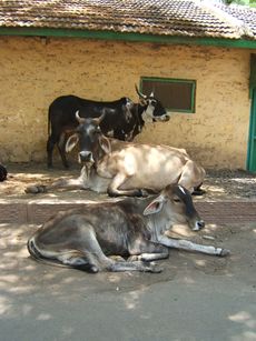
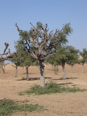
صحراء تهر
| Thar Desert Great Indian Desert | |
|---|---|
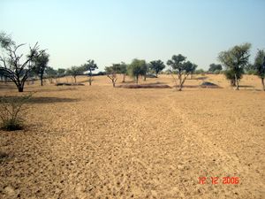
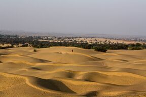 صحراء تهر في راجستان، الهند | |
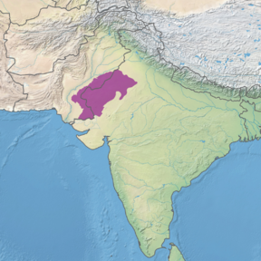 خريطة المنطقة البيئية لصحراء تهر | |
| علم البيئة | |
| النطاق | Indomalayan |
| حيوم | deserts and xeric shrublands |
| الحدود | Northwestern thorn scrub forestsو Rann of Kutch seasonal salt marsh |
| الجغرافيا | |
| المساحة | 238،254 km2 (91،990 sq mi) |
| البلدان | |
| ولايات الهند وپاكستان | راجستان، گجرات، هاريانا، پنجاب (الهند)، پنجابو السند (پاكستان) |
| الإحداثيات | 27°N 71°E / 27°N 71°E |
| الحفاظ | |
| وضع الحفاظ | vulnerable[1] |
| المحمية | 41,833 كم² (18%)[2] |
صحراء تهر، وتـُعرف أيضاً بإسم الصحراء الهندية الكبرى هي منطقة قاحلة كبيرة في الجزء الشمالي الغربي من شبه القارة الهندية، والتي تشكل حداً طبيعياً بين الهند وپاكستان. وهي الصحراء رقم 17 بين أكبر صحاري العالم، وتاسع أكبر صحراء تحت مدارية.[3] About 85% of the Thar Desert is in India, and the remaining 15% is in Pakistan.[4] In India, it covers about 320،000 km2 (120،000 sq mi), forming approximately 10% of the total geographic area of India. More than 60% of the desert lies in the state of Rajasthan alone and extends into Gujarat, Punjab, and Haryana.[5]
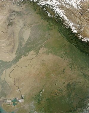 A NASA satellite image of the Thar Desert, with the India–Pakistan border superimposed |
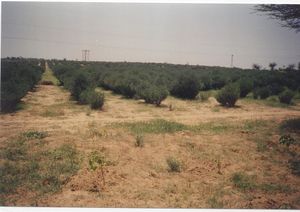
This desert comprises a very dry part, the Marusthali region in the west, and a semidesert region in the east with fewer sand dunes and slightly more precipitation.[6]
الجغرافيا
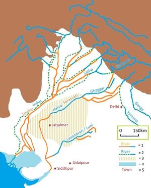
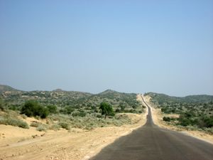
The Thar Desert extends between the Aravalli Hills in the north-east,[4] the Great Rann of Kutch along the coast and the alluvial plains of the Indus River in the west and north-west. Most of the desert is covered by huge shifting sand dunes that receive sediments from the alluvial plains and the coast. The sand is highly mobile due to strong winds occurring before the onset of the monsoon. The Luni River is the only river integrated into the desert.[7] Rainfall is limited to 100–500 mm (3.9–19.7 in) per year, mostly falling from July to September.[4]
السيطرة على التصحر
التنوع الحيوي
الوحيش
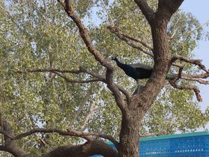
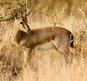
The region is a haven for 141 species of migratory and resident birds of the desert. One can see eagles, harriers, falcons, buzzards, kestrel and vultures. There are short-toed eagles (Circaetus gallicus), tawny eagles (Aquila rapax), greater spotted eagles (Aquila clanga), laggar falcons (Falco jugger) and kestrels. There are also a number of reptiles.
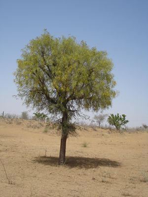
The Indian peafowl is a resident breeder in the Thar region. The peacock is designated as the national bird of India and the provincial bird of the Punjab (Pakistan). It can be seen sitting on khejri or pipal trees in villages or Deblina.Bishnois Dharmaguru Jambeshwar was an ecologist.
النبيت
البشر
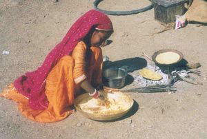
The Thar Desert is the most densely populated desert in the world, with a population density of 83 people per km2.[8] In India, the inhabitants comprise Hindus, Muslims, and Sikhs. In Pakistan, inhabitants also include both Muslims and Hindus.[9]
تهر في الأدب القديم
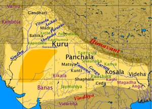
The Indian epics describe this region as Lavanasagara (salt ocean). The Ramayana mentions Lavanasagara when Rama goes to attack Lanka with the army of vanaras. Rama uses his agneyashtra-amogha to dry up the sea named drumakulya situated north of Lavanasagara. A fresh water source named Pushkar surrounded by Marukantara was created.[10]
According to Jain cosmology, Jambūdvīpa is at the centre of Madhyaloka, or the middle part of the universe, where the humans reside. Jambūdvīpaprajñapti or the treatise on the island of roseapple tree contains a description of Jambūdvīpa and life biographies of Ṛṣabha and King Bharata. Jambūdvīpa continent is surrounded by the ocean Lavanoda (salt ocean).
The Sarasvati River is one of the chief Rigvedic rivers mentioned in ancient Hindu texts. The Nadistuti hymn in the Rigveda mentions the Sarasvati between the Yamuna in the east and the Sutlej in the west, and later Vedic texts like Tandya and Jaiminiya Brahmanas as well as the Mahabharata mention that the Sarasvati dried up in a desert.
النظام البيئي للصحراء
الزراعة
الماشية
التحريش
السياحة البيئية
بحيرات الماء المالح
There are a number of salt water lakes in Thar desert. These are Sambhar, Pachpadra, Tal Chhapar, Falaudi and Lunkaransar where Sodium chloride salt is produced from salt water. The Didwana lake produces Sodium Sulphate salt. Ancient Archaeological evidences of habitations have been recovered from Sambhar and Didwana lakes which shows their antiquity and historical importance.[10]
الماء والإسكان في الصحراء
الترفيه
انظر أيضاً
- Arid Lands Information Network
- Arid Forest Research Institute
- Aridification
- Cholistan Desert
- Cyclone Phet—tracked directly over the desert
- Deforestation
- Geography of India
- List of deserts by area
- Marwar
- Pokhran
المراجع
- ^ قالب:WWF ecoregion
- ^ Eric Dinerstein, David Olson, et al. (2017). An Ecoregion-Based Approach to Protecting Half the Terrestrial Realm, BioScience, Volume 67, Issue 6, June 2017, Pages 534–545; Supplemental material 2 table S1b. [1]
- ^ Singhvi, A. K. and Kar, A. (1992). Thar Desert in Rajasthan: Land, Man & Environment. Geological Society of India, Bangalore.
- ^ أ ب ت Sinha, R. K., Bhatia, S., & Vishnoi, R. (1996). Desertification control and rangeland management in the Thar desert of India. RALA Report No. 200: 115–123.
- ^ Sharma, K. K. and S. P. Mehra (2009). The Thar of Rajasthan (India): Ecology and Conservation of a Desert Ecosystem. Chapter 1 in: Sivaperuman, C., Baqri, Q. H., Ramaswamy, G., & Naseema, M. (eds.) Faunal ecology and conservation of the Great Indian Desert. Springer, Berlin Heidelberg.
- ^ Sharma, K. K., S. Kulshreshtha, A. R. Rahmani (2013). Faunal Heritage of Rajasthan, India: General Background and Ecology of Vertebrates. Springer Science & Business Media, New York.
- ^ Laity, J. J. (2009). Deserts and Desert Environments. John Wiley & Sons.
- ^ Singh, P. (ed.) (2007). Report of the Task Force on Grasslands and Deserts. Government of India Planning Commission, New Delhi.
- ^ Raza, Hassan (5 March 2012). "Mithi: Where a Hindu fasts and a Muslim does not slaughter cows". Dawn.
A Muslim resident of Thar shared his account by saying: "In our village, Hindus and Muslims have been living together for decades and there has not been a single day, when I have seen a religious conflict. No loud speaker is used for Azaan at the time when Hindus are worshiping in their temple, and no bells are rung when it is time for namaz. Nobody eats in public when it is Ramazan and Holi is played by every member of the village." I had always heard stories about interfaith harmony from Sindh but it was so much more amazing to see it firsthand. The love and brotherhood that exists between the Hindus and Muslims of Mithi is a perfect example of pluralism and the tolerant Sufi culture of Sindh.
- ^ أ ب خطأ استشهاد: وسم
<ref>غير صحيح؛ لا نص تم توفيره للمراجع المسماةGupta2008
للاستزادة
- Bhandari M.M.- Flora of The Indian Desert, MPS Repros, 39, BGKT Extension, New Pali Road, Jodhpur, India.
- Zaigham, N. A. (2003). Strategic sustainable development of groundwater in Thar Desert of Pakistan. Water Resources in the South: Present Scenario and Future Prospects, Commission on Science and Technology for Sustainable Development in the South, Islamabad.
- Govt. of India. Ministry of Food & Agriculture booklet (1965)—soil conservation in the Rajasthan Desert—Work of the Desert Afforestation Research station, Jodhpur.
- Gupta, R.K. & Prakash Ishwar (1975). Environmental analysis of the Thar Desert. English Book Depot., Dehra Dun.
- Kaul, R.N. (1967). Trees or grass lands in the Rajasthan: Old problems and New approaches. Indian Forester, 93: 434-435.
- Burdak, L.R. (1982). Recent Advances in Desert Afforestation. Dissertation submitted to Shri R.N. Kaul, Director, Forestry Research, F.R.I., Dehra Dun.
- Yashpal, Sahai Baldev, Sood, R.K., and Agarwal, D.P. (1980). "Remote sensing of the 'lost' Saraswati river". Proceedings of the Indian Academy of Sciences (Earth and Planet Science), V. 89, No. 3, pp. 317–331.
- Bakliwal, P.C. and Sharma, S.B. (1980). "On the migration of the river Yamuna". Journal of the Geological Society of India, Vol. 21, Sept. 1980, pp. 461–463.
- Bakliwal, P.C. and Grover, A.K. (1988). "Signature and migration of Sarasvati river in Thar desert, Western India". Record of the Geological Survey of India V 116, Pts. 3–8, pp. 77–86.
- Rajawat, A.S., Sastry, C.V.S. and Narain, A. (1999-a). Application of pyramidal processing on high resolution IRS-1C data for tracing the migration of the Saraswati river in parts of the Thar desert. in "Vedic Sarasvati, Evolutionary History of a Lost River of Northwestern India", Memoir Geological Society of India, Bangalore, No. 42, pp. 259–272.
- Ramasamy, S.M. (1999). Neotectonic controls on the migration of Sarasvati river of the Great Indian desert. in "Vedic Sarasvati, Evolutionary History of a Lost River of Northwestern India", Memoir Geological Society of India, Bangalore, No. 42, pp. 153–162.
- Rajesh Kumar, M., Rajawat, A.S. and Singh, T.N. (2005). Applications of remote sensing for educidate the Palaeochannels in an extended Thar desert, Western Rajasthan, 8th annual International conference, Map India 2005, New Delhi.
وصلات خارجية
 صحراء تهر travel guide from Wikivoyage
- قالب:WWF ecoregion
- Dharssi.org.uk, Photos of the Thar desert
- Avgustin.net, Photos of the Thar desert in Pakistan side
- MIT.gov, आपणो राजस्थान
- Pages using gadget WikiMiniAtlas
- Short description is different from Wikidata
- Coordinates on Wikidata
- Pages with empty portal template
- صحراء تهر
- Deserts of India
- Deserts of Pakistan
- الصحارى والشجيرات الجافة
- Ecoregions of India
- Ecoregions of Pakistan
- عروق (جغرافيا)
- Geography of Punjab, Pakistan
- Geography of Rajasthan
- Geography of Sindh
- Tharparkar District
- Environment of Rajasthan
- Environment of Sindh
- Indomalaya ecoregions
- صحاري الهند
