صحراء كوير
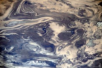
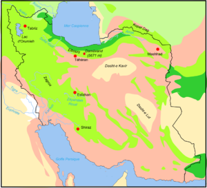
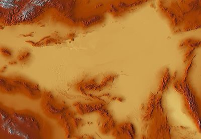
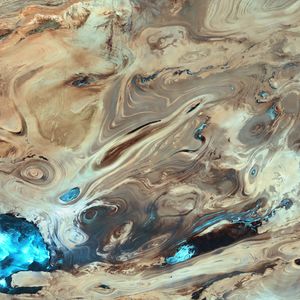
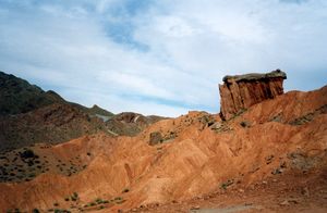
صحراء كوير (فارسية: دشت كوير، حرفياً تعني: 'السهول المنخفضة' بالفارسية الكلاسيكية، من خوَر (منخفض)، و دشت (سهل، أرض منبسطة)، ويُعرف أيضاً بإسم كوير نمك (وتعني 'لأراضي منخفضة مالحة') وصحراء الملح الكبرى؛ إنگليزية: Dasht-e Kavir)، هي صحراء كبيرة في وسط الهضبة الإيرانية. ويبلغ طولها نحو 800 كم ويبلغ عرضها 320 كم بمساحة إجمالية قدرها نحو 77,600 كم² مما يجعل ترتيبها الثالثة والعشرون بين أكبر صحاري العالم.[1] تمتد مساحة هذه الصحراء من سلسلة جبال البرز في الشمال الغربي إلى صحراء لوط في الجنوب الشرقي وتمتد في محافظات خراسان وسمنان وطهران واصفهان ويزد.
دشت تعني 'سهل' بالفارسية. It is named after the salt marshes ("kavirs") located there.[2] نمک تعني 'ملح'.
السمات
Central in the desert lies the Kavir Buzurg (Great Kavir), which is about 320 km long and 160 km (99 mi) wide. In the west lies the Daryahcheh-e Namak ("salt lake"), of 1,800 km2 (690 sq mi). It contains some large salt plates in a mosaic-like shape. It is part of a 4,000 km2 (1,500 sq mi) protected ecological zone, the Kavir National Park. One of the most desolate places of Dasht-e Kavir is the Rig-e Jenn ("devil's dunes).
الاستزراع
The extreme heat and many storms in Dasht-e Kavir cause extensive erosion, which makes it almost impossible to cultivate the lands. The desert is almost uninhabited and knows little exploitation. Camel and sheep breeding and agriculture are the sources of living to the few people living on its soil. Human settling is restricted to some oases, where wind-blocking housing constructions are raised to deal with the harsh weather conditions. For irrigation, Iranians developed a sophisticated system of water-wells known as qanats. These are still in use, and modern globally used water-revenue systems are based on their techniques.
انظر أيضاً
- صحراء لوط ('صحراء الخواء')
- جغرافيا إيران
- International rankings of Iran
- قائمة الصحاري حسب المساحة
- القناة الفارسية
الهامش
- ^ Wright, John W., ed. (2006). The New York Times Almanac (2007 ed.). New York, New York: Penguin Books. p. 456. ISBN 0-14-303820-6.
- ^ John K. Warren (2006). Evaporites:Sediments, Resources and Hydrocarbons: Sediments, Resources, and Hydrocarbons. Springer. p. 219. ISBN 978-3-540-32344-0.
- Pages using gadget WikiMiniAtlas
- Articles containing فارسية-language text
- Articles containing إنگليزية-language text
- Pages using Lang-xx templates
- Coordinates on Wikidata
- Deserts of Iran
- قطاعات جغرافية طبيعية
- الهضبة الإيرانية
- Salt flats
- Geography of Yazd Province
- Geography of Isfahan Province
- Geography of Tehran Province
- Geography of Semnan Province
