صحراء قرة قم
| صحراء قرة قم | |
|---|---|
| Karakum Desert | |
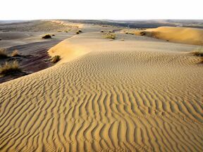 Sand dunes in the desert, in Turkmenistan | |
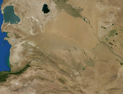 The Karakum Desert by NASA World Wind | |
| المساحة | 350،000 km2 (140،000 sq mi) |
| الجغرافيا | |
| البلد | Turkmenistan |
| الولاية/المقاطعة | Central Asia |
| الإحداثيات | خطأ في التعبير: علامة ترقيم لم نتعرف عليها «,».km 40°30′N 60°00′E / 40.500°N 60.000°E |
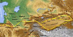
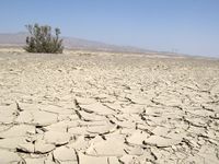
صحراء قرةقوم Karakum Desert وتُكتَب أيضاً Kara-Kum و Gara-Gum (تركمانية: Garagum, تُنطق [ɡɑɾɑˈɡʊm], from gara ("أسود") and gum ("رمل")؛ روسية: Караку́мы, النطق Karakumy; النطق الروسي: [kərɐˈkumɨ] هي صحراء تقع في آسيا الوسطى. The name refers to the shale-rich sand beneath the surface.[1] وتقع إلى الشرق من بحر قزوين تغطي 70% من أراضي تركمانستان وتبلغ مساحتها 350,000 كم².
The population is sparse, with an average of one person per 6.5 km2 (2.5 sq mi). Rainfall is also rare, ranging from 70 إلى 150 mm (3 إلى 6 in) per year.[2] ويشهد معدل سقوط الأمطار في المنطقة انخفاضاً كبيراً فنادراً ما تمطر خلال مدة عقد.
الجغرافيا
The desert covers roughly seventy percent of Turkmenistan,[3] a long east–west swath. It sits east of the Caspian Sea which has a steep east bank. It adjoins, to the north, the long delta feeding the South Aral Sea further north, another endorheic lake, about 58 m (190 ft) higher than the Caspian Sea. The delta is that of the Amu Darya river to the northeast, demarcating the long border with the Kyzylkum Desert of Uzbekistan. The desert is divided into three regions, the elevated northern Trans-Unguz Karakum, the low-lying Central Karakum, and the southeastern Karakum, home to a chain of salt marshes.[4] Since the early 1980s, the relatively small desert extension, the Aralkum, has come to occupy most of the former seabed of the Aral Sea, about 15،440 sq mi (40،000 km2). The sea has fluctuated over millennia, but its majority loss during the Soviet Union's existence coincided with great irrigation projects. The North Aral Sea was partly restored, but the South Aral Sea ebbed to a small-size stasis at its river mouth,[5] which itself dried up by 2014,[6] leaving only fragments of the former sea behind, such as Barsakelmes Lake.
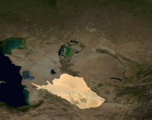
Within the north-west edge of the desert used to be a river. In the late Pleistocene, the Amu Darya used to flow beyond the Aral Basin to Sarykamysh Lake then to the Caspian Sea. Sedimentation and floods during a pluvial period led to overflow to the Zeravshan River valley to the east. The two flows merged and formed or expanded Horezm Lake, which had been formed by the earlier Khvalinian period, and as it overflowed northwards it carved its link with the Aral Sea along the Akcha Dar'ya population corridor of that low, gentle valley (a remote community of Western Uzbekistan and north-east Turkmenistan).[7]
البيئة
The sands of the Aral Karakum are made of finely-dispersed evaporites and remnants of alkaline mineral deposits, washed into the basin from irrigated fields.
الحياة البرية
Wildlife in this area is not very diverse and includes insects and arachnids such as ants, termites, ticks, spiders, dung beetles, and darkling beetles. Lizards, turtles and snakes also live in the Karakum. Bird species include Alauda, desert sparrows, and other species, while rodents include jerboas and gophers. The tolai hare, goitered gazelle, and corsac fox are examples of mammal species in the Karakum Desert.[8]
الجيولوجيا

The Karakum is home to the Darvaza gas crater. Also called the "Door to Hell" or the "Gates of Hell" by locals, it is a crater of natural gas that has been burning since 1971. The crater is a major tourist attraction, with hundreds of visitors arriving each year.[9]
The area has significant oil and natural gas deposits.[بحاجة لمصدر]
الهيدروجرافيا
To the south the Murghab and Tejen rivers flow out of the Hindu Kush mountains, flow west, and empty into the desert, providing water for irrigation.
The desert is crossed by the second-largest irrigation canal in the world, the Karakum Canal, which brings water from the Amu Darya to southern regions of the desert.[1] Construction on the canal was started in 1954 and completed in 1958.[1] It is 1،375 km (900 mi) in length, and carries 13-20 km³ of water annually.[1]
الآثار
Within the Karakum are the Uly Balkan, a mountain range in which archaeologists have found human remains dating back to the Stone Age.
الاقتصاد والموارد
The oases of Mary and Tejen are noted for cotton growing.
النقل
The desert is crossed by the Trans-Caspian Railway.
بحيرة العصر الذهبي
Golden Age Lake, known as Altyn Asyr köli locally,[10] alternatively as Karakum Lake, is a man-made lake under construction in the Karashor depression in the Karakum Desert.
Upon completion, the lake will span 2،000 متر كيلومربع (770 sq mi) with a maximum depth of 70 متر (230 ft), and hold more than 130 cubic kilometers (4600 billion cubic feet) of water. Filling the lake could take 15 years and cost up to $4.5 billion.[11] According to government plans, it is intended to be filled by a 2،650-كيلومتر (1،650 mi) network of tributary canals. The Dashoguz Collector, spanning a distance of 432 kilometers, traces approximately half of its course along the historic path of the Uzboy River. The Great Turkmen Collector starts in Lebap Province and is 720 km (450 mi) long.[12] They are used for pumping run-off water from irrigated cotton fields[13] towards the lake.
انظر أيضاً
ملاحظات ومراجع
- Footnotes
- References
- ^ أ ب ت ث Scheffel, Richard L.; Wernet, Susan J., eds. (1980). Natural Wonders of the World. United States of America: Reader's Digest Association, Inc. pp. 199. ISBN 0-89577-087-3.
- ^ "Karakum Desert -- Britannica Online Encyclopedia". www.britannica.com. Retrieved 2008-02-22.
- ^ "Karakum Desert | Map & Facts | Britannica". www.britannica.com (in الإنجليزية). Retrieved 2022-01-28.
- ^ "Karakum Desert | Map & Facts | Britannica". www.britannica.com (in الإنجليزية). Retrieved 2022-01-28.
- ^ "Aral Sea". State of Environment of the Aral Sea Basin: Regional Report of the Central Asian States. International Fund on the Aral Sea. 2000. Archived from the original on 16 March 2009.
- ^ "World of Change: Shrinking Aral Sea". The Earth Observatory. National Aeronautics and Space Administration. Retrieved 3 November 2022.
- ^ Razakov, RM (1996). The Aral Sea Basin. Springer. ISBN 978-3-642-64736-9. Retrieved 27 March 2019.
- ^ Rustamov, Anver K. (1994), "Ecology of Birds in the Karakum Desert", Biogeography and Ecology of Turkmenistan, Monographiae Biologicae, 72, Dordrecht: Springer Netherlands, pp. 247–263, doi:, ISBN 978-94-010-4487-5
- ^ Geiling, Natasha. "This Hellish Desert Pit Has Been On Fire for More Than 40 Years". Smithsonian (in الإنجليزية). Retrieved 2017-06-19.
- ^ President inaugurates Turkmen lake
- ^ Turkmenistan creates vast lake in the desert
- ^ A New Great Lake—or Dead Sea?
- ^ Turkmenistan Vows to Water its Desert
وصلات خارجية
- Gonur Depe site in the Karakum Desert
- photos and about the Karakum Desert
- TravelBlog Darvasa Craters: Entrance to Hell
- Where Is the Karakum Desert? at WorldAtlas
 Chisholm, Hugh, ed. (1911). . دائرة المعارف البريطانية. Vol. 15 (eleventh ed.). Cambridge University Press. pp. 675–676.
 {{cite encyclopedia}}: Cite has empty unknown parameter:|coauthors=(help)
- Pages using gadget WikiMiniAtlas
- Short description is different from Wikidata
- Coordinates on Wikidata
- Articles containing تركمانية-language text
- Pages with plain IPA
- Articles containing روسية-language text
- Articles with unsourced statements from March 2017
- مقالات المعرفة المحتوية على معلومات من دائرة المعارف البريطانية طبعة 1911
- صحاري آسيا الوسطى
- صحاري قزاقستان
- صحاري أوزبكستان
- عروق (جغرافيا)
- صحاري تركمانستان
