محافظة مازندران
محافظة مازندران
| |
|---|---|
 | |
| الإحداثيات: 36°33′56″N 53°03′32″E / 36.5656°N 53.0588°E | |
| البلد | |
| المنطقة | الأولى [1] |
| العاصمة | ساري |
| مقاطعات | 22 |
| المساحة | |
| • الإجمالي | 23٬842 كم² (9٬205 ميل²) |
| التعداد (2016)[2] | |
| • الإجمالي | 3٬283٬582 |
| • الكثافة | 140/km2 (360/sq mi) |
| صفة المواطن | مازندراني |
| منطقة التوقيت | UTC+03:30 (توقيع إيران) |
| • الصيف (التوقيت الصيفي) | UTC+04:30 (توقيت إيران الصيفي) |
| ISO 3166 code | IR-02 |
| اللغات الرئيسية | مازندراني (طبري)[3] الفارسية[3] |
| HDI (2017) | 0.845[4] very high · 4th |


.jpg&filetimestamp=20240116044452&)


محافظة مازندران النطق (فارسية: استان مازندران وتُرَوْمن: Ostân-e Mâzandarân؛ مازندراني: مازِرون اوستان, romanized as Mâzerun Ustâne}}[أ]، هي واحدة من 31 محافظة في إيران. وُضعت المدينة كجزء من المنطقة الأولى لدى تقسيم المحافظات إلى 5 مناطق، والذي يهدف فقط لأغراض التنسيق والتنمية، في 22 يونيو 2014.[1] Its capital is the city of Sari.[5] Located along the southern coast of the Caspian Sea and in the adjacent Central Alborz mountain range, the province is in the central-northern part of the country. Mazandaran, founded in 1937, covers an area of 23,842 km2.[6][7]
At the time of the 2006 National Census, the province had a population of 2,893,087 in 783,169 households.[8] The following census in 2011 counted 3,073,943 people in 931,007 households.[9] At the most recent census in 2016, the population had risen to 3,283,582 in 1,084,798 households.[2] Mazandaran is one of the most densely populated provinces in Iran.[10]
The province has diverse natural resources, notably large reservoirs of oil and natural gas.[11] The diverse natural habitats of the province include plains, prairies, forests and rainforest[12] stretching from the sandy beaches of the Caspian Sea to the rugged and snowcapped Alborz sierra,[13] including Mount Damavand, one of the highest peaks and volcanoes in Asia.[14]
Mazandaran is a major producer of farmed fish,[15] and aquaculture provides an important economic addition to traditional dominance of agriculture.[16] Another important contributor to the economy is the tourism industry, as people from all of Iran enjoy visiting the area.[17] Mazandaran is also a fast-growing centre for biotechnology.[11]
. . . . . . . . . . . . . . . . . . . . . . . . . . . . . . . . . . . . . . . . . . . . . . . . . . . . . . . . . . . . . . . . . . . . . . . . . . . . . . . . . . . . . . . . . . . . . . . . . . . . . . . . . . . . . . . . . . . . . . . . . . . . . . . . . . . . . . . . . . . . . . . . . . . . . . . . . . . . . . . . . . . . . . . .
أصل الاسم
Literally "the gate or the valley of the giants" from مازن (mâzan) + در (dar) + ـان (ân), from Avesta (آڤستان: 𐬨𐬀𐬰𐬀𐬌𐬥𐬌𐬌𐬀, romanized: mazainiia, lit. 'giant'). The name has been used in Shahnameh to refer to a land inhabited by divs or (daevas) and sorcerers and is difficult to conquer.
In Mazandaran, there are places named Div Asiyab, Div Cheshmeh, Div Kela, Div Hamam, etc.
التاريخ
 Sasanian silver-gilt plate with scene of musicians playing. Seventh century. |
Human habitation in the area dates back at least 75,000 years.[18] Recent excavations in Gohar Tape in Rostamkola provide proof that the area has been urbanized for more than 5,000 years, and the area is considered one of the most important historical sites of Iran.[19] It has played an important role in cultural and urban development of the region.[20] Mazandaran is one of the oldest areas without a significant nomadic heritage, thus culturally sedentary.
Indigenous peoples of the region include the ethnic Mazanderanis,[21] who speak an Iranian language which most closely resembles Gilaki and Sangiseri language, but also has phono-typical similarities to several Caucasian languages, reflecting the history of the region and its peoples.
In the early 20th century, Reza Shah connected northern Elbourz to the southern slopes by constructing seven new roads and railways, the provinces of Mazandaran and Gilan became known as Shomal by all Iranians (meaning "the North" in Persian). Mazandaran is a Caspian province in the north of Iran.[22] Located on the southern coast of the Caspian Sea, it is bordered clockwise by Russia (across the sea), Golestan, Semnan, Tehran, Alborz, Qazvin, and Gilan Provinces. Sari is the largest city and the capital of Mazandaran province.
Mazandaran Province was made part of the Region 1 upon the division of the provinces into five regions solely for coordination and development purposes on June 22, 2014.[1]

.jpg&filetimestamp=20231117032014&)
897.12-31.189.jpg&filetimestamp=20240713135751&)
قبل الإسلام
| جزء من سلسلة عن |
| تاريخ طبرستان |
|---|
 |
Before the arrival of the Iranian-speakers to Iran, native people of this area were subsistence hunters and cattle herders. Archaeological studies in caves belt and Hutu man in Behshahr in the Mazandaran date to ca. 9500 BCE. The Amard were a tribe living along the mountainous region bordering the Caspian Sea, including current day Amol. Tapuri[23] were a tribe in the Medes south of the Caspian Sea mentioned by Ptolemy and Arrian.[24] Ctesias refers to the land of Tapuri between the two lands of Cadusii and Hyrcania.[25]

The territory known as Mazandaran has changed hands among various dynasties from early in its history. There are several fortresses remaining from the Parthian Empire and Sasanian Empire, and many older cemeteries scattered throughout the province. During this era, Mazandaran was part of Hyrcania, which was one of the important provinces.
In 662 CE, ten years after the death of Yazdegerd III, the last Sasanian emperor, a large Muslim army under the command of Hassan ibn Ali invaded Tabarestan.
With the advent of the Sasanian Empire, the King of Mazandaran (Tabaristan and Padashkhwargar) was Gushnasp,[26] whose ancestors had reigned in the area (under the Parthian empire) since the time of Alexander the Great. In 529–536, Mazandaran was ruled by the Sasanian prince Kawus, son of Kawadh.[26] Anushirawan, the Sasanian king, defeated Zarmihr, who claimed his ancestry from the legendary blacksmith Kaveh.[26] This dynasty ruled the area till 645 AD, when Gil Gilanshah (a descendant of the Sasanian king Jamasp and a grandson of Piruz) joined Mazandaran to Gilan.[26]
In 651 the Sasanid Empire fell, and all of the Sasanid domains gradually came under Arab control, except for the Caspian region of Iran (among which Tabaristan).
التاريخ الإسلامي
Tabaristan maintained an existence independent of the Umayyad Caliphate which supplanted the Sasanian Empire in the early seventh century, with independent Zoroastrian houses like the Bavand and Karen fighting an effective guerilla warfare against the Ummayads. A short-lived Alid Shiite state collapsed before the subsequent take-over by the Ziyarid princes. During the post-Islamic period the local dynasties fell into three classes: local families of pre-Islamic origin; the ʿAlid sayyid; and local families of secondary importance.[26]

The Karinids claimed descent from Karin, brother of Zarmihr who was the pre-Islamic ruler under the Sasanians.[26] Their last representative Mazyar was put to death in 839.[26]
In the 9th-11th century AD, there were repetitively military raids undertaken by the Rus' between 864 and 1041 on the Caspian Sea shores of Iran, Azerbaijan, and Dagestan as part of the Caspian expeditions of the Rus'.[27] Initially, the Rus' appeared in Serkland in the 9th century traveling as merchants along the Volga trade route, selling furs, honey, and slaves. The first small-scale raids took place in the late 9th and early 10th century. The Rus' undertook the first large-scale expedition in 913; having arrived on 500 ships, they pillaged the westernmost parts of Gorgan as well as Mazandaran and Gilan, taking slaves and goods.

The Bavandids, who claimed descent from Kawus, provided three dynasties.[26] The first dynasty (665–1007) was overthrown on the conquest of Tabaristan by the Ziyarid Kabus b. Wushmgir.[26] The second dynasty reigned from 1073 to 1210, when Mazandaran was conquered by 'Ala al-Din Muhammad Khwarzamshah.[26] The third ruled from 1237 to 1349 as vassals of the Mongols.[26] The last representative of the Bavandids was killed by Afrasiyab Chulawi.[26]
The Paduspanids claimed descent from the Dabuyids of the north.[26] They came to prominence around 660 and during the rule of the ʿAlids were their vassals. Later, they were vassals of the Buyids and Bavandids, who deposed them in 1190.[26] The dynasty, restored in 1209–10, survived until the time of Timur; the branch, claiming descent from Kawus the son of Kayumarth reigned until 1567 and the other, that of Iskandar the son of Kayumarth, until 1574.[26]
In the Safavid era (1501–1736) Mazandaran was settled by very large numbers of Georgians, Circassians, Armenians, and other Peoples of the Caucasus, whose descendants still live or linger across Mazandaran. Towns, villages and neighbourhoods in Mazandaran still bear the name "Gorji" (i.e., Georgian) in them, although most of the large amounts of Georgians, Armenians, and Circassians are already assimilated into the mainstream Mazandaranis. The history of Georgian settlement is described by Iskandar Beg Munshi, the author of the 17th century Tarikh-e Alam-Ara-ye Abbasi, and both the Circassian and Georgian settlements by Pietro Della Valle, among other authors.[28]
Tabaristan remained independent until 1596, when Shah Abbas I, Mazandarani on his mother's side, incorporated Mazandaran into his Safavid empire, forcing many Armenians Circassians, Georgians, to settle in Mazandaran. Pietro della Valle (1586–1652), who visited a town near Firuzkuh in Mazandaran, noted that Mazandarani women never wore the veil and didn't hesitate to talk to foreigners. He also noted the extremely large amount of Circassians and Georgians in the region, and that he had never encountered people with as much civility as the Mazandaranis.
Today, Persia proper, Fars, Mazanderan on the Caspian Sea and many other lands of this empire are all full of Georgian and Circassian inhabitants. Most of them remain Christian to this day, but in a very crude manner, since they have neither priest nor minister to tend them.
. . . . . . . . . . . . . . . . . . . . . . . . . . . . . . . . . . . . . . . . . . . . . . . . . . . . . . . . . . . . . . . . . . . . . . . . . . . . . . . . . . . . . . . . . . . . . . . . . . . . . . . . . . . . . . . . . . . . . . . . . . . . . . . . . . . . . . . . . . . . . . . . . . . . . . . . . . . . . . . . . . . . . . . .
Post-Safavid period
After the Safavid period, the Qajars began to campaign south from Mazandaran with Agha Mohammad Khan who already incorporated Mazandaran into his empire in 1782. On 21 March 1782, Agha Mohammad Shah proclaimed Sari as his imperial capital. Mazandaran was the site of local wars in those years, which led to the transfer of the capital from Sari to Tehran by Fath Ali Shah. In Modern era at Mazandaran make new house and bridge in Amol and Sari. In along the beach and in the forest built Villa and modern settlements.
Before the reign of Nader Shah, the province was briefly occupied by the Russian army in the aftermath of the Russo-Persian War (1722–23) and returned to Persia in 1735. Following the outcomes of the Russo-Persian War (1804–13) and the Russo-Persian War (1826–28) northern Iran, especially Mazandaran and Gilan, as well as, to a certain extent, Tehran, fell under a growing Russian sphere of influence.[بحاجة لمصدر]
In the 19th century, during the reign of Fath-Ali Shah Qajar, the verdant region of Mazandaran was paid due attention as a recreational area.
The top provincial official referred to the existence of three international airports and three major sea ports in the province and the visit of millions of Iranian and foreign tourists to Mazandaran, including health tourists.
الجغرافيا
.JPG&filetimestamp=20240713135738&)

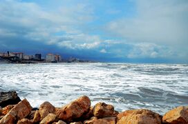
Mazandaran is located on the southern coast of the Caspian Sea. It is bordered clockwise by Golestan, Semnan and Tehran provinces.[29] This province also borders Qazvin and Gilan to the west.
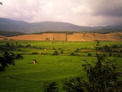
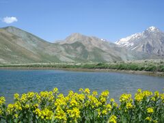
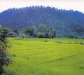
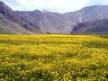
Mazandaran Province is geographically divided into two parts: the coastal plains, and the mountainous areas. The Alborz Mountain Range surrounds the coastal strip and the plains abutting the Caspian Sea like a huge wall. Due to the prevailing sea breeze and local winds of the southern and eastern coasts of the Caspian Sea, sandy hills are formed, causing the appearance of a low natural barrier between the sea and plain. There is often snowfall in the Alborz regions, which run parallel to the Caspian Sea's southern coast, dividing the province into many isolated valleys. The province enjoys a moderate, subtropical climate with an average temperature of 25 °C in summer and about 8 °C in winter. Although snow may fall heavily in the mountains in winter, it rarely falls at sea level.
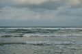
Caspian Sea coast at Nur
Shalizar (Rice Fields)
Pasturage
Aseman kuh (peak in Alborz range) viewed from Kahrizak Dare (lake), Lar.
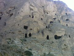
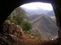
Kafer Keli rock-cut dwellings, Larijan, Mount Damavand
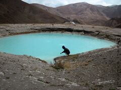
Dyvasyab Mineral springs, Dasht-e Lar, Mount Damavand
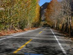
Karaj Chalus Road

Javarom Forest Park
Alborz Dam Lafoor
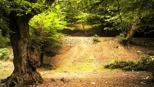
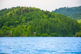
Forest in Mazandaran
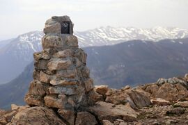
Arfa Kuh Summit, Mazandaran, Iran


.jpg&filetimestamp=20240713135922&)


_springs,_(Info_in_page_1),_Damavand_mount,_Dasht-e_Lar_-_panoramio.jpg&filetimestamp=20240713135905&)


Ecoregions:
The total wood production from these forests is estimated at 269,022 cubic metres (9,500,400 cu ft). Golestan National Park and Shastkolateh forest watershed are located in Golestan Province and Mazandaran Province (the total area of the Hyrcanian forest is estimated at 965,000 ha (2,380,000 acres). From these forests, 487,195 ha (1,203,890 acres) are used commercially, 184,000 ha (450,000 acres) are protected and the rest are regarded as forest lands or over-used forests. The total of the forest woods used in this province is estimated at 770,551 cubic metres (27,211,800 cu ft). The Kojoor, Dohezar and Sehezar forest watersheds are located in Mazandaran Province. The Elburz Range forest steppe ecoregion is an arid, mountainous 1,000-kilometer arc south of the Caspian Sea, stretching across northern Iran from the Azerbaijan border to near the Turkmenistan border. It covers 63,300 square kilometres (24,400 sq mi) and encompasses the southern and eastern slopes of the Alborz Mountains as well as their summits. The Caspian Hyrcanian mixed forests ecoregion, with its lush green mountainsides and plains that receive moisture from the Caspian Sea, forms this ecoregion's northern border. The vast Central Persian desert basin ecoregion forms its southern border. The Alborz range is composed of a granite core overlain with sedimentary rock including limestones, shales, sandstones, and tuffs. Metamorphic rocks such as schists, marbles, and amphibolite are also widely found.[30] The climate is arid with annual precipitation varying from 150 mm to 500 mm, falling mostly as winter snow.
البيئة
The now extinct Caspian tiger and the Caspian horse are two of the animals of Mazandaran province.
The 1971 Ramsar Convention on Wetlands of International Importance especially as Waterfowl Habitat was held in Mazandaran in the city of Ramsar.
أماكن قريبة من محافظة مازندران | |
|---|---|

Unlike the rest of Iran, Mazandaran is watered by numerous rivers, or mountain torrents, all running from the mountains to the sea. The German traveller Samuel Gottlieb Gmelin, who visited this country in 1771, says that in the space of eight miles, on the road from Resht to Amot, 250 of such streams are to be seen, many of them being so exceedingly broad and deep, that the passage across is sometimes impracticable for weeks together.
المناخ

Mazandaran Province naturally comes under the influence of the geographical latitude, the Alborz mountain range, elevation from sea level, distance from the sea, and the southern barren areas of Turkmenistan, local and regional air currents, and versatile vegetation cover. These conditions result in the climatic division of the province into three types:[31]
- Moderate Caspian climate with hot, humid summers and mild, humid winters. This climate is found in the western and central plains of the province between the Caspian sea and the foothills the Alborz mountains. Rainfall is significant in this climate zone and is highest in autumn. the annual accumulation decreases from west to east. Frost occasionally occurs during winters.
- moderate mountainous climate generally in the altitude between 1,500 to 3,000 metres (4,900 to 9,800 ft) meters and is characterized by a decrease in both precipitation and monthly temperatures. winters are long, cold and freezing and summers are mild and short.
- Cold mountainous climate with long freezing winters with long periods of frost and short cool summers. There is often snowfall during most of the seasons in the latter region, which continues till mid-summer. The climate is mainly found at an altitude above 3,000 m (9,800 ft), such as the top of Mount Damavand and Alam-Kuh, where the conditions are suitable for mountain glacier
التقسيمات الإدارية
| خريطة محافظة مازندران حسب المدينة |

| Counties | 2006[8] | 2011[9] | 2016[2] |
|---|---|---|---|
| Abbasabad[ب] | — | 47,591 | 52,832 |
| Amol | 343,747 | 370,774 | 401,639 |
| Babol | 464,538 | 495,472 | 531,930 |
| Babolsar | 172,600 | 124,323 | 135,191 |
| Behshahr | 154,957 | 155,247 | 168,769 |
| Chalus | 119,559 | 122,736 | 116,542 |
| Fereydunkenar[ت] | — | 57,980 | 60,031 |
| Galugah | 39,450 | 38,847 | 40,078 |
| Juybar | 70,204 | 73,554 | 77,576 |
| Kelardasht[ث] | — | — | 23,648 |
| Mahmudabad | 90,054 | 96,019 | 98,407 |
| Miandorud[ج] | — | 55,776 | 55,053 |
| Neka | 104,753 | 111,944 | 119,511 |
| North Savadkuh[ح] | — | — | 24,834 |
| Nowshahr | 116,334 | 128,647 | 138,913 |
| Nur | 104,807 | 109,281 | 121,531 |
| Qaem Shahr | 293,721 | 320,741 | 309,199 |
| Ramsar | 67,675 | 68,323 | 74,179 |
| Sari | 490,830 | 478,370 | 504,298 |
| Savadkuh | 66,430 | 64,378 | 43,913 |
| Simorgh[خ] | — | — | 19,376 |
| Tonekabon | 193,428 | 153,940 | 166,132 |
| Total | 2,893,087 | 3,073,943 | 3,283,582 |
. . . . . . . . . . . . . . . . . . . . . . . . . . . . . . . . . . . . . . . . . . . . . . . . . . . . . . . . . . . . . . . . . . . . . . . . . . . . . . . . . . . . . . . . . . . . . . . . . . . . . . . . . . . . . . . . . . . . . . . . . . . . . . . . . . . . . . . . . . . . . . . . . . . . . . . . . . . . . . . . . . . . . . . .
Cities
According to the 2016 census, 1,897,238 people (over 57% of the population of Mazandaran Province) live in the following cities: [2]
| City | Population |
|---|---|
| Abbasabad | 13,482 |
| Alasht | 1,193 |
| Amirkola | 30,478 |
| Amol | 237,528 |
| Arateh | 10,327 |
| Babol | 250,217 |
| Babolsar | 59,966 |
| Bahnemir | 7,906 |
| Baladeh | 970 |
| Behshahr | 94,702 |
| Chalus | 65,196 |
| Chamestan | 11,194 |
| Dabudasht | 1,758 |
| Emamzadeh Abdollah | 5,768 |
| Farim | 369 |
| Fereydunkenar | 38,154 |
| Galugah (Babol) | 6,908 |
| Galugah (Galugah) | 21,352 |
| Gatab | 7,374 |
| Gazanak | 319 |
| Hachirud | 10,398 |
| Hadishahr | 7,889 |
| Izadshahr | 7,439 |
| Juybar | 32,924 |
| Kelarabad | 6,267 |
| Kelardasht | 13,401 |
| Ketalem and Sadat Shahr | 20,716 |
| Khalil Shahr | 11,032 |
| Khorramabad | 11,542 |
| Khush Rudpey | 5,742 |
| Kiakola | 8,040 |
| Kiasar | 3,384 |
| Kojur | 3,120 |
| Kuhi Kheyl | 2,242 |
| Mahmudabad | 31,844 |
| Marzanabad | 6,698 |
| Marzikola | 868 |
| Nashtarud | 6,394 |
| Neka | 60,991 |
| Nowshahr | 49,403 |
| Nur | 26,947 |
| Pain Hular | 956 |
| Pol-e Sefid | 8,294 |
| Pul | 3,150 |
| Qaem Shahr | 204,953 |
| Ramsar | 35,997 |
| Rineh | 982 |
| Rostamkola | 11,686 |
| Royan | 7,731 |
| Salman Shahr | 9,656 |
| Sari | 309,820 |
| Shirgah | 8,671 |
| Shirud | 11,377 |
| Sorkhrud | 6,699 |
| Surak | 9,208 |
| Tonekabon | 55,434 |
| Zargarmahalleh | 3,991 |
| Zirab | 16,191 |
أكبر المدن
The following sorted table, lists the most populous cities in Mazandaran.
| الترتيب | المدينة | المقاطعة | التعداد[2] |
|---|---|---|---|
| 1 | Sari | Sari | 309,820 |
| 2 | Babol | Babol | 250,217 |
| 3 | آمل | Amol | 237,528 |
| 4 | Qaem Shahr | Qaem Shahr | 204,953 |
| 5 | Behshahr | Behshahr | 94,702 |
| 6 | Chalus | Chalus | 65,196 |
| 7 | Neka | Neka | 60,991 |
| 8 | Babolsar | Babolsar | 59,966 |
| 9 | Tonekabon | Tonekabon | 55,434 |
| 10 | Nowshahr | Nowshahr | 49,403 |
| 11 | Fereydunkenar | Fereydunkenar | 38,154 |
| 12 | Ramsar | Ramsar | 35,997 |
الحوكمة
Mazandaran has 9 electoral fields and a total of 12 seats in the Islamic Consultative Assembly.[38]
السكان

The population of the province has been steadily growing during the last 50 years. The following table shows the approximate province population, excluding the Golestan province, which has separated as an independent province in 1998.
The population is overwhelmingly Mazandarani, with a minority of Gilaks, Azerbaijanis, Kurds, Georgians, Armenians, Circassians, Turkmen and others.[39][40]
Mazandarani people have a background in Tabari ethnicity and speak Mazandarni. Their origin goes back to Tapuri people. So their land was called Tapuria, the land of Tapuris. Tapuris were made to migrate to the south coast of the Caspian Sea during the Achaemenid dynasty.[24][41][42]
The native people of Sari, Amol, Qaem Shahr, Babol, Nowshahr, Chalus, and Tonekabon are Mazandarani people and speak the Mazandarani language.[43][44]
The eastern Gīlakī dialect is spoken in the entire valley of the Čālūs river, though Kurdish tribes were established in the yeylāq of Kojūr and Kalārdašt in the Qajar period.[45] Today Kurds in Mazandaran are mostly known as Khajevand Kurds and form majority of the cities of Kelardasht, Abbasabad, Nowshahr, Chalus and Kajur. Other Kurdish tribes in Mazandaran Province are Modanlu (In Sari), Jahanbeiglou (In Sari), Abdolmaleki (In Behshahr), Jalalvand (In Ramsar) and Amarlu (In Tonekabon).[39]
The Mazandarani inhabit the majority of the province. The closely related Gilak form the largest minority and are concentrated in Ramsar,[46][47] Tonekabon.[48]
In recent years the region has seen an influx of Iranians from other regions of Iran, many of them attracted by its nature and seaside.
Language

Mazanderani or Tabari is a Northwestern Iranian language. Various Mazandarani dialects exist which are spoken in Mazandaran province and the neighboring Golestan province such as Mazanderani, and Gorgani and possibly Qadikolahi (Ghadikolahi) and Palani. Today, Mazandaranis also use Persian (Western Persian).[3] The educated can communicate and read Persian well.[49]
Mazandarani people have a background in Tabari ethnicity and speak Mazandarni. Their origin goes back to Tapuri people. So their land was called Tapuria, the land of Tapuris. Tapuris were made to migrate to the south coast of the Caspian Sea during the Achaemenid dynasty.[24][41][42]
The native people of Sari, Qaem Shahr, Babol, Amol, Nowshahr, Chalus, and Tonekabon are Mazandarani people and speak the Mazandarani language.[43][44]
The people residing in Chalus speak Mazanderani language. The dialect of Kalarestaqi[50] is spoken in the west of Chalus and the dialect of Kojuri[51] in the east.
The people residing in Nowshahr speak the Kojuri-dialect of Mazanderani language.[51]
The closely related Gilaks form the largest minority in Mazandaran. They speak the Gilaki language and are concentrated in Ramsar,[46][47] and Tonekabon.[48] The native people in Ramsar are Gilaks although there are also Mazandarani people living there. They speak the Gilaki language although the style they speak has been influenced by the Mazandarani language, making it slightly different from the Gilaki spoken in Gilan.
The eastern Gīlakī dialect is spoken in the entire valley of the Čālūs river (Bazin and Bromberger, p. 13), though some Kurdish tribes were established in the yeylāq of Kojūr and Kalārdašt in the Qajar period (Planhol, p. 38).[45]
A dialect of Azeri is spoken in the town of Galoogah.[52]
الاقتصاد
.jpg&filetimestamp=20240713145655&)
The province is one of the 5 wealthiest in Iran. Oil wealth has stimulated industries in food processing, cement, textiles, cotton, and fishing (caviar). Iran's Cultural Heritage Organization lists close to 630 sites of historical and cultural significance, many of which are tourist attractions. Rice, grain, fruits, cotton, tea, tobacco, sugarcane, Flower, Mineral water, caviar, Dairy product, Meat industry and silk are produced in the lowland strip along the Caspian shore. Oil wealth has stimulated industries in food processing, cement, textiles, cotton, and fishing (caviar). Mazandaran, with 230,000 hectares of paddies, produces about one million tonnes of rice a year, or 42 percent of the country's total.[53] Over 70 kinds of agricultural produce are grown in Mazandaran that meets 40% of domestic demand for rice and 50% of citrus fruits. The province is also the sole domestic supplier of kiwi.[54] Mazandaran has 3,500 industrial and production units. Mazandaran is home to 460,000 hectares of farmland producing around 6 million tons of agro products annually. Over 10% of value-added in Iran's agriculture sector is generated in Mazandaran province.[55]
The textile industry included 212 large and small industrial units operating in the province in 1995. These include the Mazandaran's nassaji company, based in Qaemshahr, the Chitsazi factory of Behshahr, the Gooni bafi of Mahmudabad, and the Chukha factory of Sari.[56] Some of these industrial units are no longer active because of issues happened after being transferred to the private sector in 1990s and 2000s.[57][58][59]
الصادرات
Germany, Russia, Iraq, France Turkey, Kazakhstan, India, Malaysia, United Arab Emirates, Afghanistan, Belarus, Italy, Bahrain, Pakistan, Switzerland Ukraine, United States, Spain, Netherlands and Central Asian countries were Mazandaran's main export destinations during the period. The province in 2017 exported close to $800 million worth of goods. In the previous year totally about 800 million dollars of non-oil goods produced in Mazandaran were exported, half of which were exported from customs outside the province.[60] In 2017 year main exports from the province consisted of dairy products (57%), food products (12%), industrial commodities (10%), pipes and profiles (8%) and cement (7%).[61]
Station
Mazandaran is also a fast-growing centre for tourist, innovation, biotechnology and civil engineering.
الغاز والنفط
From 1951 to 1978, and particularly after the formation of National Iranian Oil Company (NIOC), the first exploration well was spudded. Up to 1970, 16 wells had been drilled near mud volcanoes. All these wells produced only natural gas and technical studies showed that continuation of these operations would be uneconomical. 10 thousand tons export oil and Uncertain amount of gas exported to Asian countries from Mazandaran.
إحصائيات
- 9th rank industrial units Iran
- 5th rank general industry Iran
- 4th rank tooling machines Iran
- 2nd rank coal Iran
- 1st rank livestock and agricultural products Iran
- 1st rank granite Iran
- 1st rank fluorine Iran
- 1st rank flowers and ornamental plants Iran
- 1st rank citrus exports Iran
- 1st rank food products exports Iran
النقل

الطرق
المطارات
السكك الحديدية
| Iran North Railway Dept. | |||||||||||||||||||||||||||||||||||||||||||||||||||||||||||||||||||||||||||||||||||||||||||||||||||||||||||||||||||||||||||||||||||||||||||||||||||||||||||||||||||||||||||||||
|---|---|---|---|---|---|---|---|---|---|---|---|---|---|---|---|---|---|---|---|---|---|---|---|---|---|---|---|---|---|---|---|---|---|---|---|---|---|---|---|---|---|---|---|---|---|---|---|---|---|---|---|---|---|---|---|---|---|---|---|---|---|---|---|---|---|---|---|---|---|---|---|---|---|---|---|---|---|---|---|---|---|---|---|---|---|---|---|---|---|---|---|---|---|---|---|---|---|---|---|---|---|---|---|---|---|---|---|---|---|---|---|---|---|---|---|---|---|---|---|---|---|---|---|---|---|---|---|---|---|---|---|---|---|---|---|---|---|---|---|---|---|---|---|---|---|---|---|---|---|---|---|---|---|---|---|---|---|---|---|---|---|---|---|---|---|---|---|---|---|---|---|---|---|---|---|
| |||||||||||||||||||||||||||||||||||||||||||||||||||||||||||||||||||||||||||||||||||||||||||||||||||||||||||||||||||||||||||||||||||||||||||||||||||||||||||||||||||||||||||||||
الثقافة

اللغات
في الأدب

المعالم السياحية، التاريخية والطبيعية


fakhrul_islam_and_rukn_al_din_Amuli.JPG)


_bridge.jpg)
.jpg&filetimestamp=20240713144556&)
.jpg&filetimestamp=20240713144550&)


.jpg&filetimestamp=20240713144520&)

_(cropped).jpg&filetimestamp=20240713144629&)

- جبل دماوند
- حديقة عباس أباد بهشهر
- ضريح مير بوزورگ مرعشي
- Kandolus[62]
- largan[62]
- Tomb of Haydar Amuli
- ضريح برج السيد حيدر آملي
- قصر صفي عباد
- قلعة مالك بهمان

- بيت نيما يوشيج
- جسر محمد حسن خان في بابول
- Relief Shekle Shah
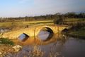
- Davazdah Cheshmeh Bridge
- Moalagh Bridge Amol
- Tomb tower Nasser Kabir - Hasan al-Utrush
- Waterfall Shahandasht
- Waterfall Gozo
- Bazaar of Amol
- Cave Espahbod Khorshid
- Historical collection Farahabad Sari
- Cheshmeh Kileh Bridge Tonekabon
- Lajim Tower
- Veresk Bridge
- Castle Poolad Nour
- Shapour Bridge Juybar
- Bathroom Vaziri Sari
- Tomb Darvish Fakhruddin Babol
- Emamzadeh Hashem Haraz
- Daniel Cave Salman Shahr
- Marmar Palace of Ramsar
- Ramsar Hotel
- Cellar Kafer Keli

- متحف آمل التاريخي
- متحف بابول أمول
- Hot water rineh - Larijan
- Shah Neshin Castle
- Lake Valasht
- Lake Valasht Chalus
- Lar Dam
- Alam-Kuh
- Lar National Park
- Badab-e Surt

- Tomb of Imamzadeh Abbas
- Kandolus Museum Nowshahr
- Atashkadeh of Amol
- Imamzadeh Ebrahim Amol and Babolsar
- Imamzadeh Yahya Sari
- See Sangan
- Cave Zangian Qaemshahr
- Alimastan Village
- Shahrak-e Namak Abrud
- Huto and Kamarband Caves
- Cemetery Sefid Chah
- Rescet Tower Savadkuh
- Waterfall Tircan
- Jameh Mosque of Amol
- Jameh Mosque of Sari
- Bridge Felezi of Babolsar
- Imam Hassan Askari Mosque
- Lake Miyansheh

- Forest Park Nur and Amol
- Clock tower Sari
- Waterfall Sangeno
- Heshtel Towers
- Amoloo Mineral Water Spring
- Harijan Village Chaloos
- Tamishan Palace Noor
- Div Sefid Cave

- Alasht Village
- Cemetery Ispe Chah
- Zangian Cave
- Cheshmeh Imarat Behshar

- Haft Abshar Waterfall Babol
- Hill Qlaya Ghale Kety
- Bathroom Vaziri Sari
- House Kalbadi Sari
- House Manouchehri Amol

- Palace of Shapur
- Temple Kowsan
- Cave rostam Kola
- Garden Chehelsotoon
- Mansion Municipal Tonekabon
- Castle Kanglou

- Tower Shervin Bavand
- Church sourkh Abad
- Watchtower of Babol
- Tomb Shab baloo zahid Amuli
- Mosque Jameh of Babol
- Mosque Mohadesin
- Abpari Waterfall
- Tomb of Ibn-e Shahr Ashoob
- Imamzadeh Sayyid Ali kia Sultan
- Tomb of Seyed Mohammad Zarrin Nava
- Herijan Waterfall
- Deryouk Waterfall
- Espe-o Waterfall
- Kiasar Waterfall
- Takieh Taker

- Lake Sahon
- Forest Park Chaldareh
- Forest Park Shahid Zare
- Forest Park Mirza Kuchik Khan Haraz
- Forst Park Kashpel
- Miankaleh peninsula
- Marko Summit
- Forst Park Dalkhani
- Do hezar Village
- Abe ask Village
- Shahrak-e Darya Kenar
- Lavij Village
- Sheikh Musa Village
- Shoormast Lake Savadkuh
- Forest Sange no Neka
- Amoloo mineral water Spring
- Ramsar mineral water Springs
- Pahlavi Hotel Qaem Shahr
- Band-e Borideh River
النقل
المطارات
الطرق
السكك الحديدية

مشاهير المحافظة


التعليم
- جامعة مازندران، بابولسار
- جامعة مازندران للعلوم الطبية، ساري
- جامعة بابول نوشيرواني للتكنولوجيا، بابول
- جامعة بابول للعلوم الطبية، بابول
- جامعة ساري للعلوم الزراية والموارد الطبيعية، ساري
- جامعة شمال، أمول
- جامعة أمول للتقنيات الحديثة الخاصة، أمول
- جامة بهشهر للعلوم والتكنولوجيا، بهشهر
- جامعة الإمام الخميني للعلوم البحرية، نوشهر
- جماعة أزاد الإسلامية في مازندران وتقع في ساري، خاميشهر، بابول، أمول، چالوس، سڤادكه، بهشهر، نكا.
المحافظات الشقيقة
معرض الصور
بحر مازندران
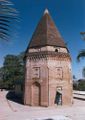
Teki-e Taker

Larijan Kafer Keli
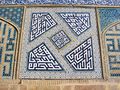
Geometric calligraphy at the Friday Mosque
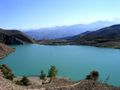
Velasht

Ramsar Palace
Imamzadeh Abbas
Abbas Abad Dam
Juybar Bridge
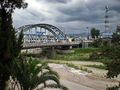
Chalus Bridge
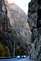
Chalus Road
Mazandaran Nature

Alam Kuh
Lar National Park
Zangian Cave


.jpg&filetimestamp=20231117032014)
897.12-31.189.jpg&filetimestamp=20240713135751)
.JPG&filetimestamp=20240713135738)
.jpg&filetimestamp=20240713145655)
انظر أيضاً
المصادر
- ^ أ ب ت همشهری آنلاین-استانهای کشور به ۵ منطقه تقسیم شدند
- ^ أ ب ت ث ج "Census of the Islamic Republic of Iran, 1395 (2016)". AMAR (in الفارسية). The Statistical Center of Iran. p. 02. Archived from the original (Excel) on 7 October 2021. Retrieved 19 December 2022.
- ^ أ ب ت Maryam Borjian - Bilingualism in Mazandaran: Peaceful Coexistence With Persian. Archived سبتمبر 21, 2006 at the Wayback Machine
- ^ "Sub-national HDI - Area Database - Global Data Lab". hdi.globaldatalab.org (in الإنجليزية). Archived from the original on 2018-09-23. Retrieved 2018-09-13.
- ^ Habibi, Hassan (21 June 1369). "Approval of the organization and chain of citizenship of the elements and units of the divisions of Mazandaran province, centered in Sari city". Lamtakam (in الفارسية). Ministry of Interior, Defense Political Commission of the Government Council. Archived from the original on 14 January 2024. Retrieved 14 January 2024.
- ^ "Natural attractions of Mazandaran in IRIB". Archived from the original on 2017-03-06. Retrieved 2016-11-27.
- ^ http://www.sci.org.ir/content/userfiles/_sci_en/sci_en/sel/year85/f1/CS_01_4.HTM[dead link]
- ^ أ ب "Census of the Islamic Republic of Iran, 1385 (2006)". AMAR (in الفارسية). The Statistical Center of Iran. p. 02. Archived from the original (Excel) on 20 September 2011. Retrieved 25 September 2022.
- ^ أ ب "Census of the Islamic Republic of Iran, 1390 (2011)". Syracuse University (in الفارسية). The Statistical Center of Iran. p. 02. Archived from the original (Excel) on 19 January 2023. Retrieved 19 December 2022.
- ^ Statistical Centre, Government of Iran. See: "General Characteristics of Ostans according to their administrative divisions at the end of 1383 (2005 CE)"[dead link], "Population estimation by urban and rural areas, 2005"[dead link]
- ^ أ ب "University of Mazanderan". Archived from the original on October 3, 2008.
- ^ Springer Netherlands; July 10, 2005; Contributions to the knowledge of the useful plants and plant raw materials of Iran; ISSN 0921-9668
- ^ Mazandaran, Geography & History Archived فبراير 28, 2008 at the Wayback Machine
- ^ "Elburz Mountains | mountain range, Iran". www.britannica.com. Archived from the original on May 3, 2008.
- ^ Freshwater Fishes of Iran Archived مارس 3, 2016 at the Wayback Machine; Revised: 12 July 2007
- ^ "Encyclopædia Britannica, Entry for Mazandaran". Archived from the original on 2007-06-24.
- ^ [1][dead link] (Persian)
- ^ IRAN Daily Caspian Region Archived سبتمبر 12, 2007 at the Wayback Machine
- ^ Parthia News, November 6, 2005.
- ^ "400 Historical Sites Discovered within 7 Days in Mazandaran". www.payvand.com. Archived from the original on March 4, 2016.
- ^ "CHN Page for Mazandaran". Archived from the original on 2007-02-14. Retrieved 2007-02-14.
- ^ Keddie, N. R.; 1968; The Iranian villages before and after land reform. Journal of Contemporary History, 3(3), 69–78.
- ^ Tapuri. The mountains inland from the coast of Hyrcania are called the “Tapurian mountains” by Arrian, after the people there, settled in the mountains between the Derbices and the Hyrcanii (Str., 11.9.1, 11.11.8). They are spread toward the Caspian Gates and Rhaga in Media (Ptol., 6.2.6).These western Tapuri could have resulted from a tribal division north of the Sarnius/Atrak river—another, perhaps ancestral, group, the Tapurei, is located by Ptolemy (6.14.12) in Scythia. The remainder moved south and east into Margiana (“between the Hyrcani and the Arii,” Str., 11.8.8; Ptol., 6.10.2) along the Ochus/Arius (mod. Tejen/Hari-rud) river into Aria (cf. Polyb., 10.49). The Tapuri on the Caspian could, alternatively, represent a later westward migration along the main east-west highway from Margiana. These Tapuri furnished 1,000 cavalry for the battle of Gaugamela (Curt., 3.2.7), apparently aligned with the Hyrcanii (the “Topeiri,” Arr., An. 3.8.4). Alexander later subdued them (Arr., An. 3.23.1-2; Polyb., 5.44.5; Curt., 6.4.24-25). A separate satrap administered them at the time of Alexander’s arrival, and this official was assigned the Caspian Mardi as well (Arr., An. 3.22.7, 24.3; 4.18.2)., IRANICAONlINE IRAN v. PEOPLES OF IRAN (2) Pre-Islamic
- ^ أ ب ت "Dictionary of Greek and Roman Geography, illustrated by numerous engravings on wood. William Smith, LLD. London. Walton and Maberly, Upper Gower Street and Ivy Lane, Paternoster Row; John Murray, Albemarle Street. 1854., TAPU´RI". www.perseus.tufts.edu. Retrieved 2021-02-04.
- ^ Of the lands which lie on the sea and of the others which border on these, Ninus subdued Egypt and Phoenicia, then Coele-Syria, Cilicia, Pamphylia, and Lycia, and also Caria, Phrygia, and Lydia; moreover, he brought under his sway the Troad, Phrygia on the Hellespont, Propontis, Bithynia, Cappadocia, and all the barbarian nations who inhabit the shores of the Pontus as far as the Tanais; he also made himself lord of the lands of the Cadusii, Tapyri, Hyrcanii, Drangi, of the Derbici, Carmanii, Choromnaei, and of the Borcanii, and Parthyaei; and he invaded both Persis and Susiana and Caspiana, as it is called, which is entered by exceedingly narrow passes, known for that reason as the Caspian Gates. 4 Many other lesser nations he also brought under his rule, about whom it would be a long task to speak. But since Bactriana was difficult to invade and contained multitudes of warlike men, after much toil and labour in vain he deferred to a later time the war against the Bactriani, and leading his forces back into Assyria selected a place excellently situated for the founding of a great city.. Diodorus Siculus, Library 1-7 (2.2.3)
- ^ أ ب ت ث ج ح خ د ذ ر ز س ش ص ض Minorsky, V.; Vasmer, R. "Mazandaran" Encyclopaedia of Islam. Edited by: P. Bearman, Th. Bianquis, C.E. Bosworth, E. van Donzel and W. P. Heinrichs. Brill, 2007. Brill Online.
- ^ Logan, F. Donald (1992). The Vikings in History. Second edition. Abingdon: Routledge. p. 201. ISBN 0-415-08396-6.
- ^ Pietro Della Valle, Viaggi, 3 vols. in 4 parts, Rome, 1658–63; tr. J. Pinkerton as Travels in Persia, London, 1811.
- ^ Gwillim Law, Statoids website. "Provinces of Iran" Archived أكتوبر 22, 2016 at the Wayback Machine. Retrieved on 2007-08-28
- ^ قالب:WWF ecoregion
- ^ "Mazandaran Province". mazmet. Mazandaran Meteorology General Office. Retrieved 23 March 2024.
- ^ Davoodi, Parviz (3 March 2018). "Divisional reforms and changes in Mazandaran Province". Laws and Regulations Portal of the Islamic Republic of Iran (in الفارسية). Ministry of Interior, Cabinet of Ministers. Archived from the original on 20 May 2023. Retrieved 20 May 2023.
- ^ Davodi, Parviz (29 July 1386). "Approval letter regarding the reforms of country divisions in Mazandaran province". Lamtakam (in الفارسية). Ministry of Interior, Political-Defense Commission of the Government Board. Archived from the original on 16 January 2024. Retrieved 16 January 2024.
- ^ Rahimi, Mohammad Reza (20 December 2013). "The transformation of Kelardasht District in Mazandaran province to a county". Qavanin (in الفارسية). Ministry of Interior. Archived from the original on 23 May 2023. Retrieved 23 May 2023.
- ^ "Miandorud County was added to the map of country divisions; with eight changes in the geography of Mazandaran province". DOLAT (in الفارسية). Ministry of Interior, Board of Ministers. 8 December 2009. Archived from the original on 31 December 2010. Retrieved 26 May 2023.
- ^ Rahimi, Mohammadreza (20 April 2012). "With the approval of the Cabinet, Northern Savadkuh County was created". DOLAT (in الفارسية). Ministry of Interior, Board of Ministers. Archived from the original on 26 December 2016. Retrieved 26 May 2023.
- ^ Rahimi, Mohammadreza (23 January 2013). "With some changes in the map of country divisions: Simorgh County was created in Mazandaran province". DOLAT (in الفارسية). Ministry of Interior, Board of Ministers. Archived from the original on 21 April 2019. Retrieved 24 November 2023.
- ^ "Table of electoral fields of the 9th period of the Islamic consultative assembly" (PDF). IRIB research Center. Archived (PDF) from the original on 5 October 2018. Retrieved 25 March 2024.
- ^ أ ب "Welcome to Encyclopaedia Iranica".
- ^ "Kurish writer Archives - KHRN | Kurdistan Human Rights Network".
- ^ أ ب Borjian, Habib (2004). "Māzandarān: Language and People". Iran & the Caucasus. Brill. 8 (2): 291. doi:10.1163/1573384043076045. JSTOR 4030997.
- ^ أ ب Potts, Daniel (2014). Nomadism in Iran: From Antiquity to the Modern Era. Oxford University Press. p. 110. ISBN 9780199330799. Retrieved 2021-12-15.
- ^ أ ب "Spoken L1 Language: Mazanderani". Glottolog 4.6.
- ^ أ ب Windfuhr, G. L. (1989). "New Iranian languages: Overview". In Rüdiger Schmitt (ed.). Compendium linguarum Iranicarum. Wiesbaden: L. Reichert. p. 490.
- ^ أ ب "ČĀLŪS". Encyclopaedia Iranica.
- ^ أ ب سفرنامه ملگونوف به سواحل جنوبی دریای خزر، صفحهٔ ۵۷
- ^ أ ب سفرنامه یاسنت لویی رابینو، صفحهٔ ۴۶
- ^ أ ب «تنکابن». دانشنامه جهان اسلام. دریافتشده در ۲۰۱۷-۰۷-۰۷.
- ^ Gordon, R.G., Jr. (2005). Ethnologue: Languages of the World, 15th edition. (Dallas, TX: SIL International). Online version "Ethnologue: Languages of the World". Archived from the original on 2016-11-07. Retrieved 2009-11-12.
- ^ "KALĀRESTĀQ i. The District and Sub-District". Encyclopaedia Iranica.
- ^ أ ب "KOJUR i. Historical Geography". Encyclopaedia Iranica.
- ^ Lars Johanson, Éva Csató, Eva Agnes Csato. The Turkic Languages. Taylor & Francis, 1998. ISBN 0-415-08200-5; p. 274
- ^ Mazandaran Exports Register Growth
- ^ "Mazandaran Citrus Exports to Reach 20,000 Tons". Financial Tribune. October 22, 2016.
- ^ Russian Delegation Visits Mazandaran
- ^ "A look at the state of textile industries in Mazandaran" (in Persian). The Islamic republic news agency. IRNA. 30 October 1995. Retrieved 3 April 2024.
{{cite news}}: CS1 maint: unrecognized language (link) - ^ "Mahmoud Abad sack weaving factory is being completely destroyed". Shomal news. North of Iran News Agancy. 27 February 2017. Retrieved 14 April 2024.
- ^ "he workers of Chokha sari textile company are facing many livelihood problems" (in Persian). The Islamic republic news agency. IRNA. 25 May 2002. Retrieved 14 April 2024.
{{cite news}}: CS1 maint: unrecognized language (link) - ^ "Chief Justice: Behshahr Chit Factory's bankruptcy order was issued". Irna (in Persian). The Islamic republic news agency. 7 December 2006. Retrieved 3 April 2024.
{{cite web}}: CS1 maint: unrecognized language (link) - ^ "Mazandaran non-oil export rises 14%". 16 August 2018. Archived from the original on 2018-10-31. Retrieved 2018-10-31.
- ^ "Mazandaran Customs Revenues Up". Financial Tribune. July 1, 2015.
- ^ أ ب "جاذبه های گردشگری مازندران insulation". irib. Archived from the original on 2019-07-23. Retrieved 2019-07-23.
وصلات خارجية
- Official website of Mazandaran Governorship
- ICCIM's page on Mazandaran
- Mazandaran Cultural Heritage Organization
- Mazandaran Tourism palaces
- Official website of Mazandaran Meteorology Organization
- Official website of Mazandaran TV
- Registration Mazandaran
- A Mazandarani folk-song sung by Shusha Guppy in the 1970s: Darling Dareyne
| العاصمة |      | |
|---|---|---|
| المقاطعات والمدن | ||
| المعالم | 
| |
| أماكن مأهولة | ||
خطأ استشهاد: وسوم <ref> موجودة لمجموعة اسمها "lower-alpha"، ولكن لم يتم العثور على وسم <references group="lower-alpha"/>
- CS1 الفارسية-language sources (fa)
- Articles with dead external links from November 2016
- Articles with dead external links from March 2017
- Articles with dead external links from August 2018
- Short description is different from Wikidata
- Articles containing فارسية-language text
- Articles containing مازندراني-language text
- Pages using Lang-xx templates
- Pages using multiple image with auto scaled images
- Pages using gadget WikiMiniAtlas
- Articles with hatnote templates targeting a nonexistent page
- Articles containing آڤستان-language text
- Articles with unsourced statements from November 2021
- محافظة مازندران
- محافظات إيران