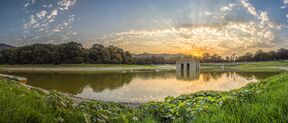
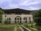
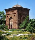
مقاطعة بهشهر
مقاطعة بهشهر
فارسية: شهرستانِ بِهْشَهْر Behshahr County | |
|---|---|
مقاطعة | |
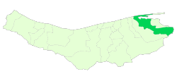 موقع مقاطعة بهشهر في محافظة مازندران | |
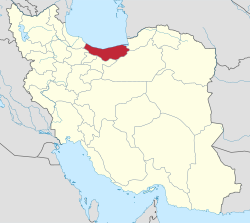 موقع محافظة مازندران في إيران | |
| الإحداثيات: 36°37′45″N 53°42′53″E / 36.62917°N 53.71472°E[1] | |
| البلد | |
| المحافظة | مازندران |
| العاصمة | بهشهر |
| البخوش | المركزي، يانه سر |
| المساحة | |
| • الإجمالي | 1٬416٫27 كم² (546٫82 ميل²) |
| التعداد (2016)[3] | |
| • الإجمالي | 168٬769 |
| • الكثافة | 120/km2 (310/sq mi) |
| منطقة التوقيت | UTC+3:30 (IRST) |
| مقاطعة بهشهر can be found at GEOnet Names Server, at this link, by opening the Advanced Search box, entering "9207234" in the "Unique Feature Id" form, and clicking on "Search Database". | |
مقاطعة بهشهر (بالـ فارسية: شهرستانِ بِهْشَهْر وبالـ مازندراني: بِهْشَهْرِ شهرسّون, romanized: Behšahr-e-Šahresun) تقع في محافظة مازندران، إيران على بحر قزوين. عاصمتها هي مدينة بهشهر.
At the 2006 census, the county's population was 154,957 in 40,432 households.[4] The following census in 2011 counted 155,247 people in 46,100 households.[5] At the 2016 census, the county's population was 168,769 in 55,140 households.[3]
التقسيمات الإدارية
The population history of Behshahr County's administrative divisions over three consecutive censuses is shown in the following table. The latest census shows two districts, five rural districts, and three cities.[3]
| التقسيمات الإدارية | 2006[4] | 2011[5] | 2016[3] |
|---|---|---|---|
| البخش المركزي | 144,332 | 148,279 | 157,097 |
| كوهستان، ب.ر. | 17,420 | 16,680 | 17,436 |
| ميان كاله، ب.ر. | 18,320 | 17,355 | 18,469 |
| پنج هزاره، ب.ر. | 3,653 | 3,299 | 3,772 |
| بهشهر (مدينة) | 83,537 | 89,251 | 94,702 |
| خليل شهر (مدينة) | 10,096 | 10,141 | 11,032 |
| Rostamkola (مدينة) | 11,306 | 11,553 | 11,686 |
| Yaneh Sar District | 10,625 | 6,968 | 11,672 |
| Ashrestaq RD | 7,284 | 4,433 | 6,911 |
| Shohada RD | 3,341 | 2,535 | 4,761 |
| الإجمالي | 154,957 | 155,247 | 168,769 |
انظر أيضاً
مشاع المعرفة فيه ميديا متعلقة بموضوع مقاطعة بهشهر.
المراجع
- ^ OpenStreetMap contributors (23 May 2023). "Behshahr County" (Map). OpenStreetMap. Retrieved 23 May 2023.
- ^ Mozaffa F.; Aghae Y.; Taghvaei M.; Shaykh Baygloo R. (Winter 2011). "Analysis of Intraregional Disparities of Development in Mazandaran Ostan" (PDF). Geography and Environmental Planning. 40 (4): 13–28. Retrieved 23 August 2013.
- ^ أ ب ت ث "Census of the Islamic Republic of Iran, 1395 (2016)". AMAR (in الفارسية). The Statistical Center of Iran. p. 02. Archived from the original (Excel) on 7 October 2021. Retrieved 19 December 2022.
- ^ أ ب "Census of the Islamic Republic of Iran, 1385 (2006)". AMAR (in الفارسية). The Statistical Center of Iran. p. 02. Archived from the original (Excel) on 20 September 2011. Retrieved 25 September 2022.
- ^ أ ب "Census of the Islamic Republic of Iran, 1390 (2011)" (Excel). Iran Data Portal (in الفارسية). The Statistical Center of Iran. p. 02. Retrieved 19 December 2022.
This article may include material from Wikimedia licensed under CC BY-SA 4.0. Please comply with the license terms.
تصنيفات:
- Pages using gadget WikiMiniAtlas
- CS1 الفارسية-language sources (fa)
- Short description is different from Wikidata
- Articles containing فارسية-language text
- Pages using multiple image with auto scaled images
- Coordinates on Wikidata
- Articles containing مازندراني-language text
- Pages using Lang-xx templates
- مقاطعة بهشهر
- مقاطعات محافظة مازندران

