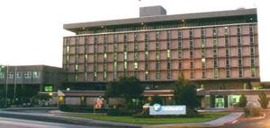
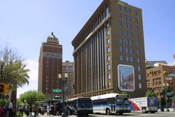
إل پاسو، تكساس
إل پاسو | |
|---|---|
|
| |
| الكنية: | |
 الموقع في مقاطعة إل پاسو وولاية تكساس | |
| الإحداثيات: 31°45′33″N 106°29′19″W / 31.75917°N 106.48861°W | |
| البلد | الولايات المتحدة |
| الولاية | تكساس |
| المقاطعة | إل پاسو |
| First settlement | 1680 |
| استوطنت باسم فرانكلن | 1849 |
| أعيد تسميتها إل پاسو | 1852 |
| تأسيس البلدة | 1859 |
| دُمجت | 1873 |
| الحكومة | |
| • النوع | المجلس-رئيس المدينة |
| • مجلس المدينة |
|
| • رئيس المدينة | كلااري وستين (بالإنابة) |
| المساحة | |
| • مدينة | 259٫25 ميل² (671٫46 كم²) |
| • البر | 258٫43 ميل² (669٫33 كم²) |
| • الماء | 0٫82 ميل² (2٫13 كم²) |
| المنسوب | 3٬740 ft (1٬140 m) |
| التعداد | |
| • مدينة | 678٬815 |
| • الترتيب | رقم 22 في الولايات المتحدة رقم 6 في تكساس |
| • الكثافة | 2٬626٫69/sq mi (1٬014٫17/km2) |
| • Urban | 854٬584 (الولايات المتحدة: رقم 53) |
| • الكثافة الحضرية | 3٬339٫7/sq mi (1٬289٫5/km2) |
| • العمرانية | 868٬859 (الولايات المتحدة: رقم 67) |
| صفة المواطن | El Pasoan |
| منطقة التوقيت | UTC−07:00 (MST) |
| • الصيف (التوقيت الصيفي) | UTC−06:00 (MDT) |
| الرمز البريدي |
|
| رمز المنطقة | 915 |
| رمز FIPS | 48-24000 |
| GNIS feature ID | 1380946[6] |
| الموقع الإلكتروني | www |
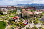
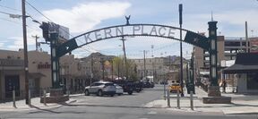
إل پاسو (إنگليزية: El Paso)، مدينة أمريكية تقع في ولاية تكساس. وهي حاضرة مقاطعة إل باسو، وأكبر مدن منطقة غرب تكساس، وسادس أكبر مدن الولاية. حسب تقديرات عام 2005 عدد سكان المدينة 598590 نسمة. تقع المدينة على الحدود الأمريكية المكسيكية بالقرب من مدينة خواريز المكسيكية. توجد في المدينة جامعة تكساس في إل باسو التي تأسست في عام 1914 كمدرسة. مساحة المدينة 648.9 كم2. اسم المدينة أخذ من عبارة "El Paso de Norte" (الطريق أو الممر نحو الشمال) والتي تشير إلى مدينة خواريز المكسيكية حالياً.
تستخدم بوابةً رئيسية للسفر بين البلدين. كما أنها مركزٌُ مُهِمٌّ للتصنيع والتوزيع في الجنوب الغربي. ويبلغ عدد سكانها 563,662 نسمة.
تمتد مدينة إل باسو على الحافة الشمالية لنهر ريو گراند، في الزاوية الغربية البعيدة لولاية تكساس، على ممر بين جبال سييرا مادرى في المكسيك إلى الجنوب وجبال فرانكلن إلى الشمال حيث يمتد جزء من المدينة فوقها.
التاريخ

الجغرافيا
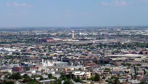


المناخ
درجات الحرارة
| أخفمتوسطات الطقس لإل پاسو | |||||||||||||
|---|---|---|---|---|---|---|---|---|---|---|---|---|---|
| شهر | يناير | فبراير | مارس | أبريل | مايو | يونيو | يوليو | أغسطس | سبتمبر | اكتوبر | نوفمبر | ديسمبر | السنة |
| العظمى القياسية °F (°C) | 80 (27) | 83 (28) | 89 (32) | 98 (37) | 105 (41) | 114 (46) | 112 (44) | 108 (42) | 104 (40) | 96 (36) | 87 (31) | 80 (27) | 114 (46) |
| متوسط العظمى °ف (°م) | 57 (14) | 63 (17) | 70 (21) | 79 (26) | 87 (31) | 96 (36) | 95 (35) | 93 (34) | 88 (31) | 79 (26) | 66 (19) | 58 (14) | 78 (26) |
| متوسط الصغرى °ف (°م) | 31 (-1) | 35 (2) | 41 (5) | 49 (9) | 58 (14) | 66 (19) | 70 (21) | 68 (20) | 62 (17) | 50 (10) | 38 (3) | 32 (0) | 50 (10) |
| الصغرى القياسية °ف (°C) | -8 (-22) | 8 (-13) | 14 (-10) | 23 (-5) | 31 (-1) | 46 (8) | 57 (14) | 56 (13) | 42 (6) | 25 (-4) | 1 (-17) | 5 (-15) | −8 (−22) |
| هطول الأمطار بوصة (mm) | 0.44 (11.2) | 0.43 (10.9) | 0.39 (9.9) | 0.25 (6.4) | 0.28 (7.1) | 0.69 (17.5) | 1.62 (41.1) | 1.54 (39.1) | 1.39 (35.3) | 0.73 (18.5) | 0.33 (8.4) | 0.55 (14) | 8٫64 (219٫5) |
| المصدر: {{{source}}} {{{accessdate}}} | |||||||||||||
العمارة
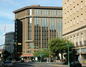
أعلى 10 مباني في إل پاسو
| الترتيب | الاسم | الارتفاع | الطبقات |
|---|---|---|---|
| 1 | Wells Fargo Plaza | 296 feet (90 m) | 21 |
| 2 | Chase Tower | 250 feet (76 m) | 20 |
| 3 | Plaza Hotel | 239 feet (73 m) | 19 |
| 4 | Kayser Building | 232 feet (71 m) | 20 |
| 5 | El Paso Natural Gas Company Building | 208 feet (63 m) | 18 |
| 6 | Camino Real Hotel | 205 feet (62 m) | 17 |
| 7 | Doubletree Hotel | 202 feet (62 m) | 17 |
| 8 | O. T. Bassett Tower | 196 feet (60 m) | 15 |
| 9 | El Paso County Courthouse | 185 feet (56 m) | 13 |
| 10 | Anson Mills Building | 145 feet (44 m) | 12 |
الحكومة
الاقتصاد
الديموغرافيا
| التعداد التاريخي | |||
|---|---|---|---|
| التعداد | Pop. | %± | |
| 1850 | 200 | — | |
| 1860 | 428 | 114�0% | |
| 1880 | 736 | — | |
| 1890 | 10٬338 | 1٬304٫6% | |
| 1900 | 15٬906 | 53٫9% | |
| 1910 | 39٬279 | 146٫9% | |
| 1920 | 77٬560 | 97٫5% | |
| 1930 | 102٬421 | 32٫1% | |
| 1940 | 96٬810 | −5٫5% | |
| 1950 | 130٬485 | 34٫8% | |
| 1960 | 276٬687 | 112�0% | |
| 1970 | 339٬615 | 22٫7% | |
| 1980 | 425٬259 | 25٫2% | |
| 1990 | 515٬342 | 21٫2% | |
| 2000 | 563٬662 | 9٫4% | |
| 2010 | 649٬121 | 15٫2% | |
| 2018 (تق.) | 682,669 | [7] | Formatting error: invalid input when rounding% |
| U.S. Decennial Census[8] Texas Almanac: 1850–2000[9] 2012 Estimate[10] El Paso 1850 to 2006[11] TX State Historical Association[12] | |||
| أخفالملف الديموغرافي | 2017[13] | 2010[14] | 2000[15] | 1990[16] | 1970[16] |
|---|---|---|---|---|---|
| بيض | 92.0% | 80.8% | 76.3% | 76.9% | 96.7% |
| —Non-Hispanic whites | 11.8% | 14.2% | 18.3% | 26.4% | 40.4%[17] |
| African American or Black | 3.9% | 3.4% | 3.5% | 3.4% | 2.3% |
| Hispanic or Latino (of any race) | 82.8% | 80.7% | 76.6% | 69.0% | 57.3%[17] |
| Asian | 1.3% | 1.2% | 1.5% | 1.2% | 0.3% |
As of 2010 U.S. census, 649,121 people, 216,694 households, and 131,104 families resided in the city. The population density was 2,263.0 people per square mile (873.7/km²). There were 227,605 housing units at an average density of 777.5 per square mile (300.2/km²). Recent census estimates say that the racial composition of El Paso is: White– 92.0% (Non-Hispanic Whites: 11.8%), African American or Black – 3.9%, Two or more races – 1.5%, Asian – 1.3%, Native American – 1.0%, and Native Hawaiian and other Pacific Islander – 0.2%.[18] There are no de facto Anglo and African-American neighborhoods.[19]
Ethnically, the city was: 82.8% Hispanic or Latino of any race.
There were 216,894 households in 2010, out of which 37.6% had children under the age of 18 living with them, 48.5% were married couples living together, 20.7% had a female householder with no husband present, and 25.3% were not families. About 21.5% of all households were made up of individuals, and 24.9% had someone living alone who was 65 years of age or older. The average household size was 2.95 and the average family size was 3.47
In the city, the population was distributed as 29.1% under the age of 18, 7.5% from 20 to 24, 26.2% from 25 to 44, 22.8% from 45 to 64, and 11.1% who were 65 years of age or older. The median age was 32.5 years.
The median income for a household in the city was $44,431, and for a family was $50,247. Males had a median income of $28,989 versus $21,540 for females. The per capita income for the city was $21,120. About 17.3% of families and 20.3% of the population were below the poverty line, including 28.5% of those under age 18 and 18.4% of those age 65 or over.
الرياضة
التعليم
المستشفيات
الثقافة
نقاط مهمة
المسارح
النقل
 Interstate 10 The primary thoroughfare through the city, connecting the city with other major U.S. cities such as Houston, Los Angeles, New Orleans, Phoenix and Dallas (via Interstate 20). The I-10 is also a connector to Interstate 25, which connects with the cities of Albuquerque, Denver and Cheyenne.
 U.S. Highway 54 Officially called the Patriot Freeway, locally known as the North-South Freeway. A business route runs along Dyer Street, the former US 54, from the freeway near Fort Bliss to the Texas-New Mexico border, where it again rejoins the expressway. The original U.S. 54 was a transcontinental route connecting El Paso with Chicago.
 U.S. Highway 62 mostly Paisano Drive, rerouted to Montana Avenue.
 U.S. Highway 85 Paisano Drive west of Santa Fe Ave to I-10.
 U.S. Highway 180 Montana Avenue, which is a bypass route to the Dallas-Fort Worth Metroplex to the east, and Flagstaff, Arizona to the west.
 SH 20 Alameda Avenue, formerly US 80.
 SH 178
 Loop 478 Copia Avenue to Dyer Street.
 Loop 375 Texas Highway Loop 375 encircles the city of El Paso. In the Northeast section of the city, it is Woodrow Bean Trans Mountain Drive. In East El Paso, the North- and Southbound section is known as Joe Battle Blvd., or simply as "the Loop". South of I-10, in the east and westbound portion, it is known as the Cesar Chavez Border Highway, a four-lane expressway which is located along the U.S.-Mexico border between Downtown El Paso and the Ysleta area.
المدن الشقيقة
 – تشيواوا، المكسيك[20]
 – شريش، اسپانيا[21]
 – ميريدا، اسپانيا[21]
 – خواريز، المكسيك[21]
 – توريون، المكسيك[21]
 – زاكاتيكاس، المكسيك[21]
انظر أيضاً
المصادر
الهوامش
- ^ "Visit El Paso, Texas". El Paso Convention & Visitors Bureau. Retrieved November 6, 2013.
- ^ "El Chuco tells of El Paso pachuco history – Ramon Renteria". El Paso Times. June 30, 2013. Archived from the original on February 1, 2014. Retrieved January 5, 2014.
- ^ "2019 U.S. Gazetteer Files". United States Census Bureau. Retrieved August 7, 2020.
- ^ "QuickFacts: El Paso city, Texas". United States Census Bureau. Retrieved 21 August 2021.
- ^ "2020 Population and Housing State Data". United States Census Bureau. Retrieved 22 August 2021.
- ^ "US Board on Geographic Names". United States Geological Survey. October 25, 2007. Retrieved January 31, 2008.
- ^ "QuickFacts". Retrieved May 24, 2019.
- ^ "U.S. Decennial Census". U.S. Census Bureau. Archived from the original on February 8, 2006. Retrieved January 14, 2012.
{{cite web}}: Unknown parameter|dead-url=ignored (|url-status=suggested) (help) - ^ "Texas Almanac: City Population History 1850–2000" (PDF). Retrieved September 22, 2012.
- ^ "Annual Estimates of the Resident Population: April 1, 2010 to July 1, 2012" (CSV). Retrieved September 22, 2012.
- ^ "El Paso–Juarez Regional Historic Population Summary – Development Services Department, Planning Division" (PDF). PDF. Archived from the original (PDF) on ديسمبر 19, 2011. Retrieved سبتمبر 22, 2012.
{{cite web}}: Unknown parameter|deadurl=ignored (|url-status=suggested) (help) - ^ "Texas State Historical Association". June 12, 2010. Retrieved September 22, 2012.
- ^ "United States Census Quick Facts". census.gov. Retrieved February 25, 2019.
- ^ "El Paso (city), Texas". State & County QuickFacts. U.S. Census Bureau. Archived from the original on مايو 8, 2013.
{{cite web}}: Unknown parameter|deadurl=ignored (|url-status=suggested) (help) - ^ "Profile of General Demographic Characteristics: 2000" (PDF). United States Census Bureau. Archived from the original (PDF) on سبتمبر 4, 2015.
{{cite web}}: Unknown parameter|deadurl=ignored (|url-status=suggested) (help) - ^ أ ب "Race and Hispanic Origin for Selected Cities and Other Places: Earliest Census to 1990". U.S. Census Bureau. Archived from the original on August 12, 2012.
{{cite web}}: Unknown parameter|deadurl=ignored (|url-status=suggested) (help) - ^ أ ب From 15% sample
- ^ "State & County QuickFacts – U.S Census Bureau". U.S. Census Bureau. Archived from the original on مايو 8, 2013. Retrieved مايو 23, 2013.
{{cite web}}: Unknown parameter|deadurl=ignored (|url-status=suggested) (help) - ^ "State & County QuickFacts – U.S Census Bureau". U.S. Census Bureau. Archived from the original on مايو 8, 2013. Retrieved مايو 23, 2013.
{{cite web}}: Unknown parameter|deadurl=ignored (|url-status=suggested) (help) - ^
"City Council Meetings - Voting Items". City of El Paso. 2008-11-18. Retrieved 27 December 2008.
ADDN1A. MAYOR AND COUNCIL: Discussion and action to authorize the Mayor to sign a Sister City agreement with the City of Chihuahua, Mexico reaffirming the commitment made in 2002. ACTION TAKEN: AUTHORIZED
- ^ أ ب ت ث ج
Andrade, Robert (2007). "Sister Cities". ¿Qué Pasa? A biweekly electronic newsletter from Mayor Cook. City of El Paso. Retrieved 27 December 2008.
Currently on record, there are four Sister Cities, three in Mexico (Ciudad Juarez, Zacatecas and Torreon) and one in Spain (Jerez).
{{cite web}}: Unknown parameter|month=ignored (help)
وصلات خارجية
- City of El Paso Website
- Chamber of Commerce Website
- Forty years at El Paso, 1858–1898; recollections of war, politics, adventure, events, narratives, sketches, etc., by W. W. Mills, hosted by the Portal to Texas History
- El Paso Metropolitan Planning Organization
- El Paso Mortgage Company
- El Paso, Texas from the Handbook of Texas Online
- El Paso - The Best Little Music City in Texas, from Vanity Fair, March 2009.
قالب:El Pasoقالب:El Paso TVقالب:El Paso Radio قالب:El Paso Texas Museums قالب:El Paso County, Texas
- Pages using gadget WikiMiniAtlas
- CS1 errors: unsupported parameter
- Articles with hatnote templates targeting a nonexistent page
- Missing redirects
- Short description is different from Wikidata
- Pages using multiple image with auto scaled images
- Coordinates on Wikidata
- Articles containing إنگليزية-language text
- Pages using Lang-xx templates
- Pages using US Census population needing update
- Pages with empty portal template
- إل پاسو، تكساس
- مدن تكساس
- مقاعد مقاطعة في تكساس
- مقاطعة إل پاسو، تكساس
- Texas communities with Hispanic majority populations
- مدن تأسست في 1659
- بلدات الحدود الأمريكية المكسيكية


