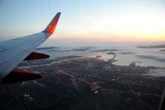
شرق خليج سان فرانسسكو
37°42′N 122°00′W / 37.7°N 122°W
The East Bay is the eastern region of the San Francisco Bay Area and includes cities along the eastern shores of the San Francisco Bay and San Pablo Bay. The region has grown to include inland communities in Alameda and Contra Costa Counties.[1] With a population of roughly 2.5 million in 2010, it is the most populous subregion in the Bay Area.[2]
Oakland is the largest city in the East Bay and the third largest in the Bay Area. The city serves as a major transportation hub for the U.S. West Coast, and its port is the largest in Northern California. Increased population has led to the growth of large edge cities such as Alameda, Emeryville, Fremont, Pleasanton, San Ramon and Walnut Creek.
. . . . . . . . . . . . . . . . . . . . . . . . . . . . . . . . . . . . . . . . . . . . . . . . . . . . . . . . . . . . . . . . . . . . . . . . . . . . . . . . . . . . . . . . . . . . . . . . . . . . . . . . . . . . . . . . . . . . . . . . . . . . . . . . . . . . . . . . . . . . . . . . . . . . . . . . . . . . . . . . . . . . . . . .
المدن
East Bay cities include:
انظر أيضاً
المراجع
- ^ "East Bay Division". League of California Cities.
- ^ "The Association of Bay Area Governments". Abag.ca.gov. April 14, 2011. Retrieved November 4, 2011.


