پالو ألتو، كاليفورنيا
پالو ألتو
Palo Alto | |
|---|---|
| City of Palo Alto | |
|
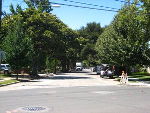
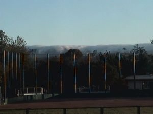
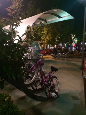
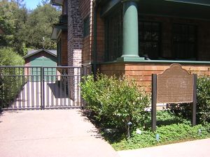
Clockwise: Palo Alto Baylands Nature Preserve; Palo Alto Circle; U.S. Post Office; Palo Alto High School; Downtown Palo Alto | |
 موقع پالو ألتو في مقاطعة سانتا كلارا وولاية كاليفورنيا. | |
| الإحداثيات: 37°25′45″N 122°8′17″W / 37.42917°N 122.13806°W | |
| البلد | الولايات المتحدة |
| الولاية | كاليفورنيا |
| المقاطعة | سانتا كلارا |
| دمجت | 23 أبريل 1894[1] |
| الحكومة | |
| • النوع | المجلس-المدير |
| • الكيان | مجلس المدينة |
| المساحة | |
| • الإجمالي | 26٫00 ميل² (67٫35 كم²) |
| • البر | 24٫10 ميل² (62٫41 كم²) |
| • الماء | 1٫91 ميل² (4٫94 كم²) 7.38% |
| المنسوب | 30 ft (9 m) |
| التعداد | |
| • الإجمالي | 64٬403 |
| • Estimate (2019)[6] | 65٬364 |
| • الكثافة | 2٬712٫65/sq mi (1٬047٫35/km2) |
| منطقة التوقيت | UTC−8 (Pacific) |
| • الصيف (التوقيت الصيفي) | UTC−7 (PDT) |
| ZIP Codes | 94301, 94303, 94304, 94306 |
| Area code | 650 |
| FIPS code | 06-55282 |
| GNIS feature IDs | 277572, 2411362 |
| الموقع الإلكتروني | www |
پالو ألتو Palo Alto ( /ˌpɑːloʊˈɑːltoʊ/, /ˌpæloʊˈæltoʊ/; بالإسپانية: پالو: تعني حرفياً "العصى"، بالعامية: "الشجرة" وألتو: "الطويلة"؛ أي: "الشجرة الطويلة")، هي مدينة تقع في الركن الشمالي الغربي من سانتا كلارا، كاليفورنيا، منطقة خليج سان فرانسيسكو، الولايات المتحدة. تتشارك المدينة حدودها مع شرق پالو ألتو، ماونتن ڤيو، لوس ألتوس، لوس ألتوس هيل، ستانفورد، پورتولا ڤالي، ومنلو پارك. سميت المدينة على اسم شكرة الخشب الأحمر الساحلية إل پالو ألتو.
أسسها للاند ستانفورد الأكبر عندما أسس جامعة ستانفورد، في أعقاب وفاة ابنه، للاند ستانفورد الأصغر. تشمل المدينة أجزاء من ستانفورد وهي المقر الرئيسي لعدد من شركات التكنولوجيا المتقدمة، ومنها هيولت-پاكرد، ڤإموير، تسلا للسيارات، پارك، نينگ، إيديو، سكايپ، وپالانتير للتكنولجيا. وتضم أيضاً العديد من شركات التكنولوجيا المتقدمة الأخرى مثل گوگل،[7] فيسبوك، لوجيتك،[8] إنتويت، پيترست وپايپال.
في تعداد 2010، كان إجمالي السكان المقيمين بالمدينة 64.403 نسمة. پالو ألتو هي واجدة من أغلى المدن في الولايات المتحدة ومواطنيها من أكثر الأشخاص تعليماً في الولايات المتحدة.[9]
التاريخ

Prior to the arrival of Europeans, the Ohlone lived on the San Francisco peninsula; in particular, the Puichon Ohlone lived in the Palo Alto area. The area of modern Palo Alto was first recorded by the 1769 party of Gaspar de Portolá, a 63-man, 200-horse expedition from San Diego to Monterey. The group overshot Monterey in the fog and when they reached modern-day Pacifica, ascended Sweeney Ridge and saw the San Francisco Bay. Portolá descended from Sweeney Ridge southeast down San Andreas Creek to Laguna Creek (now Crystal Springs Reservoir), thence to the San Francisquito Creek watershed, ultimately camping from November 6–11, 1769, by a tall redwood later to be known as El Palo Alto. Thinking the bay was too wide to cross, the group retraced their journey to Monterey, and never became aware of the Golden Gate entrance to the Bay.[10][بحاجة لمصدر]
In 1777, Father Junipero Serra established the Mission Santa Clara de Asis, whose northern boundary was San Francisquito Creek and whose lands included modern Palo Alto. The area was under the control of the viceroy of Mexico and ultimately under the control of Spain. On November 29, 1777, Pueblo de San Jose de Guadalupe (now the city of San Jose a few miles to the south of what was to be Palo Alto) was established by order of the viceroy despite the displeasure of the local mission. The Mexican War of Independence ending in 1821 led to Mexico becoming an independent country, though San Jose did not recognize rule by the new Mexico until May 10, 1825. Mexico proceeded to sell off or grant much of the mission land.
During the Mexican–American War, the United States seized Alta California in 1846; however, this was not legalized until the Treaty of Guadalupe Hidalgo was signed on July 4, 1848. Mexican citizens in the area could choose to become United States citizens and their land grants were to be recognized if they chose to do so (though many legal disputes arose over this).
الجغرافيا
الطبوغرافيا
الخصائص البيئية
المناخ
| أخفClimate data for پالو ألتو (1981–2010) | |||||||||||||
|---|---|---|---|---|---|---|---|---|---|---|---|---|---|
| Month | Jan | Feb | Mar | Apr | May | Jun | Jul | Aug | Sep | Oct | Nov | Dec | Year |
| Mean daily maximum °F (°C) | 58.4 (14.7) |
61.6 (16.4) |
65.7 (18.7) |
69.7 (20.9) |
74.3 (23.5) |
78.4 (25.8) |
79.6 (26.4) |
79.4 (26.3) |
79.5 (26.4) |
74.0 (23.3) |
64.8 (18.2) |
58.3 (14.6) |
70.3 (21.3) |
| Mean daily minimum °F (°C) | 38.5 (3.6) |
40.6 (4.8) |
43.1 (6.2) |
44.7 (7.1) |
48.7 (9.3) |
52.4 (11.3) |
55.1 (12.8) |
54.9 (12.7) |
52.5 (11.4) |
48.1 (8.9) |
42.4 (5.8) |
38.0 (3.3) |
46.6 (8.1) |
| Average precipitation inches (mm) | 3.06 (78) |
3.31 (84) |
2.49 (63) |
.98 (25) |
.48 (12) |
.09 (2.3) |
0 (0) |
.03 (0.76) |
.15 (3.8) |
.76 (19) |
1.96 (50) |
2.95 (75) |
16.26 (412.86) |
| [بحاجة لمصدر] | |||||||||||||
الحكومة المحلية
السياسة
الديموغرافيا
2010
|
2000
الإسكان
الاقتصاد
- Amazon.com's A9.com
- Aricent
- Better Place
- Bon Appétit Management Company
- CPI International
- Electric Power Research Institute
- Hewlett-Packard
- IDEO
- Institute for the Future
- Mashable
- Mopay
- Nanosys[14]
- Ning
- PAIX
- Palantir Technologies
- Palo Alto Medical Foundation
- Palo Alto Research Center (PARC)
- Playdom
- Socialtext
- Space Systems/Loral
- Tapulous
- Tesla Motors
- Tibco Software
- Varian Medical Systems
- VMware
- Wilson Sonsini Goodrich & Rosati
- Xerox
من الشركات الشهيرة الأخرى في پالو ألتو:
- Accenture (Former North American HQ. The main HQ now resides in Ireland)
- AOL Inc.
- CNF Inc.
- Dailymotion
- Dell
- Genencor (based in Palo Alto)
- Groupon
- Lockheed Martin
- Slam Content[15]
- Mercedes-Benz Research and Development North America, Headquarters[16]
- Merrill Lynch (largest office outside New York)
- Nokia Research Center
- Onlive
- Posedge Inc
- Rave Wireless (founded in Palo Alto)
- refund.me Group Inc.
- SAP AG (North American Labs)
- Schering-Plough Biopharma
- Skype (received a LEED Silver certification for its efficient use of resources when compared to conventional buildings)[17]
- Talygen Business Intelligence[18] (It is the developer of Talygen Business Suite. PC Magazine included the suite in its list of Top Ten Tech Products for Small Biz at CES 2014 in January 2014.[19])
- The Wall Street Journal
- Wso2
أكبر أرباب العمل
According to the City's 2019 Comprehensive Annual Financial Report,[20] the top employers in the city are:
| # | رب العمل | # الموظفين |
|---|---|---|
| 1 | Lucile Packard Children's Hospital | 5,700 |
| 2 | Stanford Health Care | 5,500 |
| 3 | Stanford University | 4,500 |
| 4 | Veteran's Affairs Palo Alto Health Care System | 3,900 |
| 5 | ڤإموير | 3,500 |
| 6 | معامل ساپ | 3,500 |
| 7 | Space Systems/Loral | 2,800 |
| 8 | هيولت-پاكرد | 2,500 |
| 9 | Palo Alto Medical Foundation | 2,200 |
| 10 | Varian Medical Systems | 1,400 |
المرافق
ادارات المطافي والشرطة
التعليم
المكتبات
الإعلام
النقل
الطرق
الجوي
السكك الحديدية
الحافلات
الدراجات
المشي
مدن شقيقة
Palo Alto لها six مدن شقيقة، حسب توصيف المدن الشقيقة الدولية:
أشهر المباني والمعالم الرئيسية

مشاهير المدينة
التقاضي
قضية جماعية ضد منتجي البطاريات
كانت پالو ألتو أول مدينة في كاليفورنيا تشارك في class action lawsuit against major battery producers, and currently serves as a representative for various cities and public entities across the state. القضية رُفِعت ضد المنتجين العالميين لبطاريات الليثيوم-أيون، بما فيهم پاناسونيك، LG Chem، سوني, هيتاتشي و سانيو.
انظر أيضاً
- قائمة المدن والبلدات في كاليفورنيا
- قائمة المدن والبلدات في منطقة خليج سان فرانسسكو
- قائمة الأشخاص من پالو ألتو
- Mayfield Brewery
الهوامش
- ^ "California Cities by Incorporation Date" (Word). California Association of Local Agency Formation Commissions. Retrieved August 25, 2014.
- ^ "مجلس المدينة والعمدة". City of Palo Alto. Retrieved January 29, 2016.
- ^ "2019 U.S. Gazetteer Files". United States Census Bureau. Retrieved July 1, 2020.
- ^ "Palo Alto". نظام معلومات الأسماء الجغرافية، المسح الجيولوجي الأمريكي. Retrieved October 7, 2014.
- ^ "Palo Alto (city) QuickFacts". United States Census Bureau. Archived from the original on February 24, 2016. Retrieved February 8, 2015.
- ^ خطأ استشهاد: وسم
<ref>غير صحيح؛ لا نص تم توفيره للمراجع المسماةUSCensusEst2019CenPopScriptOnlyDirtyFixDoNotUse - ^ [1][dead link]
- ^ http://www.logitech.com/lang/pdf/logitech_history_200703.pdf
- ^ Top 101 cities with the most people having Master's or Doctorate degrees (population 50,000+). City-data.com. Retrieved on July 21, 2013.
- ^ "El Palo Alto Park". City of Palo Alto. Retrieved January 5, 2015.
- ^ PALO ALTO, CALIFORNIA – Climate Summary. Wrcc.dri.edu. Retrieved on July 21, 2013.
- ^ http://www.weather.com/weather/wxclimatology/monthly/graph/USCA0830
- ^ http://www.bayareacensus.ca.gov "Demographic Profile Bay Area Census".
{{cite web}}: Check|url=value (help) - ^ "Contact Us". Nanosys, Inc. Retrieved April 26, 2011.
- ^ Slam Content | CrunchBase Profile. Crunchbase.com. Retrieved on July 21, 2013.
- ^ Mercedes-Benz Research & Development North America, Inc. Mbrdna.com. Retrieved on July 21, 2013.
- ^ Andrey Talalaev (June 1, 2013). "Skype office space in Palo Alto". BangkokStartup.com. BangkokStartup.com. Retrieved January 10, 2014.
- ^ "Talygen Contact Us". Talygen Business Intelligence. Retrieved March 19, 2014.
- ^ Lynn, Samara (January 13, 2014). "The Top 10 Tech Products for Small Biz at CES". PC Magazine. Retrieved March 19, 2014.
- ^ "City of Palo Alto 2019 CAFR".
- ^ Visiting Palo Alto
قراءات إضافية
- John Jenks, David Crimp, C. Michael Hogan et al., Engineering and Environmental Evaluations of Discharge to the Coast Casey Canal and Charleston Slough, prepared by Kennedy Jenks Engineers and Earth Metrics Inc. (1976)
- Santa Clara County Heritage Resource Inventory, Santa Clara County Historical Heritage Commission, published by Santa Clara County, San Jose, Ca., June 1979
- A description of high-tech life in Palo Alto around 1995 is found in the novel by Douglas Coupland, Microserfs.
- Coleman, Charles M., P. G. and E. of California: The Centennial Story of Pacific Gas and Electric Company 1852–1952, (New York: McGraw-Hill, 1952).
- Hanson, Warren D., San Francisco Water and Power: A History of the Municipal Water Department and Hetch Hetchy System, (San Francisco: San Francisco Public Utilities Communications Group, 2002).
- Map: PG&E Backbone Gas Transmission System, (San Francisco: Pacific Gas and Electric Co., undated).
- Map: Water Conveyance, Treatment, and Distribution System, (San Jose: Santa Clara Valley Water District, 1978).
- Earthquake Planning Scenario Special Publication #61, (Sacramento, California: State of California, Division of Mines and Geology, 1981).
- $117,730,000 Bond Offering: Transmission Agency of Northern California, (Sacramento, California: Transmission Agency of Northern California, 1992).
وصلات خارجية
- Pages using gadget WikiMiniAtlas
- Articles with dead external links from July 2013
- CS1 errors: URL
- Articles with hatnote templates targeting a nonexistent page
- Missing redirects
- Short description is different from Wikidata
- Coordinates on Wikidata
- Articles with unsourced statements from April 2015
- Articles with unsourced statements from November 2012
- Pages with empty portal template
- Official website different in Wikidata and Wikipedia
- سليكون ڤالي
- پالو ألتو، كاليفورنيا
- تأسيسات 1894 في كاليفورنيا
- جيوب أكاديمية
- مدن مقاطعة سانتا كلارا، كاليفورنيا
- مدن في منطقة خليج سان فرانسيسكو
- ركوب الدراجات في كاليفورنيا
- مدن وبلدات مدمجة في كاليفورنيا
- وادي السيليكون
- بلدات جامعات في الولايات المتحدة


