بايبورد
بايبورد
Bayburt | |
|---|---|
 | |
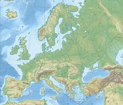
| الإحداثيات: 40°15′35″N 40°13′40″E / 40.25972°N 40.22778°E | |
| البلد | تركيا |
| المنطقة | البحر الأسود |
| المحافظة | بايبورد |
| الحكومة | |
| • العمدة | Hükmü Pekmezci (MHP) |
| • الوالي | جنيد إپجيم |
| المساحة | |
| • District | 2٬655٫41 كم² (1٬025٫26 ميل²) |
| المنسوب | 1٬550 m (5٬090 ft) |
| التعداد (2012)[2] | |
| • Urban | 35٬947 |
| • District | 61٬354 |
| • كثافة District | 23/km2 (60/sq mi) |
| منطقة التوقيت | UTC+3 (TRT) |
| Postal code | 69xxx |
| مفتاح الهاتف | 458 |
| لوحة السيارة | 69 |
| الموقع الإلكتروني | Municipality Provincial Government |
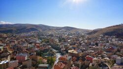
بايبورد هي عاصمة محافظة بايبورت تقع في شمال شرق تركيا، على نهر چروح. ويبلغ تعداد سكانها حوالي 32,285 نسمة.
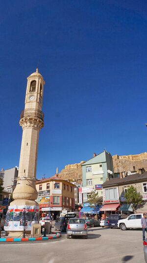
Bayburt was once an important center on the ancient Silk Road. It was visited by Marco Polo and Evliya Çelebi. Remains of its medieval castle still exist. There are several historical mosques, Turkish baths, and tombs in the city. There are also ancient historical sites such as the Çatalçeşme Underground Complex and natural wonders like the Sirakayalar Waterfall in the other parts of the province.
الاسم
The name of the town was formerly written in Ottoman Turkish as بايبورد (Bayburd)[3] and in English as Baiburt.[4][5] It was known as Paipert under the Byzantines.[بحاجة لمصدر] The name derives from the medieval Armenian Baydbert (Բայտբերդ), which derives from its ancient name Ambatavan (Ամբատավան).[بحاجة لمصدر]
التاريخ
Bayburt straddles the Çoruh amid an open and fertile plateau on the route between Trabzon and Erzurum.[5] It was founded by the Azzi people.[بحاجة لمصدر] It was subsequently settled or conquered by the Cimmerians in the 8th century BC, the Medes in the 7th century BC, then the Persians, Pontus, Rome, the Byzantines, the Bagratid Armenian Kingdom, the Seljuk Turks, the Aq Qoyunlu, Safavid Persia, and then the Ottoman Turks.[بحاجة لمصدر]
The town was the site of an Armenian fortress in the 1st century and may have been the Baiberdon fortified by the emperor Justinian.[4] It was a stronghold of the Genovese in the late Middle Ages[4] and prospered in the late 13th and early 14th century because of the commerce between Trebizond and Persia.[6] It contained a mint under the Seljuks and Ilkhanids.[6] From c. 1243 to 1266, Bayburt was under brief control of the Georgian princes of Samtskhe. A Christian church within the Bayburt castle was built in the 13th century under the Trapezuntine or Georgian influence.[7]
Under Ottoman rule, the town was the center of the Bayburt Sanjak in Erzurum Eyalet. When Erzurum was devastated in the early 16th century, Bayburt served for a time as the de facto capital of the province.[6] The area was raided by the Safavids in 1553. Bayburt was captured by a Russian army under General Paskevich[5] and its fortifications thoroughly demolished in 1829.[4] It was the furthest westward reach of the Russians during that campaign.[5] The British traveller William John Hamilton commented on the ruins in the 1840s,[8] though the population grew to 6000 by the 1870s.[4] The bazaar, however, remained poor and the town long lacked industry.[5] Prior to the First World War, the population of 10,000 was mostly Turkish with some Armenians.[5]
According to Qamus al-A'lam (Qāmūsu'l-aˁlām/قاموس الأعلام) of Shemseddin Sami, Sanjak of Bayburt, comprising four kazas called Ispir, Şiran, Kelkit and Bayburt itself, had 505 villages and 40 nahiyes. The sanjak had a population of 124019 people. 108373 people of the population was Turkish and Muslim, and the rest of the population was Christian, predominantly Armenian.
Inside of Sanjak of Bayburt 292 mosque and masjid, 176 madrasah, 87 church and monastery, 2 middle school (rushdiye), 108 primary school (sıbyan mektebi).[9]
المناخ
Bayburt has a continental climate with freezing cold winters and heavy snow. Summers are warm with cool nights. The climate is humid continental under the Köppen Climate System. Most of the precipitation occurs in late spring and early summer. The lowest temperature recorded was -31.3 °C (-24.3 °F) in January 1972. The highest temperature recorded was 37.1 °C (98.8 °F) in August 2006. The highest snow thickness recorded was 110 cm (43.3 inches) in March 1976.
| أخفClimate data for بايبورد (1960-2012) | |||||||||||||
|---|---|---|---|---|---|---|---|---|---|---|---|---|---|
| Month | Jan | Feb | Mar | Apr | May | Jun | Jul | Aug | Sep | Oct | Nov | Dec | Year |
| Record high °C (°F) | 10.3 (50.5) |
13.9 (57.0) |
21.2 (70.2) |
25.3 (77.5) |
29.6 (85.3) |
32.4 (90.3) |
36.2 (97.2) |
37.1 (98.8) |
33.3 (91.9) |
28.8 (83.8) |
20.0 (68.0) |
18.2 (64.8) |
37.1 (98.8) |
| Mean daily maximum °C (°F) | −1.3 (29.7) |
0.2 (32.4) |
5.4 (41.7) |
12.7 (54.9) |
18.0 (64.4) |
22.4 (72.3) |
26.9 (80.4) |
27.3 (81.1) |
23.3 (73.9) |
16.7 (62.1) |
8.6 (47.5) |
1.7 (35.1) |
13.5 (56.3) |
| Daily mean °C (°F) | −6.5 (20.3) |
−5.3 (22.5) |
0.0 (32.0) |
7.0 (44.6) |
11.7 (53.1) |
15.4 (59.7) |
19.0 (66.2) |
18.8 (65.8) |
14.7 (58.5) |
9.2 (48.6) |
2.6 (36.7) |
−3.2 (26.2) |
7.0 (44.5) |
| Mean daily minimum °C (°F) | −10.9 (12.4) |
−9.8 (14.4) |
−4.5 (23.9) |
1.7 (35.1) |
5.5 (41.9) |
8.2 (46.8) |
11.0 (51.8) |
10.8 (51.4) |
7.1 (44.8) |
3.4 (38.1) |
−1.9 (28.6) |
−7.1 (19.2) |
1.1 (34.0) |
| Record low °C (°F) | −31.3 (−24.3) |
−27.6 (−17.7) |
−28.3 (−18.9) |
−12.7 (9.1) |
−4.4 (24.1) |
−1.6 (29.1) |
0.2 (32.4) |
2.4 (36.3) |
−2.1 (28.2) |
−10.6 (12.9) |
−23.6 (−10.5) |
−29.0 (−20.2) |
−31.3 (−24.3) |
| Average precipitation mm (inches) | 26.5 (1.04) |
28.2 (1.11) |
39.7 (1.56) |
62.8 (2.47) |
68.6 (2.70) |
52.0 (2.05) |
20.6 (0.81) |
14.2 (0.56) |
20.7 (0.81) |
44.4 (1.75) |
34.2 (1.35) |
28.8 (1.13) |
440.7 (17.34) |
| Average precipitation days | 11.2 | 10.9 | 12.4 | 13.9 | 15.4 | 10.5 | 5.1 | 4.3 | 4.7 | 8.7 | 9.1 | 10.7 | 116.9 |
| Source: Devlet Meteoroloji İşleri Genel Müdürlüğü [10] | |||||||||||||
مناظر
المدن الشقيقة
بايبورت متوأمة مع:
انظر أيضاً
الهامش
- ^ "Area of regions (including lakes), km²". Regional Statistics Database. Turkish Statistical Institute. 2002. Retrieved 2013-03-05.
- ^ "Population of province/district centers and towns/villages by districts - 2012". Address Based Population Registration System (ABPRS) Database. Turkish Statistical Institute. Retrieved 2013-02-27.
- ^ Miroğlu, İsmet. "BAYBURT". TDV İslâm Ansiklopedisi. Archived from the original on 7 June 2020. Retrieved 1 July 2020.
- ^ أ ب ت ث ج EB (1878).
- ^ أ ب ت ث ج ح EB (1911).
- ^ أ ب ت Sinclair, T.A. (1989). Eastern Turkey: An Architectural & Archaeological Survey, Volume I. Pindar Press. pp. 284–289. ISBN 9780907132325.
- ^ Peacock, Andrew (2012). "Between Georgia and the Islamic world: the atabegs of Samc'xe and the Turks". In Beyazit, Deniz (ed.). At the Crossroads of Empires: 14th-15th century Eastern Anatolia. Varia Anatolica. Vol. 25. Paris and Istanbul: Institut français d'études anatoliennes. pp. 49–70. ISBN 978-2-36245-002-0.
- ^ Hamilton, William John (1842). Researches in Asia Minor, Pontus, and Armenia. Murray. pp. 231–233..
- ^ Frashëri, (Shemseddin) Sami (1896). Kamus-ül alâm: tarih ve coğrafya lûgati ve tabir-i esahhiyle kâffe-yi esma-yi hassa-yi camidir (قاموس الأعلام). Istanbul: Mihran Matbbası.
- ^ "İl ve İlçelerimize Ait İstatistiki Veriler- Meteoroloji Genel Müdürlüğü". Dmi.gov.tr. 1996-10-25. Archived from the original on 30 April 2011. Retrieved 2011-03-20.
المراجع
- Baynes, T. S., ed. (1878), , Encyclopædia Britannica, vol. 3 (9th ed.), New York: Charles Scribner's Sons, p. 240
 Maunsell, Francis Richard (1911). . In Chisholm, Hugh (ed.). دائرة المعارف البريطانية. Vol. 3 (eleventh ed.). Cambridge University Press. p. 214.
 {{cite encyclopedia}}: Cite has empty unknown parameter:|coauthors=(help)
- Pages using gadget WikiMiniAtlas
- Short description is different from Wikidata
- Coordinates on Wikidata
- Articles with unsourced statements from December 2015
- Articles containing أرمنية-language text
- Wikipedia articles incorporating a citation from EB9
- مقالات المعرفة المحتوية على معلومات من دائرة المعارف البريطانية طبعة 1911
- محافظة بايبورد
- مدن تركيا
- منطقة البحر الأسود
- أماكن مأهولة في محافظة بايبورد
- مدن قديمة في الشرق الأوسط
- أقضية محافظة بايبورت
- قضاء بايبورد
- محافظة بايبورد
- بذرة تركيا


