أسانسول
Asansol | |
|---|---|
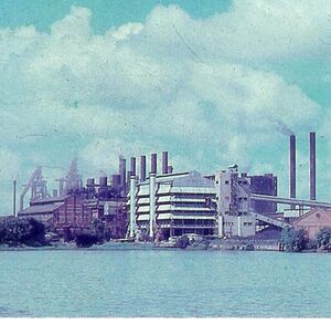
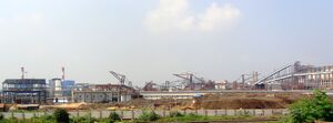
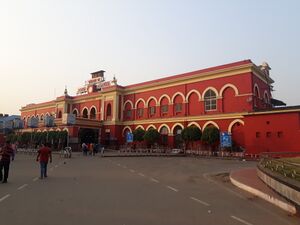
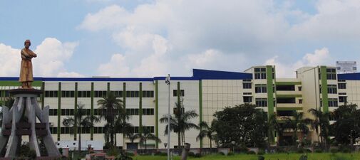
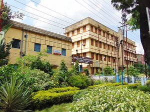
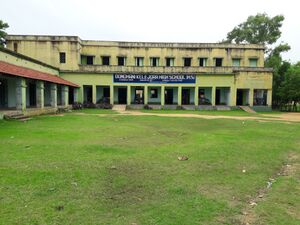
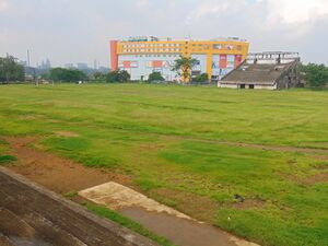
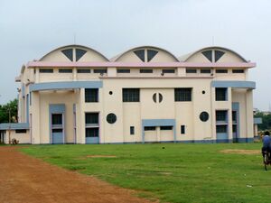
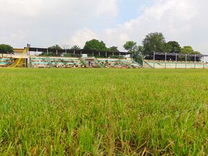
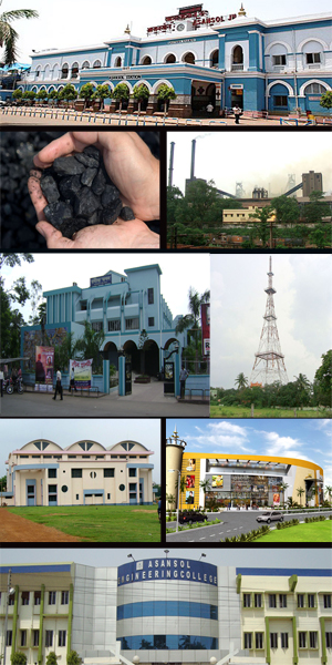 Asansol cityscape Clockwise from top: Asansol Railway Station, IISCO Steel Plant, TV Tower, Galaxy Mall, Asansol Engineering College, Asansol Indoor Stadium, Rabindra Bhavan, Eastern Coalfields Limited | |
| الكنية: | |
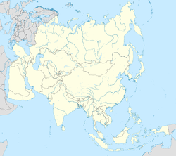
| الإحداثيات: 23°41′N 86°59′E / 23.68°N 86.99°E | |
| Country | |
| State | |
| District | Paschim Bardhaman |
| الحكومة | |
| • النوع | Municipal Corporation |
| • الكيان | Asansol Municipal Corporation |
| • Mayor | Bidhan Upadhyay |
| • Deputy Mayor |
|
| • Police Commissioner | Sukesh Kumar Jain, IPS |
| المساحة | |
| • Metropolis | 326 كم² (126 ميل²) |
| • العمران | 1٬615 كم² (624 ميل²) |
| ترتيب المساحة | 2nd in West Bengal |
| المنسوب | 111 m (364 ft) |
| التعداد | |
| • Metropolis | 1٬243٬414 [3][4][5] |
| • الترتيب | 2nd in West Bengal |
| • العمرانية | 3٬000٬000 |
| صفة المواطن | Asansolians / Asansolites/ Asansolbashi |
| Languages | |
| • Official | Bengali[9][10] |
| • Additional official | English[10] |
| منطقة التوقيت | UTC+5:30 (IST) |
| PIN | 713 3xx |
| Telephone code | 0341 |
| لوحة السيارة | WB 37 / WB 38 / WB 44 (WB 44A, WB 44B, WB 44C, WB 44D) |
| Sex ratio | 1.08[11] ♂/♀ |
| Literacy | 84.82[11] |
| Lok Sabha constituency | Asansol (MP — Shatrughan Sinha — TMC) |
| Vidhan Sabha constituencies | Asansol Uttar (MLA — Moloy Ghatak —TMC)
Asansol Dakshin (MLA —Agnimitra Paul —BJP) Pandaveswar (MLA — Narendranath Chakraborty —TMC) Raniganj (MLA — Tapas Banerjee —TMC) Jamuria (MLA — Hareram Singh —TMC) Kulti (MLA —Ajay Kumar Poddar —BJP) Barabani (MLA —Bidhan Upadhyay —TMC) |
| Police | Asansol-Durgapur Police Commissionerate |
| الموقع الإلكتروني | paschimbardhaman |
Asansol is a city in the Indian state of West Bengal. It is the second largest city in West Bengal. It is the 33rd largest urban agglomeration in India by population. Asansol is the district headquarters of Paschim Bardhaman district. According to a 2010 report released by the International Institute for Environment and Development, a UK-based policy research non-governmental body, Asansol was ranked 11th among Indian cities and 42nd in the world in its list of 100 fastest-growing cities.[12] Asansol is classed as a Y-category city for calculation of HRA (House Rent Allowance) for public servants (rate 16%) making it a "Tier-II" city.
Etymology
"Asan", a species of tree which generally grows thirty meters tall, is found on the banks of the Damodar River; "sol" refers to land. The name "Asansol" is a combination of these two words. Asansol is a city on the banks of Damodar and its land is rich in minerals.[13]
Historically the city was anglicised as Assensole during the British era but the name was reverted after Independence.[14]
History
The region is believed to have been a part of the kingdom of Vishnupur where the Malla dynasty ruled for approximately a thousand years till the emergence of the British. This theory is backed by the presence of Vishnupur style temple present at Chhotodighari village and Domohani village in Asansol.[15]
الجغرافيا
MC: بلدية، P: مركز إداري ريفي، CT: بلدة تعداد، N: مجاورة، OG: نمو زائد، T: معبد
بسبب قيود المساحة في الخريطة الصغيرة، المواقع الفعلية في خريطة أكبر قد تتغير قليلاً
استعراض
Asansol is a cosmopolitan city located on the lower Chota Nagpur Plateau, which occupies most of Jharkhand, between the Damodar and Ajay rivers. Another river, the Barakar, joins the Damodar near Dishergarh. Two small rivulets, Nunia and Garui flows past Asansol.
While Dhanbad district in Jharkhand lies on the western side, Durgapur subdivision lies on the eastern side. To the south, across the Damodar river are the Purulia and Bankura districts. To the north are Dumka and Birbhum districts. Dhanbad district is a major coal mining area and has close links with Asansol; both lie in the Damodar valley.
The city is connected by the Grand Trunk Road and by rail with Durgapur, Burdwan, and Kolkata. It is an important coal-trading and railway centre, with large railway workshops and a railway colony.
المناخ
Asansol has hot and dry summers and mild winters. In summers temperatures soar above 45 °C with dry hot air blowing known as 'loo' while in winter temperatures go below 10 °C. Monsoon lasts from June to September and sometimes in October as well. The Köppen Climate Classification sub-type for this climate is "Aw" (Tropical Savanna Climate).[16]
| Climate data for أسانسول، الهند | |||||||||||||
|---|---|---|---|---|---|---|---|---|---|---|---|---|---|
| Month | Jan | Feb | Mar | Apr | May | Jun | Jul | Aug | Sep | Oct | Nov | Dec | Year |
| Mean daily maximum °C (°F) | 26 (78) |
28 (82) |
34 (94) |
44 (111) |
45 (113) |
43 (110) |
32 (90) |
32 (89) |
32 (90) |
32 (89) |
29 (84) |
26 (79) |
32 (90) |
| Mean daily minimum °C (°F) | 12 (53) |
14 (57) |
19 (66) |
23 (74) |
26 (78) |
26 (79) |
26 (78) |
26 (78) |
25 (77) |
22 (71) |
16 (60) |
12 (53) |
21 (69) |
| Average precipitation mm (inches) | 18 (0.7) |
33 (1.3) |
20 (0.8) |
20 (0.8) |
74 (2.9) |
240 (9.5) |
350 (13.7) |
340 (13.3) |
210 (8.3) |
110 (4.3) |
15 (0.6) |
5.1 (0.2) |
1٬430 (56.3) |
| Source: Weatherbase[17] | |||||||||||||
Government and politics
Administration
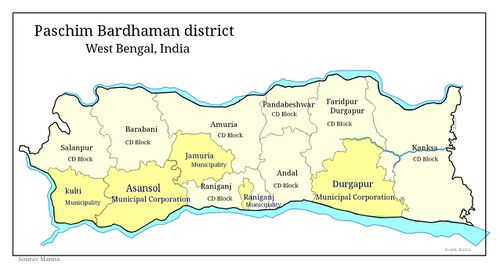
Asansol is administered by the Asansol Municipal Corporation. In 1850, a union committee was formed to look after the civic needs of Asansol. The Assensole (now Asansol) Municipality was approved in 1885 but started functioning effectively in 1896.[18] It was upgraded to the status of a corporation in 1994.[19] Since 2011 it has had its own Police Commissionerate.[20] In 2015, Kulti, Jamuria and Raniganj Municipalities were dissolved and now these areas are administered by the Asansol Municipal Corporation. Thus the proper city limits of Asansol includes the old Asansol Area, including Burnpur, as well as other prominent locations like Raniganj, Chinakuri, Mithani, Barakar, Kulti, Dishergarh, Neamatpur, Sitarampur and Jamuria. Asansol Municipal Corporation has 106 wards.[21]
Asansol-Durgapur Development Authority (ADDA) was established in April 1980 by the merger of the Asansol Planning Organisation and the Durgapur Development Authority. Jurisdiction of ADDA covers the areas administered by Asansol Municipal Corporation, the Jamuria Panchayet Samiti, the Community Development Blocks of Andal, Pandabeswar and Durgapur-Faridpur, Durgapur Municipal Corporation and a small part of Kanksa Community Development Block.[22]
Police stations
Asansol North police station has jurisdiction over Raniganj CD Block and parts of Asansol Municipal Corporation. The area covered is 50 km2 and the population covered is 410,000 (2001). It has police investigation centres at Kanyapur and Jahagirmohalla[23][24]
Asansol South police station has jurisdiction over parts of Asansol municipal corporation. The area covered is 69 km2 and the population covered is 475,439 (2001).[23][24]
Asansol Women PS covers Asansol subdivision.[23][24]
Raniganj PS has jurisdiction within the city and has the following centres under its area;
| PP/IC | Address |
|---|---|
| Panjabi More Investigation Centre | Panjabi More |
| Ballavpur Police Post | Raghunathchak |
| Nimcha Investigation Centre | Jemari |
Jamuria PS has jurisdiction over the following centres;
| PP/IC | Address |
|---|---|
| Sripur Investigation Centre | Nigha, Bengala Occidental |
| Kendra Police Post | Kendra |
| Churulia Investigation Centre | Churulia |
Hirapur and Kulti Police Stations also serve the following parts of Asansol municipal corporation area.[23][24]
| PP/IC/OP | Address |
|---|---|
| Neamatpur Investigation Centre | Neamatpur Fanri Rd, Neamatpur |
| Barakar Police Post | Station Rd, Barakar |
| Sanctoria Investigation Centre | Dishergarh |
| Chowrangi Outpost | Chittaranjan Rd |
Demographics
| Year | Pop. | ±% |
|---|---|---|
| 1951 | 185٬000 | — |
| 1961 | 289٬000 | +56.2% |
| 1971 | 376٬000 | +30.1% |
| 1981 | 637٬000 | +69.4% |
| 1991 | 942٬000 | +47.9% |
| 2001 | 1٬073٬000 | +13.9% |
| 2011 | 1٬243٬414 | +15.9% |
| Source: [25] | ||
As per the 2011 census, the Asansol municipal area has a total population of 563,917,[26] and the total population of Asansol UA is 1,243,414 out of which 646,052 are males and 597,362 are females.[27][4] The city has a literacy rate of 83.30%.[28][29]
Religion
Religion in Asansol as of 2011.
The major religions in Asansol are Hinduism, followed by 75.18% of the population, and Islam, followed by 21.26% of the population. 1.09% of the populace are adherents of Sikhism, while 0.99% of the population adheres to Christianity.[26]
Languages
Bengali is spoken by the majority (43.1%), followed by Hindi (31.7%), Urdu (19.4%), Santali (2.9%), and Punjabi (1.2%).[30]
Economy
The economy of Asansol is primarily dependent on its steel and coal industries, railways, and its trade and commerce.
Steel
The Steel Authority of India IISCO (Indian Iron and Steel Company Ltd) steel-making plant at Kulti was the first such facility in India. It became well known during the 1960s and 1970s, with its company shares being traded on the London Stock Exchange. However, a decade later the company became loss-making until it was revived in 2006 when it merged with the Steel Authority of India. Modernisation at IISCO Steel Plant has helped the city develop at a very rapid pace. The plant's capacity will be raised from 0.4 MT to 2.5 MT of saleable steel, using what will be the biggest blast furnace in the country.[31] As of 2015, the investment for modernisation was the single largest investment in West Bengal till then.[32]
Coal
Eastern Coalfields, which has its headquarters in Sanctoria P.O. - Dishergarh, has a significant presence in the area due to the huge deposits of high-quality coal. However, most of the coalfields and surrounding residential colonies are located away from the main city. Nearby areas like Raniganj, Chinakuri, and Jamuria are of particular importance as coal blocks. As of 2012, the total coal reserve in the ECL command area up to 600 metre depth was 49.17 billion tonnes.[33][34]
Railways
Railways also is a big contributor to the economy of Asansol. Railways were the first employer in the city and they are credited with developing the city in the late 19th century. Asansol is one of four divisions of Eastern Railway Zone and among the major revenue generating divisions in Indian Railways. World's largest vertically integrated organisation Chittaranjan Locomotive Works under Indian Railways is also situated here. It is India's first locomotive works and Asia's largest Locomotive manufacturer.[35]
Other business ventures
Other industries include Dishergarh Power Supply, Damodar Valley Corporation, Burn Standard Co. which is now a subsidiary of Eastern Railways, Hindustan Cables Limited and cement factories like Burnpur Cement.[36]
Transport
Road
The Grand Trunk Road (NH 19 - old numbering NH 2) runs across the subdivision and NH 14 (old numbering NH 60) connects Asansol with Odisha. NH 19 has been broadened as part of the Golden Quadrilateral project and now allows three-lane traffic in both directions. A highway bypass avoids the areas of Ushagram, Murgasol, Asansol Bazar, Chelidanga, BNR, Gopalpur, Neamatpur, Kulti, and Barakar. Some of the other important roads of the city are namely Vivekananda Avenue, Burnpur Road, and S.B Gorai Road.
The South Bengal State Transport Corporation operates daily bus services to Kolkata and numerous other destinations, such as Malda, Siliguri, Midnapur, Bankura, Siuri, Purulia, Burdwan, Kalna, Howrah, Barrackpore, Digha, Bolpur, Kirnahar and Berhampore. The North Bengal State Transport Corporation also runs services to and from the city and towns in North Bengal like Malda, Raiganj and Balurghat. There are also many private buses, Taxis and Radio Taxis, which ply locally and on intercity and interstate routes.
Railway
Asansol Junction railway station is the Division of Eastern Railway zone This is one of the oldest divisions on the Indian Railways and has always been in the forefront of operations, both freight and passenger. As far as Eastern Railway is concerned, Asansol Division is referred to as the heart of operations, being at the crossroads of the Grand Chord route via Gaya and the main line route via Patna. With a total of 629.38 route kilometres, the division has the unique distinction of having quadruple lines (two up and two down line) from Khana to Sitarampur.
The railway track from Kolkata to Delhi passes through the subdivision and bifurcates into the main line and the grand chord line at Sitarampur railway junction, a little to the west of Asansol railway junction. Another railway track links Asansol with Adra and then to Jamshedpur via Purulia and Kharagpur via Bankura. A branch line connects Andal with Sainthia on the Sahibganj Loop.
Almost all the trains linking Kolkata with north India also connect with Asansol including Howrah-Patna Vande Bharat Express, Sealdah Rajdhani, Howrah Rajdhani, Howrah Duronto, Sealdah Humsafar Express, Yuva Express and Shalimar Duronto. As a result, Asansol enjoys good connectivity with cities like New Delhi, Jammu, Amritsar, Ludhiana, Allahabad, Kanpur, Lucknow, Dehradun, Jaipur, Kota, Jodhpur, Jaisalmer, Gwalior, Bhopal, Indore, Patna, Ranchi, Durgapur and Dhanbad on the one hand and commands a fairly good traffic movement towards the western cities like Mumbai, Ahmedabad and Surat and southern cities like Bhubaneshwar, Visakhapatnam, Vijaywada, Chennai, Bangalore and Trivandrum. It is also connected with Guwahati in the north-east region.[37]
Air
The domestic airport that serves the city is Kazi Nazrul Islam Airport. The airport is located in Andal. It is roughly 25 kilometres (16 mi) from the Asansol City Bus Terminus.
There is also a private airport located at Burnpur Riverside Area. At present this Airport is operated by IISCO. Recently Airport Authority of India gave nod to start commercial flights for six routes in West Bengal; Burnpur Airport being one of them is hopeful to receive its first commercial flight by the last quarter of 2019.[38]
The nearest international airport is Netaji Subhas Chandra Bose International Airport at Dum Dum in Kolkata.
Education
Among the many educational institutions are:
Schools
- Asansol Ramakrishna Mission High School
- Assembly of God Church School
- DAV Public School, Asansol[39]
- Loreto Convent, Asansol
- Kendriya Vidyalaya, Asansol[40]
- St. Patrick's Higher Secondary School
- St. Vincent's High and Technical School
- Subhaspally Bidyaniketan
Colleges/Universities
- Asansol Engineering College
- Asansol Girls' College
- Asansol Polytechnic
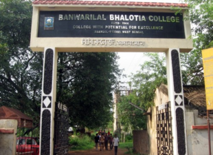
- Banwarilal Bhalotia College, Asansol
- Bengal Homoeopathic Medical College and Hospital
- Bidhan Chandra College, Asansol
- Deshbandhu Mahavidyalaya
- Kanyapur Polytechnic
- Kazi Nazrul Islam Mahavidyalaya
- Kazi Nazrul University
- Khandra College
- Kulti College
- Raniganj Girls' College
- St. Xavier's College, Asansol
- Triveni Devi Bhalotia College
Libraries
There are several public libraries, including the District Library.[41]
Media
Prasar Bharati has a High Power Transmitter Station at Asansol which broadcasts Doordarshan National / Bangla and Doordarshan News Channel. Transmissions are not only received by the city but also neighbouring places. Other than national channels, several local channels are available through cable TV networks, such as Vision 24, Drishti Channel, ATV, and ISP Channel.
Asansol currently has four FM radio stations: All India Radio 100.3 FM, 92.7 BIG FM, 93.5 RED FM and Radio Mirchi 95 FM.[42]
Sports facilities
- The Polo Ground has been a landmark in Asansol for a long time. The ground got its name from the sport of polo which was played here during British rule. Asansol Indoor Stadium is on the same site and has a capacity of 500 spectators. The stadium, which is notable for having the largest shell concrete roof in the district, has two badminton courts and an interchangeable volleyball court. Adjacent to this is Asansol Stadium, where both district and subdivision level football and cricket matches are played.[43][44]
- Eastern Railway Divisional Stadium, popularly known as the Loco Ground, houses several district and subdivision level football and cricket tournaments.
- The Burnpur Football Stadium is a centre of extensive sports activities. Players groomed in the SAIL Football Academy at Burnpur have represented SAIL in the Kolkata IFA and 1st Division League matches.[45][46]
- Burnpur Cricket Club Ground is a first-class level cricket stadium located at Burnpur.
- Asansol Rifle Club Shooting Range is located in Kanyapur Road beside the Ravindra Vidyala Government School. The Rifle Shooting ground founded in the year 1951 under the initiation of some elite citizen of Asansol under the aegis of WBRA and NRAI.[47][48][49]
- Kazi Nazrul Islam Krirangan is being developed as an international standard stadium at the former Sen Raleigh Football Ground.[بحاجة لمصدر]
Notable people
- S. S. Ahluwalia
- Arjun Atwal
- Ajitesh Bandopadhyay
- Meenakshi Banerjee, scientist
- Timir Biswas, Indian playback singer and composer.
- Ritwik Das
- Kazi Nazrul Islam, writer, lyricist and poet
- Manoj Kumar Mukherjee
- Vivek Singh
- Sharmila Tagore, Indian actress
See also
- List of cities in West Bengal
- Asansol Sadar subdivision
- Asansol Municipal Corporation
- Asansol Junction
References
- ^ Asansol, The City of Brotherhood, 2022, https://asansol.org, retrieved on 20 November 2023
- ^ "Indian Cities and Their Nicknames - Complete List". 22 July 2015. Retrieved 25 December 2019.
- ^ "Siliguri, India Metro Area Population 1950-2021".
- ^ أ ب "Asansol City Population Census 2011 - West Bengal". census.gov.in. Retrieved 3 July 2020.[dead link]
- ^ "The Kolkata Gazette" (PDF). Notification No. 335/MA/O/C-4/1M-36/2014 dated 3 June 2015. Department of Municipal Affairs, Government of West Bengal. Archived from the original (PDF) on 12 March 2017. Retrieved 9 March 2017.
- ^ أ ب "Asansol City". asansolmunicipalcorporation. Retrieved 24 November 2020.
- ^ أ ب "City - Asansol (West Bengal, India) -". Retrieved 6 September 2023.
- ^ أ ب Asansol Durgapur Development Authority, https://www.sudawb.org/wbdma_oldversion/HTM/MUNI_ADDA.htm
- ^ "52nd Report of the Commissioner for Linguistic Minorities in India" (PDF). Nclm.nic.in. Ministry of Minority Affairs. p. 85. Archived from the original (PDF) on 25 May 2017. Retrieved 28 August 2019.
- ^ أ ب "Fact and Figures". Wb.gov.in. Retrieved 28 August 2019.
- ^ أ ب "Cities having population 1 lakh and above, Census 2011" (PDF). censusindia.gov.in. Retrieved 12 March 2022.
- ^ "World's fastest growing urban areas (1)". City Mayors. 7 December 2010. Retrieved 16 March 2011.
- ^ "Indian Laurel". Retrieved 25 December 2019.
- ^ "General Report - Public Instruction In Bengal" (PDF). 1884–1885: 108.
{{cite journal}}: Cite journal requires|journal=(help) - ^ "Archived copy" (PDF). Archived from the original (PDF) on 5 February 2018. Retrieved 21 April 2017.
{{cite web}}: CS1 maint: archived copy as title (link) - ^ "Climate Summary for Asansol". Weatherbase.com.
- ^ "Asansol, India – Monthly - All Weather Averages". Weatherbase. 2013. Retrieved 31 July 2013.
- ^ "পাতা:গবর্ণমেণ্ট্ গেজেট্ (মার্চ) ১৮৮৬.pdf/৩৪০ - উইকিসংকলন একটি মুক্ত পাঠাগার". bn.wikisource.org. Retrieved 25 December 2019.
- ^ "Asansol Municipal Corporation". Asansol Municipal Corporation.
- ^ "Asansol-Durgapur Police Commissionerate". Asansoldurgapurpolice.in.
- ^ "Archived copy" (PDF). Archived from the original (PDF) on 12 March 2017. Retrieved 9 March 2017.
{{cite web}}: CS1 maint: archived copy as title (link) - ^ "Welcome to ADDA". addaonline.in.
- ^ أ ب ت ث "District Statistical Handbook 2014 Bardhaman". Tables 2.1, 2.2. Department of Statistics and Programme Implementation, Government of West Bengal. Archived from the original on 21 January 2019. Retrieved 23 September 2018.
- ^ أ ب ت ث "Asansol Durgapur Police Commissionerate". Find your police station. Asansol Durgapur Police. Archived from the original on 22 January 2012. Retrieved 18 February 2017.
- ^ "Siliguri, India Metro Area Population 1950-2023". www.macrotrends.net. Retrieved 6 September 2023.
- ^ أ ب "Census of India Website : Office of the Registrar General & Census Commissioner, India". censusindia.gov.in. Retrieved 18 December 2021.
- ^ "Census of India Website : Office of the Registrar General & Census Commissioner, India". censusindia.gov.in. Archived from the original on 26 December 2018. Retrieved 20 February 2019.
- ^ "Asansol growing faster than Kolkata, says UN report". The Times of India. 6 November 2012. Retrieved 20 February 2019.
- ^ "Kolkata | History, Population, Government, & Facts". Encyclopædia Britannica (in الإنجليزية). Retrieved 20 February 2019.
- ^ أ ب "C-16 City: Population by mother tongue (town level)". Office of the Registrar General & Census Commissioner, India. Retrieved 29 March 2024.
- ^ "PM Dedicates to the Nation SAIL's Modernised & Expanded IISCO Steel Plant at Burnpur". Press Release. SAIL. Archived from the original on 22 March 2016. Retrieved 4 March 2017.
- ^ "Chairman, SAIL reviews performance of ISP, Burnpur". Press Release 7 March 2015. SAIL. Archived from the original on 13 October 2018. Retrieved 30 March 2017.
- ^ "Welcome to official website of Eastern Coalfields Limited (ECL)". www.easterncoal.gov.in.
- ^ "History". Archived from the original on 4 February 2018. Retrieved 25 December 2019.
- ^ "Asansol Division". Archived from the original on 7 May 2017. Retrieved 19 April 2017.
- ^ "Asansol on the net – A complete information on Asansol city". Asansolcity.com. Archived from the original on 29 October 2013. Retrieved 24 October 2013.
- ^ "Asansol Jn Train Railway Station". Make My Trip. Archived from the original on 23 May 2010.
- ^ RCS round 1 and 2cadup.gov.in Archived 27 فبراير 2019 at the Wayback Machine
- ^ "CBSE 10: Stellar show fuels doctor dreams for Bengal girl". The Times of India (in الإنجليزية). 7 May 2019. Retrieved 8 March 2022.
- ^ "Times School Survey releases the list of top schools in West Bengal". The Times of India. 18 October 2023. Retrieved 10 July 2024.
- ^ "Other Pages". Archived from the original on 2 November 2013. Retrieved 31 October 2013.
- ^ "Private stations Location Wise". Archived from the original on 15 November 2010.
- ^ "Polo Ground Cricket Ground in Asansol | CricHeroes". cricheroes.in. Retrieved 15 January 2024.
- ^ "Polo Ground, Asansol Court Area". www.mappls.com (in الإنجليزية). Retrieved 15 January 2024.
- ^ "Driving directions to Burnpur Football Ground, Asansol". Waze (in الإنجليزية). Retrieved 15 January 2024.
- ^ [1]
- ^ "Google Maps". Google Maps (in الإنجليزية). Retrieved 23 December 2023.
- ^ worldsearch. "World Search | ASANSOL RIFLE CLUB". worldsearch.co.in (in الإنجليزية). Retrieved 23 December 2023.
- ^ "Asansol Rifle Club News | Latest News on Asansol Rifle Club - Times of India". The Times of India (in الإنجليزية). Retrieved 23 December 2023.
Further reading
- History of The Indian Iron and Steel Co. Ltd. by Dr. N.R.Srinivasan
- Bardhaman Jelar Itihas O Lok Sanskriti (History and Folk-lore of Bardhaman District) in Bengali by Akkari Chattopadhyay
External links
قالب:Paschim Bardhaman District
خطأ لوا في وحدة:Authority_control على السطر 278: attempt to call field '_showMessage' (a nil value).
- Pages using gadget WikiMiniAtlas
- صفحات بها مخططات
- Articles with dead external links from September 2023
- Short description is different from Wikidata
- Pages using infobox settlement with possible nickname list
- Coordinates on Wikidata
- Articles containing OSM location maps
- Articles with hatnote templates targeting a nonexistent page
- Articles with unsourced statements from July 2023
- Asansol
- Metropolitan cities in India
- Cities and towns in Paschim Bardhaman district
- Cities in West Bengal
- صفحات مع الخرائط


