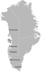
نوك
نوك
Nuuk Godthåb | |
|---|---|
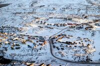
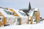
(left to right, top to bottom:) Skyline at night; Church; Downtown Nuuk, with Katuaq in the foreground; Sermitsiaq mountain overlooking Nuussuaq; Nuussuaq district; Qernertunnguit, neighbourhood in the Quassussuup Tungaa district; the skyline at night with the aurora borealis above | |
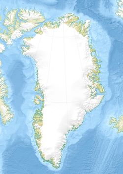
Location within Greenland | |
| الإحداثيات: 64°10′36″N 51°44′10″W / 64.17667°N 51.73611°W | |
| Sovereign state | |
| Constituent country | |
| Municipality | Sermersooq |
| Founded | 29 August 1728 |
| Incorporated | 1728 |
| المساحة | |
| • الإجمالي | 49 كم² (18٫8 ميل²) |
| المنسوب | 5 m (16 ft) |
| التعداد (2024) | |
| • الإجمالي | 19٬872 (Largest in Greenland) |
| • الكثافة | 408/km2 (1٬057/sq mi) |
| City and metropolitan population is co-extensive, the entire Metro area belongs to Nuuk City[clarify] | |
| صفة المواطن | Nuummioq |
| منطقة التوقيت | UTC−02:00 (Western Greenland Time) |
| • الصيف (التوقيت الصيفي) | UTC−01:00 (Western Greenland Summer Time) |
| Postal code | 3900, 3905 |
| الموقع الإلكتروني | www |
نوك ( Nuuk ؛ النطق الگرينلاندي: [nuːk]; دنماركية: Nuuk,[1] سابقاً Godthåb [ˈkʌtˌhɔˀp])[2] هي عاصمة وأكبر مدن جرينلاند، الإقليم المستقل ذاتياً في مملكة الدنمارك. نوك هي مقر حكومة جرينلاند وأكبر مركز ثقافي واقتصادي بالإقليم. أقرب المدن الرئيسية من البلدان الأخرى هي Iqaluit و St. John's في كندا و ريكياڤيك في آيسلندا. Nuuk contains a third of Greenland's population and its tallest building. نوك هي أيضاً مقر الحكومة في Sermersooq بلدية. في يناير 2023 بلغ عدد سكانها 19,604 نسمة.[3] Nuuk is considered a modernized city after the policy began in 1950.[4]
أسسها عام 1728 المبشر الدنماركي-النرويجي هانز إگدى عندما انتقل من مستعمرة الأمل Hope (Haabets Koloni) where he arrived in 1721. The governor Claus Paarss was part of the relocation. The new colony was placed at the Inuit settlement of Nûk and was named Godthaab ("Good Hope"). "Nuuk" is the Greenlandic word for "cape" (دنماركية: næs) and is commonly found in Greenlandic place names. It is so named because of its position at the end of the Nuup Kangerlua fjord on the eastern shore of the Labrador Sea. Its latitude, at 64°11' N, makes it the world's northernmost capital, only a few kilometres farther north than the Icelandic capital Reykjavík. When home rule was established in 1979, the authorization of place names was transferred to Greenlandic authorities, who subsequently preferred Greenlandic names over Danish ones. The name Godthåb mostly went out of use over the next two decades.
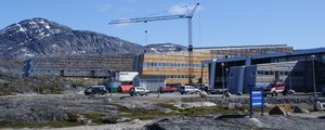
The campus of the University of Greenland, hosting Statistics Greenland and the main holdings of the Public and National Library of Greenland,[5] are at the northern end of the district, near the road to Nuuk Airport.[6]
Nuuk receives its electric power mainly from the renewable energy-powered Buksefjord hydroelectric power plant by way of a 132 kV powerline crossing Ameralik fjord over a distance of 5,376 m (17,638 ft), the world's longest free span.[7][8]
ويتشكل سكان المدينة اليوم من عرقيتي الإنويت (الإسكيمو) ودانماركيون.
التاريخ
نوك هي مدينة لديها تاريخ طويل بالنسبة لمن سكنها، أول من سكنها هم الإسكيمو.
The site has a long history of habitation. The area around Nuuk was first occupied by the ancient, pre-Inuit, Paleo-Eskimo people of the Saqqaq culture as far back as 2200 BC when they lived in the area around the now abandoned settlement of Qoornoq.[9] For a long time, it was occupied by the Dorset culture around the former settlement of Kangeq, but they disappeared from the Nuuk district before AD 1000. The Nuuk area was later inhabited by Viking explorers in the 10th century (Western Settlement), and shortly thereafter by Inuit peoples.[10] Inuit and Norsemen both lived with little interaction in this area from about 1000 until the disappearance of the Norse settlement for uncertain reasons during the 15th century.
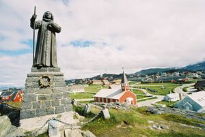
The city proper was founded as the fort of Godt-Haab in 1728 by the royal governor Claus Paarss, when he relocated the missionary and merchant Hans Egede's earlier Hope Colony (Haabets Koloni) from Kangeq Island to the mainland. At that time, Greenland was formally still a Norwegian colony (until 1814) under the united Dano-Norwegian Crown, but the colony had not had any contact for over three centuries. Paarss's colonists consisted of mutinous soldiers, convicts, and prostitutes and most died within the first year of scurvy and other ailments. In 1733 and 1734, a smallpox epidemic killed most of the native population as well as Egede's wife.[11] Hans Egede went back to Denmark in 1736 after 15 years in Greenland, leaving his son Poul to continue his work.[12] Godthaab became the seat of government for the Danish colony of South Greenland,[13] while Godhavn (modern Qeqertarsuaq) was the capital of North Greenland until 1940, when the administration was unified in Godthaab.[14]
In 1733, Moravian missionaries received permission to begin a mission on the island; in 1747, there were enough converts to prompt the construction of the Moravian Brethren Mission House and the formal establishment of the mission as New Herrnhut (دنماركية: Nye-Hernhut). This became the nucleus for present-day Nuuk as many Greenlanders from the southeastern coast left their territory to live at the mission station. From this base, further missions were established at Lichtenfels (1748), Lichtenau (1774), Friedrichsthal (1824), Umanak (1861), and Idlorpait (1864),[15] before they were discontinued in 1900 and folded into the Lutheran Church of Denmark.[16]
Around 1850, Greenland, and especially the area around Nuuk, were in crisis. The Europeans had brought diseases and a culture that conflicted with the ways of the native Greenlanders. Many Greenlanders were living in poverty. In 1853, Hinrich Johannes Rink came to Greenland and was surprised at how local Greenlandic culture and identity had been suppressed under Danish influence. In response, in 1861, he started the Atuagagdliutt, Greenland's first newspaper, with a native Greenlander as editor. This newspaper based in Nuuk later became an important token of Greenlandic identity.
During World War II, there was a reawakening of Greenlandic national identity. The use of written Greenlandic grew, a council was assembled under Eske Brun's leadership in Nuuk. In 1940, an American and a Canadian Consulate were established in Nuuk.
Under new regulations in 1950, two councils amalgamated into one. This Countryside Council was abolished on 1 May 1979, when the city of Godthåb was renamed Nuuk by the Greenland Home Rule government. The city boomed during the 1950s when Denmark began to modernize Greenland. As in Greenland as a whole, Nuuk is populated today by both Inuit and Danes. Over a third of Greenland's total population lives in the Nuuk Greater Metropolitan area.[17]
An article examining indigenous influences on cities worldwide[18] suggested,
One city... stands out. Nuuk... has probably the highest percentage of aboriginal people of any city: almost 90% of Greenland's population of 58,000 is Inuit, and at least eight in 10 live in urban settlements. Nuuk also celebrates Inuit culture and history to an extent that is unprecedented in many cities with higher total aboriginal populations. By proportion and by cultural authority and impact, it may well be tiny Nuuk that is the most indigenous city in the world.[18]
الجغرافيا
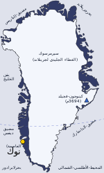
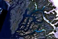
Nuuk is located at approximately 64°10′N 51°44′W / 64.167°N 51.733°W[19] at the mouth of Nuup Kangerlua (formerly Baal's River[20]), some 10 km (6.2 mi) from the shores of the Labrador Sea on the southwestern coast of Greenland, and about 240 km (150 mi) south of the Arctic Circle. Initially, the fjord flows to the northwest, to then turn southwest at 64°43′N 50°37′W / 64.717°N 50.617°W, splitting into three arms in its lower run, with three big islands in between the arms: Sermitsiaq Island, Qeqertarsuaq Island, and Qoornuup Qeqertarsua.[21] The fjord widens into a bay dotted with skerries near its mouth, opening into Labrador Sea at approximately 64°03′N 51°58′W / 64.050°N 51.967°W. Some 20 km (12 mi) to the northeast, reaching a height of 1,210 m (3,970 ft), Sermitsiaq can be seen from almost everywhere in Nuuk. The mountain has given its name to the nationwide newspaper Sermitsiaq. Closer to the town are the peaks of Store Malene, 790 m (2,590 ft), and Lille Malene, 420 m (1,380 ft).[22] The magnetic declination at Nuuk is extreme.[23][24]
تقع نوك في بلدية سيرمرسوك.
المناخ
 مقالة مفصلة: مناخ قطبي
مناخ نوك هو مناخ قطبي، البارد شتاءً والمثلج صيفاً. متوسط درجات الحرارة تحت الصفر لمدة 7 أشهر في السنة.
Nuuk has a maritime-influenced tundra climate (Köppen ET) with cold, long, snowy winters and cool, short summers. Although the winters in Nuuk are relatively cold, they are milder compared to other tundra climates, such as in Alaska in the United States or parts of Eastern Siberia. Instead, peak winter is similar to identical latitudes in the Nordic countries. On 21 December, the shortest day and longest night of the year, the sun rises at 10:30 am and sets at 2:20 pm. By contrast, on the longest day and shortest night of the year, 21 June, the sun rises at 2:54 am and does not set until 12:04 am, giving a quasi-Midnight Sun. Nuuk can have mild temperatures on brief occasions year-round, with each month having recorded 13 °C (55 °F) or warmer, although only June, July, August, and September have recorded what could be considered hot weather (defined as 22.5 °C (72.5 °F) or higher). The monthly averages range from −9 °C (16 °F) to 7 °C (45 °F), whereas all-time extremes range from −32.5 °C (−26.5 °F) on 14 January 1984 to 26.3 °C (79.3 °F) on 6 July 2008. The record wind in Nuuk is 68 km/h.
The average monthly temperature (7.3 °C (45.1 °F) in August) is colder than what is considered the limit for trees (10 °C (50 °F) during the warmest month). There are a few planted trees[25] which do not sustain well.
| Climate data for نوك (1991–2020 normals, extremes 1866–present) | |||||||||||||
|---|---|---|---|---|---|---|---|---|---|---|---|---|---|
| Month | Jan | Feb | Mar | Apr | May | Jun | Jul | Aug | Sep | Oct | Nov | Dec | Year |
| Record high °C (°F) | 13.5 (56.3) |
13.0 (55.4) |
15.2 (59.4) |
14.6 (58.3) |
18.3 (64.9) |
23.8 (74.8) |
26.3 (79.3) |
25.1 (77.2) |
23.8 (74.8) |
19.9 (67.8) |
15.8 (60.4) |
13.3 (55.9) |
26.3 (79.3) |
| Mean daily maximum °C (°F) | −5.0 (23.0) |
−6.0 (21.2) |
−5.1 (22.8) |
−0.7 (30.7) |
3.9 (39.0) |
8.4 (47.1) |
11.1 (52.0) |
10.2 (50.4) |
6.5 (43.7) |
2.3 (36.1) |
−1.1 (30.0) |
−3.2 (26.2) |
1.8 (35.2) |
| Daily mean °C (°F) | −7.5 (18.5) |
−8.6 (16.5) |
−7.7 (18.1) |
−3.0 (26.6) |
1.2 (34.2) |
5.0 (41.0) |
7.4 (45.3) |
7.0 (44.6) |
4.0 (39.2) |
0.2 (32.4) |
−3.3 (26.1) |
−5.5 (22.1) |
−0.9 (30.4) |
| Mean daily minimum °C (°F) | −9.7 (14.5) |
−10.9 (12.4) |
−10.0 (14.0) |
−5.2 (22.6) |
−1.2 (29.8) |
2.0 (35.6) |
4.4 (39.9) |
4.5 (40.1) |
2.0 (35.6) |
−1.8 (28.8) |
−5.3 (22.5) |
−7.7 (18.1) |
−3.3 (26.1) |
| Record low °C (°F) | −32.5 (−26.5) |
−29.6 (−21.3) |
−27.5 (−17.5) |
−30.0 (−22.0) |
−19.0 (−2.2) |
−10.3 (13.5) |
−6.6 (20.1) |
−4.7 (23.5) |
−8.2 (17.2) |
−16.6 (2.1) |
−24.4 (−11.9) |
−25.2 (−13.4) |
−32.5 (−26.5) |
| Average precipitation mm (inches) | 67.1 (2.64) |
51.1 (2.01) |
58.9 (2.32) |
53.3 (2.10) |
57.4 (2.26) |
61.7 (2.43) |
69.3 (2.73) |
90.8 (3.57) |
104.6 (4.12) |
80.5 (3.17) |
79.0 (3.11) |
74.5 (2.93) |
852.6 (33.57) |
| Average precipitation days (≥ 0.1 mm) | 13.8 | 12.7 | 15.1 | 13.2 | 13.0 | 10.5 | 12.5 | 12.5 | 14.1 | 13.5 | 14.3 | 14.4 | 159.6 |
| Average snowy days | 13.6 | 12.1 | 14.5 | 11.4 | 9.4 | 2.8 | 0.1 | 0.2 | 4.3 | 9.8 | 12.7 | 13.8 | 104.7 |
| Average relative humidity (%) | 73.8 | 74.7 | 74.3 | 78.3 | 81.1 | 85.0 | 85.3 | 86.7 | 82.3 | 76.7 | 73.3 | 73.4 | 78.7 |
| Average dew point °C (°F) | −11 (12) |
−12 (10) |
−12 (10) |
−7 (19) |
−2 (28) |
2 (36) |
5 (41) |
5 (41) |
1 (34) |
−4 (25) |
−8 (18) |
−10 (14) |
−4 (24) |
| Mean monthly sunshine hours | 15.5 | 65.0 | 148.8 | 180.0 | 189.1 | 204.0 | 195.3 | 164.3 | 141.0 | 80.6 | 30.0 | 6.2 | 1٬419٫8 |
| Mean daily sunshine hours | 0.5 | 2.3 | 4.8 | 6.0 | 6.1 | 6.8 | 6.3 | 5.3 | 4.7 | 2.6 | 1.0 | 0.2 | 3.9 |
| Source 1: Danish Meteorological Institute[26][27] | |||||||||||||
| Source 2: Meteo Climat (record highs and lows),[28] Deutscher Wetterdienst (sun 1980–1990),[29] NOAA(humidity 1991-2020), [30] Time and Date (dewpoints, 1985-2015)[31] | |||||||||||||
السكان
يبلع عدد سكان مدينة نوك 19,604 نسمة عام 2023 وتعتبر الأسرع نمواً في غرينلاند، [32] مع المهاجرين من البلدات والمستوطنات. إزداد عدد السكان بأكثر من الربع بالنسبة إلى مستويات عام 1990، وبنسبة 16% بالمقارنة مع مستويات عام 2000.[32]
التعليم
النقل
 مقالة مفصلة: مطار نوك
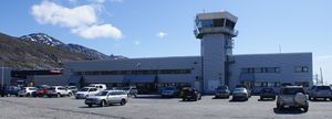
يوجد في مدينة نوك مطار نوك الدولي، إسمه الرسمي: قالب:جرينلاندية يقع شمال شرقي المدينة نوك، يتكون من مدرج واحد أبعاده 950 متر × 30 متر (3,117 قدم × 98 قدم). بني المطار سنة 1979م .[33] يُعد مركز العمليات الرئيسية لشركة طيران جرينلاند ويُدار من قبلها.
المعالم
يتواجد العديد من المعالم المختلفة في المدينة.
الدينية
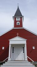
بنيت الكاتدرائية اللوثرية نوك من أبرشية غرينلاند في عام 1849م ، المبنى الأحمر هو موقع بارز على الساحة.
الثقافية
- كاتواك هو مركز ثقافي يُستخدم للحفلات، المعارض، مؤتمرات وحتى لعروض السينما، أفتتح في 15 فبراير 1997.
- متحف فن نوك يحتوي على مجموعة بارزة من لوحات مائية ورسومات والعديد من الفنون الأخرى التي تم جمعها من قبل رجل الأعمال سفيند جانج.
التعليمية
جامعة غرينلاند، هي الجامعة الوطنية في غرينلاند. ويُدرّس فيها معظم المجالات باللغة الدنماركية.
الرياضية
يتواجد في المدينة ملعب نوك وهو ملعب متعدد الإستخدامات ويتم إستخدامه في الأغلب لمباريات كرة القدم ويستوعب 2,000 مشاهد، وتشمل المدينة الأندية الرياضية العديدة، بالإضافة إلى تلة للتزلج على الثلج بإرتفاع حوالي 300م.
البلديات والمدن المتوأمة
معرض الصور
المصادر
- ^ "DSN".
- ^ The pre-1948 spelling was Godthaab.
- ^ "Population January 1st by place of birth, gender, age, residence type and time". StatBank (in الإنجليزية). Retrieved 2023-03-23.
- ^ Dzik, Tony (October 1, 2018). "Nuuk, Greenland: Site, Situation, and "The Law of the Primate City"".
- ^ "Velkommen til Ilimmarfik". University of Greenland, Ilimmarfik. Archived from the original on 11 July 2010. Retrieved 11 July 2010.
- ^ "Kontakt". University of Greenland. Archived from the original on 12 July 2010. Retrieved 11 July 2010.
- ^ "Greenland hydro capacity increases with new plant". North of 56. 20 August 2013. Retrieved 21 December 2015.
- ^ "Buksefjorden: Grønlands første vandkraftværk satte verdensrekord" (in الدانمركية). Arctic Business Network. 19 February 2014. Retrieved 21 December 2015.
- ^ "Human history". Nuuk Tourism. Archived from the original on 15 June 2010. Retrieved 12 July 2010.
- ^ "Nuuk". Encyclopædia Britannica. Retrieved 12 July 2010.
- ^ Wurm, Stephen A.; Mühlhäusler, Peter; Tyron, Darrell T. (1996). Atlas of Languages of Intercultural Communication in the Pacific, Asia, and the Americas, International Council for Philosophy and Humanistic Studies. Volume 2, Part 1 Volume 13 of Trends in Linguistics. Walter de Gruyter. p. 1051. ISBN 978-3-11-013417-9.
- ^ "Nuuk travel guide". Archived from the original on 12 April 2009. Retrieved 24 May 2009.
- ^ Scandinavian Review. American-Scandinavian Foundation. 1921. p. 681.
- ^ Lemkin, Raphael (1 June 2008). Axis Rule in Occupied Europe. The Lawbook Exchange, Ltd. p. 167. ISBN 978-1-58477-901-8.
- ^ Lüdecke, Cornelia. "East Meets West: Meteorological observations of the Moravians in Greenland and Labrador since the 18th century Archived 3 مارس 2016 at the Wayback Machine". History of Meteorology 2 (2005). Retrieved 27 April 2012.
- ^ Wittman, P. "Greenland". The Catholic Encyclopedia. Robert Appleton Co. (New York), 1909. Retrieved 28 April 2012.
- ^ "CIA World Factbook – Greenland". 2 March 2022.
- ^ أ ب Daley, Paul (29 June 2016). "Which is the world's most indigenous city?". The Guardian. Retrieved 29 June 2016.
- ^ Municipality information. Archived 16 يونيو 2007 at the Wayback Machine De grønlandske kommuners Landsforening, KANUKOKA
- ^ Nicoll, James. An Historical and Descriptive Account of Iceland, Greenland and the Faroe Islands. Oliver & Boyd, 1840.
- ^ O'Carroll, Etain (2005). Greenland and the Arctic. Lonely Planet. p. 154. ISBN 978-1-74059-095-2.
- ^ خطأ استشهاد: وسم
<ref>غير صحيح؛ لا نص تم توفيره للمراجع المسماةdsd - ^ On 11 October 2015, the magnetic declination between the North Pole and Nuuk was "27° 49' W ± 0° 33' changing by 0° 22' E per year", calculated with NOAA's Magnetic Field Calculators, National Geophysical Data Center.
- ^ "Magnetic declination in Nuuk, Greenland". Magnetic Declination. Retrieved 22 December 2015.
- ^ e.g Gult Archived 17 ديسمبر 2013 at the Wayback Machine by Henrik Greve Thorsen
- ^ "Klimanormaler Grønland". DMI (in الدانمركية). Retrieved 2021-11-26.
- ^ "The Observed Climate of Greenland, 1958–99 with Climatological Standard Normals, 1961–90" (PDF). Danish Meteorological Institute. Retrieved 31 October 2019.
- ^ "Station Nuuk" (in الفرنسية). Météo Climat. Retrieved 10 February 2019.
- ^ "Klimatafel von Godthaab (Nuuk) / Grönland (zu Dänemark)" (PDF). Baseline climate means (1961–1990) from stations all over the world (in الألمانية). Deutscher Wetterdienst. Retrieved 16 December 2019.
- ^ "Nuuk Climate Normals 1991-2020". National Oceanic and Atmospheric Administration. Retrieved August 11, 2023.
- ^ "Climate & Weather Averages in Nuuk". Time and Date. Retrieved 24 July 2022.
- ^ أ ب "Population in localities January 1.st by locality, age, gender and place of birth 1977-2010". Statistics Greenland. Retrieved 12 July 2010.
- ^ Air Greenland, History[[تصنيف:مقالات ذات وصلات خارجية مكسورة from خطأ: زمن غير صحيح.]]<span title=" منذ خطأ: زمن غير صحيح." style="white-space: nowrap;">[وصلة مكسورة] Archived 2013-05-24 at the Wayback Machine
وصلات خارجية
- Pages using gadget WikiMiniAtlas
- CS1 الدانمركية-language sources (da)
- CS1 الفرنسية-language sources (fr)
- CS1 الألمانية-language sources (de)
- Short description is different from Wikidata
- Articles containing Greenlandic-language text
- Articles containing دنماركية-language text
- Coordinates on Wikidata
- All Wikipedia articles needing clarification
- Wikipedia articles needing clarification from August 2022
- Pages using Lang-xx templates
- Articles with hatnote templates targeting a nonexistent page
- نوك
- Capitals in North America
- Cities and towns in Greenland
- Populated coastal places in Greenland
- Populated places established in 1728
- Populated places in Greenland
- Port cities and towns in Greenland
- أماكن مأهولة في عصر الڤايكنگ
- عواصم أوروبا
- 1728 establishments in North America
- Norse colonization of North America


