منيپور
منيپور
Manipur | |||||||||||||||||||||||
|---|---|---|---|---|---|---|---|---|---|---|---|---|---|---|---|---|---|---|---|---|---|---|---|
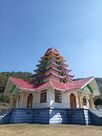
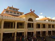
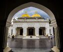
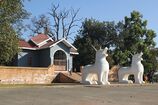
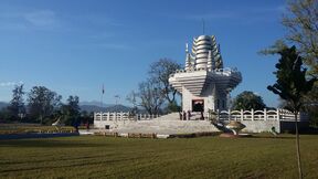
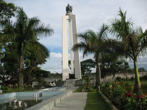
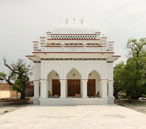
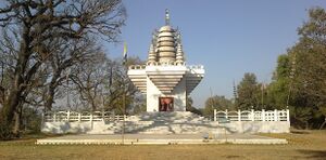
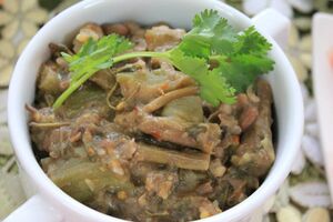
مع عقارب الساعة من أعلى: Sanamahi Kiyong في جبل Nongmaiching Ching، the Ima Keithel (Ima Market)، زوج التماثيل لتنيني كانگلا شا، Loktak lake, the Temple of Pakhangba داخل حصن كانگلا، the Manipuri classical dance, the Shree Shree Govindajee Temple | |||||||||||||||||||||||
| النشيد: Sana Leibak Manipur[1] (منيپور، أرض الذهب) | |||||||||||||||||||||||
 | |||||||||||||||||||||||
| البلد | |||||||||||||||||||||||
| اندمجت مع الهند | 15 أكتوبر 1949[2] | ||||||||||||||||||||||
| Capital | إمپل | ||||||||||||||||||||||
| الأضلع | 16 | ||||||||||||||||||||||
| الحكومة | |||||||||||||||||||||||
| • الحاكم | La. Ganesan[3] | ||||||||||||||||||||||
| • كبير الوزراء | N. Biren Singh (BJP)[4] | ||||||||||||||||||||||
| • المجلس التشريعي | أحادي الغرفة (60 مقعد) | ||||||||||||||||||||||
| • الدائرة البرلمانية | راجيا سابها 1 لوك سابها 2 | ||||||||||||||||||||||
| • المحكمة العليا | المحكمة العليا لمنيپور | ||||||||||||||||||||||
| المساحة | |||||||||||||||||||||||
| • الإجمالي | 22٬327 كم² (8٬621 ميل²) | ||||||||||||||||||||||
| ترتيب المساحة | 23 | ||||||||||||||||||||||
| التعداد (2011[5]) | |||||||||||||||||||||||
| • الإجمالي | 2٬855٬794 | ||||||||||||||||||||||
| • الترتيب | 23 | ||||||||||||||||||||||
| • الكثافة | 130/km2 (330/sq mi) | ||||||||||||||||||||||
| اللغات | |||||||||||||||||||||||
| • لغة الولاية | منيپوري[6][7] | ||||||||||||||||||||||
| GDP (2018–19) | |||||||||||||||||||||||
| • الإسمي للفرد | ₹75٬226 (US$940) | ||||||||||||||||||||||
| منطقة التوقيت | UTC+05:30 (IST) | ||||||||||||||||||||||
| ISO 3166 code | IN-MN | ||||||||||||||||||||||
| HDI (2018) | ▲ 0.696[8] medium · 15th | ||||||||||||||||||||||
| معرفة القراءة والكتابة | 79.85% (16th) | ||||||||||||||||||||||
| الموقع الإلكتروني | www.manipur.gov.in | ||||||||||||||||||||||
| |||||||||||||||||||||||
| [1] It was elevated from the status of a Union Territory by the North-Eastern Areas (Reorganisation) Act, 1971 | |||||||||||||||||||||||
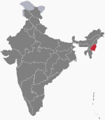
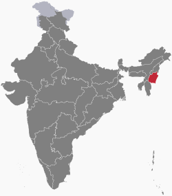
منيپور ( Manipur ؛ /ˌmʌnɪˈpʊər/)[10][11] ؛ mnipur بلغة مـِيْتـِيْ مايك) هي ولاية في شمال شرق الهند، تشترك في الحدود مع بورما. معظم سكان هذه الولاية مزارعون قبليّون. وعاصمتها مدينة إمپل.[12] وتحدها الولايات الهندية ناگالاند إلى الشمال، ميزورام إلى الجنوب و أسام إلى الغرب. كما تتاخم بعض أقاليم ميانمار: إقليم زگاين إلى الشرق وولاية تشين إلى الجنوب. تغطي الولاية مساحة 22,327 كم² ويناهز تعدادها 3 مليون نسمة، بما في ذلك المـِيْتـِيْ و الناگا والكوكي والزومي ومجتمعات أخرى أصغر، والتي تتكلم تنويعات من اللغات الصينية-التبتية. كانت منيپور على مفرق طرق التبادل الاقتصادي والثقافي الآسيوي لأكثر من 2,500 سنة.[13] وهي تربط شبه القارة الهندية ووسط آسيا بمناطق جنوب شرق آسيا وشرق آسيا وسيبيريا، والمنطقة القطبية وميكرونيزيا وپولينيزيا فتمكـِّن هجرة الناس وانتقال الثقافات والأديان.[14][15]
وفي عهد الإمبراطورية الهندية البريطانية, the Kingdom of Manipur was one of the princely states.[16] Between 1917 and 1939, some people of Manipur pressed the princely rulers for democracy. By the late 1930s, the princely state of Manipur negotiated with the British administration its preference to continue to be part of the Indian Empire, rather than part of Burma, which was being separated from India. These negotiations were cut short with the outbreak of World War II in 1939. On 11 August 1947, Maharaja Budhachandra signed an Instrument of Accession, joining India.[17][18] Later, on 21 September 1949, he signed a Merger Agreement, merging the kingdom into India, which led to its becoming a Part C State.[19][20] This merger was later disputed by groups in Manipur, as having been completed without consensus and under duress.[21] The dispute and differing visions for the future has resulted in a 50-year insurgency in the state for independence from India, as well as in repeated episodes of violence among ethnic groups in the state.[22] From 2009 through 2018, the conflict was responsible for the violent deaths of over 1000 people.[23]
The Meitei[24] represents around 53% of the population of Manipur state, followed by various Naga tribes at 24% and various Kuki/Zomi tribes at 16%.[25] The main language of the state is Meiteilon (also known as Manipuri). Tribals constitute about 41% of the state population (according to 2011 census)[25] and have dialects and cultures that are often village-based. Manipur's ethnic groups practice a variety of religions.[26] According to 2011 census, Hinduism is the major religion in the state, closely followed by Christianity. Other religions include Islam, Sanamahism, Buddhism, and Judaism, etc.[26][27]
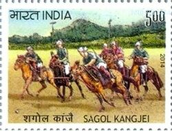
Manipur has primarily an agrarian economy, with significant hydroelectric power generation potential. It is connected to other areas by daily flights through Imphal airport, the second largest in northeastern India.[28] Manipur is home to many sports and the origin of Manipuri dance,[29] and is credited with introducing polo to Europeans.[30]
أسماء بديلة
كلمة "منيپور" is made-up of two Sanskrit words (Maṇi), which means jewel and (Purǝ), which means land/place/abode, Manipur is translated as "Jewelled land". Manipur is mentioned in historic texts as Kangleipak (ꯀꯪꯂꯩꯄꯛ) or Meeteileipak.[31] Sanamahi Laikan wrote that officials during the reign of Meidingu Pamheiba in the eighteenth century adopted Manipur's new name.
Neighbouring cultures each had differing names for Manipur and its people. The Shan or Pong called the area Cassay, the Burmese Kathe, and the Assamese Meklee. In the first treaty between the British East India Company and Meidingu Chingthangkhomba (Bhagyachandra), signed in 1762, the kingdom was referred to as “Meckley”. Bhagyachandra and his successors issued coins engraved with "Manipureshwar", or "lord of Manipur", and the British discarded the name Meckley. Later on, the work Dharani Samhita (1825–34) popularised the Sanskrit legends of the origin of Manipur's name.[32]
The term Kanglei, meaning "of Manipur/Kangleipak", is used to refer to items associated with the state where the term Manipuri is a recently given name.
| أمثلة لاستخدام المصطلح "Kanglei" | الترجمة |
|---|---|
| Kanglei | of Kangleipak/Manipur |
| Kangleicha | People of Kangleipak/Manipur |
| Kanglei foods | Foods of Kangleipak/Manipur |
| Kanglei style | Style of Kangleipak/Manipur |
التاريخ
القِدم
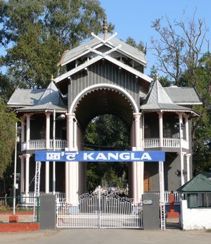
يعتقد بعض المؤرخين أن إمفال أُسست قبل 2,000 سنة. استمدت المدينة هذا الاسم من يومفام وتعني منزل الأسرة أو بيت الآباء والأجداد. وهي من أقدم عواصم الولايات الهندية. وظلت مانيبور مستقلة عن المناطق القبلية المجاورة. وهناك آثار تاريخية مهمة في المنطقة. أهمها معبد بشنوبور ويبعد نحو 30 كم عن العاصمة أمفال. بُني هذا المعبد عام 1467 في عهد الملك كيامبا، واستُخدم في بنائه الطوب الصغير الحجم الذي يعكس التأثر بالفن المعماري الصيني. وذلك لأن أجزاء كبيرة من الولاية كانت تحكمها سبع جماعات صينية حتى القرن الثامن عشر حيث توحّدت على يد الملك ناجيا كاندرا. كما كان البورميون يقومون بهجمات متكررة على مانيبور. ورغم ذلك شهدت هذه الولاية فترات طويلة من الاستقرار، وساعدتها بريطانيا في حربها ضد بورما عام 1762م. وفي عام 1826م أعيدت مانيبور إلى الهند بموجب معاهدة ياندابو عقب نهاية الحرب الهندية البورمية. وسيطر الإنجليز عليها عام 1891م، ثم احتلها اليابانيون أثناء الحرب العالمية الثانية (1939- 1945) مع وجود قاعدة للجيش الهندي على هذه الولاية. وفور استقلال الهند عام 1947 أصبحت مانيبور محافظة ثم تحولت إلى ولاية كاملة عام 1972.
The history of Manipur Meities is chronicled in Puyas or Puwaris (stories about the forefathers), namely, the Ninghthou Kangbalon, Cheitharol Kumbaba, Ningthourol Lambuba, Poireiton Khunthokpa, Panthoibi Khongkul, and so forth in the archaic Meitei script, which is comparable to the Thai script. The historical accounts presented here were recordings from the eyes and the judgment of Meitei kings and Maichou (Meitei scholars). Hill tribes have their own folk tales, myths, and legends. Manipur was known by different names at various periods in its history, such as, Tilli-Koktong, Poirei-Lam, Sanna-Leipak, Mitei-Leipak, Meitrabak or Manipur (present day). Its capital was Kangla, Yumphal or Imphal (present day). Its people were known by various names, such as Mi-tei, Poirei-Mitei, Meetei, Maitei or Meitei. The Puwaris, Ninghthou Kangbalon, Ningthourol Lambuba, Cheitharol Kumbaba, Poireiton Khunthokpa, recorded the events of each King who ruled Manipur in a span of more than 3500 years until 1955 CE (a total of more than 108 kings). A 14th century inscription from Pagan mentions Kasan (Manipur) to be one of the 21 states under Mong Mao ruler Thonganbwa (1413–1445/6) who was later captured by the Governor of Taungdwingyi.[33] Ningthou Kangba (15th century BCE) is regarded as the first and foremost king of Manipur. There were times when the country was in turmoil without rulers, and long historical gaps exist between 1129 BCE and 44 BCE. In 1891 CE, after the defeat of the Meiteis by the British in the Anglo-Manipuri war of Khongjom, the sovereignty of Manipur which it had maintained for more than three millenniums, was lost. In 1926, it became a part of Pakokku Hill Tracts Districts of British Burma until 4 January 1947. It regained its freedom on 14 August 1947. On 15 October 1949, Manipur was unified with India.[34]
العصور الوسطى
By the medieval period, marriage alliances between the royal families of Manipur, مملكة أهوم and Burma had become common.[34] Medieval era manuscripts discovered in the 20th century, particularly the Puya, provide evidence that Hindus from the Indian subcontinent had married Manipur royalty by at least the 14th century. In centuries thereafter, royal spouses came also from what is now Assam, Bengal, and Uttar Pradesh and from other South Indian kingdoms as well.[35] Another manuscript suggests that Muslims arrived in Manipur in the 17th century, from what is now Bangladesh, during the reign of Meidingu Khagemba.[35] The socio-political turmoil and wars, particularly the persistent and devastating Anglo-Burmese wars, affected the cultural and religious demography of Manipur.[36]
الفترة الامبراطورية
In 1824, the ruler of Manipur entered into a subsidiary alliance with the British Empire in the Indian subcontinent, which became responsible for Manipur's external defence. The British recognised that the state remained internally self-governing, as a princely state.[37] During World War II, Manipur was the scene of many fierce battles between Japanese invaders and British Indian forces. The Japanese were beaten back before they could enter Imphal, which was one of the turning points of the overall war in South Asia.
التاريخ الحديث
After the war, British India moved towards independence, and the princely states which had existed alongside it became responsible for their own external affairs and defence, unless they joined the new India or the new Pakistan. The Manipur State Constitution Act of 1947 established a democratic form of government, with the Maharaja continuing as the head of state.[38] Maharaja Bodhchandra was summoned to Shillong, to merge the kingdom into the Union of India.[39] He is believed to have signed the merger agreement under duress.[40] Thereafter, the legislative assembly was dissolved, and in October 1949 Manipur became part of India.[41] It was made a Union Territory in 1956.[42] and a fully-fledged State in 1972 by the North-Eastern Areas (Reorganisation) Act, 1971.[43]

Manipur had a long record of insurgency and inter-ethnic violence.[44][45] The first armed opposition group in Manipur, the United National Liberation Front (UNLF), was founded in 1964 and declared that it wanted to gain independence from India and form Manipur as a new country. Over time, many more groups formed in Manipur, each with different goals, and deriving support from diverse ethnic groups in Manipur. In 1977 the People's Revolutionary Party of Kangleipak (PREPAK) was formed, and the People's Liberation Army (PLA), formed in 1978 which Human Rights Watch said had received arms and training from China. In 1980, the Kangleipak Communist Party (KCP) was formed. These groups began a spree of bank robberies and attacks on police officers and government buildings. The state government appealed to the central government in New Delhi for support in combating this violence.[22]
From 1980 to 2004, the Indian government referred to Manipur as a disturbed area. This term (designated by the Ministry of Home Affairs or a state governor) refers to a territory where extraordinary laws under the Armed Forces (Special Powers) Act can be used. The laws allow the military to treat private and public spaces, in the same manner, detain individuals up to 24 hours with unlimited renewals, to perform warrantless searches, and to shoot and kill individuals that break laws, carry weapons, or gather in groups larger than four as well as giving legal immunity to the military.[46] Since 1980, the application of AFSPA has been at the heart of concerns about human rights violations in the region, such as arbitrary killings, torture, cruel, inhuman and degrading treatment, and forced disappearances. Its continued application has led to numerous protests, notably the longstanding hunger strike by Irom Sharmila Chanu.[47][48]
In 2004, the government lifted the disturbed status after a violent attack on a local woman. The rape of a manipuri woman, Thangjam Manorama Devi, by members of the Assam Rifles paramilitary had led to wide protests including a nude protest by the Meira Paibis women association.[49]
الجغرافيا
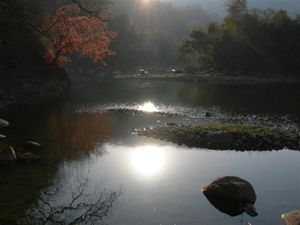
تقع مانيبور على بُعد يقرب من 700كم شمال شرقي كلكتا، ولها حدود دولية من الجهة الشرقية مع بورما، وأخرى إقليمية مع ناگلاند في الشمال، وأسام في الشرق، وميزورام في الجنوب.
يصل ارتفاع معظم أراضي هذه الولاية إلى 200م فوق مستوى سطح البحر، ما عدا المنطقة المأهولة بالسكان في الوسط فإنها منطقة منخفضة. كما توجد بحيرة لوكتاك في وسط الولاية. ويصب في هذه البحيرة عدة أنهار لعدة أودية، وهناك أيضًا عدة بحيرات في وسط الولاية تنحدر منها الأنهار صوب الجنوب وتُستغل هذه البحيرات لصيد الأسماك والبط وسباق القوارب.
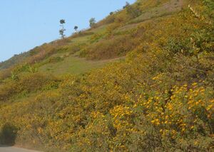
مانيبور منطقة غنية بالغابات حيث يوجد الخيزران وخشب التيك، وأشجار المجنولية، وأشجار البلوط. ومن الأزهار الشائعة في هذه المنطقة زهرة الخشخاش وزهرة الربيع، والورد. كما توجد فيها الحيوانات المتوحشة مثل الفيل والخرتيت والببر.
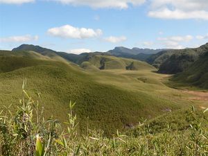
تنخفض درجة الحرارة في مدينة إمفال عاصمة الإقليم خلال فصل الشتاء إلى 4°م في الليل، أما درجة الحرارة في النهار فإنها ترتفع إلى 21°م حتى في شهر يناير، ويبلغ معدّل درجة الحرارة في فصل الصيف خلال الفترة من أبريل إلى سبتمبر 29°م. ويبلغ معدّل هطول الأمطار سنويًا 40سم، ولكنه يزداد في مناطق أخرى من الولاية.
النبيت
Natural vegetation occupies an area of about 14،365 متر كيلومربع (5،546 sq mi), nearly 64% of the total geographical area of the state,[بحاجة لمصدر] and consists of short and tall grasses, reeds and bamboos, and trees. Broadly, there are four types of forests: Tropical Semi-evergreen, Dry Temperate Forest, Sub-Tropical Pine, and Tropical Moist Deciduous.[بحاجة لمصدر]
There are forests of teak, pine, oak, uningthou, leihao, bamboo, and cane. Rubber, tea, coffee, orange, and cardamom are grown in hill areas. Rice is a staple food for Manipuris.
المناخ
Manipur's climate is largely influenced by the topography of the region. Lying 790 metres above sea level, Manipur is wedged among hills on all sides. This northeastern corner of India enjoys a generally amiable climate, though the winters can be chilly. The maximum temperature in the summer months is 32 °C (90 °F). The coldest month is January, and the warmest July.
The state receives an average annual rainfall of 1،467.5 ميليمتر (57.78 in) between April and mid-October. Precipitation ranges from light drizzle to heavy downpour. The capital city Imphal receives an annual average of 933 ميليمتر (36.7 in). Rainfall in this region is caused by The South Westerly Monsoon picking up moisture from the Bay of Bengal and heading towards the Eastern Himalaya ranges. This normal rainfall pattern of Manipur enriches the soil and much of the agrarian activities are dependent on it as well.
Manipur is already experiencing climate change, especially changes in weather, with both increased variability in rain as well as increasingly severe changes in temperature.[50]
حقائق موجزة
العاصمة: إمفال. المدن الكبرى: إمفال وتاما وماراو. عدد السكان: حسب تعداد عام 1991م: 1,826,714 نسمة. المساحة: 22,327كم². المنتجات الرئيسية: الزراعية: الخيزران، والفواكه، والأرز وقصب السكر، والتبغ، الصناعية: تتمثل في المنسوجات.
مجموعة من سكان مانيبور يستقلون زورقًا شجريًا على مجرى فومي بمتنزه كيبول لامجو الوطني بمانيبور.
الديمغرافيا
التعداد
| Population Growth | |||
|---|---|---|---|
| Census | Pop. | %± | |
| 1951 | 578٬000 | ||
| 1961 | 780٬000 | 34.9% | |
| 1971 | 1٬073٬000 | 37.6% | |
| 1981 | 1٬421٬000 | 32.4% | |
| 1991 | 1٬837٬000 | 29.3% | |
| 2001 | 2٬294٬000 | 24.9% | |
| 2011 | 2٬855٬794 | 24.5% | |
| Source:Census of India | |||
The distribution of area, population and density, and literacy rate as per the 2001 Census provisional figures are as below:[بحاجة لمصدر]
| Demographics of Manipur (2011) | |
|---|---|
| Total Population | 2,855,794 |
| Male Population | 1,438,586 |
| Female Population | 1,417,208 |
| Rural Population | 1,736,236 |
| Urban Population | 834,154 |
| Child Sex Ratio | 936 female to 1000 male |
| Density (per km2) | 115 |
| Literacy | 1,768,181 (85.4%) |
| Towns | 33 |
السكان
The Meitei[24] (synonymous to Manipuri) and the Pangal constitute the majority of the state's population. In 1901, the Meitei-Pangals were recorded as the main ethnicity of Manipur.[51]
معظم السكان قبليون مع خليط من البورميين والمنغوليين. معظم سكّان الأودية هندوس يعبدون فيشنو، وينتمون إلى قبيلة الميتهي ذات الصلة بقبيلة شانس في بورما. وبالإضافة إلى ذلك توجد نحو 30 قبيلة أخرى يشكل أفرادها ما يقارب ثلث سكان الولاية معظمهم نصارى.
يمتاز سكان ولاية مانيبور بأنهم محاربون أشداء يمارسون رياضة المصارعة والمبارزة وبعض فنون القتال الأخرى. ويقال إن لعبة البولو نشأت في هذا الإقليم. أما لغة الولاية فهي المانيبورية.
يمثل إقليم مانيبور عضوان في اللوك سابها (مجلس العموم) وعضو في الراجيا سابها (مجلس الأعيان) في البرلمان الهندي. وللإقليم جمعية تشريعية تضم 60 عضوًا.
اللغات
The official languages are Meitei and English.
The Meitei language (or Manipuri) is the lingua franca in Manipur and is one of the languages listed in the Eighth Schedule of the Indian Constitution. Manipur has a diverse group of ethnic groups speaking different languages and dialects, practising Hinduism, Christianity, Sanamahism, Buddhism, Islam, and other folk religions.[26]
الدين
The religion groups of the Meitei include Sanamahis, Meitei Christians, Hindus, Pangals and Manipuri Brahmins (locally called "Meetei Bamons").
الهندوسية
The Meitei people are one of the three majority groups in the state of Manipur. According to the 2011 Census of India, about 41.39% of the Manipuri people practice Hinduism, and 41.29% Christianity. A large minority of the Meitei practices Sanamahism. The Hindu population is heavily concentrated in the Manipur valley, among the Meitei people. The districts of Bishnupur, Thoubal, Imphal East, and Imphal West all have Hindu majorities, averaging 67.62% (range 62.27–74.81%) according to the 2011 census data.[53]
الإسلام
Manipuri Muslims, known locally as Meitei Pangal, are the third largest majority group in the state as they constitute about 8.3% of the state population as per 2011 census. Sufi saint, Shaikh Shah Jalal d-Dīn al-Mujarrad al-Turk al Naqshbandi, came to Sylhet,[بحاجة لمصدر] and Azan Fakir Baghdadi arrived in 1690 CE in Assam.[بحاجة لمصدر] They influenced Manipuri Muslims. They belong to the Sunni group of Hanafi school of thought and there are Arab, Bangladesh, Turani, Bengali and Mughal or Chaghtai Turk sections among Manipuri Muslims.[54]
The literacy rate among Muslims is 58.6 percent (male 75 percent and female 41.6 percent) below the state's average of 70.5 percent (male 80.3 percent and female 60.5 percent). In 1995, out of 135,000 Muslims, 5,704 had matriculated from secondary school. There was a total of 1,822 who had graduated in addition to 86 technical and professional graduates. There were 51 Class I Muslim officers including three women, 101 Class II officers and 1,270 and 1,663 employees belonging to Class III and IV categories respectively.[55]
الديانات الشعبية
Folk religions are practised by the Meitei, the Pangal and Meitei Christians. These religions have a long history in Manipur. Sanamahi is the ancient indigenous animistic religion.[56] Sanamahi worship concentrates on the Sun God/Sanamahi. The early Meitei worshiped a Supreme deity, Lainingthou Soralel, and followed their ancestors. Their ancestor worship and animism was based on Umang Lai – ethnic governing deities worshiped in sacred groves. Some of the traditional deities (Lais) whom Meiteis worship are Atiya Sidaba, Pakhangba, Sanamahi, Leimaren, Oknarel, Thangnarel, Panganba, Thangjing, Marjing, Wangbaren, and Koubru. Out of the 233,767 people who opted for the "Other religion" option, 222,315 were Sanamahi. The various other religions were mostly followers of tribal folk religions. 6,444 were Heraka, 2,032 were Jewish and 1,180 were from other tribal religions such as Tingkao Ragwang Chapriak.
الحكومة
The government of Manipur is a collective assembly of 60 elected members, of which 19 are reserved for Scheduled Tribes and 1 for Scheduled Castes.[57] The state sends two representatives to the Lok Sabha of the Parliament of India. The state sends one representative to the Rajya Sabha. The legislature of the state is Unicameral.[58] Representatives are elected for a five-year term to the state assembly and the Indian parliament through voting, a process overseen by the offices of the Election Commission of India.[59]
The state has one autonomous council.
الأمن والتمرد
The violence in Manipur extends beyond the conflict between Indian security forces and insurgent armed groups. There is violence between the Meiteis, Nagas, Kukis, and other tribal groups.[22] Splinter groups have arisen within some of the armed groups, and disagreement between them is rife. Other than the UNLF, PLA, and PREPAK, Manipuri insurgent groups include the Revolutionary Peoples Front (RPF), Manipur Liberation Front Army (MLFA), Kanglei Yawol Kanba Lup (KYKL), Revolutionary Joint Committee (RJC), Kangleipak Communist Party (KCP), Peoples United Liberation Front (PULF), Manipur Naga People Front (MNPF), National Socialist Council of Nagaland (NSCN-K), National Socialist Council of Nagaland (NSCN-I/M), United Kuki Liberation Front (UKLF), Kuki National Front (KNF), Kuki National Army (KNA), Kuki Defence Force (KDF), Kuki Democratic Movement (KDM), Kuki National Organisation (KNO), Kuki Security Force (KSF), Chin Kuki Revolutionary Front (CKRF), Kom Rem Peoples Convention (KRPC), Zomi Revolutionary Volunteers (ZRV), Zomi Revolutionary Army (ZRA), Zomi Reunification Organisation (ZRO), and Hmar Peoples Convention (HPC).[60][22]
The Meitei insurgent groups seek independence from India. The Kuki insurgent groups want a separate state for the Kukis to be carved out from the present state of Manipur. The Kuki insurgent groups are under two umbrella organisations: the Kuki National Organisation (KNO) and United Peoples Forum.[61] The Nagas wish to annex part of Manipur and merge with a greater Nagaland or Nagalim, which is in conflict with Meitei insurgent demands for the integrity of their vision of an independent state. There have been many tensions between the tribes and numerous clashes between Naga and Kukis, Meiteis and Muslims.[22]
According to SATP, there has been a dramatic decline in fatalities in Manipur since 2009. In 2009, 77 civilians died (about 3 per 100,000 people).[23] From 2010 onward, about 25 civilians have died in militant-related violence (about 1 per 100,000 people), dropping further to 21 civilian deaths in 2013 (or 0.8 per 100,000 people). However, there were 76 explosions in 2013 compared to 107 in 2012. Different groups have claimed responsibility for the explosions, some claiming they were targeting competing militant groups, others claiming their targets were state and central government officials.[62] As a point of comparison, the average annual global rate of violent death between 2004 and 2009 was 7.9 per 100,000 people.[63]
The CM Biren Singh used the National Security Act on a journalist who criticized him by calling him as 'puppet'. NSA is meant to be used when there is grave danger to society not to stifle dissent. These acts further cement isolation and insurgency among locals.[64]
الاقتصاد
يعتمد أكثر من 70% من السكان الذين يعيشون في المناطق الريفية على الزراعة باعتبارها موردًا أساسيًّا للمعيشة، بمعنى أنهم ينتجون المواد الغذائية للاستهلاك الشخصي. ويُعَدّ الأرز المحصول الرئيسي إضافة إلى الذرة الشامية التي تزرع على سفوح المرتفعات.
يوجد في الإقليم القليل من المصانع مثل مصنع هاندلوم للنسيج وهو مصنع كبير، وكذلك مصانع منتجات الغابات وصناعة الخزف الحجري الذي يُعدّ من الصناعات المهمة، ومصنع للسكر في وانغال.
ترتبط عاصمة الإقليم إمفال برحلات طيران يومية بمدينة دلهي عاصمة الهند، وتمر هذه الرحلات بسلتشار وغوهاتي في أسام عبر كلكتا في البنغال الغربي. ولا توجد خطوط سكك حديدية في الولاية، وتعد ديمابور الواقعة على الحدود الشمالية أقرب محطة سكك حديدية لها. أما شبكة الطرق البرية فهي محدودة. ونظرًا لضآلة عدد سكان الولاية فإن التجمعات السكنية المتوسطة الحجم متباعدة بعضها عن بعض.
| Year | الناتج المحلي الإجمالي للولاية |
|---|---|
| 1980 | 2,180 |
| 1985 | 4,180 |
| 1990 | 8,210 |
| 1995 | 16,270 |
| 2000 | 29,200 |
السياحة
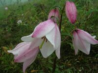
The tourist season is from October to February when it is often sunny without being hot and humid.[بحاجة لمصدر] The culture features martial arts, dance, theatre and sculpture. Greenery accompanies a moderate climate. The seasonal Shirui Lily plant at Ukhrul (district), Dzüko Valley at Senapati, Sangai (Brow antlered deer) and the floating islands at Loktak Lake are among the rarities of the area. Polo, which can be called a royal game, originated in Manipur.
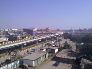
Imphal (العاصمة)
The city is inhabited by the Meitei, who predominate, also Pangals (Manipuri Muslims) and other tribes. The city contains the Tulihal Airport. The district is divided into East and West. The Khuman Lampak Sports Complex was built for the 1997 National Games. The stadium is used for a sports venue. It also contains a cyclists' velodrome. Most of the imported goods are sold here at its Paona Bazaar, Gambhir Singh Shopping Complex and Leima Plaza. Shree Govindajee Temple, Andro village, and the Manipur State Museum are in the city.
البحيرات والجزر
48 km (30 mi) from Imphal, lies the largest fresh water lake in northeast India, the Loktak Lake, a miniature inland sea. There is a tourist bungalow atop Sendra Island. Life on the lake includes small islands that are floating weed on which live the lake people, the blue waters of the lake, and colourful water plants. There is a Sendra tourist home with an attached cafeteria in the middle of the lake. Floating islands are made out of the tangle of watery weeds and other plants. The wetland is swampy and is favourable for a number of species. It is in the district of Bishnupur. The etymology of Loktak is "lok = stream / tak = the end" (End of the Streams).[67] Sendra park and resort is opening on the top of Sendra hills and attracting the tourist.
الربى والوديان
Kaina is a hillock about 921 متر (3،022 ft) above sea level. It is a sacred place for Manipuri Hindus. The legend is that, Shri Govindajee appeared in the dream of his devotee, Shri Jai Singh Maharaja, and asked the saintly king to install in a temple, an image of Shri Govindajee. It was to be carved out of a jack fruit tree, which was then growing at Kaina. It is 29 km (18 mi) from Imphal. The Dzüko Valley is in Senapati district bordering with Kohima. There are seasonal flowers and number of flora and fauna. It is at an altitude of 2،438 متر (7،999 ft) above sea level, behind Mount Japfü in Nagaland. The rare Dzüko lily is found only in this valley.[بحاجة لمصدر]
السياحة البيئية
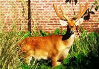
Keibul Lamjao National Park, 48 km (30 mi) away from Imphal is an abode of the rare and endangered species of brow antlered deer. This ecosystem contains 17 rare species of mammals.[67] It is the only floating national park of the world.[69][بحاجة لمصدر] ستة كيلومتر (3.7 mi) to the west of Imphal, at the foot of the pine growing hillocks at Iroisemba on the Imphal-Kangchup Road are the Zoological Gardens. Some brow antlered deer (Sangai) are housed there.
مساقط المياه
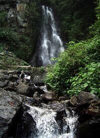
Sadu Chiru waterfall is near Ichum Keirap village[70] 27 km (17 mi) from Imphal, in the Sadar hill area, Senapati district. This consists of three falls with the first fall about 30 متر (98 ft) high. Agape Park is in the vicinity.
الكهوف الطبيعية
Thalon Cave (around 910 متر (2،990 ft) above sea level) is one of the historical sites of Manipur under Tamenglong district. It is around 185 كيلومتر (115 mi) from the state capital and around 30 كيلومتر (19 mi) from Tamenglong district headquarters in north side. From Thalon village, this cave is 4–5 كيلومتر (2.5–3.1 mi).[71] Khangkhui Cave is a natural limestone cave in Ukhrul district. The big hall in the cave is the darbar hall of the Devil King living deep inside while the northern hall is the royal bedroom, according to local folklore. During World War II, villagers sought shelter here. This cave is an hour's trek from Khangkui village.[72]
انظر أيضاً
- Khangabok
- Loi
- Manipuri dance
- Court Chronicle of The Kings of Manipur: The Cheitharon Kumpapa; Original Text, Translation And Notes 33-1763 CE, trans. Saroj Nalini Arambam Parratt (London: Routledge, 2005).
المصادر
- ^ "'Sana Leibak Manipur' adopted as State Song by Cabinet". 12 August 2021. Archived from the original on 16 September 2021. Retrieved 16 September 2021.
- ^ SINHA, L. P. (1987). "The Politics and Government of Manipur". The Indian Journal of Political Science. 48 (4): 487–493. ISSN 0019-5510. JSTOR 41855332. Archived from the original on 14 August 2021. Retrieved 14 August 2021.
- ^ Laithangbam, Iboyaima (27 August 2021). "Ganesan sworn in as Manipur Governor". The Hindu. Archived from the original on 20 October 2021. Retrieved 29 August 2021.
- ^ BJP leader Biren Singh sworn in as Manipur Chief Minister Archived 15 مارس 2017 at the Wayback Machine, India Today (15 March 2017)
- ^ "Manipur Population Sex Ratio in Manipur Literacy rate data". census2011.co.in. Archived from the original on 8 September 2015. Retrieved 1 September 2015.
- ^ "At a Glance « Official website of Manipur". Archived from the original on 5 March 2017. Retrieved 4 December 2016.
- ^ Abstract of speakers' strength of languages and mother tongues – 2000 Archived 8 ديسمبر 2016 at the Wayback Machine, Census of India, 2001
- ^ "Sub-national HDI - Subnational HDI - Global Data Lab". globaldatalab.org. Archived from the original on 12 November 2020. Retrieved 17 April 2020.
- ^ "State Fishes of India" (PDF). National Fisheries Development Board, Government of India. Archived (PDF) from the original on 10 October 2020. Retrieved 25 December 2020.
- ^ قالب:Lexico
- ^ قالب:MW
- ^ Manipur: Treatise & Documents, Volume 1, ISBN 978-8170993995, Introduction
- ^ Naorem Sanajaoba (editor), Manipur, Past and Present: The Heritage and Ordeals of a Civilization, Volume 4, Chapter 1: NK Singh, ISBN 978-8170998532
- ^ Naorem Sanajaoba (editor), Manipur, Past and Present: The Heritage and Ordeals of a Civilization, Volume 4, Chapter 4: K Murari, ISBN 978-8170998532
- ^ "Trade connection of Manipur with Southeast Asia in Pre British period Part 2 by Budha Kamei". Archived from the original on 8 يوليو 2018. Retrieved 7 يوليو 2018.
- ^ Naorem Sanajaoba (Editor), Manipur, Past and Present: The Heritage and Ordeals of a Civilization, Volume 4, Chapter 2: NT Singh, ISBN 978-8170998532
- ^ Why Pre-Merger Political Status for Manipur: Under the Framework of the Instrument of Accession, 1947, Research and Media Cell, CIRCA, 2018, p. 26, GGKEY:8XLWSW77KUZ, https://books.google.com/books?id=oKZoDwAAQBAJ&pg=PA26, retrieved on 19 August 2018
- ^ Singh, Socio-religious and Political Movements in Modern Manipur 2011, Chapter 6, p. 139
- ^ U. B. Singh, India Fiscal Federalism in Indian Union (2003), p. 135
- ^ K.R. Dikshit; Jutta K Dikshit (2013). North-East India: Land, People and Economy. Springer Science. p. 56. ISBN 978-94-007-7055-3.
- ^ Kalpana Kannabiran; Ranbir Singh (2008). Challenging The Rules(s) of Law. SAGE Publications. p. 264. ISBN 978-81-321-0027-0.
- ^ أ ب ت ث ج "Background: Conflict in Manipur" Archived 24 سبتمبر 2015 at the Wayback Machine Human Rights Watch (2008)
- ^ أ ب State wise Indian fatalities, 1994-2013 Archived 15 يوليو 2014 at the Wayback Machine Militancy and Terrorism Database, SATP, New Delhi
- ^ أ ب Khomdan Singh Lisam, Encyclopaedia Of Manipur, ISBN 978-8178358642, pp. 322–347
- ^ أ ب "Census of India Website : Office of the Registrar General & Census Commissioner, India". Archived from the original on 7 September 2015. Retrieved 15 July 2019.
- ^ أ ب ت ث "Population by religion community - 2011". Census of India, 2011. The Registrar General & Census Commissioner, India. Archived from the original on 25 August 2015.
- ^ "Hueiyen Lanpao | Official Website Manipur Daily". Archived from the original on 18 سبتمبر 2016. Retrieved 29 مايو 2016.
- ^ خطأ استشهاد: وسم
<ref>غير صحيح؛ لا نص تم توفيره للمراجع المسماةmanipuraai - ^ Reginald Massey 2004, pp. 177–184.
- ^ خطأ استشهاد: وسم
<ref>غير صحيح؛ لا نص تم توفيره للمراجع المسماةnam.ac.uk - ^ Naorem Sanajaoba (1988). Manipur, Past and Present: The Heritage and Ordeals of a Civilization. Mittal Publications. pp. 31–32 with footnotes. ISBN 978-81-7099-853-2.
- ^ Gangmumei Kabui, History of Manipur, National Publishing House, Delhi, 1991.
- ^ (Luce & Htway 1976:214)
- ^ أ ب A Brief History (Puwari) of the Meiteis of Manipur. Archived from the original on 31 January 2010. Retrieved 15 November 2009.
- ^ أ ب Naorem Sanajaoba (1988). Manipur, Past and Present: The Heritage and Ordeals of a Civilization. Mittal Publications. pp. 12–14. ISBN 978-81-7099-853-2.
- ^ Naorem Sanajaoba (1988). Manipur, Past and Present: The Heritage and Ordeals of a Civilization. Mittal Publications. pp. 15–18. ISBN 978-81-7099-853-2.
- ^ N. Lokendra (1998). The Unquiet Valley: Society, Economy, and Politics of Manipur (1891-1950). Mittal Publications. pp. 36–38. ISBN 978-81-7099-696-5. Archived from the original on 18 April 2017. Retrieved 4 October 2016.
- ^ "Manipur State Constitution Act 1947". Archived from the original on 4 April 2019. Retrieved 23 March 2019.
- ^ Rustomji, Nari (1971), Enchanted Frontiers, Oxford University Press, p. 109, https://archive.org/details/enchantedfrontie0000rust
- ^ Pradip Phanjoubam. "Why it matters how Manipur became a state". www.telegraphindia.com. Archived from the original on 4 July 2021. Retrieved 29 November 2020.
- ^ "Manipur Merger Agreement, 1949". satp.org. Archived from the original on 24 September 2015. Retrieved 1 September 2015.
- ^ "The Constitution (Amendment)". indiacode.nic.in. Archived from the original on 1 May 2017. Retrieved 1 September 2015.
- ^ "Indiacode - Acts" (PDF). Archived (PDF) from the original on 5 December 2013. Retrieved 26 March 2014.
- ^ "The mayhem in Manipur" Archived 14 يوليو 2014 at the Wayback Machine The Economist (1 March 2007)
- ^ "Manipur, India - A safe house for dangerous men" Archived 14 يوليو 2014 at the Wayback Machine The Economist (9 March 2007)
- ^ McDuie-Ra, Duncan. 2016. Borderland city in new India: Frontier to gateway (pp. 15, 17–19). Amsterdam University Press.
- ^ "Irom Sharmila: World's longest hunger strike ends". BBC News. 9 August 2016. Archived from the original on 24 March 2019. Retrieved 23 March 2019.
- ^ "Indian hunger striker Irom Chanu Sharmila to end 16-year fast". TheGuardian.com. 9 August 2016. Archived from the original on 23 March 2019. Retrieved 23 March 2019.
- ^ McDuie-Ra, Duncan. 2016. Borderland City in New India: Frontier to Gateway, Amsterdam University Press, p. 18
- ^ SAMOM, SOBHAPATI. "Manipur affected by changing climate, say scientists". NorthEast Now (in الإنجليزية الأمريكية). Archived from the original on 7 October 2021. Retrieved 2021-10-07.
- ^ census 1901
- ^ "C-1 Population By Linguistic Community". Census. Archived from the original on 13 September 2015. Retrieved 10 June 2019.
- ^ "Census of India : C-1 Population By Religious Community". censusindia.gov.in. Archived from the original on 13 September 2015. Retrieved 1 September 2015.
- ^ "Evolution of clan system Manipuri Muslim 1". e-pao.net. Archived from the original on 23 September 2015. Retrieved 1 September 2015.
- ^ "Muslims in Manipur: A look at their socio-economic condition". twocircles.net. 11 January 2010. Archived from the original on 3 March 2016. Retrieved 1 September 2015.
- ^ Bertil Lintner (2015). Great Game East: India, China, and the Struggle for Asia's Most Volatile Frontier. Yale University Press. p. 113. ISBN 978-0-300-19567-5.
- ^ "State/UT wise Seats in the Assembly and their Reservation Status". Election Commission of India. Archived from the original on 19 May 2018. Retrieved 23 May 2018.
- ^ Manipur Government Archived 22 أكتوبر 2016 at the Wayback Machine, Govt of India
- ^ ECI Manipur Archived 19 مايو 2017 at the Wayback Machine, Govt of India
- ^ Singh, Vijaita. "Centre inks peace accord with Naga insurgent outfit". The Hindu (in الإنجليزية). Archived from the original on 27 November 2020. Retrieved 12 March 2017.
- ^ "仏壇修理・洗浄なら石川県羽咋市の宮本仏檀店". kukination.net. Archived from the original on 24 April 2015. Retrieved 1 September 2015.
- ^ Manipur Assessment - Year 2014 Archived 4 يوليو 2014 at the Wayback Machine SATP, New Delhi
- ^ Global Burden of Armed Violence Archived 24 سبتمبر 2015 at the Wayback Machine Chapter 2, Geneva Declaration, Switzerland (2011)
- ^ "Misusing NSA: the detention of a Manipur journalist". The Hindu (in الإنجليزية). 21 December 2018. ISSN 0971-751X. Archived from the original on 8 November 2020. Retrieved 21 December 2018.
- ^ State bird Nongin Archived 27 أغسطس 2014 at the Wayback Machine Government of Manipur
- ^ State flower SHIRUI LILY Archived 3 فبراير 2014 at the Wayback Machine Government of Manipur
- ^ أ ب خطأ استشهاد: وسم
<ref>غير صحيح؛ لا نص تم توفيره للمراجع المسماةwww.e-pao.net - ^ State animal Sangai Archived 1 فبراير 2014 at the Wayback Machine Government of Manipur
- ^ "The world's only floating national park". Archived from the original on 10 June 2018. Retrieved 23 March 2019.
- ^ "Ichum Keirap". yolasite.com. Archived from the original on 25 April 2015. Retrieved 1 September 2015.
- ^ "Thalon Cave, Tamenglong: December 2009 ~ Pictures from Manipur". e-pao.net. Archived from the original on 21 September 2015. Retrieved 1 September 2015.
- ^ "Ukhrul District". ukhrul.nic.in. Archived from the original on 4 September 2015. Retrieved 1 September 2015.
وصلات خارجية
- E-Pao - The most comprehensive site about Manipur
- Information on Shopping in Manipur, Manipur Sights, Fast Fact... etc
- Official website of the Government of Manipur
- History of Manipur
- Northeasterner: Beautiful People
- Kanglaonline:Manipur News
- hiv-network:Network for exchange of drug use and HIV/AIDS information
- Manipuri language resources
- Manipur Comments: A collective group blog of Manipur
- Cable TV network based in Imphal
- Manipur and other northeastern states of India
- CS1 الإنجليزية الأمريكية-language sources (en-us)
- Short description is different from Wikidata
- Pages using multiple image with auto scaled images
- Pages using infobox settlement with no coordinates
- Articles with hatnote templates targeting a nonexistent page
- Articles containing Meitei-language text
- Articles with unsourced statements from October 2015
- Articles with unsourced statements from September 2015
- Articles with unsourced statements from January 2015
- Articles with unsourced statements from August 2015
- منيپور
- شمال شرق الهند
- ولايات وأقاليم الهند
- الولايات الشقيقات السبع
- دول وأراضي تأسست في 1972
