مقاطعات سريلانكا
| ||||||||||||||||||
| ||||||||||||||||||
| التقسيمات الادارية لسريلانكا |
|---|
| المستوى الأول |
| المحافظات |
| المستوى الثاني |
| المقاطعات |
| المستوى الثالث |
| البلديات |
| المستوى الرابع |
| الواردات |
| المستوى الخامس |
 |
|---|
في سريلانكا، المقاطعات Districts (بالسنهالية: [දිස්ත්රික්ක Distrikka] Error: {{Lang}}: text has italic markup (help)، بالتاميل: மாவட்டம்)، هي تقسيمات ادارية من المستوى الثاني، وهي ضمن المحافظات. يوجد في سريلانكا 25 مقاطعة منظمة داخل 9 محافظات.[1] كل مقاطعة تحت ادارة أمين المقاطعة،[2] الذي تعينه الحكومة المركزية.[3] المهام الرئيسية لأمانة المقاطعة تتضمن تنسيق اتصال وأنشطة الحكومة المركزية وأمانات المقاطعات. كذلك فإن أمانة المقاطعة مسئولة عن تنفيذ ومراقبة المشروعات التنموية على مستوى المقاطعة ومساعدة التقسيمات الادارية الأدنى في أنشطتها،[4] فضلاً عن جمع العائدات وتنسيق الانتخابات في المقاطعة.[5] تنقسم المقاطعة إلى عدد من أقسام أمانة المقاطعة، والتي تنقسم بدورها إلى 14.022 قسم گراما نيلاداري.[6] يوجد في سريلانكا 231 قسم أمانة مقاطعة.[7]
. . . . . . . . . . . . . . . . . . . . . . . . . . . . . . . . . . . . . . . . . . . . . . . . . . . . . . . . . . . . . . . . . . . . . . . . . . . . . . . . . . . . . . . . . . . . . . . . . . . . . . . . . . . . . . . . . . . . . . . . . . . . . . . . . . . . . . . . . . . . . . . . . . . . . . . . . . . . . . . . . . . . . . . .
التاريخ
كانت سريلانكا تنقسم إلى عدة وحدات ادارية أثناء مملكة أنوراداپورا. كانت المملكة تنقسم إلى ثلاث محافظات؛ راجاراتا، ررهونا ومالاي راتا. وكانت هذه المحافظات تنقسم إلى وحدات أصغر تسمى راتا.[8] بمرور الوقت، ازداد عدد المحافظات، لكن استمر التقسيم الاداري من المستوى الثاني، راتا كما هو. ومع ذلك، ففي النهاية، أصبحت البلاد تنقسم إلى أكثر من مملكة بالإضافة للبعثات الاستعمارية الأجنبية والمناطق الواقعة تحت سيطرة بلادهم، بدأ هذا التنظيم في التغير. أراضي مملكة كوت كانت تنقسم إلى أربع ديسڤاسات، والتي كانت بدورها تنقسم إلى أربعين كورالس. كان لكل كورالس مسئولين مدينيين وعسكريين بمليشيات عسكرية صغيرة. يبدو أن مملكة جافنا كانت تتمتع بتنظيم اداري مشابه لهذه المحافظات الأربعة.[9]
عندما أحكمت الپرتغال سيطرتها على مناطق في البلد بعد وصول الپرتغاليين عام 1505،[10] حافظوا على التنظيم الاداري المشابه والذي اتبعه حكام سريلانكا.[11] أثناء الحكم الهولندي لسريلانكا، كانت الأراضي الواقعة تحت سيطرتهم تنقسم إلى ثلاث تقسيمات ادارية. والتي كانت تنقسم إلى ديساڤاسات كما كانت في النظم السابقة.[12] في البداية استمر البريطانيون في اتباع هذا النظام،[13] لكن الاصلاحات اللاحقة من عام 1796 حتى 1802، كانت البلاد مقسمة تبعاً للتركيبة العرقية.[14][15] أُلغي هذا باصلاحات كولبروك-كامرون عام 1833 وتأسس المجلس التشريعي، [16] مما جعل الجزيرة وحدة منفردة سياسياً وادارياً. تأسست المحافظات الخمس، والتي ازدادت لاحقاً لتصبح تسعة، وكانت تنقسم إلى احدى وعشرين مقاطعة. كانت هذه المقاطعات تحت حكم موظفين يعرفون بالعملاء الحكوميين أو مساعدي العملاء الحكوميين.[14]
المقاطعات
جميع البيانات السكانية واردة من أحدث تعداد لسريلانكا، عام 2012.
| المقاطعة | خريطة المنطقة | المحافظة | عاصمة المقاطعة |
مساحة الأرض كم2 (ميل2)[17] |
مساحة المياه الداخلية كم 2 (ميل2)[17] |
إجمالي المساحة كم2 (ميل2)[17] |
تعداد السكان (2012)[18] |
الكثافة السكانية لكل كم2 (لكل ميل2)[أ] |
|---|---|---|---|---|---|---|---|---|
| أمپارا | 
|
الشرقية | أمپارا | 4,222 (1,630) | 193 (75) | 4,415 (1,705) | 649,402 | 154 (400) |
| أنوراداپورا | 
|
الشمالية الوسطى | أنوراداپورا | 6,664 (2,573) | 515 (199) | 7,179 (2,772) | 860,575 | 129 (330) |
| بادولا | 
|
أوڤا | بادولا | 2,827 (1,092) | 34 (13) | 2,861 (1,105) | 815,405 | 288 (750) |
| باتيكالوا | 
|
الشرقية | باتيكالوا | 2,610 (1,010) | 244 (94) | 2,854 (1,102) | 526,567 | 202 (520) |
| كلومبو | 
|
الغربية | كولومبو | 676 (261) | 23 (8.9) | 699 (270) | 2,324,349 | 3,438 (8,900) |
| گال | 
|
الجنوبية | گال | 1,617 (624) | 35 (14) | 1,652 (638) | 1,063,334 | 658 (1,700) |
| گامپاها | 
|
الغربية | گامپاها | 1,341 (518) | 46 (18) | 1,387 (536) | 2,304,833 | 1,719 (4,450) |
| هامبانتوتا | 
|
الجنوبية | هامبانتوتا | 2,496 (964) | 113 (44) | 2,609 (1,007) | 599,903 | 240 (620) |
| جافنا | 
|
الشمالية | جافنا | 929 (359) | 96 (37) | 1,025 (396) | 583,882 | 629 (1,630) |
| كالوتارا | 
|
الغربية | كالوتارا | 1,576 (608) | 22 (8.5) | 1,598 (617) | 1,221,948 | 775 (2,010) |
| كاندي | 
|
الوسطى | كاندي | 1,917 (740) | 23 (8.9) | 1,940 (750) | 1,375,382 | 716 (1,850) |
| كاگال | 
|
سباراگاموا | كاگال | 1,685 (651) | 8 (3.1) | 1,693 (654) | 840,648 | 499 (1,290) |
| كيلينوچچي | 
|
الشمالية | كيلينوچچي | 1,205 (465) | 74 (29) | 1,279 (494) | 113,510 | 94 (240) |
| كورونگالا | 
|
الشمالية الغربية | كورونگالا | 4,624 (1,785) | 192 (74) | 4,816 (1,859) | 1,618,465 | 350 (910) |
| منار | 
|
الشمالية | منار | 1,880 (730) | 116 (45) | 1,996 (771) | 99,570 | 53 (140) |
| متال | 
|
الوسطى | متال | 1,952 (754) | 41 (16) | 1,993 (770) | 484,531 | 248 (640) |
| متارا | 
|
الجنوبية | متارا | 1,270 (490) | 13 (5.0) | 1,283 (495) | 814,048 | 641 (1,660) |
| موناراگالا | 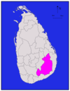
|
أوڤا | موناراگالا | 5,508 (2,127) | 131 (51) | 5,639 (2,177) | 451,058 | 82 (210) |
| مولايتيڤو | 
|
الشمالية | مولايتيڤو | 2,415 (932) | 202 (78) | 2,617 (1,010) | 92,238 | 38 (98) |
| نوارا إليا | 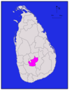
|
الوسطى | نوارا إليا | 1,706 (659) | 35 (14) | 1,741 (672) | 711,644 | 417 (1,080) |
| پولوناروا | 
|
الشمالية الوسطى | پولوناروا | 3,077 (1,188) | 216 (83) | 3,293 (1,271) | 406,088 | 132 (340) |
| پوتالام | 
|
الشمالية الغربية | پوتالام | 2,882 (1,113) | 190 (73) | 3,072 (1,186) | 762,396 | 265 (690) |
| راتناپورا | 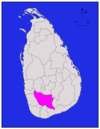
|
سباراگاموا | راتناپورا | 3,236 (1,249) | 39 (15) | 3,275 (1,264) | 1,088,007 | 336 (870) |
| ترينكومالي | 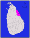
|
الشرقية | ترينكومالي | 2,529 (976) | 198 (76) | 2,727 (1,053) | 379,541 | 150 (390) |
| ڤايونيا | 
|
الشمالية | ڤايونيا | 1,861 (719) | 106 (41) | 1,967 (759) | 172,115 | 92 (240) |
| الاجمالي | 62,705 (24,211) | 2,905 (1,122) | 65,610 (25,330) | 20,359,439 | 325 (840) |
. . . . . . . . . . . . . . . . . . . . . . . . . . . . . . . . . . . . . . . . . . . . . . . . . . . . . . . . . . . . . . . . . . . . . . . . . . . . . . . . . . . . . . . . . . . . . . . . . . . . . . . . . . . . . . . . . . . . . . . . . . . . . . . . . . . . . . . . . . . . . . . . . . . . . . . . . . . . . . . . . . . . . . . .
انظر أيضاً
الهوامش
- ^ Population density has been calculated using the land area rather than the total area.
المراجع
- ^ "At a Glance". Sri Lanka in Brief. Government of Sri Lanka. Archived from the original on 7 July 2009. Retrieved 21 July 2009.
{{cite web}}: Unknown parameter|deadurl=ignored (|url-status=suggested) (help) - ^ "Vision & Mission". District Secretariats Portal. Ministry of Public Administration & Home Affairs, Sri Lanka. Archived from the original on 13 May 2009. Retrieved 21 July 2009.
- ^ "Kilinochchi a brief look". Daily News (Sri Lanka). 27 April 2009. Retrieved 1 August 2009.
- ^ "About Us". Vavuniya District Secretariat. Archived from the original on 12 November 2010. Retrieved 29 July 2009.
- ^ "Performs Report and Accounts—2008" (PDF). District and Divisional Secretariats Portal—Ministry of Public Administration and Home Affairs. Archived from the original (PDF) on 2011-10-03. Retrieved 2009-07-29.
{{cite web}}: Unknown parameter|deadurl=ignored (|url-status=suggested) (help) - ^ "Identification of DS Divisions of Sri Lanka Vulnerable for food insecurity" (PDF). World Food Programme. Archived from the original (PDF) on 4 March 2011. Retrieved 21 July 2009.
{{cite web}}: Unknown parameter|deadurl=ignored (|url-status=suggested) (help) - ^ "Grama Niladhari Administration Division". Retrieved 23 June 2016.
- ^ Siriweera 2004, p. 91.
- ^ Yogasundaram 2006, p. 170.
- ^ Hewavissenti, Panchamee (3 February 2008). "Episodes of colonised history". Sunday Observer (Sri Lanka). Archived from the original on 7 February 2008. Retrieved 21 July 2009.
{{cite news}}: Unknown parameter|deadurl=ignored (|url-status=suggested) (help) - ^ Yogasundaram 2006, p. 168.
- ^ Yogasundaram 2006, p. 195.
- ^ Yogasundaram 2006, p. 214.
- ^ أ ب Yogasundaram 2006, p. 258.
- ^ Peebles 2006, p. 48.
- ^ Peebles 2006, p. 52.
- ^ أ ب ت "Table 1.1: Area of Sri Lanka by province and district" (PDF). Statistical Abstract 2014. Department of Census and Statistics, Sri Lanka.
- ^ "Census of Population and Housing of Sri Lanka, 2012 - Table A1: Population by district, sex and sector" (PDF). Department of Census & Statistics, Sri Lanka.
المصادر
- "Administrative Districts and Main Towns of Sri Lanka". International Centre for Ethnic Studies. Archived from the original on 2009-06-08. Retrieved 2009-07-18.
{{cite web}}: Unknown parameter|deadurl=ignored (|url-status=suggested) (help) - Siriweera, W. I. (2004). History of Sri Lanka: From Earliest Times Up to the Sixteenth Century. Dayawansa Jayakodi & Company. ISBN 955-551-257-4.
{{cite book}}: Invalid|ref=harv(help) - Yogasundaram, Nath (2006). A Comprehensive History of Sri Lanka from Prehistory to Tsunami. Vijitha Yapa Publishers. ISBN 978-955-665-002-0.
{{cite book}}: Invalid|ref=harv(help) - Peebles, Patrick (2006). The History of Sri Lanka. Greenwood Publishing Group. ISBN 0-313-33205-3.
{{cite book}}: Invalid|ref=harv(help)
وصلات خارجية
- Provinces of Sri Lanka at statoids.com
