خليج كامپتشى
| Bay of Campeche | |
|---|---|
| |
 Bay of Campeche | |
| الموقع | |
| الإحداثيات | 20°00′00″N 94°00′00″W / 20.00000°N 94.00000°W |
| جزء من | |
| منابع المحيط/البحر | Gulf of Mexico |
| بلدان الحوض | Mexico |
| أقصى طول | 152 ميل بحري (175 mi; 282 km) |
| أقصى عرض | 378 ميل بحري (435 mi; 700 km) |
| مساحة السطح | 41،909 ميل بحري مربع (55،500 sq mi; 143،740 km2) |
| الجزر |
|
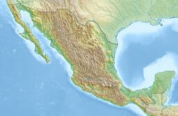
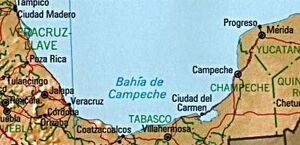
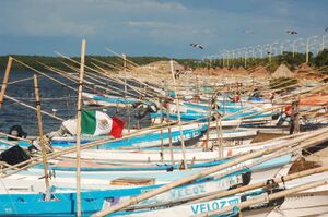
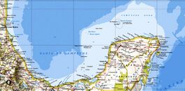
خليج كامپتشه (إسپانية: Golfo de Campeche، Bay of Campeche)، هو مسطح مائي من خليج المكسيك. يحيطه من الجهات الثلاثة الولايات المكسيكية كامپتشه، تاباسكو، ڤراكروز. سمي على اسم فرنشيسكو هرناندز ده كوردوبا وأنطون ده ألامينوس أثناء تجريدهما عام 1517.
موارد النفط
Cantarell Complex of five oil fields lies beneath the Bay of Campeche. In 2003, it was the second most productive oil field in the world, then supplying about two thirds of Mexico's crude oil output, but it went into a steep decline soon thereafter.
On June 3, 1979, Ixtoc I, an exploratory oil well located in the bay, suffered a blowout that caused a catastrophic explosion, resulting in what has been ranked as the third largest unintentional oil spill in history.
المناخ
During the months of June and July, the Bay of Campeche is considered one of the "hot" breeding spots for Atlantic hurricanes.[1]
It experiences strong winds from the north from November into February along its western edge, with the winds ultimately funneling between the mountains and out into the Pacific near Salina Cruz.[5]
On the other hand, the bay is also known for being a hurricane "graveyard", with unusually weak steering currents in the area causing hurricanes to slow down and meander, starving themselves (for example, Hurricane Roxanne in 1995). The bay is also considered the eastern border on the main migration routes for birds in the Americas.[2]
صور
المراجع
- ^ [[[:قالب:Geonameslink]] Triángulo Sur] in [[[:قالب:Geonamesabout]] Geonames.org (cc-by)]
- ^ [[[:قالب:Geonameslink]] Triángulo Oeste] in [[[:قالب:Geonamesabout]] Geonames.org (cc-by)]
- ^ [[[:قالب:Geonameslink]] Triángulo Este] in [[[:قالب:Geonamesabout]] Geonames.org (cc-by)]
- ^ [[[:قالب:Geonameslink]] Cayos Arcas] in [[[:قالب:Geonamesabout]] Geonames.org (cc-by)]
- ^ "Salina Cruz Climate, Weather By Month, Average Temperature (Mexico) - Weather Spark". weatherspark.com (in الإنجليزية). Retrieved 2022-10-09.
الهوامش
- ^ Hauptmann, David. "Where do hurricanes form and where do they strike?". Archived from the original on 2005-11-20. Retrieved 2006-03-27.
- ^ "Routes of Migration". Migration of Birds. Northern Prairie Wildlife Research Center. Archived from the original on 17 April 2006. Retrieved 2006-03-27.
{{cite web}}: Unknown parameter|deadurl=ignored (|url-status=suggested) (help)
- Pages using gadget WikiMiniAtlas
- Short description is different from Wikidata
- Coordinates on Wikidata
- Articles containing إسپانية-language text
- Pages using Lang-xx templates
- CS1 errors: unsupported parameter
- Bays of Mexico
- Bays of the Gulf of Mexico
- Gulf Coast of Mexico
- Landforms of Campeche
- Bights (geography)
- Campeche City
- خلجان المكسيك
- جغرافيا كامپتشه
- مناطق المكسيك
- خلجان خليج المكسيك
