توكلاو
09°10′S 171°50′W / 9.167°S 171.833°W
توكلاو Tokelau | |
|---|---|
| Motto: | |
| النشيد الوطني: "Te Atua o Tokelau"[1] | |
 | |
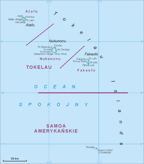 Map of all Tokelau Islands. Swains Island is shown to the south. | |
| Sovereign state | New Zealand |
| Protectorate created | June 1889 |
| British colony | 29 February 1916 |
| Assigned to New Zealand | 11 February 1926 |
| New Zealand sovereignty | 1 January 1949 |
| العاصمة | None[note 1] |
| أكبر مدينة | Atafu |
| اللغات الرسمية | |
| صفة المواطن | Tokelauan |
| الحكومة | Devolved parliamentary dependency under a constitutional monarchy |
• Monarch | قالب:Monarch of New Zealand, current |
| Don Higgins[3] | |
| Kerisiano Kalolo | |
| Legislature | General Fono |
| المساحة | |
• Total | 10 km2 (3.9 sq mi) |
• Water (%) | negligible |
| أعلى منسوب | 5 m (16 ft) |
| التعداد | |
• 2016 census | 1,499[4] (237th) |
• Density | 115/km2 (297.8/sq mi) (86th) |
| GDP (PPP) | 2017 estimate |
• Total | US$10 million[5] |
• Per capita | US$6,275 (not ranked) |
| GDP (nominal) | estimate |
• Total | US$9,406,225[5] |
| العملة | New Zealand dollar (NZ$) (NZD) |
| Time zone | UTC+13:00 |
| Date format | dd/mm/yyyy |
| Driving side | left |
| Calling code | +690 |
| ISO 3166 code | TK |
| Internet TLD | .tk |
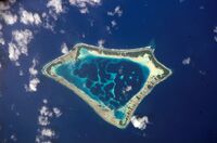
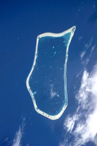
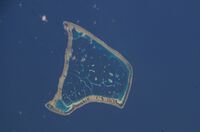
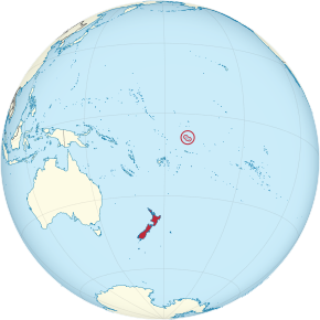
Tokelau (/ˈtoʊkəlaʊ/; حرفياً 'north-northeast' or 'north wind';[6][7] known previously as the Union Islands, and, until 1976, known officially as the Tokelau Islands[8]) is a dependent territory of New Zealand in the southern Pacific Ocean. It consists of three tropical coral atolls: Atafu, Nukunonu, and Fakaofo. They have a combined land area of 10 km2 (4 sq mi). The capital rotates yearly among the three atolls.[9] In addition to these three, Swains Island, which forms part of the same archipelago, is the subject of an ongoing territorial dispute; it is currently administered by the United States as part of American Samoa. Tokelau lies north of the Samoan Islands, east of Tuvalu, south of the Phoenix Islands, southwest of the more distant Line Islands, and northwest of the Cook Islands.
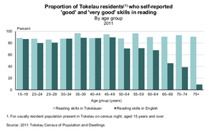
Tokelau has a population of approximately 1,500 people; it has the fourth-smallest population of any sovereign state or dependency in the world. As of the 2016 census, around 45% of its residents had been born overseas, mostly in Samoa or New Zealand.[10] The populace has a life expectancy of 69, which is comparable to that of other Oceanian island nations. Approximately 94% of the population speak Tokelauan as their first language. Tokelau has the smallest economy of any sovereign nation, although it is a leader in renewable energy, being the first 100% solar powered nation in the world.[11]
Tokelau is officially referred to as a nation by both the New Zealand government and the Tokelauan government.[11][12][13] It is a free and democratic nation with elections every three years. However, in 2007, the United Nations General Assembly included Tokelau on its list of non-self-governing territories.[14] Its inclusion on this list is controversial, as Tokelauans have twice narrowly voted against further self-determination, and the islands' small population makes the viability of self-government challenging. The basis of Tokelau's legislative, administrative and judicial systems is the Tokelau Islands Act 1948, which has been amended on a number of occasions. Since 1993, the territory has annually elected its own head of government, the Ulu-o-Tokelau. Before 1993, the administrator of Tokelau was the highest official in the government and the territory was directly administered by a New Zealand government department.
التسمية
التاريخ
ما قبل التاريخ
التواصل مع الثقافات الأخرى

الأعاصير الإستوائية
المنطقة الزمنية
الحكومة
السياسة
الجغرافيا
| الجزيرة | الإحداثيات |
|---|---|
| Atafu | 8°33′6″S 172°30′3″W / 8.55167°S 172.50083°W |
| Nukunonu | 9°10′6″S 171°48′35″W / 9.16833°S 171.80972°W |
| Fakaofo | 9°21′55″S 171°12′54″W / 9.36528°S 171.21500°W |
البيئة
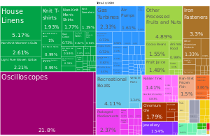
الاقتصاد
الطاقة الشمسية
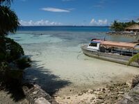
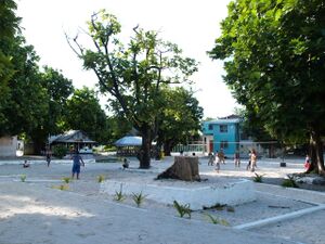
Nukunonu Lagoon in Tokelau.
اسم نطاق الإنترنت
الديموغرافيا
الديانات
الثقافة
الرعاية الصحية والتعليم
الرياضة
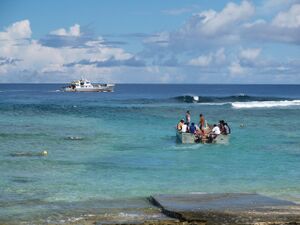
الاتصالات والنقل
انظر أيضاً
الهوامش
- ^ Each atoll has its own administrative centre.
المصادر
- ^ "Government of Tokelau". www.tokelau.org.nz (in الإنجليزية). Retrieved 20 September 2017.
- ^ "Tokelau Info". Tokelau-info.tk. Archived from the original on 26 October 2013. Retrieved 30 December 2011.
- ^ "New Administrator of Tokelau announced".
- ^ Final population counts: 2016 Tokelau Census. Statistics New Zealand. November 2016. p. 3. Archived from the original. You must specify the date the archive was made using the
|archivedate=parameter. https://www.tokelau.org.nz/site/tokelau/files/TokelauNSO/2016Census/TokelauCensusTechnicalRelease1E.pdf. - ^ أ ب "Tokelau's Gross Domestic Product determined for first time this century". www.tokelau.org.nz.
- ^ "Culture of Tokelau - history, people, clothing, traditions, women, beliefs, food, family, social". www.everyculture.com (in الإنجليزية). Retrieved 2017-02-28.
Tokelau" means "north-northeast.
- ^ "Tokelau". OCHA (in الإنجليزية). 2018-02-20. Retrieved 2022-02-05.
- ^ Tokelau Amendment Act 1976
- ^ "Welcome to sunny Tokelau, an untouched Pacific Paradise". Archived from the original on 11 يناير 2010.
- ^ "Profile of Tokelau" (PDF). Tokelau National Statistics Office. April 2017. Retrieved 19 March 2022.
- ^ أ ب "Tokelau, world first solar power nation | New Zealand Trade and Enterprise". Nzte.govt.nz. 12 يوليو 2012. Archived from the original on 21 مايو 2017. Retrieved 11 ديسمبر 2016.
- ^ "Government of Tokelau". Tokelau.org.nz. Retrieved 2016-12-11.
- ^ "Tokelauans – Te Ara Encyclopedia of New Zealand". Teara.govt.nz. Retrieved 2016-12-11.
- ^ "Official site for the Tokelau Council of Ongoing Government". Archived from the original on 20 February 2014. Retrieved 4 November 2007.
قراءات إضافية
- Heller, Maxwell H. (2005). Where on Earth Is Tokelau?: A Doctor's Experiences in the South Seas. ISBN 978-0-901100-58-0.
- Huntsman, Judith; Hooper, Antony (1996). Tokelau: A Historical Ethnography. ISBN 978-1-86940-153-5.
- Huntsman, Judith; Kalolo, Kelihiano (2007). The Future of Tokelau Decolonising Agendas, 1975–2006. ISBN 978-1-86940-398-0.
وصلات خارجية
| Find more about Tokelau at Wikipedia's sister projects | |
| Definitions from Wiktionary | |
| Media from Commons | |
| Quotations from Wikiquote | |
| Source texts from Wikisource | |
| Textbooks from Wikibooks | |
| Travel guide from Wikivoyage | |
| Learning resources from Wikiversity | |
- Tokelau. The World Factbook. Central Intelligence Agency.
- Tokelau from UCB Libraries GovPubs
- توكلاو at Curlie
 Wikimedia Atlas of Tokelau
- Ethnology of Tokelau Islands
الحكم
- Tokelau Council of Ongoing Government, executive branch of the government
- The Administrator of Tokelau, Tokelau website of the NZ Ministry of Foreign Affairs and Trade
الجزر المرجانية
| التقسيمات الادارية في نيوزيلندا | |||||||||||
|---|---|---|---|---|---|---|---|---|---|---|---|
| أملاك الكومنولث | عموم نيوزيلندا | ||||||||||
| الأقاليم والمناطق التابعة | نيوزيلندا | Ross Dependency | توكلاو | جزر كوك | نيوي | ||||||
| المناطق | 11 non-unitary regions | 5 unitary regions | Chatham Islands | الجزر النائية خارج أي سلطة مناطقية (جزر كرمادك، جزر الملوك الثلاث, and sub-Antarctic islands) | |||||||
| السلطات الإقليمية | 13 cities and 53 districts | ||||||||||
| هوامش | بعض المقاطعات تقع في أكثر من منطقة | These combine the regional and the territorial authority levels in one | السلطة الإقليمية الخاصة | جزر سولاندر النائية تشكل جزءا من منطقة ساوثلاند | New Zealand's الأراضي الأنتارتيكية | Non-self-governing territory لنيوزيلندا | دول في ارتباط حر مع نيوزيلندا | ||||
- Pages using gadget WikiMiniAtlas
- Short description is different from Wikidata
- Coordinates on Wikidata
- Articles containing Tokelauan-language text
- Articles containing إنگليزية-language text
- Articles with hatnote templates targeting a nonexistent page
- Articles with Curlie links
- دول اوقيانوسية
- توكلاو
- 1948 establishments in Oceania
- Atolls of New Zealand
- British Western Pacific Territories
- Dependent territories of New Zealand
- بلدان وأراضي ناطقة بالإنگليزية
- Geography of Polynesia
- بلدان جزر
- States and territories established in 1948


