جزر كرمادك
الاسم الأصلي: Kermadec Islands | |
|---|---|
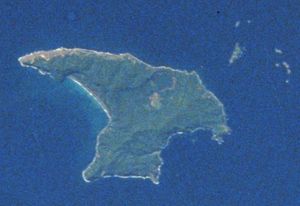
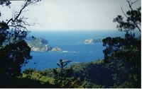 منظر من جزيرة راؤول، بأقصى شمال جزر كرمادك | |
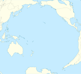
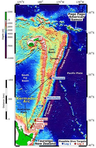
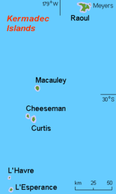 خريطة جزر كرمادك | |
| الجغرافيا | |
| الإحداثيات | 29°16′0″S 177°55′10″W / 29.26667°S 177.91944°W --> |
| الأرخبيل | أرخبيل نيوزيلندا |
| قريبة من | جنوب المحيط الهادي |
| المساحة | 33 km2 (13 sq mi) |
جزر كرمادك (Kermadec Islands ؛ /kərˈmædɛk/ (Rangitāhua بلغة الماوري[1]) هي قوس جزر شبه مداري في جنوب المحيط الهادي على بعد 800-1000 كم شمال شرق الجزيرة الشمالية في نيوزيلندا، وعلى بعد مسافة مماثلة جنوب غرب تونگا. الجزر هي جزء من نيوزيلندا، وتبلغ مساحتها الإجمالية 33 كم² وحالياً هي غير مأهولة، إلا من تواجد أمني دائم على محطة جزيرة راؤول، الذي هو النقطة الأقصى شمالاً في نيوزيلندا.
The islands are listed with the New Zealand Outlying Islands. The islands are an immediate part of New Zealand, but not part of any region or district, but instead Area Outside Territorial Authority, like all the other outlying islands except the Solander Islands.
التاريخ
أناس پولينزيون استقروا في جزر كرمادك حوالي القرن 14 (وربما قبل ذلك في القرن العاشر)،[2] ولكن الأوروپيين الأوائل الذين وصلوا المنطقة—على متن الليدي پنرين في مايو 1788—لم يجدوا أي سكان. سميت الجزر على اسم القبطان البريتوني جان-ميشل هون دى كرمادك، الذي زار الجزر كجزء من تجريدة d'Entrecasteaux في ع1790. European settlers, initially the Bell family, lived on the islands from the early nineteenth century until 1937, as did whalers. One of the Bell daughters, Bessie Dyke, recounted the family's experience there to writer Elsie K. Morton, who published the story in 1957 as Crusoes of Sunday Island.[3]
الجيولوجيا
الهامش
- ^ Taonga, New Zealand Ministry for Culture and Heritage Te Manatu. "Kermadec Islands – Te Ara Encyclopedia of New Zealand". teara.govt.nz. Retrieved 22 March 2018.
- ^ Gentry, Steven (2013). "2: Rangitahua – the Stopping-off Place". Raoul & the Kermadecs: New Zealand's Northernmost Islands, a History. pp. 37–51. ISBN 978-1-927242-02-5.
- ^ Morton, Elsie (1957). "Author's Note". Crusoes of Sunday Island.
وصلات خارجية
- Kermadec Marine Reserve at the New Zealand Department of Conservation
- قالب:WWF ecoregion
- The Kermadecs: an ocean wilderness
- Kermadec Islands Marine Reserve at Seafriends
- Kermadec Ocean Sanctuary from the Ministry for the Environment / Manatū Mō Te Taiao
| التقسيمات الادارية في نيوزيلندا | |||||||||||
|---|---|---|---|---|---|---|---|---|---|---|---|
| أملاك الكومنولث | عموم نيوزيلندا | ||||||||||
| الأقاليم والمناطق التابعة | نيوزيلندا | Ross Dependency | توكلاو | جزر كوك | نيوي | ||||||
| المناطق | 11 non-unitary regions | 5 unitary regions | Chatham Islands | الجزر النائية خارج أي سلطة مناطقية (جزر كرمادك، جزر الملوك الثلاث, and sub-Antarctic islands) | |||||||
| السلطات الإقليمية | 13 cities and 53 districts | ||||||||||
| هوامش | بعض المقاطعات تقع في أكثر من منطقة | These combine the regional and the territorial authority levels in one | السلطة الإقليمية الخاصة | جزر سولاندر النائية تشكل جزءا من منطقة ساوثلاند | New Zealand's الأراضي الأنتارتيكية | Non-self-governing territory لنيوزيلندا | دول في ارتباط حر مع نيوزيلندا | ||||
- Pages using gadget WikiMiniAtlas
- Coordinates on Wikidata
- Pages using infobox islands with an ambiguous map caption
- جزر كرمادك
- أرخبيلات نيوزيلندا
- أرخبيلات المحيط الهادي
- Tropical and subtropical moist broadleaf forests
- Ecoregions of New Zealand
- Oceanian ecoregions
- Island restoration
- Important Bird Areas of New Zealand
- قوائم إحداثيات
- Volcanism of New Zealand
- دول وأقاليم تأسست في 1887
- تأسيسات 1887 في نيوزيلندا
