بحر البوران
| Alboran Sea | |
|---|---|
| Mar de Alborán | |
 | |
| الموقع | Southern Europe and North Africa |
| الاحداثيات | 36°0′N 3°0′W / 36.000°N 3.000°W |
| منابع النهر | Guadalhorce River, Guadalfeo River, Adra River (Spain) and Nekor River (Morocco) |
| منابع المحيط/البحر | Atlantic Ocean |
| بلدان الحوض | Algeria, Gibraltar (UK), Morocco, and Spain |
| متوسط العمق | 445 metres (1,460 ft) |
| أقصى عمق | 1,500 metres (4,900 ft) |
| التجمعات السكنية | Málaga, Motril, Almería and Cartagena, Spain Alhucemas and Nador, Morocco, Gibraltar |
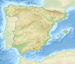
بحر البوران Alboran Sea هو الجزء الأقصى غرباً من البحر المتوسط، ويقع بين اسبانيا في الشمال والمغرب والجزائر في الجنوب. مضيق جبل طارق، الذي يقع على الطرف الغربي بحر البوران، يربط البحر المتوسط بالمحيط الأطلسي.
الجغرافيا
ومتوسط عمقه هو 1,461 feet (445 m) وأقصى عمق فيه هو 4,920 feet (1,500 m).
تسري التيارات السطحية في بحر البوران شرقاً، جالبة الماء من الأطلسي إلى المتوسط؛ التيارات الأعمق تحت السطح تسري غرباً، حاملة مياة المتوسط الأكثر ملوحة إلى الأطلسي. وكثيراً ما يكون فيه دورة كاملة الاستدارة، وتسمى gyre، في بحر البوران نتيجة هذا التبادل للمياه. فبحر البوران هو منطقة انتقال بين البحرين، ويحتوي خليط من أنواع كائنات المتوسط والأطلنطي. وبحر البوران هو موطن أكبر تعداد للدرفيل قنيني الأنف، في غرب المتوسط، وهو موطن لآخر تجمع من harbour porpoise في البحر المتوسط، and is the most important feeding grounds for loggerhead sea turtles in Europe. The Alboran sea also hosts important commercial fisheries, including sardines and swordfish. In 2003, the World Wildlife Fund raised concerns about the widespread صيد شبكات الجر الذي يهدد تجمعات الدرافيل والسلاحف وباقي الحيوانات البحرية.
تتناثر في البحر العديد من الجزر الصغيرة مثل جزيرة البوران. ومعظمهم، حتى أولئك القريبين من الساحل المغربي تسيطر عليهم اسبانيا.
ويحيط قوس من الجبال، يعرف باسم قوس جبل طارق، بالجوانب الشمالية والغربية والجنوبية لبحر البوران. وتألف قوس جبل طارق من Baetic Cordillera في جنوب اسبانيا وجبال الريف بالمغرب. هذه الجبال، known to ecologists as the Baetic-Rifan complex, are one of the Mediterranean's biodiversity hotspots; like the Alboran sea, the Baetic-Rifan complex is a transition between the Mediterranean and Atlantic (Macaronesian) ecologies. التأثير المتعادل للأطلسي سمح للعديد من الأنواع في الجبال البائتية وجبال الريف أن تحافظ على وجودها في ظل التقلبات المناخية في ملايين السنين القليلة الماضية والتي جعلتهم ينقرضوا من الأماكن الأخرى حول حوض المتوسط.
الجيولوجيا
The Alboran domain, the seafloor beneath the Alboran Sea (known as the internal zones) together with the surrounding mountains (known as the external zones; the Gibraltar Arc and Atlas Mountains), is mostly made of continental crust and marks the westernmost terminus of the terranes that were subducted between the African and Eurasian Plates when the Tethys Ocean closed. Reoccurring earthquakes at a depth of about 600 km (370 mi) indicate that this subduction is ongoing and that complex interactions between the lithosphere and mantle are forming the region.[1] The internal zones are made of Late Paleozoic to Triassic rocks that were piled up during the Tertiary and has been extended since the Early Miocene.[2]
The seafloor is morphologically complex with several sub-basins, including three main sub-basins named West, East, and South Alboran Basins, ridges, and seamounts. The most prominent structure in the Alboran Sea is the 180 km long (110 mi) Alboran Ridge which stretches southwest from the volcanic Alborán Island.[3]
علم البحار
Surface currents in the Alboran Sea, influenced by the prevailing winds, flow eastward, bringing water from the Atlantic into the Mediterranean; deeper subsurface currents flow westward, carrying saltier Mediterranean water over the Gibraltar sill into the Atlantic. Thus there is typically a vertical rotary circulation, also known as a gyre, in the Alboran Sea as a result of this exchange of water.[4]
البيئة
The Alboran Sea is a transition zone between ocean and sea, containing a mix of Mediterranean and Atlantic species. The Alboran Sea is habitat for the largest population of bottlenose dolphins and the last population of harbour porpoises in the western Mediterranean, and is the most important feeding grounds for loggerhead sea turtles in Europe. The Alboran sea also hosts important commercial fisheries, including sardines and swordfish. In 2003, the World Wildlife Fund raised concerns about the widespread drift net fishing endangering populations of dolphins, turtles, as well as other marine animals. In 2023, the European Union, Morocco, and Algeria agreed to ban bottom fishing practices around Cabliers Bank, protecting the only cold-water coral reef known to be growing in the Mediterranean.[5]
An arc of mountains, known as the Gibraltar Arc, wraps around the northern, western and southern sides of the Alboran Sea. The Gibraltar Arc is made up of the Baetic Cordillera of Southern Spain and the Rif Mountains of Morocco. These mountains, known to ecologists as the Baetic-Rifan complex, comprise one of the Mediterranean's biodiversity hotspots; like the Alboran Sea, the Baetic-Rifan complex represents a transition between the Mediterranean and Atlantic (Macaronesian) ecological zones. The moderating influence of the Atlantic has allowed many relict species in the Baetic and Rif mountains to survive the climatic fluctuations of the last few million years that have caused them to become extinct elsewhere around the Mediterranean basin.
الجزر
There are some small islands in the sea:[6]
المراجع
الهامش
- ^ Alpert et al. 2013, Introduction, pp. 4265–4266.
- ^ Iribarren et al. 2007, Introduction, p. 98.
- ^ Comas et al. 1999, p. 559.
- ^ C. Michael Hogan. 2011. "Alboran Sea" in. eds. P. Saundry & C. J. Cleveland. Encyclopedia of Earth. (National Council for Science and the Environment) Washington DC
- ^ "Mediterranean countries unite to protect unique deep-sea coral from fishing impacts". europe.oceana.org (in الإنجليزية). Retrieved 2023-11-17.
- ^ "Map of Alboran Sea - Alboran Sea Map, World Seas, Alboran Location - World Atlas". www.worldatlas.com (in الإنجليزية). Retrieved 2017-10-12.
- ^ "Alboran Sea - a sea in Atlantic Ocean". www.deepseawaters.com. Retrieved 2017-10-12.
المصادر
- Alpert, L. A.; Miller, M. S.; Becker, T. W.; Allam, A. A. (2013). "Structure beneath the Alboran from geodynamic flow models and seismic anisotropy" (PDF). Journal of Geophysical Research: Solid Earth. 118 (8): 4265–4277. doi:10.1002/jgrb.50309. Retrieved 7 November 2015.
- Comas, M. C.; Platt, J. P.; Soto, J. I.; Watts, A. B. (1999). "44. The origin and tectonic history of the Alboran Basin: insights from Leg 161 results". Proceedings of the Ocean Drilling Program Scientific Results. Vol. 161. pp. 555–580. Retrieved 25 October 2015.
- Iribarren, L.; Vergés, J.; Camurri, F.; Fullea, J.; Fernandez, M. (2007). "The structure of the Atlantic–Mediterranean transition zone from the Alboran Sea to the Horseshoe Abyssal Plain (Iberia–Africa plate boundary)". Marine Geology. 243 (1): 97–119. doi:10.1016/j.margeo.2007.05.011. Retrieved 7 November 2015.
- Pages using gadget WikiMiniAtlas
- Short description is different from Wikidata
- Coordinates on Wikidata
- Wikipedia infobox body of water articles without coordinates
- بحار إسپانيا
- Bodies of water of Morocco
- Bodies of water of Algeria
- Morocco–Spain border
- Gibraltar–Spain border
- Algeria–Morocco border
- بحار أوروپية
- بحار أفريقيا
- Back-arc basins
- بحار هامشية للبحر المتوسط
- تضاريس إسپانيا
- تضاريس المغرب
- تضاريس الجزائر


