پلوڤديڤ
پلوڤديڤ
Пловдив (بلغارية) Plovdiv | |
|---|---|
 From top, left to right:
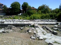
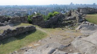
Hills of Plovdiv • Ancient theatre • Ancient stadium • Historical Museum • Hisar Kapia • Ethnographic Museum • Tsar Simeon's garden • | |
| الكنية: The city of the seven hills Градът на седемте хълма (بلغارية) Gradăt na sedemte hălma (transliteration) | |
| الشعار: | |
Location of Plovdiv within Bulgaria | |
| الإحداثيات: 42°9′N 24°45′E / 42.150°N 24.750°E | |
| البلد | |
| Province | Plovdiv |
| Municipalities | Plovdiv-city |
| الحكومة | |
| • Mayor | Zdravko Dimitrov (GERB) |
| المساحة | |
| • الإجمالي | 101٫98 كم² (39٫37 ميل²) |
| المنسوب | 164 m (538 ft) |
| التعداد (31 December 2018)[3] | |
| • الإجمالي | 346٬893 |
| • Urban | 544٬628[1] |
| • Metro | 675٬586[2] |
| صفة المواطن | Plovdivchanin/Plovdivchanka |
| منطقة التوقيت | UTC+2 (EET) |
| • الصيف (التوقيت الصيفي) | UTC+3 (EEST) |
| Postal code | 4000 |
| مفتاح الهاتف | (+359) 032 |
| Car plates | PB |
| الموقع الإلكتروني | www.plovdiv.bg |
پلوڤديڤ أو فيليبي (بالبلغارية: Пловдив) هي ثاني أكبر مدن بلغاريا بعد العاصمة صوفيا، حيث بلغ عدد سكانها 341873 نسمة في عام 2005. وهي أيضاً أهم وأكبر مدن منطقة تراقيا التاريخية. تقع المدينة في محافظة بلوفديف جنوب البلاد، وتعرف بالثقافة القديمة والمتنوعة وبالتاريخ الكبير. معظم سكان المدينة من أصول بلغارية، إلا أنه يوجد بها نسبة من الغجر.
التاريخ
Antiquity
Roman writer Lucian.
پلوڤديڤ هي من أقدم مدن قارة أوروبا. عرفت في اللغة التراقية قديماً باسم "Evmolpia"، وفتحها فيليبوس الثاني المقدوني (والد الإسكندر الكبير) في عام 342 قبل الميلاد، ثم غير اسمها إلى "فيليبوبوليس" (باليونانية: Φιλιππόπολις) أي "مدينة فيليبوس". بعد ذلك حررها وحكمها التراقيون وسموها "Pulpudeva"، حتى ضمت إلى الإمبراطورية الرومانية حينما سميت باسم "Trimontium" أي "مدينة الثلاث تلال" وتحولت إلى عاصمة منطقة تراقيا. يمكن مشاهدة الكثير من الآثار الرومانية في المدينة حتى الآن. واحتلها السلاف في القرن 6، ثم البلغاريون في عام 815. استخدم الاسم "بلوفديف" الحالي أول مرة في القرن 15.
العصور الوسطى

ثم احتلها العثمانيون، وكانت مركزاً للحركة القومية البلغارية، وبني أول دار للطباعة للغة البلغارية في المدينة.
الإحياء الوطني

Under the rule of the Ottoman Empire, Filibe (as the city was known at that time) was a focal point for the Bulgarian national movement and survived as one of the major cultural centers for Bulgarian culture and tradition.
شرق الروملي
بعد تحررها من العثمانيين عام 1878، لم تكن ضمن إمارة بلغاريا الجديدة. بدلاً من ذلك كانت عاصمة منطقة روميليا الشرقية شبه المستقلة السابقة، وظلت كذلك حتى توحدت روميليا الشرقية مع بلغاريا في عام 1885. أصبحت المدينة تحت الحكم الشيوعي بعد نهاية الحرب العالمية الثانية، وكانت مركزاً للحركة الديمقراطية بالنسبة للبلاد حتى أطيح بالحكم السوفييتي عام 1989.
Plovdiv has hosted specialized exhibitions of the World's Fair in 1981, 1985, and 1991.
المناخ
| أخفClimate data for Plovdiv (1952–2000; extremes 1942–present) | |||||||||||||
|---|---|---|---|---|---|---|---|---|---|---|---|---|---|
| Month | Jan | Feb | Mar | Apr | May | Jun | Jul | Aug | Sep | Oct | Nov | Dec | Year |
| Record high °C (°F) | 23.0 (73.4) |
24.0 (75.2) |
30.0 (86.0) |
34.2 (93.6) |
36.0 (96.8) |
41.0 (105.8) |
45.0 (113.0) |
42.5 (108.5) |
37.6 (99.7) |
36.8 (98.2) |
27.0 (80.6) |
22.9 (73.2) |
45.0 (113.0) |
| Mean daily maximum °C (°F) | 5.2 (41.4) |
8.3 (46.9) |
13.0 (55.4) |
18.4 (65.1) |
23.7 (74.7) |
28.0 (82.4) |
30.7 (87.3) |
30.3 (86.5) |
26.0 (78.8) |
19.4 (66.9) |
11.9 (53.4) |
6.4 (43.5) |
18.5 (65.3) |
| Daily mean °C (°F) | 0.9 (33.6) |
3.2 (37.8) |
7.2 (45.0) |
12.3 (54.1) |
17.3 (63.1) |
21.5 (70.7) |
23.9 (75.0) |
23.2 (73.8) |
19.0 (66.2) |
13.1 (55.6) |
6.9 (44.4) |
2.3 (36.1) |
12.7 (54.9) |
| Mean daily minimum °C (°F) | −3.0 (26.6) |
−1.4 (29.5) |
1.8 (35.2) |
6.2 (43.2) |
11.0 (51.8) |
15.0 (59.0) |
17.0 (62.6) |
16.5 (61.7) |
12.6 (54.7) |
7.6 (45.7) |
2.6 (36.7) |
−1.3 (29.7) |
7.1 (44.8) |
| Record low °C (°F) | −31.5 (−24.7) |
−29.1 (−20.4) |
−17.5 (0.5) |
−4.0 (24.8) |
−0.3 (31.5) |
6.0 (42.8) |
8.2 (46.8) |
5.6 (42.1) |
0.7 (33.3) |
−5.9 (21.4) |
−9.1 (15.6) |
−22.7 (−8.9) |
−31.5 (−24.7) |
| Average precipitation mm (inches) | 27 (1.1) |
34 (1.3) |
37 (1.5) |
41 (1.6) |
77 (3.0) |
57 (2.2) |
39 (1.5) |
43 (1.7) |
35 (1.4) |
37 (1.5) |
36 (1.4) |
39 (1.5) |
502 (19.8) |
| Average precipitation days | 4.8 | 5.1 | 5.8 | 4.7 | 6.5 | 6.2 | 3.8 | 3.1 | 3.1 | 3.9 | 5.8 | 6.2 | 60.7 |
| Average relative humidity (%) | 76 | 67 | 60 | 53 | 53 | 50 | 45 | 46 | 48 | 59 | 69 | 76 | 59 |
| Mean monthly sunshine hours | 94 | 110 | 170 | 200 | 252 | 281 | 328 | 315 | 230 | 162 | 120 | 77 | 2٬339 |
| Source 1: Climatebase.ru | |||||||||||||
| Source 2: Danish Meteorological Institute (sun and relative humidity),[4] | |||||||||||||
| أخفClimate data for Plovidiv (2008-2018) | |||||||||||||
|---|---|---|---|---|---|---|---|---|---|---|---|---|---|
| Month | Jan | Feb | Mar | Apr | May | Jun | Jul | Aug | Sep | Oct | Nov | Dec | Year |
| Mean daily maximum °C (°F) | 7.3 (45.1) |
10.2 (50.4) |
16.2 (61.2) |
19.3 (66.7) |
25.2 (77.4) |
28.7 (83.7) |
32.1 (89.8) |
31.8 (89.2) |
26.9 (80.4) |
21.5 (70.7) |
15.3 (59.5) |
8.8 (47.8) |
21 (70) |
| Daily mean °C (°F) | 2.2 (36.0) |
4.5 (40.1) |
8.5 (47.3) |
14.3 (57.7) |
19.3 (66.7) |
23.4 (74.1) |
25.6 (78.1) |
25.5 (77.9) |
21.6 (70.9) |
16.3 (61.3) |
10.7 (51.3) |
4.6 (40.3) |
14.0 (57.2) |
| Mean daily minimum °C (°F) | −1.3 (29.7) |
−0.5 (31.1) |
3.6 (38.5) |
8.3 (46.9) |
13.5 (56.3) |
17.3 (63.1) |
18.9 (66.0) |
18.8 (65.8) |
14.7 (58.5) |
10.5 (50.9) |
6.3 (43.3) |
0.5 (32.9) |
9.2 (48.6) |
| Source: Stringmeteo.com[صفحة مطلوبة] | |||||||||||||
السكان
| Plovdiv | |||||||||||||
|---|---|---|---|---|---|---|---|---|---|---|---|---|---|
| السنة | 1887 | 1910 | 1934 | 1946 | 1956 | 1965 | 1975 | 1985 | 1992 | 2001 | 2005 | 2009 | 2011 |
| السكان | 33,032 | 47,981 | 99,883 | 126,563 | 161,836 | 225,508 | 299,638 | 342,131 | 341,058 | 338,224 | 341,9 | 338,2 | 338,153 |
| أعلى رقم 348,465 في 2009 | |||||||||||||
| Sources: National Statistical Institute,[5][6] „citypopulation.de“,[7] „pop-stat.mashke.org“,[8] Bulgarian Academy of Sciences[9] | |||||||||||||

At the first census after the Liberation of Bulgaria in 1880 with 24,053 citizens,[10] Plovdiv is the second largest city behind Ruse, which had 26,163 citizens then,[11] and ahead of the capital Sofia, which had 20,501 citizens then. As of the 1887 census, Plovdiv was the largest city in the country for several years with 33,032 inhabitants compared to 30,428 for Sofia. According to the 1946 census, Plovdiv was the second largest city with 126,563 inhabitants compared to 487,000 for the capital.[12]
Ethnicity and religion
| Year[13] | Muslims | Christians | Roma | Jews |
|---|---|---|---|---|
| 1472 | 81.7% | 18.3% | ||
| 1489 | 87.1% | 8.2% | 3.5% | |
| 1490 (households)[14] | 796 | 78 | 33 | |
| 1516 | 86.7% | 7% | 2.8% | 2.5% |
| 1525 | 85.2% | 7.5% | 3.2% | 3% |
| 1530 | 82.1% | 9.1% | 3.8% | 3.7% |
| 1570 | 82% | 9.3% | 2.7% | 5.4% |
| 1595 | 78.2% | 14% | 2.9% | 4.8% |
| 1614 | 68.3% | 22.6% | 7.7% | 4.1% |
| 1695[15] | 81% | 14% | ||
| 1876[16] | 33% |
| Census | Total | Bulgarians | Turks | Jews | Greeks | Armenians | Roma | Others | Unspecified |
|---|---|---|---|---|---|---|---|---|---|
| 1878 | 24053[17] | 10909 (45.35%) | 5558 (23.10%) | 1134 (4.71%) | 4781 (19.88%) | 806 (3.35%) | 865 (3.60%) | 902 (3.75%) | |
| 1884[18]
– |
33442 | 16752 (50.09%) | 7144 (21.36%) | 2168 (6.48%) | 5497 (16.44%) | 979 (2.93%) | 112 | 902 (2.70%) | |
| 1887 | 33032 | 19542 | 5615 | 2202 | 3930 | 903 | 348 | 492 | |
| 1892 | 36033 | 20854 | 6381 | 2696 | 3906 | 1024 | 237 | 935 | |
| 1900 | 43033 | 24170 | 4708 | 3602 | 3908 | 1844 | 1934 | 2869 | |
| 1910 | 47981 | 32727 | 2946 | 4436 | 1571 | 1794 | 3524 | 983 | |
| 1920 | 64415 | 46889 | 5605 | 5144 | 1071 | 3773 | 1342 | 591 | |
| 1926 | 84655 | 63268 | 4748 | 5612 | 549 | 5881 | 2746 | 1851 | |
| 1934 | 99883 | 77449 | 6102 | 5574 | 340 | 5316 | 2728 | 2374 | |
| 1939 | 105643 (100%) | 82012 (77.63%) | 6462 (6.12%) | 5960 (5,64%) | 200 (0.19%) | 6591 (6.24%) | 2982 (2.82%) | 1436 (1.36%) | |
| 2001[19] | 338224 | 302858 (89.5%) | 22501 (6.7%) | 5192 (1.5%) | 5764 (1.7%) | 1909 | |||
| 2011[20][21] | 338153 | 277804 (82.2%) | 16032 (4.7%) | 9438 (2.8%) | 1436 (0.4%) | 3105 (0.9%) | 31774 (9.4%) |
The Dzhumaya Mosque
The Orthodox seminary
Districts and neighbourhoods
| Number | Neighbourhood | Number | Neighbourhood | Number | Neighbourhood | Number | Neighbourhood |
|---|---|---|---|---|---|---|---|
| 1 | Center | 12 | Sadiiski | 23 | Hristo Smirnenski | 34 | Sheker Mahala |
| 2 | Old Town | 13 | Stochna Gara | 24 | Proslav | ||
| 3 | Kamenitsa 1 | 14 | Kyutchuk Paris | 25 | Mladezhki Halm | ||
| 4 | Kamenitsa 2 | 15 | Vastannicheski | 26 | Otdih i Kultura | ||
| 5 | Izgrev | 16 | Belomorski | 27 | Marasha | ||
| 6 | Stolipinovo | 17 | Institut po Ovoshtarstvo | 28 | Maritsa Sever | ||
| 7 | Izgrev | 18 | Ostromila | 29 | Zaharna Fabrika | ||
| 8 | Industrial zone – East | 19 | Yuzhen | 30 | Karshiaka | ||
| 9 | Trakia | 20 | Tsentralna Gara | 31 | Gagarin | ||
| 10 | Industrial zone – Trakia | 21 | Komatevo | 32 | Industrial Zone – North | ||
| 11 | Industrial zone – South | 22 | Komatevski Vazel | 33 | Filipovo |
الاقتصاد
GVA by sector (2013)
Employees by sector (2014)
الآن تقع مدينة بلوفديف في وسط منطقة ذات أهمية زراعية كبيرة، فيعد إنتاج الأطعمة أهم صناعاتها. كما تنتج المدينة الآلات والمنسوجات والمواد الكيميائية.
Economic Indicators
| Indicator | Unit | 2010 | 2011 | 2012 | 2013 | 2014 |
|---|---|---|---|---|---|---|
| GDP | BGN million | 5,539 | 6,062 | 6,178 | 6,374 | 6,273 |
| Share in Bulgaria's GDP | % | 7.5 | 7.6 | 7.6 | 7.8 | 7.5 |
| GDP per capita | BGN | 7,924 | 8,888 | 9,087 | 9,394 | 9,268 |
| Population | Number | 696,300 | 680,884 | 678,860 | 678,197 | 675,586 |
| Average annual number of employees under labor contract | Number | 208,438 | 207,599 | 205,876 | 203,933 | 207,057 |
| Average salary of employees under labor contract | BGN | 6,462 | 6,889 | 7,418 | 7,922 | 8,504 |
| Economic activity rate | % | 64.9 | 64.2 | 67.7 | 70.7 | 71.7 |
| Unemployment rate | % | 8.5 | 8.8 | 11.2 | 13.4 | 13.1 |
| FDI | EUR million | 1.118 | 1.259 | 1.340 | 1.648 | 1.546 |
Source: The National Statistical Institute[22]
المدن الشقيقة
المعالم
المدينة الرومانية
On Nebet hill are the remains of the first settlement which in 12th century BC grew to the Thracian city of Eumolpias, one of the first cities in Southeastern Europe. Massive walls surrounding a temple and a palace have been excavated. The oldest part of the fortress was constructed from large syenite blocks, the so-called "cyclopean construction".
- Ancient monuments
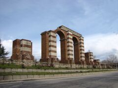
The Eastern Gate
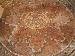
Mosaics in Eirene residence
معرض صور
Statue of the medieval Bulgarian Khan Krum in Plovdiv
- PlovdivCentreNicolaGruev.JPG
A building in the centre
- TheCentralSquarePlovdivNicolaGruev.JPG
The central square
- PlovdivCityCentreNicolaGruev.JPG
The centre of Plovdiv
- PlovdivCentralStreetNicolaGruev.JPG
A typical building in the pedestrian street
- PedestrianStreetPlovdivNicolaGruev.JPG
Another view of the main street
- OldcityPlovdivNicolaGruev.JPG
Houses in the old town of Plovdiv
- Houses in The Old Town-NicolaGruev.jpg
Old town
A view of Plovdiv with Balkan mountain in the background
St. Cyril and Methodius Plovdiv seminary
- Plovdiv old house 1.JPG
The old Plovdiv
انظر أيضاً
الهامش
- ^ "Functional Urban Areas – Population on 1 January by age groups and sex". Eurostat. 1 April 2016. Archived from the original on 23 April 2016. Retrieved 12 April 2016.
- ^ "Population on 1 January by broad age group, sex and metropolitan regions". eurostat.ec. Eurostat. 8 October 2017. Archived from the original on 3 December 2018. Retrieved 26 October 2017.
- ^ "Population and Demographic Processes in 2014 (Final data) – National statistical institute". www.nsi.bg. Archived from the original on 15 November 2016. Retrieved 8 December 2015.
- ^ Cappelen, John; Jensen, Jens. "Bulgarien – Plovdiv" (PDF). Climate Data for Selected Stations (1931–1960) (in الدانمركية). Danish Meteorological Institute. p. 42. Archived (PDF) from the original on 16 January 2013. Retrieved 16 April 2013.
- ^ Bulgarian National Statistical Institute – Bulgarian towns in 2009 Archived 13 نوفمبر 2010 at the Wayback Machine.
- ^ Urban Audit – The City of Plovdiv Archived 15 أبريل 2015 at the Wayback Machine.
- ^ "WorldCityPopulation" Archived 31 مايو 2012 at the Wayback Machine.
- ^ "pop-stat.mashke.org". Pop-stat.mashke.org. Archived from the original on 16 October 2015. Retrieved 3 July 2011.
- ^ (in بلغارية) Bulgarian Academy of Sciences Archived 6 يوليو 2011 at the Wayback Machine.
- ^ "Archived copy". Archived from the original on 11 July 2011. Retrieved 11 January 2010.
{{cite web}}: CS1 maint: archived copy as title (link) - ^ [1] Archived 6 يوليو 2011 at the Wayback Machine
- ^ خطأ استشهاد: وسم
<ref>غير صحيح؛ لا نص تم توفيره للمراجع المسماةocertsi - ^ Bazdar, Osman. Demographic Features of Ottoman Upper Thrace: A Case Study On Filibe, Tatar Pazarcik and Stanımaka (1472–1614). The Institute of Economics and Social Sciencesof Bilkent University. By GRIGOR BOYKOV. In Partial Fulfillment of the Requirements for the Degree of MASTER OF ARTS. Archived from the original. You must specify the date the archive was made using the
|archivedate=parameter. https://www.academia.edu/952671. Retrieved on 25 August 2017. - ^ Art and Society of Bulgaria in the Turkish Period: A Sketch of the Economic, Juridical, and Artistic Preconditions of Bulgarian Post-Byzantine Art and Its Place in the Development of the Art of the Christian Balkans, 1360/70-1700 : a New Interpretation, p. 83
- ^ خطأ استشهاد: وسم
<ref>غير صحيح؛ لا نص تم توفيره للمراجع المسماةegeweb2.ege.edu.tr - ^ Demeter, Gabor. New series of ethnic maps by Zsolt Bottlik. Archived from the original. You must specify the date the archive was made using the
|archivedate=parameter. https://www.academia.edu/25242517. Retrieved on 9 March 2019. - ^ ИЗТОЧНА РУМЕЛИЯ МЕЖДУ ЕВРОПА И ОРИЕНТА Archived 11 يوليو 2011 at the Wayback Machine, посетен на 17 януари 2008 г.
- ^ "Източна Румелия между Европа и Ориента" (in البلغارية). Регионален исторически музей Пловдив. Archived from the original on 11 يوليو 2011. Retrieved 11 يناير 2010.
- ^ "Municipal development plan of Plovdiv (incl. 2001 census data)" (PDF). Archived from the original (PDF) on 14 February 2012. Retrieved 10 August 2011.
- ^ (in بلغارية) Population on 01.02.2011 by provinces, municipalities, settlements and age; National Statistical Institute Archived 14 أغسطس 2013 at WebCite
- ^ Population by province, municipality, settlement and ethnic identification, by 01.02.2011; Bulgarian National Statistical Institute Archived 5 أبريل 2013 at WebCite (in بلغارية)
- ^ خطأ استشهاد: وسم
<ref>غير صحيح؛ لا نص تم توفيره للمراجع المسماةnsi - ^ "Partnership towns of the City of Košice" (in Slovak). 2007-2009 City of Košice Magistrát mesta Košice, Tr. SNP 48/A, 040 11 Košice. Retrieved 12 July 2009.
{{cite web}}: External link in|publisher= - ^ "Twinning Cities". City of Thessaloniki. Retrieved 7 July 2009.
وصلات خارجية
- Official web page
- Pictures from Plovdiv (the old town)
- The Ancient Plovdiv
- Plovdiv web page and virtual tour
- Ancient Plovdiv Municipal Institute
- Map of Plovdiv
- Information for Plovdiv (بلغارية)
قالب:Plovdiv Province قالب:Districts of Plovdiv قالب:Maritsa قالب:Rodopi
- صفحات تستخدم خطا زمنيا
- CS1 الدانمركية-language sources (da)
- Articles with بلغارية-language sources (bg)
- CS1 البلغارية-language sources (bg)
- Short description is different from Wikidata
- Articles containing بلغارية-language text
- Pages using infobox settlement with possible nickname list
- Pages using infobox settlement with possible motto list
- Pages using gadget WikiMiniAtlas
- Pages using infobox settlement with unknown parameters
- Articles with hatnote templates targeting a nonexistent page
- مقالات بالمعرفة بحاجة لذكر رقم الصفحة بالمصدر from August 2021
- مدن بلغاريا
- پلوڤديڤ
- Populated places in Bulgaria
- عواصم سابقة لبلغاريا
- محافظة پلوڤديڤ
- مدن يونانية قديمة
- مدن قديمة


