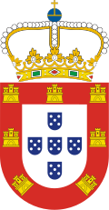
ماديرا
| ماديرا Madeira | |||
| منطقة ذاتية (Região Autónoma) | |||
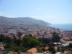
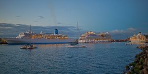
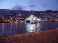
منظر فونشال، عاصمة المنطقة ذات الاستقلال الذاتي.
| |||
|
|
|||
| Official name: Região Autónoma da Madeira | |||
| Name origin: madeira، في البرتغالية تعني غابة | |||
| Motto: Das Ilhas as Mais Belas e Livres (الترجمة: بين كل الجزر، الأجمل والحرة) | |||
| البلد | |||
|---|---|---|---|
| منطقة ذاتية | |||
| المنطقة | المحيط الأطلسي | ||
| Subregion | Tore-Madeira Ridge | ||
| Position | Madeira Platform, Savage Islands submarine mount | ||
| جزر | ماديرا, Porto Santo, Desertas, Selvagens | ||
| العاصمة | فونشال | ||
| أكبر مدينة | فونشال | ||
| - الإحداثيات | 32°39′4″N 16°54′35″W / 32.65111°N 16.90972°W | ||
| أعلى نقطة | Pico Ruivo | ||
| - الموقع | Paul da Serra, سانتانا, ماديرا | ||
| - المنسوب | 1،862 m (6،109 ft) | ||
| أوطى نقطة | Sea level | ||
| - الموقع | المحيط الأطلسي, ماديرا | ||
| - المنسوب | 0 m (0 ft) | ||
| المساحة | 801 km2 (309 sq mi) | ||
| التعداد | 267٬785 (2011) Estimate[1]▲ | ||
| الكثافة | 308.5/km2 (799/sq mi) | ||
| مستوطنة | ح. 1420 | ||
| - استقلال ذاتي اداري | ح. 1895 | ||
| - الاستقلال الذاتي | 1 يوليو 1976 | ||
| الاكتشاف | ح. 1415 | ||
| Management | |||
| - location | Assembleia Regional, Sé, فونشال | ||
| - elevation | 16 m (52 ft) | ||
| - الاحداثيات | 32°38′49.96″N 16°54′29.59″W / 32.6472111°N 16.9082194°W | ||
| الحكومة | |||
| - location | Quinta Vigia, Sé, فونشال | ||
| - elevation | 51 m (167 ft) | ||
| - الإحداثيات | 32°38′42.39″N 16°54′57.16″W / 32.6451083°N 16.9158778°W | ||
| الرئيس (الحكومة) | Miguel Albuquerque | ||
| - President (Assembleia) | José Miguel Jardim d´Olival de Mendonça (PPD-PSD}) | ||
| Timezone | WET (UTC+0) | ||
| - summer (DST) | WEST (UTC+1) | ||
| ISO 3166-2 code | PT-30 | ||
| Postal code | 9XXX-XXX | ||
| Area code | (+351) 291 XXX XXX | ||
| ccTLD | .pt | ||
| Date format | dd-mm-yyyy | ||
| Drive | right-side | ||
| Demonym | Madeiran; Madeirense | ||
| القديس الحامي | Nossa Senhora do Monte | ||
| Holiday | 1 يوليو | ||
| Anthem | [A Portuguesa] Error: {{Lang}}: text has italic markup (help) (national) [Hino da Madeira] Error: {{Lang}}: text has italic markup (help) (regional) | ||
| Currency | Euro (€)[2] | ||
| GDP (nominal) | تقدير 2010 | ||
| - Total | € 5.224 بليون[3] | ||
| - Per capita | € 21,100[3] | ||
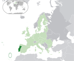
Location of Madeira relative to Portugal (green) and the rest of the European Union (light green)
| |||
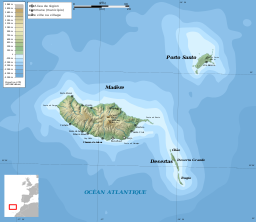
Distribution of the islands of the archipelago (not including the Savage islands)
| |||
| Wikimedia Commons: Madeira | |||
| إحصائيات: Instituto Nacional de Estatística[4] | |||
| الموقع: www.gov-madeira.pt | |||
| Geographic detail from CAOP (2010)[5] produced by Instituto Geográfico Português (IGP) | |||
ماديرا (Madeira؛ /məˈdɪərə/ mə-DEER-ə أو /məˈdɛərə/ mə-DAIR-ə; البرتغالية: [mɐˈðejɾɐ] أو [mɐˈðɐjɾɐ]) هي أرخبيل برتغالي يقع في شمال المحيط الأطلسي، غرب وإلى الجنوب قليلاً من البرتغال. بلغ تعداد سكانها في عام 2011 نحو 267,785.
وتقع جزر ماديرا في شمال غربي أفريقيا وعاصمة الجزر فونشال.
يبلغ سكان ماديرا حوالي 250,000 نسمة، وهاجر اليها المسلمين من المغرب، ويعتقد أنهم يشكلون حوالي 10% من سكان الجزر.
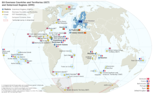
It is just under 400 كيلومتر (250 mi) north of Tenerife, Canary Islands. Since 1976, the archipelago has been one of the two Autonomous regions of Portugal (the other being the Azores, located to the northwest). It includes the islands of Madeira, Porto Santo, and the Desertas, administered together with the separate archipelago of the Savage Islands. It is an outermost region of the European Union.[6]
Madeira was claimed by Portuguese sailors in the service of Prince هنري الملاح in 1419, and settled after 1420. The archipelago is considered to be the first territorial discovery of the exploratory period of the Portuguese Age of Discovery, which extended from 1415 to 1542.
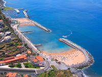
Today, it is a popular year-round resort, being visited every year by about one million tourists.[7] The region is noted for its Madeira wine, flowers, landscapes and embroidery artisans. Its annual New Year celebrations feature the largest fireworks show in the world, as officially recognised by Guinness World Records in 2006.[8][9] The main harbour in Funchal is the leading Portuguese port in cruise liner dockings,[10] being an important stopover for commercial and trans-Atlantic passenger cruises between Europe, the Caribbean and North Africa.
التاريخ
الاستكشاف
Pliny mentioned certain "Purple Islands", their position corresponding to the location of the Fortunate Isles (or Canary Islands), that may have referred to islands of Madeira. Plutarch (Sertorius, 75 AD) referring to the military commander Quintus Sertorius (d. 72 BC), relates that after his return to Cádiz: "...The islands are said to be two in number separated by a very narrow strait and lie 10,000 furlongs from Africa. They are called the Isles of the Blessed...". The estimated distance from Africa, 2،000 كيلومتر (1،200 mi), and the closeness of the two islands, seem to describe the similar position of the islands of Madeira and Porto Santo.
Archeological evidence suggests that the islands may have been visited by the Vikings sometime between 900-1030 AD.[11] This is based on carbon-dated Scandinavian mice bones found on the island and the following extinction of various bird species.
الأسطورة
During the reign of King Edward III of England, lovers Robert Machim and Anna d'Arfet were said to flee from England to France in 1346. They were driven off their course by a violent storm and their ship went aground along the coast of an island, that may have been Madeira. Later this legend was the basis of the naming of the city of Machico, in memory of the young lovers. Its name was transliterated from the name of the young man in the tale.[12]
الاكتشاف
Knowledge of some Atlantic islands, such as Madeira, existed before their formal discovery and settlement, as the islands were shown on maps as early as 1339.[13] From a portolan dating to 1351, and preserved in Florence, Italy, the islands of Madeira appeared to have been discovered long before Portuguese explorers reached them. In Libro del Conocimiento (1348–1349), a Castilian monk identified the location of the islands in their present location, naming them as Leiname (modern Italian legname, cognate of Portuguese madeira, "wood"), Diserta, and Puerto Santo. [بحاجة لمصدر]
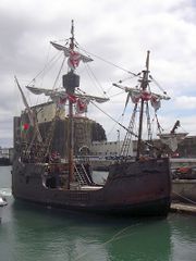
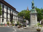
In 1418, two captains under service to Prince Henry the Navigator, João Gonçalves Zarco and Tristão Vaz Teixeira, were driven off-course by a storm to an island which they named Porto Santo (بالعربية: الميناء المقدس) in gratitude for divine deliverance from a shipwreck. The following year, an organised expedition, under the captaincy of Zarco, Vaz Teixeira, and Bartolomeu Perestrello, traveled to the island to claim it on behalf of the Portuguese Crown. Subsequently, the new settlers observed "a heavy black cloud suspended to the southwest."[14] Their investigation revealed it to be the larger island they called Madeira.[15]
الجغرافيا
| ماديرا Madeira | |
| جزيرة (Ilha) | |
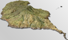
A three-dimensional rendering of topographic maps characterizing the island of Madeira
| |
| Official name: Ilha da Madeira | |
| Name origin: madeira, Portuguese for the wood | |
| Motto: Das ilhas, as mais belas e livres ([Of all islands, the most beautiful and free] Error: {{Lang}}: text has italic markup (help)) | |
| Nickname: Pérola do Atlântico ([Pearl of the Atlantic] Error: {{Lang}}: text has italic markup (help)) | |
| البلد | Portugal |
|---|---|
| Autonomous Region | Madeira |
| Location | Tore-Madeira Ridge, African Tectonic Plate, Atlantic Ocean |
| Archipelago | Madeira |
| أعلى نقطة | Pico Ruivo |
| - الموقع | Pico Ruivo, [(Santana)], Santana |
| - المنسوب | 1،862 m (6،109 ft) |
| أوطى نقطة | Sea level |
| - الموقع | Atlantic Ocean |
| - المنسوب | 0 m (0 ft) |
| الطول | 57 km (35 mi), West-East |
| الاتساع | 22 km (14 mi), North-South |
| المساحة | 740.7 km2 (286 sq mi) |
| Biomes | Temperate, Mediterranean |
| الجيولوجيا | Alkali basalt, Tephra, Trachyte, Trachybasalt |
| Orogeny | Volcanism |
| الفترة | Miocene |
| Demonym | Madeirense; Madeiran |
| Ethnic groups | Portuguese |
| Wikimedia Commons: Madeira | |
| الموقع: http://www.gov-madeira.pt | |
| Statistics from INE (2001); geographic detail from Instituto Geográfico Português (2010) | |
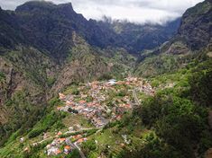
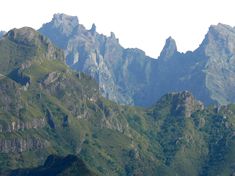

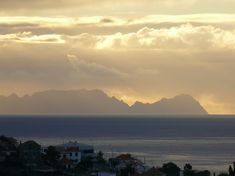
The archipelago of Madeira is located 520 km (280 nmi) from the African coast and 1،000 km (540 nmi) from the European continent (approximately a one-and-a-half hour flight from the Portuguese capital of Lisbon).[16] It is found in the extreme south of the Tore-Madeira Ridge, a bathymetric structure of great dimensions oriented along a north-northeast to south-southwest axis that extends for 1،000 كيلومتر (540 nmi). This submarine structure consists of long geomorphological relief that extends from the abyssal plain to 3500 metres; its highest submersend point is at a depth of about 150 metres (around latitude 36ºN). The origins of the Tore-Madeira Ridge are not clearly established, but may have resulted from a morphological buckling of the lithosphere.[17][18]
الجزر والجـُزَيرات
Madeira (740.7 km2), including Ilhéu de Agostinho, Ilhéu de São Lourenço, Ilhéu Mole (northwest);
Porto Santo (42.5 km2), including Ilhéu de Baixo ou da Cal, Ilhéu de Ferro, Ilhéu das Cenouras, Ilhéu de Fora, Ilhéu de Cima;
Desertas Islands (14.2 km2), including the three uninhabited islands: Deserta Grande Island, Bugio Island and Ilhéu de Chão;
Savage Islands (3.6 km2), archipelago 280 km south-southeast of Madeira Island including three main islands and 16 uninhabited islets in two groups: the Northwest Group (Selvagem Grande Island, Ilhéu de Palheiro da Terra, Ilhéu de Palheiro do Mar) and the Southeast Group (Selvagem Pequena Island, Ilhéu Grande, Ilhéu Sul, Ilhéu Pequeno, Ilhéu Fora, Ilhéu Alto, Ilhéu Comprido, Ilhéu Redondo, Ilhéu Norte).
جزيرة ماديرا
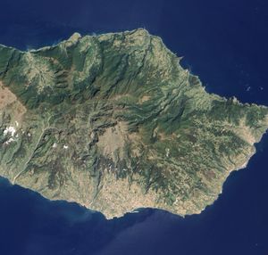
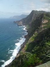
The island of Madeira is at the top of a massive shield volcano that rises about 6 km (20،000 ft) from the floor of the Atlantic Ocean, on the Tore underwater mountain range. The volcano formed atop an east-west rift[19][20] in the oceanic crust along the African Plate, beginning during the Miocene epoch over 5 million years ago, continuing into the Pleistocene until about 700,000 years ago.[21] This was followed by extensive erosion, producing two large amphitheatres open to south in the central part of the island. Volcanic activity later resumed, producing scoria cones and lava flows atop the older eroded shield. The most recent volcanic eruptions were on the west-central part of the island only 6,500 years ago, creating more cinder cones and lava flows.[21]
Madeira Island represents 93% of the archipelago's area, with 90% of the landmass above 500 m. [بحاجة لمصدر] It is the largest island of the group with an area of 741 km2 (286 sq mi), a length of 57 km (35 mi) (from Ponte de São Lourenço to Ponte do Pargo), while approximately 22 km (14 mi) at its widest point (from Ponte da Cruz to Ponte São Jorge), with a coastline of 150 km (90 mi).

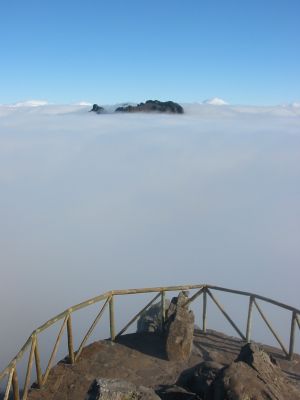
جزيرة ماديرا تشكلت من مجموعة براكين قاعدية، متجمعة في ماسيفين:
المناخ
| بيانات المناخ لـ فونشال، عاصمة ماديرا | |||||||||||||
|---|---|---|---|---|---|---|---|---|---|---|---|---|---|
| الشهر | ينا | فب | مار | أبر | ماي | يون | يول | أغس | سبت | أكت | نوف | ديس | السنة |
| متوسط القصوى اليومية °س (°ف) | 19.1 (66.4) |
19.1 (66.4) |
19.5 (67.1) |
19.6 (67.3) |
20.9 (69.6) |
22.3 (72.1) |
24.3 (75.7) |
25.6 (78.1) |
25.7 (78.3) |
24.2 (75.6) |
22.0 (71.6) |
20.0 (68.0) |
21.8 (71.2) |
| المتوسط اليومي °س (°ف) | 16.1 (61.0) |
16.0 (60.8) |
16.3 (61.3) |
16.5 (61.7) |
17.8 (64.0) |
19.4 (66.9) |
21.2 (70.2) |
22.3 (72.1) |
22.3 (72.1) |
20.9 (69.6) |
18.8 (65.8) |
17.0 (62.6) |
18.6 (65.5) |
| متوسط الدنيا اليومية °س (°ف) | 13.1 (55.6) |
12.8 (55.0) |
13.0 (55.4) |
13.4 (56.1) |
14.6 (58.3) |
16.5 (61.7) |
18.0 (64.4) |
18.9 (66.0) |
18.9 (66.0) |
17.6 (63.7) |
15.6 (60.1) |
13.9 (57.0) |
15.5 (59.9) |
| متوسط تساقط الأمطار mm (inches) | 102.7 (4.04) |
87.2 (3.43) |
63.6 (2.50) |
38.9 (1.53) |
18.9 (0.74) |
11.9 (0.47) |
25 (1.0) |
31 (1.2) |
36.7 (1.44) |
75.0 (2.95) |
100.8 (3.97) |
99.9 (3.93) |
691.6 (27.2) |
| Average rainy days (≥ 0.1 mm) | 12 | 11 | 10 | 8 | 5 | 3 | 1 | 2 | 6 | 9 | 11 | 13 | 91 |
| Mean monthly ساعات سطوع الشمس | 167.4 | 171.1 | 204.6 | 225.0 | 213.9 | 198.0 | 244.9 | 260.4 | 225.0 | 204.6 | 168.0 | 164.3 | 2٬447٫2 |
| Source: World Meteorological Organization (UN),[23] Climatetemp.info[24] for Sunshine hours data | |||||||||||||
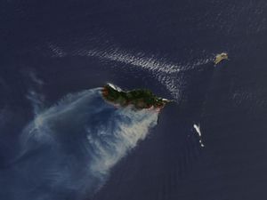
حرائق الغابات
الحيوم
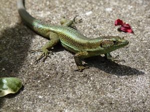
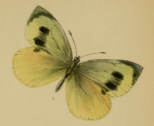
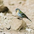
معرض صور الطيور الأصلية
معرض صور النبيت الأصلي
ليڤادا
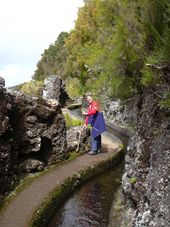
جزيرة ماديرا مطيرة في الشمال الغربي ولكنها جافة في الجنوب الشرقي. In the 16th century the Portuguese started building levadas or aqueducts to carry water to the agricultural regions in the south. The most recent were built in the 1940s. Madeira is very mountainous, and building the levadas was difficult and often sentenced criminals or slaves were used. Many are cut into the sides of mountains, and it was also necessary to dig 25 ميل (40 km) of tunnels, some of which are still accessible.
الحوكمة
Administratively, Madeira (with a population of 267,302 inhabitants in 2011[4]) and covering an area of 768.0 km2 (296.5 sq mi) is organised into eleven municipalities:[25]
| Municipality | Population (2011)[4] |
Area | Main settlement | Parishes |
| Funchal[26] | 111,892 | 75.7 km2 (29.2 sq mi) | Funchal | 10 |
| Santa Cruz[27] | 43,005 | 68.0 km2 (26.3 sq mi) | Santa Cruz | 5 |
| Câmara de Lobos | 35,666 | 52.6 km2 (20.3 sq mi) | Câmara de Lobos | 5 |
| Machico | 21,828 | 67.6 km2 (26.1 sq mi) | Machico | 5 |
| Ribeira Brava | 13,375 | 64.9 km2 (25.1 sq mi) | Ribeira Brava | 4 |
| Calheta | 11,521 | 110.3 km2 (42.6 sq mi) | Calheta | 8 |
| Ponta do Sol | 8,862 | 46.8 km2 (18.1 sq mi) | Ponta do Sol | 3 |
| Santana | 7,719 | 93.1 km2 (35.9 sq mi) | Santana | 6 |
| São Vicente | 5,723 | 80.8 km2 (31.2 sq mi) | São Vicente | 3 |
| Porto Santo[28] | 5,483 | 42.4 km2 (16.4 sq mi) | Vila Baleira | 1 |
| Porto Moniz | 2,711 | 82.6 km2 (31.9 sq mi) | Porto Moniz | 4 |
فونشال
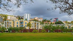
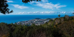
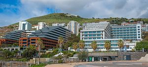
Funchal is the capital and principal city of the Madeira Autonomous Region, located along the southern coast of the island of Madeira. It is a modern city, located within a natural geological "amphitheatre" composed of vulcanological structure and fluvial hydrological forces. Beginning at the harbour (Porto de Funchal), the neighbourhoods and streets rise almost 1،200 متر (3،900 ft), along gentle slopes that helped to provide a natural shelter to the early settlers.
الشتات
Madeiran immigrants in North America mostly clustered in the New England and mid-Atlantic states,Toronto Northern California, and Hawaii. They also settled in Rhode Island and Massachusetts to participate in the flourishing American whaling industry. [بحاجة لمصدر] By 1980, the U.S. Census registered more than a million Americans of Portuguese descent, a large portion Madeirans. [بحاجة لمصدر] The city of New Bedford is especially rich in Madeirans, hosting the Museum of Madeira Heritage, as well as the annual Madeiran and Luso-American celebration, the Feast of the Blessed Sacrament, the world's largest celebration of Madeiran heritage, regularly drawing crowds of tens of thousands to the city's Madeira Field. A Large group of Madeirans and Madeiran decedents are centered around the Greater Toronto Area having emigrated from the Madeiran Island in the early 50's and 60's. They are proud members of the Multicultural mix of Toronto.
الاقتصاد

السياحة
النقل
الثقافة

الموسيقى
المقاطعات الشقيقة
Madeira Island has the following sister provinces:
 - Autonomous Region of Aosta Valley, Italy (1987)
- قالب:Country data JER - Bailiwick of Jersey, British Crown Dependencies (1998)
 - Eastern Cape Province, South Africa
 – Jeju Province, South Korea (2007)
 - Gibraltar, British Overseas Territory
الجاليات الماديرية
Madeira Island has large Cultural Communities around the world :
- New Bedford, Newark, Hawaii الولايات المتحدة
- Toronto, Canada
- Johannesburg , South Africa
- Jersey, London, United Kingdom
- Caracas, Venezuela
- São Paulo, Brazil
طوابع بريدية
Portugal has issued postage stamps for Madeira during several periods, beginning in 1868.
أبناء بارزون


The following people were either born or have lived part of their lives in Madeira:
- António de Abreu, naval officer and navigator
- Bruno Aguilar, composer and famous singer from Madeira and international hotels. Work in the best hotels in the world, like Tokyo, Dubai, Qatar, etc.
- ناديا ألمادا، a winner of the British reality show Big Brother
- منسه بن إسرائيل، حاخام يهودي بارز.
- جو براردو, Portuguese millionaire, and art collector
- Pedro Macedo Camacho, composer
- كارل الأول من النمسا، deposed monarch, died in exile on Madeira in 1922
- Catarina Fagundes, Olympic athlete for windsurf
- Vânia Fernandes, Portuguese singer who represented Portugal in Eurovision 2008
- José Vicente de Freitas, military and politician
- Vasco da Gama Rodrigues, poet, born in Paul do Mar
- Teodósio Clemente de Gouveia, Cardinal of the Roman Catholic Church
- Herberto Hélder, poet
- Moisés Henriques, former Australian Under-19 Captain and current NSW Blues cricketer
- Alberto João Jardim, second President of the Regional Government
- Luís Jardim, producer of music
- Paul Langerhans, German pathologist and biologist
- Fátima Lopes, fashion designer
- Jaime Ornelas Camacho, first and former President of the Regional Government
- Aires de Ornelas e Vasconcelos, former Archbishop of the former Portuguese colonial enclave Goa (in India)
- Sir Lloyd William Matthews, British naval officer, politician and abolitionist
- Dionísio Pestana, president of the Pestana Group
- Rigo 23, artist
- João Rodrigues, Olympic windsurfer
- كريستيانو رونالدو، Real Madrid, Portugal and former Manchester United football player
- John Santos, photographer
- Ana da Silva, founding member of the post-punk band The Raincoats
- Manoel Dias Soeyro or Menasseh Ben Israel (1604–1657), Sephardi Rabbi and publisher
- Artur de Sousa Pinga, former CS Marítimo and FC Porto football player
- Maximiano de Sousa (Max), popular singer, born in Funchal
- Virgílio Teixeira, actor
- José Travassos Valdez, 1st Count of Bonfim, governor in 1827–1828
- Miguel Albuquerque, third and current President of the Regional Government
انظر أيضاً
- مطار ماديرا
- Madeira Island Open, an annual European Tour golf tournament.
- Surfing in Madeira
- Have Some Madeira M'Dear
- Madeira cake
الهامش
- ملاحظات
- ^ http://www.ine.pt/scripts/flex_v10/Main.html
- ^ Until 2002, the Portuguese escudo was used in financial transactions, and until 1910 the Portuguese real was the currency used by the monarchy of Portugal.
- ^ أ ب "Regiões de Portugal". AICEP.
- ^ أ ب ت INE, ed. (2010) (in Portuguese), Censos 2011 - Resultadas Preliminares, Lisbon, Portugal: Instituto Nacional de Estatística, http://www.ine.pt/xportal/xmain?xpid=INE&xpgid=ine_publicacoes&PUBLICACOESpub_boui=122114780&PUBLICACOESmodo=2, retrieved on 1 July 2011 خطأ استشهاد: وسم
<ref>غير صالح؛ الاسم "INE" معرف أكثر من مرة بمحتويات مختلفة. - ^ IGP, ed. (2010) (in Portuguese), Carta Administrativa Oficial de Portugal, Lisbon, Portugal: Instituto Geográfico Português, http://www.igeo.pt/produtos/cadastro/caop/download/Areas_Freg_Mun_Dist_CAOP2010.zip, retrieved on 1 July 2011
- ^ "EUROPA - Glossary - Outermost regions". Europa.eu. 17 July 2008. Retrieved 30 July 2010.
- ^ "Hotelaria da Madeira suaviza quebras em 2010 apesar de impacto devastador dos temporais". presstur.com. October 2, 2011. Retrieved 16 September 2011.
- ^ [1][dead link]
- ^ "A Guinness World Record Fireworks Show – Madeira Island, 2006-2007 New Year Eve at Wayfaring Travel Guide". Wayfaring.info. Retrieved 16 September 2011.
- ^ "Madeira welcomes most cruisers". The Portugal News. Retrieved 12 March 2013.
- ^ World Archaeology, Issue 66, August/September 2014, Volume 6, No. 6, page 64.
- ^ Nicholas Cayetano de Bettencourt Pitta, 1812, p.11-17
- ^ Fernández-Armesto, Felipe (2004). "Machim (supp. fl. 14th cent.)". Oxford Dictionary of National Biography. Oxford: Oxford University Press. doi:10.1093/ref:odnb/17535. Retrieved 2 September 2009.
- ^ Nicholas Cayetano de Bettencourt Pitta, 1812, p.20
- ^ The discoveries of Porto Santo and Madeira were first described by Gomes Eanes de Zurara in Chronica da Descoberta e Conquista da Guiné. (Eng. version by Edgar Prestage in 2 vols. issued by the Hakluyt Society, London, 1896–1899: The Chronicle of Discovery and Conquest of Guinea.) French author Arkan Simaan refers to these discoveries in his historical novel based on Azurara's Chronicle: L'Écuyer d'Henri le Navigateur (2007), published by Éditions l'Harmattan, Paris.
- ^ "Madeira Islands Tourism". Madeiraislands.travel. Retrieved 30 July 2010.[dead link]
- ^ Ribeiro et al., 1996
- ^ Kullberg & Kullberg, 2000
- ^ Geldemacher et al., 2000
- ^ Ribeiro, 2001
- ^ أ ب خطأ لوا: expandTemplate: template "cite web archived" does not exist.
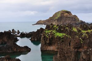
- ^ http://www.tripadvisor.com/Attraction_Review-g644297-d1928951-Reviews-Lava_Pools-Porto_Moniz_Madeira_Madeira_Islands.html
- ^ "Weather Information for Funchal". June 2011. Retrieved 29 March 2011.
- ^ "Funchal, Madeira Climate, Temperature, Average Weather History, Rainfall/Precipitation, Sunshine".
- ^ Map of municipalities at FreguesiasDePortugas l.com
- ^ Statistics include Savage Islands, which are administered by the parish of Sé
- ^ Statistics include the mainland parish of Santa Cruz and the islands of the Desertas
- ^ Statistics represent island population; Porto Santo is the second largest island in the archipelago of Madeira
- مراجع
- Pitta, Nicholas Cayetano de Bettencourt (1812). Account of the Island of Madeira. London, England: C.Stewart Printer.
81. Making the Black Atlantic: Britain and the African Diaspora, by James Walvin, 2000.
مصادر
- الأقليات المسلمة في أفريقيا - سيد عيد المجيد بكر
وصلات خارجية
- صفحات المعرفة التي فيها البلد أو التقسيم غير معروف
- Pages using gadget WikiMiniAtlas
- Articles with dead external links from September 2011
- Articles with dead external links from March 2011
- Articles containing برتغالية-language text
- Coordinates on Wikidata
- Pages using deprecated coordinates format
- Pages using geobox2 unit with unknown unit type
- Lang and lang-xx template errors
- Geobox usage tracking for region type
- Articles with hatnote templates targeting a nonexistent page
- مقالات ذات عبارات بحاجة لمصادر
- Geobox usage tracking for other type
- جزيرة ماديرا
- جزر مكارونيزيا
- Autonomous regions of Portugal
- NUTS 2 statistical regions of Portugal
- المناطق النائية للاتحاد الاوروبي
- براكين البرتغال
- براكين المحيط الأطلسي
- Wine regions of Portugal
- ماديرا
- أرخبيلات المحيط الأطلسي
- شمال أفريقيا
- Integral overseas territories
- أماكن مأهولة تأسست في عقد 1420
- تأسيسات عقد 1420 في الامبراطورية البرتغالية
- دول وأراضي تأسست في 1976
- تأسيسات 1976 في البرتغال
- انحلالات 1976 في الامبراطورية البرتغالية
