كمپالا
كمپالا
Kampala | |
|---|---|
 Counter-clockwise from top: Panoramic view of central Kampara, Bahá'i Temple, Makerere University, panoramic view of Lake Victoria, Kampara Worker's House, Gaddafi National Mosque | |
 كمپالا موقع كمبالا في أوغندا وأفريقيا | |
| الإحداثيات: 00°18′49″N 32°34′52″E / 0.31361°N 32.58111°E | |
| البلد | |
| المحافظة | كمپالا (محافظة) |
| الحكومة | |
| • Lord Mayor | Erias Lukwago |
| • Executive Director | Andrew Kitaka Mubiru[1] |
| المساحة | |
| • الإجمالي | 189 كم² (73 ميل²) |
| • البر | 176 كم² (68 ميل²) |
| • الماء | 13 كم² (5 ميل²) |
| المنسوب | 1٬190 m (3٬900 ft) |
| التعداد (2014 Census) | |
| • الإجمالي | 1٬507٬080 |
| • الكثافة | 7٬928/km2 (20٬530/sq mi) |
| منطقة التوقيت | UTC+3 (EAT) |
| الموقع الإلكتروني | www |


كمبالا (Kampala ؛ UK /kæmˈpɑːlə/,[2][3] الأمريكي /kɑːmˈʔ/)[2][4]) هي عاصمة أوغندا وأكبر مدنها إذ يصل عدد سكانها لما يزيد 1.2 مليون نسمة. ترتفع عن سطح البحر بمعدل 1189 م وتطل على شواطئ بحيرة فكتوريا. The city is divided into five boroughs that oversee local planning: Kampala Central Division, Kawempe Division, Makindye Division, Nakawa Division, and Rubaga Division. Surrounding Kampala is the rapidly growing Wakiso District, whose population more than doubled between 2002 and 2014 and as of 2014 Wakiso was reported to stand at over 2 million.[5]
Kampala was named the 13th fastest growing city on the planet, with an annual population growth rate of 4.03 percent,[6] by City Mayors. Kampala has been ranked the best city to live in East Africa[7] ahead of Nairobi and Kigali by Mercer, a global development consulting agency based in New York City.
أصل الاسم
The name Kampala originally referred to only the present-day Old Kampala hill on whose summit was located the former Fort Lugard and the headquarters of the British Colonialist in the soon to be Uganda Protectorate. Prior to the British occupation and construction of Fort Lugard, this hill was a hunting reserve of the Kabaka of Buganda and had several species of antelope, particularly the impala. When the British arrived, they called this place " The Hill of the Impala". Later on, the Baganda in whose territory this British Settlement was located, translated "Hill of the Impala" as Akasozi ke'Empala – "Kasozi" meaning "hill", "ke" meaning "of", and "empala" the plural of "impala". In Luganda, the words "ka'mpala" mean "that it is of the impala", in reference to a hill, and the single word "Kampala" came to refer to the British colonial Settlement that later developed out of the occupied Old Kampala hill near the pre-existing Kibuga (capital) of Buganda Kingdom.''.[8]
التاريخ
This area of numerous hills that later become known as Kampala was the core of the highly centralized Buganda Kingdom and site of the location of shifting Kibuga(capitals) and of its different Bassekabaka(Kings). Each Kabaka(king) would set up his Kibuga(capital)on a new and different hill in this area, the first written description of this Kibuga was by the explorer Richard Francis Burton in his book The Lake Region of East Africa published in 1860.
In the book, Burton relying on the information collected by Snay Bin Amir, an Arab trader, described the Kibuga as “…the settlement is not less than a day’s journey in length, the buildings are of cane and rattan. The sultan (Kabaka)’s palace is at least a mile long and the circular huts neatly arranged in a line are surrounded by a strong fence which has only four gates.
in 1862 when explorer John Speke arrived in the Buganda Kingdom Mutesa I of Buganda was king and his Kibuga(Capital) was at Bandabarogo present-day Banda hill. Later on, in 1875 explorer Henry Morton Stanley reported the capital as being at present-day Lubaga hill were he met the same Kabaka Mutesa I. And during this visit, Henry Stanley Morton wrote a letter that was published in the Daily Telegraphy inviting missionaries to come to Buganda.
In 1877 the first lot of missionaries of Church Mission Society who were of the protestant faith, arrived from the United Kingdom to Buganda and were given Namirembe hill and two years later in 1879 the catholic White Fathers missionaries also arrived in Buganda and were also given another hill Lubaga hill. The arrival of these two missionaries groups laid the ground for the Religious wars of 1888 to 1892 between their new converts and forcing the missionaries from Britain to then lobby for the British government to take over Buganda/Uganda as a protectorate.
In 1890 Frederick Lugard, an agent of the Imperial British East Africa Company, arrived in Buganda during the reign of Ssekabaka Mwanga II with whom he signed a treaty of protection by the British government over Buganda and whose Kibuga(Capital) was at Mengo hill. Captain Lugard would, later on, be allocated the hill that would soon be known as Old Kampala were he built a fort.
In 1895, Mengo Senior School the first school offering Western Education in Kampala was opened by the Church Missionary Society at Namirembe hill were mostly children of chiefs and pages of the Royal palaces were the students.
In 1897 Ssekabaka Mwanga would rebel and wage a war against British rule and was subsequently captured and deported in 1899 to Seychelles alongside Omukama Kabalega and Mwanga's son who was 3 years old at the time was made the King by the combined forces of the British officers, Nubian soldiers and Baganda collaborators and culminating in the signing of the Buganda Agreement (1900) that formalized British colonial rule in Buganda.
In 1897, Kampala's first Western-style health facility Mengo Hospital was opened on Namirembe hill by British Doctor and missionary Sir Albert Ruskin Cook would also, later on, founded Mulago Hospital the current National Referral Hospital in 1913 at Mulago hill. In 1899, Missionary Sisters of Our Lady of Africa would open Lubaga Hospital at Lubaga hill.
This agreement by Sir Harry Johnston created new land tenures such as Freehold, Crownland, Mailo and divided up and allocated the land in such a way would that would come to define the development of Kampala.
The Land in Buganda's capital (Kibuga) included Mengo hill,Makerere hill, etc was allocated to the young king of Buganda, the Baganda colonial collaborators, etc under mailo and freehold.
The Religious Missions were also formally allocated land they were previously occupying including Catholic White Fathers who got Lubaga hill, the Protestant Church Missionary Society got Namirembe hill, the Muslims under Prince Nuhu Mbogo's leadership received Kibuli hill and the Catholic Saint Joseph's Missionary Society of Mill Hill from Britain received most of Nsambya hill. and finally, the Uganda colonial/Protectorate government got land classified as crownland in the area such as Old Kampala hill, Nakasero Hill, etc this would be formalized by the Uganda Crownland Ordinance of 1903.
In 1906, the Crownland consisting of Old Kampala and Nakasero hills and covering 567 Hectares(5.67sqkm) was consolidated and gazetted as Kampala Township and by 1912 when Kampala Township first got its first land-use plan the Township had a population of 2,850 people who were mostly European and Asians.[9]
In 1922,Makerere University Kampala's oldest University was founded as the Uganda Technical College at the present Makerere hill and offered carpentry, building construction and mechanics, arts, education, agriculture, and medicine.
In 1930 another planning scheme (land use plan) was introduced to regulate developments within the township. The 1930 land-use plan for Kampala segregated residential, industrial and commercial areas as well as a planned civic center.[9]
In 1930 the first sewerage plan was prepared targeting a population of 20,000 people in Nakasero and Old Kampala areas of the Kampala township. This plan guided sewerage development from 1936–1940 in planned urban areas of the Kampala Township and excluded the Kibuga area occupied by the Baganda and other natives.[10]
In 1931, the Uganda Railway line reached Kampala connecting Kampala to Mombasa Port thirty-five years from the commencement of its construction.[11]
In 1938, The East African Power & Lighting Company was granted a license for thermal electric power generation and distribution for towns of Kampala and Entebbe and in the same year Governor Sir Philip Mitchel switched on Kampala and Uganda's first electric street lights.[12],[13]
In 1945, Ernst May a German Architect was commissioned by Uganda Protectorate Government to design a new physical plan for Kampala. Ernst May's plan 0f 1947 was intended to extend Kampala eastwards covering Kololo hill, Naguru hill and with commercial center on the southern slopes of Nakasero hill, an industrial zone in the southeast of Kampala and for the first time a planned residential zone for the Ugandan natives.[14] The plan was never fully implemented and 1951 the third physical plan by Henry Kendall was instead adopted though it incorporated some elements of Ernst May's 1947 plan.[14]


Henry Kendall's 1951 plan expanded Kampala from the 5.67sqkm area of 1930 plan to an area of 28sqkm incorporating areas like Kololo hill, Industrial Area, etc. However, like the first two planning schemes, the 1951 plan failed to achieve many of its stated objectives[9]
On 9th October of 1962, Uganda gained independence subsequently the capital city was transferred from Entebbe to Kampala and in the same year, Kampala was granted City status.
In 1968, five years after Uganda attaining Independence the Boundaries of Kampala were expanded incorporating the Kibuga(now known as Mengo Municipality), Kawempe and Nakawa Townships, areas of Muyenga, Ggaba, etc.[15] This increased administrative area of Kampala from 28sqkm to the current 189sqkm.
In 1972, the fourth physical plan for Kampala was made covering the newly incorporated areas of Kampala's boundary extensions of 1968 but the subsequent political and economic turmoil of the 1970s and 1980s meant the plan was never implemented.[15],[16] Similarly, the fifth physical plan for Kampala made in 1994, like 1972 plan was never also implemented.
In 2010 Kampala Capital City Authority act was enacted giving the government more control of the administration Kampala city and the act also created the Kampala Metropolitan Physical Planning Authority with aims of improving the infrastructure of the Kampala proper and the surrounding areas of Wakiso district, Mukono Town, and parts of Mpigi and Luwero districts.[17]
Geography

Several neighbourhoods of Kampala are bordering Lake Victoria.
Climate
Kampala has a tropical rainforest climate (Af) under the Köppen-Geiger climate classification system.[18]
A facet of Kampala's weather is that it features two annual wetter seasons. While the city does not have a true dry season month, it experiences heavier precipitation from August to December and from February to June. However, it's between February and June that Kampala sees substantially heavier rainfall per month, with April typically seeing the heaviest amount of precipitation at an average of around 169 millimetres (6.7 in) of rain. Kampala has been frequently described as the lightning-strike capital of the world.
| Climate data for Kampala | |||||||||||||
|---|---|---|---|---|---|---|---|---|---|---|---|---|---|
| Month | Jan | Feb | Mar | Apr | May | Jun | Jul | Aug | Sep | Oct | Nov | Dec | Year |
| Record high °C (°F) | 33 (91) |
36 (97) |
33 (91) |
33 (91) |
29 (84) |
29 (84) |
29 (84) |
29 (84) |
31 (88) |
32 (90) |
32 (90) |
32 (90) |
36 (97) |
| Mean daily maximum °C (°F) | 28.6 (83.5) |
29.3 (84.7) |
28.7 (83.7) |
27.7 (81.9) |
27.3 (81.1) |
27.1 (80.8) |
26.9 (80.4) |
27.2 (81.0) |
27.9 (82.2) |
27.7 (81.9) |
27.4 (81.3) |
27.9 (82.2) |
27.8 (82.0) |
| Daily mean °C (°F) | 23.2 (73.8) |
23.7 (74.7) |
23.4 (74.1) |
22.9 (73.2) |
22.6 (72.7) |
22.4 (72.3) |
22.0 (71.6) |
22.2 (72.0) |
22.6 (72.7) |
22.6 (72.7) |
22.5 (72.5) |
22.7 (72.9) |
22.7 (72.9) |
| Mean daily minimum °C (°F) | 17.7 (63.9) |
18.0 (64.4) |
18.1 (64.6) |
18.0 (64.4) |
17.9 (64.2) |
17.6 (63.7) |
17.1 (62.8) |
17.1 (62.8) |
17.2 (63.0) |
17.4 (63.3) |
17.5 (63.5) |
17.5 (63.5) |
17.6 (63.7) |
| Record low °C (°F) | 12 (54) |
14 (57) |
13 (55) |
14 (57) |
15 (59) |
12 (54) |
12 (54) |
12 (54) |
13 (55) |
13 (55) |
14 (57) |
12 (54) |
12 (54) |
| Average rainfall mm (inches) | 68.4 (2.69) |
63.0 (2.48) |
131.5 (5.18) |
169.3 (6.67) |
117.5 (4.63) |
69.2 (2.72) |
63.1 (2.48) |
95.7 (3.77) |
108.4 (4.27) |
138.0 (5.43) |
148.7 (5.85) |
91.5 (3.60) |
1٬264٫3 (49.77) |
| Average rainy days (≥ 1.0 mm) | 4.8 | 5.1 | 9.5 | 12.2 | 10.9 | 6.3 | 4.7 | 6.7 | 8.6 | 9.1 | 8.4 | 7.4 | 93.7 |
| Average relative humidity (%) | 66 | 68.5 | 73 | 78.5 | 80.5 | 78.5 | 77.5 | 77.5 | 75.5 | 73.5 | 73 | 71.5 | 74.5 |
| Mean monthly sunshine hours | 155 | 170 | 155 | 120 | 124 | 180 | 186 | 155 | 150 | 155 | 150 | 124 | 1٬824 |
| Source 1: World Meteorological Organization,[19] Climate-Data.org for mean temperatures[18] | |||||||||||||
| Source 2: BBC Weather[20] | |||||||||||||
الروابي

Kampala was originally built on seven hills, but it has expanded to cover more than the original seven hills.
معرض صور
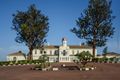
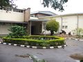
Mengo Palace
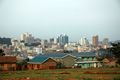
Kampala skyline
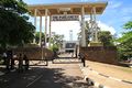
Entrance to the Parliament building
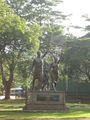
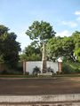
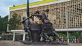
Stride monument
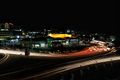
Kampala City by night
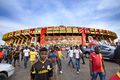
Nelson Mandela National Stadium, the home of the National Football team, the Uganda Cranes
Independence Monument
Namugongo Martyrs Shrine
Uganda Museum
National Theatre
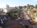
Street in the city centre
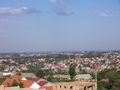
A view of suburban Kampala
A view of suburban Kampala


_04.JPG&filetimestamp=20190903084523&)


_02.JPG&filetimestamp=20190903084521&)


النقل

المصادر
- ^ Salim Segawa (18 December 2018). "Who Is Andrew Kitaka Mubiru, The KCCA Acting Executive Director?". Kampala: PulseLive Uganda. Retrieved 24 August 2019.
- ^ أ ب "Kampala". Collins English Dictionary. HarperCollins. Retrieved 2 August 2019.
- ^ قالب:Cite Oxford Dictionaries
- ^ "Kampala". The American Heritage Dictionary of the English Language (5th ed.). HarperCollins. Retrieved 2 August 2019.
- ^ "Uganda: Administrative Division (Regions and Districts)". CityPopulation.de. 2019-07-01. Retrieved 2019-08-27.
- ^ "City Mayors: World's fastest growing urban areas (1)". www.citymayors.com.
- ^ Muhindo, Clare (2016-02-26). "Kampala Ranked Best City In East Africa". New Vision. Retrieved 2019-08-27.
- ^ "Kampala: Origin of The Name". Myetymology.com. Archived from the original on 31 December 2013. Retrieved 11 June 2014.
{{cite web}}: Unknown parameter|dead-url=ignored (|url-status=suggested) (help) - ^ أ ب ت Nyakwebara, C (2010). "Chronology of Planning in Kampala: Implications for Future Structure Planning". The Urban Planning Magazine. No. 1. pp. 3–6.
- ^ Nilsson, David (2006). "A heritage of unsustainability? Reviewing the origin of the large-scale water and sanitation system in Kampala, Uganda". Environment and Urbanization. SAGE Publications. 18 (2): 369–385. doi:10.1177/0956247806069618. ISSN 0956-2478.
- ^ Lubega, Henry (2015-04-18). "History of Uganda Railway". Daily Monitor. Retrieved 2019-08-27.
- ^ Gore, Christopher D. (2017). Electricity in Africa: The Politics of Transformation in Uganda. Boydell & Brewer. p. 34. ISBN 978-1-84701-168-8.
- ^ Mugabe, Faustin (2018-04-20). "110 years of electricity in Uganda". Daily Monitor. Retrieved 2019-08-27.
- ^ أ ب Pinther, Kerstin; Förster, Larissa; Hanussek, Christian (2012). Afropolis: City Media Art. Jacana Media. p. 59. ISBN 978-1-4314-0325-7.
- ^ أ ب Situation Analysis of Informal Settlements in Kampala (PDF). United Nations Human Settlements Programme. 2007.
- ^ Omolo-Okalebo, Fredrick (Jan-Feb 2011). "Perspectives on City Planning of Post Independence Kampala: The Emergence of the Metropolitan Growth Model and the Hexagonal Cell" in Second International Conference on Advances in Engineering and Technology.: 64–71.
- ^ "Kampala Capital City Act, 2010". Uganda Legal Information Institute. 2010-12-28. Retrieved 2019-08-27.
- ^ أ ب "Kampala Climate". Climate-Data.org. Retrieved 2019-08-27.
- ^ "World Weather Information Service: Kampala". World Meteorological Organization. Retrieved 2019-08-27.
- ^ "Kampala". BBC Weather. Retrieved 2019-08-27.
وصلات خارجية
![]() Kampala travel guide from Wikivoyage
Kampala travel guide from Wikivoyage
- Official website
- Musinguzi, Bamuturaki (2016-01-29). "Kampala now mapping its historical buildings". The East African. Retrieved 2019-08-26.
- Google (10 August 2019). "Kampala" (Map). Google Maps. Google. Retrieved 10 August 2019.
{{cite map}}: Invalid|mode=CS2(help)
- Pages using gadget WikiMiniAtlas
- CS1 errors: unsupported parameter
- Short description is different from Wikidata
- Coordinates on Wikidata
- Official website different in Wikidata and Wikipedia
- كمپالا
- Capitals in Africa
- مدن في الوادي المتصدع الأكبر
- Populated places in Uganda
- Populated places on Lake Victoria
- Central Region, Uganda