شفيلد
شفيلد
Sheffield | |
|---|---|
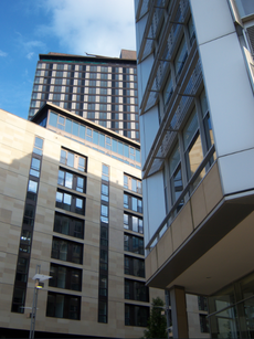
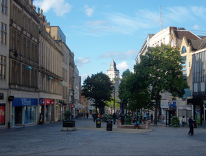
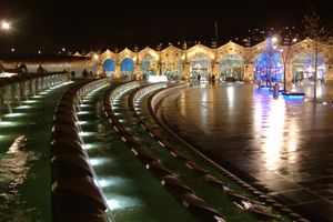
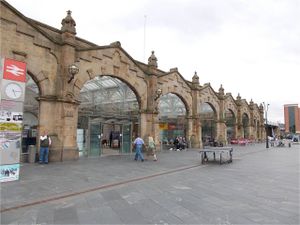
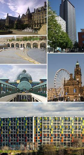 مع عقارب الساعة من أعلى اليسار: مبنى بلدية شفيلد؛ St Paul's Tower from Arundel Gate; the Wheel of Sheffield; Meadowhall shopping centre; محطة شفيلد and Sheaf Square. Park Hill at the bottom. | |
| الكنية: "مدينة الصلب" | |
| الشعار: "Deo Adjuvante Labor Proficit" "With God's help our labour is successful" | |
 شفيلد في جنوب يوركشاير | |
الموقع في المملكة المتحدة | |
| الإحداثيات: 53°23′01″N 1°28′01″W / 53.38361°N 1.46694°W | |
| الدولة | المملكة المتحدة |
| البلد المكون | إنگلترة |
| المنطقة | يوركشاير والهمبر |
| Ceremonial county | جنوب يوركشاير |
| المقاطعة التاريخية | يوركشاير Urban core and outlying areas دربيشاير بعض الضواحي الجنوبية |
| Founded | ح. القرن الثامن |
| Town charter | 10 August 1297 |
| City status | 1893 |
| Administrative HQ | Sheffield Town Hall |
| الحكومة | |
| • النوع | Metropolitan borough, مدينة |
| • الكيان الحاكم | مجلس مدينة شفيلد |
| • Lord Mayor | طالب حسين (ع) |
| • زعيم المجلس | Julie Dore (L) |
| • MPs: | Clive Betts (ع) Paul Blomfield (ع) Nick Clegg (LD) Louise Haigh (ع) Vacant[1] Angela Smith (ع) |
| المساحة | |
| • City | 367٫94 كم² (142٫06 ميل²) |
| التعداد (2008 تق.) | |
| • City | 551٬800 (Ranked 3rd) |
| • الكثافة | 1٬500/km2 (4٬000/sq mi) |
| • Urban | 640٬720 (Sheffield urban area) |
| • الكثافة الحضرية | 3٬949٫2/km2 (10٬228/sq mi) |
| • العمرانية | 1٬569٬000 [2] |
| صفة المواطن | Sheffielder |
| منطقة التوقيت | UTC+0 (Greenwich Mean Time) |
| Postcode | |
| مفتاح الهاتف | 0114 |
| الموقع الإلكتروني | www.sheffield.gov.uk |
شفيلد (Sheffield ؛ /ˈʃɛfiːld/) هي مدينة وmetropolitan borough in South Yorkshire, England. Historically part of the West Riding of Yorkshire, its name derives from the River Sheaf, which runs through the city. With some of its southern suburbs annexed from Derbyshire, the city has grown from its largely industrial roots to encompass a wider economic base. The population of the City of Sheffield is 551,800 (2008 تق.)[3] and it is one of the eight largest regional English cities that make up the Core Cities Group.[4] Sheffield is the third largest English district by population. The metropolitan population of Sheffield is 1,569,000.[2]
In the 19th century, Sheffield gained an international reputation for steel production. Many innovations were developed locally, including crucible and stainless steel, fuelling an almost tenfold increase in the population in the Industrial Revolution. Sheffield received its municipal charter in 1843, becoming the City of Sheffield in 1893. International competition in iron and steel caused a decline in these industries in the 1970s and 1980s, coinciding with the collapse of coal mining in the area.
The 21st century has seen extensive redevelopment in Sheffield along with other British cities. Sheffield's gross value added (GVA) has increased by 60% since 1997, standing at £9.2 billion in 2007. The economy has experienced steady growth averaging around 5% annually, greater than that of the broader region of Yorkshire and the Humber.[5]
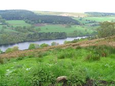
The city is in the valleys of the River Don and its four tributaries, the Loxley, the Porter Brook, the Rivelin and the Sheaf. 61% of Sheffield's entire area is green space, and a third of the city lies within the Peak District national park.[6] There are more than 250 parks, woodlands and gardens in the city,[6] and an estimated 2 million trees, giving Sheffield the highest ratio of trees to people of any city in Europe.[6] The city has a long sporting heritage, and is home to the world's oldest football club.[7]
التاريخ
الحكم
الجغرافيا

|
Rotherham, Doncaster | Barnsley, Leeds, Wakefield | Huddersfield, Penistone | 
|
| Worksop, Retford, Lincoln | Manchester, Glossop | |||
| Mansfield, Newark, Nottingham | Chesterfield, Dronfield, Derby | Buxton, Bakewell, Matlock |
المناخ
| Climate data for كاتدرائية شفيلد ، ارتفاع: 131م (1981–2010) الدرجات القصوى (1960–الحاضر) | |||||||||||||
|---|---|---|---|---|---|---|---|---|---|---|---|---|---|
| Month | Jan | Feb | Mar | Apr | May | Jun | Jul | Aug | Sep | Oct | Nov | Dec | Year |
| Record high °C (°F) | 13.9 (57.0) |
17.6 (63.7) |
23.3 (73.9) |
24.8 (76.6) |
28.2 (82.8) |
30.7 (87.3) |
33.3 (91.9) |
34.3 (93.7) |
28.4 (83.1) |
25.7 (78.3) |
17.6 (63.7) |
17.6 (63.7) |
34.3 (93.7) |
| Mean daily maximum °C (°F) | 6.8 (44.2) |
7.1 (44.8) |
9.8 (49.6) |
12.5 (54.5) |
16.1 (61.0) |
18.8 (65.8) |
21.1 (70.0) |
20.6 (69.1) |
17.7 (63.9) |
13.5 (56.3) |
9.5 (49.1) |
6.9 (44.4) |
13.4 (56.1) |
| Daily mean °C (°F) | 4.4 (39.9) |
4.4 (39.9) |
6.6 (43.9) |
8.7 (47.7) |
11.8 (53.2) |
14.7 (58.5) |
16.9 (62.4) |
16.5 (61.7) |
14.0 (57.2) |
10.5 (50.9) |
7.0 (44.6) |
4.6 (40.3) |
10.0 (50.0) |
| Mean daily minimum °C (°F) | 1.9 (35.4) |
1.7 (35.1) |
3.3 (37.9) |
4.8 (40.6) |
7.5 (45.5) |
10.5 (50.9) |
12.7 (54.9) |
12.4 (54.3) |
10.3 (50.5) |
7.5 (45.5) |
4.5 (40.1) |
2.3 (36.1) |
6.6 (43.9) |
| Record low °C (°F) | −9.2 (15.4) |
−8.3 (17.1) |
−8.3 (17.1) |
−6.6 (20.1) |
−0.7 (30.7) |
1.4 (34.5) |
3.9 (39.0) |
4.2 (39.6) |
1.9 (35.4) |
−4.1 (24.6) |
−7.2 (19.0) |
−9.1 (15.6) |
−9.2 (15.4) |
| Average precipitation mm (inches) | 83.4 (3.28) |
60.4 (2.38) |
63.4 (2.50) |
65.5 (2.58) |
53.8 (2.12) |
75.6 (2.98) |
56.0 (2.20) |
65.3 (2.57) |
63.8 (2.51) |
81.2 (3.20) |
79.4 (3.13) |
86.7 (3.41) |
834.6 (32.86) |
| Average rainy days (≥ 1.0 mm) | 13.4 | 10.5 | 12.3 | 10.3 | 9.6 | 9.1 | 9.2 | 9.9 | 8.9 | 12.7 | 12.6 | 13.0 | 131.6 |
| Mean monthly sunshine hours | 45.2 | 68.3 | 111.9 | 144.0 | 190.9 | 179.5 | 199.5 | 185.0 | 136.2 | 90.7 | 53.7 | 40.0 | 1٬444٫9 |
| Source 1: Met Office[8] | |||||||||||||
| Source 2: KNMI[9] | |||||||||||||
الديمغرافيا
| Year | Pop. | ±% |
|---|---|---|
| 1801 | 60٬095 | — |
| 1821 | 84٬540 | +40.7% |
| 1841 | 134٬599 | +59.2% |
| 1861 | 219٬634 | +63.2% |
| 1881 | 335٬953 | +53.0% |
| 1901 | 451٬195 | +34.3% |
| 1921 | 543٬336 | +20.4% |
| 1941 | 569٬884 | +4.9% |
| 1951 | 577٬050 | +1.3% |
| 1961 | 574٬915 | −0.4% |
| 1971 | 572٬794 | −0.4% |
| 1981 | 530٬844 | −7.3% |
| 1991 | 528٬708 | −0.4% |
| 2001 | 513٬234 | −2.9% |
| 2007 | 530٬300 | +3.3% |
| 2011 | 551٬800 | +4.1% |
| [10] | ||
الاقتصاد
| ملامح العمالة | ||
|---|---|---|
| Total employee jobs | 255,700 | |
| Full-time | 168,000 | 65.7% |
| Part-time | 87,700 | 34.3% |
| Manufacturing | 31,800 | 12.4% |
| Construction | 8,500 | 3.3% |
| Services | 214,900 | 84.1% |
| Distribution, hotels & restaurants | 58,800 | 23.0% |
| Transport & communications | 14,200 | 5.5% |
| Finance, IT, other business activities | 51,800 | 20.2% |
| Public admin, education & health | 77,500 | 30.3% |
| Other services | 12,700 | 5.0% |
| Tourism-related | 18,400 | 7.2% |
التعليم
تحتضن جامعة شفيلد التي تعتبر من مجموعة جامعات القرميد الأحمر، وأخرى تدعى جامعة شفيلد هالام.
الرياضة
من نواديها شيفيلد يونايتد وشيفيلد وينزداي.
المواصلات
تقع على الطريق السريع رقم 1 الذي يربطها بلندن من جهة، وبليدز ثم الشمال الشرقي من الجهة الأخرى. كما يربطها بإدنبرة ولندن سكة حديد الساحل الشرقي الرئيسية، وترتبط بكافة المدن القريبة بقطارات وطرق. داخليا هناك ترام حديث يربط أنحاء المدينة وضواحيها بمركزها التجاري.
السفر الداخلي
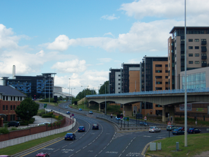
المعالم
يوجد مركز تسوق مستقل على طرف المدينة يسمى «ميدوهال» إنگليزية: Meadowhall.
المدن الشقيقة
The "Sheffield International Linking Committee" promotes Sheffield overseas, especially with five sister cities:[11]
 Chengdu, People's Republic of China
 Anshan, People's Republic of China
 Bochum, Germany
 Donetsk, Ukraine
 إستلي, Nicaragua
A further four cities have a Friendship Agreement with Sheffield:
 Kawasaki, Japan
 Kitwe, Zambia
 Kotli, Pakistan-administered Kashmir
 Pittsburgh, United States
Two roads in Sheffield have been named after sister cities; a section of the A6102 in Norton is named Bochum Parkway, and a road in Hackenthorpe is named Donetsk Way. Likewise in Bochum, Germany there is a major road called the Sheffield-Ring.
انظر أيضاً
- List of metropolitan areas in Europe
- List of people from Sheffield
- List of pubs in Sheffield
- People of Sheffield
- Timeline of Sheffield history
المصادر
- شفيلد - الموسوعة العربية الميسرة، 1965
المراجع والملاحظات
- ^ http://www.telegraph.co.uk/news/obituaries/12147039/Harry-Harpham-MP-obituary.html
- ^ أ ب British Urban Pattern: Population Data (Epson)
- ^ The mid-2008 تق. population for the whole City of Sheffield was 551,800 according to the Office for National Statistics ("Population Estimates for UK, England and Wales, Scotland and Northern Ireland, Mid-2019". Office for National Statistics. 6 May 2020. Retrieved 6 May 2020.), though some population figures, like those given at List of English cities by population, use just the urban core of the city and are therefore lower.
- ^ "Sheffield".
- ^ "Income & Wealth". Sheffield City Council. 30 November 2007. Archived from the original on 21 May 2010. Retrieved 7 July 2010.
- ^ أ ب ت "City Profile Introduction". Sheffield City Council. 31 January 2013. Retrieved 13 October 2013.
- ^ خطأ استشهاد: وسم
<ref>غير صحيح؛ لا نص تم توفيره للمراجع المسماةcelebration - ^ خطأ استشهاد: وسم
<ref>غير صحيح؛ لا نص تم توفيره للمراجع المسماةMet Averages - ^ "Sheffield extreme values". KNMI. Retrieved 8 November 2011.
- ^ "Sheffield District: Total Population". A Vision of Britain Through Time. Great Britain Historical GIS Project. Retrieved 16 August 2009.
- ^ "International Links". Sheffield City Council. Retrieved 6 May 2010.
خطأ استشهاد: الوسم <ref> ذو الاسم "BaldwinBottomsWalker" المُعرّف في <references> غير مستخدم في النص السابق.
خطأ استشهاد: الوسم <ref> ذو الاسم "Binfield" المُعرّف في <references> غير مستخدم في النص السابق.
خطأ استشهاد: الوسم <ref> ذو الاسم "BurgoyneClark" المُعرّف في <references> غير مستخدم في النص السابق.
خطأ استشهاد: الوسم <ref> ذو الاسم "Hampton" المُعرّف في <references> غير مستخدم في النص السابق.
خطأ استشهاد: الوسم <ref> ذو الاسم "TaylorEvansFraser" المُعرّف في <references> غير مستخدم في النص السابق.
<ref> ذو الاسم "Mann" المُعرّف في <references> غير مستخدم في النص السابق.وصلات خارجية
- K. Baker et al. 2011 'Archaeological Investigations at the Upper Chapel, Norfolk Street, Sheffield, UK', Internet Archaeology 29.
 The Wiktionary definition of شفيلد
 Media related to شفيلد at Wikimedia Commons
 Quotations related to شفيلد at Wikiquote
 شفيلد travel guide from Wikivoyage
- Sheffield City Council Website
- قالب:OpenDomesday
- The Story of Sheffield by John Derry, 1915
- A tale of two cities: the Sheffield Project a report by University of Sheffield commissioned by David Blunkett about inequality within the city
قالب:Sheffield قالب:South Yorkshire
- Pages using gadget WikiMiniAtlas
- Short description is different from Wikidata
- Pages using infobox settlement with unknown parameters
- Articles containing إنگليزية-language text
- Pages using Lang-xx templates
- Pages with empty portal template
- Coordinates on Wikidata
- شفيلد
- Articles including recorded pronunciations (UK English)
- Cities in Yorkshire and the Humber
- Local government districts in South Yorkshire
- Local government districts of Yorkshire and the Humber
- Metropolitan boroughs
- Populated places established in the 1st millennium


