الرام
الرّام | |
|---|---|
 الدار العازل وراء الرام | |
 الرّام موقع الرام في فلسطين | |
| الإحداثيات: 31°51′13″N 35°14′00″E / 31.85361°N 35.23333°E | |
| التربيع الفلسطيني | 172/140 |
| الدولة | فلسطين |
| المحافظة | القدس |
| الحكومة | |
| • النوع | بلدية |
| المساحة | |
| • الإجمالي | 3٬289 dunams (3٫3 كم² or 1٫3 ميل²) |
| التعداد (2017)[1] | |
| • الإجمالي | 15٬814 |
| • الكثافة | 4٬800/km2 (12٬000/sq mi) |
| معنى الاسم | من العبرية راما، "التل". بالعربية: "المياه الراكدة"[2] |
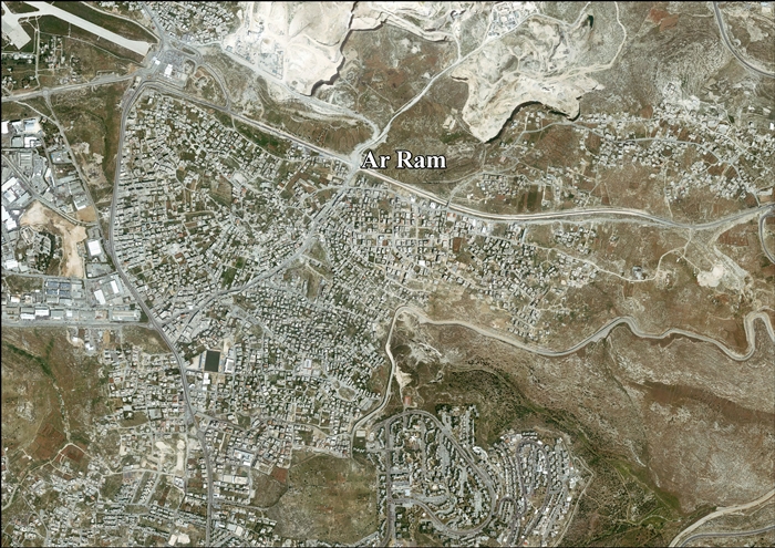
الرّام (Al-Ram)، هي بلدة فلسطينية تقع شمال شرق القدس، على الحدود البلدية للمدينة مباشرة. القرية جزء من المنطقة الحضرية المبنية بالقدس، وتحدها المنطقة الصناعية عطاروت وبيت حنينا من الغرب، ونڤى يعقوب من الجنوب،[3] بمساحة بناء تبلغ 3289 دونم. بحسب الجهاز المركزي للإحصاء الفلسطيني، بلغ عدد سكان الرام 15,814 نسمة في عام 2017.[1] ويقدر رئيس مجلس قرية الرام أن عدد سكان القرية يبلغ 58,000 نسمة، أكثر من نصفهم يحملون بطاقات هوية إسرائيلية.[4]
التاريخ
إسرائيل القديمة
يُعتقد عمومًا أن الرام هو موقع مدينة الرامة التوراتية في بنيامين.[5][6][7][8] تشير الأدلة الأثرية إلى أن المدينة كانت مكتظة بالسكان خلال العصر الحديدي الثاني، ثم تراجعت خلال الفترة الفارسية، ثم تم إحياؤها لاحقًا خلال الحضارة الهيلينية.[9]
الفترة الكلاسيكية
تم اكتشاف صناديق دفن الموتى في الرام والتي يرجع تاريخها إلى القرن الأول قبل الميلاد تحمل نقوشًا عبرية بأسماء مثل مريم ويهوحنان و شمعون بن زكريا.[10]
الفترة الصليبية
في المصادر الصليبية، سُميت الرام باسم "آرام، هرم، راما، راماثا، رميتا"، أو "رماثيس".[11] كانت الرام واحدة من 21 قرية أعطاها گدفري من بويون (حكم من 1099 إلى 1100) إقطاعية لـ كنيسة القيامة.[12][13] جميع سكان القرية الذين ورد ذكرهم في المصادر الصليبية بين عامي 1152 و1160 كانوا يحملون أسماء تدل على أنهم مسيحيون.[14][15] 1161[15][16]
الفترة العثمانية
في عام 1517، أصبحت القرية جزءًا من الدولة العثمانية إلى جانب بقية فلسطين. في سجلات الضرائب عام 1596، ظهرت باسم راما، وتقع في ناحية جبل قدس التابع لـ لواء القدس. وكان عدد السكان 28 أسرة جميعهم مسلمين. لقد دفعوا ضريبة ثابتة قدرها 33.3% على المنتجات الزراعية، بما في ذلك القمح، والشعير، والزيتون وأشجار الكروم، بالإضافة إلى الإيرادات العرضية، والماعز وخلايا النحل؛ ما مجموعه 4700 آقچه.[17]
في عام 1838، وجد إدوارد روبنسون أن القرية فقيرة جدًا وصغيرة، لكن الحجارة الكبيرة والأعمدة المتناثرة تشير إلى أنها كانت في السابق مكانًا مهمًا.[5] في عام 1870 وجد المستكشف الفرنسي فيكتور غيران أن عدد سكان القرية هو 200 نسمة،[18]بينما أظهرت قائمة القرى العثمانية في نفس العام تقريبًا أن الرام كان بها 32 منزلًا ويبلغ عدد سكانها 120 نسمة، على الرغم من أن عدد السكان يشمل الرجال فقط.[19][20]
في عام 1883، وصف صندوق استكشاف فلسطين في مسح غرب فلسطين الرام بأنها "قرية صغيرة في موقع بارز على قمة تل أبيض، بها زيتون. وبها بئر إلى الجنوب. [..] منازلها مبنية من الحجر، وجزء منها مبني من مواد قديمة".[21] "إلى الغرب من القرية توجد بركة جيدة ذات قبو مدبب؛ وفي أسفل التل هناك عمود مكسور إلى قسمين، ربما من الكنيسة. ويوجد على التل خزانات .وتُستخدم الحجارة المصقولة في أسوار القرية. وفي خان الرام، على الطريق الرئيسي، يوجد محجر به كتل نصف مكتملة، وصهريجين. يبدو أن الخان حديث تمامًا، وهو في حالة خراب. وتوجد محاجر واسعة النطاق على سفوح التل بالقرب منه."[22]
في عام 1896، قُدر عدد سكان الرام بحوالي 240 نسمة.[23]
الانتداب البريطاني
في تعداد فلسطين عام 1922 الذي أجرته سلطات الانتداب البريطاني، كان عدد سكان الرام 208 نسمة، جميعهم مسلمون.[24] وقد ارتفع هذا العدد في تعداد 1931 إلى 262، جميعهم مسلمين، في 51 منزلاً.[25]عانت الرام بشدة في زلزال 1927، حيث انهارت الجدران القديمة.[26]
وفي مسح عام 1945، كان عدد سكان الرام 350 نسمة، جميعهم من المسلمين،[27] وتبلغ مساحة أراضيها 5598 دونم.[28] وتم تخصيص 441 دونمًا للمزارع والأراضي القابلة للري، و2291 دونمًا للحبوب،[29] في حين بلغت مساحة البناء 14 دونما.[30]
الحكم الأردني
.jpg&filetimestamp=20240117204118&)
في أعقاب الحرب العربية الإسرائيلية عام 1948، وبعد اتفاقيات الهدنة، أصبحت الرام تحت الحكم الأردني.
في عام 1961، بلغ عدد سكان الرام 769 نسمة.[31]
1967-الحاضر
منذ حرب الأيام الستة عام 1967، كانت الرام تحت الاحتلال الإسرائيلي.
بلغ عدد السكان في تعداد عام 1967 الذي أجرته السلطات الإسرائيلية 860 نسمة، 86 منهم من الأراضي الإسرائيلية.[32]
بحسب أريج، بعد اتفاقيات 1995، تم تصنيف 33.2% (أو حوالي 2226 دونم) من أراضي الرام على أنها أراضي منطقة ب، في حين تم تحديد نسبة 66.8% المتبقية (~4,482 دونمًا) على أنها منطقة ج.[33] صادرت إسرائيل أراضي بلدة الرام من أجل بناء منطقتين صناعيتين مستوطنة إسرائيلية:
- تم الاستيلاء على 315 دونماً لصالح نفي يعقوب،[34]
- 56 وتم الاستيلاء على 56 دونماً لموقع عطروت الصناعي.[34]
في عام 2006، رفضت المحكمة العليا الإسرائيلية ثلاثة التماسات تعترض على بناء حاجز أمني يفصل الرام عن القدس.[35] وقد تم تعديل مسار السياج المخطط لتطويق شمال القدس عدة مرات. ودعت الخطة الأخيرة، التي تم تنفيذها بفعالية، إلى إنشاء طريق "بسيط" يتبع الحدود البلدية على مسافة عدة مئات من الأمتار. وهذا ما جعل بلدة الرام خارج السياج بشكل شبه كامل، باستثناء الجزء الجنوبي من البلدة، والذي يسمى ضاحية البريد.[36][37]
الآثار
قناع العصر الحجري الحديث
يذكر "مسح فلسطين الغربية" أن الدكتور "تشابلن"، الذي زار الرام مهتمًا بالبقايا الأثرية، كان بحوزته "قناع حجري غريب جدًا... تم الحصول عليه من القرية". إنه يمثل وجه إنسان بدون شعر أو لحية، والأنف مقصوص بشكل جيد، والعينان والفم مصممان بشكل ضعيف للغاية، والقناع مجوف من الخلف، وله فتحتان عميقتان في الخلف كما لو كان مثبتًا على الحائط.
يبلغ قطرها أكثر من قدم، ويشبه بشكل غريب بعض الوجوه في المجموعة الموآبية لـ للسيد شابيرا. لا يمكن أن يكون هناك أي شك في طابعها الحقيقي، ولم يتم العثور على شيء مثلها، على حد علمي، في فلسطين."[22][38]
بحلول عام 2018، تم اكتشاف مجموعه مكونة من 15 قناعًا حجريًا من فترة العصر الحجري الحديث قبل الخزفي ب في جنوب بلاد الشام، ومن المعروف أنه تم شراؤها في أواخر القرن التاسع عشر من القرويين في الرام محفوظ الآن في صندوق استكشاف فلسطين في لندن.[39]
Dr Thomas J. Chaplin (1830–1904) was the director of the London Society for Promoting Christianity Amongst the Jews' own British Hospital for the Jews in Jerusalem for some 25 years.[40]
الأطلال الصليبية
تم التعرف على مبنيين صليبيين في البلدة.
البرج
حدد علماء الآثار أنقاض مبنى فناء صليبي تم تطويره من برج أولي، على أنه مزرعة لمدينة فرنجية جديدة تأسست عام 1160.[41]
الكنيسة الصليبية السابقة

The former (old) mosque of Al-Ram was once a Crusader parish church.[15][42]'Old', but working mosque? Or 'former', i.e. abandoned mosque?[محل شك]
في عام 1838، أشار روبنسون إلى أن "مسجدًا صغيرًا به أعمدة يبدو أنه كان في يوم من الأيام كنيسة".[5]
In 1870, Guérin described "a mosque, replacing a former Christian church, of which it occupies the choir; the inhabitants venerate there the memory of Shaykh Hasen. The columns of this sanctuary come from the church."[43]
In 1881, Lieutenant Conder reported: "At the shrine which is so conspicuous near this village are remains of a former chapel. The lintel stone (as it would seem), with a bas-relief of rosettes, has been found by Dr. Chaplin within the building."[22][38]
In 1883, SWP noted that "west of the village is the Mukam of Sheik Hasein, once a small Christian basilica". It further described it as "The remains of the north aisle 6 feet 8 inches wide, are marked by four columns 2 feet in diameter. The chamber of the saint's tomb occupies part of the nave, and into its north wall the lintel of the old door is built, a stone 10 feet long, half of which is visible, with designs as shown. In the courtyard east of this chamber is an old well of good water and a fine mulberry-tree. In the west wall of the Mukam other stones, with discs in low relief, are built in."[22]
مدن شقيقة
المصادر
- ^ أ ب Preliminary Results of the Population, Housing and Establishments Census, 2017. State of Palestine. February 2018. pp. 64–82. Archived from the original. You must specify the date the archive was made using the
|archivedate=parameter. https://www.pcbs.gov.ps/Downloads/book2364-1.pdf. Retrieved on 2023-10-24. - ^ Palmer, 1881, p. 324
- ^ "The Separation Barrier surrounding a-Ram". Btselem. January 1, 2014. Retrieved 18 January 2014.
- ^ "Israel's Apartheid Wall Surrounding a-Ram". B'Tselem. Palestine Media Center. June 27, 2005. Archived from the original on September 27, 2011. Retrieved January 9, 2015.
- ^ أ ب ت Robinson and Smith, 1841, vol 2, pp. 315-317
- ^ Studium Biblicum Franciscanum, Rama - (al-Ram) Archived 2012-10-03 at the Wayback Machine, accessed 25 October 2017
- ^ Jewish Encyclopedia, Ramah, accessed 26 October 2017
- ^ Na'aman, Nadav (2019-10-02). "Reconsidering the Ancient name of Nebi Samwil". Palestine Exploration Quarterly. 151 (3–4): 202–217. doi:10.1080/00310328.2019.1684772. ISSN 0031-0328.
- ^ Finkelstein, Israel (2018). Hasmonean realities behind Ezra, Nehemiah, and Chronicles. SBL Press. p. 41. ISBN 978-0-88414-307-9. OCLC 1081371337.
- ^ Corpus inscriptionum Iudaeae/Palaestinae: a multi-lingual corpus of the inscriptions from Alexander to Muhammad. Vol. IV: Iudaea / Idumaea. Eran Lupu, Marfa Heimbach, Naomi Schneider, Hannah Cotton. Berlin: de Gruyter. 2018. pp. 231–233. ISBN 978-3-11-022219-7. OCLC 663773367.
{{cite book}}: CS1 maint: others (link) - ^ Pringle, 1998, p. 179
- ^ Conder and Kitchener, 1883, SWP III, p. 11
- ^ de Roziére, 1849, p. 263: Haram, cited in Röhricht, 1893, RRH, pp. 16-17, No 74
- ^ Röhricht, 1893, RRH, pp. 70- 71, No 278; p. 92, No 353
- ^ أ ب ت Pringle, 1998, p. 180
- ^ Röhricht, 1893, RRH, p. 96, No 365
- ^ Hütteroth and Abdulfattah, 1977, p. 117
- ^ Guérin, 1874, p. 199 ff
- ^ Socin, 1879, p. 158
- ^ Hartmann, 1883, p. 127, also noted 32 houses
- ^ Conder and Kitchener, 1883, SWP III, p. 13
- ^ أ ب ت ث ج Conder and Kitchener, 1883, SWP III, p. 155
- ^ Schick, 1896, p. 121
- ^ Barron, 1923, Table V||, Sub-district of Jerusalem, p. 14
- ^ Mills, 1932, p. 42
- ^ Pringle, 1983, p. 163
- ^ Department of Statistics, 1945, p. 25
- ^ Government of Palestine, Department of Statistics. Village Statistics, April, 1945. Quoted in Hadawi, 1970, p. 58 Archived 2018-11-03 at the Wayback Machine
- ^ Government of Palestine, Department of Statistics. Village Statistics, April, 1945. Quoted in Hadawi, 1970, p. 104 Archived 2012-03-14 at the Wayback Machine
- ^ Government of Palestine, Department of Statistics. Village Statistics, April, 1945. Quoted in Hadawi, 1970, p. 154 Archived 2014-04-27 at the Wayback Machine
- ^ Government of Jordan, Department of Statistics, 1964, p. 23
- ^ Perlmann, Joel (November 2011 – February 2012). "The 1967 Census of the West Bank and Gaza Strip: A Digitized Version" (PDF). Levy Economics Institute. Retrieved 24 June 2016.
- ^ Ar Ram Town Profile, ARIJ, 2012, pp. 18-19
- ^ أ ب Ar Ram Town Profile, ARIJ, 2012, p. 19
- ^ High Court: A-Ram fence is our defense, Dec. 13, 2006, The Jerusalem Post
- ^ Btselem (January 2016). "The Separation Barrier surrounding a-Ram". Retrieved 16 April 2019.
- ^ Harel, Amos (November 10, 2003). "Separation fence to include wide area east of Jerusalem". Haaretz. Retrieved 18 January 2014.
- ^ أ ب Conder and Kitchener, 1883, SWP III, p. 438
- ^ Gannon, Megan (30 November 2018). "Haunting, 9,000-Year-Old Stone Mask Discovered in a Field in the West Bank". Live Science. Retrieved 10 November 2020.
- ^ Lev, Efraim; Perry, Yaron (2004). "Dr Thomas Chaplin, Scientist and Scholar in Nineteenth-Century Palestine". Palestine Exploration Quarterly. London: Palestine Exploration Fund. 136 (136:2): 151–162. doi:10.1179/003103204x4067. S2CID 161268746. Retrieved 10 November 2020.
- ^ Pringle, 1997, p. 88
- ^ Wilson, 1881, p. 214: picture
- ^ Guérin, 1874, p. 200, as translated in Pringle, 1998, p. 180
المراجع
- Barron, J.B., ed. (1923). Palestine: Report and General Abstracts of the Census of 1922. Government of Palestine.
- Conder, C.R. (1881). "Lieutenant Conder´s reports". Quarterly Statement - Palestine Exploration Fund. 13 (3): 158–208. doi:10.1179/peq.1881.13.3.158.
- Conder, C.R.; Kitchener, H.H. (1883). The Survey of Western Palestine: Memoirs of the Topography, Orography, Hydrography, and Archaeology. Vol. 3. London: Committee of the Palestine Exploration Fund.
- Government of Jordan, Department of Statistics (1964). First Census of Population and Housing. Volume I: Final Tables; General Characteristics of the Population (PDF).
- Government of Palestine, Department of Statistics (1945). Village Statistics, April, 1945.
- Guérin, V. (1874). Description Géographique Historique et Archéologique de la Palestine (in الفرنسية). Vol. 2: Samarie, pt. 1. Paris: L'Imprimerie Nationale.
- Hadawi, S. (1970). Village Statistics of 1945: A Classification of Land and Area ownership in Palestine. Palestine Liberation Organization Research Center. Archived from the original on 2018-12-08. Retrieved 2014-04-27.
- Hartmann, M. (1883). "Die Ortschaftenliste des Liwa Jerusalem in dem türkischen Staatskalender für Syrien auf das Jahr 1288 der Flucht (1871)". Zeitschrift des Deutschen Palästina-Vereins. 6: 102–149.
- Hütteroth, Wolf-Dieter; Abdulfattah, Kamal (1977). Historical Geography of Palestine, Transjordan and Southern Syria in the Late 16th Century. Erlanger Geographische Arbeiten, Sonderband 5. Erlangen, Germany: Vorstand der Fränkischen Geographischen Gesellschaft. ISBN 3-920405-41-2.
- Mills, E., ed. (1932). Census of Palestine 1931. Population of Villages, Towns and Administrative Areas. Jerusalem: Government of Palestine.
- Palmer, E. H. (1881). The Survey of Western Palestine: Arabic and English Name Lists Collected During the Survey by Lieutenants Conder and Kitchener, R. E. Transliterated and Explained by E.H. Palmer. Committee of the Palestine Exploration Fund.
- Pringle, D.; Leach, Peter (1983). "Two Medieval Villages North of Jerusalem: Archaeological Investigations in Al-Jib and Ar-Ram". Levant. 15: 141–177, pls.xvi-xxiia. doi:10.1179/lev.1983.15.1.141.
- Pringle, D. (1997). Secular buildings in the Crusader Kingdom of Jerusalem: an archaeological Gazetter. Cambridge University Press. ISBN 0521-46010-7.
- Pringle, D. (1998). The Churches of the Crusader Kingdom of Jerusalem: L-Z (excluding Tyre). Vol. II. Cambridge University Press. ISBN 0-521-39037-0.
- Robinson, E.; Smith, E. (1841). Biblical Researches in Palestine, Mount Sinai and Arabia Petraea: A Journal of Travels in the year 1838. Vol. 2. Boston: Crocker & Brewster. ( pp. 108, 114, 141)
- Röhricht, R. (1893). (RRH) Regesta regni Hierosolymitani (MXCVII-MCCXCI) (in اللاتينية). Berlin: Libraria Academica Wageriana. (Index: p. 491: Aram (Haram), p. 504: Rama, Ramatha )
- Röhricht, R. (1904). (RRH Ad) Regesta regni Hierosolymitani Additamentum (in اللاتينية). Berlin: Libraria Academica Wageriana. (Index: p. 129: Aram #74; p. 134: er Ram #74; Rama #30a; (Rame? #512)
- Roziére, de, ed. (1849). Cartulaire de l'église du Saint Sépulchre de Jérusalem: publié d'après les manuscrits du Vatican (in اللاتينية and الفرنسية). Paris: Imprimerie nationale.
- Schick, C. (1896). "Zur Einwohnerzahl des Bezirks Jerusalem". Zeitschrift des Deutschen Palästina-Vereins. 19: 120–127.
- Socin, A. (1879). "Alphabetisches Verzeichniss von Ortschaften des Paschalik Jerusalem". Zeitschrift des Deutschen Palästina-Vereins. 2: 135–163.
- Toledano, E. (1984). "The Sanjaq of Jerusalem in the Sixteenth Century: Aspects of Topography and Population". Archivum Ottomanicum. 9: 279–319.
- Wilson, C.W., ed. (c. 1881). Picturesque Palestine, Sinai and Egypt. Vol. 1. New York: D. Appleton.
وصلات خارجية
- Welcome To al-Ram
- Al-Ramm, Welcome to Palestine
- Survey of Western Palestine, Map 17: IAA, Wikimedia commons
- Al-Ram Town (Fact Sheet), Applied Research Institute–Jerusalem (ARIJ)
- Ar Ram Town Profile, ARIJ
- Ar Ram aerial photo, ARIJ
- Locality Development Priorities and Needs in Ar Ram, ARIJ
- "Another Palestinian Ghetto in East Jerusalem: Israel Closes the Segregation Wall in Al Ram". Applied Research Institute–Jerusalem. 21 March 2005. Archived from the original on 14 August 2007.
- Oz Rosenberg (11 April 2012). "IDF closes off central Palestinian town to vehicles". Haaretz.


.jpg&filetimestamp=20240117204118)