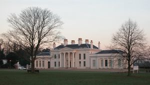
تشلمزفورد
| Chelmsford | |
|---|---|
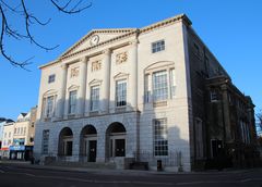 Shire Hall | |
Location within Essex | |
| Population | 111٬511 (2011 Census)[1] |
| OS grid reference | TL713070 |
| District | |
| Shire county | |
| Region | |
| Country | England |
| Sovereign state | United Kingdom |
| Post town | CHELMSFORD |
| Postcode district | CM1, CM2, CM3 |
| Dialling code | 01245 |
| Police | Essex |
| Fire | Essex |
| Ambulance | East of England |
| EU Parliament | East of England |
| UK Parliament | |
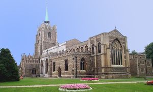
تشلمزفورد (Chelmsford ؛ /ˈtʃɛlmzfəd/)[2] هي مدينة ومقر مقاطعة إسكس، في شرق إنگلترة. وتقع في حزام توشع لندن، وتبعد نحو 30 miles (50 kilometres) من شمال شرق مركز لندن في Charing Cross ونحو 22 miles (35 kilometres) من كولتشستر. المنطقة الحضرية من المدينة يبلغ تعداد سكانها نحو 112,000 نسمة،[1] بينما يبلغ تعداد سكان الناحية 168,310 نسمة.[3][4]
The main conurbation of Chelmsford incorporates all or part of the former parishes of Broomfield, Newland Spring, Great Leigh's, The Walthams, Great Baddow, Little Baddow, Galleywood, Howe Green, Margaretting, Pleshey, Stock, Roxwell, Danbury, Writtle, Moulsham, Rettendon, The Hanningfields, The Chignals, Widford and Springfield, including Springfield Barnes, now known as Chelmer Village. The communities of Chelmsford, Massachusetts, Chelmsford, Ontario and Chelmsford, New Brunswick are named after the city. Chelmsford's population consists of a large number of City and Docklands commuters, attracted by the 30–35-minute journey into Central London via the Great Eastern Main Line railway. The same journey takes at least 60 minutes by road, via the A12.
On 14 March 2012, Lord President of the Privy Council and Deputy Prime Minister, Nick Clegg, announced that Chelmsford was to be granted city status to mark the Diamond Jubilee of Elizabeth II.[5][6][7][8] The Letters Patent officially granting city status to Chelmsford were received on 6 June 2012.[9] The demonym for a Chelmsford resident is "Chelmsfordian".
. . . . . . . . . . . . . . . . . . . . . . . . . . . . . . . . . . . . . . . . . . . . . . . . . . . . . . . . . . . . . . . . . . . . . . . . . . . . . . . . . . . . . . . . . . . . . . . . . . . . . . . . . . . . . . . . . . . . . . . . . . . . . . . . . . . . . . . . . . . . . . . . . . . . . . . . . . . . . . . . . . . . . . . .
التاريخ
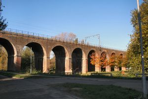
التاريخ المبكر
Before 1199, there were settlements nearby from ancient times. A Neolithic and a late Bronze Age settlement have been found in the Springfield suburb, and the town was occupied by the Romans. A Roman fort was built in AD 60, and a civilian town grew up around it. The town was given the name of Caesaromagus (Caesar's field or Caesar's marketplace), although the reason for it being given the great honour of bearing the Imperial prefix is now unclear – possibly as a failed 'planned town' provincial capital to replace Londinium or Camulodunum. The remains of a mansion, a combination post office, civic centre and hotel, lie beneath the streets of modern Moulsham, and the ruins of an octagonal temple are located beneath the Odeon roundabout. The town disappeared for a while after the Romans left Britain.
الاقتصاد
Business and commerce
ماركوني
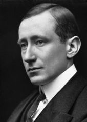
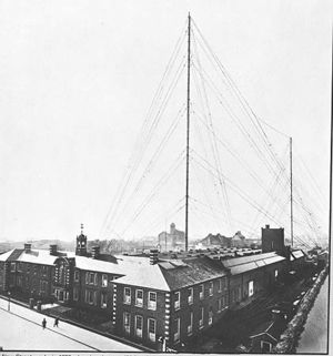
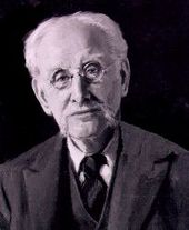
في 1899، افتتح گوليلمو ماركوني أول مصنع في العالم "للاسلكي" بإسم 'The Marconi Wireless Telegraph & Signal Company' في شارع هال، وكان يوظف نحو 50 شخصاً. The company was later called the Marconi Wireless Telegraph Company Ltd. For this reason Chelmsford is credited as the "birthplace of radio", and this phrase can be seen on administrative signs on major roads entering the city, although this statement is disputed.[10]
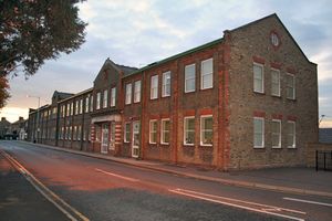
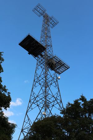
Marconi soon outgrew its Hall Street premises, and in June 1912 the company moved to the brand new purpose-built 70,000-square-foot (6,500-square-metre) New Street Works. On 15 June 1920 the factory was the location of the first official publicised sound broadcast in the United Kingdom, featuring Dame Nellie Melba using two 450-foot (140-metre) radio broadcasting masts.
In 1922, the world's first regular wireless broadcasts for entertainment began from the Marconi laboratories at Writtle near Chelmsford – Call sign '2MT' in what was little more than a wooden hut.
In 1999, Marconi's defence division, including the Chelmsford facilities, was purchased by British Aerospace to form BAE Systems. Two sites remain under BAE control; the Great Baddow site which is now BAE's Advanced Technology Centre and its Integrated Systems Technologies business at Glebe Road.
The military and secure communications division of Marconi was merged into Selex Communications was based at the New Street factory however they vacated the site in April 2008 with the remaining operations moved to nearby Basildon. This brought to an end of more than 100 years of the Marconi name in Chelmsford.[11]
The New Street factory was scheduled to be redeveloped with work planned to start during 2010,[12] however this fell through after the new site owners Ashwell Property Group entered administration in December 2009.
The New Street factory remained empty, derelict and vandalised for several years much to the dismay of Marconi Veterans and Chelmsfordians.[13][14]
The site was finally sold for redevelopment to Bellway Homes in the summer of 2012 with demolition of the majority of the site including the iconic Marconi House and Building 720 in April/May 2013. Only the Grade II listed water tower, The 1912 front building façade, the New Street cottages and the power house will remain.[15]
معالم
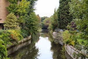 نهر كان في وسط المدينة ويظهر جزء من استحكامات خطة مواجهة الفيضانات من ع1960 |
الجغرافيا والمناخ
الجيولوجيا
From over 600,000 years ago, during the Pleistocene ice age, until the Anglian Stage around 478,000 to 424,000 years ago, the early River Thames flowed through the area where Chelmsford now stands, from Harlow to Colchester, before crossing what is now the North Sea to become a tributary of the Rhine. Consequently, gravel deposits are frequently found in the area and current and former gravel pits in the district are common.
المناخ
| Climate data for ريتل، بمنسوب 32 م، 1981–2010، القصوى 1960– | |||||||||||||
|---|---|---|---|---|---|---|---|---|---|---|---|---|---|
| Month | Jan | Feb | Mar | Apr | May | Jun | Jul | Aug | Sep | Oct | Nov | Dec | Year |
| Record high °C (°F) | 15.1 (59.2) |
18.4 (65.1) |
22.8 (73.0) |
27.0 (80.6) |
30.0 (86.0) |
33.6 (92.5) |
37.7 (99.9) |
35.7 (96.3) |
32.1 (89.8) |
28.6 (83.5) |
18.5 (65.3) |
16.6 (61.9) |
37.7 (99.9) |
| Mean daily maximum °C (°F) | 7.4 (45.3) |
7.7 (45.9) |
10.7 (51.3) |
13.6 (56.5) |
17.0 (62.6) |
20.2 (68.4) |
22.9 (73.2) |
22.7 (72.9) |
19.3 (66.7) |
15.0 (59.0) |
10.5 (50.9) |
7.7 (45.9) |
14.6 (58.3) |
| Mean daily minimum °C (°F) | 1.5 (34.7) |
1.0 (33.8) |
2.7 (36.9) |
3.8 (38.8) |
6.8 (44.2) |
9.8 (49.6) |
12.0 (53.6) |
11.8 (53.2) |
9.7 (49.5) |
7.1 (44.8) |
3.9 (39.0) |
1.8 (35.2) |
6.0 (42.8) |
| Record low °C (°F) | −20.6 (−5.1) |
−13.3 (8.1) |
−11.1 (12.0) |
−6.1 (21.0) |
−2.8 (27.0) |
−1.7 (28.9) |
2.2 (36.0) |
0.6 (33.1) |
−1.1 (30.0) |
−6.7 (19.9) |
−8.1 (17.4) |
−18 (0) |
−20.6 (−5.1) |
| Average precipitation mm (inches) | 53.2 (2.09) |
39.2 (1.54) |
40.2 (1.58) |
41.6 (1.64) |
48.7 (1.92) |
49.9 (1.96) |
44.3 (1.74) |
51.7 (2.04) |
48.6 (1.91) |
64.1 (2.52) |
58.0 (2.28) |
52.3 (2.06) |
591.8 (23.30) |
| Mean monthly sunshine hours | 58.0 | 76.1 | 112.4 | 165.7 | 196.6 | 198.2 | 209.9 | 204.0 | 147.4 | 113.9 | 68.7 | 47.4 | 1٬598٫2 |
| Source 1: Met Office[16] | |||||||||||||
| Source 2: KNMI[17] | |||||||||||||
| Climate data for Writtle, elevation 32 m, 1971–2000 | |||||||||||||
|---|---|---|---|---|---|---|---|---|---|---|---|---|---|
| Month | Jan | Feb | Mar | Apr | May | Jun | Jul | Aug | Sep | Oct | Nov | Dec | Year |
| Mean daily maximum °C (°F) | 7.1 (44.8) |
7.5 (45.5) |
10.3 (50.5) |
12.8 (55.0) |
16.8 (62.2) |
19.6 (67.3) |
22.4 (72.3) |
22.3 (72.1) |
18.9 (66.0) |
14.6 (58.3) |
10.0 (50.0) |
7.9 (46.2) |
14.2 (57.5) |
| Mean daily minimum °C (°F) | 1.1 (34.0) |
0.8 (33.4) |
2.4 (36.3) |
3.6 (38.5) |
6.3 (43.3) |
9.3 (48.7) |
11.5 (52.7) |
11.4 (52.5) |
9.5 (49.1) |
6.6 (43.9) |
3.3 (37.9) |
1.9 (35.4) |
5.6 (42.1) |
| Average precipitation mm (inches) | 53.97 (2.12) |
34.9 (1.37) |
42.29 (1.66) |
41.77 (1.64) |
45.38 (1.79) |
52.83 (2.08) |
39.38 (1.55) |
49.49 (1.95) |
51.71 (2.04) |
58.16 (2.29) |
54.14 (2.13) |
52.9 (2.08) |
576.92 (22.7) |
| Source: KNMI[17] | |||||||||||||
. . . . . . . . . . . . . . . . . . . . . . . . . . . . . . . . . . . . . . . . . . . . . . . . . . . . . . . . . . . . . . . . . . . . . . . . . . . . . . . . . . . . . . . . . . . . . . . . . . . . . . . . . . . . . . . . . . . . . . . . . . . . . . . . . . . . . . . . . . . . . . . . . . . . . . . . . . . . . . . . . . . . . . . .
أقرب الأماكن
البلدات التوأم
Chelmsford's official twin towns are:[18][19]
 أنوناي، Ardèche, Auvergne-Rhône-Alpes، فرنسا[18]
 باكنانگ، Baden-Württemberg، ألمانيا[18]
كما أن لتشلمزفورد مدينة شقيقة:
للاستزادة
- Foreman, Stephen: Hylands – the story of an Essex country house and its owners (Ian Henry Publications, 1999)
- Lee, Janet Olivia: Chelmsford – Birthplace of Radio (Chelmsford Borough Council, 2001)
- Lowen, Ceri: Hylands House – a brief history and guide (Chelmsford Borough Council, 2005)
- Wander, Tim: 2MT Writtle – The birth of British Broadcasting (Capella Publications, 1988)
- Weller-Lewis, Hugh: Chelmsford Borough Guide (Macmillan, 1995)
- Wickenden, Nick: A Celebration of Chelmsford (Chelmsford Borough Council, 1999)
- A town, its people and its past (Chelmsford Record Office, 1988)
- Grieve, Hilda: The Sleepers and the Shadows Volume 2 Chelmsford: a town, its people and its past (Chelmsford Record Office, 1994)
- Begent, Andrew: Chelmsford At War (Ian Henry Publications Ltd, 1999)
- Torry, Gilbert: Chelmsford through the ages (East Anglian Magazine Ltd, 1977)
- John Alec Baker: The Peregrine, The Hill of Summer and Diaries (Collins, 2011)
الهامش
- ^ أ ب "2011 Census – Built-up areas". ONS. Retrieved 11 August 2013.
- ^ "Chelmsford". www.collinsdictionary.com. HarperCollins Publishers. n.d. Retrieved 31 May 2020.
- ^ "ONS – 2011 Census, Key Statistics for Local Authorities in England and Wales".
- ^ "Census 2011: Key Statistics Chelmsford" (PDF). Chelmsford City Council. Archived from the original (PDF) on 5 March 2016. Retrieved 17 March 2015.
- ^ "The Queen Gives Chelmsford City Status". Archived from the original on 29 October 2013.
- ^ "Chelmsford, Perth and St Asaph gain city status to mark the Diamond Jubilee". The official website of The Queen's Diamond Jubilee. Archived from the original on 30 October 2013. Retrieved 11 May 2012.
- ^ "Written Ministerial Statement – Diamond Jubilee Civic Honours Competition" (PDF). Cabinet Office. 14 March 2012. Retrieved 11 May 2012.
- ^ "No. 60167". The London Gazette. 11 June 2012. p. 11125.
- ^ "Chelmsford to receive Letters Patent granting city status". BBC News. 6 June 2012.
- ^ "Tesla – Master of Lightning: Who Invented Radio?". PBS. Retrieved 17 September 2010.
- ^ "Chelmsford: Marconi moving after a century (From Chelmsford Weekly News)". Chelmsfordweeklynews.co.uk. Retrieved 21 April 2012.
- ^ Project Wireless Consultation – Newsletter Issue 1: Winter 2006 Archived 2 ديسمبر 2007 at the Wayback Machine Retrieved 24 December 2007,
- ^ "Legal action to save Marconi site (From Chelmsford Weekly News)". Chelmsfordweeklynews.co.uk. 12 June 2010. Retrieved 21 April 2012.
- ^ "The 90th anniversary of Dame Nellie's broadcast should have been a landmark event to be proud of. | This is Essex". Thisistotalessex.co.uk. 17 June 2010. Archived from the original on 5 May 2013. Retrieved 21 April 2012.
- ^ "Chelmsford: Former Marconi site, New Street". Government of the United Kingdom. Archived from the original on 4 April 2015. Retrieved 11 May 2013.
- ^ "Climate Normals 1981–2010". Met Office. Retrieved 3 December 2012.
- ^ أ ب "Climate Normals 1971–2000". KNMI. Retrieved 3 March 2011.
- ^ أ ب ت "Chelmsford Town Twinning Association". Archived from the original on 17 May 2013. Retrieved 14 July 2013.
- ^ "Chelmsford Borough Council – Twin Towns". Government of the United Kingdom. Retrieved 17 September 2010.
- ^ "Chelmsford – China Daily". China Daily. Retrieved 9 May 2016.

