كورفو
كورفو
Κέρκυρα | |
|---|---|
 پونتيكونيسي (في الخلفية) و دير ڤلاخرنا (في المقدمة) كما تظهران من قمم تلال كانوني | |
أظهر الموقع في المنطقة | |
| الإحداثيات: 39°35′N 19°52′E / 39.583°N 19.867°E | |
| البلد | |
| المنطقة الادارية | الجزر الأيونية |
| الوحدة المحلية | كورفو |
| الحكومة | |
| • العمدة | Konstantinos Nikolouzos[1] |
| المساحة | |
| • البلدية | 610٫9 كم² (235٫9 ميل²) |
| أعلى منسوب | 906 m (2٬972 ft) |
| أوطى منسوب | 0 m (0 ft) |
| التعداد (2011)[2] | |
| • البلدية | 102٬071 |
| • كثافة البلدية | 170/km2 (430/sq mi) |
| صفة المواطن | Corfiote |
| منطقة التوقيت | UTC+2 (EET) |
| • الصيف (التوقيت الصيفي) | UTC+3 (EEST) |
| Postal code | 490 82, 490 83, 490 84, 491 00 |
| مفتاح الهاتف | 26610, 26620, 26630 |
| Vehicle registration | KY |
كورفو ( /kɔrˈfuː,_ʔfjuː/؛ باليونانية: Κέρκυρα, Kérkyra [ˈcercira]؛ باليونانية قديمة: Κέρκυρα or Κόρκυρα؛ لاتينية: Corcyra؛ إيطالية: Corfù؛ إنگليزية: Corfu) هي جزيرة يونانية في البحر الأيوني. وهي ثاني أكبر الجزر الأيونية،[3] ، ومع جزرها الساتلة الصغيرة، تشكل أقصى أجزاء اليونان في الشمال الغربي.[4] الجزيرة هي جزء من كورفو، الوحدة المحلية، وتدار كبلدية واحدة، والتي تضم أيضاً الجزر الأصغر: إريكوسا، ماثراكي وأوتونوي. المدينة الرئيسية في الجزيرة ومقر البلدية (بتعداد 32,095) تسمى أيضاً كورفو.[5] كورفو هي مقر الجامعة الأيونية.
الجغرافيا
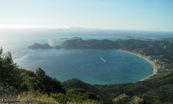

جزيرة لازارِتـّو
المناخ
تتسم كورفو بـمناخ متوسطي حار صيفاً (Csa في تصنيف كوپن للمناخ).
| أظهرClimate data for كورفو |
|---|
التاريخ
التاريخ المبكر


السياسات والتراث البندقي

القرن التاسع عشر

اللوردات المفوضون البريطانيون
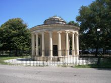
This is a list of the British High Commissioners of the Ionian Islands; (as well as the transitional Greek Governor, appointed a year prior to Enosis (Union) with Greece in 1864).[9]
- Sir James Campbell 1814–1816
- السير توماس ميتلاند (1759–1824) 1815–1823
- Sir Frederick Adam (1781–1853) 1823–1832
- Sir Alexander Woodford (1782–1870) 1832
- George Nugent-Grenville, 2nd Baron Nugent (1788–1850) 1832–1835
- Howard Douglas (1776–1861) 1835–1840
- James Alexander Stewart-Mackenzie (1784–1843) 1840–1843
- John Colborne, 1st Baron Seaton (1778–1863) 1843–1849
- Sir Henry George Ward (1797–1860) 1849–1855
- Sir John Young (1807–1876) 1855–1859
- William Ewart Gladstone (1809–1898) 1859
- Sir Henry Knight Storks (1811–1874) 1859–1863
- Count Dimitrios Nikolaou Karousos, President of Parliament (1799–1873) 1863–1864
الحرب العالمية الأولى
فترة ما بين الحربين
In 1923, after a diplomatic dispute between Italy and Greece, Italian forces bombarded and occupied Corfu. The League of Nations settled this Corfu incident.
الحرب العالمية الثانية والمقاومة
الاحتلال الإيطالي
الاحتلال الألماني والمحرقة
التحرير
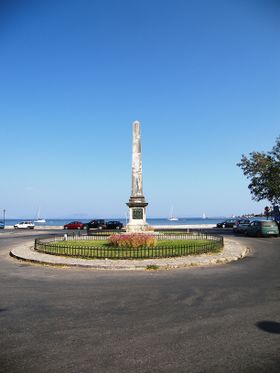
البسيطة الحضرية
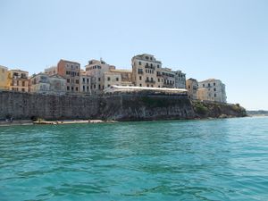
البلدة القديمة
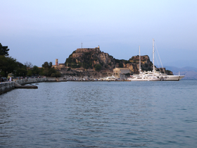
پالايو فروريو

نيو فروريو
پلايا أناكتورا وحدائقها
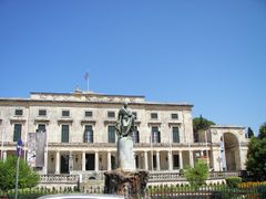

الآثار والعمارة
استعراض معماري: من الكلاسيكي إلى الحديث
العمارة الإيطالوية
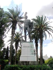
الأخيليون

جسر القيصر
German Kaiser Wilhelm II was also fond of taking holidays in Corfu. Having purchased the Achilleion in 1907 after Sissi's death, he appointed Carl Ludwig Sprenger as the botanical architect of the Palace, and also built a bridge later named by the locals after him—the "Kaiser's bridge" (Greek: η γέφυρα του Κάιζερ transliterated as: i yefyra tou Kaizer) -- to access the beach without traversing the road forming the island's main artery to the south. The bridge, arching over the road, spanned the distance between the lower gardens of Achilleion and the nearby beach; its remains, a monument to imperial vanity, are an important landmark on the highway. The bridge's central section was demolished by the Wehrmacht in 1944, during the German occupation of World War II, to allow for the passage of an enormous cannon, forming part of the Nazi defences in the southeastern coast of Corfu.[10][11]
البلدية
The present municipality of Corfu was formed in the 2011 local government reform by the merger of the following 15 former municipalities, which became municipal units:[5]
انظر أيضاً
- Music of the Heptanese
- Heptanese School (painting)
- Cuisine of the Ionian islands
- Aspioti-ELKA
- Hercules (vehicles)
الهامش
- ^ "Mayor of Corfu". corfu.gr.
- ^ أ ب "Απογραφή Πληθυσμού - Κατοικιών 2011. ΜΟΝΙΜΟΣ Πληθυσμός" (in اليونانية). Hellenic Statistical Authority.
- ^ خطأ استشهاد: وسم
<ref>غير صحيح؛ لا نص تم توفيره للمراجع المسماةIndependent - ^ Trevor Webster (1994). Where to Go in Greece: A New Look. Vol. 1. Settle Press. p. 221. ISBN 9781872876207.
Corfu is one of the most northern isles in Greece and also the most westerly, apart from three of its own small satellite isles...
- ^ أ ب Kallikratis law Greece Ministry of Interior (باليونانية)
- ^ "Mean Corfu Climatic Averages". Hellenic National Meteorological Service. Retrieved 1 March 2015.
- ^ "Kekira Climate Normals 1961–1990". National Oceanic and Atmospheric Administration. Retrieved 1 March 2015.
- ^ Nondas Stamatopoulos (1993). Old Corfu: history and culture. N. Stamatopoulos. pp. 164–165. Retrieved 6 April 2013.
Again, during the first great siege of Corfu by the Turks in 1537, Angelocastro ... and After a siege lasting a year the invaders were finally driven away by the defenders of the fortress who were helped by the inhabitants of the neighbouring villages. In 1571, when they once more invaded Corfu, the Turks again unsuccessfully attacked, Angelocastro, where 4,000 people had taken refuge. During the second great siege of the city by the Turks in 1716, Angelokastro once again served
- ^ ca:Història de Corfú
- ^ Frank Giles; Spiro Flamburiari; Fritz Von der Schulenburg (1 September 1994). Corfu: the garden isle. J. Murray in association with the Hellenic Group of Companies Ltd. p. 109. ISBN 978-1-55859-845-4. Retrieved 4 May 2013.
Although subsequently demolished in 1944 to allow the passage of a huge German coastal gun beneath, the locality still bears the name "Kaiser's Bridge".
- ^ Corfu map: The bridge was destroyed during a German attack in World War II. The remains can still be seen today.
للاستزادة
- Published in the 19th century
- "Corfu", A Hand-book for Travellers in the Ionian Islands, Greece, Turkey, Asia Minor, and Constantinople, London: J. Murray, 1840, OCLC 397597, http://www.archive.org/stream/ahandbookfortra01murrgoog#page/n69/mode/2up
- Published in the 20th century
- "Corfu", Handbook for Travellers in Greece (7th ed.), London: John Murray, 1900, http://www.archive.org/stream/handbookfortra00lond#page/n133/mode/2up
- "Corfu", Greece (4th ed.), Leipzig: Karl Baedeker, 1909, http://www.archive.org/stream/greecehandbookfo00karl#page/n425/mode/2up
- "Corfu", The Encyclopaedia Britannica (11th ed.), New York: Encyclopaedia Britannica, 1910, OCLC 14782424
وصلات خارجية
- Municipality of Corfu (official site)
- Serbs in Corfu and Vido: Historical Website
- Pages using gadget WikiMiniAtlas
- CS1 اليونانية-language sources (el)
- Articles with hatnote templates targeting a nonexistent page
- Short description is different from Wikidata
- Coordinates on Wikidata
- Pages using infobox Greece place with unknown parameters
- Articles containing Greek-language text
- Articles containing Ancient Greek (to 1453)-language text
- Articles containing لاتينية-language text
- Pages using Lang-xx templates
- Articles containing إيطالية-language text
- Articles containing إنگليزية-language text
- كورفو
- كورفو (وحدة محلية)
- المستعمرات الكورنثية
- مستعمرات وابية
- جزر إقليم الجزر الأيونية
- جاليات يهودية إيطالية
- Locations in Greek mythology
- موانئ على البحر المتوسط في اليونان
- بلديات إقليم الجزر الأيونية
- مراكز اليونان
- السياحة في اليونان
- جمهورية الجزر السبع
- جزر اليونان


