سانتا كاتارينا
سانتا كاتارينا | |
|---|---|
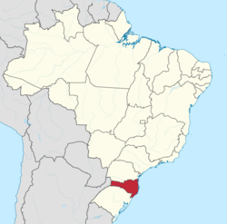 موقع ولاية سانتا كاتارينا في البرازيل | |
| الإحداثيات: 27°50′S 48°25′W / 27.833°S 48.417°W | |
| بلد | |
| العاصمة | فلوريانوپولس |
| أكبر مدينة | جوانڤيل |
| الحكومة | |
| • الحاكم | ريموندو كولمبو |
| • Vice Governor | Eduardo Pinho Moreira |
| المساحة | |
| • الإجمالي | 95٬346٫181 كم² (36٬813٫366 ميل²) |
| ترتيب المساحة | 20 |
| التعداد (2012)[1] | |
| • الإجمالي | 6٬383٬286 |
| • الترتيب | 11 |
| • الكثافة | 67/km2 (170/sq mi) |
| • ترتيب الكثافة | 9 |
| صفة المواطن | Catarinense or Barriga-Verde (Green Belly) |
| الناتج المحلي الإجمالي | |
| • سنة | 2006 تقدير |
| • المجموع | R$ 93,173,000,000 (7) |
| • Per capita | R$ 20,369 (4) |
| مؤشر التنمية البشرية | |
| • سنة | 2005 |
| • التصنيف | 0.840 - high (2) |
| منطقة التوقيت | UTC-3 (BRT) |
| • الصيف (التوقيت الصيفي) | UTC-2 (BRST) |
| الرمز البريدي | 87000-000 to 89990-000 |
| ISO 3166 code | BR-SC |
| الموقع الإلكتروني | sc.gov.br |
ولاية سانتا كاتارينا Santa Catarina (البرتغالية البرازيلية: [ˈsɐ̃ta kataˈɾina] (![]() استمع) "Saint Catherine")[2] تقع في نصف الجهة الجنوبية من البرازيل وتحدها ولاية پارانا من الشمال، وولاية ريو گراند دو سول من الجنوب والمحيط الاطلسي من الشرق والأرجنتين من الغرب ، عاصمتها فلوريانوپولس.
استمع) "Saint Catherine")[2] تقع في نصف الجهة الجنوبية من البرازيل وتحدها ولاية پارانا من الشمال، وولاية ريو گراند دو سول من الجنوب والمحيط الاطلسي من الشرق والأرجنتين من الغرب ، عاصمتها فلوريانوپولس.
Santa Catarina is bordered by Paraná to the north, Rio Grande do Sul to the south, the Atlantic Ocean to the east, and to the west by the Argentine province of Misiones. The coastal path is over 450 km, i.e., about half of Portugal's mainland coast. The host city of the state executive, legislative and judiciary powers is the capital Florianópolis. Joinville, however, is the most populous city in the state. Besides Espírito Santo, Santa Catarina is the only state whose capital is not the most populous city.[3] South of the Tropic of Capricorn, situated in the planet's southern temperate zone, the state has a humid subtropical climate (Cfa) in the east and west and an oceanic climate (Cfb) in the center.[4] Climatic conditions vary according to the relief of the region: in the west and mountainous plateau, it is relatively frequent that frosts and snow occur, while on the coast the climate is warmer, capable of reaching high temperatures in summer.[4]
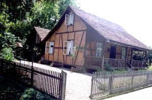
The territory of Santa Catarina is one of the oldest states in Brazil, separated from São Paulo in 1738, its first governor being José da Silva Pais. The state was created for one reason only: to extend the Portuguese domains to southern Brazil until reaching the Rio de la Plata region. It is also the oldest state of the South Region of Brazil, older than Rio Grande do Sul (1807) and Paraná (1853). The state of Santa Catarina was settled by European immigrants: the coast was colonized by the Azorean Portuguese in the 18th century; the Itajaí Valley – a portion of the southern region and northern Santa Catarina – was settled by the Germans in the mid 19th century.[5][6] The south of the state was populated by the Italians in the last years of the 19th century. Children and grandchildren of Italian and German immigrants who moved from Rio Grande do Sul settled the west of Santa Catarina in the mid 20th century.[7]
The state's social indexes are among the best in Brazil. It has the highest rate of life expectancy in the country (just like the Federal District),[8] the lowest infant mortality rate and is also the state with the lowest economic inequality and illiteracy in Brazil.[9][10] Santa Catarina has the 6th highest GDP in the country,[11] with a diverse economy and strong affinities to industrialization.
الجغرافيا
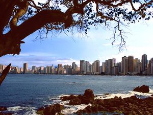
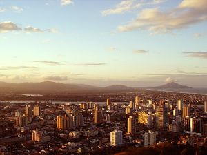
 منظر جوي لـ فلوريانوپولس |
سانتا كاتارينا هو في موقع استراتيجي جدا في مركوسول، والسوق المشتركة لأمريكا الجنوبية. يقع موقعها في الخريطة بين موازية 25 º 57'41 "و 29 º 23'55" من خط العرض الجنوبي وبين خطوط الطول 48 º 19'37 "و 53 º 50'00" من خط الطول الغربي. عاصمتها فلوريانوپولس، 1,673 كم منبرازيليا، 705 كم من ساو پاولو، 1,144 كم من ريو دي جانيرو و 1,850 كم من بوينس آيرس.
تاريخ
اكتشفت الولاية بنفس الفترة التي اكتشفت فيها البرازيل و مر بها العديد من البحارين من جنسيات مختلفة و إستولى الفرنسي (Binot Paulmier de Gonneville) عليها لمدة ستة أشهر. وفي 1504 و صل المكتشفين البرتغاليين إلى أول جزيرة لقبت بجزيرة باتوس ( جزيرة سانتا كاتارينا الحالية) واستولى عليها البرتغاليون في 1514 ليأتي من بعدهم الأسبان و من ثم البرتغاليين مرة ثانية.
ديموغرافيا
| الترتيب | المنطقة المتوسطة | التعداد | الترتيب | المنطقة المتوسطة | التعداد | ||||
|---|---|---|---|---|---|---|---|---|---|
 جوينڤيل  فلوريانوپولس |
1 | جوينڤيل | نورتي كاتاريننسي | 583,144 | 11 | بالنياريو كامبوريو | ڤالي دو إيتاجاي | 138,732 |  بلومناو  ساو جوزيه |
| 2 | فلوريانوپولس | گراندي فلوريانوپولس | 492,977 | 12 | بروسكي | ڤالي دو إيتاجاي | 131,703 | ||
| 3 | بلومناو | ڤالي دو إيتاجاي | 352,460 | 13 | توباراو | سول كاتاريننسي | 104,937 | ||
| 4 | ساو جوزيه | گراندي فلوريانوپولس | 242,927 | 14 | ساو بنتو دو سول | نورتي كاتاريننسي | 83,576 | ||
| 5 | تشاپكو | أوستي كاتاريننسي | 216,654 | 15 | كامبوريو | ڤالي دو إيتاجاي | 80,834 | ||
| 6 | إيتاجاي | ڤالي دو إيتاجاي | 215,895 | 16 | كاسادور | أوستي كاتاريننسي | 77,863 | ||
| 7 | كريسيوما | سول كاتاريننسي | 213,023 | 17 | ناڤگانتس | ڤالي دو إيتاجاي | 79,285 | ||
| 8 | پالهوسا | گراندي فلوريانوپولس | 168,259 | 18 | كونكورديا | أوستي كاتاريننسي | 74,106 | ||
| 9 | جاراكوا دو سول | نورتي كاتاريننسي | 174,158 | 19 | ريو دو سول | ڤالي دو إيتاجاي | 70,100 | ||
| 10 | لاگس | سرانا | 157,743 | 20 | أرارانگوا | سول كاتاريننسي | 67,578 | ||
وفقا لمعهد البرازيل للجغرافيا والإحصاء لسنة 2008, كان عدد المقيمين في الولاية 6,091,000. وكانت الكثافة السكانية 61.53 inhabitants per square kilometre (159.4/sq mi).
التحضر: 82.5% (2006); النمو السكاني: 1.9% (1991–2000); المنازل: 1,836,000 (2006).[13]
الاستيطان الاوروپي
| Year | Pop. | ±% p.a. |
|---|---|---|
| 1872 | 159٬802 | — |
| 1890 | 283٬769 | +3.24% |
| 1900 | 320٬289 | +1.22% |
| 1920 | 668٬743 | +3.75% |
| 1940 | 1٬178٬340 | +2.87% |
| 1950 | 1٬560٬502 | +2.85% |
| 1960 | 2٬146٬909 | +3.24% |
| 1970 | 2٬930٬411 | +3.16% |
| 1980 | 3٬687٬652 | +2.33% |
| 1991 | 4٬538٬248 | +1.90% |
| 2000 | 5٬349٬580 | +1.84% |
| 2010 | 6٬248٬436 | +1.57% |
| 2017 | 7٬001٬161 | +1.64% |
| المصدر:[14] | ||
One of the Brazilian states that exhibits the most evident signs of 19th-century European immigration, Santa Catarina, where the vast majority of the population descends from European settlers, is also the state with the highest percentage of European phenotype citizens.
The state is also famous for having towns where most of the population belongs to a single main ancestry thanks to the settlement program with European colonists. Here are a few examples of such towns in the Southern region:
| بعض بلدات جنوب البرازيل ذات تركز قومي معين | |||
|---|---|---|---|
| اسم البلدة | الولاية | العرق الرئيسي | النسبة |
| Nova Veneza | سانتا كاتارينا | إيطالي | 95%[15] |
| Pomerode | سانتا كاتارينا | ألماني | 90%[16] |
| Treze Tílias | سانتا كاتارينا | نمساوي | 60%[17] |
الپرتغاليون
بدأ توافد الپرتغاليون في عقد 1750، من جزر الآزور، واستعمرو الساحل. في أواخر القرن الثامن عشر كان نصف سكان ولاية سانتا كاتارينا مواليد البرتغال. أسس البرتغاليون مدن كثيرة في الولاية أهمها عاصمة الولاية مدينة فلوريانوپولس
الألمان
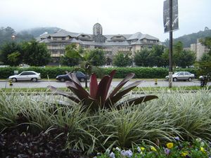
تم عزل الألمان في المجتمعات الريفية على مدى عقود. لم يكونوا على اتصال بالشعوب الأخرى في البرازيل، وكانوا يحافظون على لغتهم وتقاليدهم في البرازيل، الإ أن هذا الوضع تغير في عام 1942، خلال الحرب العالمية الثانية، عندما أعلنت البرازيل الحرب على ألمانيا، وكان مطلوب من المهاجرين الألمان وأبنائهم تعلم اللغة الپرتغالية واتباع الطريقة البرازيلية في الحياة.
الإيطاليون
الاقتصاد
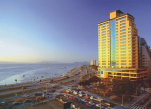
القطاع الصناعي هو أكبر عنصر في الناتج المحلي الإجمالي حيث يمثل 52.5٪، يليه قطاع الخدمات 33.9٪. الزراعة تمثل 13.6٪ من الناتج المحلي الإجمالي لسنة (2004). صادرات سانتا كاتارينا: تربية الطيور 26.1٪، المنتجات الخشبية 15.4٪، ضواغط 8.5٪، القطن 6.8٪، والسيارات 5.8٪ (2002).
المشاركة في الاقتصاد البرازيلي: 4% (2005).
سانتا كاتارينا لديها واحد من أعلى مستويات المعيشة في البرازيل، وهي مركز صناعي وزراعي رئيسي.
إحصائيات
المركبات: 2,489,343 (مارس/2007); الهواتف النقالة: 3.7 مليون (أبريل/2007); الهواتف: 1.6 مليون (أبريل/2007). المدن: 293 (2007).[18]
التعليم
الكليات والجامعات
- Universidade Federal de Santa Catarina (UFSC) (جامعة سانتا كاتارينا الاتحادية);
- Universidade do Estado de Santa Catarina (UDESC) (جامعة سانتا كاتارينا الحكومية);
- Universidade do Sul de Santa Catarina (UNISUL) (جامعة سانتا كاتارينا الجنوبية);
- Universidade do Vale do Itajaí (UNIVALI) (University of the Itajaí Valley);
- Universidade da Regiao de Joinville (UNIVILLE) (جامعة إقليم جوانيڤل);
- Universidade Católica de Santa Catarina (جامعة سانتا كاتارينا الكاثوليكية)
- Universidade do Contestado (UnC) (جامعة كونتستاندو);
- Universidade do Oeste de Santa Catarina (Unoesc) (جامعة سانتا كاتارينا الغربية);
- Universidade do Planalto de Santa Catarina (Uniplac) (University of the Plateau of Santa Catarina);
- Universidade do Extremo Sul Catarinense (Unesc) (University of Southernmost Santa Catarina);
- Fundação Universidade Regional de Blumenau (FURB) (Regional University Foundation of Blumenau);
- Sociedade Educacional de Santa Catarina (SOCIESC) (Educational Society for Santa Catarina)
- وغيرهم الكثير.
البنية التحتية
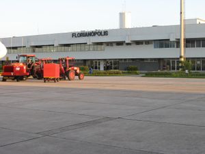
المطار الدولي
السياحة
الرياضة
كرة القدم
تنس
التزحلق
لغات الأقليات

انظر أيضا
- قائمة مدن البرازيل (جميع المدن والبلديات)
الهوامش
- ^ [1]
- ^ The European Portuguese pronunciation is [ˈsɐ̃tɐ kɐtɐˈɾinɐ].
- ^ "IBGE | Cities | Santa Catarina | Joinville". cidades.ibge.gov.br. Retrieved 9 August 2019.
- ^ أ ب Alvares, Clayton Alcarde; Stape, José Luiz; Sentelhas, Paulo Cesar; de Moraes Gonçalves, José Leonardo; Sparovek, Gerd (December 2013). "Köppen's climate classification map for Brazil". www.ingentaconnect.com (in الإنجليزية). Retrieved 9 August 2019.
- ^ CABRAL, Oswaldo R. História de Santa Catarina. Rio de Janeiro, RJ: Laudes, 1970.
- ^ MATOS, Jacinto Antônio de. Colonização do Estado de Santa Catarina, Tip. de "O Dia": Florianópolis, 1917. 241 p.
- ^ EL-KHATIB, Faissal. História de Santa Catarina. Curitiba, PR: Grafipar, 1970. 4 v.
- ^ "Federation Units – Life expectancy at birth – Brazil – Total – 2017" (PDF). IBGE. p. 11. Retrieved 29 November 2018.
- ^ "Complete mortality table for Brazil – 2015" (PDF). IBGE. Retrieved 2 December 2016.
- ^ "Pesquisa Nacional por Amostra de Domicílios Contínua – PNAD Contínua | IBGE". www.ibge.gov.br. Retrieved 9 August 2019.
- ^ Pontes, Helena Maria Mattos. "Contas Regionais 2015: queda no PIB atinge todas as unidades da federação pela primeira vez na série". IBGE – Agência de Notícias (in البرتغالية البرازيلية). Retrieved 9 August 2019.
- ^ "ESTIMATIVAS DA POPULAÇÃO RESIDENTE NOS MUNICÍPIOS BRASILEIROS COM DATA DE REFERÊNCIA EM 2018" (in البرتغالية). Brazilian Institute of Geography and Statistics. 3 September 2018. Archived from the original (PDF) on 31 August 2011. Retrieved 3 September 2018.
- ^ Source: PNAD.
- ^ IGBE
- ^ Nova Veneza Archived 19 أغسطس 2008 at the Wayback Machine
- ^ POMERODE-SC
- ^ História de Treze Tílias Archived 2 نوفمبر 2008 at the Wayback Machine
- ^ Source: IBGE.
المصادر
تحوي هذه المقالة معلومات مترجمة من الطبعة الحادية عشرة لدائرة المعارف البريطانية لسنة 1911 وهي الآن من ضمن الملكية العامة.
وصلات خارجية
![]() تعريفات قاموسية في ويكاموس
تعريفات قاموسية في ويكاموس
![]() كتب من معرفة الكتب
كتب من معرفة الكتب
![]() اقتباسات من معرفة الاقتباس
اقتباسات من معرفة الاقتباس
![]() نصوص مصدرية من معرفة المصادر
نصوص مصدرية من معرفة المصادر
![]() صور و ملفات صوتية من كومونز
صور و ملفات صوتية من كومونز
![]() أخبار من معرفة الأخبار.
أخبار من معرفة الأخبار.
- Pages using gadget WikiMiniAtlas
- CS1 البرتغالية البرازيلية-language sources (pt-br)
- CS1 البرتغالية-language sources (pt)
- Short description is different from Wikidata
- Coordinates on Wikidata
- Pages using infobox settlement with unknown parameters
- مقالات مأخوذة من الطبعة الحادية عشرة لدائرة المعارف البريطانية
- ولايات البرازيل
- سانتا كاتارينا (ولاية)


