جبال پوكونو
| الپوكونوز The Poconos | |
|---|---|
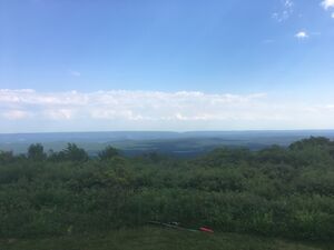
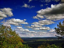 View from Mount Pocono Knob Lookout | |
| أعلى نقطة | |
| القمة | Kistler Ledge |
| الارتفاع | 2،215 ft (675 m) |
| الإحداثيات | 41°13′44″N 75°22′24″W / 41.2290°N 75.3734°W |
| التسمية | |
| أصل الكلمة | Lenape term for "stream between two mountains". |
| الجغرافيا | |
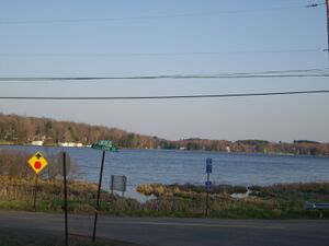
جبال پوكونو Pocono Mountains ، ويشيع الإشارة إليها بإسم ذا پوكونو (the Poconos ؛ /ˈpoʊkəˌnoʊz/)، هي منطقة جغرافية وجيولوجية وثقافية في شمال شرق پنسلڤانيا، بالولايات المتحدة. The Poconos are an upland of the larger Allegheny Plateau. Forming a 2،400-ميل-مربع (6،200 km2) escarpment overlooking the Delaware River and Delaware Water Gap to the east, the mountains are bordered on the north by Lake Wallenpaupack, on the west by the Wyoming Valley and the Coal Region, and to the south by the Lehigh Valley. The name comes from the Munsee word Pokawachne, which means "Creek Between Two Hills."[1] Much of the Poconos region lies within the Greater New York-Newark, NY-NJ-CT-PA Combined Statistical Area. The wooded hills and valleys have long been a popular recreation area, accessible within a two-hour drive to millions of metropolitan area residents, with many communities having resort hotels with fishing, hunting, skiing, and other sports facilities.
التعداد
The Pocono Mountains are a popular recreational destination for local and regional visitors. While the area has long been a popular tourist destination, many communities have seen a rise in population, especially communities within Monroe County and Pike County. The region has a population of about 340,300, which is growing at a rapid pace. The Poconos now serves as a commuter community for New York City and northern New Jersey.[2] The commute to workplaces often takes as much as two hours each way due to traffic.[3]
The region lacks a major population center, although there are municipalities such as Stroudsburg, East Stroudsburg, Mount Pocono. The three towns and the surrounding townships are all located in Monroe County where the population is 165,058, which is about half of the total population in the Poconos.
البلديات والتجمعات
The Pocono Mountains of northeastern Pennsylvania is divided into six regions: Mountain Region, Lake Region, Delaware River Region, Upper Delaware River Region, Wyoming Valley, and Lehigh River Gorge Region.[4][المصدر لا يؤكد ذلك]
منطقة الجبل
Located in Monroe, Luzerne, Southern Lackawanna, and Northern Carbon Counties.
- Albrightsville
- Barrett Township
- Bartonsville
- Bear Creek
- Blakeslee
- Canadensis
- Chestnuthill Township
- Coolbaugh Township
- Drifton
- Delaware Water Gap
- East Side
- East Stroudsburg
- Foster Township
- Freeland
- Gouldsboro
- Henryville
- Jackson Township
- Jim Thorpe
- Jonas, Pennsylvania
- Kidder Township
- Lake Harmony
- Lausanne Township
- Long Pond
- Marshalls Creek
- Middle Smithfield
- Mount Pocono
- Mountainhome
- Packer Township
- Paradise Township
- Penn Forest Township
- Penn Lake Park
- Pocono Lake
- Pocono Pines
- Pocono Summit
- Pocono Township
- Price Township
- Reeders
- Smithfield Township
- Scotrun
- Stroudsburg
- Stroud Township
- Thornhurst
- Weatherly
- White Haven
- Swiftwater
- Tannersville
- Tobyhanna
- Saylorsburg
منطقة البجيرات
Located in Pike و Wayne counties:
منطقة نهر دلاوير
Located in Monroe and Pike counties:
Upper Delaware River Region
Located in Pike and Wayne counties:
وادي وايومنگ
يقع في Luzerne county:
المناطق النائية
The boundary of the region can be at times, unclear, and these Lehigh Valley, Carbon County, Schuylkill County, and Greater Hazleton (Luzerne County) communities fall on the periphery of the Poconos:
- Coaldale (Schuylkill County)
- Pen Argyl (Northampton County)
- Bangor (Northampton County)
- Walnutport (Northampton County)
- Slatington (Lehigh County)
- Drums (Luzerne County)
- Hazleton (Luzerne County)
- West Hazleton (Luzerne County)
- Aquashicola (Carbon County)
- Andreas (Carbon and Schuylkill Counties)
- Beaver Meadows (Carbon County)
- Ashfield (Carbon County)
- Bowmanstown (Carbon County)
- Forest Inn (Carbon County)
- Lansford (Carbon County)
- Lehighton (Carbon County)
- Nesquehoning (Carbon County)
- Palmerton (Carbon County)
- Parryville (Carbon County)
- Portland (Northampton County)
- Summit Hill (Carbon County)
- Tamaqua (Schuylkill County)
- Weissport (Carbon County)
النقل
الطرق
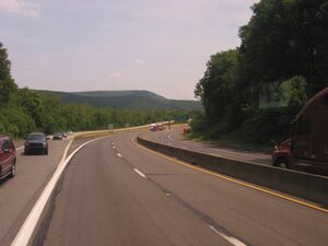
The Poconos Region is served by many state highways. The most-used of these highways include Pennsylvania Route 115, Pennsylvania Route 715, Pennsylvania Route 903 (designated in some areas as the "Highway to Adventure" because of the numerous venues and resorts along the highway), Pennsylvania Route 33, Pennsylvania Route 940, and Pennsylvania Route 611. Pennsylvania Route 309, a major north–south route connecting Northeastern Pennsylvania with the Delaware Valley region passes through the western end of the region.
There are two U.S. Highways in the Pocono Mountains region. The more used is U.S. Route 209, which goes from Ulster, New York to Millersburg, Pennsylvania (near Harrisburg). The route's midpoint is in the region north of Stroudsburg. The other main U.S. Highway in the region is U.S. Route 6, which is a transcontinental highway that starts near Bishop, California and runs for over 3,000 miles to its eastern terminus in Provincetown, Massachusetts. It is designated a scenic route in Pennsylvania. U.S. Route 11, U.S. Route 22, and U.S. Route 46 are also not far from the region and serve it indirectly.
The main east–west Interstate Highway in the region is Interstate 80, off of which branches Interstate 380, which connects the Poconos to Scranton. The other Interstate Highways in the region in Interstate 476, the Pennsylvania Turnpike's Northeast Extension, which has interchanges near Lehighton (Mahoning Valley), Albrightsville (Route 903), and White Haven (Pocono), and Interstate 81, which serves as an alternate route for the much-busier Interstate 87 and Interstate 95, particularly for travelers from Toronto, Syracuse, Binghamton and Montreal to Philadelphia, Baltimore, and Washington, D.C. Other Interstates that serve the region are Interstate 84, which begins in Scranton and goes east to New England, and Interstate 78, by way of Route 33 or Route 309.
استعادة خدمة قطار الركاب
NJ Transit is rebuilding trackage on the Lackawanna Cut-Off route from Scranton through the Poconos to Hoboken, New Jersey. There is no clear estimated target year when the Lackawanna Cut-Off Restoration Project will be completed. The service would consist of nine trains per day in each direction. Until 1970, the Erie Lackawanna Railway operated long-distance trains through the Poconos to Buffalo and Chicago to the west, and Hoboken to the east.
السفر جواً
There are two airports that are located just outside of the region, one being Wilkes-Barre/Scranton International Airport, and the other being Lehigh Valley International Airport.
الجغرافيا

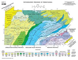
The Pocono Mountains is a defined area encompassing portions of Carbon, Monroe, Pike, and southern Wayne counties of Pennsylvania.[5] In total, the Poconos encompasses over 2،500 ميل مربع (6،500 km2).[بحاجة لمصدر] Some definitions also extend the Poconos to Lackawanna, Luzerne, eastern Schuylkill, and Susquehanna counties. The Poconos are geologically part of the Allegheny Plateau, like the nearby Catskills. The Poconos' highest summit, Kistler Ledge in Monroe County, reaches over 2215 feet (675 m), while its lowest elevation is 350 feet (107 m) in Pike County.[بحاجة لمصدر]
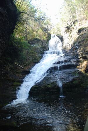
The Delaware River flows through the Pocono Mountains and gives the region its name, from a Native American term roughly translating to "stream between two mountains." The Lehigh and Lackawaxen Rivers also flow through the region, totaling about 170 miles (270 km) of waterways.[بحاجة لمصدر]
المناخ
منطقة الهضبة السفلى الجليدية
According to the Trewartha climate classification system, the Glaciated Low Plateau region of the northern and eastern Poconos has a Temperate Continental climate (Dc) with warm summers (b), cold winters (o) and year-around precipitation (Dcbo). Dcbo climates are characterized by at least one month having an average mean temperature ≤ 32.0 °F (0.0 °C), four to seven months with an average mean temperature ≥ 50.0 °F (10.0 °C), all months with an average mean temperature < 72.0 °F (22.2 °C) and no significant precipitation difference between seasons. Although most summer days are comfortably humid on the Low Plateau, episodes of heat and high humidity can occur with heat index values > 93 °F (34 °C). Since 1981, the highest air temperature was 94.1 °F (34.5 °C) on 08/06/2001, and the highest daily average mean dew point was 70.8 °F (21.6 °C) on 08/01/2006. July is the peak month for thunderstorm activity which correlates with the average warmest month of the year. Since 1981, the wettest calendar day was 5.83 بوصات (148 mm) on 09/17/2004. During the winter months, the plant hardiness zone is 5b with an average annual extreme minimum air temperature of −13.1 °F (−25.1 °C).[6] Since 1981, the coldest air temperature was −27.9 °F (−33.3 °C) on 01/21/1994. Episodes of extreme cold and wind can occur with wind chill values less than −26 °F (−32 °C). The average snowiest month is January which correlates with the average coldest month of the year. Ice storms and large snowstorms depositing ≥ 12 بوصات (30 cm) of snow occur nearly every year, particularly during nor’easters from December through March.
| بيانات المناخ لـ Lake Wallenpaupack, Elevation 1،188 ft (362 m), 1981-2010 normals, extremes 1981-2018 | |||||||||||||
|---|---|---|---|---|---|---|---|---|---|---|---|---|---|
| الشهر | ينا | فب | مار | أبر | ماي | يون | يول | أغس | سبت | أكت | نوف | ديس | السنة |
| القصوى القياسية °ف (°س) | 63.2 (17.3) |
72.2 (22.3) |
82.5 (28.1) |
87.8 (31.0) |
91.0 (32.8) |
90.7 (32.6) |
93.9 (34.4) |
94.1 (34.5) |
91.0 (32.8) |
83.1 (28.4) |
79.0 (26.1) |
67.5 (19.7) |
94.1 (34.5) |
| متوسط القصوى اليومية °ف (°س) | 32.2 (0.1) |
35.3 (1.8) |
43.6 (6.4) |
56.0 (13.3) |
67.1 (19.5) |
75.1 (23.9) |
78.7 (25.9) |
78.1 (25.6) |
71.0 (21.7) |
59.8 (15.4) |
48.2 (9.0) |
36.4 (2.4) |
56.9 (13.8) |
| المتوسط اليومي °ف (°س) | 22.5 (−5.3) |
25.0 (−3.9) |
32.9 (0.5) |
44.6 (7.0) |
55.2 (12.9) |
64.0 (17.8) |
67.9 (19.9) |
66.9 (19.4) |
59.4 (15.2) |
48.0 (8.9) |
38.6 (3.7) |
27.7 (−2.4) |
46.2 (7.9) |
| متوسط الدنيا اليومية °ف (°س) | 12.9 (−10.6) |
14.8 (−9.6) |
22.1 (−5.5) |
33.2 (0.7) |
43.4 (6.3) |
53.0 (11.7) |
57.1 (13.9) |
55.7 (13.2) |
47.7 (8.7) |
36.3 (2.4) |
29.0 (−1.7) |
18.9 (−7.3) |
35.4 (1.9) |
| الصغرى القياسية °ف (°س) | −27.9 (−33.3) |
−17.3 (−27.4) |
−10.0 (−23.3) |
9.9 (−12.3) |
25.1 (−3.8) |
31.4 (−0.3) |
40.4 (4.7) |
35.9 (2.2) |
26.6 (−3.0) |
16.3 (−8.7) |
−1.9 (−18.8) |
−17.2 (−27.3) |
−27.9 (−33.3) |
| متوسط تساقط الأمطار inches (mm) | 2.82 (72) |
2.55 (65) |
3.18 (81) |
3.62 (92) |
3.99 (101) |
4.46 (113) |
3.89 (99) |
3.77 (96) |
4.21 (107) |
4.18 (106) |
3.37 (86) |
3.32 (84) |
43.36 (1٬101) |
| متوسط هطول الثلج inches (cm) | 15.7 (40) |
11.2 (28) |
11.7 (30) |
2.8 (7.1) |
0.0 (0.0) |
0.0 (0.0) |
0.0 (0.0) |
0.0 (0.0) |
0.0 (0.0) |
0.1 (0.25) |
3.0 (7.6) |
9.4 (24) |
53.8 (137) |
| متوسط الرطوبة النسبية (%) | 73.5 | 68.8 | 63.6 | 60.3 | 62.9 | 72.5 | 72.7 | 74.4 | 75.1 | 71.4 | 71.3 | 73.7 | 70.0 |
| متوسط نقطة الندى °ف (°س) | 15.3 (−9.3) |
16.2 (−8.8) |
21.9 (−5.6) |
31.7 (−0.2) |
42.8 (6.0) |
55.0 (12.8) |
58.8 (14.9) |
58.5 (14.7) |
51.5 (10.8) |
39.2 (4.0) |
30.1 (−1.1) |
20.4 (−6.4) |
36.9 (2.7) |
| Source: PRISM[7] | |||||||||||||
منطقة هضبة پوكونو الجليدية
According to the Trewartha climate classification system, the Glaciated Pocono Plateau region of the central and western Poconos has a Temperate Continental climate (Dc) with warm summers (b), cold winters (o) and year-around precipitation (Dcbo). Dcbo climates are characterized by at least one month having an average mean temperature ≤ 32.0 °F (0.0 °C), four to seven months with an average mean temperature ≥ 50.0 °F (10.0 °C), all months with an average mean temperature < 72.0 °F (22.2 °C) and no significant precipitation difference between seasons. Although most summer days are comfortably humid on the Pocono Plateau, episodes of heat and high humidity can occur with heat index values > 93 °F (34 °C). Since 1981, the highest air temperature was 94.0 °F (34.4 °C) on 07/22/2011, and the highest daily average mean dew point was 70.7 °F (21.5 °C) on 08/01/2006. July is the peak month for thunderstorm activity which correlates with the average warmest month of the year. Since 1981, the wettest calendar day was 6.81 بوصات (173 mm) on 09/30/2010. During the winter months, the plant hardiness zone is 5b with an average annual extreme minimum air temperature of −10.1 °F (−23.4 °C).[6] Since 1981, the coldest air temperature was −21.6 °F (−29.8 °C) on 01/21/1994. Episodes of extreme cold and wind can occur with wind chill values < −22 °F (−30 °C). The average snowiest month is January which correlates with the average coldest month of the year. Ice storms and large snowstorms depositing ≥ 12 بوصات (30 cm) of snow occur nearly every year, particularly during nor’easters from December through March.
| بيانات المناخ لـ جبل پوكونو، ارتفاع 1،808 ft (551 m), 1981-2010 normals, extremes 1981-2018 | |||||||||||||
|---|---|---|---|---|---|---|---|---|---|---|---|---|---|
| الشهر | ينا | فب | مار | أبر | ماي | يون | يول | أغس | سبت | أكت | نوف | ديس | السنة |
| القصوى القياسية °ف (°س) | 61.7 (16.5) |
72.1 (22.3) |
81.2 (27.3) |
87.3 (30.7) |
89.6 (32.0) |
89.9 (32.2) |
94.0 (34.4) |
92.2 (33.4) |
90.3 (32.4) |
82.3 (27.9) |
74.7 (23.7) |
66.1 (18.9) |
94.0 (34.4) |
| متوسط القصوى اليومية °ف (°س) | 31.1 (−0.5) |
34.4 (1.3) |
42.6 (5.9) |
55.4 (13.0) |
66.4 (19.1) |
74.1 (23.4) |
78.3 (25.7) |
76.8 (24.9) |
69.8 (21.0) |
58.2 (14.6) |
47.0 (8.3) |
35.2 (1.8) |
55.9 (13.3) |
| المتوسط اليومي °ف (°س) | 23.0 (−5.0) |
25.7 (−3.5) |
33.3 (0.7) |
44.8 (7.1) |
55.3 (12.9) |
63.6 (17.6) |
68.0 (20.0) |
66.7 (19.3) |
59.7 (15.4) |
48.4 (9.1) |
38.8 (3.8) |
27.7 (−2.4) |
46.3 (7.9) |
| متوسط الدنيا اليومية °ف (°س) | 15.0 (−9.4) |
16.9 (−8.4) |
24.0 (−4.4) |
34.3 (1.3) |
44.3 (6.8) |
53.2 (11.8) |
57.7 (14.3) |
56.7 (13.7) |
49.6 (9.8) |
38.5 (3.6) |
30.5 (−0.8) |
20.2 (−6.6) |
36.8 (2.7) |
| الصغرى القياسية °ف (°س) | −21.6 (−29.8) |
−13.6 (−25.3) |
−6.6 (−21.4) |
10.6 (−11.9) |
27.0 (−2.8) |
32.9 (0.5) |
37.6 (3.1) |
33.8 (1.0) |
27.8 (−2.3) |
17.2 (−8.2) |
−0.7 (−18.2) |
−14.8 (−26.0) |
−21.6 (−29.8) |
| متوسط تساقط الأمطار inches (mm) | 3.73 (95) |
3.37 (86) |
4.54 (115) |
4.55 (116) |
4.71 (120) |
4.86 (123) |
4.71 (120) |
4.43 (113) |
5.21 (132) |
5.79 (147) |
4.45 (113) |
4.49 (114) |
54.84 (1٬393) |
| متوسط هطول الثلج inches (cm) | 19.3 (49) |
13.8 (35) |
14.3 (36) |
3.4 (8.6) |
0.0 (0.0) |
0.0 (0.0) |
0.0 (0.0) |
0.0 (0.0) |
0.0 (0.0) |
0.1 (0.25) |
3.6 (9.1) |
11.6 (29) |
66.2 (168) |
| متوسط الرطوبة النسبية (%) | 75.5 | 69.2 | 66.4 | 61.6 | 63.4 | 73.8 | 72.9 | 76.3 | 77.1 | 73.4 | 72.7 | 76.9 | 71.6 |
| متوسط نقطة الندى °ف (°س) | 16.4 (−8.7) |
17.0 (−8.3) |
23.3 (−4.8) |
32.4 (0.2) |
43.1 (6.2) |
55.1 (12.8) |
59.0 (15.0) |
59.0 (15.0) |
52.5 (11.4) |
40.3 (4.6) |
30.8 (−0.7) |
21.4 (−5.9) |
37.6 (3.1) |
| Source: PRISM[7] | |||||||||||||
منطقة الحافة والوادي
According to the Trewartha climate classification system, the Ridge and Valley section of the southern Poconos has a Temperate Continental climate (Dc) with hot summers (a), cold winters (o) and year-around precipitation (Dcao). Dcao climates are characterized by at least one month having an average mean temperature ≤ 32.0 °F (0.0 °C), four to seven months with an average mean temperature ≥ 50.0 °F (10.0 °C), at least one month with an average mean temperature ≥ 72.0 °F (22.2 °C) and no significant precipitation difference between seasons. Although most summer days are slightly humid in the Ridge and Valley, episodes of heat and high humidity can occur with heat index values > 102 °F (39 °C). Since 1981, the highest air temperature was 100.3 °F (37.9 °C) on 07/22/2011, and the highest daily average mean dew point was 72.7 °F (22.6 °C) on 08/01/2006. July is the peak month for thunderstorm activity which correlates with the average warmest month of the year. The average wettest month is September which correlates with tropical storm remnants during the peak of the Atlantic hurricane season. Since 1981, the wettest calendar day was 6.36 بوصات (162 mm) on 10/08/2005. During the winter months, the plant hardiness zone is 6a with an average annual extreme minimum air temperature of −5.4 °F (−20.8 °C).[6] Since 1981, the coldest air temperature was −18.0 °F (−27.8 °C) on 01/21/1994. Episodes of extreme cold and wind can occur with wind chill values < −17 °F (−27 °C). The average snowiest month is January which correlates with the average coldest month of the year. Ice storms and large snowstorms depositing ≥ 12 بوصات (30 cm) of snow occur once every couple of years, particularly during nor’easters from December through March.
| بيانات المناخ لـ إيست ستراودزبرگ، Elevation 531 ft (162 m), 1981-2010 normals, extremes 1981-2018 | |||||||||||||
|---|---|---|---|---|---|---|---|---|---|---|---|---|---|
| الشهر | ينا | فب | مار | أبر | ماي | يون | يول | أغس | سبت | أكت | نوف | ديس | السنة |
| القصوى القياسية °ف (°س) | 68.6 (20.3) |
77.0 (25.0) |
86.3 (30.2) |
94.4 (34.7) |
94.5 (34.7) |
95.3 (35.2) |
100.3 (37.9) |
98.7 (37.1) |
96.3 (35.7) |
87.9 (31.1) |
79.5 (26.4) |
71.1 (21.7) |
100.3 (37.9) |
| متوسط القصوى اليومية °ف (°س) | 36.1 (2.3) |
39.8 (4.3) |
48.8 (9.3) |
61.6 (16.4) |
71.9 (22.2) |
79.9 (26.6) |
83.9 (28.8) |
82.3 (27.9) |
75.1 (23.9) |
63.6 (17.6) |
52.3 (11.3) |
40.4 (4.7) |
61.4 (16.3) |
| المتوسط اليومي °ف (°س) | 27.0 (−2.8) |
29.9 (−1.2) |
37.9 (3.3) |
49.2 (9.6) |
59.3 (15.2) |
68.0 (20.0) |
72.4 (22.4) |
70.9 (21.6) |
63.5 (17.5) |
51.9 (11.1) |
42.3 (5.7) |
31.9 (−0.1) |
50.4 (10.2) |
| متوسط الدنيا اليومية °ف (°س) | 17.9 (−7.8) |
20.1 (−6.6) |
27.0 (−2.8) |
36.9 (2.7) |
46.7 (8.2) |
56.1 (13.4) |
60.9 (16.1) |
59.5 (15.3) |
51.9 (11.1) |
40.3 (4.6) |
32.3 (0.2) |
23.4 (−4.8) |
39.5 (4.2) |
| الصغرى القياسية °ف (°س) | −18.0 (−27.8) |
−8.6 (−22.6) |
−0.5 (−18.1) |
14.3 (−9.8) |
27.1 (−2.7) |
36.4 (2.4) |
42.6 (5.9) |
38.0 (3.3) |
29.8 (−1.2) |
19.8 (−6.8) |
6.1 (−14.4) |
−7.1 (−21.7) |
−18.0 (−27.8) |
| متوسط تساقط الأمطار inches (mm) | 3.40 (86) |
2.97 (75) |
3.64 (92) |
4.11 (104) |
4.43 (113) |
4.48 (114) |
4.52 (115) |
4.41 (112) |
4.97 (126) |
4.77 (121) |
4.02 (102) |
4.09 (104) |
49.81 (1٬265) |
| متوسط هطول الثلج inches (cm) | 11.8 (30) |
8.5 (22) |
8.8 (22) |
2.1 (5.3) |
0.0 (0.0) |
0.0 (0.0) |
0.0 (0.0) |
0.0 (0.0) |
0.0 (0.0) |
0.1 (0.25) |
2.2 (5.6) |
7.1 (18) |
40.6 (103) |
| متوسط الرطوبة النسبية (%) | 69.1 | 64.3 | 59.6 | 57.4 | 61.8 | 68.9 | 68.9 | 71.7 | 72.8 | 71.0 | 69.4 | 70.5 | 67.1 |
| متوسط نقطة الندى °ف (°س) | 18.2 (−7.7) |
19.3 (−7.1) |
25.1 (−3.8) |
34.8 (1.6) |
46.2 (7.9) |
57.4 (14.1) |
61.6 (16.4) |
61.3 (16.3) |
54.6 (12.6) |
42.8 (6.0) |
33.0 (0.6) |
23.4 (−4.8) |
39.9 (4.4) |
| Source: PRISM[7] | |||||||||||||
البيئة
منطقة الهضبة السفلى الجليدية
According to the A. W. Kuchler U.S. potential natural vegetation types, the Glaciated Low Plateau region of the northern and eastern Poconos would have a dominant vegetation type of Northern Hardwood (106) with a dominant vegetation form of Northern hardwood forest (26) north and west of Lake Wallenpaupack, and a dominant vegetation type of Appalachian Oak (104) with a dominant vegetation form of Eastern Hardwood Forest (25) south and east of Wallenpaupack.[8] The peak spring bloom typically occurs in early-May and peak fall color usually occurs in early-October. The plant hardiness zone is 5b with an average annual extreme minimum air temperature of −13.1 °F (−25.1 °C).[6]
منطقة هضبة پوكونو الجليدية
According to the A. W. Kuchler U.S. potential natural vegetation types, the Glaciated Pocono Plateau region of the central and western Poconos would have a dominant vegetation type of Northern Hardwood (106) with a dominant vegetation form of Northern hardwood forest (26).[8] The peak spring bloom typically occurs in early-May and peak fall color usually occurs in early-October. The plant hardiness zone is 5b with an average annual extreme minimum air temperature of −10.1 °F (−23.4 °C).[6]
منطقة الحافة والوادي
According to the A. W. Kuchler U.S. potential natural vegetation types, the Ridge and Valley region of the southern Poconos would have a dominant vegetation type of Appalachian Oak (104) with a dominant vegetation form of Eastern Hardwood Forest (25).[8] The peak spring bloom typically occurs in late-April and peak fall color usually occurs in mid-October. The plant hardiness zone is 6a with an average annual extreme minimum air temperature of −5.4 °F (−20.8 °C).[6]
تخوم سوليڤن
During the Revolutionary War in 1779, General John Sullivan marched his troops through the Pocono Mountains (Monroe and Luzerne counties) on their expedition to fight the Iroquois tribe in New York State.[9][10] Sergeant Moses Fellows of the Third New Hampshire Regiment described the area as "...very poor & Barren and I think as never will Be Settled.”[11]
الترفيه
The Poconos are a well-known outdoor recreation destination for visitors around the northeast, especially from New York City and Philadelphia. The region encompasses the Delaware State Forest, including six designated natural areas, seven state parks, and seventeen state game lands.[12] The Delaware Water Gap National Recreation Area is on the eastern edge of the Poconos and includes 70,000 acres of wilderness.[13]
المنتجعات
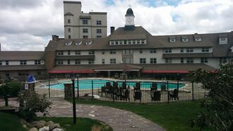
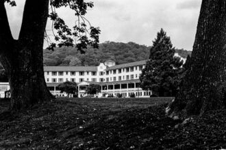
Two of the earliest Pocono resorts were founded by rival factions of the Philadelphia Quaker community: Inn at Buck Hill Falls (1901) and Pocono Manor (1902).[14][15] These resorts did not allow liquor or dancing, and evening dress was discouraged.[16] The Quakers "brought a quiet, unostentatious style to the region,"[16] but their hotels later developed from religious retreats into "luxurious mountain resorts."[17] Buck Hill's stone facade became a model for close to 300 stately stone-and-shingle homes in the region.[16] Pocono Manor offered sweeping vistas of the eastern and western Pocono region and had been referred to as the "Grand Lady of the Mountains."[18] Buck Hill closed in 1990 and the Inn at Pocono Manor was mostly destroyed by fire in 2019.[16][19]
Skytop Lodge, built in 1928, is described as a "Dutch Colonial-style manor house."[20] Designed in reaction to the Quaker resorts, it had a dance floor and served liquor in a basement bar.[16] Skytop offers thirty miles of hiking trails, and the main building "is surrounded by 5,000 acres of wood, glacial bogs, hemlock gorges, beaver marshes, and cascading waterfalls."[18] Novelist Faith Baldwin wrote about her 1932 visit to Skytop, "Here are friendly mountains, round-breasted, smiling in the clear, rosy light of dawn."[21]
The Buckwood Inn opened in 1911 and included the first golf course to be designed by renowned golf architect A. W. Tillinghast.[22][23] Bandleader Fred Waring purchased the resort in 1943, renamed it the Shawnee Inn, and broadcast his radio shows from there.[24] The Shawnee Inn is a Spanish colonial revival building with white-Moorish architecture and Spanish tiled roofs,[16] and it was identified in the 1990s as the only resort on the banks of the Delaware River.[25][26]
Tamiment was a popular resort among Jewish singles from the working and emerging middle class[27] and has been described as "a progressive version of the Catskills..."[28] The 2,200 acre facility opened in 1921 to generate income for the Rand School of Social Science, a Socialist school in New York.[27][29][30] Tamiment Playhouse entertained resort guests with an original revue every Saturday night during the 10-week summer season, and many prominent Broadway and TV figures gained experience there.[31] The playhouse was referred to as the "Poconos boot camp for Broadway writers and performers."[32] The revues were discontinued in 1960 and the resort closed down in 2005.[30][33]
Unity House, a 655-acre Pocono retreat, offered affordable vacations for factory workers. The resort was owned for seventy years by the International Ladies' Garment Workers' Union, and it served as a staging ground for union activities.[34][35] Ron Devlin of The Morning Call referred to Unity House as a "blue-collar 'Hilton.'"[34] Eleanor Roosevelt visited Unity House many times and wrote, "...you could not put children in a more favorable environment..."[36] The resort closed down in 1990, falling victim to changing times and declining union membership.[34][35]
In 1945 retired New York executive Rudolf Van Hoevenberg established the first honeymoon resort in the Pocono Mountains, Farm on the Hill.[37][38] Sally Moore of Snow Country wrote, "Far from today's sybaritic accommodations, back then the rustic cabins required new brides to make the beds and tidy up while grooms helped with the dishes and did the heavy work."[38] By 1960, the Pocono Mountains rivaled Niagara Falls as a honeymoon destination, attracting 100,000 couples a year.[39] Morris Wilkins, co-owner of Cove Haven, invented the heart-shaped bathtub in 1963 as a way to lure honeymoon customers.[40][41][42] The tub would appear in other couples resorts and became a symbol of the Pocono resort business.[40][43][44] Author Lawrence Squeri wrote in 2002, "If Americans today are asked to name the image that best represents the Poconos, chances are that many will cite couples resorts and heart-shaped bathtubs..."[40]
Mount Airy Lodge expanded from an eight-room inn into the largest Pocono resort.[45] It heavily advertised in the New York media market with the catchy jingle, "Beautiful Mount Airy Lodge."[46] Headliners, such as Bob Hope, Milton Berle, and Connie Francis, performed in the Crystal Room, Mount Airy's 2,000-seat theater. Comedian Mickey Freeman said, "The food was lousy, but it was a legalized orgy." The 1,200-acre resort's heyday was in the 1960s and 1970s before closing in 2001.[45]
In the 1950s the Kiesendahl family purchased a 12-bedroom boarding house along Lake Teedyuskung. It became the Woodloch Resort and, as of 2014, it encompassed 1,000 acres and accommodated 900 guests in a variety of lodgings. Travel + Leisure identified the Lodge at Woodloch (founded 2006) as the number 3 destination spa in the world.[13]
As of July 2015, there were four Pocono resorts with indoor water parks: Great Wolf Lodge, H20ooohh! at Split Rock Resort, Aquatopia at Camelback Resort, and Kalahari Resort.[47] In 2014 Jayne Clark of USA Today wrote, "The former Honeymoon Capital of the World, the Poconos – rebranded in 2007 as the Pocono Mountains – continues to fine-tune its image as a family-friendly outdoor adventureland, health spa getaway and emerging waterpark capital."[13]
القمار
In November 2006 the Pocono Downs harness-racing complex opened the first slot-machine parlor in the state of Pennsylvania. It was owned by the Mohegan Indian Tribe of Connecticut and included two gambling floors with nearly 1,100 machines.[48] The Mount Airy Casino Resort opened in October 2007 (on the site of the former Mount Airy Lodge) with about 2,500 slot machines. The owner, Louis DeNaples, was later charged with perjury due to suspected ties with organized crime figures. He turned the resort over to his daughter and avoided prosecution.[49]
التخييم
The Poconos are home to several Scout camps. Camp Minsi, owned by the Boy Scouts' Minsi Trails Council, is centrally located in the Poconos on a property of 1،200 acre (490 ha) in Pocono Summit. Camp Mosey Wood, owned by the Girl Scouts' Eastern Pennsylvania council, is located on a property of 425 acre (170 ha) in White Haven, Pennsylvania. Other Scout camps located in the Poconos include Goose Pond Scout Reservation (Lake Ariel), Resica Falls Scout Reservation (Marshalls Creek), and Trexler Scout Reservation (Jonas).
The Poconos are also home to several Jewish summer camps, including Camp Massad, Camp Ramah, and Pinemere Camp.[50] Other non-denominational season summer camps include Camp Lohikan, Camp Watonka, and Pocono Springs Camp.
السباق
Pocono Raceway, a major automobile race track, is home to an IndyCar race, the Pocono 500 in August, and two NASCAR Cup Series races, the Pocono 400 in early June and the Pennsylvania 400 in late July. It also serves as a racing school, motorcycle track, and hosts club events. The two NASCAR weekends at Pocono are vital to the region for the tourism money it brings to the local economy. Pocono Raceway is the closest major professional race track to Philadelphia and the major metropolitan areas of New York and New Jersey.
التزلج
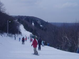
Skiing was a $230 million a year industry in the Poconos and in 1987 accounted for one-quarter of the region's tourist business. Pennsylvania native John Guresh, an employee at Big Boulder Ski Resort, is credited for bringing the ski industry to the Poconos.[51][52][53] In the winter of 1956–57 he invented a machine "resembling a lawn sprinkler atop a sled" to generate artificial snow. Joyce Gemperlein of The Philadelphia Inquirer wrote, "Until Guresh perfected snowmaking at Big Boulder, skiing in the Poconos was a relatively minor sport." Ski resorts in the region could not rely on natural snow and, according to Big Boulder manager Ken Knize, there were times when conditions were right for skiing only two weeks a year. Cal Conniff, president of the National Ski Areas Association, regarded Guresh as "one of the pioneers" of the U.S. ski industry.[51]
- Alpine Mountain - now closed.[54]
- Blue Mountain Ski Area[55] — one of the most popular ski resorts in Pennsylvania with 39 trails, 13 lifts and 1،082 أقدام (330 m) of elevation gain.
- Camelback Ski Area — The second-highest number of ski runs in the Poconos and one of the more popular ski areas and peaks over 2،133 أقدام (650 m).
- Jack Frost Mountain and Big Boulder[56] — Both resorts are owned by the same parent company. Jack Frost caters to more traditional family skiing, while Big Boulder is largely focused on terrain park skiing and snowboarding.
- Shawnee Mountain Ski Area[57] — closest to New York City, just across the Delaware River from New Jersey, suited for families and beginners.
- Ski Big Bear[58]
- Montage Mountain Ski Resort[59] — formerly known as "Snö Mountain".
- Tanglwood[60] — now closed.
أبرز السكان والمقيمين
- فتح الله گولن, Turkish cleric in self-imposed exile[61]
- Robert E. Kintner, ex-President of both ABC and NBC[بحاجة لمصدر]
- S. S. Kresge, founder of KMart, formerly, SS Kresge's[بحاجة لمصدر]
- Byron Lichtenberg, American engineer and fighter pilot who flew aboard two NASA Space Shuttle missions as a Payload Specialist.
- Kelly Monaco, actress and winner of the first season of Dancing with the Stars[62]
- James Mungro, former NFL running back and Super Bowl Champion with the Indianapolis Colts[63]
- Paul Sorvino, actor and opera singer.[بحاجة لمصدر]
- Morris Wilkins, inventor of the heart-shaped bathtub and champagne glass bathtub[64]
- Rob Felicetti, bassist in alternative rock/pop punk band Bowling For Soup.
الإعلام
المطبوعات
The Pocono Record is the newspaper for the Poconos. Its coverage area centers on Stroudsburg and East Stroudsburg and covers parts of Monroe, Pike, Lackawanna, Luzerne, Wayne and Carbon counties as well as areas of western New Jersey.
The Times News, of Lehighton, covers Carbon, Schuylkill, and Monroe counties, and also portions of northern Lehigh and Northampton counties.
West End Happenings covers events in the West End of Monroe County.
The Morning Call, of Allentown, is distributed to a sizeable portion of the region, especially southern Carbon, southern Monroe, and southeastern Schuylkill counties, though its coverage is mostly centered on the neighboring Lehigh Valley. A similar situation occurs with the Times-Tribune of the Scranton/Wilkes-Barre area and northern Monroe, northern Carbon, and Luzerne counties.
The Standard-Speaker, of Hazleton, covers parts of Luzerne, Carbon, Monroe, and Schuylkill counties.
Blue Mountain Moments is a monthly publication covering the Route 903 corridor from Blakeslee to Jim Thorpe.
الإذاعة
WABT "Pocono 96.7" is licensed to Lehman Township in Pike County.
WESS at (90.3 FM) broadcasts from the Borough of East Stroudsburg as a service of East Stroudsburg University. Students and faculty of the University provide programing often, and the station rebroadcasts BBC World Service when live DJs are not available.
WSBG (93.5 FM) is a radio station broadcasting an adult contemporary format. Licensed to Stroudsburg, the station serves the Pocono area with the slogan "The Poconos' Best Variety."
WKRZ (98.5 FM/107.9 FM) is a radio station broadcasting a contemporary hits radio format. The station's call letters are WKRF-FM and is licensed to Tobyhanna and simulcasts WKRZ-FM (98.5 FM from Wilkes Barre) on 107.9 FM.
انظر أيضاً
- Mount Pocono, Pennsylvania – Monroe County Borough
- East Stroudsburg, Pennsylvania – Most populous borough in the Poconos
الهامش
- ^ "gilwell.com: the Lenape / English Dictionary". gilwell.com.
- ^ "The exurbia phenomenon". poconorecord.com.
- ^ MICHAEL RUBINKAM. "Gangs' growth in Poconos raises concerns". poconorecord.com.
- ^ "Pocono Mountains Official Website – Resorts, Restaurants, Things to Do, Golf, Skiing – Vacation and Visitors Information from the Official Pocono Mountains Visitors Bureau". 800poconos.com.
- ^ "About Pocono counties including Carbon Monroe Pike and Wayne". Retrieved July 11, 2017.
- ^ أ ب ت ث ج ح "USDA Interactive Plant Hardiness Map". United States Department of Agriculture. Retrieved September 10, 2019.
- ^ أ ب ت "PRISM Climate Group, Oregon State University". Retrieved September 10, 2019.
- ^ أ ب ت "U.S. Potential Natural Vegetation, Original Kuchler Types, v2.0 (Spatially Adjusted to Correct Geometric Distortions)". Retrieved September 10, 2019.
- ^ Mintz, Max (1999). Seeds of Empire. New York: New York University Press. p. 94. ISBN 0-8147-5622-0.
- ^ Heffelfinger, Bill (January 14, 1968). "'Sullivan's Trail' Truly Historic". The Morning Call. Allentown, Pennsylvania. Retrieved December 21, 2020.
- ^ Mintz, p. 96
- ^ "Game Commission". www.pgc.state.pa.us. Retrieved July 11, 2017.
- ^ أ ب ت Clark, Jayne (August 21, 2014). "We still the Poconos". USA Today. Retrieved September 18, 2015.
- ^ Squeri, Lawrence (2002). Better in the Poconos: The Story of Pennsylvania's Vacationland. University Park, PA: Pennsylvania State University Press. pp. 71–73. ISBN 0271021578.
- ^ "Corvelle named assistant GM at Pocono Manor". Pocono Record. Stroudsburg, Pennsylvania. October 11, 2009. Retrieved September 18, 2015.
- ^ أ ب ت ث ج ح Fleeson, Lucinda (September 2, 1994). "Fading Memories In The Poconos". The Philadelphia Inquirer. Retrieved December 21, 2020.
- ^ Uguccioni, Marilyn (May 29, 1976). "Resort industry old-timer in the Pocono Mountains". The Pocono Record. Retrieved December 21, 2020.
- ^ أ ب Sulon, Bill (February 6, 2003). "Cold comfort: a trio of Pennsylvania inns". The Baltimore Sun. Retrieved December 21, 2020.
- ^ Scott, Andrew; Sigafoos, Stephanie (November 1, 2019). "'This is heartbreaking': Wind-whipped fire destroys 117-year-old Pocono Manor resort in Monroe County". The Morning Call. Allentown, PA. Retrieved January 14, 2019.
- ^ "Skytop Lodge". Historic Hotels of America. National Trust For Historic Preservation. Retrieved October 3, 2015.
- ^ Motavalli, Jim (March 2003). "Peace in the Poconos". E Magazine.
- ^ Goodwin, Stephen; Wolffe, Rick. "The Creator of Golf Courses". The Tillinghast Association. Retrieved September 19, 2018.
- ^ Jesky, Mike (October 26, 1997). "Shawnee Inn: It's stately, yet inviting". Standard Speaker. Hazleton, PA. Retrieved December 21, 2020.
- ^ Squeri (2002), p. 182
- ^ Fodor's national parks and seashores of the east (1 ed.). New York: Fodor's Travel Publications. 1994. p. 164.
- ^ Shea, Barbara (September 11, 1994). "Let the current set the pace at the Delaware Water Gap". The Courier-News. Somerville, NJ. Retrieved December 21, 2020.
- ^ أ ب Sweet, Jeffrey (November 2008). "The Tamiment Connection". American Theatre: 74.
- ^ Nesteroff, Kliph (2015). The Comedians. New York: Grove Press. Chapter Four. ISBN 978-0-8021-2398-5.
- ^ Swanson, Dorothy (April 1989). "The Tamiment Institute/Ben Josephson Library and the Robert F. Wagner Labor Archives at New York University". Library Quarterly. 59 (2): 153. In JSTOR
- ^ أ ب Devlin, Ron (May 15, 2005). "Tamiment bidders find bargains full of memories". The Morning Call. Allentown, Pennsylvania. Archived from the original on 2010-10-03. Retrieved 2015-09-18.
- ^ Sweet, pp. 74–79.
- ^ Smith, Cecil; Litton, Glenn (1981). Musical Comedy In America (Second ed.). New York: Routledge. p. 226. ISBN 0-87830-564-5.
- ^ Sweet, p. 79.
- ^ أ ب ت Devlin, Ron (August 26, 1990). "Blue-collar `Hilton' For Sale". The Morning Call. Allentown, Pennsylvania. Retrieved September 18, 2015.
- ^ أ ب Ellis, Lisa (August 12, 1990). "A Working-class Resort No More Union's Hideaway In Poconos Is For Sale". The Philadelphia Inquirer. Retrieved September 18, 2015.
- ^ Wolensky, Kenneth; Wolensky, Nicole; Wolensky, Robert (2002). Fighting For The Union Label. University Park, PA: The Pennsylvania State University Press. p. 124. ISBN 0-271-02167-5.
- ^ Otnes, Cele; Pleck, Elizabeth (2003). Cinderella Dreams: The Allure of the Lavish Wedding. Berkeley, California: University of California Press. p. 142. ISBN 0-520-23661-0.
- ^ أ ب Moore, Sally (February 1989). "Loving The Poconos". Snow Country. p. 62.
- ^ Spano, Susan (June 1, 2012). "Passion in the Poconos". Smithsonian.com. Retrieved September 18, 2015.
- ^ أ ب ت Squeri (2002), p. 217
- ^ Cook, Bonnie (May 31, 2015). "Morris Benjamin Wilkins, 90, entrepreneur". The Philadelphia Inquirer. Retrieved September 18, 2015.
- ^ Nassauer, Sarah (April 8, 2010). "The Lonely Heart-Shaped Tub Club". The Wall Street Journal. Retrieved September 18, 2015.
- ^ Dash, Judi (June 8, 1986). "It Started With A Heart-shaped Tub". The Philadelphia Inquirer. Retrieved September 22, 2015.
- ^ Bivens, Terry (July 31, 1988). "Playful Passion In The Poconos". The Philadelphia Inquirer. Retrieved September 18, 2015.
- ^ أ ب Jacobs, Andrew (November 2, 2001). "The Thrills Are Over At Mount Airy Lodge". The New York Times.
- ^ Rubinkam, Michael (February 27, 2005). "For sale at Poconos lodge: The heart-shaped tub, and lots more". The Star-Democrat. Easton, Maryland. Retrieved December 21, 2020.
- ^ Lauer-Williams, Kathy (July 19, 2015). "Water Park windfall". The Morning Call. Allentown, Pennsylvania. Retrieved December 21, 2020.
- ^ "Gamblers press their luck as Pa.'s first casino opens". USA Today. November 14, 2006. Retrieved October 8, 2015.
- ^ McKinley, Jesse; Bagli, Charles (November 6, 2014). "In Faded Vacationland, Gambling's Promise Falls Short". The New York Times. Retrieved October 8, 2015.
- ^ Pinemere Camp — Providing Quality Jewish Overnight Camping for Over 70 Summers. Pinemere.com. Retrieved on 2013-08-09.
- ^ أ ب Gemperlein, Joyce (January 18, 1987). "One Man Who Defied Nature And Created His Own Snow". The Philadelphia Inquirer. Retrieved September 19, 2015.
- ^ Fox, Bert (December 5, 1993). "Never Mind The Weather – In The Poconos They Know How To Do Snow". The Philadelphia Inquirer. Retrieved September 19, 2015.
- ^ "John Guresh, Thorpe Resident, Was Snowmaking Pioneer". The Morning Call. Allentown, Pennsylvania. January 22, 1999. Retrieved September 19, 2015.
- ^ "Alpine Mountain". Retrieved July 11, 2017.
- ^ "Blue Mountain – Premier PA Skiing, Riding, & Tubing Resort". Blue Mountain.
- ^ "Home Jack Frost". www.jfbb.com. Retrieved July 11, 2017.
- ^ Shawnee Mountain Ski Area. "Shawnee Mountain Ski Area". shawneemt.com.
- ^ "Home". ski-bigbear.com.
- ^ "Montage Mountain Is Back!". montageisback.com.
- ^ "Tanglwood Resorts". tanglwoodresorts.com.
- ^ Vella, Vinny. "The cleric next door: Pocono neighbors weigh in on Fethullah Gülen, the man Turkey wants back". www.inquirer.com (in الإنجليزية الأمريكية). Retrieved 2020-01-25.
- ^ "Playmate Of The Month April 1997 - Kelly Marie Monaco | Playboy.com". 2012-11-15. Archived from the original on 2012-11-15. Retrieved 2020-01-25.
- ^ reports, Staff. "20 years ago: Mungro was best player in Pa. and Cavaliers best team in District 11". poconorecord.com (in الإنجليزية). Retrieved 2020-01-25.
- ^ "Las Vegan Morris Wilkins, inventor of the heart-shaped bathtub, dies at 90 | Las Vegas Review-Journal". 2015-07-22. Archived from the original on 2015-07-22. Retrieved 2020-01-25.
وصلات خارجية
قالب:Mountains of Pennsylvania قالب:Pocono Mountains قالب:Lehigh Valley
- Pages using gadget WikiMiniAtlas
- CS1 الإنجليزية الأمريكية-language sources (en-us)
- Short description is different from Wikidata
- Coordinates on Wikidata
- مقالات ذات عبارات بحاجة لمصادر
- Articles with unsourced statements from May 2010
- Articles with unsourced statements from January 2020
- جبال پوكونو
- Mountain ranges of Pennsylvania
- Subranges of the Appalachian Mountains
- Allegheny Plateau
- Landforms of Carbon County, Pennsylvania
- Landforms of Lackawanna County, Pennsylvania
- Landforms of Luzerne County, Pennsylvania
- Landforms of Monroe County, Pennsylvania
- Landforms of Pike County, Pennsylvania
- Landforms of Schuylkill County, Pennsylvania
- Landforms of Susquehanna County, Pennsylvania
- Landforms of Wayne County, Pennsylvania
- Regions of Pennsylvania
