تكيرداغ
تكيرداغ
Tekirdağ | |
|---|---|
 | |
 موقع تكيرداغ في محافظة تكيرداغ | |
| الإحداثيات: 40°58′40″N 27°30′55″E / 40.97778°N 27.51528°E | |
| البلد | |
| المحافظة | تكيرداغ |
| الحكومة | |
| • Mayor | قادر البيرق (CHP) |
| المساحة | |
| • District | 1٬111٫53 كم² (429٫16 ميل²) |
| المنسوب | 37 m (121 ft) |
| التعداد (2019)[2] | |
| • الإجمالي | 204٬001 |
| منطقة التوقيت | UTC+3 (TRT) |
| Postal code | 59xxx |
| الموقع الإلكتروني | www.tekirdag.bel.tr |
مدينة تكيرداغ هي عاصمة محافظة تكيرداغ في شمال غرب تركيا. وهي جزء من المنطقة المعروفة تاريخياً بإسم شرق تراقيا، وتقع في شبه جزيرة البلقان في جنوب شرق أوروبا. وفي 2019، بلغ تعداد سكانها حوالي 204,001 نسمة. وتوجد قنصليات فخرية لليونان وبلغاريا في تكيرداغ.
الأسماء وأصولها
Tekirdağ was called Bisanthe or Bysanthe (باليونانية: Βισάνθη/Βυσάνθη),[3][4] and also Rhaedestus (Ῥαιδεστός) in classical antiquity. The latter name was used until the Byzantine era,[5] transformed to Rodosçuk after it fell to the Ottomans in the 14th century (in western languages usually rendered as Rodosto). After the 18th century it was called Tekfurdağı, based on the Turkish word tekfur, meaning "Byzantine lord". In time, the name mutated into the Turkish Tekirdağ, and this became the official name under the Turkish Republic. The historical name "Rhaedestos" (transcribed also as Raidestos) was continuously used until today in Greek Orthodox ecclesiastical context (e.g. Bishop of Raidestos,[6] Metropolitanate of Heraclia and Raidestos[7] (18th-19th centuries).
الموقع
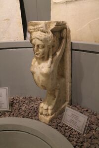 Sphinx table leg, Roman period in Tekirdağ Museum of Archaeology and Ethnography |
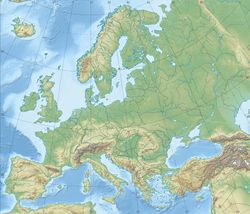
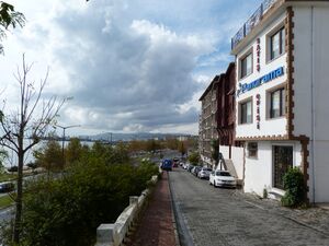
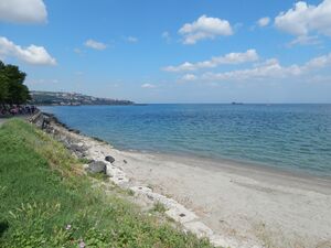
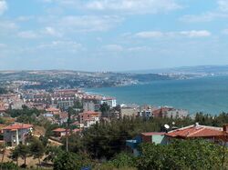
Tekirdağ is situated on the northern coast of the Sea of Marmara, 135 kilometres (84 miles) west of Istanbul. The picturesque bay of Tekirdağ is enclosed by the great promontory of the mountain which gives its name to the city, Tekir Dağı (ancient Combos), a spur about 2000 ft. that rises into the hilly plateau to the north. Between Tekirdağ and Şarköy is another mountain, Ganos Dağı.
المناخ
Tekirdağ has a Mediterranean climate (Köppen: Csa, Trewartha: Cs). Summers are hot and humid whilst winters are cool and wet. Snowfall is quite common between the months of December and March, snowing for a week or two.
| أخفClimate data for تكيرداغ (1991–2020, extremes 1939–2020) | |||||||||||||
|---|---|---|---|---|---|---|---|---|---|---|---|---|---|
| Month | Jan | Feb | Mar | Apr | May | Jun | Jul | Aug | Sep | Oct | Nov | Dec | Year |
| Record high °C (°F) | 23.9 (75.0) |
24.7 (76.5) |
28.1 (82.6) |
34.3 (93.7) |
33.8 (92.8) |
40.2 (104.4) |
38.4 (101.1) |
37.5 (99.5) |
39.7 (103.5) |
35.1 (95.2) |
27.9 (82.2) |
23.5 (74.3) |
40.2 (104.4) |
| Mean daily maximum °C (°F) | 8.6 (47.5) |
9.4 (48.9) |
12.0 (53.6) |
16.1 (61.0) |
21.2 (70.2) |
26.0 (78.8) |
28.7 (83.7) |
29.1 (84.4) |
25.1 (77.2) |
20.0 (68.0) |
15.1 (59.2) |
10.4 (50.7) |
18.5 (65.3) |
| Daily mean °C (°F) | 5.2 (41.4) |
5.8 (42.4) |
8.1 (46.6) |
12.0 (53.6) |
17.1 (62.8) |
21.8 (71.2) |
24.4 (75.9) |
24.8 (76.6) |
20.7 (69.3) |
16.1 (61.0) |
11.4 (52.5) |
7.1 (44.8) |
14.5 (58.1) |
| Mean daily minimum °C (°F) | 2.4 (36.3) |
2.8 (37.0) |
4.8 (40.6) |
8.4 (47.1) |
13.1 (55.6) |
17.4 (63.3) |
19.8 (67.6) |
20.5 (68.9) |
16.7 (62.1) |
12.7 (54.9) |
8.2 (46.8) |
4.2 (39.6) |
10.9 (51.6) |
| Record low °C (°F) | −13.5 (7.7) |
−13.3 (8.1) |
−10.4 (13.3) |
−1.2 (29.8) |
2.7 (36.9) |
8.6 (47.5) |
10.9 (51.6) |
11.0 (51.8) |
3.7 (38.7) |
−1.8 (28.8) |
−7.8 (18.0) |
−10.9 (12.4) |
−13.5 (7.7) |
| Average precipitation mm (inches) | 58.2 (2.29) |
62.7 (2.47) |
53.7 (2.11) |
40.8 (1.61) |
37.8 (1.49) |
37.9 (1.49) |
28.5 (1.12) |
16.4 (0.65) |
45.7 (1.80) |
81.6 (3.21) |
61.2 (2.41) |
76.6 (3.02) |
601.1 (23.67) |
| Average precipitation days | 12.30 | 11.30 | 12.27 | 10.67 | 9.80 | 7.73 | 3.87 | 3.00 | 6.17 | 9.23 | 9.73 | 12.97 | 109.0 |
| Mean monthly sunshine hours | 83.7 | 98.9 | 136.4 | 180.0 | 232.5 | 264.0 | 297.6 | 269.7 | 207.0 | 145.7 | 99.0 | 77.5 | 2٬092 |
| Mean daily sunshine hours | 2.7 | 3.5 | 4.4 | 6.0 | 7.5 | 8.8 | 9.6 | 8.7 | 6.9 | 4.7 | 3.3 | 2.5 | 5.7 |
| Source: Turkish State Meteorological Service[8] | |||||||||||||
التاريخ
The history of the city of Tekirdağ dates back to around 4000 BC.[9] In Xenophon's Anabasis it is mentioned to be a part of the kingdom of the Thracian king Seuthes. It is also mentioned as Bisanthe by Herodotus (VII, 137).
The city was a Samian colony.[10]
Its restoration by Justinian I in the 6th century AD is chronicled by Procopius. In 813 and again in 1206, after the Battle of Rodosto, it was sacked by the Bulgarians, but it continued to appear as a place of considerable note in later Byzantine history. It was also ruled by the Venetians between 1204 and 1235. The 11th-century Byzantine historian Michael Attaleiates owned property in Raidestos which he describes in his will.
In the Ottoman period the city was successively a part of the Rumelia Eyalet, then of the Province of the Kapudan Pasha, the Silistra Eyalet, and Edirne Vilayet. After 1849 it was the seat of the Sanjak of Tekfürtaği.
In 1905, the city had a population of about 35,000; of whom half were Greeks[11] who were exchanged with Muslims living in Greece under the 1923 agreement for Exchange of Greek Orthodox and Muslim Populations between the two countries.
In 1912, after the defeat at the Battle of Lule Burgas the retreating Turkish army set fires on several parts of the town and massacred many Christians.[12] Even children were thrown to the flames.[13]
Tekirdağ was for many years a depot for the produce of the Edirne province, but its trade suffered when Alexandroupolis became the terminus of the railway up the river Maritsa.
الأسقفية
Rhaedestus was the name of the city during the Roman Empire and remains a titular see of the Roman Catholic Church. The diocese belonged to the ecclesiastical province of Heraclea Sintica.[14] Roman Catholic Church activity has long ceased.
الأساقفة الكاثوليك
- Emmet Michael Walsh 8 September 1949 16 November 1952
- Manuel Alfonso de Carvalho 10 February 1953 17 June 1957
- Wilson Laus Schmidt 5 September 1957 18 May 1962
- Carlos Horacio Ponce de Léon 9 June 1962 28 April 1966
تكيرداغ اليوم
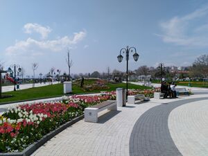
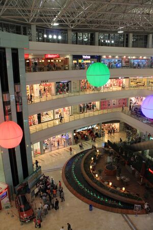
The Tekirdağ area is the site of many holiday homes, as the city is only two hours drive from Istanbul via a new four-lane highway. The villages of Şarköy, Mürefte and Kumbağ are particularly popular with Turkish tourists. Much of this holiday property has been built in an unregulated and unplanned manner and thus much of the coast looks over-built. The Marmara Sea is polluted but there are still a number of public beaches near Tekirdağ, especially the Yeniçiftlik beaches.
Tekirdağ is a Turkish commercial town centre with a harbour for agricultural products; the harbor is being expanded to accommodate a new rail link to the main freight line through Thrace. Tekirdağ is the home port of Martas and the BOTAŞ Terminal, both of which are important for trade activities in the Marmara Region.
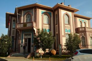
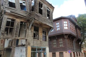
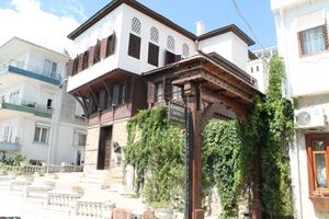
Most of the city's Ottoman wooden buildings have been replaced by concrete apartment blocks, but some are being restored or replaced with attractive houses in the traditional style. Except for the Rüstem Paşa Camii, built by the Ottoman architect, Mimar Sinan, in the 16th century, and the narrow streets that help one imagine life in the Ottoman period, the city lacks antique charm. One reason to visit is the local delicacy, the small spicy cylindrical grilled meatballs called Tekirdağ köftesi, traditionally followed by courses of a sweet local cheese and semolina pudding.
The inland areas are fertile farmland, growing crops including winter wheat, sunflowers, cherries and grapes for wine-making: thus the high quality rakı for which Tekirdağ is noted. The distilleries were state-owned until the 1990s but are now in private hands and the wine and rakı industries are undergoing a renewal. Local red wines are inexpensive and worth a taste.
Both the east–west highway (the Via Egnatia from Roman times) and the highway north toward Muratlı and Lüleburgaz are four lanes. There is a prison next to the rakı distillery and another north of the city on the road to Muratlı.
Tekirdağ is the home of Namık Kemal University, which was founded in 2006 with three faculties. It is located at the eastern edge of the city.
معالم
- The Tekirdağ Museum of Archaeology and Ethnography contains archaeological artifacts found in and around the province, as well as ethnographical items used by the residents of the region relating to the history of cultural life.
- The Namık Kemal House Museum is devoted to the life and works of the Turkish nationalist poet نامق كمال (1840–1888).
- The Rakoczi Museum, an 18th-century Turkish house, where the Hungarian national hero, Francis II Rákóczi lived during his exile, from 1720 till his death in 1735. Today, the museum is a property of Hungary and is widely visited, having become a place of national pilgrimage.
- Of all the statues of Atatürk in Turkey, the town centre of Tekirdağ holds the only one that was made exactly life-size.
- Kutman Wine Museum of Kutman Winery at Mürefte, Şarköy in Tekirdağ
أشخاص بارزون
- Nefise Akçelik (1955–2003) civil engineer specialising in tunnel building
- Phaedimus of Bisanthe, ancient Greek poet (3rd or 2nd century BC)
- Rifat Karlova (born 1980), comedian and actor residing in Taiwan
- Namık Kemal (1840–1888), nationalist poet
- Bekri Mustafa Pasha (1688–1698), Ottoman Grand Vizier
- Tekirdağlı Hüseyin Pehlivan, Yağlı Güreş champion
- Cezayirli Gazi Hasan Pasha
- Francis II Rákóczi (1676–1735), Hungarian prince and national hero
- Erhan Tabakoglu (born 1967), Medizinprofessor and Rector of the Trakya Üniversitesi Edirne
- Memduh Şevket Esendal (1883–1952), writer
- Emre Tetikel (born 1985), actor and novelist
- Solomon Maimon (Rabbi) (1918–2019), American Sephardic Rabbi
البلدات التوأم – المدن الشقيقة
 Bayreuth, Germany
 Kardzhali, Bulgaria
 Kecskemét, Hungary
 Sárospatak, Hungary
 Sliven, Bulgaria
 Techirghiol, Romania
Namesakes
- Tekirdağ Province, which contains Tekirdağ
- TC-JGE, a Turkish Airlines Boeing 737-800 which crashed as Flight 1951 on 25 February 2009[16]
انظر أيضاً
- Tsar Kaloyan of Bulgaria, destroyer of Rodosto in 1206.
- Turkish Airlines Flight 1951, A Boeing 737-800 that crashed. Named after this city.
معض
Thracian King Cersobleptes (Tekirdağ Museum of Archaeology and Ethnography)
Bedesten (Ottoman Bazaar)
المراجع
- ملاحظات
- ^ "Area of regions (including lakes), km²". Regional Statistics Database. Turkish Statistical Institute. 2002. Retrieved 2013-03-05.
- ^ "Population in Turkey". TUIK. TUIK. 4 February 2020. Retrieved 30 November 2020.
- ^ Playfair, James (1812). "A System of Geography, Ancient and Modern". google.gr.
- ^ "Full text of "Hellenica; Books I-II"". archive.org.
- ^ See: Warren Treadgold, The Middle Byzantine Historians (Palgrave Macmillan, 2013)
- ^ "Ecumenical Patriarchate – George Raidestinos I". ec-patr.net.
- ^ Kiminas, Demetrius (March 2009). The Ecumenical Patriarchate. ISBN 9781434458766.
{{cite book}}:|work=ignored (help) - ^ "Resmi İstatistikler: İllerimize Ait Mevism Normalleri (1991–2020)" (in التركية). Turkish State Meteorological Service. Retrieved 11 April 2021.
- ^ "History of Tekirdağ". Archived from the original on 6 February 2007. Retrieved 22 March 2007.
- ^ Scott, Lionel (July 2017). Historical Commentary on Herodotus. BRILL. p. 160. doi:10.1163/9789047407980. ISBN 978-90-47-40798-0.
- ^ Volume V23, Page 448 of the 1911 Encyclopædia Britannica
- ^ "THE LATEST". The Bendigo Independent. No. 13, 049. Victoria, Australia. 8 November 1912. p. 5. Retrieved 9 July 2018 – via National Library of Australia.
- ^ "MASSACRE AND PILLAGE—SCENES AT RODOSTO". The Register (Adelaide). Vol. LXXVII, no. 20, 591. South Australia. 8 November 1912. p. 7. Retrieved 9 July 2018 – via National Library of Australia.
- ^ Rhaedestus[dead link] At catholic-hierarchy.org.
- ^ "Study in Turkey". intrelations.nku.edu.tr. International Relations Center of Tekirdağ Namık Kemal University. Retrieved 2021-02-07.
- ^ "Accident Information Page". Turkish Airlines. Retrieved 26 February 2009.
وصلات خارجية
 تكيرداغ travel guide from Wikivoyage
- Official website
- Tekirdağ photo gallery
- Pages using gadget WikiMiniAtlas
- CS1 errors: periodical ignored
- CS1 التركية-language sources (tr)
- CS1: Julian–Gregorian uncertainty
- Articles with dead external links from November 2017
- Articles with hatnote templates targeting a nonexistent page
- Missing redirects
- Short description is different from Wikidata
- Coordinates on Wikidata
- Articles containing Greek-language text
- محافظة تكيرداغ
- مدن تركيا
- منطقة مرمرة
- تكيرداغ
- Port cities of the Sea of Marmara
- Fishing communities in Turkey
- Populated coastal places in Turkey
- مقاطعات محافظة تكيرداغ


