تريپورا
Tripura
| |||||||||||
|---|---|---|---|---|---|---|---|---|---|---|---|
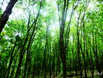
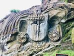
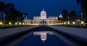
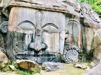
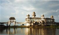
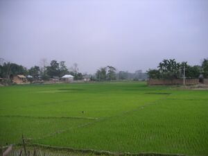
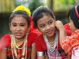
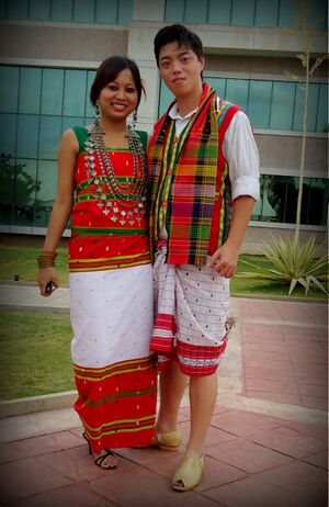
(clockwise from top) Clouded Leopard National Park; Rock-cut sculptures at Unakoti; Ujjayanta Palace; Tripuri dance; Neermahal palace | |||||||||||
 | |||||||||||
| الإحداثيات (Agartala): 23°50′N 91°17′E / 23.84°N 91.28°E | |||||||||||
| Subdivision | 23 subdivisions | ||||||||||
| Union territory | 1 November 1956 | ||||||||||
| State | 21 January 1972[1] | ||||||||||
| Capital | Agartala | ||||||||||
| Most populous city | Agartala | ||||||||||
| Districts | 8 | ||||||||||
| الحكومة | |||||||||||
| • الكيان | Government of Tripura | ||||||||||
| • Governor | Satyadev Narayan Arya[1] | ||||||||||
| • Chief Minister | Biplab Kumar Deb (BJP)[2] | ||||||||||
| • Deputy Chief Minister | Jishnu Dev Varma (BJP)[3] | ||||||||||
| • Legislature | Unicameral (60 seats) | ||||||||||
| المساحة | |||||||||||
| • الإجمالي | 10٬491٫69 كم² (4٬050٫86 ميل²) | ||||||||||
| ترتيب المساحة | 27th (2014) | ||||||||||
| التعداد (2011) | |||||||||||
| • الإجمالي | |||||||||||
| • الترتيب | 22nd (2014) | ||||||||||
| Languages | |||||||||||
| GDP (2019–20) | |||||||||||
| • Nominal | ₹0٫461 lakh crore (5٫8 بليون US$) | ||||||||||
| • Nominal per capita | ₹112٬849 (US$1٬400) | ||||||||||
| منطقة التوقيت | UTC+05:30 (IST) | ||||||||||
| ISO 3166 code | IN-TR | ||||||||||
| لوحة السيارة | TR- | ||||||||||
| HDI | ▲ 0.663 (medium) | ||||||||||
| HDI rank | 25th | ||||||||||
| Literacy | 87.75 % (2011)[5] | ||||||||||
| Official languages[6] | |||||||||||
| الموقع الإلكتروني | tripura | ||||||||||
| |||||||||||
| [2]It was elevated from the status of Union territory by the North-Eastern Areas (Reorganisation) Act 1971 | |||||||||||
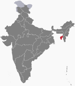
تِريْـبُورَا (Tripura ؛ /ˈtrɪpʊrə, -ərə/)[7] هي ولاية زراعيَة صغيرة في شمال شرق الهند. The third-smallest state in the country, it covers 10،491.69 km2 (4،050.86 sq mi) and is bordered by Bangladesh to the north,[8] south, and west, and the Indian states of Assam and Mizoram to the east. In 2011 the state had 3,671,032 residents, constituting 0.3% of the country's population.
The area of modern Tripura—ruled for several centuries by the Manikya dynasty—was part of an independent princely state under the protectorate of the British Empire. The independent Tripuri Kingdom (also known as Hill Tippera) joined the newly independent India in 1949.
Tripura lies in a geographically isolated location in India, as only one major highway, the National Highway 8, connects it with the rest of the country. Five mountain ranges—Boromura, Atharamura, Longtharai, Shakhan and Jampui Hills—run north to south, with intervening valleys; Agartala, the capital, is located on a plain to the west. The state has a tropical savanna climate, and receives seasonal heavy rains from the south west monsoon. Forests cover more than half of the area, in which bamboo and cane tracts are common. Tripura has the highest number of primate species found in any Indian state. Due to its geographical isolation, economic progress in the state is hindered. Poverty and unemployment continue to plague Tripura, which has a limited infrastructure. Most residents are involved in agriculture and allied activities, although the service sector is the largest contributor to the state's gross domestic product.
According to 2011 census, Tripura is one of the most literate states in India with a literacy rate of 87.75%. According to 2015 Child Census, the literacy rate had increased to about 95.65%. Mainstream Indian cultural elements coexist with traditional practices of the ethnic groups, such as various dances to celebrate religious occasions, weddings and festivities; the use of locally crafted musical instruments and clothes; and the worship of regional deities. The sculptures at the archaeological sites Unakoti, Pilak and Devtamura provide historical evidence of artistic fusion between organised and tribal religions.
وبعض أجزائها جبلية، وبها عدة وديان نهريَّة عميقة. تقع تريبورا في متناول الرياح الموسمية التي تهب على المحيط الهندي وجنوب آسيا. تغطي الغابات الخضراء الكثيفة المناطق الجبليَّة الرَّطبة من الولاية. أمّا في الجنوب، فتقلُّ الغابات وتزداد الكثافة السُّكانيَّة. وعاصمة تريبورا هي أغارتالا وتقع في جنوب الولاية.
أصل الاسم
The Sanskrit name of the state is linked to the Hindu goddess of beauty; Tripura Sundari, the presiding deity of the Tripura Sundari Temple at Udaipur, one of the 51 Shakti Peethas (pilgrimage centres of Shaktism),[9][10] and to the legendary tyrant king Tripur, who reigned in the region. Tripur was the 39th descendant of Druhyu, who belonged to the lineage of Yayati, a king of the Lunar Dynasty.[11]
There are alternative theories regarding the origin of the name Tripura, such as a possible Sanskritic folk etymology of a Tibeto-Burman (Kokborok) name. Variants of the name include Tipra, Tuipura and Tippera. A Kokborok etymology from twi (water) and pra (near) has been suggested; the boundaries of Tripura extended to the Bay of Bengal when the kings of the Tipra Kingdom held sway from the Garo Hills of Meghalaya to Arakan, the present Rakhine State of Burma; so the name may reflect vicinity to the sea.[9][10][12]
التاريخ
Although there is no evidence of lower or middle Paleolithic settlements in Tripura, Upper Paleolithic tools made of fossil wood have been found in the Haora and Khowai valleys.[13] The Indian epic, the Mahabharata; ancient religious texts, the Puranas; and the Edicts of Ashoka – stone pillar inscriptions of the emperor Ashoka dating from the third century BCE – all mention Tripura.[11] An ancient name of Tripura (as mentioned in the Mahabharata) is Kirat Desh (English: "The land of Kirat"), probably referring to the Kirata Kingdoms or the more generic term Kirata.[14] However, it is unclear whether the extent of modern Tripura is coterminous with Kirat Desh.[15] The region was under the rule of the Twipra Kingdom for centuries, although when this dates from is not documented. The Rajmala, a chronicle of Tripuri kings which was first written in the 15th century,[16] provides a list of 179 kings, from antiquity up to Krishna Kishore Manikya (1830–1850),[17][18][19] but the reliability of the Rajmala has been doubted.[20]
The boundaries of the kingdom changed over the centuries. At various times, the borders reached south to the jungles of the Sundarbans on the Bay of Bengal; east to Burma; and north to the boundary of the Kamarupa kingdom in Assam.[16] There were several Muslim invasions of the region from the 13th century onward,[16] which culminated in Mughal dominance of the plains of the kingdom in 1733,[16] although their rule never extended to the hill regions.[16] The Mughals had influence over the appointment of the Tripuri kings.[16]
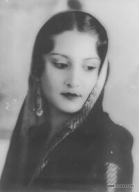
وفي القرن الرَّابع عشر الميلادي وقعت تريبورا تحت سيطرة الأسرة المنيكية ذات الأصل الهندي المغولي، وامتدت سيطرة الحكام المنيكيين السّياسية لتشمل أسَام والبنغال، وفي القرن السَّابع عشر الميلادي نجح أباطرة المغول في احتلال معظم ولاية تريبورا إلا أن الملوك المنيكيين المحليين أو المهراجات احتفظوا بجزء من نفوذهم. وفي أواخر القرن الثامن عشر الميلادي وقعت المناطق التي كان يحكمها المغول تحت السيطرة البريطانية. وأطلق على تريبورا هيل تيبيرا، وذلك بصفتها جزءًا من الإقليم المحتل بشرق البنغال وأسام.
وفي خلال القرنين التاسع عشر والعشرين برز اثنان من حكام تريبورا من مهراجات أمانيكيا. الأول هو بيرتشاندرا مانيكيا باهدور، وقد حكم الولاية بين عامي 1862م و1896م وهو شاعر، وموسيقي بارع، ورجل سياسة. حاول تطوير الولاية بإعادة تنظيم إدارتها والقضاء على الرّق. أما الحاكم الثاني فهو بير بيكرامْ كيشُوُر مانيكيا باهدور، وقد حكم الولاية بين عامي 1923 و1947، وواصل مجهودات التحديث مع مشروعه للتطوير التربوي في مجالات الفنون والعلوم والزراعة والطب والتكنولوجيا. كما افتتح المطار في أغارتا وشيد مدرسة ثانوية بالجزء الشَّرقي من المدينة. وما تزال المدرسة تحمل اسم مؤسسها.
التاريخ الحديث
وبعد وفاة بيربيكرام في عام 1947 استعدت تريبورا لكي تصبح جزءًا من دولة الهند المستقلة، وانضمت للاتحاد الهندي في أكتوبر 1949م، وأصبحت داخل حدود الاتحاد في عام 1956. وفي عام 1972 أصبحت تريبورا إحدى ولايات جمهورية الهند. والحزبان السِّياسيان اللذان لهما تأثير ونفوذ قوي في ولاية تريبورا، هما حزب المؤتمر والحزب الشُّـيوعي الهندي.
Since the partition of India, many Bengali Hindus have migrated to Tripura as refugees fleeing religious persecution in Muslim-majority East Pakistan, especially after 1949.[21] Settlement by Hindu Bengalis increased during the Bangladesh Liberation War of 1971. Parts of the state were shelled by the Pakistan Army during the Indo-Pakistani War of 1971. Following the war, the Indian government reorganised the North East region to ensure effective control of the international borders – three new states came into existence on 21 January 1972:[22] Meghalaya, Manipur, and Tripura.[22] Before independence, most of the population was indigenous.[21] Ethnic strife between the Tripuri tribe and the predominantly immigrant Bengali community led to scattered violence,[23] and an insurgency spanning decades, including occasional massacres such as the 1980 Mandai massacre.[24] This gradually abated following the establishment of a tribal autonomous district council and the use of strategic counter-insurgency operations.[25] Tripura remains peaceful, as of 2016.[26]
الجغرافيا
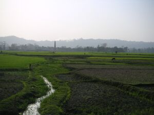
Tripura is a landlocked state in North East India, where the seven contiguous states – Arunachal Pradesh, Assam, Manipur, Meghalaya, Mizoram, Nagaland and Tripura – are collectively known as the Seven Sister States. Spread over 10،491.69 km2 (4،050.86 sq mi), Tripura is the third-smallest among the 28 states in the country, behind Goa and Sikkim. It extends from 22°56'N to 24°32'N, and 91°09'E to 92°20'E.[21] Its maximum extent measures about 178 km (111 mi) from north to south, and 131 km (81 mi) east to west. Tripura is bordered by the country of Bangladesh to the west, north and south; and the Indian states of Assam to the north east; and Mizoram to the east.[21] It is accessible by national highways passing through the Karimganj district of Assam and Mamit district of Mizoram.[27]
الطبوغرافيا
The physiography is characterised by hill ranges, valleys and plains. The state has five anticlinal ranges of hills running north to south, from Boromura in the west, through Atharamura, Longtharai and Shakhan, to the Jampui Hills in the east.[28] The intervening synclines are the Agartala–Udaipur, Khowai–Teliamura, Kamalpur–Ambasa, Kailasahar–Manu and Dharmanagar–Kanchanpur valleys.[28] At an altitude of 939 m (3،081 ft), Betling Shib in the Jampui range is the state's highest point.[21] The small isolated hillocks interspersed throughout the state are known as tillas, and the narrow fertile alluvial valleys, mostly present in the west, are called lungas.[21] A number of rivers originate in the hills of Tripura and flow into Bangladesh.[21] The Khowai, Dhalai, Manu, Juri and Longai flow towards the north; the Gumti to the west; and the Muhuri and Feni to the south west.[28]
The lithostratigraphy data published by the Geological Survey of India dates the rocks, on the geologic time scale, between the Oligocene epoch, approximately 34 to 23 million years ago, and the Holocene epoch, which started 12,000 years ago.[28] The hills have red laterite soil that is porous. The flood plains and narrow valleys are overlain by alluvial soil, and those in the west and south constitute most of the agricultural land.[21] According to the Bureau of Indian Standards, on a scale ranging from I to V in order of increasing susceptibility to earthquakes, the state lies in seismic zone V.[29]
اليابسة
تقع ولاية تريبورا المرتفعة في الشَّمال الشَّرقي من الهند. وتحيط بها بنغلاديش من الشّمال والغرب والجنوب، وتحدها ولايتا ميزورام وأَسَام من جهتي الشرق والشّمال الشرقي. ويتكون شمال الولاية من أربعة وديان تفصل بينها سلسلة تلال، ويصل ارتفاع السلسلة الشرقية إلى 1,000م تقريبًا. ومن مصارف الأنهار الشمالية مصرف الديوه، ومصرف الدالاي، ومصرف الكوواري ومصرف المانُو، كما يقوم نهر الغومتي وروافده بتصريف مياه السهل الموجود في جنوبي تريبورا. وقد اختفت أغلب الغابات الطبيعية الخضراء، ويعتبر خشب السال الثمين هو النوع السائد. ويعيش في ولاية تريبورا، كجيرانها من المناطق المرتفعة، العديد من الحيوانات المتوحشة مثل الفيلة والنمور والخنازير البرية والجاموس الوحشي، كما يعيش فيها أضحم ثور في العالم ويعرف باسم الغاور.
المناخ
أثناء موسم الرياح الموسمية الذي يمتد من يونيو إلى سبتمبر تسقط أمطار تتعدى 200سم على ولاية تريبورا وقد تصل كمية الأمطار الكلية التي تسقط سنويًا على الولاية إلى أكثر من 250سم. وترتفع الحرارة في الوديان، وتقل فوق الجبال. The four main seasons are winter, from December to February; pre-monsoon or summer, from March to April; monsoon, from May to September; and post-monsoon, from October to November.[30] During the monsoon season, the south west monsoon brings heavy rains, which cause frequent floods.[21][28] The average annual rainfall between 1995 and 2006 ranged from 1،979.6 إلى 2،745.9 mm (77.94 إلى 108.11 in).[31] During winter, temperatures range from 13 إلى 27 °C (55 إلى 81 °F), while in the summer they fall between 24 و 36 °C (75 و 97 °F).[30] According to a United Nations Development Programme report, the state lies in "very high damage risk" zone from wind and cyclones.[32]
| الشهر | ينا | فب | مار | أبر | ماي | يون | يول | أغس | سبت | أكت | نوف | ديس | السنة |
|---|---|---|---|---|---|---|---|---|---|---|---|---|---|
| متوسط القصوى اليومية °س (°ف) | 25.6 (78.1) |
28.3 (82.9) |
32.5 (90.5) |
33.7 (92.7) |
32.8 (91.0) |
31.8 (89.2) |
31.4 (88.5) |
31.7 (89.1) |
31.7 (89.1) |
31.1 (88.0) |
29.2 (84.6) |
26.4 (79.5) |
30.5 (86.9) |
| متوسط الدنيا اليومية °س (°ف) | 10 (50) |
13.2 (55.8) |
18.7 (65.7) |
22.2 (72.0) |
23.5 (74.3) |
24.6 (76.3) |
24.8 (76.6) |
24.7 (76.5) |
24.3 (75.7) |
22 (72) |
16.6 (61.9) |
11.3 (52.3) |
19.7 (67.4) |
| متوسط تساقط الأمطار mm (inches) | 27.5 (1.08) |
21.5 (0.85) |
60.7 (2.39) |
199.7 (7.86) |
329.9 (12.99) |
393.4 (15.49) |
363.1 (14.30) |
298.7 (11.76) |
232.4 (9.15) |
162.5 (6.40) |
46 (1.8) |
10.6 (0.42) |
2٬146 (84.49) |
| Source: [33] | |||||||||||||
النبيت والوحيش
| State symbols of Tripura[34] | |
| State animal | Phayre's leaf monkey |
| State bird | Green imperial pigeon |
| State tree | Agarwood |
| State flower | Mesua ferrea |
| State fruit | Queen pineapple |
Like most of the Indian subcontinent, Tripura lies within the Indomalayan realm. According to the Biogeographic classification of India, the state is in the "North-East" biogeographic zone.[35] In 2011 forests covered 57.73% of the state.[36] Tripura hosts three different types of ecosystems: mountain, forest and freshwater.[37] The evergreen forests on the hill slopes and the sandy river banks are dominated by species such as Dipterocarpus, Artocarpus, Amoora, Elaeocarpus, Syzygium and Eugenia.[38] Two types of moist deciduous forests comprise majority of the vegetation: moist deciduous mixed forest and Sal (Shorea robusta)-predominant forest.[38] The interspersion of bamboo and cane forests with deciduous and evergreen flora is a peculiarity of Tripura's vegetation.[38] Grasslands and swamps are also present, particularly in the plains. Herbaceous plants, shrubs, and trees such as Albizia, Barringtonia, Lagerstroemia and Macaranga flourish in the swamps of Tripura. Shrubs and grasses include Schumannianthus dichotoma (shitalpati), Phragmites and Saccharum (sugarcane).[38]
According to a survey in 1989–90, Tripura hosts 90 land mammal species from 65 genera and 10 orders,[39] including such species as elephant (Elephas maximus), bear (Melursus ursinus), binturong (Arctictis binturong), wild dog (Cuon alpinus), porcupine (Artherurus assamensis), barking deer (Muntiacus muntjak), sambar (Cervus unicolor), wild boar (Sus scrofa), gaur (Bos gaurus), leopard (Panthera pardus), clouded leopard (Neofelis nebulosa), and many species of small cats and primates.[39] Out of 15 free ranging primates of India, seven are found in Tripura; this is the highest number of primate species found in any Indian state.[39] The wild buffalo (Bubalus arnee) is extinct now.[40] There are nearly 300 species of birds in the state.[41]
Wildlife sanctuaries of the state are Sipahijola, Gumti, Rowa and Trishna wildlife sanctuaries.[42] National parks of the state are Clouded Leopard National Park and Rajbari National Park.[42] These protected areas cover a total of 566.93 km2 (218.89 sq mi).[42] Gumti is also an Important Bird Area.[43] In winter, thousands of migratory waterfowl throng Gumti and Rudrasagar lakes.[44]
التقسيمات الادارية
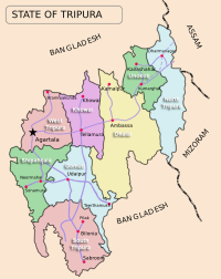
In January 2012, major changes were implemented in the administrative divisions of Tripura. Beforehand, there had been four districts – Dhalai (headquarters Ambassa), North Tripura (headquarters Kailashahar), South Tripura (headquarters Udaipur, Tripura), and West Tripura (headquarters Agartala). Four new districts were carved out of the existing four in January 2012 – Khowai, Unakoti, Sipahijala and Gomati.[45] Six new subdivisions and five new blocks were also added.[46] Each is governed by a district collector or a district magistrate, usually appointed by the Indian Administrative Service. The subdivisions of each district are governed by a sub-divisional magistrate and each subdivision is further divided into blocks. The blocks consist of Panchayats (village councils) and town municipalities. As of 2012, the state had eight districts, 23 subdivisions and 58 development blocks.[47] National census and state statistical reports are not available for all the new administrative divisions, as of March 2013. Agartala, the capital of Tripura, is the most populous city. Other major towns with a population of 10,000 or more (as per 2015 census) are Sabroom, Dharmanagar, Jogendranagar, Kailashahar, Pratapgarh, Udaipur, Amarpur, Belonia, Gandhigram, Kumarghat, Khowai, Ranirbazar, Sonamura, Bishalgarh, Teliamura, Mohanpur, Melaghar, Ambassa, Kamalpur, Bishramganj, Kathaliya, Santirbazar and Baxanagar.
السكان والحكومة
أكثر من نصف سكان تريبورا من الهندوس، أما الباقون فهم نصارى مع وجود أقلية من المسلمين والبوذيين. ويتكلم أكثر من نصف السُّكان اللُّغة البنغاليَّة، كما تعد اللُّغتان التريبورية والمنيبورية نسبة إلى منيبورا من اللغات المنتشرة أيضًا.
| نمو السكان | |||
|---|---|---|---|
| Census | Pop. | %± | |
| 1951 | 639٬000 | ||
| 1961 | 1٬142٬000 | 78.7% | |
| 1971 | 1٬556٬000 | 36.3% | |
| 1981 | 2٬053٬000 | 31.9% | |
| 1991 | 2٬757٬000 | 34.3% | |
| 2001 | 3٬199٬000 | 16.0% | |
| Source:Census of India[48] | |||
| اللغة | العائلة اللغوية | |
|---|---|---|
| بنغالي | Bengali | Indo-European |
| Tipra/تريپوري | تريپوري | Sino-Tibetan |
| Bishnupriya Manipuri | Bishnupriya Manipuri | Indo-European |
| Manipuri | Meitei | Sino-Tibetan |
| Chakma | Changma Vaj | Indo-European |
| Kuki | Kuki | Sino-Tibetan |
| لوشاي | ميزو | Sino-Tibetan |
| Mogh | Mogh | Sino-Tibetan |
ويمثل تريبورا عضوان منتخبان في المجلس التَّشريعي الأدنى لُوك سابْها، وممثل مُعيَّن في المجلس التَّشريعي الأعلى راجيَا سَابْها بالبرلمان الوطني الهندي. ويتكوَّن المجلس التشريعيُّ للولاية من 60 عضوًا.
الاقتصاد
| GSDP at Constant Prices (2004–05 base)[49]
figures in crores Indian rupee | |
| Year | GSDP |
|---|---|
| 2004–05 | 8,904 |
| 2005–06 | 9,482 |
| 2006–07 | 10,202 |
| 2007–08 | 10,988 |
| 2008–09 | 11,596 |
| 2009–10 | 12,248 |
| 2010–11 | 12,947 |
Tripura's gross state domestic product for 2010–11 was ₹129٫47 billion (1٫6 بليون US$) at constant price (2004–05),[49] recording 5.71% growth over the previous year. In the same period, the GDP of India was ₹48٬778٫42 billion (610 بليون US$), with a growth rate of 8.55%.[49] Annual per capita income at current price of the state was ₹38٬493 (US$480), compared to the national per capita income ₹44٬345 (US$560).[50] In 2009, the tertiary sector of the economy (service industries) was the largest contributor to the gross domestic product of the state, contributing 53.98 percent of the state's economy compared to 23.07 percent from the primary sector (agriculture, forestry, mining) and 22.95 percent from the secondary sector (industrial and manufacturing).[50] According to the Economic Census of 2005, after agriculture, the maximum number of workers were engaged in retail trade (28.21% of total non-agricultural workforce), followed by manufacturing (18.60%), public administration (14.54%), and education (14.40%).[51]
Tripura is an agrarian state with more than half of the population dependent on agriculture and allied activities.[52] However, due to hilly terrain and forest cover, only 27% of the land is available for cultivation.[52] Rice, the major crop of the state, is cultivated in 91% of the cropped area.[52] According to the Directorate of Economics & Statistics, Government of Tripura, in 2009–10, potato, sugarcane, mesta, pulses and jute were the other major crops cultivated in the state.[53] Jackfruit and pineapple top the list of horticultural products.[53] Traditionally, most of the indigenous population practised jhum method (a type of slash-and-burn) of cultivation. The number of people dependent on jhum has declined over the years.[54]
Pisciculture has made significant advances in the state. At the end of 2009–10, the state produced a surplus of 104.3 million fish seeds, primarily carp.[55] Rubber and tea are the important cash crops of the state. Tripura ranks second to Kerala in the production of natural rubber in the country.[56] The state is known for its handicraft, particularly hand-woven cotton fabric, wood carvings, and bamboo products. High quality timber including sal, garjan, teak and gamar are found abundantly in the forests of Tripura. Tata Trusts signed a pact with Government of Tripura in July 2015 to improve fisheries and dairy in the state.[57]
| Per Capita Income with 2004–05 Base | ||
| Year | Tripura | India |
|---|---|---|
| 2004–05 | 24,394 | 24,095 |
| 2005–06 | 26,668 | 27,183 |
| 2006–07 | 29,081 | 31,080 |
| 2007–08 | 31,111 | 35,430 |
| 2008–09 | 33,350 | 40,141 |
| 2010–11 | 33,493 | 44,345 |
The industrial sector of the state continues to be highly underdeveloped – brickfields and tea industry are the only two organised sectors.[51] Tripura has considerable reservoirs of natural gas.[28] According to estimates by Oil and Natural Gas Corporation (ONGC), the state has 400 billion metres3 reserves of natural gas, with 16 billion metres3 is recoverable.[56] ONGC produced 480 million metres3 natural gas in the state, in 2006–07.[56] In 2011 and 2013, new large discoveries of natural gas were announced by ONGC.[58] Tourism industry in the state is growing – the revenue earned in tourism sector crossed ₹10 million (US$130٬000) for the first time in 2009–10, and surpassed ₹15 million (US$190٬000) in 2010–11.[59] Although Bangladesh is in a trade deficit with India, its export to Tripura is significantly more than import from the state; a report in the newspaper The Hindu estimated Bangladesh exported commodities valued at about ₹3٫5 billion (44 مليون US$) to the state in 2012, as opposed to "very small quantity" of import.[60] Alongside legal international trade, unofficial and informal cross-border trade is rampant.[61] In a research paper published by the Institute of Developing Economies in 2004, the dependence of Tripura's economy on that of Bangladesh was emphasised.[62]
The economy of Tripura can be characterised by the high rate of poverty, low capital formation, inadequate infrastructure facilities, geographical isolation and communication bottlenecks, inadequate exploration and use of forest and mineral resources, slow industrialisation and high unemployment. More than 50% of the population depends on agriculture for sustaining their livelihood.[63] However agriculture and allied activities to Gross State Domestic Production (GSDP) is only 23%, this is primarily because of low capital base in the sector. Despite the inherent limitation and constraints coupled with severe resources for investing in basic infrastructure, this has brought consistency progress in the quality of life and income of people cutting across all sections of society. The state government through its Tripura Industrial Policy and Tripura Industrial Incentives Scheme, 2012, has offered heavy subsidies in capital investment and transport, preferences in government procurement, waivers in tender processes and fees, yet the impact has been not much significant beyond a few industries being set up in the Bodhjungnagar Industrial Growth Center.[64]
The Planning Commission estimates the poverty rate of all North East Indian states by using headcount ratio of Assam (the second largest state in North East India after Arunachal Pradesh). According to 2001 Planning Commission assessment, 22 percent of Tripura's rural residents were below the poverty line. However, Tripura government's independent assessment, based on consumption distribution data, reported that, in 2001, 55 percent of the rural population was below the poverty line.[51] Geographic isolation and communication bottleneck coupled with insufficient infrastructure have restricted economic growth of the state.[52] High rate of poverty and unemployment continues to be prevalent.[52]
يُعد الأرز المحصول الغذائي الرَّئيسي، وهو يلائم الأراضي التي تنتشر فيها المستنقعات في الوديان الشَّماليّة والسُّهول المنخفضة في الجنوب. أما الجوت والشاي فهما من المحاصيل الرَّئيسيّة للدّخل القومي. كما يزرع القطن والفواكه والخردل والبطاطس وقصب السُّكر. والميستا (نبات كالكتان) يزرع من أجل أليافه التي تُستخدم في صناعة الأكياس والحبال.
الصناعة
من أهم الأنشطة الصّناعيَّة في ولاية تريبورا تصنيع المنتجات الزراعية التي تأتي بالدخل للولاية ومنها الجوت وقصب السكر، إلا أنه لا توجد مصانع ضخمة. وتقوم المصانع الصغيرة بتجهيز الفاكهة للتعليب، وتصنيع الشاي والأخشاب. وقد قامت الولاية، بتشجيع من الحكومة، بتنمية بعض الصناعات الصغيرة، مثل صناعة السلال والنجارة والفخار والنسيج بالإضافة إلى الأواني المصنوعة من الألومنيوم والمنتجات الجلدية ورقائق الخشب والأثاث المعدني. كما توجد بولاية تريبورا مطاحن الدّقيق والأرز، وورش تقطيع الأخشاب. ومن أهم منتجات الأخشاب خشب السَّـال الهندي المتين والفحم النباتي كما تتطور بصورة سريعة عملية تربية دودة القز لإنتاج الحرير الخام وتعرف باسم القزاز.
وتُعدُّ الطائرة الوسيلة الوحيدة الملائمة للسَّفر إلى أغارتالا وهناك رحلات جويَّة يوميَّة من وإلى كُلكَتا بالبنغال الغربية، بالإضافة إلى الطَّيران غير المباشر إلى غوهاتي وسيلشار بولاية أسام. ولا يتعدَّى طول الطرق الممهدة بالولاية 1,300كم، وتبعد تريبورا مسافات شاسعة عن المدن الهندية الرئيسيَّة. فهي تبعد عن كلكتا أكثر من وعن غوهاتي 600كم، وعن شيلونغ 500كم. وليست هناك خطوط سكك حديدية.
الثقافة
الديمغرافيا
التعداد
| نمو السكان[48][65][66] | ||
| الإحصاء | التعداد | %± |
|---|---|---|
| 1871 | 65,334 | — |
| 1881 | 95,637 | 46.4% |
| 1891 | 137,442 | 43% |
| 1901 | 173,325 | 26% |
| 1911 | 229,613 | 32.48% |
| 1921 | 304,437 | 32.59% |
| 1931 | 382,450 | 25.63% |
| 1941 | 513,010 | 34.14% |
| 1951 | 639,000 | 24.56% |
| 1961 | 1,142,000 | 78.7% |
| 1971 | 1,556,000 | 36.3% |
| 1981 | 2,053,000 | 31.9% |
| 1991 | 2,757,000 | 34.3% |
| 2001 | 3,199,203 | 16% |
| 2011 | 3,671,032 | 14.7% |
Tripura ranks second to Assam as the most populous state in North East India. According to the provisional results of 2011 census of India, Tripura has a population of 3,671,032 with 1,871,867 males and 1,799,165 females.[67] It constitutes 0.3% of India's population. The sex ratio of the state is 961 females per thousand males,[67] higher than the national ratio 940. The density of population is 350 persons per square kilometre.[68] The literacy rate of Tripura in 2011 was 87.75%,[67] higher than the national average 74.04%, and third best among all the states.
Tripura ranked sixth in Human Development Index (HDI) among 35 states and union territories of India, according to 2006 estimate by India's Ministry of Women and Child Development; the HDI of Tripura was 0.663, better than the all-India HDI 0.605.[69]
In 2011, the police in Tripura recorded 5,803 cognisable offences under the Indian Penal Code, a number second only to Assam (66,714) in North East India.[70] The crime rate in the state was 158.1 per 100,000 people, less than the all-India average of 192.2.[71] However, 2010 reports showed that the state topped all the states for crime against women, with a rate of 46.5 per 100,000 people, significantly more than the national rate of 18.[72]
الجماعات العرقية
The Indigenous Tripuri constitute about 31% of the state population while other people like Bengalis about 69% of Tripura's population.[73][74] The other ethnic groups of people recognised by the country's constitution, consist of ethnic groups like Chakma (2.1%), Halam (4.8%), Mog (3.1%), Munda (1.2%), Kuki (1.2%) and Garo (1.1%).[73] and many sub-groups,[75] with diverse languages and cultures.
اللغات
Tripuri (Kokborok) is the Indigenous and official language of the state.[78] However, Bengali is also the official and the most spoken language due to migration from the neighboring country Bangladesh with Noakhailla, as the most widespread dialect. Other minority languages such as Mog, Odia, Bishnupriya Manipuri, Manipuri, Halam, Garo and Chakma belonging to Indo-European and Sino-Tibetan families are spoken in the state.[79] Thadou, a nearly extinct language, is spoken by only four people in one village, as of 2012.[80]
الأديان
According to 2011 census, Hinduism is the majority religion in the state, followed by 83.40% of the population.[82] Muslims make up 8.60% of the population, Christians 4.35%, and Buddhists 3.41%.[83]
| الدين | التعداد |
|---|---|
| هندوس ( |
3,063,903 |
| مسلمون ( |
316,042 |
| مسيحيون ( |
159,882 |
| بوذيون ( |
125,385 |
| آخرون | 8,705 |
| الإجمالي | 3,673,917 |
Christianity is chiefly followed by members of the Lushai, Kuki, Garo, Halam tribes and as per 2017 census has 159,882 adherents.[85]
ديمغرافيا السكان الأصليين
نسبة التريپوري حسب العقد[86][87][88][89][90]
| السنة | النسبة | Increase |
|---|---|---|
| 1871 | 90.04% | - |
| 1881 | 87.06% | -2.98% |
| 1891 | 75.75% | -11.31% |
| 1901 | 74.68% | -1.07% |
| 1911 | 64.34% | -10.34% |
| 1921 | 68.34% | -4% |
| 1931 | 70.09% | -1.75% |
| 1941 | 62.06% |
–8.03% |
| 1951 | 48.65% | -13.41% |
| 1961 | 31.55% | -17.1% |
| 1971 | 28.95% | -2.6% |
| 1981 | 28.44% | -0.51% |
| 1991 | 30.95% | +2.51% |
| 2001 | 31.05% | +0.1% |
| 2011 | 31.78% | +0.73% |
Once Tripura was a overwhelming Tripuri majority state.[91] In 1941, the native Tripuris made up 62.06% of the population in present- day Tripura while the non-Tripuri people, mainly Bengalis and non-Bengalis occupies rest of the percentage.[92] The percentage of Tripuris decreased from 62.06% in 1941 (before partition) to 48.65% (after partition) in 1951 due to East Bengali refugees who were coming from East Pakistan present-day-Bangladesh. After 1971, The indigenous Tripuri population of Tripura have increased from 28.44% in 1981 to 31.05% in 2001.[93] The 2011 census stated that indigenous Tripuri constitute 31.78% of the state population which is up from the previous census record of 31.05% in 2001.[94]
وصول اللاجئين البنغال

During the Partition of Bengal in 1947, lakhs of thousands of Bengali refugees fled from East Pakistan into India's Tripura following the persecution and discrimination prevailing there by state sponsored government. Estimation shows that between the period of (1947-51), around 6.10 lakh Bengalis — the figure almost equal to the State’s total population have poured into the state leading to the completely change of the demography scenario in the first phase.[95] Again during Bangladesh liberation war of 1971, the second phase nearly around 10.38 lakhs Bengalis (most being Hindus) have came into various parts of Tripura to take refugees and most of them have settled here permanently afterwards.[96]
| السنة | الأعداد |
|---|---|
| 1946 (شغب نواخالي) | 3,327 |
| 1947 (سنة التقسيم) | 8,124 |
| 1948 | 9,554 |
| 1949 (قلاقل طائفية) | 11,575 |
| 1950 (شغب طائفي شديد) | 67,151 |
| 1951 | 184,000 |
| 1952 (شغب شديد) | 233,000 |
| 1953 | 80,000 |
| 1954 | 4,700 |
| 1955 | 17,500 |
| 1956 | 50,700 |
| 1957 | 57,700 |
| 1958 | 3,600 |
| 1964-65 (شغب شديد) | 100,340 |
| 1965-66 | 13,073 |
| 1966-67 | 1,654 |
| 1967-68 | 12,229 |
| 1968-69 | 3,120 |
| 1969-70 | 4,334 |
| 1970-71 (إلى 24 مارس) | 5,774 |
| من (1946-71) | الإجمالي - (871,455) |
Culture
The diverse ethno-linguistic groups of Tripura have given rise to a composite culture.[99][100] However, most of the rich culture of Tripura can be credited to the Tripuris. Since ancient times Tripuris had ruled over this region, as a result Tripuri culture is the most reflected in the state.
The Tripuri Maharajas were great patrons of art and culture, they themselves were great artists. They were highly skilled in different art forms such as painting, music, literature, photography. Apart from Tripuri culture they also promoted Bengali culture, which shows Tripuri kings respected everyone's culture.
Performing arts
Tripura had a wide collection of notable art and cultural displays.
- Mamita dance : A Tripuri dance form performed during Mamita occasion, which is after the harvesting of year's first corps and to worship Ama Mailuma.
- Goria dance : Tripuri dance performed during Goria puja.
- Hojagiri dance : A divine Tripuri dance form.
- Lebang dance : A Tripuri dance form.
- Mosak Sulmani dance : A Tripuri dance form.
- Jadu Kolija : A Tripuri folk-classical song.
- Dangsa Mwsamung: A type of Tripuri play performed on stage.[101]
Other dance forms of minority groups include Sangrai dance and Owa dance of Mog, Hai-hak dance of Halam, Wangla dance of Garo, Bizhu dance of Chakma.[101] Alongside such traditional music, mainstream Indian musical elements such as Indian classical music and dance are also practised.[102] Sachin Dev Burman, a member of the Tripuri royal family, was a maestro in the filmi genre of Indian music.[103]
Music and dance are integral to the culture of the state. Some local musical instruments are:
- sarinda : A Tripuri string instrument.
- chongpreng : Tripuri string instrument.
Tripura is noted for bamboo and cane handicrafts.[100] Bamboo, wood and cane are used to create an array of furniture, utensils, hand-held fans, replicas, mats, baskets, idols and interior decoration materials.[104][105]
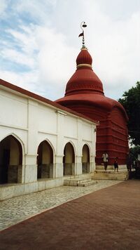
Hindus believe that Tripura Sundari is the patron goddess of Tripura and an aspect of Shakti.[17] Durga Puja, Kali Puja, Dolyatra, Ashokastami and the worship of the Chaturdasha deities are important festivals in the state. Some festivals represent confluence of different regional traditions, such as Ganga puja, Garia puja, Kharchi puja and Ker puja.[106][107] Unakoti, Pilak and Devtamura are historic sites where large collections of stone carvings and rock sculptures are noted.[100][108] Like Neermahal is a cultural Water Palace of this state. Sculptures are evidence of the presence of Buddhist and Brahmanical orders for centuries, and represent a rare artistic fusion of traditional organised religions and tribal influence.[109][110][111] The State Museum in the Ujjayanta Palace in Agartala has impressive galleries that depict the history and culture of Tripura through pictures, videos and other installations.
انظر أيضاً
- Kokborok
- البنغال
- Agartala
- Tipra
- Tripuri
- Tripura Police
- Acharya Gour Ganguly, leader of Agartala's satyagraha movement in the 1970s against atrocities on women
أماكن الجذب
الهامش
- ^ "List of Governors of States/UTs of India". PendulumEdu. PendulumEdu. Retrieved 12 July 2021.
- ^ "Biplab Deb takes oath as Tripura chief minister". Livemint. 9 March 2018. Archived from the original on 9 March 2018. Retrieved 9 March 2018.
- ^ "BJP picks Biplab Deb as new Tripura CM, Jishnu Debbarma to be his deputy". Hindustan Times. 9 March 2018.
- ^ "Know Tripura | Tripura State Portal". tripura.gov.in. Retrieved 23 December 2020.
- ^ State of Literacy, censusindia.gov.in, http://censusindia.gov.in/2011-prov-results/data_files/india/Final_PPT_2011_chapter6.pdf, retrieved on 20 June 2015
- ^ "Report of the Commissioner for linguistic minorities: 52nd report (July 2014 to June 2015)" (PDF). Commissioner for Linguistic Minorities, Ministry of Minority Affairs, Government of India. pp. 79–84. Archived from the original (PDF) on 15 نوفمبر 2016. Retrieved 16 فبراير 2016.
- ^ Wells, John C. (2008). Longman Pronunciation Dictionary (3rd ed.). Longman. ISBN 9781405881180.
- ^ "Rohingya crisis: Security tightened along India-Myanmar border". Archived from the original on 15 September 2017.
- ^ أ ب Das, J.K. (2001). "Chapter 5: old and new political process in realization of the rights of indigenous peoples (regarded as Tribals) in Tripura". Human rights and indigenous peoples. APH Publishing. pp. 208–9. ISBN 978-81-7648-243-1.
- ^ أ ب Debbarma, Sukhendu (1996). Origin and growth of Christianity in Tripura: with special reference to the New Zealand Baptist Missionary Society, 1938–1988. Indus Publishing. p. 20. ISBN 978-81-7387-038-5. Archived from the original on 29 April 2016.
- ^ أ ب Acharjya, Phanibhushan (1979). Tripura. Publications Division, Ministry of Information and Broadcasting, Government of India. p. 1. ASIN B0006E4EQ6.
- ^ Prakash (ed.), Encyclopaedia of North-east India, vol. 5, 2007, p. 2272 Archived 24 أبريل 2016 at the Wayback Machine
- ^ Singh, Upinder (2008). A history of ancient and early medieval India: from the stone age to the 12th century. Pearson Education India. p. 77. ISBN 978-81-317-1677-9. Archived from the original on 23 July 2016.
- ^ أ ب Tripura district gazetteers. Educational Publications, Department of Education, Government of Tripura. 1975. Archived from the original on 4 May 2016.
- ^ Rahman, Syed Amanur; Verma, Balraj (5 August 2006). The beautiful India – Tripura. Reference Press. p. 9. ISBN 978-81-8405-026-4. Archived from the original on 17 June 2016.
- ^ أ ب ت ث ج ح "Hill Tippera – history" (GIF). The Imperial Gazetteer of India. 13: 118. 1909. Archived from the original on 7 يونيو 2011. Retrieved 27 أكتوبر 2011.
- ^ أ ب Bera, Gautam Kumar (2010). The land of fourteen gods: ethno-cultural profile of Tripura. Mittal Publications. ISBN 978-81-8324-333-9.
- ^ Sen, Kali Prasanna, ed. (2003). Sri rajmala volume – IV (in Bengali). Tribal Research Institute, Government of Tripura. Archived from the original on 6 June 2012. Retrieved 10 May 2013.
- ^ Bhattacharyya, Apurba Chandra (1930). Progressive Tripura. Inter-India Publications. p. 179. OCLC 16845189.
- ^ Sircar, D.C. (1979). Some epigraphical records of the mediaeval period from eastern India. Abhinav Publications. p. 89. ISBN 978-81-7017-096-9. Archived from the original on 28 May 2016.
- ^ أ ب ت ث ج ح خ د ذ خطأ استشهاد: وسم
<ref>غير صحيح؛ لا نص تم توفيره للمراجع المسماةhdrchap1 - ^ أ ب Wolpert, Stanley A. (2000). A new history of India. Oxford University Press. pp. 390–1. ISBN 978-0-19-533756-3. Archived from the original on 1 May 2016.
- ^ أ ب Kumāra, Braja Bihārī (1 January 2007). Problems of ethnicity in the North-East India. Concept Publishing Company. pp. 68–9. ISBN 978-81-8069-464-6. Archived from the original on 14 May 2013. Retrieved 11 July 2012.
- ^ "350 Bengalis Are Massacred in Indian Village". Pittsburgh Post-Gazette. 16 June 1980. Retrieved 15 July 2012.
- ^ Sahaya, D.N. (19 September 2011). "How Tripura overcame insurgency". The Hindu. Archived from the original on 25 September 2011. Retrieved 20 April 2012.
- ^ "Tripura assessment – year 2013". South Asia terrorism portal. Institute for Conflict Management. Archived from the original on 4 November 2001. Retrieved 20 January 2013.
- ^ "National highways and their length" (PDF). National Highways Authority of India. Archived from the original (PDF) on 6 September 2012. Retrieved 3 October 2012.
- ^ أ ب ت ث ج ح Geology and mineral resources of Manipur, Mizoram, Nagaland and Tripura. Miscellaneous publication No. 30 Part IV. 1 (Part-2). Geological Survey of India, Government of India. 2011. Archived from the original. You must specify the date the archive was made using the
|archivedate=parameter. http://www.portal.gsi.gov.in/gsiImages/information/miscpub30-4-2_man-mizo-naga-tripura.pdf. Retrieved on 10 July 2012. - ^ Seismic zoning map (Map). India Meteorological Department. Archived from the original on 3 June 2014. Retrieved 19 January 2013.
- ^ أ ب "Annual plan 2011–12" (PDF). Department of Agriculture, Government of Tripura. Archived from the original (PDF) on 15 December 2011. Retrieved 30 October 2012.
- ^ "Monthly and yearly quinquennial average rainfall in Tripura" (PDF). Statistical abstract of Tripura – 2007. Directorate of Economics & Statistics, Planning (Statistics) Department, Government of Tripura. p. 13. Archived from the original (PDF) on 27 November 2012. Retrieved 30 October 2012.
- ^ "Hazard profiles of Indian districts" (PDF). National capacity building project in disaster management. UNDP. Archived from the original (PDF) on 19 May 2006. Retrieved 23 August 2006.
- ^ "Monthly mean maximum & minimum temperature and total rainfall based upon 1901–2000 data" (PDF). India Meteorology Department. p. 6. Archived from the original (PDF) on 13 April 2015. Retrieved 29 January 2013.
- ^ "State animals, birds, trees and flowers" (PDF). Wildlife Institute of India. Archived from the original (PDF) on 15 June 2007. Retrieved 5 March 2012.
- ^ Biogeographic classification of India: zones (Map). 1 cm=100 km. Wildlife Institute of India. Archived from the original on 15 June 2013. Retrieved 12 October 2012.
- ^ "Forest and tree resources in states and union territories: Tripura" (PDF). India state of forest report 2011. Forest Survey of India, Ministry of Environment & Forests, Government of India. pp. 225–9. Archived from the original (PDF) on 23 May 2012. Retrieved 1 April 2012.
- ^ "Biodiversity". State of environment report of Tripura – 2002. Ministry of Environment and Forests, Government of India. Archived from the original on 13 November 2007. Retrieved 2 April 2012.
- ^ أ ب ت ث "Forest". State of environment report of Tripura – 2002. Ministry of Environment and Forests, Government of India. Archived from the original on 4 March 2016. Retrieved 2 April 2012.
- ^ أ ب ت Gupta, A.K. (December 2000). "Shifting cultivation and conservation of biological diversity in Tripura, Northeast India". Human Ecology. 28 (4): 614–5. doi:10.1023/A:1026491831856. ISSN 0300-7839. S2CID 153323209.
- ^ Choudhury, A.U. (2010). The vanishing herds: the wild water buffalo. Gibbon Books & The Rhino Foundation, Guwahati, India, 184pp.
- ^ Choudhury, A.U. (2010). Recent ornithological records from Tripura, north-eastern India, with an annotated checklist. Indian Birds 6(3): 66–74.
- ^ أ ب ت "Protected area network in India" (PDF). Ministry of Environment and Forests, Government of India. p. 28. Archived from the original (PDF) on 7 March 2012. Retrieved 2 April 2012.
- ^ Choudhury, Anwaruddin (يوليو–سبتمبر 2009). "Gumti –Tripura's remote IBA" (PDF). Mistnet. Indian Bird Conservation Network. 10 (3): 7–8. Archived from the original (PDF) on 2 فبراير 2014. Retrieved 6 أبريل 2013.
- ^ Choudhury, Anwaruddin (أبريل–يونيو 2008). "Rudrasagar – a potential IBA in Tripura in north-east India" (PDF). Mistnet. Indian Bird Conservation Network. 9 (2): 4–5. Archived from the original (PDF) on 2 فبراير 2014. Retrieved 6 أبريل 2013.
- ^ "Four new districts, six subdivisions for Tripura". CNN-IBN. 26 October 2011. Archived from the original on 26 January 2013. Retrieved 10 April 2012.
- ^ "Four new districts for Tripura — plan for six more subdivisions to decentralise administration". The Telegraph. 27 October 2011. Archived from the original on 19 April 2012. Retrieved 11 August 2012.
- ^ "New districts, sub-divisions and blocks for Tripura". tripurainfo. 28 ديسمبر 2011. Archived from the original on 7 نوفمبر 2016. Retrieved 11 أغسطس 2012.
- ^ أ ب "Census Population" (PDF). Census of India. Ministry of Finance India. Retrieved 2008-12-18. خطأ استشهاد: وسم
<ref>غير صالح؛ الاسم "Census Population" معرف أكثر من مرة بمحتويات مختلفة. - ^ أ ب ت "Gross state domestic product of Tripura". North Eastern Development Finance Corporation. Archived from the original on 23 April 2012. Retrieved 3 April 2012.(يتطلب اشتراك)
- ^ أ ب "Economic review of Tripura 2009–2010" (PDF). Directorate of Economics and Statistics, Planning (Statistics) Department, Government of Tripura. p. 9. Archived from the original (PDF) on 13 May 2013. Retrieved 4 April 2012.
- ^ أ ب ت "Economic review of Tripura 2010–11" (PDF). Directorate of Economics and Statistics, Planning (Statistics) Department, Government of Tripura. pp. 77–82. Archived from the original (PDF) on 24 January 2013. Retrieved 20 April 2012.
- ^ أ ب ت ث ج "Economic review of Tripura 2010–11" (PDF). Directorate of Economics and Statistics, Planning (Statistics) Department, Government of Tripura. pp. 8–10. Archived from the original (PDF) on 24 January 2013. Retrieved 20 April 2012.
- ^ أ ب "Tripura at a glance – 2010" (PDF). Directorate of Economics and Statistics, Planning (Statistics) Department, Government of Tripura. Section: Agriculture 2009–10. Archived from the original (PDF) on 21 October 2012. Retrieved 4 April 2012.
- ^ "The economy" (PDF). Tripura human development Report 2007. Government of Tripura. 2007. Archived from the original (PDF) on 2 مايو 2013. Retrieved 19 أبريل 2012.
- ^ "Economic review of Tripura 2010–11" (PDF). Directorate of Economics and Statistics, Planning (Statistics) Department, Government of Tripura. pp. 133–8. Archived from the original (PDF) on 24 January 2013. Retrieved 20 April 2012.
- ^ أ ب ت "Economic review of Tripura 2010–11" (PDF). Directorate of Economics and Statistics, Planning (Statistics) Department, Government of Tripura. pp. 14–6. Archived from the original (PDF) on 13 May 2013. Retrieved 20 April 2012.
- ^ "Tata Trust signs MoU with Tripura Govt. for sustainable development". Tripura Infoway. Archived from the original on 11 July 2015.
- ^ ONGC makes three oil, gas discoveries Archived 2 أبريل 2015 at the Wayback Machine UPI (March 2013)
- ^ "Economic review of Tripura 2010–11" (PDF). Directorate of Economics and Statistics, Planning (Statistics) Department, Government of Tripura. pp. 228–30. Archived from the original (PDF) on 24 January 2013. Retrieved 20 April 2012.
- ^ خطأ استشهاد: وسم
<ref>غير صحيح؛ لا نص تم توفيره للمراجع المسماةhindu 5 march 2013 - ^ Dey, Supratim (9 February 2011). "Tripura-Bangladesh border fencing to boost trade". Business Standard. Archived from the original on 2 February 2014. Retrieved 9 May 2013.
- ^ Saha, Arunadoy (2004). Murayama, Mayumi; Inoue, Kyoko; Hazarika, Sanjoy (eds.). "Sub-regional relations in the eastern South Asia: with special focus on India's North Eastern region" (PDF). Archived from the original (PDF) on 20 January 2013. Retrieved 9 May 2013.
- ^ "tripurainfo". Archived from the original on 19 يونيو 2015. Retrieved 20 يونيو 2015.
- ^ "Industrial Growth Centers". Tripura Industrial Development Corporation Limited, Government of Tripura. Archived from the original on 1 January 2014. Retrieved 27 June 2015.
- ^ "Population of Tripura". m.statisticstimes.com.
- ^ "Population history of Tripura". www.tripura.org.in.
- ^ أ ب ت "Provisional population totals paper 2 of 2011: Tripura" (PDF). Registrar General & Census Commissioner, India. Retrieved 20 April 2012.
- ^ "Provisional population totals at a glance figure : 2011 – Tripura". Registrar General & Census Commissioner, India. Archived from the original on 20 January 2012. Retrieved 20 April 2012.
- ^ "HDI and GDI estimates for India and the states/UTs: results and analysis" (PDF). Gendering human development indices: recasting the gender development index and gender empowerment measure for India. Ministry of Women and Child Development, Government of India. 2009. pp. 30–2. Archived from the original (PDF) on 16 March 2012. Retrieved 19 October 2012.
- ^ National Crime Records Bureau (2011). "Crime in India-2011" (PDF). Ministry of Home Affairs. p. 246. Archived from the original (PDF) on 14 July 2014.
- ^ National Crime Records Bureau (2011). "Crime in India-2011" (PDF). Ministry of Home Affairs. p. 200. Archived from the original (PDF) on 14 July 2014.
- ^ National Crime Records Bureau (2010). "Crime in India-2010" (PDF). Ministry of Home Affairs. p. 81. Archived from the original (PDF) on 19 April 2013.
- ^ أ ب ت "Tripura data highlights: the scheduled tribes" (PDF). Registrar General & Census Commissioner, India. Archived (PDF) from the original on 3 March 2012. Retrieved 20 April 2012.
- ^ "When Indira Gandhi said: Refugees of all religions must go back – Watch video". www.timesnownews.com (in الإنجليزية). Retrieved 2021-07-15.
- ^ "State wise scheduled tribes: Lo Tripura" (PDF). Ministry of Tribal Affairs, Government of India. Archived from the original (PDF) on 24 January 2011. Retrieved 22 March 2013.
- ^ "2011 Indian Census: Language and Mother Tongue". censusindia.gov.in. Retrieved 19 April 2021.
- ^ https://www.thehindu.com/news/national/other-states/tripura-where-demand-for-assam-like-nrc-widens-gap-between-indigenous-people-and-non-tribal-settlers/article25348269.ece
- ^ Today, North East (2021-06-17). "Tripura: TTAADC Initiates Official Use Of Kokborok". Northeast Today (in الإنجليزية الأمريكية). Retrieved 2021-07-15.
- ^ "Report of the commissioner for linguistic minorities: 47th report (July 2008 to June 2010)" (PDF). Ministry of Minority Affairs, Government of India. 2011. pp. 116–21. Archived from the original (PDF) on 13 May 2012. Retrieved 13 August 2012.
- ^ "Just 4 people keep a language alive". The Hindu. 18 يوليو 2012. Archived from the original on 3 يناير 2013. Retrieved 7 أبريل 2013.
- ^ "Population by religion community – 2017". Census of India, 2017. The Registrar General & Census Commissioner, India. Archived from the original on 25 August 2015.
- ^ "Census of India – Religious Composition". Government of India, Ministry of Home Affairs. Archived from the original on 13 سبتمبر 2015. Retrieved 11 ديسمبر 2017.
- ^ "Census of India – Religious Composition". Government of India, Ministry of Home Affairs. Archived from the original on 13 سبتمبر 2015. Retrieved 27 أغسطس 2015.
- ^ "Census of India Website : Office of the Registrar General & Census Commissioner, India". censusindia.gov.in. Retrieved 2021-10-27.
- ^ Bareh, Hamlet (2017). Encyclopaedia of North-East India: Tripura. Mittal Publications. ISBN 978-81-7099-795-5. Archived from the original on 23 July 2016.
- ^ Sitlhou, Makepeace. "In Tripura, Indian citizenship law reignites old hostilities". www.aljazeera.com (in الإنجليزية). Retrieved 2021-10-27.
- ^ Karmakar, Rahul (2020-02-22). "Brus vs non-tribal Bengalis: It's a clash among the displaced in Tripura". The Hindu (in الإنجليزية). ISSN 0971-751X. Retrieved 2021-10-27.
- ^ https://repository.tribal.gov.in › ...PDF Web results Kaloi Community in Tripura Group-A (500 Copy) - Tribal Digital ...
- ^ "Tribal Population & Statistics | Tribal Research and Cultural Institute". trci.tripura.gov.in. Retrieved 2021-10-27.
- ^ "Tripura, the Histirical land of Tripuri People". www.tripura.org.in. Retrieved 2021-10-27.
- ^ "Tripura, the Histirical land of Tripuri People". www.tripura.org.in. Retrieved 2021-10-27.
- ^ Karmakar, Rahul (2020-02-22). "Brus vs non-tribal Bengalis: It's a clash among the displaced in Tripura". The Hindu (in الإنجليزية). ISSN 0971-751X. Retrieved 2021-10-27.
- ^ "Census data busts Tripura tribal myths". www.telegraphindia.com. Retrieved 2021-10-27.
- ^ https://repository.tribal.gov.in › ...PDF Web results Kaloi Community in Tripura Group-A (500 Copy) - Tribal Digital ...
- ^ https://www.thehindu.com/news/national/other-states/tripura-where-demand-for-assam-like-nrc-widens-gap-between-indigenous-people-and-non-tribal-settlers/article25348269.ece
- ^ "When Indira Gandhi said: Refugees of all religions must go back – Watch video". www.timesnownews.com (in الإنجليزية). Retrieved 2021-10-27.
- ^ http://www.mcrg.ac.in › 2.pdfPDF Changing Mentality of the Bengalee Refugees: The Story of Tripura (1946 ...
- ^ "510 Subir Bhaumik, Disaster in Tripura". www.india-seminar.com. Retrieved 2021-10-27.
- ^ Das, J.K (2001). Human rights and indigenous peoples. APH Publishing. p. 215. ISBN 978-81-7648-243-1.
- ^ أ ب ت Chaudhury, Saroj (2009). "Tripura: a composite culture" (PDF). Glimpses from the North-East. National Knowledge Commission. pp. 55–61. Archived from the original (PDF) on 11 September 2010. Retrieved 5 July 2012.
- ^ أ ب "The folk dance and music of Tripura" (PDF). Tripura Tribal Areas Autonomous District Council. Archived from the original (PDF) on 2 April 2013. Retrieved 7 July 2012.
- ^ Hazarika, Sanjoy (2000). Rites of passage: border crossings, imagined homelands, India's east and Bangladesh. Penguin Books India. p. 169. ISBN 978-0-14-100422-8.
- ^ Ganti, Tejaswini (24 August 2004). Bollywood: a guidebook to popular Hindi cinema. Psychology Press. p. 109. ISBN 978-0-415-28853-8.
- ^ خطأ استشهاد: وسم
<ref>غير صحيح؛ لا نص تم توفيره للمراجع المسماةChakraborty2006 - ^ "Handicrafts". Government of Tripura. Archived from the original on 10 April 2012. Retrieved 7 July 2012.
- ^ Sharma, A.P. (8 May 2010). "Tripura festival". Famous festivals of India. Pinnacle Technology. ISBN 978-1-61820-288-8. Archived from the original on 14 May 2013.
- ^ "Fairs and festivals". Government of Tripura. Archived from the original on 4 February 2012. Retrieved 7 July 2012.
- ^ "Tripura sculptures, rock images speak of glorious past". Deccan Herald. 25 July 2008. Archived from the original on 5 January 2015. Retrieved 7 July 2012.
- ^ Chauley, G. C. (1 September 2007). Art treasures of Unakoti, Tripura. Agam Kala Prakashan. ISBN 978-81-7320-066-3. Archived from the original on 14 May 2013.
- ^ North East India History Association. Session (2003). Proceedings of North East India History Association. The Association. p. 13. Archived from the original on 14 May 2013.
- ^ Chaudhuri, Saroj; Chaudhuri, Bikach (1983). Glimpses of Tripura. Vol. 1. Tripura Darpan Prakashani. p. 5. ASIN B0000CQFES. Archived from the original on 14 May 2013.
للاستزادة
- Jagadis Gan-Chaudhuri (1985), An Anthology of Tripura, Inter India Publications ISBN 8121000750
- Roychoudhury, N.R. (1977), Tripura Through the Ages: A Short History of Tripura from the Earliest Times to 1947 A.D., Bureau of Research & Publications on Tripura.
- Bhattacharjee, P.R. (1994), Economic Transition in Tripura (Hardcover), Vikas Publishing House ISBN 978-0706971712
- Palit, P.K. (2004), History of Religion in Tripura (Hardcover) Kaveri Books ISBN 978-8174790644
- Debbarma, Chandramani (2006), Glory of Tripura Civilisation Parul Prakashani, Agartala
وصلات خارجية
- Government
معلومات عامة
- تريپورا at Curlie
 Geographic data related to تريپورا at OpenStreetMap
- Pages using gadget WikiMiniAtlas
- CS1 Bengali-language sources (bn)
- صفحات تحتوي روابط لمحتوى للمشتركين فقط
- CS1 الإنجليزية الأمريكية-language sources (en-us)
- Short description is different from Wikidata
- Coordinates on Wikidata
- Articles with hatnote templates targeting a nonexistent page
- Articles with Curlie links
- Pages using Sister project links with wikidata namespace mismatch
- تريپورا
- شمال شرق الهند
- ولايات وأقاليم الهند
- دول وأقاليم تأسست في 1972
- تأسيسات 1972 في الهند
- Tourism in Northeast India
- Bengali-speaking countries and territories
- Greater Tripura Region
- خلافات حدودية لبنگلادش
- الولايات الشقيقات السبع
