الدائرة القطبية الشمالية
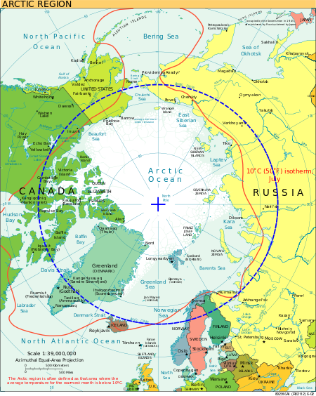
الدائرة القطبية الشمالية خط وهمي يجري خلال الأجزاء الشمالية لكندا وألاسكا وشمال روسيا الاتحادية وإسكندينافيا. كل النقط التي تقع على خط الدائرة القطبية الشمالية تقع على خط عرض َ30 66° شمالاً، حوالي 2,623 كم من القطب الشمالي الجغرافي.[1] Its southern equivalent is the Antarctic Circle.
يحدّ الدائرة القطبية الشمالية طرف منطقة تمكث فيها الشمس فوق الأفق ليوم أو أكثر كل عام. ولا تغيب الشمس مطلقًا في يوم هو أطول أيام الصيف، وذلك في حوالي 21 يونيو. كما لاتشرق الشمس هناك مطلقًا في أقصر يوم في الشتاء، وذلك في حوالي 21 ديسمبر. في القطب الشمالي ذاته، تُرى الشمس لمدة 90 يومًا قبل 21 يونيو و90 يومًا بعدها إذا كانت السماء صافية. وتبقى أسفل الأفق لوقت مماثل قبل 21 ديسمبر وبعده.
The Arctic Circle marks the southernmost latitude at which, on the winter solstice (which is the shortest day of the year) in the Northern Hemisphere, the Sun will not rise all day, and on the Northern Hemisphere's summer solstice (which is the longest day of the year), the Sun will not set. These phenomena are referred to as polar night and midnight sun respectively, and the further north one progresses, the more pronounced these effects become. For example, in the Russian port city of Murmansk, three degrees above the Arctic Circle, the Sun does not rise above the horizon for 40 successive days in midwinter.[2][3][4]
The position of the Arctic Circle is not fixed and currently runs قالب:Circle of latitude north of the Equator.[5] Its latitude depends on the Earth's axial tilt, which fluctuates within a margin of more than 2° over a 41,000-year period, owing to tidal forces resulting from the orbit of the Moon.[6] Consequently, the Arctic Circle is currently drifting northwards at a speed of about 14.5 m (48 ft) per year.
أصل الاسم اليوناني
The word arctic comes from the Greek word ἀρκτικός (arktikos: "near the Bear, northern")[7] and that from the word ἄρκτος (arktos: "bear").[8]
شمس منتصف الليل والليل القطبي
The Arctic Circle is the southernmost latitude in the Northern Hemisphere at which the centre of the Sun can remain continuously above or below the horizon for twenty-four hours; as a result, at least once each year at any location within the Arctic Circle the centre of the Sun is visible at local midnight, and at least once the centre is not visible at local noon.[9]
Directly on the Arctic Circle these events occur, in principle, exactly once per year: at the June and December solstices, respectively. However, because of atmospheric refraction and mirages, and also because the sun appears as a disk and not a point, part of the midnight sun is visible, on the night of the northern summer solstice, at a latitude of about 50 minutes of arc (′) (90 km (56 mi)) south of the Arctic Circle. Similarly, on the day of the northern winter solstice, part of the Sun may be seen up to about 50′ north of the Arctic Circle. That is true at sea level; those limits increase with elevation above sea level, although in mountainous regions there is often no direct view of the true horizon.
الاستيطان البشري
The largest communities north of the Arctic Circle are situated in Russia, Norway, and Sweden: Murmansk (population 295,374) and Norilsk (178,018) in Russia; Tromsø (75,638) in Norway, Vorkuta (58,133) in Russia, Bodø (52,357) and Harstad (24,703) in Norway; and Kiruna, Sweden (22,841). Rovaniemi (62,667) in Finland is the largest settlement in the immediate vicinity of the Arctic Circle, lying 6 km (4 mi) south of the line. Salekhard (51,186) in Russia is the only city in the world located directly on the Arctic Circle.[10]
In contrast, the largest North American community north of the Arctic Circle, Sisimiut (Greenland), has approximately 5,600 inhabitants. In the United States, Utqiagvik, Alaska (formerly known as Barrow) is the largest settlement north of the Arctic Circle with about 5,000 inhabitants. The largest such community in Canada is Inuvik in the Northwest Territories, with 3,137 inhabitants.
الجغرافيا
The Arctic Circle is roughly 16,000 km (9,900 mi) in circumference.[11] The area north of the Circle is about 20,000,000 km2 (7,700,000 sq mi) and covers roughly 4% of Earth's surface.[12]
The Arctic Circle passes through the Arctic Ocean, the Scandinavian Peninsula, North Asia, Northern America, and Greenland. The land within the Arctic Circle is divided among eight countries: Norway, Sweden, Finland, Russia, the United States (Alaska), Canada (Yukon, Northwest Territories, and Nunavut), Denmark (Greenland), and Iceland (where it passes through the small offshore island of Grímsey).
Climate
The climate north of the Arctic Circle is generally cold, but the coastal areas of Norway have a generally mild climate as a result of the Gulf Stream, which makes the ports of northern Norway and northwest Russia ice-free all year long. In the interior, summers can be quite warm, while winters are extremely cold. For example, summer temperatures in Norilsk, Russia will sometimes reach as high as 30 °C (86 °F), while the winter temperatures frequently fall below −50 °C (−58 °F).
Sites along the Arctic Circle


Starting at the prime meridian and heading eastwards, the Arctic Circle passes through:
معرض
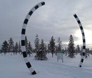
Northern Polar Circle Globe on Vikingen island marking the Arctic Circle in Norway
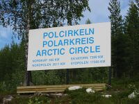
Arctic Circle sign by the Inland Line railway, Sweden
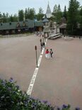
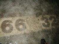
The white borderline of the Arctic Circle at the Santa Claus Village in Rovaniemi, Finland
Arctic Circle sign in the Republic of Karelia, Russia
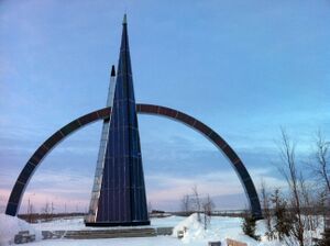
Arctic Circle sign by the Yamalo-Nenets Autonomous Okrug, Russia
A sign in the Sakha Republic (Yakutia), Russia
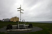
Arctic Circle marker on island of Grímsey in Iceland
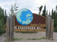
A sign along the Dalton Highway marking the location of the Arctic Circle in Alaska, United States
Polcirkeln portal in Gällivare, Sweden
انظر أيضاً
- الدائرة القطبية الجنوبية
- Arctic haze
- Scott Polar Research Institute
- Territorial claims in the Arctic
- مدار السرطان
- مدار الجدي
- التعاون والسياسة القطبية الشمالية
الهامش
- ^ "Arctic FAQ - Frequently Asked Questions about the Arctic".
- ^ "40 days without the sun. How? Polar Night begins in Murmansk". Auroravillage.info. 3 December 2018. Retrieved 24 March 2022.
- ^ Burn, Chris. The Polar Night (PDF). The Aurora Research Institute. Retrieved 28 September 2015.
- ^ N.B.: This refers to the true geometric center which actually appears higher in the sky because of refraction by the atmosphere.
- ^ "Obliquity of the Ecliptic (Eps Mean)". Neoprogrammics.com. Retrieved 13 May 2014.
- ^ Berger, A. L. (1976). "Obliquity and Precession for the Last 5000000 Years". Astronomy & Astrophysics. 51 (1): 127–135. Bibcode:1976A&A....51..127B.
- ^ Liddell, Henry; Scott, Robert. "Arktikos". A Greek–English Lexicon. Perseus Digital Library.
- ^ Liddell, Henry; Scott, Robert. "Arktos". A Greek–English Lexicon. Perseus Digital Library.
- ^ Burn, Chris. The Polar Night (PDF). The Aurora Research Institute. Retrieved 28 September 2015.
- ^ Всеволод Липатов (2011-04-26). "Город на Полярном круге". ToGeo.ru (in الروسية). Archived from the original on 8 August 2014. Retrieved 23 July 2021.
- ^ Nuttall, Mark (2004). Encyclopedia of the Arctic Volumes 1, 2 and 3. Routledge. p. 115. ISBN 978-1579584368.
- ^ Marsh, William M.; Kaufman, Martin M. (2012). Physical Geography: Great Systems and Global Environments. Cambridge University Press. p. 24. ISBN 978-0-521-76428-5.
مصادر
وصلات خارجية
- Terra Incognita: Exploration of the Canadian Arctic—Historical essay about early expeditions to the Canadian Arctic, illustrated with maps, photographs and drawings
- Temporal Epoch Calculations ©2006 by James Q. Jacobs Download: Epoch v2009.xls (modify D4)
- Useful constants" See: Obliquity of the ecliptic
- ArcticFocus Facts and news about Arctic
- (إنگليزية) (بالفرنسية) Documentaries and films about Arctic and Inuit


