گويانيا
Municipality of Goiânia | |
|---|---|
Municipality | |
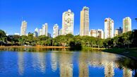
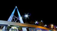
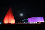
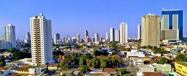
From top to bottom and left to right: Vaca Brava Park; Train Station; Monument to the Three Races; João Alves de Queiroz Viaduct; Oscar Niemeyer Cultural Center; Latif Sebba Viaduct; panoramic view of the city. | |
| الكنية: Capital do Cerrado (Capital of the Cerrado) | |
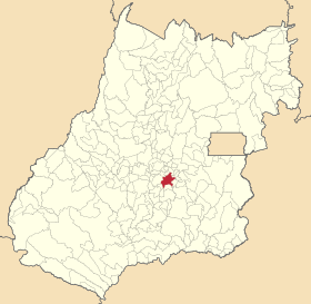 Location of Goiânia | |
| الإحداثيات: 16°40′S 49°15′W / 16.667°S 49.250°W | |
| Country | |
| Region | Central-West |
| State | |
| Founded | October 24, 1933 |
| الحكومة | |
| • Mayor | Rogério Cruz (REP) |
| المساحة | |
| • Municipality | 789 كم² (305 ميل²) |
| • العمران | 739 كم² (285 ميل²) |
| المنسوب | 749 m (2٬457 ft) |
| التعداد (2020 [1]) | |
| • Municipality | 1٬536٬097 (10th) |
| • الكثافة | 1٬604/km2 (4٬150/sq mi) |
| • العمرانية | 2٬654٬860 (10th) |
| منطقة التوقيت | UTC-3 (UTC-3) |
| Postal code | 74000-000 |
| Area code | +55 62 |
| Demonym | goianiense |
| الموقع الإلكتروني | www |
Goiânia ( /ɡɔɪˈɑːniə/;[2] النطق في البرتغالية: [ɡojˈjɐniɐ]) is the capital and largest city of the Brazilian state of Goiás. With a population of 1,536,097, it is the second-largest city in the Central-West Region and the 10th-largest in the country. Its metropolitan area has a population of 2,654,860, making it the 12th-largest in Brazil. With an area of approximately 739 square kilometres (285 square miles), it has a continuous geography with few hills and lowlands, with flat lands in most of its territory, especially the Meia Ponte River, in addition to Botafogo and Capim Puba streams.
Goiânia has its origins as a planned city, founded on October 24, 1933 by then Governor Pedro Ludovico to serve as the new state capital and administrative center. Before this, the state capital was the town of Goiás.
It is the second most populous city in the Central-West Region, only surpassed by the country's capital Brasília, located about 200 kilometers (120 miles) from Goiânia. The city is an important economic hub of the region and is considered a strategic center for such areas as industry, medicine, fashion and agriculture. Goiânia has previously been described as having the largest green area per inhabitant in Brazil and the second-most in the world, after Edmonton, Alberta, Canada.[3][4] With rapid population growth[5] and urban expansion, satellite imagery shows the majority of the green area is now at the periphery of its sprawling city limits, and the per-capita green area claim may need to be reviewed.
International relations
Twin towns – Sister cities
Goiânia is twinned with:
Goiânia was formerly twinned with:
People from Goiânia
- Irajá Abreu Politician
- Kátia Abreu Politician
- Arthur Football player
- Wanessa Camargo Singer
- Dudu Football player
- Tiago Henrique Gomes da Rocha Criminal
- Ingrid Guimarães Actress
- Lisalla Montenegro Model
- Renatinho Football player
References
- ^ IBGE 2020
- ^ Pronunciation of Goiânia Archived 2009-04-10 at the Wayback Machine at Dictionary.com
- ^ (in برتغالية) PEREIRA, Alberto. "Arborizada e planejada, Goiânia se destaca por parques e museus" Archived 2011-06-06 at the Wayback Machine. Folha de S.Paulo. May 8, 2009.
- ^ (in برتغالية) BIASETTO, Daniel and AMARO, Mariana. "As Cidades que são Numero" Archived 2009-07-04 at the Wayback Machine. Veja. July 23, 2008.
- ^ "IBGE Séries Históricas e Estatísticas (População e Demografia)" (in البرتغالية). Instituto Brasileiro de Geografia e Estatística. Archived from the original on 2017-08-08. Retrieved 2017-09-07.
- ^ "Sister Cities, Public Relations". Guadalajara municipal government. Archived from the original on March 2, 2012. Retrieved March 12, 2013.
External links
| Find more about Goiânia at Wikipedia's sister projects | |
| Definitions from Wiktionary | |
| Media from Commons | |
| Quotations from Wikiquote | |
| Source texts from Wikisource | |
| Textbooks from Wikibooks | |
| Travel guide from Wikivoyage | |
| Learning resources from Wikiversity | |
- (in برتغالية) City Hall of Goiânia website
- (in برتغالية) Government of the State of Goiás website
خطأ لوا في وحدة:Authority_control على السطر 278: attempt to call field '_showMessage' (a nil value).
- Pages using gadget WikiMiniAtlas
- Articles with برتغالية-language sources (pt)
- CS1 البرتغالية-language sources (pt)
- Short description is different from Wikidata
- Pages using multiple image with auto scaled images
- Coordinates on Wikidata
- Pages using infobox settlement with unknown parameters
- Articles with hatnote templates targeting a nonexistent page
- Goiânia
- 1933 establishments in Brazil
- Populated places established in 1933
- Planned cities in Brazil
