خالسكو
Jalisco
Estado Libre y Soberano de Jalisco | |
|---|---|
| Free and Sovereign State of Jalisco | |
| الشعار: Jalisco es México (إنگليزية: "Jalisco is Mexico") | |
 Jalisco within Mexico | |
| الإحداثيات: 20°34′N 103°41′W / 20.567°N 103.683°W | |
| Country | |
| Capital | Guadalajara |
| Largest city | Guadalajara |
| Municipalities | 125 |
| Admission | December 23, 1823[1] |
| Order | 9th |
| الحكومة | |
| • Governor | Enrique Alfaro Ramírez |
| • Senators[2] | Clemente Castañeda Hoeflich Veronica Delgadillo García María Antonia Cárdenas Mariscal |
| • Deputies[3] | |
| المساحة | |
| • الإجمالي | 78٬588 كم² (30٬343 ميل²) |
| Ranked 7th | |
| أعلى منسوب | 4٬339 m (14٬236 ft) |
| التعداد (2018)[6] | |
| • الإجمالي | 8٬256٬100 |
| • الترتيب | 4th |
| • الكثافة | 110/km2 (270/sq mi) |
| • ترتيب الكثافة | 11th |
| صفة المواطن | Jalisciense |
| منطقة التوقيت | UTC−6 (CST) |
| • الصيف (التوقيت الصيفي) | UTC−5 (CDT) |
| Postal code | 44-49 |
| Area code | |
| ISO 3166 code | MX-JAL |
| HDI | ▲ 0.788 high Ranked 12th |
| GDP (nominal) | US$ 120,589,080,000 Ranked 4th |
| GDP per capita (nominal) | US$ 15,371.79 |
| GDP (PPP) | US$ 261,403,061,000 |
| GDP per capita (PPP) | US$ 33,321.70 |
| الموقع الإلكتروني | www |
| ^ a. The state's GDP was 566,809,524 million pesos in 2008,[7] amount corresponding to 44,281,994.06 million dollars, being a dollar worth 12.80 pesos (value of June 3, 2010).[8] b. The state's flag was officially adopted in 2007[9] | |
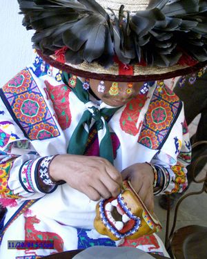
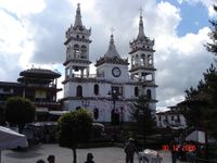
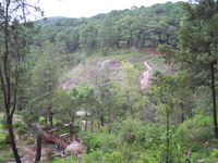
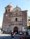
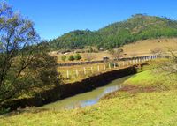
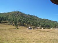
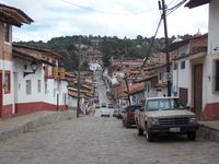
ولاية خاليسكو (Jalisco ؛ /həˈlɪskoʊ/؛ النطق الإسپاني: [xaˈlisko])، رسمياً ولاية خالسكو الحرة والسيدة (إسپانية: Estado Libre y Soberano de Jalisco النطق الإسپاني: [esˈtaðo ˈliβɾe i soβeˈɾano ðe xaˈlisko]) هي واحدة من 31 من ولايات المكسيك، والتي مع مدينة المكسيك، تشكل 32 كيان اتحادي بالمكسيك. وتقع في غرب المكسيك وتحدها ست ولايات، هي Nayarit, Zacatecas, Aguascalientes, Guanajuato, Michoacán and Colima. Jalisco is divided into 125 municipalities, and its capital city is Guadalajara. Jalisco is one of the most important states in Mexico because of its natural resources as well as its history.[10] Many of the characteristic traits of Mexican culture, particularly outside Mexico City, are originally from Jalisco, such as mariachi, ranchera music, birria, tequila, jaripeo, etc., hence the state's motto: "Jalisco es México." Economically, it is ranked third in the country, with industries centered in the Guadalajara metropolitan area, the second largest metropolitan area in Mexico. The state is home to two significant indigenous populations, the Huichols and the Nahuas. There is also a significant foreign population, mostly retirees from the United States and Canada, living in the Lake Chapala and Puerto Vallarta areas.
. . . . . . . . . . . . . . . . . . . . . . . . . . . . . . . . . . . . . . . . . . . . . . . . . . . . . . . . . . . . . . . . . . . . . . . . . . . . . . . . . . . . . . . . . . . . . . . . . . . . . . . . . . . . . . . . . . . . . . . . . . . . . . . . . . . . . . . . . . . . . . . . . . . . . . . . . . . . . . . . . . . . . . . .
التاريخ
فترة ما قبل الاسبان
Nomadic peoples moving south arrived to the Jalisco area around 15,000 years ago.[11][12]
الفترة الاستعمارية
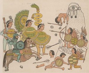
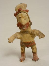
Over its history, the Jalisco area has been occupied by a variety of ethnicities including the Bapames, Caxcans, Cocas, Cuachilchils, Huichols, Cuyutecos, Otomis, Nahuas, Tecuejes, Tepehuans, Tecos, Purépecha, Pinomes, Tzaultecas and Xilotlantzingas. Some writers have also mentioned groups such as the Pinos, Otontlatolis, Amultecas, Coras, Xiximes, Tecuares, Tecoxines and Tecualmes.[13] When the Spanish arrived the main ethnic groups were the Cazcanes, who inhabited the northern regions near Teocalteche and the Lagos de Morenos, and the Huichols, who inhabited the northwest near Huejúcar and Colotlán. Other groups included the Guachichil in the Los Altos area, the Nahuatl speaking Cuyutecos in the west, the Tecuexes and Cocas near what is now Guadalajara, and the Guamares in the east near the Guanajuato border.[14]
الاستقلال
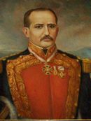
At the beginning of the 19th century, Colima, parts of Zacatecas and the San Blas region (Nayarit) were still part of the Intendencia of Guadalajara.[15] The area had relative freedom from Spanish colonial authorities and prospered with fewer trade restrictions. This, along with lingering indigenous resentment to Spanish rule since the 16th century, led it to be sympathetic to insurgent movements in the early 19th century.[13]
الجغرافيا
التنوع الحيوي
حيوانات كثيرة
| النبيت والوحيش في خالسكو | |||||||

|

|

|

|

| |||
| Armadillo | Puma | Coralillo | Zorro | Águila real | |||

|

|

|

|

| |||
| Huilota | Víbora de cascabel | Venado bura | Coyote | Borrego cimarrón | |||

|

|

|

|

| |||
| Agave | Tuna | Cactus erizo | Cardón | Pino | |||
. . . . . . . . . . . . . . . . . . . . . . . . . . . . . . . . . . . . . . . . . . . . . . . . . . . . . . . . . . . . . . . . . . . . . . . . . . . . . . . . . . . . . . . . . . . . . . . . . . . . . . . . . . . . . . . . . . . . . . . . . . . . . . . . . . . . . . . . . . . . . . . . . . . . . . . . . . . . . . . . . . . . . . . .
أقصى ارتفاعات
Nevado de Colima Volcán de Colima Sierra el Tigre |
Num. | Elevación | Altitud | Num. | Elevación | Altitud | Sierra Huichola Volcán de Tequila |
|---|---|---|---|---|---|---|---|
| 1 | Nevado de Colima | 4,260 msnm | 10 | Cerro Gordo | 2,670 msnm | ||
| 2 | Volcán de Colima | 3,820 msnm | 9 | Sierra el Tigre | 2,840 msnm | ||
| 3 | Sierra de Tapalpa | 2,960 msnm | 8 | Sierra de Manantlán | 2,840 msnm | ||
| 4 | Volcán de Tequila | 2,940 msnm | 7 | Sierra Alta | 2,850 msnm | ||
| 5 | Cerro Viejo | 2,880 msnm | 6 | Sierra Huichola | 2,860 msnm |
الديمغرافيا
| Year | Pop. | ±% |
|---|---|---|
| 1895 | 1٬114٬765 | — |
| 1900 | 1٬153٬891 | +3.5% |
| 1910 | 1٬208٬855 | +4.8% |
| 1921 | 1٬191٬957 | −1.4% |
| 1930 | 1٬255٬346 | +5.3% |
| 1940 | 1٬418٬310 | +13.0% |
| 1950 | 1٬746٬777 | +23.2% |
| 1960 | 2٬443٬261 | +39.9% |
| 1970 | 3٬296٬586 | +34.9% |
| 1980 | 4٬371٬998 | +32.6% |
| 1990 | 5٬302٬689 | +21.3% |
| 1995 | 5٬991٬176 | +13.0% |
| 2000 | 6٬322٬002 | +5.5% |
| 2005 | 6٬752٬113 | +6.8% |
| 2010 | 7٬350٬682 | +8.9% |
| 2015[16] | 7٬844٬830 | +6.7% |
التعداد
|
Num. | Municipio | Pob. | Num. | Municipio | Pob. |
|
|---|---|---|---|---|---|---|---|
| 1 | Guadalajara | 1,494,134 | 11 | Ocotlán | 92,958 | ||
| 2 | Zapopan | 1,243,538 | 12 | Arandas | 72,885 | ||
| 3 | San Pedro Tlaquepaque | 608,187 | 13 | Tala | 69,031 | ||
| 4 | Tonalá | 478,981 | 14 | San Juan de los Lagos | 65,219 | ||
| 5 | Tlajomulco de Zúñiga | 416,552 | 15 | La Barca | 64,629 | ||
| 6 | Puerto Vallarta | 255,725 | 16 | Zapotlanejo | 63,636 | ||
| 7 | Lagos de Moreno | 153,855 | 17 | Atotonilco el Alto | 57,717 | ||
| 8 | El Salto | 138,226 | 18 | Autlán de Navarro | 57,559 | ||
| 9 | Tepatitlán de Morelos | 136,123 | 19 | Ameca | 57,340 | ||
| 10 | Ciudad Guzmán | 100,534 | 20 | Encarnación de Díaz | 51,395 |
. . . . . . . . . . . . . . . . . . . . . . . . . . . . . . . . . . . . . . . . . . . . . . . . . . . . . . . . . . . . . . . . . . . . . . . . . . . . . . . . . . . . . . . . . . . . . . . . . . . . . . . . . . . . . . . . . . . . . . . . . . . . . . . . . . . . . . . . . . . . . . . . . . . . . . . . . . . . . . . . . . . . . . . .
الحكومة والمناطق
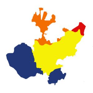
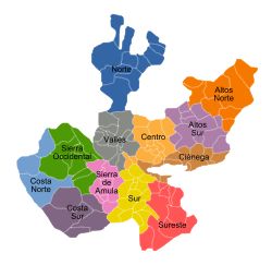
| # | المنطقة | المقر | المساحة (كم²)[17] | المساحة (%) | التعداد (2010) [17] | التعداد (%) |
|---|---|---|---|---|---|---|
| 1 | Norte | Colotlán | 10,305 | 12.9% | 78,835 | 1.1% |
| 2 | Altos Norte | Lagos de Moreno | 8,882 | 11.1% | 383,317 | 5.2% |
| 3 | Altos Sur | Tepatitlán de Morelos | 6,667 | 8.3% | 384,144 | 5.2% |
| 4 | Ciénega | La Barca | 4,892 | 6.1% | 503,297 | 6.8% |
| 5 | Sureste | Tamazula de Gordiano | 7,124 | 8.9% | 116,416 | 1.6% |
| 6 | Sur | Zapotlán el Grande | 5,650 | 7.1% | 332,411 | 4.5% |
| 7 | Sierra de Amula | El Grullo | 4,240 | 5.3% | 95,680 | 1.3% |
| 9 | Costa Norte | Puerto Vallarta | 5,985 | 7.5% | 300,760 | 4.1% |
| 10 | Sierra Occidental | Mascota | 8,381 | 10.5% | 61,257 | 0.8% |
| 11 | Valles | Ameca | 6,004 | 7.5% | 345,438 | 4.7% |
| 12 | Centro | Guadalajara | 5,003 | 6.2% | 4,578,700 | 62.3% |
| 8 | Costa Sur | Autlán de Navarro | 7,004 | 8.7% | 170,427 | 2.3% |
| total | Jalisco | Guadalajara | 80,137 | 100% | 7,350,682 | 100% |
التوزيع السكاني
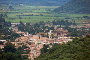
السياحة
المدن السحرية
- Mazamitla
- Tequila
- Tapalpa
- San Sebastián del Oeste
- Lagos de Moreno
- Talpa de Allende
- Mascota
- Tlaquepaque
انظر أيضا
المراجع
- ^ "Las Diputaciones Provinciales" (PDF) (in Spanish). p. 15.
{{cite news}}: CS1 maint: unrecognized language (link) - ^ "Senadores por Jalisco LXI Legislatura". Senado de la Republica. Retrieved March 24, 2010.
- ^ "Listado de Diputados por Grupo Parlamentario del Estado de Jalisco". Camara de Diputados. Retrieved March 24, 2010.
- ^ "Resumen". Cuentame INEGI. Archived from the original on March 16, 2013. Retrieved February 12, 2013.
{{cite web}}: Unknown parameter|deadurl=ignored (|url-status=suggested) (help) - ^ "Relieve". Cuentame INEGI. Archived from the original on March 1, 2011. Retrieved March 24, 2011.
{{cite web}}: Unknown parameter|deadurl=ignored (|url-status=suggested) (help) - ^ "Encuesta Intercensal 2015" (PDF). Retrieved December 8, 2015.
- ^ "Jalisco". 2010. Archived from the original on April 20, 2011. Retrieved March 24, 2011.
{{cite web}}: Unknown parameter|deadurl=ignored (|url-status=suggested) (help) - ^ "Reporte: Jueves 3 de Junio del 2010. Cierre del peso mexicano". www.pesomexicano.com.mx. Retrieved August 10, 2010.
- ^ "Ley sobre el Escudo, Bandera e Himno del Estado de Jalisco" (in Spanish). 2007-02-22. pp. Page 2. Archived from the original (Word Document) on 2008-12-19. Retrieved 2008-12-08.
{{cite web}}: Unknown parameter|deadurl=ignored (|url-status=suggested) (help)CS1 maint: unrecognized language (link) - ^ "Generalidades" [General information] (in Spanish). Mexico: State of Jalisco. Archived from the original on June 5, 2011. Retrieved September 9, 2011.
{{cite web}}: Unknown parameter|deadurl=ignored (|url-status=suggested) (help)CS1 maint: unrecognized language (link) - ^ Rosa María Espiritu Miguel (December 3, 2009). "Cultura aborigen en Jalisco" [Aboriginal culture in Jalisco] (in Spanish). Mexico: State of Jalisco. Archived from the original on March 26, 2012. Retrieved September 9, 2011.
{{cite web}}: Unknown parameter|deadurl=ignored (|url-status=suggested) (help)CS1 maint: unrecognized language (link) - ^ "Atractivos Culturales y Turísticos" [Cultural and Tourist Attractions]. Enciclopedia de los Municipios de México Jalisco (in Spanish). Mexico: Instituto Nacional para el Federalismo y el Desarrollo Municipal and Government of Jalisco. 2005. Archived from the original on December 5, 2006. Retrieved September 9, 2011.
{{cite web}}: Unknown parameter|deadurl=ignored (|url-status=suggested) (help)CS1 maint: unrecognized language (link) - ^ أ ب خطأ استشهاد: وسم
<ref>غير صحيح؛ لا نص تم توفيره للمراجع المسماةenchis - ^ خطأ استشهاد: وسم
<ref>غير صحيح؛ لا نص تم توفيره للمراجع المسماةhouston - ^ خطأ استشهاد: وسم
<ref>غير صحيح؛ لا نص تم توفيره للمراجع المسماةsigloxviiigob - ^ "Encuesta Intercensal 2015" (PDF). INEGI. Retrieved 2015-12-08.
- ^ أ ب INEGI Archived 2011-07-23 at the Wayback Machine
وصلات خارجية
- (بالإسپانية) Jalisco State Government
 Geographic data related to خالسكو at OpenStreetMap
- خالسكو at the Open Directory Project
- Congress of the State (بالإسپانية)
- State Government (بالإسپانية)
- Supreme Court of Jalisco (بالإسپانية)
- THE HISTORY OF JALISCO, by Donna S. Morales and John P. Schmal, Houston Institute for Culture
- Pages using gadget WikiMiniAtlas
- CS1 errors: unsupported parameter
- Short description matches Wikidata
- Short description is different from Wikidata
- Articles containing إنگليزية-language text
- Pages using Lang-xx templates
- Pages using infobox settlement with possible motto list
- Coordinates on Wikidata
- Articles containing إسپانية-language text
- Jalisco
- ولايات الهضبة المكسيكية
- Sierra Madre Occidental
- دول وأقاليم تأسست في 1823
- تأسيسات 1823 في المكسيك
- ولايات المكسيك


