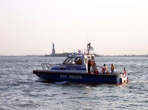
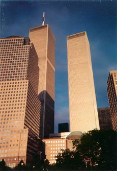
منهاتن
Manhattan
New York County, New York | |
|---|---|
 وسط منهاتن ناظرين إلى الجنوب مقابل أسفل منهاتن | |
| أصل الاسم: Lenape: Manaháhtaan (the place where we get bows) | |
| الكنية: The City[1] | |
 خريطة تفاعلية تبين حدود منهاتن | |
 Location within the state of New York | |
| الإحداثيات: 40°47′N 73°58′W / 40.783°N 73.967°W | |
| البلد | الولايات المتحدة |
| الولاية | نيويورك |
| المقاطعة | نيويورك (coterminous) |
| المدينة | مدينة نيويورك |
| Settled | 1624 |
| الحكومة | |
| • النوع | Borough (New York City) |
| • Borough President | Gale Brewer (D) — (Borough of Manhattan) |
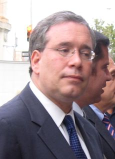
| • District Attorney | Cyrus Vance Jr. (D) — (New York County) |
| المساحة | |
| • الإجمالي | 33٫58 ميل² (87�0 كم²) |
| • البر | 22٫83 ميل² (59٫1 كم²) |
| • الماء | 10٫76 ميل² (27٫9 كم²) 32% |
| التعداد (2018) | |
| • الإجمالي | 1٬628٬701[2] |
| • الكثافة | 69٬467٫5/sq mi (26٬821٫6/km2) |
| • Demonym | Manhattanite |
| منطقة التوقيت | UTC−05:00 (EST) |
| • الصيف (التوقيت الصيفي) | UTC−04:00 (EDT) |
| ZIP Code format | 100xx, 101xx, 102xx |
| Area code | 212/646/332, 917[أ] |
| GDP (2015) | US$630 billion[4] · 2nd by U.S. county; 1st per capita |
| الموقع الإلكتروني | Manhattan Borough President |
حي مانهاتن الحي الأشهر في نيويورك وهو عبارة عن جزيرة في وسط المدينة ويوجد فيه أفخم الفنادق والمطاعم والمنازل وحديقة سنترال بارك التي ربما تكون أكبر حديقة في العالم وأغنى الشركات وأفضلها ومبنى البلدية والعمدة وغيرها من المصالح العامة وهو الخي الذي وقعت فيه حادثة 11 سبتمبر الشهيرة.
وتعد جزيرة مانهاتن المركز التجاري والمالي والثقافي لمدينة نيويورك، حيث يتجمع فيها ملايين البشر كل يوم للعمل في المكاتب والمحال التجارية والمصانع والمسارح. يبلغ عدد سكان مانهاتن 1,487,536 نسمة وتقدّر مساحتها بحوالي 88كم² منها 31كم² تغطيها المياه. وتعد مانهاتن أصغر أحياء مدينة نيويورك الخمسة. يحدّ نهر إيست ريفر مقاطعة مانهاتن من ناحية الشرق وخليج نيويورك العليا من الجنوب، ونهر هدسون من الغرب، ونهر هارلم وسبايتين ديوفيل كريك من الشمال. وترتبط الجزيرة عن طريق القنوات والعبارات ببقية أحياء نيويورك. [5].
. . . . . . . . . . . . . . . . . . . . . . . . . . . . . . . . . . . . . . . . . . . . . . . . . . . . . . . . . . . . . . . . . . . . . . . . . . . . . . . . . . . . . . . . . . . . . . . . . . . . . . . . . . . . . . . . . . . . . . . . . . . . . . . . . . . . . . . . . . . . . . . . . . . . . . . . . . . . . . . . . . . . . . . .
التسمية
التاريخ
والجدير بالذكر أن پيتر مينيويت حاكم مستعمرة هولندا الجديدة هو الذي اشترى الجزيرة من الهنود الذين كانوا يسكنون في المنطقة عام 1626م، ودفع قيمتها من الخرز والعقود والقماش والحلي، ما يعادل 24 دولارًا أمريكيًا.
استعمارية

الثورة الأمريكية وبدايات الولايات المتحدة

النمو في القرن 19
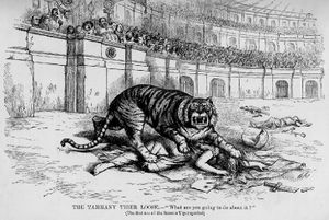
القرن 20


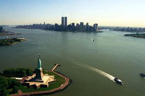
الجغرافيا
المكونات
The borough consists of Manhattan Island, Marble Hill, and several small islands, including Randalls Island and Wards Island, and Roosevelt Island in the East River, and Governors Island and Liberty Island to the south in New York Harbor.[6]
According to the United States Census Bureau, New York County has a total area of 33.6 square miles (87 km2), of which 22.8 square miles (59 km2) is land and 10.8 square miles (28 km2) (32%) is water.[3] The northern segment of Upper Manhattan represents a geographic panhandle. Manhattan Island is 22.7 square miles (59 km2) in area, 13.4 miles (21.6 km) long and 2.3 miles (3.7 km) wide, at its widest (near 14th Street).[7]
جزيرة منهاتن
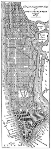
تنقسم جزيرة منهاتن بشكلٍ ما إلى داون تاون (منهاتن السفلى)، ميدتاون (منهاتن الوسطى) وأپ تاون (منهاتن العليا)، بالجادة الخامسة تفصل جانبي منهاتن الشرقي والغربي. ويحد جزيرة منهاتن نهر هدسون من الغرب والنهر الشرقي من الشرق. وإلى الشمال، يفصل نهر هارلم جزيرة منهاتن عن البرونكس والبر الرئيسي للولايات المتحدة.
Early in the 19th century, landfill was used to expand Lower Manhattan from the natural Hudson shoreline at Greenwich Street to West Street.[8] When building the World Trade Center in 1968, 1.2 million cubic yards (917,000 m³) of material was excavated from the site.[9] Rather than dumping the spoil at sea or in landfills, the fill material was used to expand the Manhattan shoreline across West Street, creating Battery Park City,[10] The result was a 700-foot (210-m) extension into the river, running six blocks or 1,484 feet (452 m), covering 92 acres (37 ha), providing a 1.2-mile (1.9 km) riverfront esplanade and over 30 acres (12 ha) of parks;[11] Hudson River Park was subsequently opened in stages beginning in 1998.[12]
. . . . . . . . . . . . . . . . . . . . . . . . . . . . . . . . . . . . . . . . . . . . . . . . . . . . . . . . . . . . . . . . . . . . . . . . . . . . . . . . . . . . . . . . . . . . . . . . . . . . . . . . . . . . . . . . . . . . . . . . . . . . . . . . . . . . . . . . . . . . . . . . . . . . . . . . . . . . . . . . . . . . . . . .
Marble Hill
الجزر الصغرى
في مرفأ نيويورك، توجد ثلاث جزر صغرى:
- جزيرة إليس، متقاسَمة مع نيوجرزي
- جزيرة گڤرنرز
- جزيرة الحرية
الجزر الصغرى الأخرى، في النهر الشرقي، تضم (من الشمال إلى الجنوب):
- Randalls and Wards Islands، متصلين بالردم
- Mill Rock
- جزيرة روزڤلت
- جزيرة أو ثانت (رسمياً جزيرة بلمونت)
جيولوجيا
الركيزة الجيولوجية
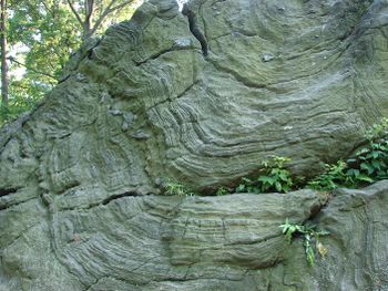
The bedrock underlying much of Manhattan is a mica schist known as Manhattan schist[13] of the Manhattan Prong physiographic region. It is a strong, competent metamorphic rock created when Pangaea formed. It is well suited for the foundations of tall buildings. In Central Park, outcrops of Manhattan Schist occur and Rat Rock is one rather large example.[14][15][16]
الأماكن

المقاطعات المجاورة
- Bergen County, New Jersey—west and northwest
- Hudson County, New Jersey—west and southwest
- Bronx County (The Bronx)—north and northeast
- Queens County (Queens)—east
- Kings County (Brooklyn)—south and southeast
- Richmond County (Staten Island)—southwest

|
مقاطعة برونكس (برونكس) |
مقاطعة برگن نيوجرزي |

| |
| مقاطعة كوينز (كوينز) |
مقاطعة هدسن، نيوجرزي | |||
| مقاطعة كينگز (بروكلين) |
مقاطعة ريتشموند (جزيرة ستاتن) |
المناطق المحمية القومية
- African Burial Ground National Monument
- Castle Clinton National Monument
- Federal Hall National Memorial
- General Grant National Memorial
- Governors Island National Monument
- Hamilton Grange National Memorial
- Lower East Side Tenement National Historic Site
- Statue of Liberty National Monument (part)
- Theodore Roosevelt Birthplace National Historic Site
الأحياء
المناخ

| متوسطات الطقس لمدينة نيويورك (سنترال پارك) | |||||||||||||
|---|---|---|---|---|---|---|---|---|---|---|---|---|---|
| شهر | يناير | فبراير | مارس | أبريل | مايو | يونيو | يوليو | أغسطس | سبتمبر | اكتوبر | نوفمبر | ديسمبر | السنة |
| العظمى القياسية °F (°C) | 72 (22) | 75 (24) | 86 (30) | 96 (36) | 99 (37) | 101 (38) | 106 (41) | 104 (40) | 102 (39) | 94 (34) | 84 (29) | 75 (24) | 106 (41) |
| متوسط العظمى °ف (°م) | 38 (3) | 41 (5) | 50 (10) | 61 (16) | 71 (22) | 79 (26) | 84 (29) | 82 (28) | 75 (24) | 64 (18) | 53 (12) | 43 (6) | 61٫8 (17) |
| متوسط الصغرى °ف (°م) | 26 (-3) | 28 (-2) | 35 (2) | 44 (7) | 54 (12) | 63 (17) | 69 (21) | 68 (20) | 60 (16) | 50 (10) | 41 (5) | 32 (0) | 47٫5 (9) |
| الصغرى القياسية °ف (°C) | -6 (-21) | -15 (-26) | 3 (-16) | 12 (-11) | 28 (-2) | 44 (7) | 52 (11) | 50 (10) | 39 (4) | 28 (-2) | 7 (-14) | -13 (-25) | −15 (−26) |
| هطول الأمطار بوصة (mm) | 4.13 (104.9) | 3.15 (80) | 4.37 (111) | 4.28 (108.7) | 4.69 (119.1) | 3.84 (97.5) | 4.62 (117.3) | 4.22 (107.2) | 4.23 (107.4) | 3.85 (97.8) | 4.36 (110.7) | 3.95 (100.3) | 49٫69 (1٬262٫1) |
| المصدر: The Weather Channel[17] Weatherbase.com[18] August 2009 | |||||||||||||
. . . . . . . . . . . . . . . . . . . . . . . . . . . . . . . . . . . . . . . . . . . . . . . . . . . . . . . . . . . . . . . . . . . . . . . . . . . . . . . . . . . . . . . . . . . . . . . . . . . . . . . . . . . . . . . . . . . . . . . . . . . . . . . . . . . . . . . . . . . . . . . . . . . . . . . . . . . . . . . . . . . . . . . .
الحكومة
 مقالة مفصلة: حكومة مدينة نيويورك
السياسة
New York County District Attorney، رئيس القسم
| السنة | الجمهوريون | الديمقراطيون |
|---|---|---|
| 2008 | 13.5% 89,906 | 85.7% 572,126 |
| 2004 | 16.7% 107,405 | 82.1% 526,765 |
| 2000 | 14.2% 79,921 | 79.8% 449,300 |
| 1996 | 13.8% 67,839 | 80.0% 394,131 |
| 1992 | 15.9% 84,501 | 78.2% 416,142 |
| 1988 | 22.9% 115,927 | 76.1% 385,675 |
| 1984 | 27.4% 144,281 | 72.1% 379,521 |
| 1980 | 26.2% 115,911 | 62.4% 275,742 |
| 1976 | 25.5% 117,702 | 73.2% 337,438 |
| 1972 | 33.4% 178,515 | 66.2% 354,326 |
| 1968 | 25.6% 135,458 | 70.0% 370,806 |
| 1964 | 19.2% 120,125 | 80.5% 503,848 |
| 1960 | 34.2% 217,271 | 65.3% 414,902 |
التمثيل الفدرالي
الجريمة

الديموغرافيا
مقارنة سكان منهاتن
| |||
|---|---|---|---|
| منهاتن [20] |
NY City [21] |
ولاية نيويورك [22] | |
| إجمالي السكان | 1,537,195 | 8,008,278 | 18,976,457 |
| الكثافة السكانية per square mile |
66,940 | 26,403 | 402 |
| Median household income (1999) | $47,030 | $38,293 | $43,393 |
| حسب دخل الفرد | $42,922 | $22,402 | $23,389 |
| على درجة بكالوريوس أو أعلى | 49.4% | 27.4% | 27.4% |
| أجانب المولد | 29.4% | 35.9% | 20.4% |
| بيض | 54.4% | 44.7% | 67.9% |
| سود | 17.4% | 26.6% | 15.9% |
| آسيويون | 9.4% | 9.8% | 5.5% |
| من اصل أسباني (of any race) |
27.2% | 27.0% | 15.1% |
| التعداد تاريخياً | |||
|---|---|---|---|
| الإحصاء | التعداد | %± | |
| 1790 | 33٬131 | ||
| 1800 | 60٬489 | 82.6% | |
| 1810 | 96٬373 | 59.3% | |
| 1820 | 123٬706 | 28.4% | |
| 1830 | 202٬589 | 63.8% | |
| 1840 | 312٬710 | 54.4% | |
| 1850 | 515٬547 | 64.9% | |
| 1860 | 813٬669 | 57.8% | |
| 1870 | 942٬292 | 15.8% | |
| 1880 | 1٬164٬674 | 23.6% | |
| 1890 | 1٬441٬216 | 23.7% | |
| 1900 | 1٬850٬093 | 28.4% | |
| 1910 | 2٬331٬542 | 26.0% | |
| 1920 | 2٬284٬103 | -2.0% | |
| 1930 | 1٬867٬312 | -18.2% | |
| 1940 | 1٬889٬924 | 1.2% | |
| 1950 | 1٬960٬101 | 3.7% | |
| 1960 | 1٬698٬281 | -13.4% | |
| 1970 | 1٬539٬233 | -9.4% | |
| 1980 | 1٬428٬285 | -7.2% | |
| 1990 | 1٬487٬536 | 4.1% | |
| 2000 | 1٬537٬195 | 3.3% | |
| تقديري 2008 | 1٬634٬795 | 6.3% | |
العمارة والمعالم
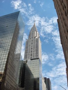

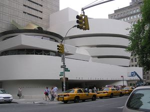
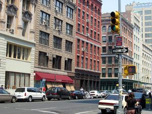
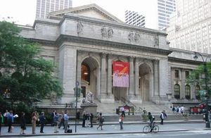
يوجد في جزيرة مانهاتن العديد من المعالم الشهيرة التي تجذب السيّاح ويشمل ذلك البرودواي، والمتنزه المركزي، وقرية جرينيتش، ومركز روكفلر، وميدان التايمز، ورئاسة الأمم المتحدة، ووول ستريت، ومبنى الإمبير ستيت والحي الصيني بالإضافة إلى العديد من الكنائس والكليات والمعارض والمسارح وناطحات السحاب. كما تتمركز معظم مباني بلدية نيويورك في هذه الجزيرة.
أفق المدينة
الاقتصاد

الثقافة


الرياضة
الإعلام
الإسكان
البنية التحتية
النقل


الخدمات
التعليم
انظر أيضا
ملاحظات
- ^ Area codes 718, 347, and 929 are used in Marble Hill.
المصادر
|
وصلات خارجية
خدمات وحكومة منهاتن الوطنية
- Manhattan Borough President official site
- New York City Government with links to Manhattan specific agencies
خرائط، شوارع، أحياء
- خريطة مفصلة لمنهاتن
- Interactive 3D map of Manhattan
- Maps of Building Heights and Land Value, plus theoretical and zoning-based maps of underdevelopment, all from www.radicalcartography.net
- Population Details, Ethnicity Map, and Income Level Map
مصادر تاريخية
- 1729 map of Manhattan
- William J. Broad, Why They Called It the Manhattan Project, The New York Times, October 2007. Ten sites in Manhattan which helped to build the first atomic bomb in the 1940s
مناقشات اجتماعية
- NYC Manhattan Community Discussion (out of operation since May 18, 2009)
- New York Forum
- NYC Business and Office Selection Advice
40°43′42″N 73°59′39″W / 40.72833°N 73.99417°W{{#coordinates:}}: لا يمكن أن يكون هناك أكثر من وسم أساسي واحد لكل صفحة
- Pages using gadget WikiMiniAtlas
- CS1 errors: unsupported parameter
- صفحات ذات وسوم إحداثيات غير صحيحة
- Articles with hatnote templates targeting a nonexistent page
- Missing redirects
- Short description is different from Wikidata
- Coordinates on Wikidata
- Pages with empty portal template
- منهاتن
- مناطق إدارية في نيويورك
- مقاعد مقاطعة في نيويورك
- مدن تأسست في 1624
- أماكن في الولايات المتحدة بها جاليات يهودية أرثوذكسية
- جزر نهرية
- جزر مدينة نيويورك
- صفحات مع الخرائط

