قائمة صخور المريخ
هذه قائمة مرتبة أبجدياً للصخور (والنيازك) المسماة الموجودة على المريخ، حسب المهمة. هذه القائمة لا تشمل نيازك المريخ الموجودة على الأرض.
أسماء صخور المريك هي تعيينات غير رسمية بشكل كبير استخدمت لتسهيل أغراض النقاش، حيث أعلن الاتحاد الفلكي الدولي نظام التسمية المريخي الرسمي الذي يطلق على الأجرام التي يقل قطرها عن 100 متر أسماء غير رسمية.
| Adirondack (Spirit) |
Barnacle Bill (Sojourner) |
Bathurst Inlet (Curiosity) |
Big Joe* (Viking) |
Block Island (Opportunity) M |
Bounce (Opportunity) |
Coronation (Curiosity) |
El Capitan (Opportunity) |
|

|
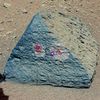
|
|||||
| Esperance* (Opportunity) |
Goulburn (Curiosity) |
Heat Shield (Opportunity) M |
Home Plate (Spirit) |
Hottah (Curiosity) |
Jake Matijevic (Curiosity) |
Last Chance (Opportunity) |
Link (Curiosity) |

|
|||||||
| Mackinac Island (Opportunity) M |
Mimi* (Spirit) |
Oileán Ruaidh (Opportunity) M |
Pot of Gold (Spirit) |
Rocknest 3 (Curiosity) |
Shelter Island (Opportunity) M |
Tintina (Curiosity) |
Yogi (Sojourner) |
| |(Notes: * = linked article is about the mission that encountered this rock; M = Meteorite) | |||||||
. . . . . . . . . . . . . . . . . . . . . . . . . . . . . . . . . . . . . . . . . . . . . . . . . . . . . . . . . . . . . . . . . . . . . . . . . . . . . . . . . . . . . . . . . . . . . . . . . . . . . . . . . . . . . . . . . . . . . . . . . . . . . . . . . . . . . . . . . . . . . . . . . . . . . . . . . . . . . . . . . . . . . . . .
1976 – برنامج ڤايكنگ: ڤايكنگ 1 وڤايكنگ 2
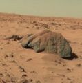
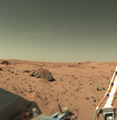
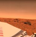
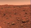
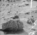
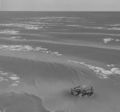
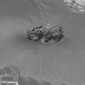
Rocks on Mars – viewed by the Viking 2 Lander (September 5, 1976).
1997 – الجوال سوجورنر
Rover Map of Sojourner's route on Mars (Sol 83, 1997) (Archive).
"Barnacle Bill" rock on Mars – near the Sojourner Rover.
"Barnacle Bill" rock on Mars - viewed by the Sojourner Rover.
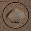
"Yogi" rock (circled) on Mars – near the Sojourner Rover.
"Yogi" rock on Mars – analyzed by the Sojourner Rover.
"Yogi" rock on Mars - viewed by the Sojourner Rover.
2004 – الجوال سپيريت
Rover Map of Spirit's route on Mars (Sol 1509, April 2, 2008) (Archive to Sol 2555, March 15, 2011 Current).
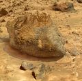
"Adirondack" rock on Mars – viewed by the Spirit Rover.
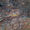
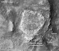
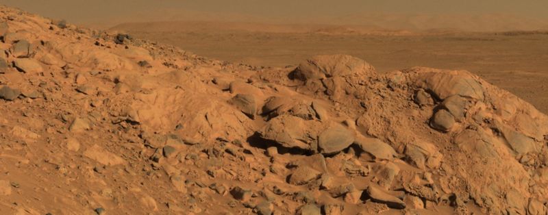
"Home Plate" rock outcrop on Mars – studied by the Spirit Rover.
"Mimi" rock on Mars – viewed by the Spirit Rover.
"Pot of Gold" rock on Mars – viewed by the Spirit Rover.
2004 – الجوال اوپورتيونيتي
Rover Map of Opportunity's route on Mars (Sol 2055, January 24, 2009) (Archive to Sol 3342, June 21, 2013 Current).
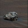
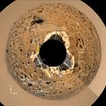
"Block Island" meteorite on Mars – viewed by the Opportunity Rover (July 31, 2009).
"Blueberries" (hematite spheres) on rock outcrop at Eagle Crater – viewed by the Opportunity Rover (Sol 46 – March, 2004).
"Blueberries" at "Kirkwood" near Endeavor Crater – Opportunity Rover (September 6, 2012).
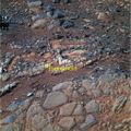
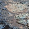
"El Capitan" rock outcrop on Mars – studied by the Opportunity Rover.
"El Capitan" rock outcrop on Mars – studied by the Opportunity Rover.
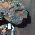
"Heat Shield" meteorite (officially, Meridiani Planum meteorite) on Mars – viewed by the Opportunity Rover (January 6, 2005).
"Homestake" vein on Mars – viewed by the Opportunity Rover (November 12, 2012).
"Last Chance" rock outcrop on Mars – viewed by the Opportunity Rover.
"Mackinac Island" meteorite on Mars – viewed by the Opportunity Rover (October 13, 2009).
"Oileán Ruaidh" meteorite on Mars – viewed by the Opportunity Rover (September 24, 2010).
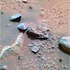
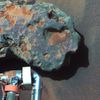
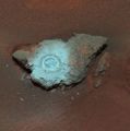
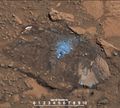
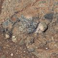
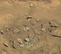
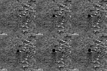
"Pinnacle Island" rock - "mysterious" appearance imaged by Opportunity (January 23, 2014).[1][2]
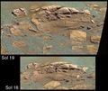
"Pinnacle Island" rock - "mysterious" appearance imaged by Opportunity (January 17, 2014).[1][2]
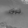
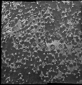
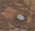
"Pinnacle Island" rock - microscopic view by Opportunity (February 1, 2014).[1][2]
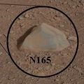
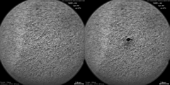
"Pinnacle Island" rock - location where rock was dislodged by Opportunity (February 4, 2014).
"Shelter Island" meteorite on Mars – viewed by the Opportunity Rover (October 3, 2009).
"Shelter Island" meteorite on Mars – viewed by the Opportunity Rover (October 1, 2009).
"Sparkling Spheres" embedded in trench wall at Meridiani Planum - viewed by the Opportunity Rover (February, 2004).
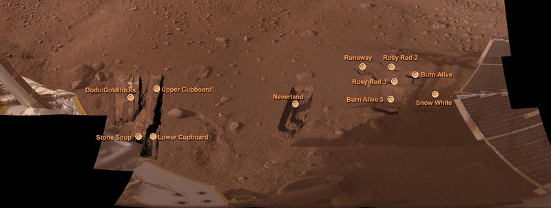
2008 – المركبة فيونكس
2012 – الجوال كريوزيتي
First-Year & First-Mile Traverse Map of the Curiosity rover on Mars (August 1, 2013; 3-D).
"Alexander Hills" bedrock on Mars - viewed by Curiosity (November 23, 2014).
"Bathurst Inlet" rock on Mars – as viewed by the MAHLI camera on the Curiosity rover (September 30, 2012).
"Bonanza King" rock on Mars - dusted and initially drilled (September 11, 2014).
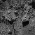
"Burwash" rock on Mars – as viewed by the MAHLI camera on the Curiosity rover (October 29, 2012).
"Confidence Hills" rock on Mars - Curiosity's first target at Mount Sharp (September 24, 2014).
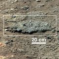
"Coronation" rock on Mars – first target of the ChemCam laser analyzer on the Curiosity rover (August 17, 2012).
"Coronation" rock on Mars – close-up - viewed by the Curiosity rover (August 17, 2012).
"Crestaurum" sand patch on Mars – before/after ChemCam laser hits – as viewed by Curiosity (October 20, 2012).
"Cumberland" bedrock on Mars - Curiosity's second drilling site (Yellowknife Bay; February 19, 2013; white balanced).
"Darwin" rock outcrop on Mars - viewed by Curiosity (Waypoint 1; September 10, 2013; overview).
"Darwin" rock outcrop ridge - viewed by Curiosity (Waypoint1; September 21, 2013; context).
"Darwin" sandstone on Mars - viewed by the Curiosity rover (Waypoint 1; September 21, 2013; closeup).
"Ekwir_1" rock on Mars – cleaned with Curiosity's "Dust Removal Tool" (DRT) (January 6, 2013; closeup).
"Et-Then" rock on Mars – as viewed by the MAHLI camera on the Curiosity rover (October 29, 2012).
"Garden City" rock - closeup – as viewed by the MAHLI camera on the Curiosity rover (March 2, 2015).
"Gillespie Lake" rock texture – as viewed by the MAHLI camera on the Curiosity rover (December 19, 2012).
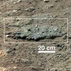
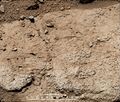
"Goulburn" rock outcrop on Mars – ancient streambed viewed by Curiosity (August 17, 2012).
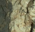
"Goulburn" rock outcrop on Mars – close-up viewed by Curiosity (August 17, 2012).
"Harrison" rock (and crystals) on Mars - viewed by the Curiosity rover (January 15, 2014).
"Hidden Valley" sand - Curiosity's tracks (August 4, 2014).
"Hidden Valley" water-related sedimentary deposits on Mars - Curiosity rover (August 7, 2014).
"Hottah" rock outcrop on Mars – ancient streambed viewed by Curiosity (September 12, 2012; closeup; 3-D).
"Ithaca" rock on Mars - target of the ChemCam laser analyzer on Curiosity (October 30, 2013; closeup).
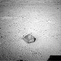
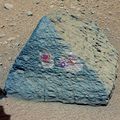
"Jake Matijevic" rock on Mars – a prime test target of the Curiosity rover (September 19, 2012).
Jake Matijevic rock on Mars – target of APSX & ChemCam on Curiosity (September 22, 2012).
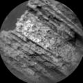
"John Klein" mudstone - drill hole (1.6 cm (0.63 in)) made by Curiosity (Yellowknife Bay; May 10, 2013).
"Knorr" sedimentary rock on Mars – as viewed by the MastCam on Curiosity (December 20, 2012).[4]
"Lamoose" rock (high silica levels) – viewed by Curiosity (July 11, 2015).
"Lebanon" meteorite on Mars – viewed by Curiosity (May 25, 2014).
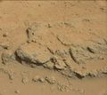
"Link" rock outcrop on Mars – ancient streambed viewed by Curiosity (September 2, 2012).
"Missoula" rock outcrop on Mars – viewed by Curiosity (July 1, 2015).
"Missoula" rock outcrop - "Buckskin" drilling site (July 1, 2015).
"Mojave 2" rock on Mars – drilling site - viewed by Curiosity (December 31, 2015).
"Nova" rock on Mars – 1st laser spark imaged (Curiosity rover; July 12, 2014; video (01:07)).
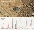
"Nova" rock on Mars – ChemCam spectra (Curiosity rover; July 12, 2014).
"Pahrump Hills" rock outcrop on Mars – viewed by Curiosity (September 23, 2014).
"Pahrump Hills" bedrock on Mars - viewed by Curiosity (November 9, 2014).
"Pahrump Hills" sand - viewed by Curiosity (November 13, 2014).
"Pahrump Hills" sand - Curiosity's tracks (November 7, 2014).
"Pink Cliffs" rock outcrop on Mars - viewed by Curiosity (October 7, 2014).
"Point Lake" rock outcrop (detail) on Mars – viewed by Curiosity (June 13, 2013; context).
"Rocknest" sand patch on Mars – target for the first use of Curiosity's scoop (September 28, 2012).
"Rocknest" sand – first X-ray analysis of Martian soil (Curiosity rover; October 30, 2012)[5]
"Rocknest" sand on Mars – scoffmark made by the Curiosity rover (MAHLI, October 4, 2012).
"Rocknest" sand patch on Mars – Curiosity's scooper sifts a load of sand (October 7, 2012).
"Rocknest 3" rock on Mars – as viewed by the MastCam on Curiosity (October 5, 2012).
"Shaler" rock outcrop on Mars – as viewed by the MastCam on the Curiosity rover (December 7, 2012).
"Sheepbed" rock outcrop on Mars – as viewed by the MastCam on Curiosity (December 13, 2012).
"Snake River" rock feature on Mars – as viewed by Curiosity (December 20, 2012).[6]
"Sutton Inlier" rock on Mars – broken by the Curiosity rover (January 31, 2013).[4]
"Wernecke" rock on Mars – cleaned with Curiosity's "Dust Removal Tool" (DRT) (January 26, 2013).[4]
"Whale" rock on Mars - cross-bedding due to passage of water - as viewed by Curiosity (November 2, 2014).
"Windjana" sandstone on Mars - as viewed by the Curiosity rover (Kimberley; April 23, 2014; context).
"Windjana" sandstone on Mars - drill hole (1.6 cm (0.63 in)) made by Curiosity (Kimberley; April 29, 2014).
"Winnipesaukee" rock on Mars - target of the ChemCam laser analyzer on Curiosity (June 8, 2014).
. . . . . . . . . . . . . . . . . . . . . . . . . . . . . . . . . . . . . . . . . . . . . . . . . . . . . . . . . . . . . . . . . . . . . . . . . . . . . . . . . . . . . . . . . . . . . . . . . . . . . . . . . . . . . . . . . . . . . . . . . . . . . . . . . . . . . . . . . . . . . . . . . . . . . . . . . . . . . . . . . . . . . . . .
تكوينات صخرية أخرى
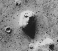
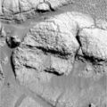
"Face on Mars" – due to Sun's lighting (Viking 1 Orbiter, July 25, 1976)
(40°45′N 9°28′W / 40.75°N 9.46°W).Mars monolith on Mars – rectangular boulder (MRO, July 24, 2008)
(7°13′52″S 267°21′00″E / 7.231°S 267.350°E).Oblong boulder on Mars lands upright after rolling down a hill (MRO, July 3, 2014)
(31°S 302°E / 31°S 302°E).Rootless cones on Mars – due to lava flows interacting with water (MRO, January 4, 2013)
(21°57′54″N 197°48′25″E / 21.965°N 197.807°E).Cave entrances (possible) on Mars.
انظر أيضاً
المصادر
- ^ أ ب ت O'Neill, Ian (January 17, 2014). "Mystery Rock 'Appears' in Front of Mars Rover". Space.com. Retrieved January 18, 2014.
- ^ أ ب ت Chang, Kenneth (January 24, 2014). "Mars Rover Marks an Unexpected Anniversary With a Mysterious Discovery". New York Times. Retrieved January 24, 2014.
- ^ Anderson, Paul Scott (February 3, 2013). "Curiosity 'hammers' a rock and completes first drilling tests". The Meridiani Journal. Retrieved February 3, 2013.
{{cite web}}: External link in|publisher= - ^ أ ب ت ث ج خطأ استشهاد: وسم
<ref>غير صحيح؛ لا نص تم توفيره للمراجع المسماةNASA-20130318 - ^ Brown, Dwayne (October 30, 2012). "NASA Rover's First Soil Studies Help Fingerprint Martian Minerals". NASA. Retrieved October 31, 2012.
- ^ خطأ استشهاد: وسم
<ref>غير صحيح؛ لا نص تم توفيره للمراجع المسماةNASA-20121220 - ^ أ ب خطأ استشهاد: وسم
<ref>غير صحيح؛ لا نص تم توفيره للمراجع المسماةBBC-20130319
وصلات خارجية
- Mars - Geologic Map (USGS, 2014) (original / crop / full / video (00:56)).
- MPF Rock Names
- Named Rocks on Mars (ppt file)
- NASA – Mars Exploration Program
- Minerals and the Origins of Life (Robert Hazen, NASA) (video, 60m, April 2014).






















!["Pinnacle Island" rock - "mysterious" appearance imaged by Opportunity (January 23, 2014).[1][2]](/w/images/thumb/9/90/PIA17761-MarsOpportunityRover-MysteryRock-Sol3528-Sol3540-color.jpg/120px-PIA17761-MarsOpportunityRover-MysteryRock-Sol3528-Sol3540-color.jpg)
!["Pinnacle Island" rock - "mysterious" appearance imaged by Opportunity (January 17, 2014).[1][2]](/w/images/thumb/9/9c/MarsOpportunityRover-MysteryRock-Sol3528-Sol3540.jpg/120px-MarsOpportunityRover-MysteryRock-Sol3528-Sol3540.jpg)
!["Pinnacle Island" rock - microscopic view by Opportunity (February 1, 2014).[1][2]](/w/images/thumb/5/58/Mars_Pinnacle_Rock.png/120px-Mars_Pinnacle_Rock.png)















!["John Klein" mudstone - results of Curiosity's first drilling tests (Yellowknife Bay; February 6, 2013).[3]](/w/images/thumb/9/9a/PIA16762-MarsCuriosityRover-DrilledHole-20130206.gif/120px-PIA16762-MarsCuriosityRover-DrilledHole-20130206.gif)

!["Knorr" sedimentary rock on Mars – as viewed by the MastCam on Curiosity (December 20, 2012).[4]](/w/images/thumb/2/2a/PIA16792-MarsCuriosityRover-KnorrRock-20121220.jpg/120px-PIA16792-MarsCuriosityRover-KnorrRock-20121220.jpg)




!["Rocknest" sand – first X-ray analysis of Martian soil (Curiosity rover; October 30, 2012)[5]](/w/images/thumb/e/e1/PIA16174-MarsCuriosityRover-Sand-Rocknest-20121030.jpg/120px-PIA16174-MarsCuriosityRover-Sand-Rocknest-20121030.jpg)


!["Snake River" rock feature on Mars – as viewed by Curiosity (December 20, 2012).[6]](/w/images/thumb/a/a3/MarsCuriosityRover-SnakeRiverRockFeature-PIA16564.jpg/120px-MarsCuriosityRover-SnakeRiverRockFeature-PIA16564.jpg)
!["Sutton Inlier" rock on Mars – broken by the Curiosity rover (January 31, 2013).[4]](/w/images/thumb/4/48/PIA16804-MarsCuriosityRover-SuttonInlierRock-20130131.jpg/120px-PIA16804-MarsCuriosityRover-SuttonInlierRock-20130131.jpg)
![Tintina broken hydrated rock on Mars – viewed by Curiosity (January 19, 2013; context).[4][7]](/w/images/thumb/3/32/PIA16795-MarsCuriosityRover-TintinaRock-Context-20130119.jpg/120px-PIA16795-MarsCuriosityRover-TintinaRock-Context-20130119.jpg)
![Tintina broken hydrated rock on Mars – viewed by Curiosity (January 19, 2013; analysis).[4][7]](/w/images/thumb/b/b8/PIA16796-MarsCuriosityRover-TintinaRock-Hydration-20130119.jpg/120px-PIA16796-MarsCuriosityRover-TintinaRock-Hydration-20130119.jpg)

!["Wernecke" rock on Mars – cleaned with Curiosity's "Dust Removal Tool" (DRT) (January 26, 2013).[4]](/w/images/thumb/b/bd/PIA16790-MarsCuriosityRover-WerneckeRock-20130126.jpg/120px-PIA16790-MarsCuriosityRover-WerneckeRock-20130126.jpg)


