طشقند، تركيا
Taşkent | |
|---|---|
تجمع سكاني | |
 | |
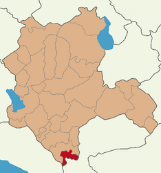
 Map showing Taşkent District in Konya Province | |
| الإحداثيات: 36°55′24″N 32°29′20″E / 36.92333°N 32.48889°E | |
| البلد | تركيا |
| المحافظة | Konya |
| الحكومة | |
| المساحة | 457 كم² (176 ميل²) |
| المنسوب | 1٬550 m (5٬090 ft) |
| التعداد (2022)[1] | 5٬768 |
| • الكثافة | 13/km2 (33/sq mi) |
| منطقة التوقيت | TRT (UTC+3) |
| Postal code | 42960 |
| Area code | 0332 |
| الموقع الإلكتروني | www |
Taşkent, formerly Pirlerkondu, is a municipality and district of Konya Province, Turkey.[2] Its area is 457 km2,[3] and its population is 5,768 (2022).[1] Its name literally means Stone City.
Composition
There are 15 neighbourhoods in Taşkent District:[4]
References
- ^ أ ب "Address-based population registration system (ADNKS) results dated 31 December 2022, Favorite Reports" (XLS) (in الإنجليزية). TÜİK. Retrieved 19 September 2023.
- ^ Büyükşehir İlçe Belediyesi, Turkey Civil Administration Departments Inventory. Retrieved 19 September 2023.
- ^ "İl ve İlçe Yüz ölçümleri". General Directorate of Mapping. Retrieved 19 September 2023.
- ^ Mahalle, Turkey Civil Administration Departments Inventory. Retrieved 19 September 2023.
External links
- District governor's official website (in تركية)
- District municipality's official website (in تركية)
?
تصنيفات:
- Pages using gadget WikiMiniAtlas
- Short description is different from Wikidata
- Turkey articles requiring maintenance
- Coordinates on Wikidata
- Articles with تركية-language sources (tr)
- مقاطعات محافظة Konya
- Taşkent District
- Populated places in Konya Province
- Districts of Konya Province
- Metropolitan district municipalities in Turkey


