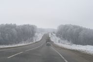
أوبلاست أوريول
Oryol Oblast | |
|---|---|
| Орловская область | |
 | |
| الإحداثيات: 52°51′N 36°26′E / 52.850°N 36.433°E | |
| البلد | روسيا |
| المنطقة الاتحادية | Central[1] |
| المنطقة الاقتصادية | Central[2] |
| تأسست | September 27, 1937 |
| Administrative center | Oryol |
| الحكومة | |
| • الكيان | Oblast Council of People's Deputies |
| • Governor | Andrey Klychkov[3] |
| المساحة | |
| • Total | 24٬652 كم² (9٬518 ميل²) |
| ترتيب المساحة | 71st |
| التعداد (2010 Census)[5] | |
| • Total | 786٬935 |
| • Estimate (2018) | 747٬247 (−5%) |
| • الترتيب | 63rd |
| • الكثافة | 32/km2 (83/sq mi) |
| • Urban | 65٫5% |
| • الريف | 34٫5% |
| منطقة التوقيت | UTC+3 (توقيت موسكو |
| ISO 3166 code | RU-ORL |
| لوحات السيارات | 57 |
| OKTMO ID | 54000000 |
| اللغات الرسمية | الروسية[7] |
| الموقع الإلكتروني | http://www.adm.orel.ru/ |
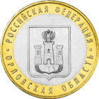
أوبلاست أوريول (روسية: Орло́вская о́бласть، أوبلاست أورلوڤسكايا)، ويُعرف أيضاً بإسم أورلوڤشينا (روسية: Орловщина) هي إحدى الكيانات الفدرالية في روسيا.
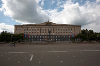
المركز الإداري هو مدينة أوريول.
التعداد: 714,094 نسمة (تقدير 2022) (تعداد 2010 — 786,935 نسمة).[5]
. . . . . . . . . . . . . . . . . . . . . . . . . . . . . . . . . . . . . . . . . . . . . . . . . . . . . . . . . . . . . . . . . . . . . . . . . . . . . . . . . . . . . . . . . . . . . . . . . . . . . . . . . . . . . . . . . . . . . . . . . . . . . . . . . . . . . . . . . . . . . . . . . . . . . . . . . . . . . . . . . . . . . . . .
الجغرافيا

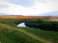
It is located in the southwestern part of the Central Federal District, in the Central Russian Upland.
In terms of area, at 24,652 km2 (9,518 sq mi) it is one of the smallest federal subjects.[8] From north to south, it extends for more than 150 km (93 mi), and from west to east—for over 200 km (120 mi).
أوبلاست كالوگا border it to the north-west; Tula Oblast is located to the north; Lipetsk Oblast — to the east; Kursk Oblast — to the south, and Bryansk Oblast is to the west.
There are 4,800 km2 (1,900 sq mi) of black earth soils (chernozems) in the oblast, which amounts to three-quarters of the world chernozem reserves.[8]
المناخ
The climate is temperate (Köppen: Dfb). The winter is moderately cold, with an average January temperature from −9 to −11 °C (16 to 12 °F). Summers are warm and humid, with an average July temperature from 19 to 21 °C (66 to 70 °F). Rainfall averages 520 to 630 mm (20 to 25 in), and snow cover averages 120 days.
المياه
On the territory of the Oryol region there are more than 2 thousand rivers and streams with a total length of 9,100 km (5,700 mi), but there are no navigable water ways. The rivers of the region belong to the basins of three rivers: Volga, Don, Dnieper.
The Oka river, one of Europe's largest rivers, flows through the oblast for part of its course (190 km) and the source of it is in the south of the region. Main tributaries: Zusha (with tributary Neruch), Vytebet, Nugr, Tson, Orlik, Rybnitsa, Kroma.
Sosna flows in the eastern part of the region. Main tributaries: Trudy, Tim, Lyubovsha, Kshen, Olym.
In the west of the region originate rivers Nerussa, Navlya, Swapa.
1100 lakes and artificial reservoirs of the region cover a total area of about 55 km2 (21 sq mi) (0,22%).
التاريخ
In the 12th century, chronicles mention Mtsensk, known as Novosil then. Then modern Orlovschina was part of the Chernigov Principality. After the death of Mikhail of Chernigov Novosil Principality was formed on these territories. By the end of the 15th century it had disintegrated into four separate principalities and, along with all the other fragments of the Chernigov principality, became a part of Grand Duchy of Lithuania. In the 16th century, the fortress town of Oryol was founded, and the town of Livny, destroyed in the 13th century, was restored. In the 16th and 17th centuries, the territory of modern Oryol was the borderland of the Tsardom of Russia, with many fortifications of the Great Abatis Line . With the reduction of the threat posed by the Tatars, agricultural activity of the area had intensified. It was created in 1937 by uniting a selection of territories of three other oblasts: Kursk Oblast, Western Oblast, and Voronezh Oblast. It also included present Bryansk Oblast between 1937 and 1944.
السياسة
التقسيمات الادارية
- 3 cities under the oblast's jurisdiction
- 24 districts
- 13 urban-type settlements
- 223 rural settlements
ويضم أوبلاست أوريول المدن والقرى التالية:
الاقتصاد
The main industries in Oryol Oblast are the food and light industries, engineering and metalworking, and ferrous and nonferrous metallurgy. The engineering and metalworking industries manufacture production equipment for various industries, forklift trucks, construction and agricultural equipment, and machinery for municipal services. Numerous companies in the instrument-making and electronics sectors maintain high scientific and technical potential with the latest high-end technologies and experienced specialists.[9] First digital telephone exchange was introduced in the oblast in 1998.[10]
الزراعة
Most of the oblast's agricultural land is used for plant cultivation. Grain growing is very important, with winter wheat and rye being the main crops. Buckwheat, oats, barley, and potatoes are also grown, and sugar beets are in great demand. The area planted in feed grains is increasing due to the expansion of livestock farming, which includes beef and dairy cattle farming, pig farming, sheep farming for meat and wool, poultry farming, and horse breeding.[11]
النقل
Pipelines and power transmission lines are routed through the region's largest oil-trunk pipeline Druzhba (202 km in area). In the southwestern part of the area lies a small section of the Urengoy - Pomary - Uzhgorod pipeline.
Oryol is a major hub of pipelines exporting to Belarus, Western Ukraine and the Baltic states, with branches passing through Bryansk and Kursk.
صناعة السيارات
As of 2016, the motorization level of the area was of 314 cars per 1000 people, which is the 15th of any region of Russia and above the national average (285).
. . . . . . . . . . . . . . . . . . . . . . . . . . . . . . . . . . . . . . . . . . . . . . . . . . . . . . . . . . . . . . . . . . . . . . . . . . . . . . . . . . . . . . . . . . . . . . . . . . . . . . . . . . . . . . . . . . . . . . . . . . . . . . . . . . . . . . . . . . . . . . . . . . . . . . . . . . . . . . . . . . . . . . . .
Demographics
Population: 714,094 (est.2022); 786,935 (تعداد 2010);[5] 860,262 (تعداد 2002);[12] 890,636 (تعداد 1989).[13]
- 2017
- Births: 7 143 (9.56 per 1000)
- Deaths: 11 839 (15.84 per 1000) [14]
- Total fertility rate:[15]
2017 - 1.42 | 2016 - 1.59 | 2015 - 1.60 | 2014 - 1.55 | 2013 - 1.53 | 2012 - 1.54 | 2011 - 1.43 | 2010 - 1.50 | 2009 - 1.45
- Ethnic composition (2010):[5]
- Russians - 96.1%
- Ukrainians - 1%
- Others - 2.9%
- 17,468 people were registered from administrative databases, and could not declare an ethnicity. It is estimated that the proportion of ethnicities in this group is the same as that of the declared group.[16]
- Religion
According to a 2012 survey,[17] 40.9% of the population of Oryol Oblast adheres to the Russian Orthodox Church, 5% are unaffiliated generic Christians, 1% are Orthodox Christian believers who don't belong to church or belong to non-Russian Orthodox churches, 1% are adherents of the Rodnovery (Slavic native faith) movement, and 1% are Old Believers. In addition, 34% of the population declares to be "spiritual but not religious", 8% is atheist, and 9.1% follows other religions or did not give an answer to the question.[17]
المراجع
- ^ Президент Российской Федерации. Указ №849 от 13 мая 2000 г. «О полномочном представителе Президента Российской Федерации в федеральном округе». (President of the Russian Federation. Decree #849 of May 13, 2000 On the Plenipotentiary Representative of the President of the Russian Federation in a Federal District).
- ^ Госстандарт Российской Федерации. №ОК 024-95 27 декабря 1995 г. «Общероссийский классификатор экономических регионов. 2. Экономические районы», в ред. Изменения №5/2001 ОКЭР. (گوستاندارت of the Russian Federation. #OK 024-95 December 27, 1995 Russian Classification of Economic Regions. 2. Economic Regions, as amended by the Amendment #5/2001 OKER).
- ^ rbc.ru Putin Replaces Oryol Oblast Governor (in روسية)
- ^ Федеральная служба государственной статистики (Federal State Statistics Service) (2004-05-21). "Территория, число районов, населённых пунктов и сельских администраций по субъектам Российской Федерации (Territory, Number of Districts, Inhabited Localities, and Rural Administration by Federal Subjects of the Russian Federation)". Всероссийская перепись населения 2002 года (All-Russia Population Census of 2002) (in الروسية). Federal State Statistics Service. Retrieved 2011-11-01.
- ^ أ ب ت ث Russian Federal State Statistics Service (2011). "Всероссийская перепись населения 2010 года. Том 1". Всероссийская перепись населения 2010 года (2010 All-Russia Population Census) (in Russian). Federal State Statistics Service. Retrieved June 29, 2012.
{{cite web}}: Invalid|ref=harv(help); Unknown parameter|trans_title=ignored (|trans-title=suggested) (help)CS1 maint: unrecognized language (link) - ^ "Об исчислении времени". Официальный интернет-портал правовой информации (in الروسية). 3 June 2011. Retrieved 19 January 2019.
- ^ الرسمية في جميع أرجاء روسيا الاتحادية حسب الفقرة 68.1 من دستور روسيا.
- ^ أ ب "Orel Region". Retrieved 2006-11-29.
- ^ "Oryol Oblast". kommersant.com.
- ^ «Ростелеком» в Орле переводит абонентов на цифровые АТС
- ^ "Oryol Region". kommersant.com.
- ^ Федеральная служба государственной статистики (Federal State Statistics Service) (2004-05-21). "Численность населения России, субъектов Российской Федерации в составе федеральных округов, районов, городских поселений, сельских населённых пунктов – районных центров и сельских населённых пунктов с населением 3 тысячи и более человек[[Category:Articles containing روسية-language text]] (Population of Russia, its federal districts, federal subjects, districts, urban localities, rural localities—administrative centers, and rural localities with population of over 3,000)". Всероссийская перепись населения 2002 года (All-Russia Population Census of 2002) (in Russian). Federal State Statistics Service. Retrieved 2008-07-25.
{{cite web}}: URL–wikilink conflict (help)CS1 maint: unrecognized language (link) - ^ "Всесоюзная перепись населения 1989 г. Численность наличного населения союзных и автономных республик, автономных областей и округов, краёв, областей, районов, городских поселений и сёл-райцентров.[[Category:Articles containing روسية-language text]] (All Union Population Census of 1989. Present population of union and autonomous republics, autonomous oblasts and okrugs, krais, oblasts, districts, urban settlements, and villages serving as district administrative centers.)". Всесоюзная перепись населения 1989 года (All-Union Population Census of 1989) (in Russian). Demoscope Weekly (website of the Institute of Demographics of the State University—Higher School of Economics. 1989. Retrieved 2007-12-13.
{{cite web}}: Italic or bold markup not allowed in:|publisher=(help); URL–wikilink conflict (help)CS1 maint: unrecognized language (link) - ^ "Естественное движение населения в разрезе субъектов Российской Федерации". www.gks.ru.
- ^ "Каталог публикаций::Федеральная служба государственной статистики". www.gks.ru.
- ^ "ВПН-2010". www.perepis-2010.ru.
- ^ أ ب ت "Arena: Atlas of Religions and Nationalities in Russia". Sreda, 2012.
- ^ 2012 Arena Atlas Religion Maps. "Ogonek", № 34 (5243), 27/08/2012. Retrieved 21/04/2017. Archived.
وصلات خارجية
 Chisholm, Hugh, ed. (1911). . دائرة المعارف البريطانية. Vol. 20 (eleventh ed.). Cambridge University Press. pp. 250–251.
 {{cite encyclopedia}}: Cite has empty unknown parameter:|coauthors=(help)- (in إنگليزية) Overview of Oryol Oblast (Kommersant newspaper)
- (in إنگليزية) Central Eurasian Information Resource: Images of Oryol Oblast - University of Washington Digital Collection
- Pages using gadget WikiMiniAtlas
- Articles containing روسية-language text
- Articles with روسية-language sources (ru)
- CS1 الروسية-language sources (ru)
- CS1 errors: unsupported parameter
- CS1 errors: URL–wikilink conflict
- CS1 errors: markup
- Short description is different from Wikidata
- Coordinates on Wikidata
- Pages using Lang-xx templates
- Articles with hatnote templates targeting a nonexistent page
- مقالات المعرفة المحتوية على معلومات من دائرة المعارف البريطانية طبعة 1911
- Articles with إنگليزية-language sources (en)
- Oryol Oblast
- States and territories established in 1937
- 1937 establishments in the Soviet Union
- اوبلاستات روسيا


