أوبلاست كورگان
| ||||||||||||||||||||||||||||||||||||||||||||||||||||||||||||||||||
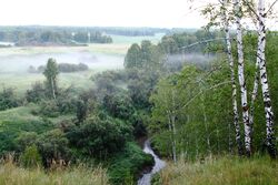
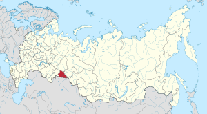
أوبلاست كورگان (روسية: Курга́нская о́бласть، Kurganskaya oblast) هي إحدى الكيانات الفدرالية في روسيا. ومركزها الاداري هو مدينة كورگان. وفي يونيو 2014، قـُدِّر عدد سكان الأوبلاست بنحو 874,100 نسمة،[13] منخفضاً من 910,807 المسجلة في تعداد 2010.[10]
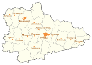
وتحوي المدن والقرى التالية:
كاتايسك، كورگان، كورتامايش، ماكوشينو، بيتوخوفو، شادرينسك، شتشوشاي، شوميخا،
التاريخ
Formed by Decree of the Presidium of the Supreme Soviet of the USSR of February 6, 1943. The region included 32 districts of the eastern part of the Chelyabinsk region and 4 districts of the Omsk region with a total population of 975,000.
Recipient of the Order of Lenin (1959).
الجغرافيا
Kurgan Oblast is located in Southern Russia and is part of the Urals Federal District. It shares borders with Chelyabinsk Oblast to the west, Sverdlovsk Oblast to the north-west, Tyumen Oblast to the north-east, and Kazakhstan (Kostanay and North Kazakhstan Region) to the south.
الاقتصاد
Kurgan Oblast borders on the oil- and gas-bearing districts of Tyumen Oblast and is also close to similar districts in Tomsk Oblast. Large oil and gas pipelines pass through its territory, and Ural and Siberian oil refineries are fairly close. The main industrial centers are Kurgan, and Shadrinsk.[14]
The oblast does not have large economic mineral reserves; therefore, it has developed mainly on the basis of subindustries associated with processing of agricultural production and assembly and packaging of finished products. The food industry is well developed here, with meat-packing plants, mills, creameries, and powdered milk factories.[14]
Modern large-scale industry began developing during World War II, when sixteen enterprises from western regions of the country were evacuated here in 1941–1942.
الديمغرافيا
التعداد: 910,807 (تعداد 2010);[10] 1,019,532 (تعداد 2002);[15] 1,104,872 (تعداد 1989).[16]
Russians (823,7222) are the largest ethnic group in the Kurgan Oblast, making up 92.5% of the population. Other prominent ethnic groups in the oblast include[10] Tatars (17,017) at 1.9%, Bashkirs (12,257) at 1.4%, Kazakhs (11,939) 1.3%, and Ukrainians (7,080) at 0.8%. Other ethnicities are 2.1%. Additionally, 20,017 people were registered from administrative databases, and could not declare an ethnicity. It is estimated that the proportion of ethnicities in this group is the same as that of the declared group.[17]
- المواليد (2010): 11,862 (13.0 لكل 1000)
- الوفيات (2010): 14,590 (16.0 لكل 1000)[18]
التجمعات السكنية
أكبر المدن أو البلدات في أوبلاست كورگان
2010 Russian Census | |||||||||
|---|---|---|---|---|---|---|---|---|---|
| الترتيب | Administrative Division | التعداد | |||||||
 كورگان  شادرينسك |
1 | كورگان | City of oblast significance of Kurgan | 333,606 | |||||
| 2 | شادرينسك | Shadrinsky District | 77,756 | ||||||
| 3 | شوميخا | Shumikhinsky District | 17,819 | ||||||
| 4 | كورتاميش | Kurtamyshsky District | 17,099 | ||||||
| 5 | كتايسك | Kataysky District | 14,003 | ||||||
| 6 | دالماتوڤو | Dalmatovsky District | 13,911 | ||||||
| 7 | پتوخوڤو | Petukhovsky District | 11,292 | ||||||
| 8 | شوچيى | Shchuchansky District | 10,973 | ||||||
| 9 | ڤارگاشي | Vargashinsky District | 9,254 | ||||||
| 10 | كارگاپوليى | Kargapolsky District | 8,433 | ||||||
- 2000 - 1.38
- 2001 - 1.35
- 2002 - 1.45
- 2003 - 1.40
- 2004 - 1.46
- 2005 - 1.40
- 2006 - 1.43
- 2007 - 1.59
- 2008 - 1.72
- 2009 - 1.77
- 2010 - 1.79
- 2011 - 1.82
- 2012 - 2.03
- 2013 - 2.12
- 2014 - 2.10
- 2015 - 2.12
- 2016 - 2.02(e)
- Vital statistics for 2012
- Births: 12 400 (13.8 per 1000)
- Deaths: 14 216 (15.9 per 1000) [21]
- Total fertility rate: 2.03
الأديان
According to a 2012 survey[22] 28.4% of the population of Kurgan Oblast adheres to the Russian Orthodox Church, 6% are nondenominational Christians (with the exclusion of such-defined Protestant churches), 2% are adherents of Islam, 1% are adherents of the Slavic native faith (Rodnovery), and 0.4% are adherents of forms of Hinduism (Vedism, Krishnaism or Tantrism). In addition, 36% of the population declares to be "spiritual but not religious", 14% is atheist, and 12.2% follows other religions or did not give an answer to the question.[22]
الهامش
- ^ Article 8 of the Charter of Kurgan Oblast states that the oblast may have an anthem, providing a law is adopted to that effect. As of 2014, no such law is in place.
- ^ Президент Российской Федерации. Указ №849 от 13 мая 2000 г. «О полномочном представителе Президента Российской Федерации в федеральном округе». (President of the Russian Federation. Decree #849 of May 13, 2000 On the Plenipotentiary Representative of the President of the Russian Federation in a Federal District).
- ^ Госстандарт Российской Федерации. №ОК 024-95 27 декабря 1995 г. «Общероссийский классификатор экономических регионов. 2. Экономические районы», в ред. Изменения №5/2001 ОКЭР. (گوستاندارت of the Russian Federation. #OK 024-95 December 27, 1995 Russian Classification of Economic Regions. 2. Economic Regions, as amended by the Amendment #5/2001 OKER).
- ^ Charter, Article 10
- ^ Charter of Kurgan Oblast, Article 13
- ^ Charter, Article 80
- ^ Official website of Kurgan Oblast. Autobiography of Oleg Alexeyvich Bogomolov، حاكم أوبلاست كورگان (بالروسية)
- ^ Charter, Article 78-1
- ^ Федеральная служба государственной статистики (Federal State Statistics Service) (2004-05-21). "Территория, число районов, населённых пунктов и сельских администраций по субъектам Российской Федерации (Territory, Number of Districts, Inhabited Localities, and Rural Administration by Federal Subjects of the Russian Federation)". Всероссийская перепись населения 2002 года (All-Russia Population Census of 2002) (in الروسية). Federal State Statistics Service. Retrieved 2011-11-01.
- ^ أ ب ت ث Russian Federal State Statistics Service (2011). "Всероссийская перепись населения 2010 года. Том 1". Всероссийская перепись населения 2010 года (2010 All-Russia Population Census) (in Russian). Federal State Statistics Service. Retrieved June 29, 2012.
{{cite web}}: Invalid|ref=harv(help); Unknown parameter|trans_title=ignored (|trans-title=suggested) (help)CS1 maint: unrecognized language (link) - ^ "Об исчислении времени". Официальный интернет-портал правовой информации (in الروسية). 3 June 2011. Retrieved 19 January 2019.
- ^ الرسمية في جميع أرجاء روسيا الاتحادية حسب الفقرة 68.1 من دستور روسيا.
- ^ Kurgan Oblast Territorial Branch of the Federal State Statistics Service. Демография (in روسية)
- ^ أ ب خطأ استشهاد: وسم
<ref>غير صحيح؛ لا نص تم توفيره للمراجع المسماةKurgan Region - ^ Федеральная служба государственной статистики (Federal State Statistics Service) (2004-05-21). "Численность населения России, субъектов Российской Федерации в составе федеральных округов, районов, городских поселений, сельских населённых пунктов – районных центров и сельских населённых пунктов с населением 3 тысячи и более человек[[Category:Articles containing روسية-language text]] (Population of Russia, its federal districts, federal subjects, districts, urban localities, rural localities—administrative centers, and rural localities with population of over 3,000)". Всероссийская перепись населения 2002 года (All-Russia Population Census of 2002) (in Russian). Federal State Statistics Service. Retrieved 2008-07-25.
{{cite web}}: URL–wikilink conflict (help)CS1 maint: unrecognized language (link) - ^ "Всесоюзная перепись населения 1989 г. Численность наличного населения союзных и автономных республик, автономных областей и округов, краёв, областей, районов, городских поселений и сёл-райцентров.[[Category:Articles containing روسية-language text]] (All Union Population Census of 1989. Present population of union and autonomous republics, autonomous oblasts and okrugs, krais, oblasts, districts, urban settlements, and villages serving as district administrative centers.)". Всесоюзная перепись населения 1989 года (All-Union Population Census of 1989) (in Russian). Demoscope Weekly (website of the Institute of Demographics of the State University—Higher School of Economics. 1989. Retrieved 2007-12-13.
{{cite web}}: Italic or bold markup not allowed in:|publisher=(help); URL–wikilink conflict (help)CS1 maint: unrecognized language (link) - ^ "ВПН-2010". www.perepis-2010.ru. Retrieved April 5, 2018.
- ^ http://gks.ru/wps/wcm/connect/rosstat/rosstatsite/main/population/demography/
- ^ "Главная::Свердловскстат". kurganstat.gks.ru. Retrieved April 5, 2018.
- ^ "Каталог публикаций::Федеральная служба государственной статистики". www.gks.ru. Retrieved April 5, 2018.
- ^ "Естественное движение населения в разрезе субъектов Российской Федерации". www.gks.ru. Retrieved April 5, 2018.
- ^ أ ب ت "Arena: Atlas of Religions and Nationalities in Russia". Sreda, 2012.
- ^ 2012 Arena Atlas Religion Maps. "Ogonek", № 34 (5243), 27/08/2012. Retrieved 21/04/2017. Archived.
وصلات خارجية
- Official website of the Oblast Duma (in روسية)
- News portal (in روسية)
- Pages using gadget WikiMiniAtlas
- Articles containing روسية-language text
- CS1 الروسية-language sources (ru)
- CS1 errors: unsupported parameter
- Articles with روسية-language sources (ru)
- CS1 errors: URL–wikilink conflict
- CS1 errors: markup
- Articles with hatnote templates targeting a nonexistent page
- Short description is different from Wikidata
- Coordinates on Wikidata
- Pages using Lang-xx templates
- أوبلاست كورگان
- دول وأقاليم تأسست في 1943
- حائزو وسام لنين


