ألڤا
| الاسم الگيلي | Ulbha |
|---|---|
| الاسم النورسي | Ulv-oy/Ulfrsey |
| معنى الاسم | Old Norse for 'wolf island' or 'Ulfr's island' |
| الموقع | |
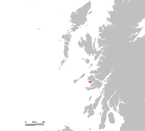
ألڤا shown within Scotland | |
| OS grid reference | NM410396 |
| Physical geography | |
| مجموعة الجزر | Mull |
| المساحة | 1،990 هكتار (7.7 sq mi) |
| ترتيب المساحة | 35 [1] |
| أعلى منسوب | Beinn Chreagach 313 متر (1،027 ft) |
| الادارة | |
| الدولة ذات السيادة | المملكة المتحدة |
| البلد | اسكتلندا |
| منطقة المجلس | Argyll and Bute |
| الديمغرافيا | |
| التعداد | 16 |
| ترتيب التعداد | 67[1] |
| أكبر مستوطنة | Ulva House (once Ormaig) |
| المراجع | [2][3][4][5] |
جزيرة الڤا Ulva ، هي احدى جزر الساحل الداخلي لإسكتلندا.
الجغرافيا
الإبراشية والمنطقة
الجزر المحيطة
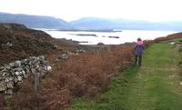
A view from Ormaig to the south east: the nearer islets are Geasgill Mòr & Geasgill Beag, while the longer island behind them is Inch Kenneth.
الجيولوجيا
الأصل
التاريخ
قبل التاريخ
Dál Riata
الفترة النورسية والعصور الوسطى
القرن الثامن عشر
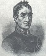
Lachlan Macquarie
بوزوِل وجونسون
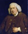
صاموِل جونسون، مرسومة حوالي 1772، قبل عام من زيارته ألڤا.
Mercheta Mulierum
القرن التاسع عشر
صناعة عشب البحر
سكوت ، هوج ، وغيرهم من الزوار
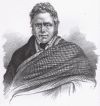
James Hogg, "The Ettrick Shepherd"

London poet John Keats was one of many famous visitors to Ulva in the 19th century
ديڤد لڤنگستون
The Clearances come to Ulva

The famous meeting of Stanley and Livingstone in Africa
القرن العشرون ووقتنا الحالي
الحياة البرية
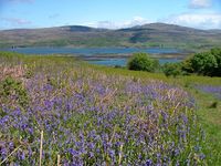
Bluebells growing near Ardalum
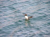
A young razorbill in nearby Loch na Keal/Loch nan Ceall
الحيوان
النبات
وسائل الإعلام والفن
Lord Ullin's Daughter
Walter Scott
Moladh Ulbha
غيرهم من الكتاب
الإقتصاد والبنية التحتية
المباني
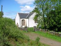
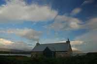
The small church at Ardalum, designed by Thomas Telford
كنيسة ألفا
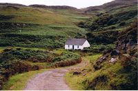
كوخ شيلا
مباني أخرى
فلكلور
المصادر
- ^ أ ب Area and population ranks: there are ح. 300 islands over 20 ha in extent and 93 permanently inhabited islands were listed in the 2011 census.
- ^ General Register Office for Scotland (28 Nov 2003) "Occasional Paper No 10: Statistics for Inhabited Islands" Retrieved 9 July 2007.
- ^ Ordnance Survey
- ^ MacKenzie, Donald W. R. (16 May 2000) As It Was/Sin Mar a Bha: A Ulva Boyhood Birlinn Ltd ISBN 978-1841580425
- ^ Haswell-Smith, Hamish. (2004) The Scottish Islands. Edinburgh. Canongate. Pages 102-5
مراجع عامة
- Bannerman, John, Studies in the History of Dalriada. Scottish Academic Press, Edinburgh, 1974. ISBN 0-7011-2040-1
- Broun, Dauvit, Dál Riata in Lynch (2001).
- قالب:Haswell-Smith (Ulva and Gometra)
- Howard, J. & Jones, A., The Isle of Ulva: A Visitor's Guide, published by Ulva Estate, (2004)
- Keay, J. & Keay, J. (1994) Collins Encyclopaedia of Scotland. London. HarperCollins. Articles: Ulva & "MacQuarrie, Lachlan"
- Johnson, Samuel (1775) A Journey to the Western Islands of Scotland. London. Chapman & Dodd. (1924 edition).
- Livingston, David LL.D., D.C.L., Missionary Travels and Researches in South Africa Including a Sketch of Sixteen Years' Residence in the Interior of Africa, and a Journey from the Cape of Good Hope to Loanda on the West Coast; Thence Across the Continent, Down the River Zambesi, to the Eastern Ocean.
- MacKenzie, Donald W. R. As It Was/Sin Mar a Bha: A Ulva Boyhood Birlinn Ltd (16 May 2000) ISBN 978-1841580425
- Report of Her Majesty's Commissioners of Inquiry Into the Condition of the Crofters and Cottars in the Highlands and Islands of Scotland (Napier Commission)
56°28.5′N 6°12′W / 56.4750°N 6.200°W
روابط خارجية
- The Isle of Ulva "A world apart"
- Now who be ye, would cross Loch Gyle? (Ulva) John Hannavy visits Ulva, a tiny island off the west coast of Mull Published in Scotland Magazine Issue 31 on 16/02/2007
- Mullmagic.com Isle of Ulva
- Images of archaeological sites in Mull and Ulva, Clive Ruggles, University of Leicester.
This article contains content from Wikimedia licensed under CC BY-SA 4.0. Please comply with the license terms.
تصنيفات:
- Pages using gadget WikiMiniAtlas
- Articles containing غالية اسكتلندية-language text
- Articles containing نورسية القديمة-language text
- Pages using deprecated coordinates format
- Articles with OS grid coordinates
- Coordinates on Wikidata
- جزر الهبريدز الداخلية
- Argyll and Bute
- Highland Clearances
- براكين اسكتلندا
- Paleogene volcanism
- براكين خامدة
- Columnar basalts
- جزر اسكتلندا

